Tips nearby


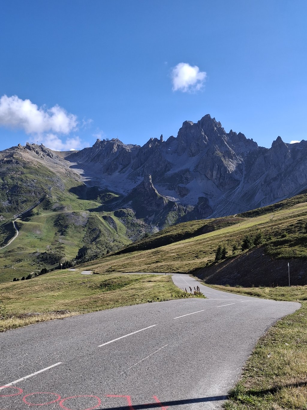
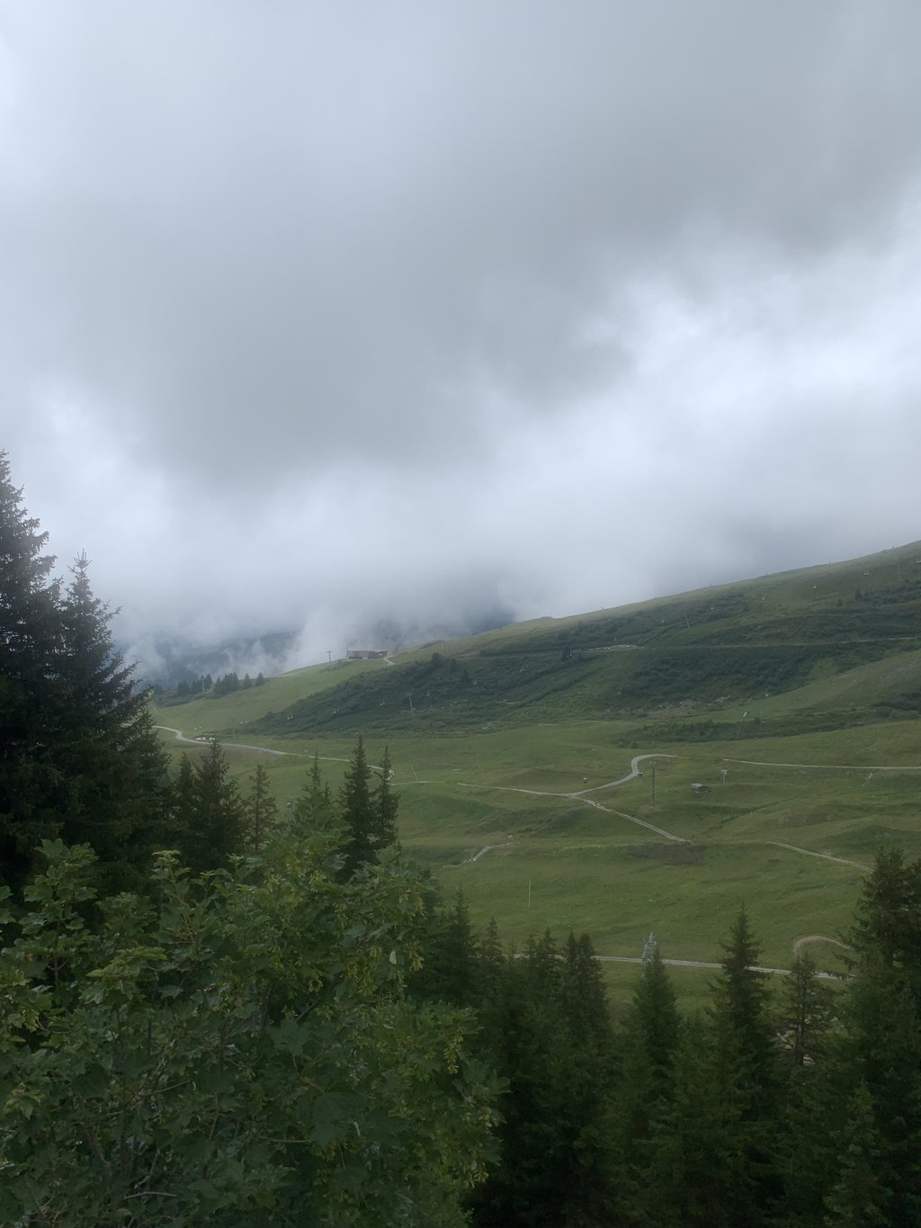
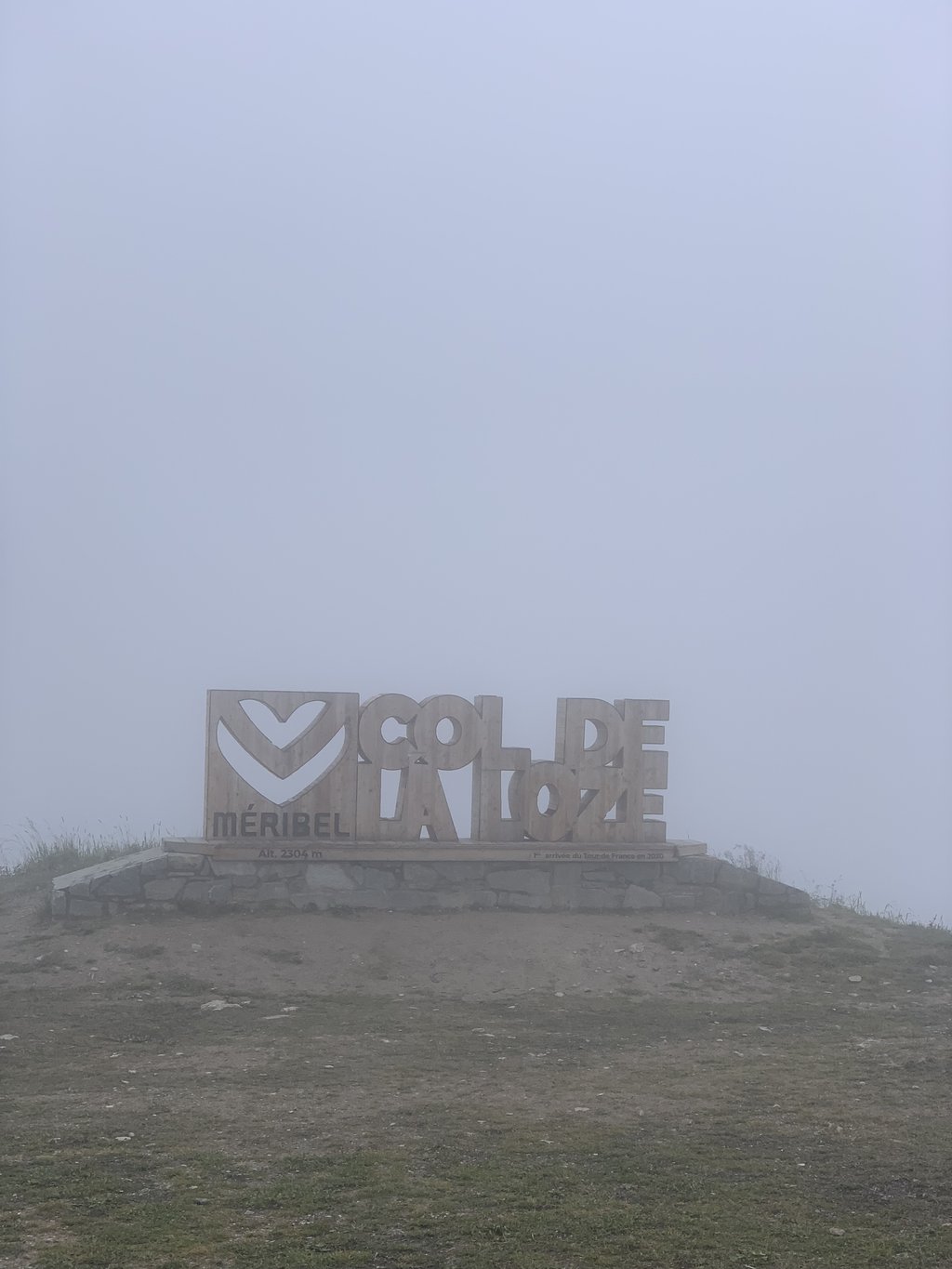
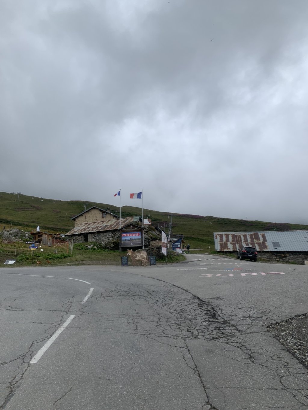
Col de la Loze from Courchevel is a climb in the region Savoie. It is 5.5 mi long and bridges 1919 ft of vertical ascent with an average gradient of 6.6%, resulting in a difficulty score of 497. The top of the ascent is located at 7556 ft above sea level. Climbfinder users shared 4 reviews of this climb and uploaded 15 photos.
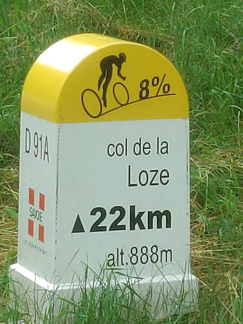
Road names: Rue de Bellecôte, Rue de Nogentil, Route de l'Altiport & Accès au Col de la Loze
5.0 by sergenavetatThis is an automatic translation, the original language is: French.Opinions on this new pass are very divided as it is a newly tarmacked road that winds through the high mountain pastures but also from station to station with chairlifts. It is difficult to ignore the ski lifts during the ascent. The positive side despite everything is the superb landscapes on a road entirely closed to traffic in the last 6 kilometers which is rare, at the approach of the summit the rocky terrain gives way to pastures and it is beautiful. At one point I thought I was in the ... read more

Welcome! Please activate your account if you would like to share something. Look for the verification email in your inbox.
If you want to upload your photos, you need to create an account. It only takes 1 minute and it's completely free.
what better way to complete my Alps babtism than this years Tour Queen stage. admittedly I was scared sh..tless. Most had returned from the climb and were celebrating i was only thinking about those last few kilometers 20% plus.. Bo the Danish coach looked to me, I said "I'm off". Glad I did. He shadowed me all the way, took the photos and set me off on a outrageous downhill ride. A must do ride
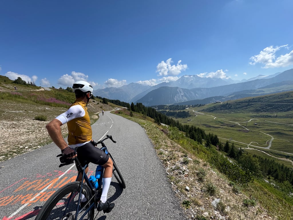
Nice climb with the passage through the resort and the final section on the cycle path. The road in the resort is in a bit of a state, but nothing to worry about. The car-free section is incredible, but watch out for cyclists coming down the Loze and taking up the whole width.
Belle montée avec le passage dans la station et la partie finale sur la piste cyclable. La route est un peu en mauvaise état dans la station, mais rien de bien gênant. La partie sans voiture est incroyable, mais attention aux cyclistes qui redescendent de la Loze en prenant toute la largeur.
Lovely climb. The last 6 km on the cycle path were nice and annoying at the same time. Without (trucks) cars it is nice cycling, but pfoe what an irregular climb from the barrier. Then flat, then super steep again. Not quite my thing. But I enjoyed the whole way. Anyone who loves cycling should go up here!
Heerlijke beklimming. De laatste 6km over het fietspad waren fijn en vervelend tegelijk. Zonder (vracht)auto's is het lekker fietsen, maar pfoe wat een onregelmatige klim vanaf de slagboom. Dan weer vlak, dan weer super steil. Niet helemaal mijn ding. Maar ik heb wel de hele weg genoten. Iedereen die van fietsen houdt moet hier omhoog!
Opinions on this new pass are very divided as it is a newly tarmacked road that winds through the high mountain pastures but also from station to station with chairlifts.
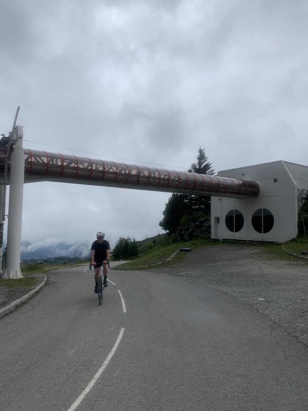
It is difficult to ignore the ski lifts during the ascent.
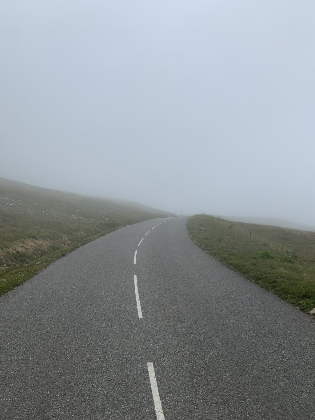
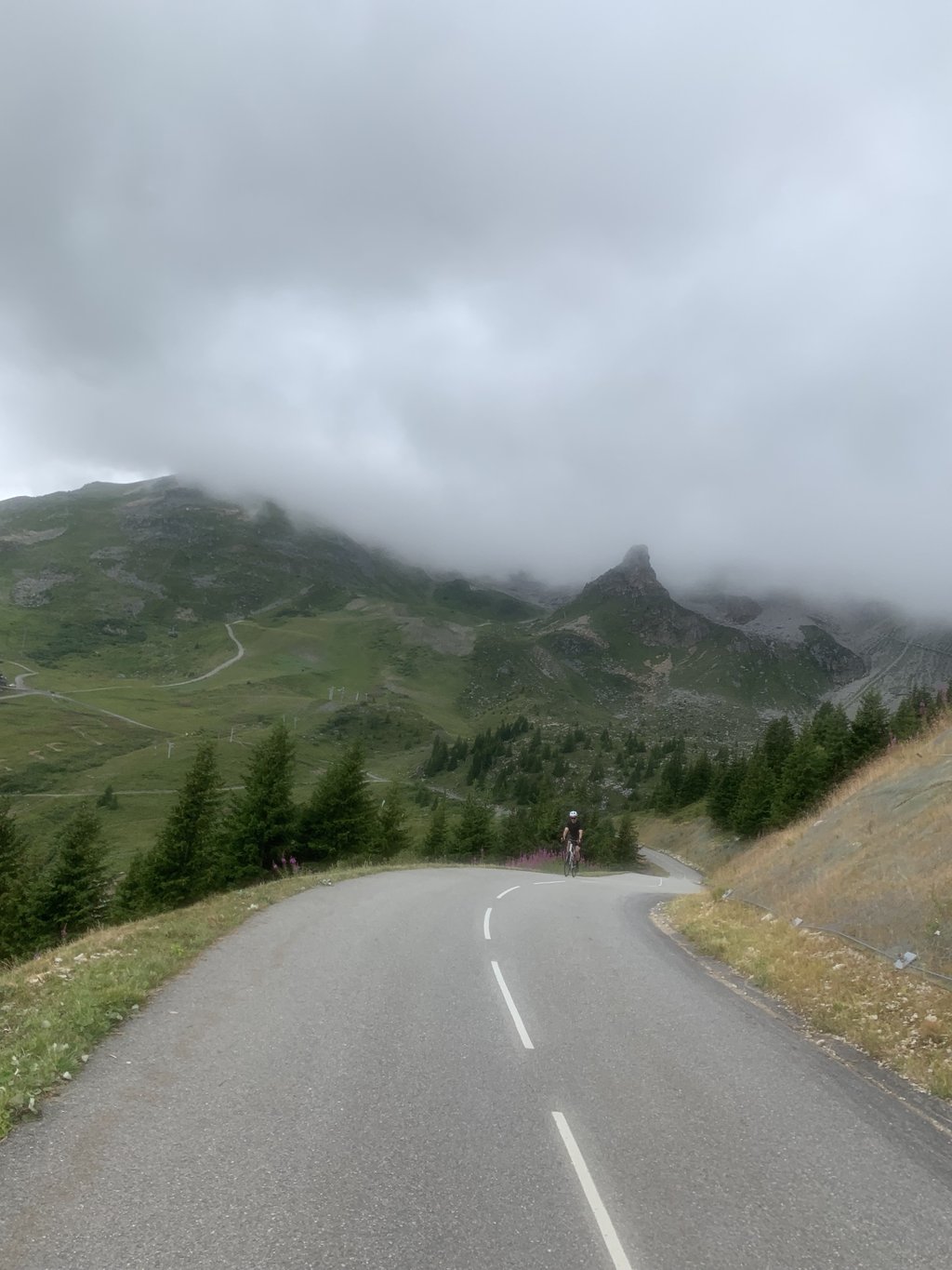
The positive side despite everything is the superb landscapes on a road entirely closed to traffic in the last 6 kilometers which is rare, at the approach of the summit the rocky terrain gives way to pastures and it is beautiful.
At one point I thought I was in the Izoard at the Casse Déserte.
Departure from Carrey, we go up to Courchevel passing Saint Bon, le Praz, and a little bit higher Moriond.
On this part the traffic is consequent.
The day I went up, the signposting was limited, I think that now it is at the top.
The steepest percentages are just after crossing the barrier with a good little wall passing at 18% and the 500M before the summit very hard about 14-15%
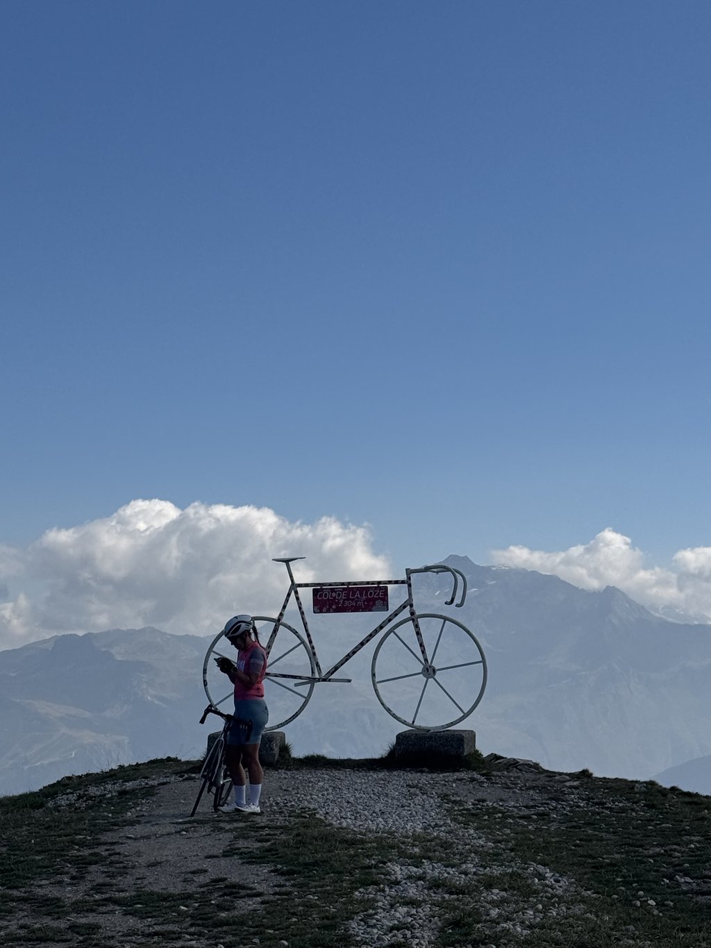
The scenery at the top is beautiful, still disregarding the lifts m lifts.
I came down through Meribel and it looks even tougher.
You really have to be careful on the descent because it goes fast and in places the laces are very tight.
There are even bands to slow down and signs that indicate a danger because this new road cuts through downhill mountain bike passages that existed long before.
I have noticed that on the arrival of the mountain bike paths there are now barriers like on the bike paths.
Les avis sur ce nouveau col sont très partagés car c’est un chemin nouvellement goudronné qui serpente dans les Alpages de Haute montagne mais aussi de Gares en Gares de Télésièges.
Difficile de faire abstraction aux remontées mécaniques lors de l’ascension.
Le côté positif malgré tout ce sont de superbes paysages sur une route entièrement fermée à la circulation dans les 6 derniers kilomètres ce qui est rare, à l'approche du sommet la rocaille fait place aux pâturages et c'est beau.
A un moment je pensais être dans l’Izoard au niveau de la Casse Déserte.
Départ du Carrey, on s’élève vers Courchevel en passant Saint Bon, le Praz,et un peu plus haut Moriond.
Sur cette partie la circulation automobile est conséquente.
Le jour où je suis monté, le fléchage était limite, je pense que maintenant il est au Top.
Les pourcentages les plus raides se situent juste après le franchissement de la barrière avec un bon petit mur passage à 18% et les 500M avant le sommet très durs environ 14-15%
Le paysage au sommet est magnifique, toujours en faisant abstraction aux remontées m mécaniques.
Je suis descendu par Méribel et ça parait encore plus costaud.
Il faut vraiment faire attention dans la descente car ça va vite et par endroits les lacets sont très resserrés.
Il y a même des bandes pour faire ralentir et des panneaux qui indiquent un danger car cette nouvelle route coupe des passages de descentes à VTT qui existaient bien avant.
D'ailleurs j'ai remarqué que sur l'arrivée des chemins VTT il y a maintenant des barrières de rétrécissements comme sur les pistes cyclables.
| 5 mph | 01:06:06 |
| 7 mph | 00:46:48 |
| 9 mph | 00:36:28 |
| 12 mph | 00:27:24 |
This page is better in the app