| Famous climb |
| 40 hairpin turns |
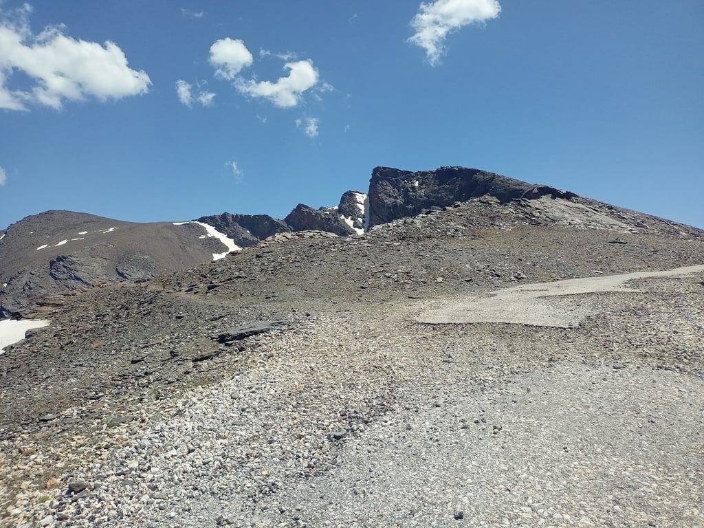
| Gravel |
| #59 toughest climb of World |
| #22 most elevation gain of World |
| #37 longest climb of Europe |
| #9 average steepest climb of Sierra Nevada |
Pico Veleta / Alto de la Sierra Nevada via Collado de las Sabinas is a climb in the region Sierra Nevada. It is 24.5 mi long and bridges 8635 ft of vertical ascent with an average gradient of 6.7%, resulting in a difficulty score of 1887. The top of the ascent is located at 11076 ft above sea level. Climbfinder users shared 7 reviews of this climb and uploaded 17 photos.
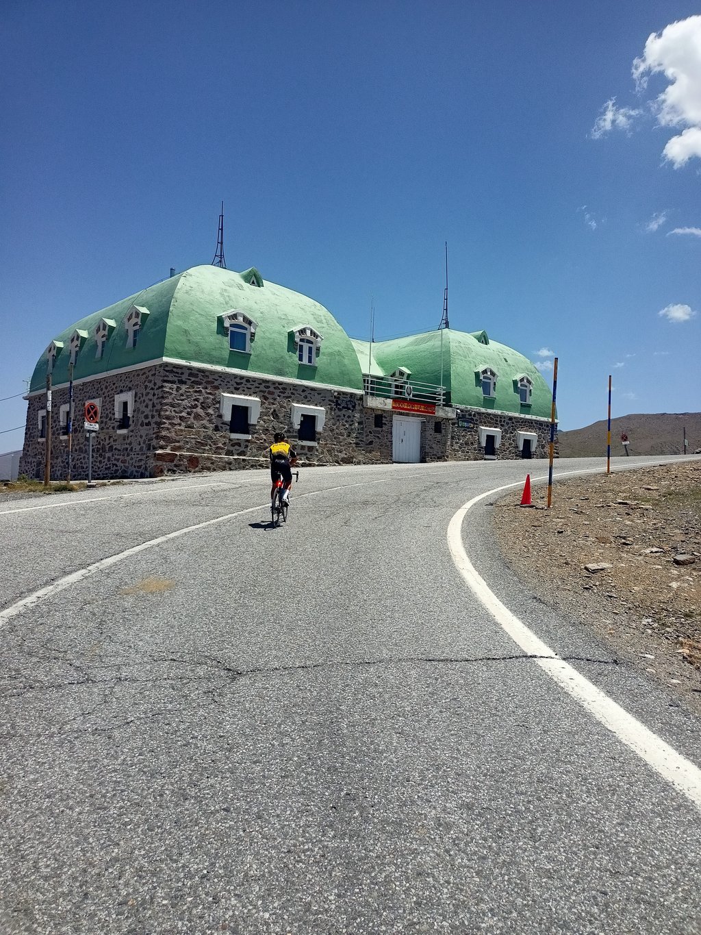
Road name: A-395
4.0 by wernerdrThis is an automatic translation, the original language is: French.This version via the A4025 (towards Colorado de Las Sabina's) is nicer than the one via the A395 all the way, I think. Still, it's very hard overall because of the distance. The last km doesn't seem feasible on a normal bike route.... read more

Welcome! Please activate your account if you would like to share something. Look for the verification email in your inbox.
If you want to upload your photos, you need to create an account. It only takes 1 minute and it's completely free.
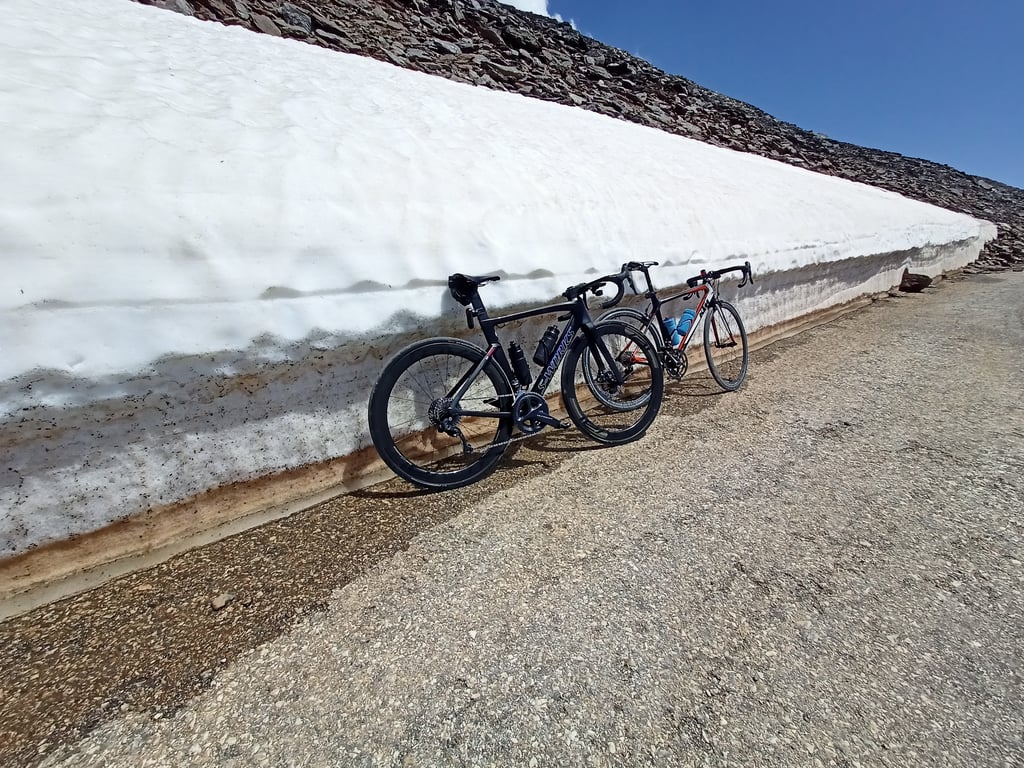
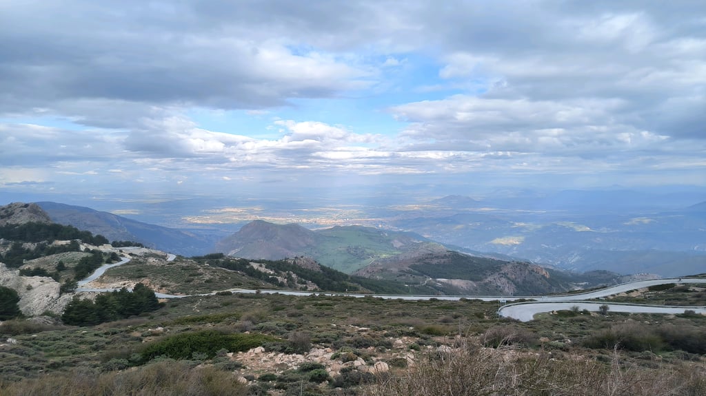
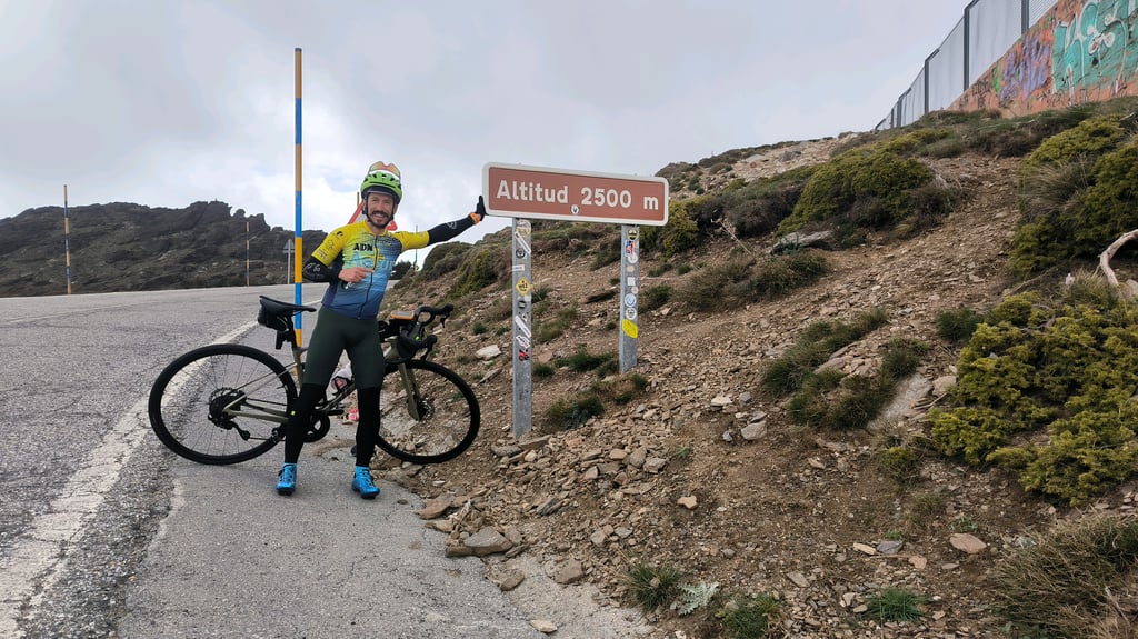
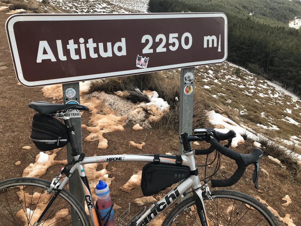
One of those ascents that you have to do if or yes, climbing to the highest pass in Europe, which we will have to return because there was still a lot of snow. The road was good up to 2500 meters above sea level, with hardly any traffic in the first part and then light.
Una de esas ascensiones que hay que hacer si o sí, subiendo al paso más alto de Europa, que tendremos que volver ya que había mucha nieve aún. La carretera buen firme hasta cota 2500 y tráfico sin apenas en la primera parte y luego ligero.
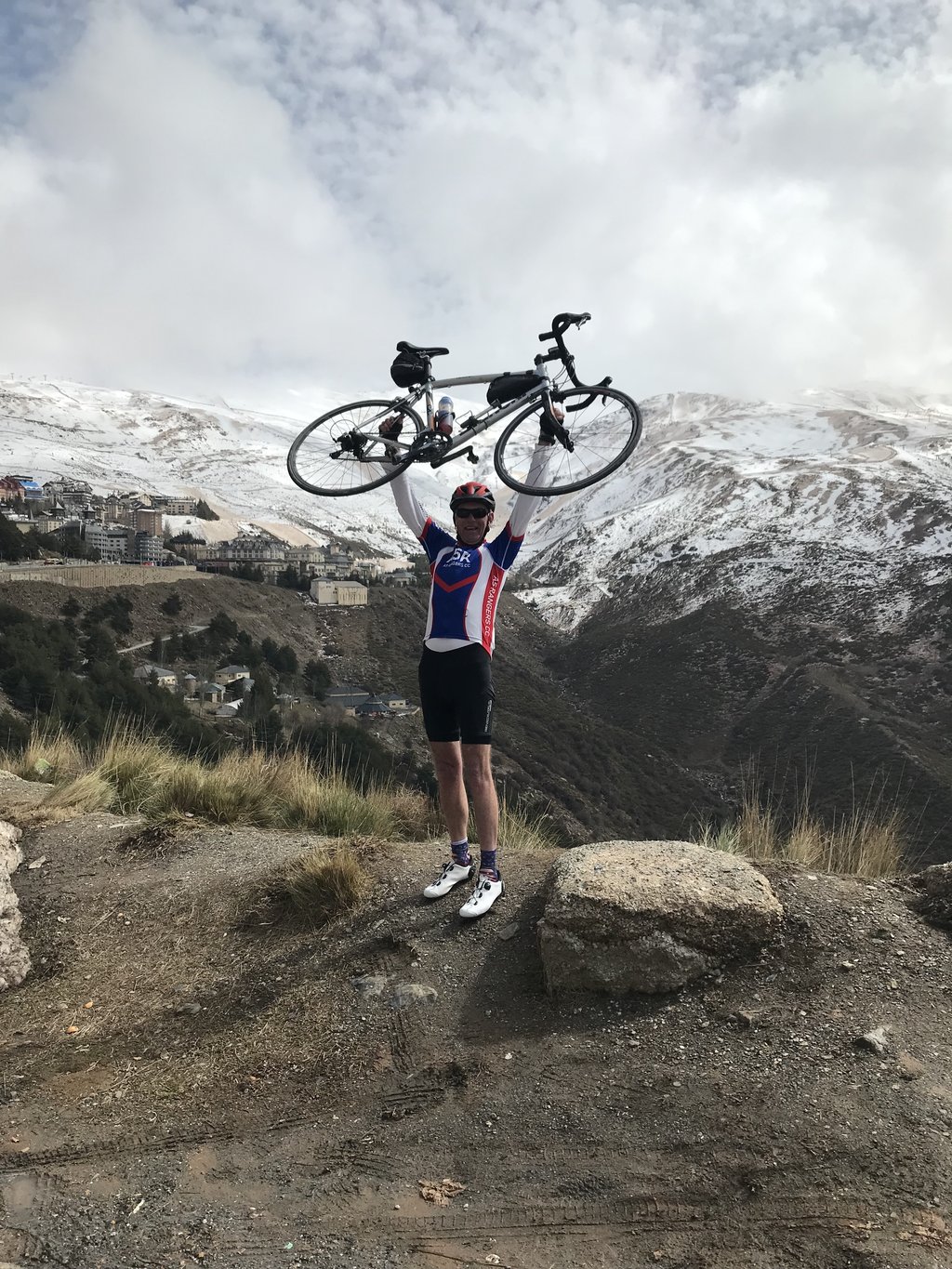
Highest tarmac road in Europe, had to be done. Flew to Malaga, hired a car and off we went. What a climb, very tough at the bottom but the gradient eases off then it’s all about distance and end endurance. And the cold and snow at the top. But don’t worry you can always buy a ski jacket at one of the ski stations for £240!!
Rode up in the early morning of the TransIberica 2023. The night was very hot, and on top (a good four hours later) it was slightly less hot.
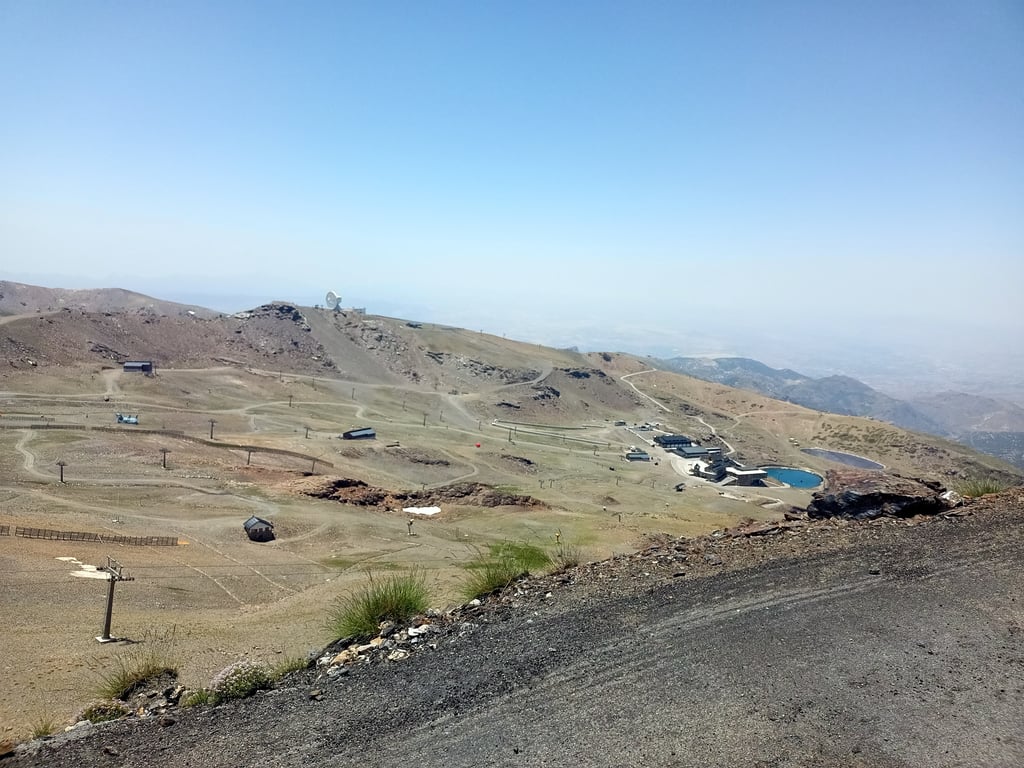
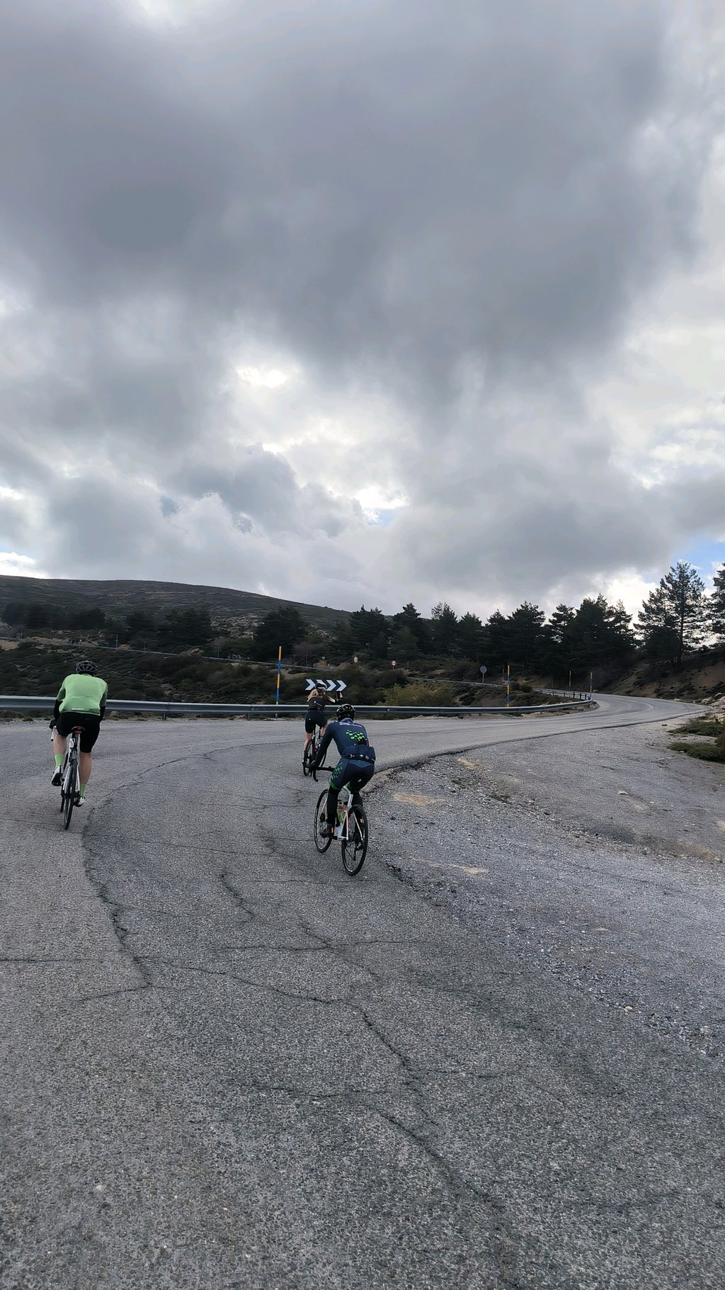
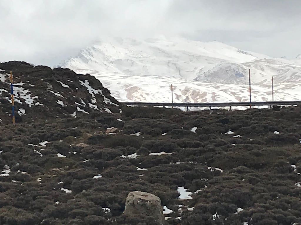
The climb is very difficult when sleep deprived, but also very beautiful. I can recommend everyone to set the alarm at 05:00 and jump on your bike. Along the way, you'll see the sun rise over the Sierra Nevada as you share the road with chamois, mountain goats and cows. Car traffic is there, but very marginal. These are also not allowed beyond the ski station at about 2800 metres uphill. Afterwards, you can cycle on. If you still encounter cars're those of the park rangers. There also seems to be a van for tourists but I have not seen it You do encounter more hikers without a bus.
The gravel section is not really good for cycling in my opinion, but by then you are very tired anyway. So a bit of hike-a-bike can be done by then. The thin air didn't bother me that much. Maybe because the mountain is relatively close to the sea, but the experts will have to say whether that is the case.
By road bike, you cannot get any higher in Europe so I absolutely recommend this. This climb does not really have an equal. Of course there are longer gradients but this climb also has a continuous heavy gradient to it. It lacks cycling history, but that is why you have all the space you need to write your own story and you should definitely do so.
In de vroege ochtend van de TransIberica 2023 omhoog gereden. De nacht was erg warm, en bovenop (een dikke vier uur later) was het iets minder warm.
De klim is erg lastig bij slaapgebrek, maar ook erg mooi. Ik kan iedereen aanraden om de wekker om 05:00 te zetten en op je fietsje te springen. Onderweg zie je de zon opkomen boven de Sierra Nevada terwijl je de weg deelt met gemzen, berggeiten en koeien. Autoverkeer is er wel, maar zeer marginaal. Die mogen ook niet verder dan het skistation op ongeveer 2800 meter hoger. Naderhand kan je doorfietsen. Als je nog auto's tegenkomt dan zijn die van de parkrangers. Er schijnt ook een busje te zijn voor toeristen maar die heb ik niet gezien Je komt wel meer wandelaars zonder bus tegen.
Het gravelstuk is naar mijn mening niet echt goed te fietsen, maar tegen die tijd ben je sowieso erg moe. Dus een beetje hike-a-bike kan er dan nog wel af. Van de ijle lucht had ik niet zo'n last. Misschien omdat de berg relatief dicht bij zee licht, maar daarover zouden de experts maar moeten zeggen of dat zo is.
Per racefiets kan je in Europa niet hoger komen dus ik raad dit absoluut aan. Deze klim kent eigenlijk niet echt een gelijke. Natuurlijk zijn er langere hellingen maar deze klim heeft er ook een continu zwaar hellingspercentage bij. Er ontbreekt wielerhistorie, maar daarom heb je alle ruimte om je eigen verhaal te schrijven en dat zou je dan ook zeker moeten doen.
This version via the A4025 (towards Colorado de Las Sabina's) is nicer than the one via the A395 all the way, I think. Still, it's very hard overall because of the distance. The last km doesn't seem feasible on a normal bike route.
Cette version par le A4025 (vers Colorado de Las Sabina's) est plus jolie que celle par A395 sur toute la durée, je pense. Très dure quand même globalement a cause de la distance. Le dernier km me semble pas faisable sur un route de vélo normal.
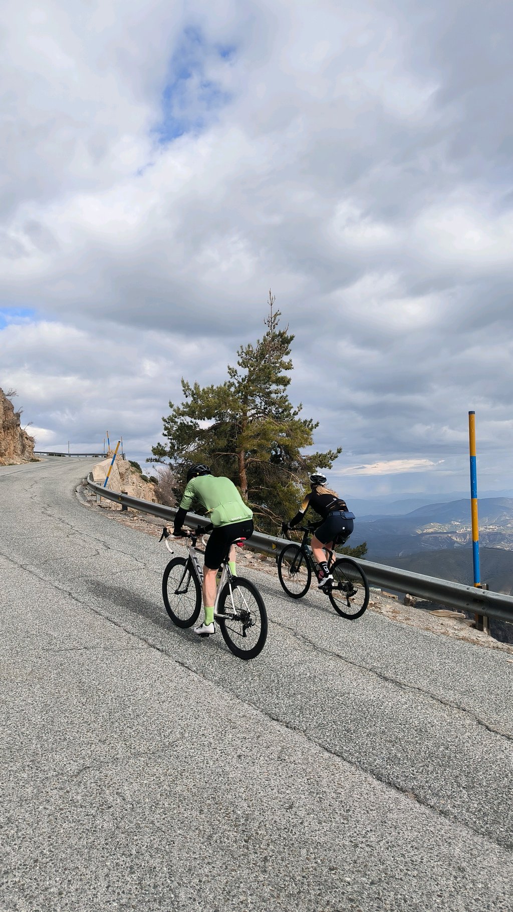
What a great climb, and what an experience. The climb is very long but doable, even though it is nowhere flat. After the barrier the road gets worse and worse, also the weather turned and there was a lot of rain and fog, making it a bit more ''exciting'. Unfortunately could see little of the view.
Wat een geweldige klim, en wat een ervaring. De klim is erg lang maar goed te doen, ook al is het nergens vlak. Na de slagboom word de weg steeds slechter, ook sloeg het weer om en was er veel regen en mist, waardoor het nog wat ''spannender' was. Helaas weinig van het uitzicht kunnen zien door het slecht weer. Wees goed voorbereid het kan spoken op de top.
Beautiful but especially long climb, views are fabulous. Last part is very bad and actually not doable on the thin tires.
Mooie maar vooral lange klim, vergezichten zijn fabuleus. Laatste stuk is erg slecht en eigenlijk niet te doen op de dunne banden.
Really a fantastic climb, especially in spring when many Dutch pros are training here. A climb for the long haul because it is over 40 km up with almost no flat spots. Temperature rose in May from 28 degrees in Granada to freezing at the top. Last part of the road is very bad, especially because there is ice between the pieces of tarmac. But where do you climb 2500 meters
Echt een fantastisch klim, vooral in het voorjaar sls veel Nederlandse profs hier ook aan het trainen zijn. Wel een klim voor de lange adem want het is meer dan 40 km omhoog met bijna geen vlak stukje. Temperatuur steeg in mei van 28 graden in Granada naar vriespunt op de top. Laatste stuk weg is erg slecht vooral omdst er ijs ligt tussen de brokken asfalt. Maar waar klim je dik 2500 meter
| 5 mph | 04:55:12 |
| 7 mph | 03:28:59 |
| 9 mph | 02:42:52 |
| 12 mph | 02:02:21 |
This page is better in the app