| 2 hairpin turns |
| Gravel |
| #99 longest climb of Cologne |
Karlshöher via Friedrichweg is a climb in the region Cologne. It is 2.6 mi long and bridges 489 ft of vertical ascent with an average gradient of 3.6%, resulting in a difficulty score of 108. The top of the ascent is located at 1102 ft above sea level. Climbfinder users shared 4 reviews of this climb and uploaded 16 photos.
Road names: Kronenberg, Gemmenicher Weg, Friedrichweg, Moresneter Weg & Karlshöher Hochweg
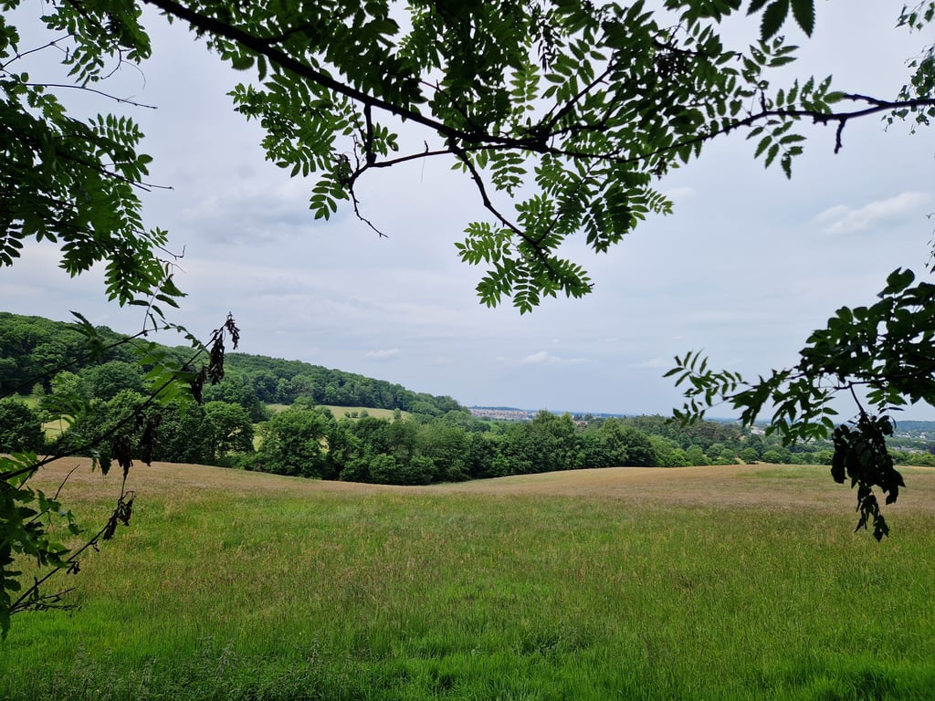
4.0 by JarinThis is an automatic translation, the original language is: Dutch.Beautiful climb through the Aachener Wald. Largely unpaved, which makes this climb not really suitable for road bikes, especially in wet conditions. In my opinion, the gravel bike was created for this climb. In the first forest section, beautiful views of Aachen.... read more

Welcome! Please activate your account if you would like to share something. Look for the verification email in your inbox.
If you want to upload your photos, you need to create an account. It only takes 1 minute and it's completely free.
Beautiful climb through the Aachener Wald. Largely unpaved, which makes this climb not really suitable for road bikes, especially in wet conditions. In my opinion, the gravel bike was created for this climb. In the first forest section, beautiful views of Aachen.
Prachtige klim door het Aachener Wald. Voor een groot gedeelte onverhard, waardoor deze klim zeker in vochtige omstandigheden niet echt geschikt is voor racefietsen. Voor deze klim is de gravelbike naar mijn mening in het leven geroepen. In het eerste bosgedeelte prachtige vergezichten op Aachen.
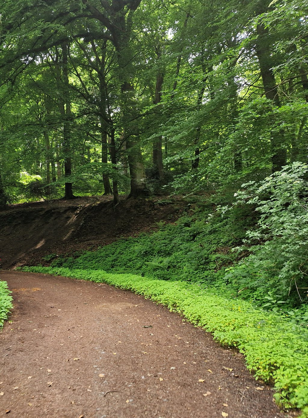
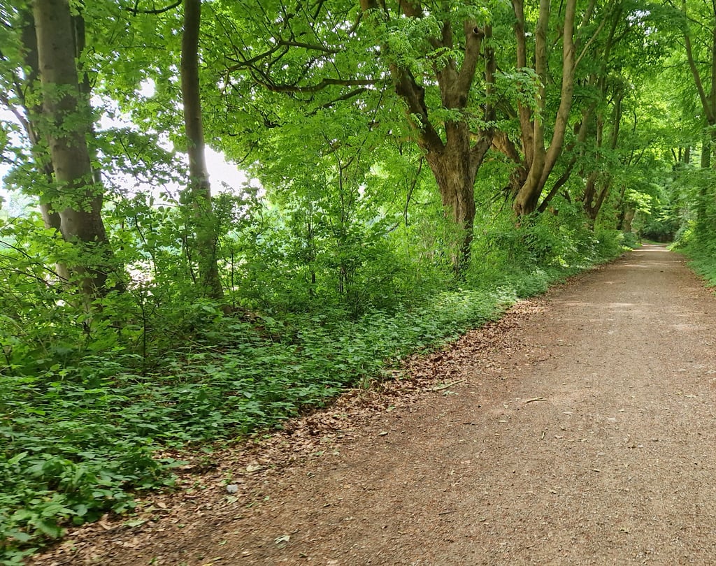
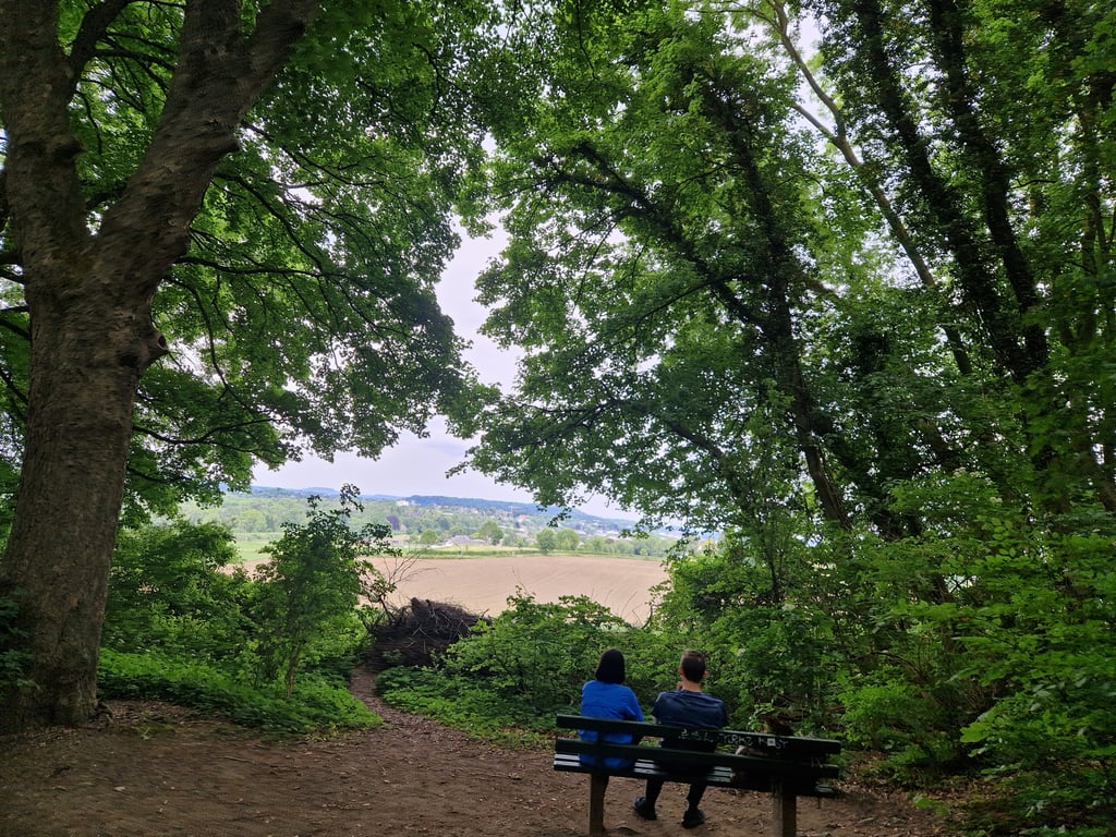
Yes it is gravel but the vast majority is perfectly rideable (hard and quite fine-grained) and the climb winds through beautiful scenery. From the built-up area, it rises relaxed along the railway (with some flatter sections). Where the asphalt road turns left, go straight ahead into the gravel road where it immediately goes up nicely. Here the gravel is a bit coarser but doable although I wouldn't go into it fully with thin tyres. After the barrier, the excellent gravel comes as described and it stays that way until you reach asphalt again. The road swings quite a bit and there are lots of side roads but you just have to follow the "curve" to stay on the route. This section starts out flat (and sometimes even descending) but further on it goes up and keeps doing so until the summit. Every now and then bits of hollow road and parts along quite steep slopes. A beautiful route. A hairpin bend brings you back to asphalt and further on you turn sharp left to the summit.
Tip: If you go straight ahead at the last turn into the excellent and almost flat gravel road (after all, you've already ridden on gravel), you'll pass a tank barrier and a bit further on you'll enter Belgium (here the road gets a bit less but remains OK). At the next junction (with road cross) you can turn right, a slightly descending tarmac road to the Vaalserberg (just before the three countries point a few metres of bad road surface).
Ja het is gravel maar het overgrote deel is prima berijdbaar (hard en behoorlijk fijnkorrelig) en de klim loopt al slingerend door een prachtige omgeving. Vanuit de bebouwde kom loopt het relaxed langs het spoor omhoog (met enkele vlakkere stukken). Waar de asfaltweg naar links gaat, ga je rechtdoor de gravelweg in waar het meteen leuk oploopt. Hier is het gravel wat grover maar goed te doen al zou ik er met dunne bandjes niet vol ingaan. Na de slagboom komt het uitstekende gravel zoals beschreven en zo blijft het tot je weer op asfalt komt. De weg slingert behoorlijk en er zijn veel zijwegen maar je hoeft gewoon de "curve" te volgen om op de route te blijven. Dit deel begint vlak (en soms zelfs dalend) maar verderop gaat het stijgen en dat blijft het doen tot de top. Zo nu en dan stukjes holle weg en delen langs best steile hellingen. Een prachtig traject dus. Via een haarspeldbocht kom je weer op asfalt en verderop ga je scherp links naar de top.
Tip: Als je bij de laatste bocht rechtdoor gaat de uitstekende en vrijwel vlakke gravelweg in (tenslotte heb je al op gravel gereden), kom je langs een tankversperring en iets verderop rijd je België in (hier wordt de weg iets minder maar blijft OK). Bij de volgende kruising (met wegkruis) kan je rechtsaf, een lichtjes dalend asfaltweggetje naar de Vaalserberg (vlak voor het drielandenpunt enkele meters slecht wegdek).
Initially gentle gradients over good tarmac, as you enter the forest the gradients become more difficult and the tarmac turns into a poor gravel path. In the flat section of the climb, however, the gravel path becomes very good. In the final section, you climb the last few metres on good asphalt. At the beginning, there are still a few views over the region, but by the middle section at the latest, it is only through a dense forest. Nevertheless, it is a very nice climb.
Zunächst sanfte Prozente über guten Aspahlt, wenn man in den Wald gelangt werden die Prozente schwieriger und der Aspahlt wird zu einem schlechten Kiesweg. Im Flachstück des Anstiegs wird der Kiesweg hingegen sehr gut. Im Schlussteil klettert man auf gutem Aspahlt die letzten Höhenmeter. Am Anfang noch mit ein paar Aussichten über die Region, spätestens im Mittelteil aber nur noch durch einen dichten Wald. Dennoch klettertechnisch sehr schön zu fahren.
Due to a road closure, we were forced to discover this gravel climb, but very grateful for it. Wonderful cycling, even with only 25mm tyres. The road winds very nicely through a green and shady forest , highly recommended for anyone in this region who is not afraid of a bit of gravel.
Door een wegafsluiting deze gravelbeklimming noodgedwongen ontdekt, maar zeer dankbaar daarvoor. Prachtig om te fietsen, zelfs met maar 25mm banden. De weg slingert heel mooi door een groen en schaduwrijk bos , absolute aanrader voor een ieder in deze streek die niet bang is voor een beetje gravel.
| 5 mph | 00:30:53 |
| 7 mph | 00:21:51 |
| 9 mph | 00:17:02 |
| 12 mph | 00:12:48 |
This page is better in the app