Tips nearby


| Famous climb |
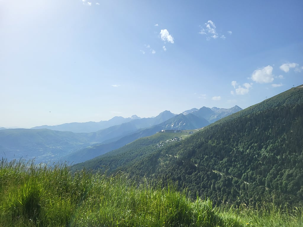
| Beautiful scenery |
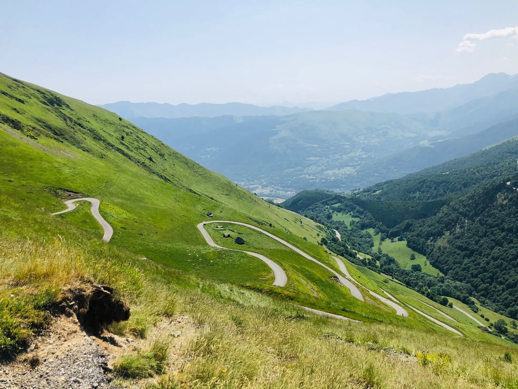
| 19 hairpin turns |
| #23 toughest climb of France |
| #59 most elevation gain of France |
| #77 longest climb of French Pyrenees |
| #75 average steepest climb of Hautes-Pyrénées |
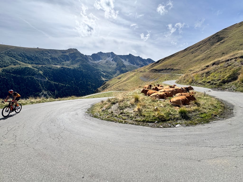
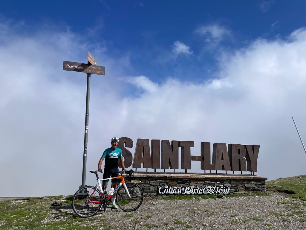
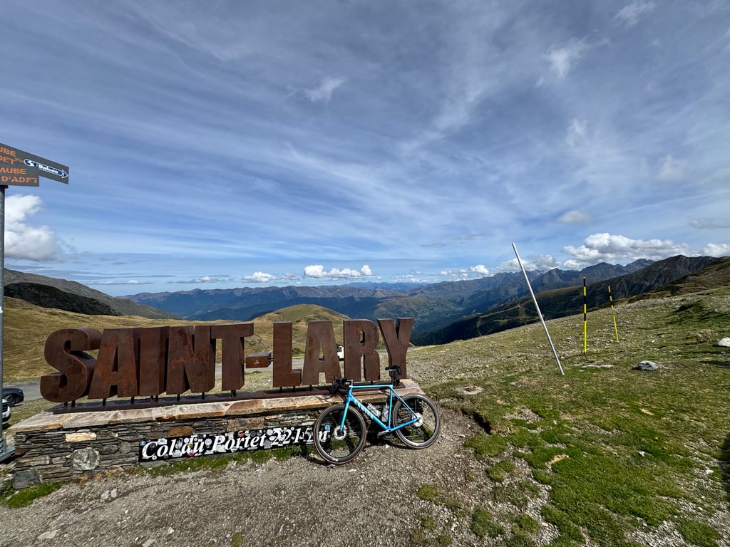
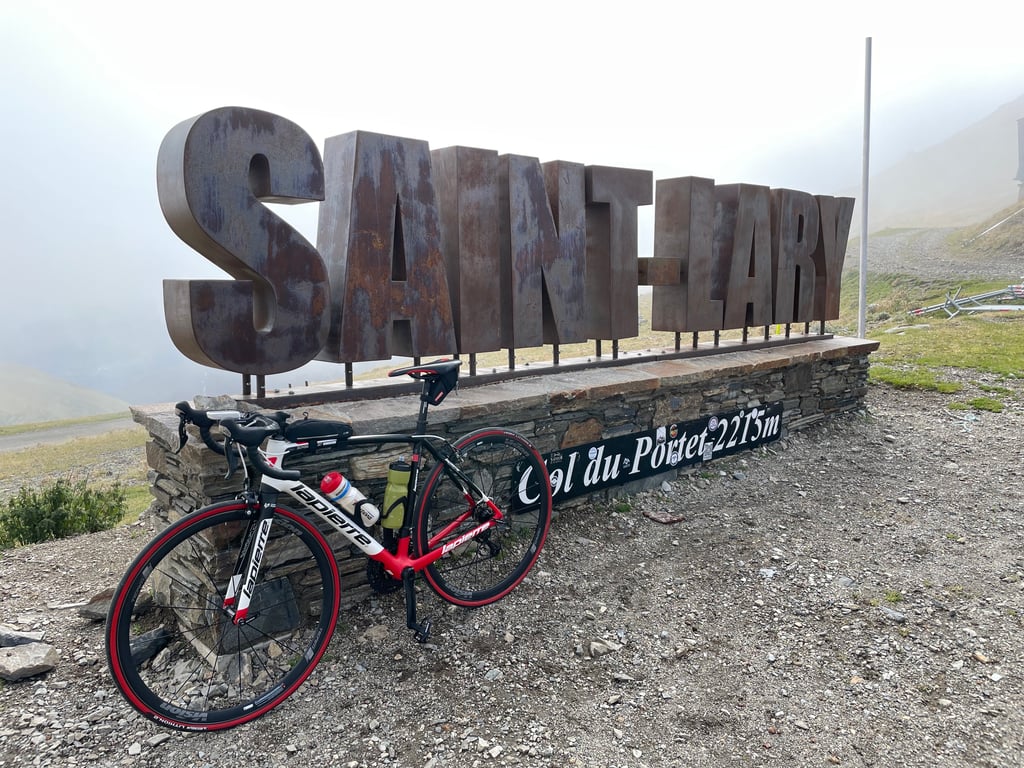
Col de Portet from Saint Lary Soulan is a climb in the region Hautes-Pyrénées. It is 16.1 km long and bridges 1395 m of vertical ascent with an average gradient of 8.7%, resulting in a difficulty score of 1273. The top of the ascent is located at 2207 m above sea level. Climbfinder users shared 21 reviews of this climb and uploaded 50 photos.
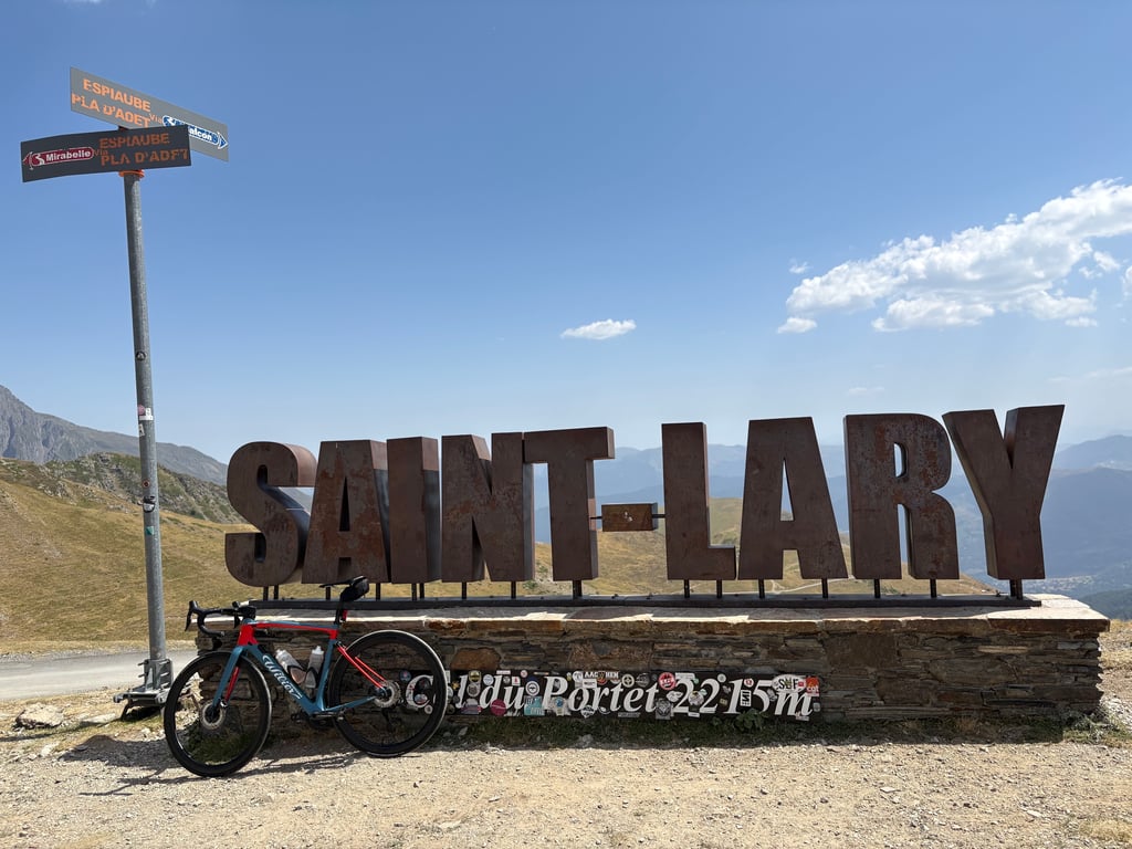
Road name: D123, col du portet
5.0 by LiezyBRThis is an automatic translation, the original language is: Dutch.Since 2018, the Col du Portet exists. An idea of the municipality of Saint-Lary-Soulan to turn a serviceroad into an arrival HC for a tour stage. Nairo Quintana then won the short climbing stage. HC. The correct category. It's a giant! A magnificent giant. The road from the village winds up beautifully. You see how steep it is. The first few kilometres do not go below 10%. From kilometer 1 to 6 you climb shared with "Pla d'Adet". The climb to the ski station. ... read more
Welcome! Please activate your account if you would like to share something. Look for the verification email in your inbox.
If you want to upload your photos, you need to create an account. It only takes 1 minute and it's completely free.
Spectacular and very hard. It is a must-see if you want to visit it.
Espectacular y durísima. Hay que conocerla si o si.
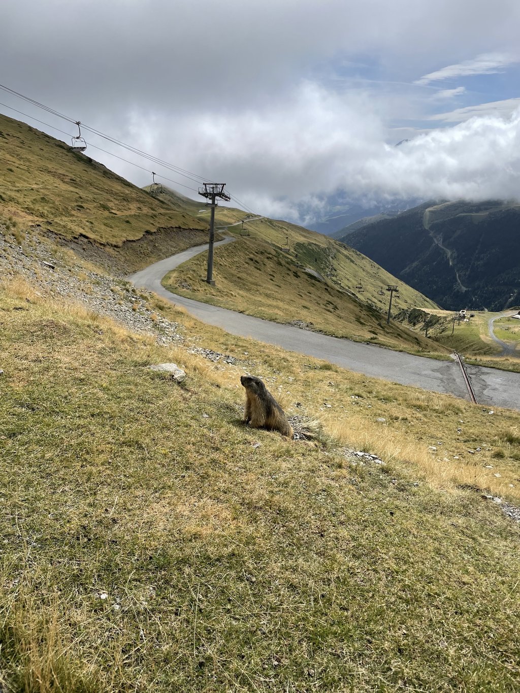
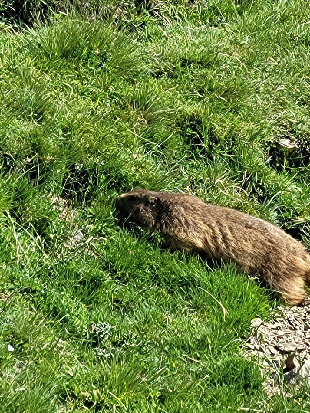
An exceptional pass with magnificent scenery and marmots. One of the highest road passes in the Pyrenees. A must-do at least once.
Un col exceptionnel avec un paysage magnifique accompagné de marmottes. Un des plus haut col routier des Pyrénées. À faire au moins une fois.
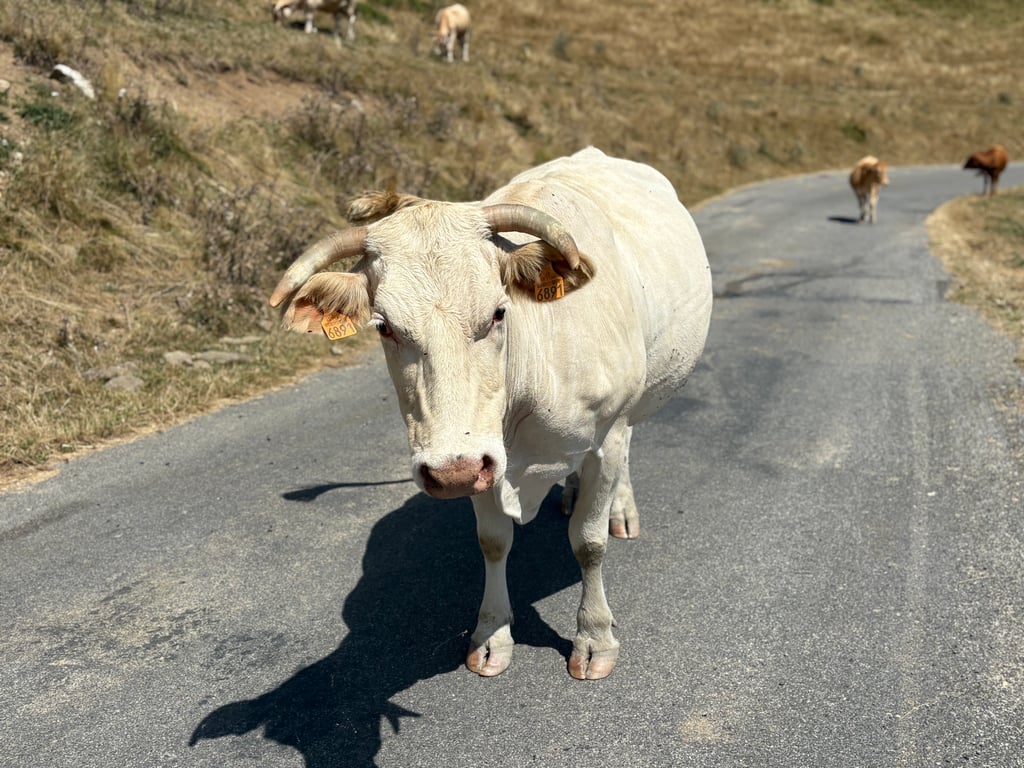
Not exceptionally beautiful, "just" a Pyrenean col above 2000 m. The tarmac "goat path" from Espiaube is almost completely devoid of traffic. Just some cows. I did the climb in August with about 37 degrees. There is no shelter and the sun burns mercilessly on your back. Make sure you grab some more water in Soulan, which is your last option
Niet uitzonderlijk mooi, “gewoon” een Pyreneeencol boven de 2000 m. Het geasfalteerde “geitenpad” vanaf Espiaube is bijna geheel zonder verkeer. Enkel wat koeien. Ik heb de klim in augustus gedaan met zo’n 37 graden. Er is geen beschutting en de zon brandt genadeloos op je rug. Zorg dat je nog wat water pakt in Soulan, dat is je laatste mogelijkheid
Exceptional, must do, no traffic, real little mountain road in the middle of cows and marmots.
Exceptionnel à faire impérativement pas de circulation vrai petite route de montagne au milieu des vaches et des marmottes
The first few kilometres are the most violent and busiest, but once past Espiaube the road is much calmer and the views breathtaking. You need a walking stick to get to the top, but what a pleasure this pass is.
Les premiers kilomètres sont les plus violents et les plus fréquentés, passé Espiaube la route est bien plus calme et la vue à couper le souffle, il faut avoir la canne pour aller en haut mais quel plaisir ce col
A powerful pass with magnificent Pyrenean scenery.
Un col tout en puissance avec les magnifique décors pyrénéens.
What a putrid, giant killer, executioner, butcher, cannibal!!! Horrible climb, but still 5 stars, for the purifying experience and the beautiful views.
Wat een rotzak, reuzendoder, beul, slager, kannibaal!!! Afschuwelijke klim, maar toch 5 sterren, voor de louterende ervaring en de mooie uitzichten.
Probably the most impressive and toughest pass I have ever done.
Probablemente el puerto más impresionante y duro que he hecho nunca
The king of this area if you ask me. A beautiful climb which gives you plenty of challenge. A must for every cyclist!
De koning van dit gebied als je het mij vraagt. Een prachtige klim welke jou genoeg uitdaging geeft. Een must voor iedere wielrenner!
a spectacular climb. 2 lane road, steep, some traffic on a Saturday morning (14/9/24) to the turn off to pla d'Adet, then single lane, loose bits of dirt gravel and squashed cow and sheep poo in the remaining 9km. stunning views across the valley tho. lots marmots just before the tunnel. steep last 1km. no cafe opened at pla d'Adet and nothing at the top of portet.
a spectacular climb. 2 lane road, steep, some traffic on a Saturday morning (14/9/24) to the turn off to pla d’Adet, then single lane, loose bits of dirt gravel and squashed cow and sheep poo in the remaining 9km. stunning views across the valley tho. lots marmots just before the tunnel. steep last 1km. no cafe opened at pla d’Adet and nothing at the top of portet.
You cannot get a lot higher on a road bike, not counting the gravel road off the Tourmalet, but there are a few dead end summits with better views. This one was windy af, blowing my bike away, even while it was laying in the grass. Luckily, no abyss... The 8 kms form Espiaubie are closed to motorized traffic from 8:30AM to 6PM (in the summer at least). Be careful when going down, as the 10-cm deep steel water gutters run diagonally across the road and can cause you to crash. Pla d'Adet is all but a freebie on your way down...
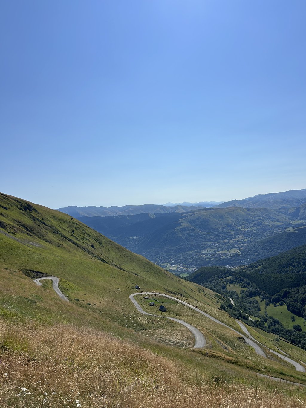
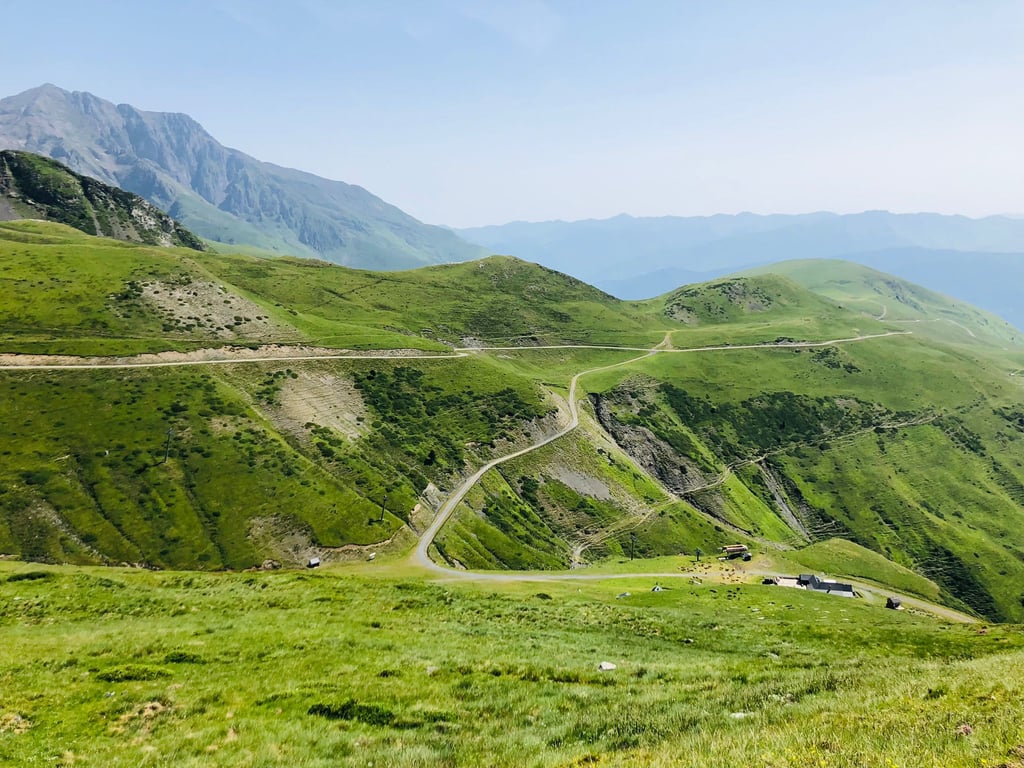
The route of the Col de Portet starts in the village of Saint-Lary-Soulan where you follow the signs to Pla d'Adet.
It immediately starts with percentages above 10% and this continues for 5 km until the village of Soulan.
Here a little less steep for a while until the junction Pla d'Adet and the Col de Portet.
At the bottom of the Col de Portet there is immediately a sign with what awaits you, 8 km average 8.6%.
You now ride into no man's land among sheep, cows and, at the top, a family of marmots.
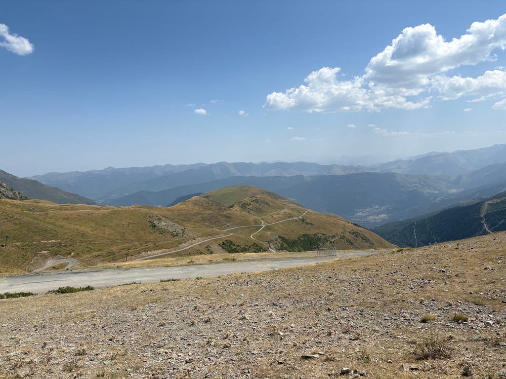
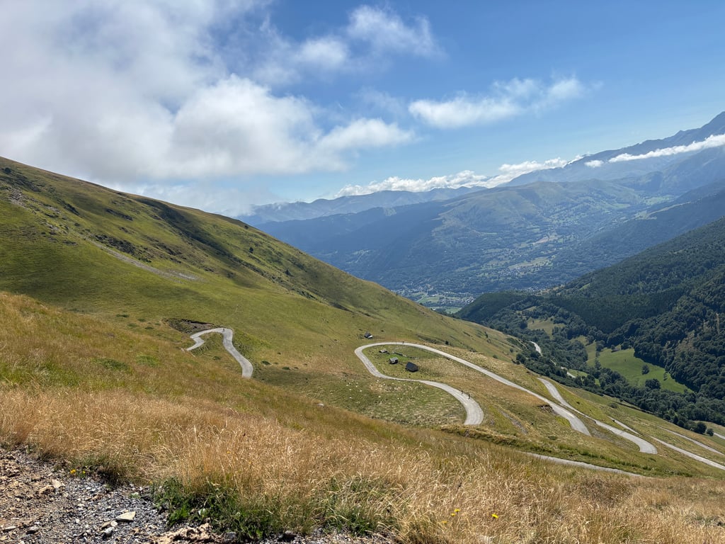
It is completely bare, which gives a wide view over the hairpin bends, among others.
Above, a special pass sign and countless goats that start licking your legs.
Very special.
1 of the most beautiful climbs I've done!
De route van de Col de Portet start in het dorp Saint-Lary-Soulan waar je de borden volgt naar Pla d'Adet.
Het begint meteen met percentages van boven de 10% en dat blijft 5 km doorgaan tot het dorp Soulan.
Hier even wat minder steil tot de splitsing Pla d'Adet en de Col de Portet.
Onderaan de Col de Portet staat meteen een bord met wat je te wachten staat, 8 km gemiddeld 8.6%.
Je rijdt nu niemandsland in tussen schapen, koeien en bovenin een familie marmotten.
Het is helemaal kaal en dat geeft een weidse blik over o.a. de haarspeldbochten.
Boven een bijzonder pasbord en talloze geiten die aan je benen beginnen te likken.
Heel bijzonder.
1 van de mooiste beklimmingen die ik gedaan heb!
It's impossible to skip this pass, which is widely regarded as the most difficult in the Pyrenees.
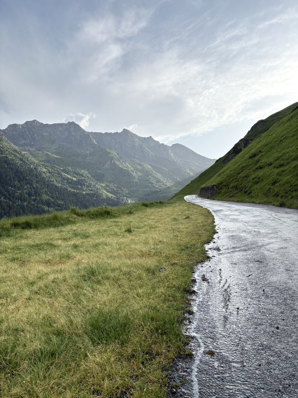
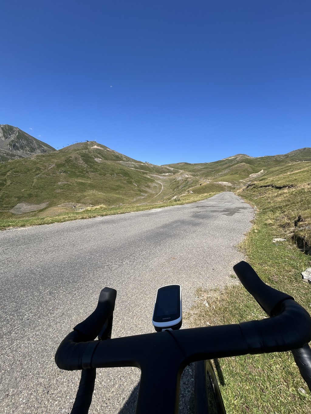
The first half is shared with the ascent to Pla d'Adet as far as Espiaube. The steepest slopes are to be found in this first part, which takes you along a cornice road offering a beautiful view over the valley. Don't look for shade in the middle of summer: there isn't any. The road is fairly light and quiet.
At Espiaube, turn right onto the Route du Portet, which is normally closed to motorised traffic (although I did pass 3 cars). For the 8km to the pass, you'll find the usual Pyrenean gradients of around 8% which you can manage without too much difficulty. The surface is a little stony: this isn't a problem on the way up, but you need to be careful on the way down, especially as the road is narrow and a few drainage gullies cross it. The landscape is very open and pastoral, and you come across cows and sheep.
Climbed at the beginning of August in conjunction with Hourquette d'Ancizan.
Comment faire l'impasse sur le col répertorié comme le plus difficile des Pyrénées ?
La première moitié est commune avec la montée vers le Pla d'Adet jusqu'à Espiaube. Les pentes les plus raides se trouvent dans cette première partie, qui emprunte une route en corniche offrant une très belle vue sur la vallée. Ne cherchez pas d'ombre en plein été : il n'y en a pas. La route est assez peu fréquentée et calme.
A Espiaube, prenez à droite la route du Portet, qui est interdite en principe à la circulation automobile (j'ai toutefois croisé 3 voitures). On retrouve, dans les 8 km jusqu'au col, des pourcentages autour de 8% habituels dans les Pyrénées que l'on peut gérer sans trop de difficulté. Le revêtement est un peu caillouteux : ce n'est pas gênant à la montée mais il faut rester prudent à la descente, d'autant que la route est étroite et que quelques rigoles de drainage la traversent. Le paysage est très ouvert et bucolique et l'on croise des vaches et des ovins.
Ascension réalisée début août en enchaînement avec la Hourquette d'Ancizan.
I made the ascent on 11∕08∕23 after the Cap de Long and Lacs Aumar/Aubert climbs, which somewhat distorts my judgement of the difficulty of this pass, compared to other climbs made without too much prior effort.
FICARI's description is completely accurate and precise, and I did see some marmots on the way down (just after the tunnel).
It's not the most beautiful pass in the Pyrenees but certainly one of the most demanding (as indicated by its Climbfinder rating). There's no shade (I climbed it at around 1pm...) and little respite. Still, it's less violent than some of the passes in the Basque country; I'm thinking in particular of Mont Artzamendi from Espelette.
I think it's a shame that the kilometre markers (with %, altitude and distance) disappear 7 km from the summit, but the fact that there are no cars from Espiaube onwards is nice.
Montée effectuée le 11∕08∕23 après les ascensions de Cap de Long et des Lacs Aumar/Aubert, ce qui fausse un peu mon jugement sur la difficulté de ce col, en comparaison à d'autres ascensions faites sans trop d'efforts préalables.
La description de FICARI est tout à fait juste et précise et j'ai ,effectivement,vu des marmottes en descendant (un peu après le tunnel).
Ce n'est pas le plus beau col des Pyrénées mais assurément un des plus exigeants (comme indiqué par sa notation Climbfinder). Il n'y a pas d'ombre (montée faite vers 13h...) et peu de répit. Il est tout de même moins violent que certains cols du Pays Basque; je pense notamment au Mont Artzamendi depuis Espelette.
Je trouve dommage que les indications kilométriques (avec %, altitude et distance) disparaissent à 7 km du sommet mais le fait qu'il n'y ait pas de voitures ,à partir d'Espiaube , est appréciable.
Col de Portet was my finale to a week in the Pyrenees. For me, it was the toughest climb in the Pyrenees. The wind chill on the mountain was 40°, with barely any shade. I chose to do the Pla d'Adet first at the turn-off, and then climb on to the Col de Portet. The views while climbing are phenomenal! However, you do have to keep paying attention because on the road to the summit, there are many loose boulders and gravel, and cattle roam freely. At the summit, the wind was very strong, but I was still able to enjoy the well-earned view. Descending done very carefully, the road surface is not suitable for a nice drive down.
Col de Portet was mijn afsluiter van een weekje Pyreneeën. Het was voor mij de zwaarste beklimming van de Pyreneeën. De gevoelstemperatuur op de berg was 40°, met amper schaduw. Ik heb ervoor gekozen om eerst de Pla d'Adet te doen bij de afsplitsing, en vervolgens door te klimmen naar de Col de Portet. Het uitzicht tijdens het klimmen is fenomenaal! Wel is het goed blijven opletten want op de weg naar de top liggen veel losse keien en steenslag, en loopt het vee vrij rond. Op de top waaide het erg hard, maar ik kon toch van het welverdiende uitzicht genieten. Afdalen zeer voorzichtig gedaan, het wegdek is niet geschikt om lekker door te rijden naar beneden.
YES YES YES!
What a treat!
I was warned that this climb would be one of the hardest in France and... Finally, I think it's OK. I did it after a rather quiet outing to the Cap de Long dam and the Aubert / Aumar lakes, so I could go all out with my legs warmed up.
The beginning is steep. Yes. 11% average speed over 3-4 kilometres. Some people find it hard, I find that on the contrary it makes you feel good and the rest seems much easier.
The 2 villages on the first part allow you to choose to rest or to rest again, with even a fountain in Soulan.
Then we turn right into the resort, then right again to start the climb which will be relentless, and rather steady until the summit, at 8%. It turns, the cows come to support us, and the kilometres go by as we gain altitude. A real treat.
The tunnel can be taken without lights, the ground is a bit uneven but not dangerous and we soon find the light again. One last push and it's already the end.
A real treat of a climb for climbers!
YES YES YES !
Quel régal !
On m'avait prévenu que cette ascension serait l'une des plus dures de France et... Finalement ça va je trouve. Je l'ai faite après une sortie plutôt tranquille vers le Barrage de Cap de Long et les lacs Aubert / Aumar, donc j'ai pu y aller à fond avec des jambes "échauffées".
Le début est raide. Oui. 11% de moyenne sur 3-4 kilomètres. Certains trouvent ça dur, moi je trouve qu'au contraire ça met en jambe et le reste semble du coup bien plus simple.
Les 2 villages sur la première partie permettent au choix de relancer pour gagner du temps, ou de se reposer, avec même une fontaine à Soulan.
Ensuite on tourne à droite dans la station, puis à nouveau à droite pour entamer la montée qui sera sans répit, et plutôt régulière jusqu'au sommet, à 8%. Ça tourne, les vaches viennent nous supporter, et les kilomètres défilent alors qu'on prend de l'altitude. Un vrai régal.
Le tunnel peut être pris sans lumières, le sol est un peu irrégulier mais pas dangereux et on retrouve vite la lumière. Un dernier coup de collier est c'est déjà la fin.
Un vrai régal d'ascension pour grimpeur !
The climb is quite difficult, but the first part of the route is very well surfaced and wide, until Espiaube.
It is possible to get drinking water in the small village of Soulan (fountain at road level) at km 4.7 from the foot of the climb.
The Col du Portet section is on a tired tarmac with metal gutters crossing the narrow road where twists and turns, high altitude scenery and herds of sheep, goats and sometimes marmots accompany you.
Ascension assez exigente mais qui se fait sur un très bon revêtement et une route large dans sa première partie, jusqu'à Espiaube.
Il est possible de se ravitailler en eau potable au petit village de Soulan (fontaine au ras de la route) au kilomètre 4,7 depuis le pied de la montée.
La partie "col du portet" proprement dite se fait sur un goudron fatigué parsemé de rigoles métalliques traversant la route peu large où lacets, paysage d'altitude et troupeaux ovins, caprins et parfois marmottes vous accompagnent. Circulation plus rare dans cette partie mais présence possible de véhicules "techniques" (été 2022) : camions. Rester bien vigilant pour toute la descente.
Although it is not indicated, it has a peak of 13%. It is not an easy climb, especially at the beginning, and certainly not when you go uphill. It is a nice sporting challenge. I have seen some riders walking uphill but also some who were faster than me.
Alhoewel het niet wordt aangegeven ziet er een piek in van 13%. Het is vooral in het begin geen eenvoudige beklimming en zeker ook niet als men verder bergop rijdt. Een mooie sportieve uitdaging. Ik heb er enkele renners gezien die bergop wandelden maar ook enkelen die sneller waren dan ikzelf.
Since 2018, the Col du Portet exists.
An idea of the municipality of Saint-Lary-Soulan to turn a serviceroad into an arrival HC for a tour stage.
Nairo Quintana then won the short climbing stage.
HC. The correct category. It's a giant!
A magnificent giant.
The road from the village winds up beautifully.
You see how steep it is.
The first few kilometres do not go below 10%.
From kilometer 1 to 6 you climb shared with "Pla d'Adet". The climb to the ski station.
At Espiaube you turn right. Just across a parking and there begins the "Route Du Portet".
The climb remains steep. Logical as we climb at an average of 8.5%. The landscape helps.
It is beautiful here. Enjoy!
One km before the top there is a dark tunnel. From there on you get the last hard kilometres. One big turn left.
You are at the top!
Be careful going downhill.
It is and always will be a service road. Not a main road. The road surface is not great and there are rocks plus gutters for melting water.
I did this climb for the first time in June 2019. The last 10km all by myself. No car, no cyclist.
Really yesterday 31 August 2020 it was busy. 4 other cyclists but unfortunately a lot of cars's.
Why? No idea because upstairs there is nothing really.
In July and August, the road is sometimes car-free between 9-15h from Espiaube.
Recommended!
Sinds 2018 bestaat de Col du Portet.
Een ideetje van de gemeente Saint-Lary-Soulan om van een serviceroad een aankomst HC voor een touretappe te maken.
Nairo Quintana won toen de korte klimetappe.
HC. De correcte categorie. Het is een reus!
Een prachtige reus.
De weg zie je vanuit het dorp mooi omhoog slingeren.
Je ziet hoe steil het is.
De eerste kilometers gaan namelijk niet onder de 10%.
Van kilometer 1 tot 6 klim je gedeeld met "Pla d'Adet". De klim naar het ski station.
Aan Espiaube sla je rechts af. Even een parking over en daar begint de "Route Du Portet".
De klim blijft steil. Logisch we klimmen gemiddeld aan 8,5%. Het landschap helpt bij het afzien.
Het is hier prachtig. Genieten!
Één kilometer voor de top heb je een donker tunneltje. Vanaf dan krijg je de laatste zware kilometer voorgeschoteld. Nog 1 grote bocht.
Je bent boven!
Wees voorzichtig berg af.
Het is en blijft een service road. Geen hoofdweg. Het wegdek is niet top en er liggen stenen plus gootjes voor smeltwater.
Ik deed deze klim voor het eerst in juni 2019. De laatste 10km helemaal alleen. Geen auto, geen fietser.
Echt gisteren 31 augustus 2020 was het druk. 4 andere fietsers maar helaas veel auto's.
Waarom? Geen idee want boven is er eigenlijk niks.
In juli en augustus is de weg soms tussen 9-15u autovrij vanaf Espiaube.
Aanrader!
The beginning of the climb you see everywhere signs of another climb namely the one to Pla d'Adet, these share the same beginning, and what a beginning. The first 2.5 ~ km is everywhere average 10% but comes regularly above. The strips are long and you can already see from a distance which part of the road you can follow in the first part.
The tarmac is great here, I'm not a good descender but I can imagine that those who can get more out of it, for me the curves were too much of a good thing to set a top speed. There is a speed camera because you have to drive 50 km/h at the foot of the road, this one went off at me, which was a nice experience (my first time flashed at on a bike :-))
If you follow the climb you eventually come to a fork, here the climb goes over to the 'Col du Portet' if you do not go left. You go over a serious cattle grid and the asphalt is a lot worse. Not disastrous but moderate in quality, especially the cattle grids and drainage jobs that they have put in the asphalt are annoying especially down, there is one where if you do not brake well for it you go into the air because it is in a kind of pit.
This part of the climb was a bit lighter than the beginning, especially since the temperature is starting to drop because of the altitude (the average during my ride was 32 degrees, max was 38), the last three kilomters are a bit spicier again and there is an unlit tunnel in it, this is a short tunnel so without lights you can make it but for safety I had taken them and put them on.
At the top awaits a magnificent view, well worth the effort.
Het begin van de klim zie je overal bordjes van een andere klim namelijk die naar Pla d'Adet, deze delen hetzelfde begin, en wat voor begin. De eerste 2.5~ km is overal gemiddeld 10% maar komt regelmatig er boven. De stroken zijn lang en je ziet van een afstandje al welk stuk weg je in het eerste stuk kunt volgen.
Het asfalt is hier geweldig, ik ben geen goede daler maar ik kan me voorstellen dat die hier meer uit weten te persen, voor mij waren de bochtjes te veel van het goede om een top snelheid te zetten. Wel staat er een flitspaal omdat je aan de voet gelijk 50/u moet rijden, deze ging bij mij af, wat wel een leuke ervaring was (mijn eerste keer geflitst op een fiets :-))
Als je de klim volgt kom je op ten duur bij een splitsing, hier gaat de klim over op de 'Col du Portet' als je tenminste niet naar links gaat. Je gaat over een serieus veerooster en het asfalt wordt hier een stuk slechter. Niet rampzalig maar wel matig van kwaliteit, met name de veeroosters en de afwateringsbanen die ze in het asfalt hebben gelegd zijn er vervelend met name naar beneden, er zit er één bij waar als je daar niet goed voor remt je de lucht in gaat omdat hij in een soort kuil ligt.
Dit stuk van de klim was een stukje lichter dan het begin, zeker omdat de temperatuur wat begint te zakken door de hoogte (het gemiddelde tijdens mijn ritje van 32 graden, max was 38), de laatste drie kilomters zijn weer wat pittiger en er zit een onverlichte tunnel in, dit is een korte tunnel dus zonder lichten haal je het wel maar voor de veiligheid had ik deze wel meegenomen en aangedaan.
Op de top wacht een schitterend uitzicht, de inspanning meer dan waard.
| 7 km/h | 02:18:06 |
| 11 km/h | 01:27:53 |
| 15 km/h | 01:04:26 |
| 19 km/h | 00:50:52 |
This page is better in the app