Trolieberg via Panoramalaan is a climb in the region Dijleland. It is 0.8 mi long and bridges 151 ft of vertical ascent with an average gradient of 3.7%, resulting in a difficulty score of 22. The top of the ascent is located at 315 ft above sea level. Climbfinder users shared 6 reviews of this climb and uploaded 2 photos.
Road names: Koning Albertlaan & Panoramalaan
2.0 by MigoEThis is an automatic translation, the original language is: English.It's a good climb, it's long and the last bit is pretty steep, the climb is next to a small road, the bicycle lane is two way and it's not the best quality, it's one of the easier ways to get up this hill.... read more
Welcome! Please activate your account if you would like to share something. Look for the verification email in your inbox.
If you want to upload your photos, you need to create an account. It only takes 1 minute and it's completely free.
A fairly long climb. I wanted to give everything on the "hairpin" section, the last few hundred metres.
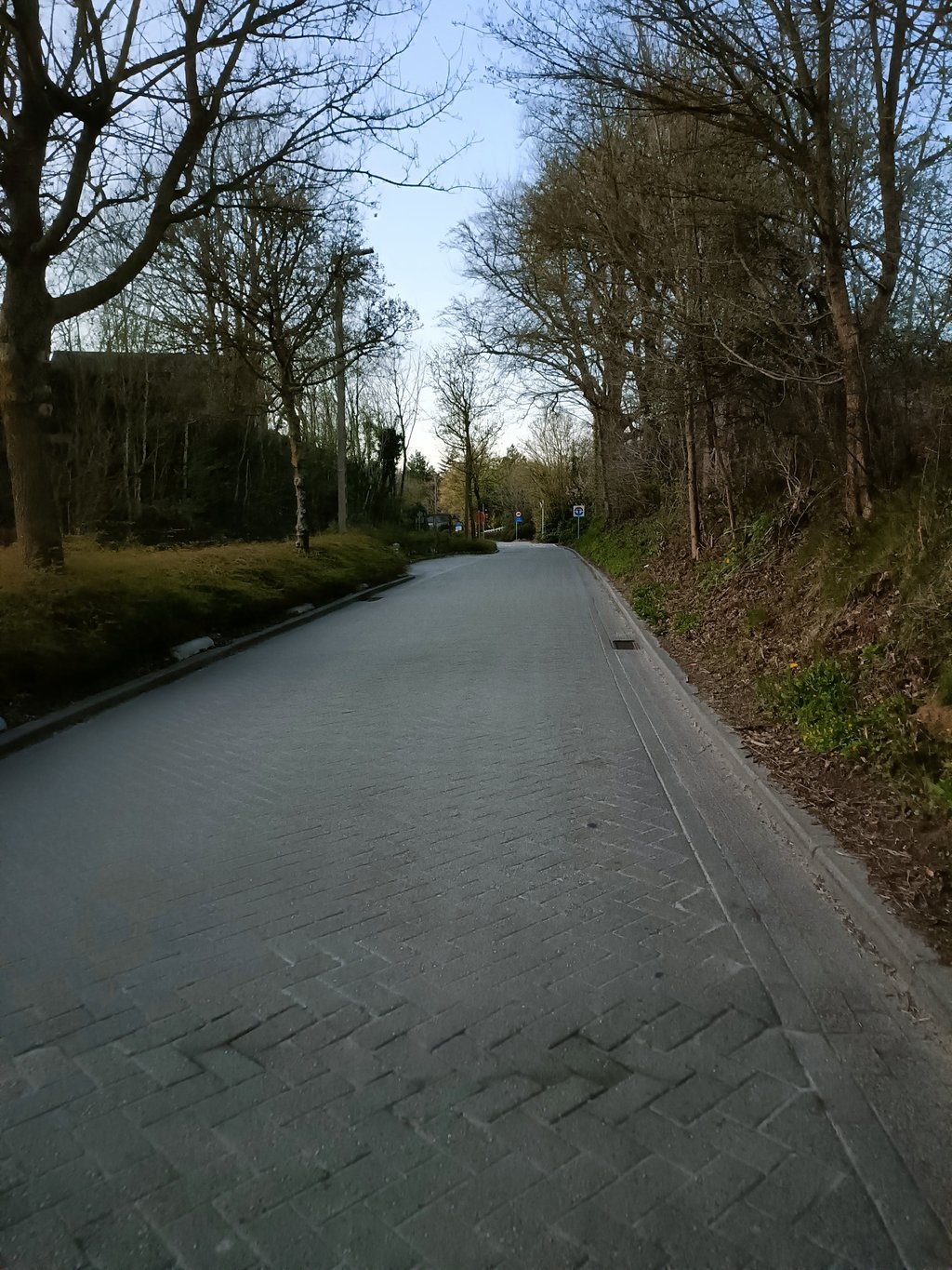
At first, you ride up on a good stretch of asphalt, false flat. Then you are forced to turn left onto the cycle path (two-way traffic). Here, the cycle path consists of bricks that are bumpy. Very irritating.
At the next junction, the cycle path improves.
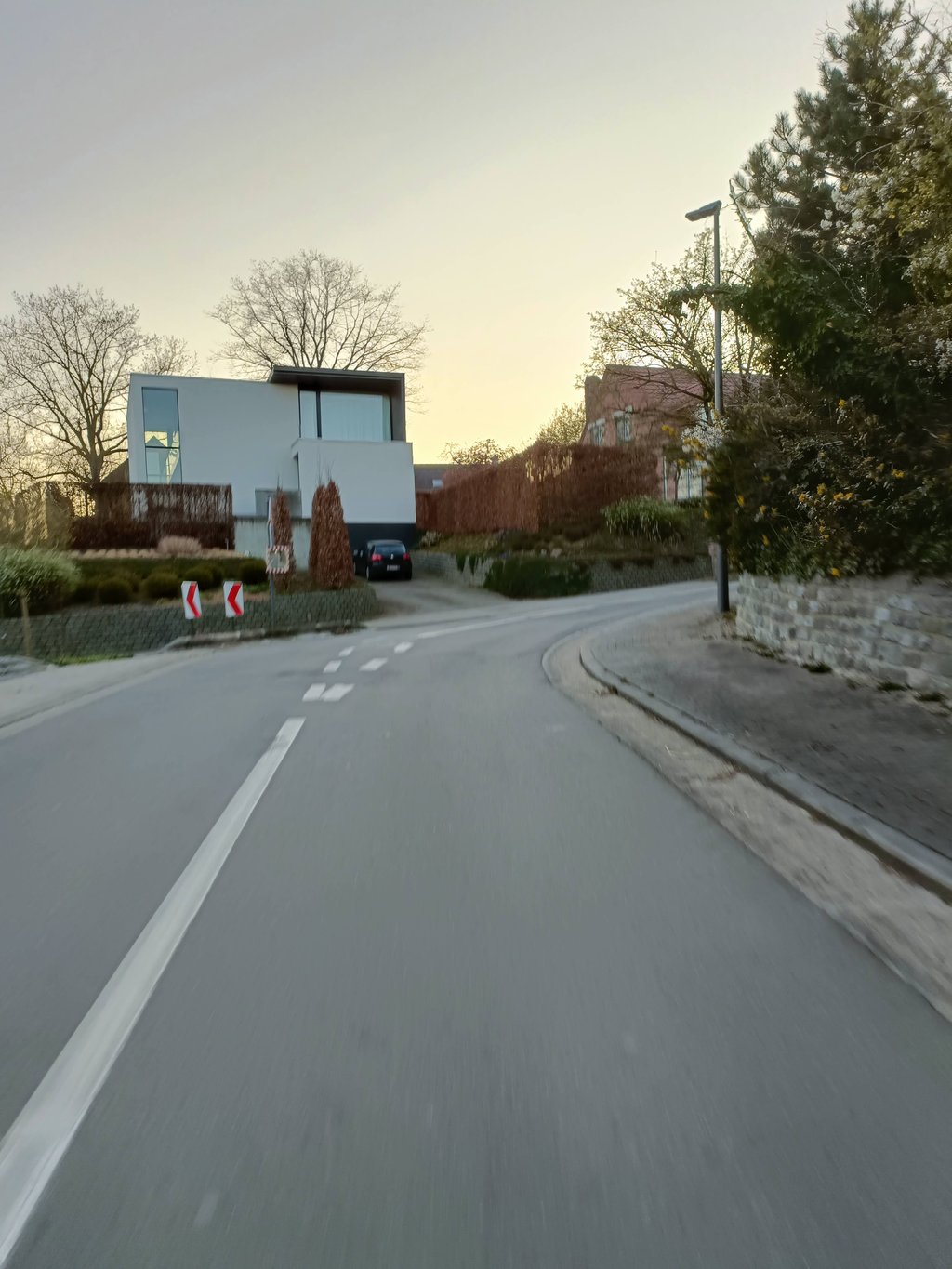
Just before Panoramalaan, I left the cycle path and entered the carriageway, so that I could take the first "hairpin bend" better. Less dangerous, too, as you have absolutely no view of oncoming traffic at the bend.
The two "hairpins" are fun and you can give full throttle. Asphalt is also good. At the road narrowing you have the steepest kink. Then follows a bit of false flat that I hurt myself on.
At the level of the hairpin bends I've always had traffic. Is a shortcut for traffic.
Een redelijk lange klim. Ik wou alles geven op het stuk van de "haarspeldbochten", de laatste honderden meters.
In het begin rijd je op een goed stuk asfalt, vals plat, omhoog. Dan word je verplicht links het fietspad op te gaan (tweerichtingsverkeer). Hier bestaat het fietspad uit klinkers die hobbelig liggen. Heel irritant.
Aan het volgende kruispunt wordt het fietspad beter.
Vlak voor de Panoramalaan ging ik al van het fietspad de rijbaan op, zodat ik de eerste "haarspeldbocht" beter kon aansnijden. Ook minder gevaarlijk, want je hebt aan de bocht totaal geen zicht op het tegenliggend verkeer.
De twee "haarspeldbochten" zijn leuk en kan je vol geven. Asfalt ligt ook goed. Aan de wegversmalling heb je het steilste knikje. Dan volgt nog een stukje vals plat waar ik me op heb pijn gedaan.
Ter hoogte van de haarspeldbochten heb ik al altijd verkeer gehad. Is een doorsteekwegje voor het verkeer.
The steeper part at the end stings a bit but definitely very doable. The climb itself is not the most beautiful one as you are getting closer to the city, meaning a lot more buildings. It does have a nice cycling path and there is still some greenery so you should not necessarily avoid the climb.
I have done this climb once and in itself a nice climb but because of the crowds I don't come there anymore, I must say that I ride a mountain bike and this is a bit out of my area (Hageland).
If there would be no traffic top but the last part can be crowded and dangerous and this part is steeper.
The Trolieberg with that street name is indeed better but too close to the center of Leuven and busier roads at the bottom that lead to it.
Ik heb deze klim 1 keer gedaan en op zich een mooi klimmetje maar door de drukte kom ik er niet meer , ik moet wel zeggen dat ik met een mountenbike fiets en dit een beetje uit mijn directe omgeving ( Hageland ) is.
Moest er geen verkeer zijn top maar het laatste stuk kan druk en gevaarlijk zijn en juist dit stuk loopt steiler op .
De Trolieberg met die straatnaam is inderdaad beter maar te dicht bij het centrum van Leuven en drukkere wegen onderaan die er naar toe leiden.
In principle, this is a really nice climb to do, but the traffic often puts a stop to that. You start the climb on a two-way bike path on the left side of the road, which is not optimal. Then you have to cross the road and all your speed goes down to start the last part of the climb. Also here there is always a lot of traffic and during rush hour you often have to put your foot on the ground because of stationary cars that you can't pass. Can you ride it all the way up without having to slow down, this one is really fun to do!
In principe is dit echt een leuke klim om te doen, maar daar steekt het verkeer vaak een stokje voor. Je start de klim op een tweerichtingsfietspad aan de linkerzijde van de weg, die er niet optimaal bijligt. Vervolgens moet je de weg oversteken en gaat al je snelheid eruit om dan te starten aan het laatste deel van de klim. Ook hier altijd veel verkeer en tijdens de spitsuren moet je hier zelfs vaak voet aan grond zetten door stilstaande wagens waar je niet voorbij kan. Kan je hem volledig op rijden zonder te moeten vertragen is deze echt leuk om te doen!
The false flat part is still on a bike path, but on the steepest part you have to walk on the road and it is a busy connecting road, so not very pleasant. Better go up via the 'real' Trolie Mountain (the street with that name), which is much quieter.
Het vals platte deel is nog op een fietspad, maar op het steilste deel moet je de weg op en het is een drukke verbindingsweg, dus niet zo gezellig. Ga beter omhoog via de 'echte' Trolieberg (de straat met die naam), die is veel rustiger.
| 5 mph | 00:09:13 |
| 7 mph | 00:06:31 |
| 9 mph | 00:05:05 |
| 12 mph | 00:03:49 |
This page is better in the app