Strada per Giovera di Sopra from Montecrestese is a climb in the region Verbano-Cusio-Ossola. It is 7.9 mi long and bridges 4199 ft of vertical ascent with an average gradient of 10.1%, resulting in a difficulty score of 1449. The top of the ascent is located at 5302 ft above sea level. Climbfinder users shared 3 reviews of this climb and uploaded 8 photos.
Road names: Via Pontetto, Via Mario Ceschi & Strada per Giovera di sopra
5.0 by esseciThis is an automatic translation, the original language is: Italian.If you are looking for a climb that emulates the legendary Mortirolo, something similar can be found near Domodossola, to be precise at Pontetto di Montecrestese, where the climb to Alpe Coipo and Giovera Superiore begins. Do not be misled by the initial stretch of about 6 kilometres to Altoggio, with normal, human gradients, because the real difficulties of the climb are concentrated in the last hellish 7 kilometres. From the Altoggio junction to the summit, the cyclist will have to overcome ... read more

Welcome! Please activate your account if you would like to share something. Look for the verification email in your inbox.
If you want to upload your photos, you need to create an account. It only takes 1 minute and it's completely free.
Awesome punishment and beautiful silent climb.
The road is narrow, asphalt is far away to be perfect but you can ride it with a road bike without problems.
The perfect climb to enjoy nature and the sound of your deep breathing and fast heartbeat. No other noise will disturb you during this harsh ascent.
It's not famous, it does not carry fame but it's 100% worth to climb it. Be aware it will destroy your legs. If you are ready to accept it, you must ride this climb. Fully worth 5 stars.
Done today. I may be biased, but this was perhaps my first SHC. I did it (from Roledo) on a very clear day in September. For this reason, for the intrinsic hardness, and for the grandeur of the environment, it remains in my opinion the most beautiful of all.
Rfatta oggi. Sarò parziale, ma questa è stata forse la mia prima SHC. L'avevo fatta (da Roledo) in una giornata limpidissima di settembre. Per questo, per la durezza intrinseca, e per la grandiosità dell'ambiente, resta a mio avviso la più bella di tutte.
If you are looking for a climb that emulates the legendary Mortirolo, something similar can be found near Domodossola, to be precise at Pontetto di Montecrestese, where the climb to Alpe Coipo and Giovera Superiore begins.
Do not be misled by the initial stretch of about 6 kilometres to Altoggio, with normal, human gradients, because the real difficulties of the climb are concentrated in the last hellish 7 kilometres.
From the Altoggio junction to the summit, the cyclist will have to overcome no less than 854 metres of altitude difference in 7 kilometres with an average gradient of 12.15 per cent, not to mention that the entire climb consists of over 13 kilometres with an average gradient of over 10 per cent. The similarities with the figures of the climb dear to cycling fans that consecrated Marco Pantani in the 1994 Giro d'Italia are quite obvious.
Therefore, for those interested in tackling it, I can only advise you to use your strength to the best of your ability without wasting it, or rather saving it, in the first half, because in the second tough section you start in double figures and stay there until almost the top. Only in the final kilometre do the gradients drop to eight to nine per cent and if you have managed to get there without putting your foot down, you can finally think you have tamed the climb.
The climb has slopes of over 15 per cent for long stretches, with peaks of over 20 per cent for short stretches. Fortunately, the road surface, despite being a classic consortium road (so beware: it is private and often lacks protection as it is not tested), is fairly well maintained, net of a few stretches with a very deformed and irregular profile. Bearing in mind that it must then be tackled downhill, it must be pointed out that it is best not to exceed speed given the rather narrow roadway that makes it difficult to overtake vehicles going uphill and to cross downhill, and that it is best to check the braking system to be sure of not having any surprises during the descent.
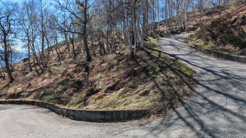
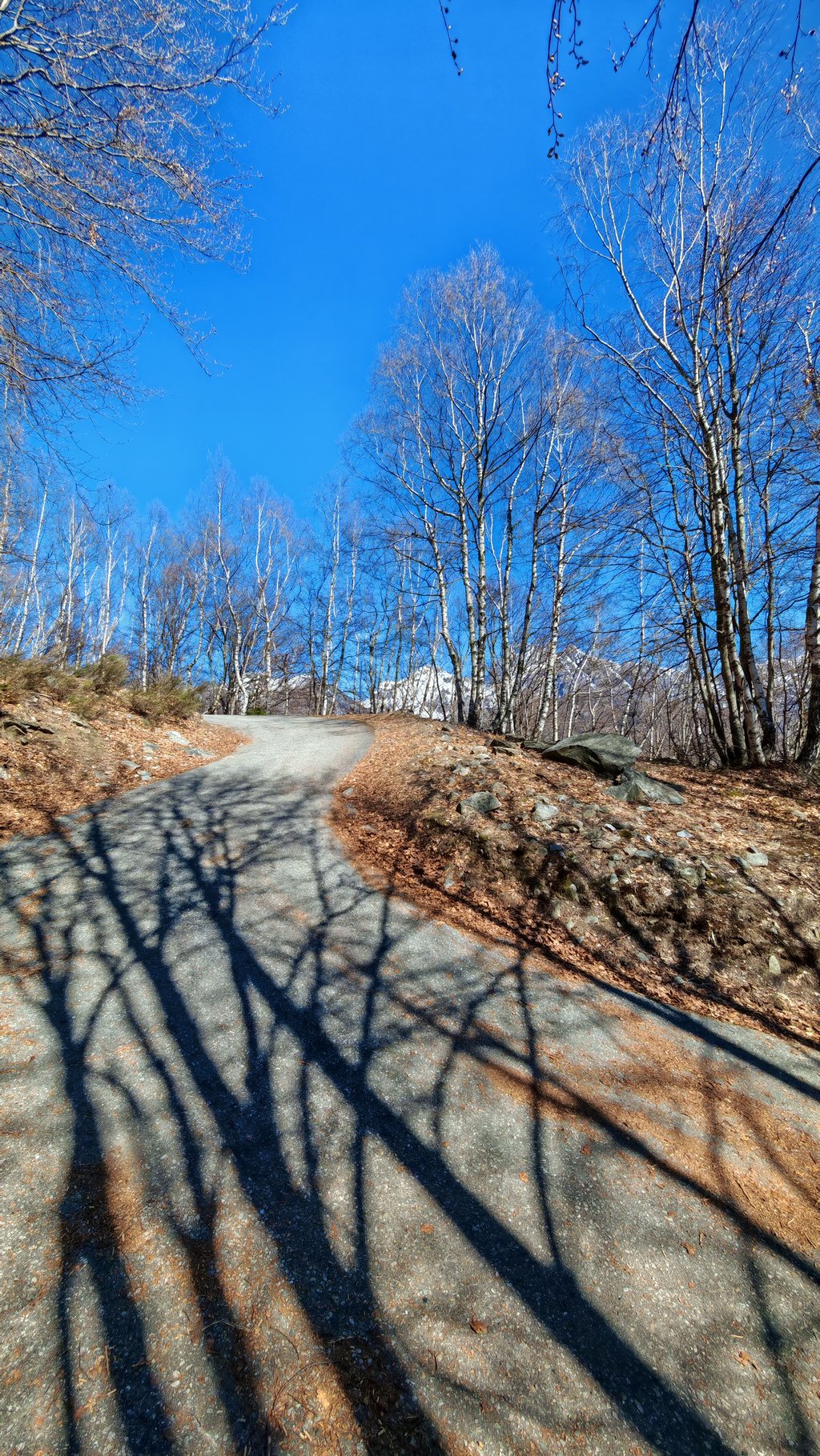
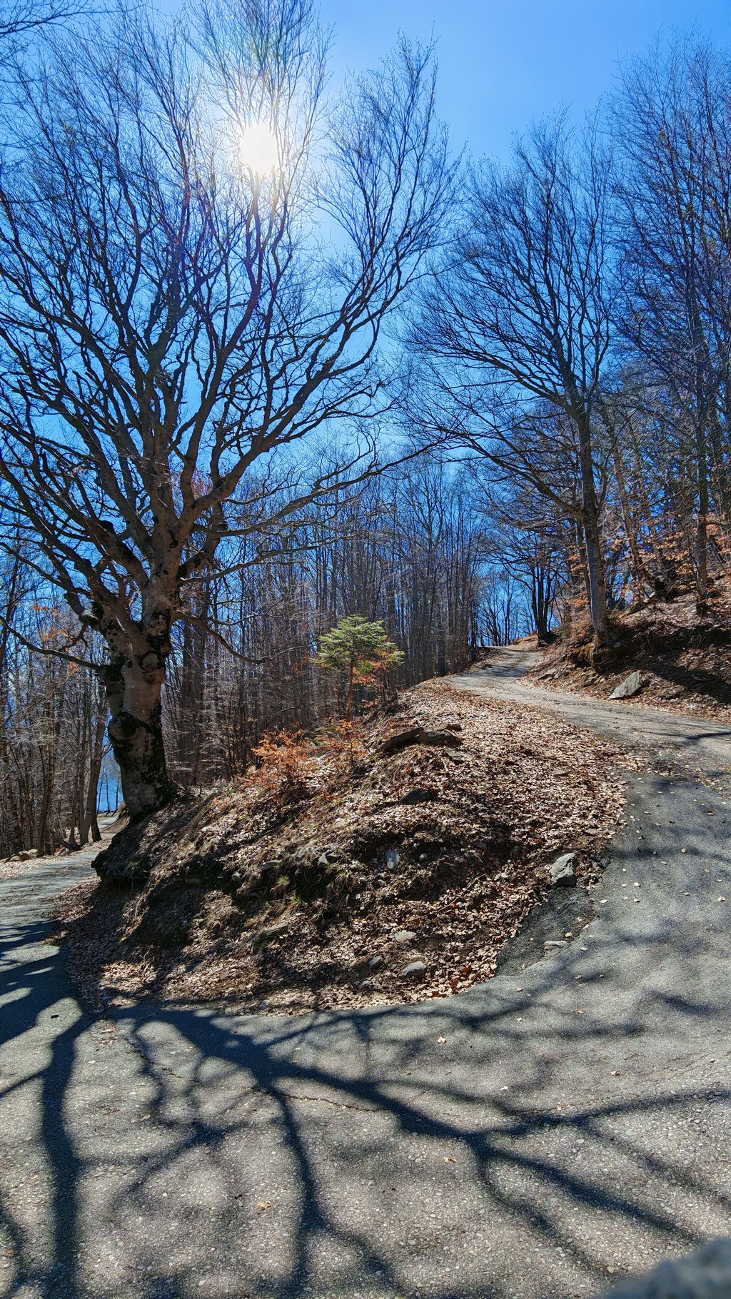
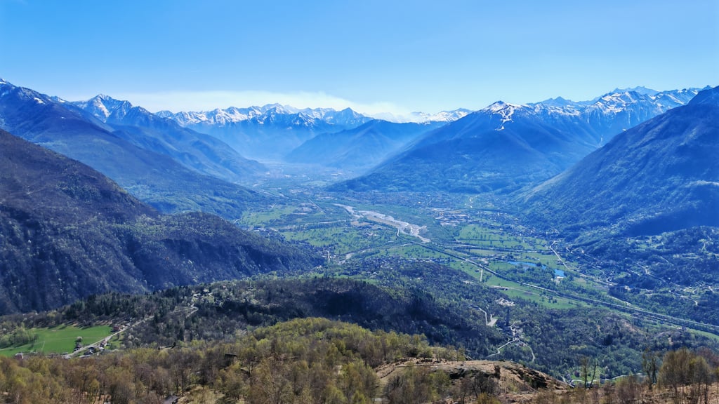
The road is entirely asphalted and can easily be travelled by road bike, always paying attention, since vehicular traffic, although very low, is present. Very interesting are the views of the Ossola valley about halfway along the route once you leave the forest to climb the mountain ridge towards Alpe Coipo. A photo stop (downhill is almost a must). Once past Alpe Coipo (some time ago the final point of the asphalted ascent and where there is a fountain), the road plunges back into the dense forest to reach in a couple of kilometres the hamlets of Giovera Inferiore and then Superiore where the asphalt road ends. In a charming little valley with small alpine pasture buildings, it is possible to find a fountain and enjoy the stupendous panorama to the south (moving briefly on foot to a picnic area).
It goes without saying that such a climb becomes lethal if you are tired or do not have suitably agile gears. The climb also lends itself to be combined with the discovery of the Agarina Valley. Here too, the final stretch will hold surprises in store for the curious and courageous, both in terms of the difficulty of the gradients, and above all for the magnificent alpine pastures located at the bottom of the valley below the mountain walls, in a majestic setting dominated only by the roar of the torrential waters and the rustle of the wind.
Se si è alla ricerca di una salita che emuli il mitico Mortirolo, qualcosa di simile si trova nei pressi di Domodossola, per la precisione a Pontetto di Montecrestese, dove inizia la salita all’Alpe Coipo e a Giovera Superiore.
Non bisogna farsi trarre in inganno dal tratto iniziale di circa 6 chilometri fino ad Altoggio, con pendenze normali ed umane perché le vere difficoltà della salita sono concentrate negli ultimi infernali 7 chilometri.
Dal bivio di Altoggio alla sommità, il ciclista dovrà superare ben 854 metri di dislivello in 7 chilometri con una pendenza media del 12 virgola 15 per cento, senza dimenticare che l’intera ascesa consta di oltre 13 chilometri con una pendenza media superiore al 10 per cento. Le somiglianze con i dati della salita cara agli appassionati di ciclismo che consacrò Marco Pantani nel Giro d’Italia del 1994 sono abbastanza evidenti.
Pertanto, coloro che fossero interessati ad affrontarla, posso solo consigliare di dosare al meglio le forze senza sprecarle, anzi risparmiandole, nella prima metà, perché nella seconda tostissima parte si inizia in doppia cifra e ci si resta fin quasi alla cima. Solo nel chilometro finale le pendenze scendono all’otto nove per cento e se si è riusciti ad arrivare fin li senza mettere il piede a terra, si può finalmente pensare di avere domato la salita.
Salita che presenta per lunghi tratti pendenze superiori al 15 per cento con punte anche per brevi tratti superiori anche al 20 per cento. Fortunatamente il fondo stradale, pur essendo la classica stradina consortile (quindi attenzione: è privata e spesso priva di protezioni non essendo collaudata), è abbastanza ben tenuto al netto di alcuni tratti con sagoma molto deformata e irregolare. Pensando che poi va affrontata in discesa, corre l’obbligo precisare che è bene non eccedere in velocità vista la sede stradale piuttosto stretta che rende difficoltoso il sorpasso da parte di veicoli in salita e l’incrocio in discesa e che meglio controllare l’impianto frenante per essere sicuri di non aver sorprese durante la discesa.
La strada è interamente asfaltata e tranquillamente percorribile in bici da corsa prestando sempre attenzione, atteso che il traffico veicolare sebbene molto ridotto è presente. Molto interessanti gli scorci che si possono avere sulla val d’Ossola a circa metà percorso una volta usciti dal bosco per inerpicarsi sul crinale della montagna verso l’alpe Coipo. Una sosta fotografica (in discesa è quasi d’obbligo). Una volta passata l’Alpe Coipo (qualche tempo fa punto terminale dell’ascesa asfaltata e ove è presente una fontana), la strada si reimmerge nel fitto del bosco per raggiungere in un paio di chilometri le località Giovera Inferiore e poi Superiore dove è posto il termine della asfaltatura. In una vallettina suggestiva con piccole costruzioni dell’alpeggio, è possibile trovare una fontana e godere dello stupendo panorama verso sud (spostandosi brevemente a piedi in una zona attrezzata per pic nic).
E’ superfluo evidenziare che una salita del genere diventa letale se si è stanchi o non si dispongono di rapporti adeguatamente agili. L’ascesa si presta per essere abbinata anche alla scoperta della Valle Agarina. Anche in questo caso il tratto finale riserverà ai curiosi e coraggiosi delle sorprese sia in termini di difficoltà delle pendenze, sia e soprattutto per i magnifici alpeggi posti a fondovalle sotto le pareti delle montagne, in uno scenario maestoso dominato solo dallo scrosciare delle acque torrentizie e dal fruscio del vento.
| 5 mph | 01:35:26 |
| 7 mph | 01:07:33 |
| 9 mph | 00:52:39 |
| 12 mph | 00:39:33 |
This page is better in the app