Road of the Goat / Carretera de la Cabra from Almuñécar is a climb in the region Andalusia. It is 21.6 mi long and bridges 4580 ft of vertical ascent with an average gradient of 4%, resulting in a difficulty score of 814. The top of the ascent is located at 4386 ft above sea level. Climbfinder users shared 10 reviews of this climb and uploaded 36 photos.
Road names: A-4050, Carretera Al Suspiro del Moro & Carretera de la Cabra
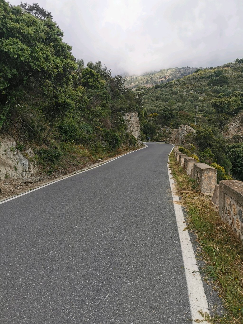
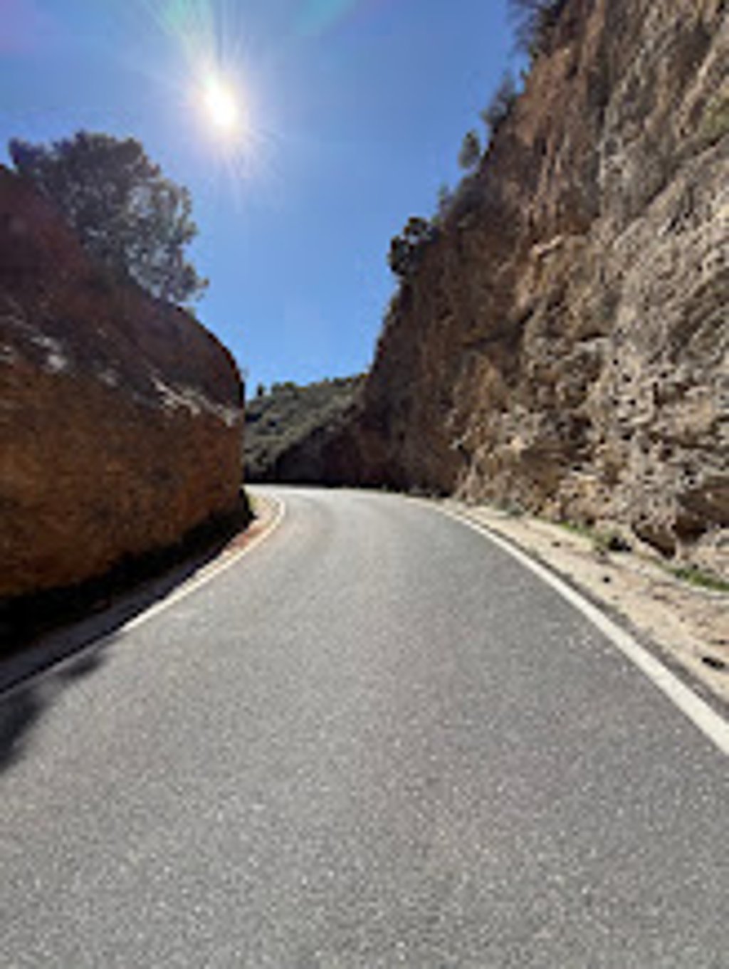
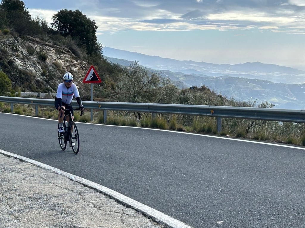
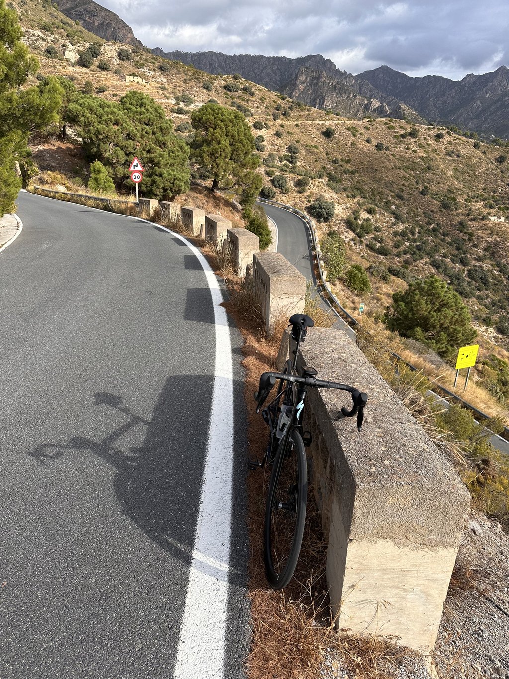
4.0 by LoiccmThis is an automatic translation, the original language is: French.For the first 3.5 kilometers to Otívar, the road is impeccable, fairly wide, and there is some vegetation to provide some shade. From Otívar, the road narrows to about 5 m for two or three kilometers and the tarmac is a bit rougher but in good condition. The climb really starts at the beginning of the village of Jete, located in the river valley. From there, a long climb of 17 km leads to the viewpoint. After leaving Jete, we encounter the first steep ramp that takes us to a crossroads to Itr... read more
Welcome! Please activate your account if you would like to share something. Look for the verification email in your inbox.
If you want to upload your photos, you need to create an account. It only takes 1 minute and it's completely free.
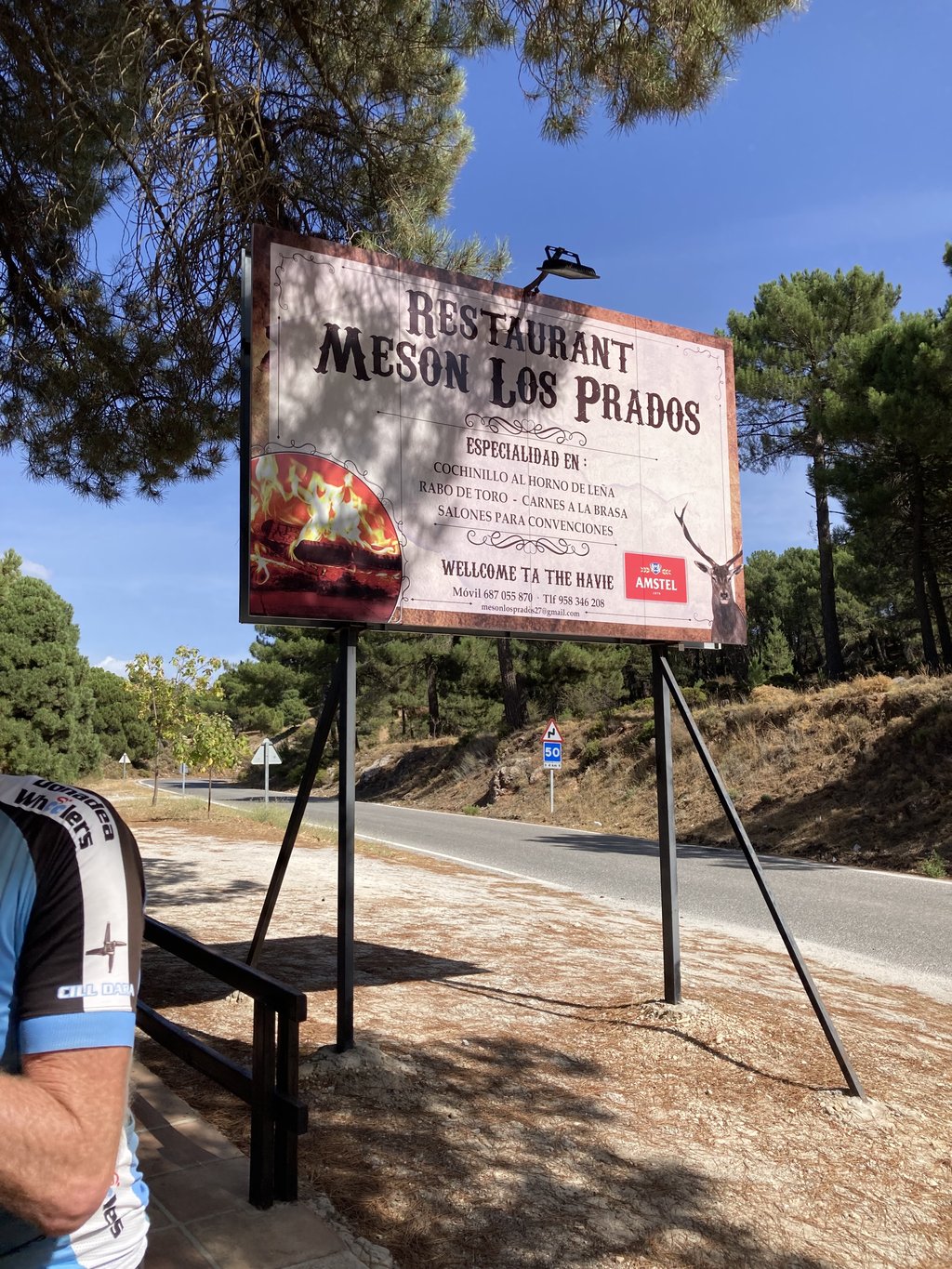
I did it from Otívar (there in a big Parking place at the crossroad to Lentegí) because of lot traffic from Almuñecar to Otívar. From Otívar to the mine end point is exactly 1.000 high meter (2 km and 80 meter before the climb end, the last part is not atttactive at all, plus Meson Los Prados is opened only from thursday to saturday). The climb is beautful, with practicaly no traffic. The most astoning part is the last 5 km where you get the feeling of the Goat Road.
Road quality: 4.5/5
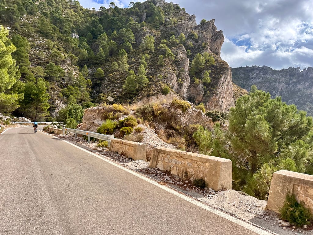
The asphalt is perfect up to the radio masts, then it gets a little rougher, but still very rideable.
Traffic: 5/5
There is very little traffic until Otívar, then almost none.
Scenery: 5/5
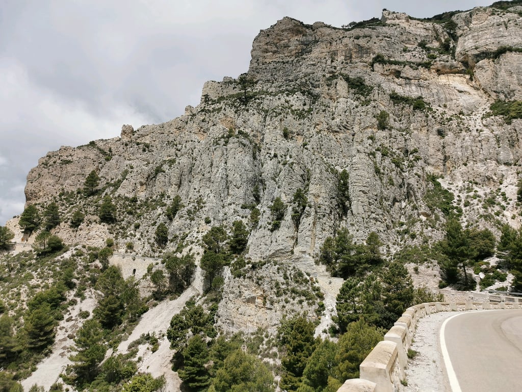
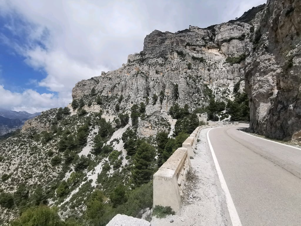
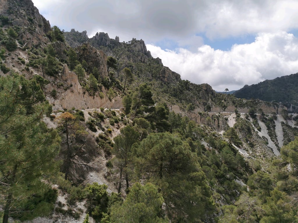
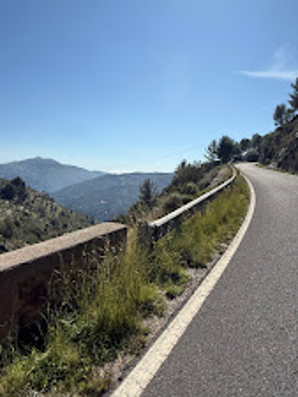
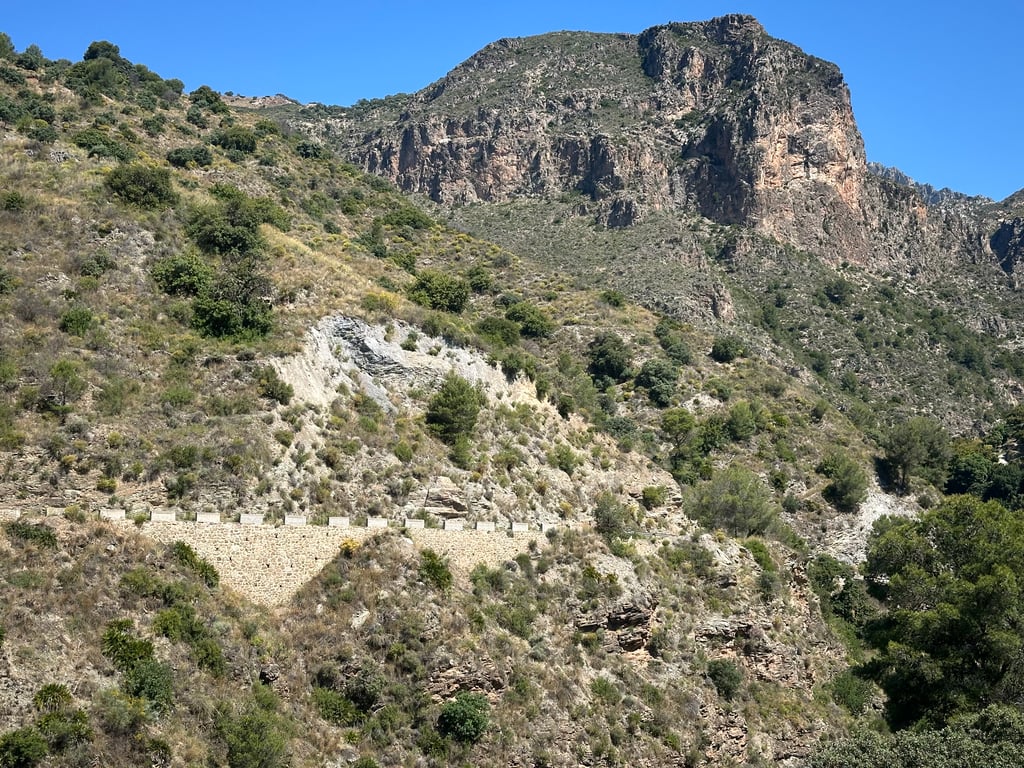
First you follow the valley along the river and can take a short dip there, after Otivar you can't stop being amazed, behind every hairpin bend there is an even more spectacular view than before. When the route then continues northwards after almost 1000 meters in altitude, the landscape becomes extremely rough and rocky. It is simply magnificent
Gradient distribution: 5/5
The gradients are actually extremely moderate throughout, almost never in double figures.
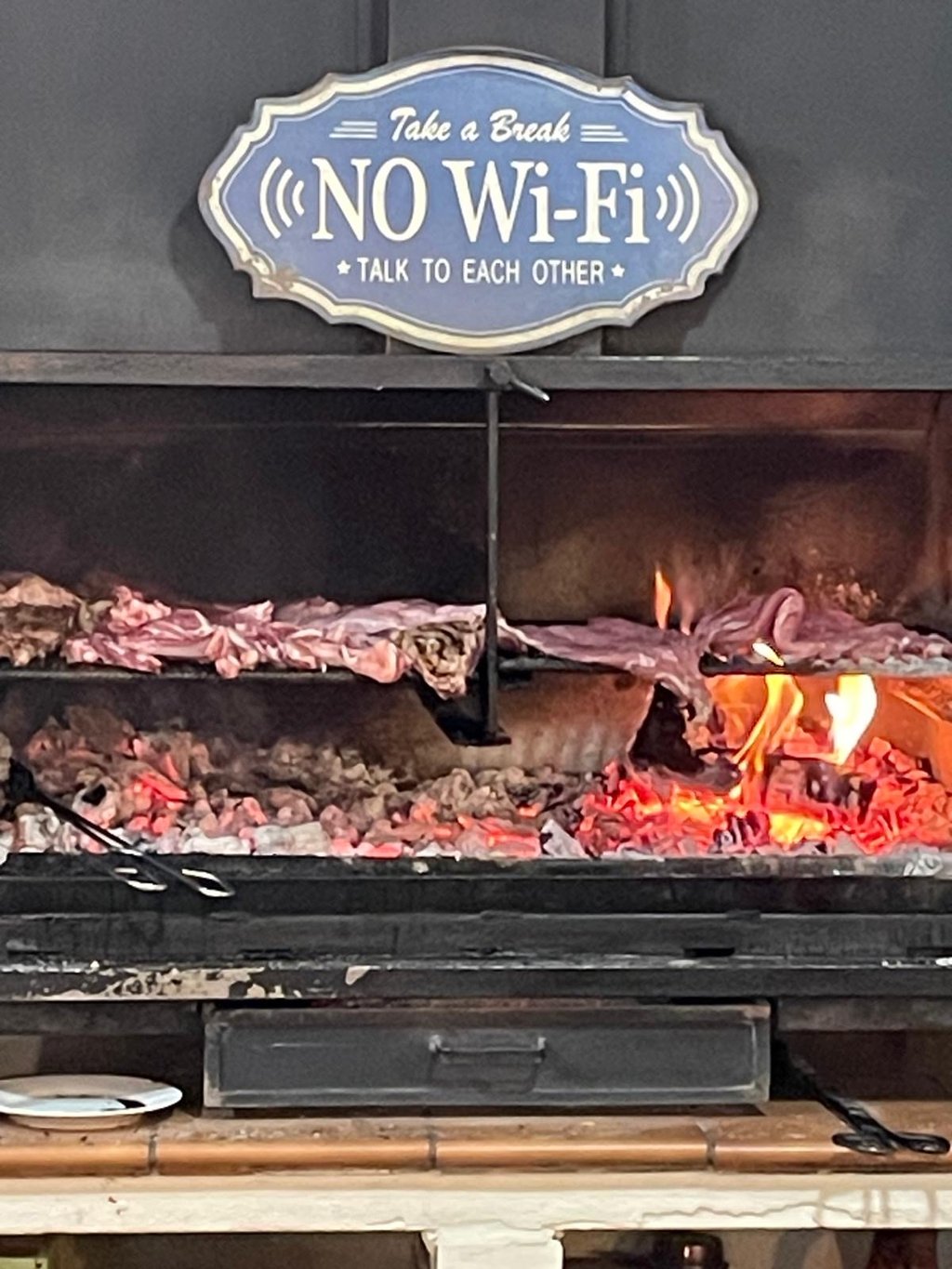
Bonus: If you ride between Thursday and Sunday, the Meson Los Prados is waiting at the end of the climb for a coffee and snack. It could always be like this.
Straßenqualität: 4,5/5
Bis zu den Funkmästen ist der Asphalt perfekt, danach wird es etwas rauer, aber weiterhin sehr gut fahrbar.
Verkehr: 5/5
Bis nach Otívar gibt es sehr wenig, danach fast keinen Verkehr mehr.
Landschaft: 5/5
Man folgt zunächst dem Tal am Fluss entlang und kann dort eine kurze Abkühlung nehmen, hinter Otivar kommt man aus dem Staunen nicht mehr raus, hinter Jeder Serpentine gibt es einen noch spekatkuläreren Blick als zuvor. Wenn die Route dann nach knapp 1000 Höhenmetern Richtung Norden weiterverläuft wird die Landschaft extrem rau und felsig. Es ist einfach grandios
Steigungsverteilung: 5/5
Die Gradienten sind eigentlich durchgehend extrem gemäßigt, quasi nie zweistellig.
Bonus: Wenn man zwischen Donnerstag und Sonntag fährt, wartet am Ende des Anstiegs das Meson Los Prados für einen Kaffee und Snack. So könnte es immer sein.
Great climb. Especially once you pass Otícar, the road is nice and quiet. You pass through some changing landscapes throughout the climb, very nice. The last few km the tarmac is a bit less (rough) but the views are great!
Geweldig mooie klim. Vooral als je Otícar voorbij bent is de weg lekker rustig. Je komt gedurende de hele klim door enkele wisselende landschappen, erg mooi. De laatste paar km is het asfalt wat minder (ruw) maar de uitzichten zijn geweldig!
Really long climb, hardish in places. A coffee stop at Otivar is highly recommended. Restaurant stop at Albunuelas was a saviour for us in the blistering September heat where we ran out of drink.
Beautiful climb, one of the best in the area. The surface from about 1000m to 1200m is very, very rough. I recommend descending to Padul. After reaching the summit, the landscape changes dramatically—from rocky mountains to a relatively flat steppe with a few short climbs. The long, straight stretches offer stunning views of the Sierra Nevada peaks.
This is a beautiful climb. It never gets really steep but the views become more and more spectacular the further you get. You also pass a few villages that you later see below you (so it seems). The stretch after Otivar is especially fun because the many twists and turns mean you constantly see the road you have already travelled. When you get to the top and expect a long descent, you are a bit disappointed. You actually end up on a more or less undulating plateau where you can see the Sierra Nevada in the distance.
Dit is een prachtige klim. Het wordt nooit echt steil maar de uitzichten worden meer en meer spectaculair hoe verder je komt. Je passeert ook een paar dorpjes die je later nog onder u (zo lijkt het) ziet liggen. Het stuk na Otivar is vooral leuk omdat door de vele kronkels je constant de weg ziet die je reeds afgelegd hebt. Als je boven komt en je aan een lange afdaling verwacht kom je wel wat bedrogen uit. Je komt eigenlijk uit op een min of meer golvend plateau waar je in de verte dan nog de Sierra Nevada ziet liggen.
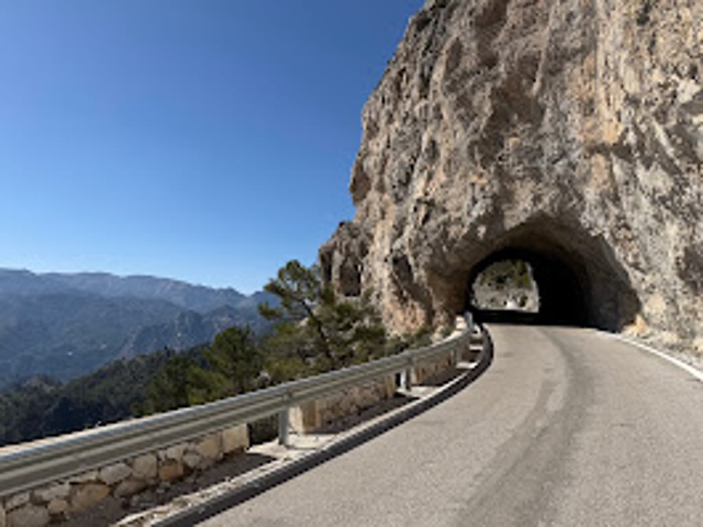
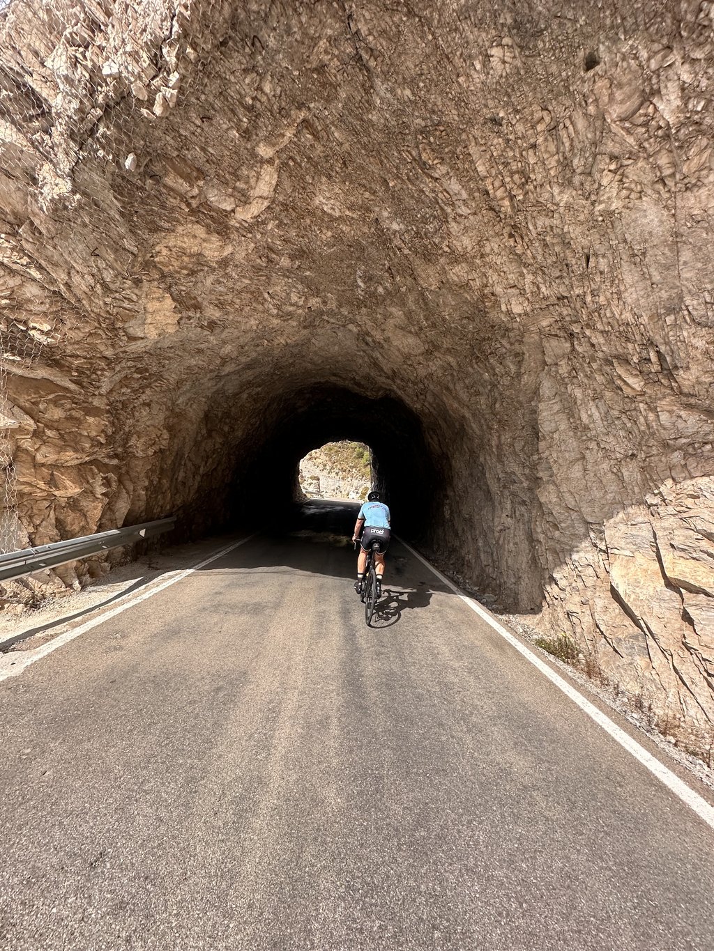
Beautiful climb, done up to the little tunnel at pass height. Great week, good tarmac until a fewkm before the summit. Then it becomes that rough concrete asphalt. Ascending not so's a problem. But when you get up to speed on the descent, you do feel like you are starting to bounce.
Prachtige klim, gedaan tot het tunneltje op pashoogte. Prima weg, goed geasfalteerd tot een paar km voor de top. Dan word het van dat ruwe betonasfalt. Stijgend niet zo'n probleem. Maar als je op snelheid komt in de afdaling toch wel gevoel dat je begint te stuiteren.
Climbed this 7 July. Great views and on a clear day great views of the Mediterranean. Road in good condition until about 1000-1100m then a bit rough but still very good.
Monté ce 7juillet. Magnifiques points de vue et par temps clair de superbes vues sur la Méditerranée. Route en bon état jusqu’à 1000-1100m environ puis un peu dégradé mais encore très bon malgré tout.
I went up there but by the stony path following a mistake of course. But I got to the top anyway
J’y suis monté mais par le chemin caillouteux suite à une erreur de parcours. Mais arrivé au sommet malgré tout
For the first 3.5 kilometers to Otívar, the road is impeccable, fairly wide, and there is some vegetation to provide some shade. From Otívar, the road narrows to about 5 m for two or three kilometers and the tarmac is a bit rougher but in good condition.
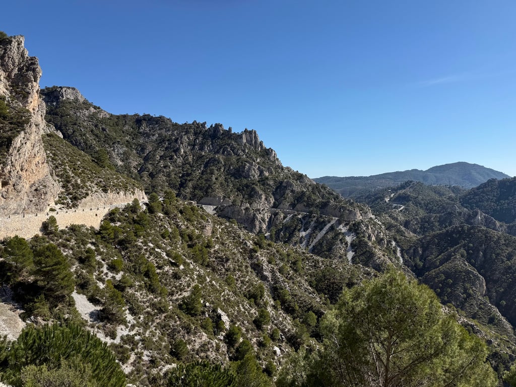
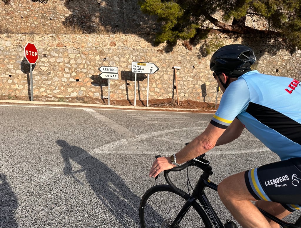
The climb really starts at the beginning of the village of Jete, located in the river valley. From there, a long climb of 17 km leads to the viewpoint. After leaving Jete, we encounter the first steep ramp that takes us to a crossroads to Itrabo, which we leave on the right, continuing toward Otívar on a stretch of about 7% grade with some small ramps at 10%. As we reach the village, we see our almost inaccessible goal in the distance, the viewpoint. After passing through the village and arriving at a crossroads on the right indicating Lentegí, we will enjoy a long and gentle descent of almost a kilometer, with some shady spots that will help us recover to face the remaining 11 kilometers to go. Turning left at a bridge, we begin the next 5 kilometers, which are a little more difficult than the last ones we have walked and average about 6.5%. Below, on the left, we can see Otívar and the first part of the ascent. Further on and overcoming some horseshoe bends, we can still see the viewpoint up there. Further on, we find the names of the professionals written on the ground. These are the names of the riders of the Vuelta a Andalucia who passed through this pass. After several hairpin bends and changing direction several times, we pass some cell phone antennas. We have only 2 km to go to reach the summit, and we do it along the rocky slope where the viewpoint is located, observing from above a large part of the ascent. We pass the only fountain of the route and, turning right further on, we can see our goal close by. Finally, we are at the top. The view is magnificent and the silence is total!
Pour les 3,5 premiers kilomètres jusqu'à Otívar, la route est impeccable, assez large, et il y a un peu de végétation pour fournir un peu d'ombre. À partir d'Otívar, la route se rétrécit à environ 5 m sur deux ou trois kilomètres et le macadam est un peu plus rugueux mais en bon état.
L’ascension commence vraiment au début du village de Jete, situé dans la vallée de la rivière. De là, une longue montée de 17 km mène au point de vue. Après avoir quitté Jete, nous rencontrons la première rampe raide qui nous amène à un carrefour vers Itrabo, que nous laissons sur la droite, en continuant vers Otívar sur un tronçon d'environ 7% de pente avec quelques petites rampes à 10%. En arrivant au village, nous apercevons au loin notre objectif presque inaccessible, le point de vue. Après avoir traversé le village et être arrivés à un carrefour sur la droite indiquant Lentegí, nous profiterons d'une longue et douce descente de presque un kilomètre, avec quelques points d’ombres qui nous aideront à récupérer pour affronter les 11 kilomètres qui restent à parcourir. En tournant à gauche à un pont, nous entamons les 5 km suivants, qui sont un peu plus difficiles que les derniers que nous avons parcourus et dont la moyenne est d'environ 6,5%. En bas, à gauche, on peut voir Otívar et la première partie de l'ascension. Plus loin et en surmontant quelques virages en fer à cheval, nous pouvons encore voir le point de vue là-haut. Plus loin, nous trouvons les noms des professionnels écrits sur le sol. Ce sont les noms des coureurs de la Vuelta a Andalucia qui sont passés par ce col. Après avoir franchi plusieurs virages en épingle à cheveux et changé plusieurs fois de direction, nous passons devant des antennes de téléphonie mobile. Il ne nous reste que 2 km à parcourir pour atteindre le sommet, et nous le faisons le long de la pente rocheuse où se trouve le point de vue, observant d'en haut une grande partie de l'ascension. Nous passons devant la seule fontaine de l'itinéraire et, en tournant à droite plus loin, nous pouvons voir notre objectif tout proche. Enfin, nous sommes au sommet. La vue est magnifique et le silence est total!
| 5 mph | 04:20:09 |
| 7 mph | 03:04:11 |
| 9 mph | 02:23:32 |
| 12 mph | 01:47:50 |
This page is better in the app