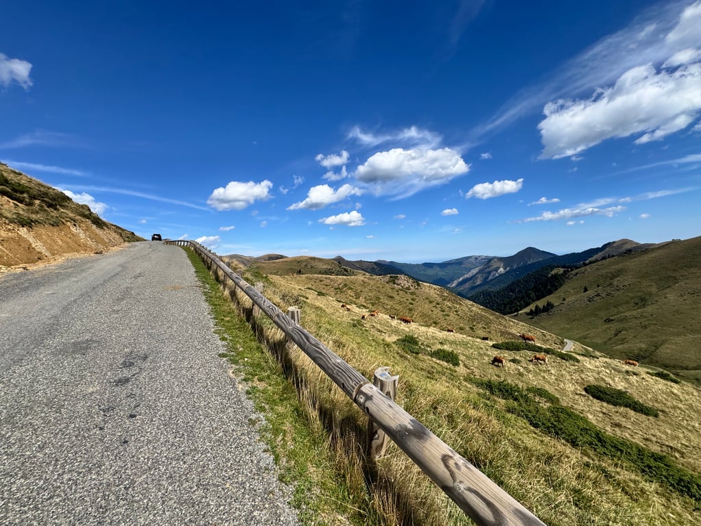
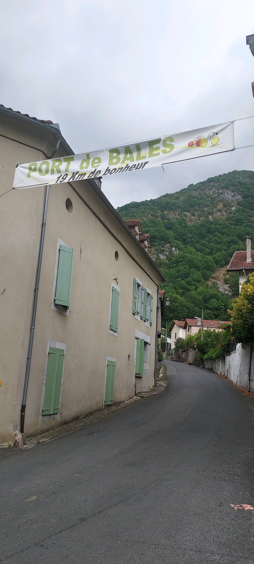
Port de Balès is a climb in the region Hautes-Pyrénées. It is 11.9 mi long and bridges 3927 ft of vertical ascent with an average gradient of 6.2%, resulting in a difficulty score of 1038. The top of the ascent is located at 5761 ft above sea level. Climbfinder users shared 11 reviews of this climb and uploaded 18 photos.
Road name: D925
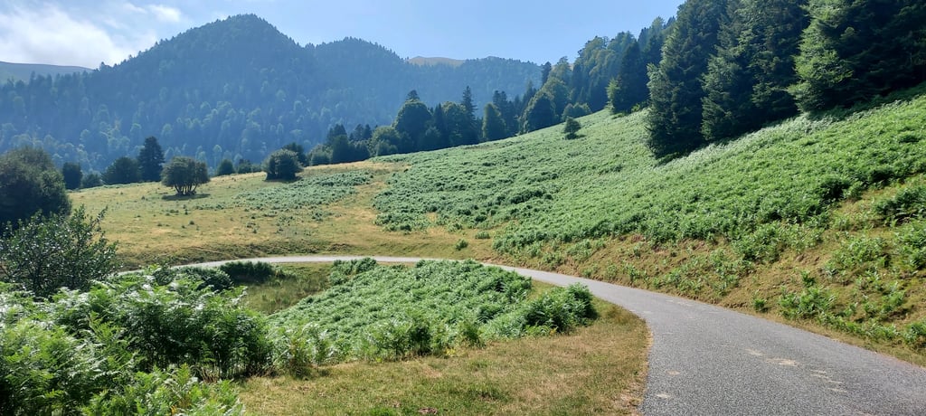
5.0 by HiFolkThis is an automatic translation, the original language is: French.This climb is divided into two sections. The first 5–6 km has a gradient between 3% and 4% all the way to the Chalet Saint-Néré. Then brace yourself—it gets tough! Don’t be fooled by the average gradient, which is misleading. There are numerous sections with gradients between 10 and 13%, which really take a toll on your legs. Stunning scenery—a real athletic challenge!... read more
Welcome! Please activate your account if you would like to share something. Look for the verification email in your inbox.
If you want to upload your photos, you need to create an account. It only takes 1 minute and it's completely free.
This climb is divided into two sections. The first 5–6 km has a gradient between 3% and 4% all the way to the Chalet Saint-Néré. Then brace yourself—it gets tough! Don’t be fooled by the average gradient, which is misleading. There are numerous sections with gradients between 10 and 13%, which really take a toll on your legs. Stunning scenery—a real athletic challenge!
Une montée qui se décompose en 2 temps . 5/6 km entre 3 et 4% jusqu'au chalet saint-Néré.Ensuite accrochez-vous c'est costaud ! Ne pas se fier au pourcentage moyen qui est trompeur. Car il y a de nombreux passages entre 10 et 13% qui font vraiment mal aux jambes. Paysages superbes , un sacré défi sportif !
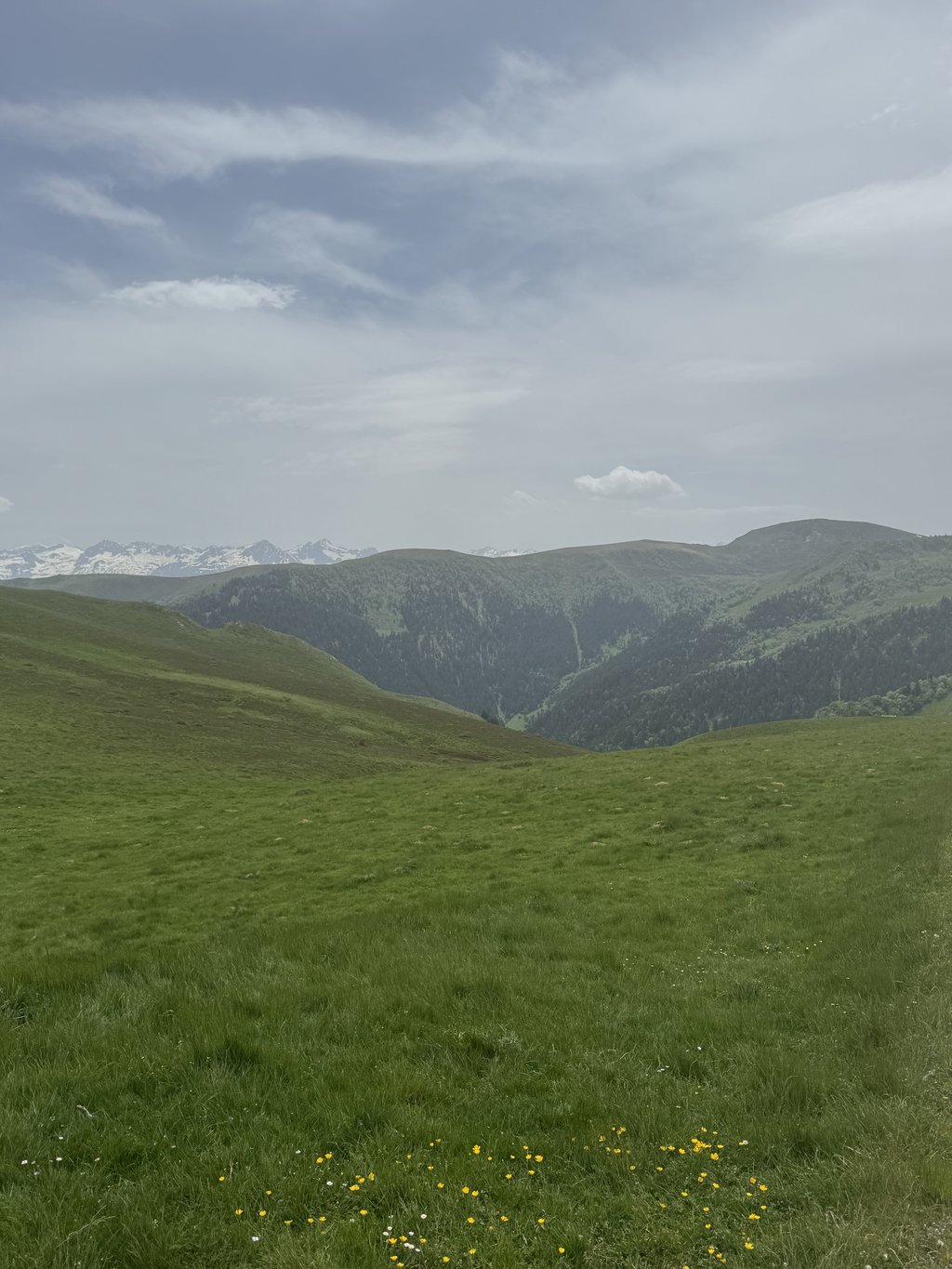
This is the most stunning climb in the area. I recommend ascending from Bagneres du Luchon and descending the other side. Steep at the bottom, shallow middle section and a punchy end. The road surface is ok and the track can be narrow, so careful when descending.
Climbed on April 30 from the Barousse side. Beware, there is work going on on the Canadian side, so you'll have to put your foot down, but the rest of the climb is passable. A demanding climb due to its irregularity, but there are always moments of respite. Be careful on the descent on the Luchon side, as animals roam the road.
Montée réalisée le 30 avril par le côté Barousse. Attention, il y a des travaux sur les canadiennes, il faut donc poser le pied au sol mais le reste de la montée est praticable. Montée exigeante de part l'irrégularité mais on trouve toujours des petits moments de répits. Attention à la descente côté luchon, des animaux errent sur la route.
Difficult climb as it is very uneven. Road not very busy, few cars, a few motorbikes and bicycles. Magnificent view from the summit.
Montee difficile car tres irrégulière. Route peu passante, peu de voitures quelques motos et des vélos.magnifique vue au sommet
One outing a week, plus other low-intensity sports, and I had doubts about my ability to climb!
The scenery and the calm helped considerably!
Very strong sections alternating with recovery sections or sections that come close to recovery... in short, there's never a dull moment, it's a great time... don't forget the little gargote at the top in the middle of the mountain pastures!
Une sortie la semaine, plus d autre sport à faible intensité, j avais des doutrs sur mes capacités à monter !
Le paysage le calme aident considérablement !
Des portions très fortes alternent avec des.secteurs de récupération ou qui s en rapprochent...bref on ne s'ennuie jamais, un moment ttrs fort...ne pas oublier la petite gargote en haut au milieu des estives !
Great and classic from mauleon, first kilometers easy warm up, then a demanding (irregular) climb with hardly any cars in May, not too hot then, can’t imagine doing this in 30+ degrees
Harder than it looks from the profile. Like most profiles, while mathematically sound, you'll be surprised by the 10+ % stretches you face. Once you get into the open higher up, there are nice views looking up and they are equally nice when you look down from the summit. Tricky descend going down to Bagnères-de-Luchon, at least the first half.
Not a particularly tough climb, but so damn irregular. The first 7 kilometers are good to warm up, then it gets steeper on average, but fluctuates between 3% and 10% the whole time. For me, it was the 3rd col of the day, and I didn't really like climbing like that anymore. The last 3-4 km, you get above the trees, and it becomes more regular, and you can enjoy the view.
Geen bijzonder zware klim, maar zo verdomd onregelmatig. De eerste 7 kilometers zijn goed om warm te draaien, daarna wordt het gemiddeld steiler, maar schommelt het de hele tijd tussen 3% en 10%. Voor mij was het de 3de col van de dag, en dan vond ik het niet echt fijn meer om zo te klimmen. De laatste 3-4 km kom je boven de bomen, en wordt het wat regelmatiger, en kun je wat van het uitzicht genieten.
A beautiful climb in nature. Very quiet and you see almost no cars, although some tourists come walking on top of the col.
Een mooi beklimming in de natuur. Erg rustig en je ziet er bijna geen enkele auto, alhoewel er toch wat toeristen komen wandelen bovenop de col.
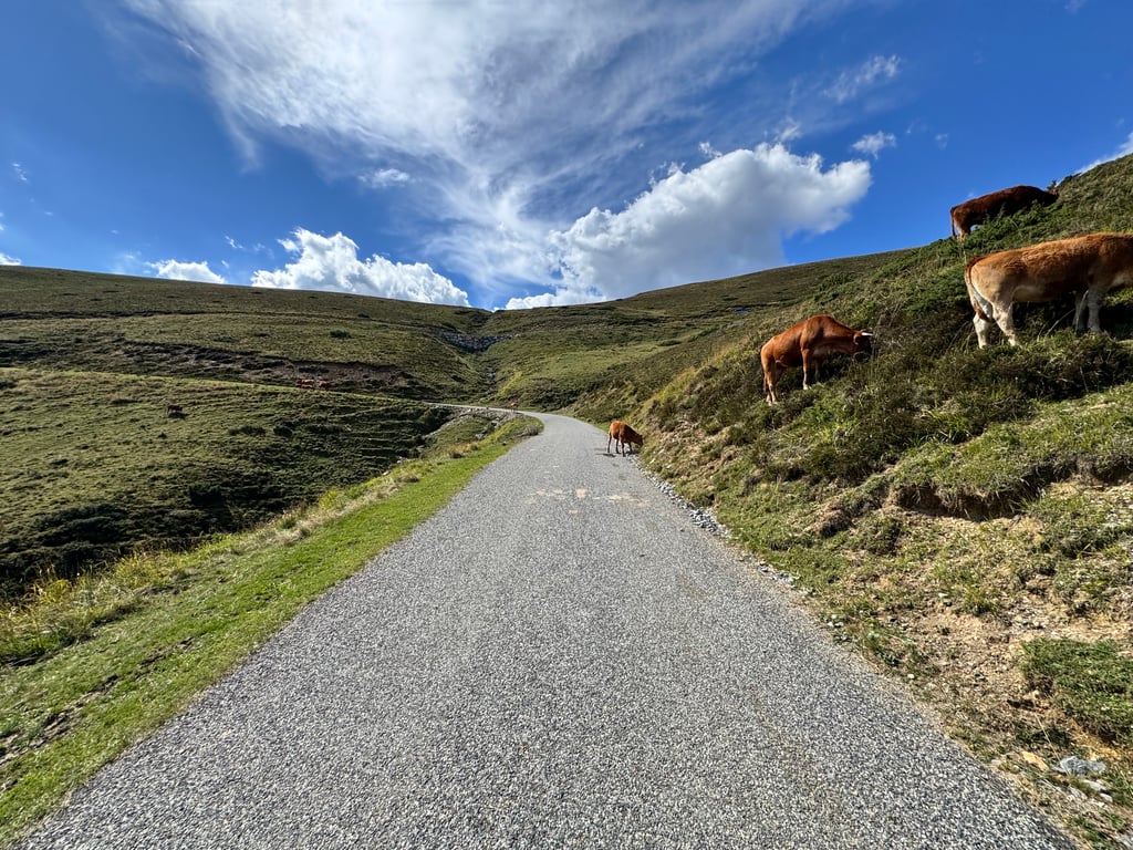
Great turtleneck. I think it's one of the most beautiful. Nice and long and a bit heavier. With beautiful views, cows on the road (not always nice). And certainly from this side a real challenge. I have done it three times now, but it is sometimes difficult to find the entrance of the col.
Geweldige col. Ik vind het één van de mooiste. Lekker lang en steeds wat zwaarder. Met mooie vergezichten, koeien op de weg (niet altijd leuk overigens). En zeker van deze kant een echte uitdaging. Heb hem nu drie keer gedaan, maar het is soms wel even zoeken naar de toegang van de col.
This was my first Hors Categorie, an outer category, and it has that status for a reason. I also encountered all those walls. Next km at 8% often means first a fairly flat piece and then make up the meters with +10%. This is also the case in the 10 and 11% average km's. At one point I could feel my rear wheel spinning from the saddle because of the steepness of the slope. Along the way you encounter cows and goats. I passed a lot of cattle and others who were totally parked. Around 1.580m there is a turning point. I also thought I would never make it, but the road makes a slight turn to the right, along a striking rocky outcrop to the part above the tree line. There you can recover for the last 2,5 km. At the top the view, weather permitting, is fantastic! Oh yes, watch out in the descent to Bagnères. It is nothing more than an asphalted goat path and I almost fell down because of a crossing herd.
Dit was mijn eerste Hors Categorie, buitencategorie dus en die status heeft ie niet voor niets. Al die muren ben ik ook tegen gekomen. Volgende km à 8% betekent dus vaak eerst een vrij plat stuk en dan de meters weer goedmaken met +10%. Ook in de km's van 10 en 11% gemiddeld is dat het geval. Op een gegeven moment voelde ik uit het zadel mijn achterwiel zelfs doorspinnen door de steile helling. Onderweg kom je koeien en geiten tegen. Ik ben heel wat afstappers voorbij gereden en anderen die totaal geparkeerd stonden. Rond de 1.580m ong. zit een omslagpunt. Ik dacht het ook ff niet meer te redden, maar de weg maakt een lichte bocht naar rechts, langs een opvallende rotspartij zo het gedeelte op boven de boomgrens. Daar kan je dan weer herstellen voor de laatste 2,5 km. Boven is het uitzicht, bij mooi weer, fantastisch! Oh ja pas op in de afdaling naar Bagnères. Het is niet meer dan een geasfalteerd geitenpad en ik kwam bijna ten val door een overstekende kudde.
| 5 mph | 02:23:58 |
| 7 mph | 01:41:55 |
| 9 mph | 01:19:25 |
| 12 mph | 00:59:40 |
This page is better in the app