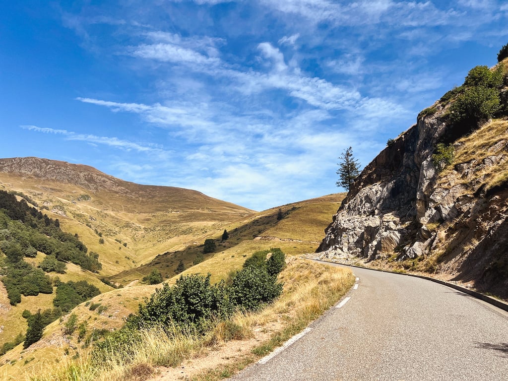
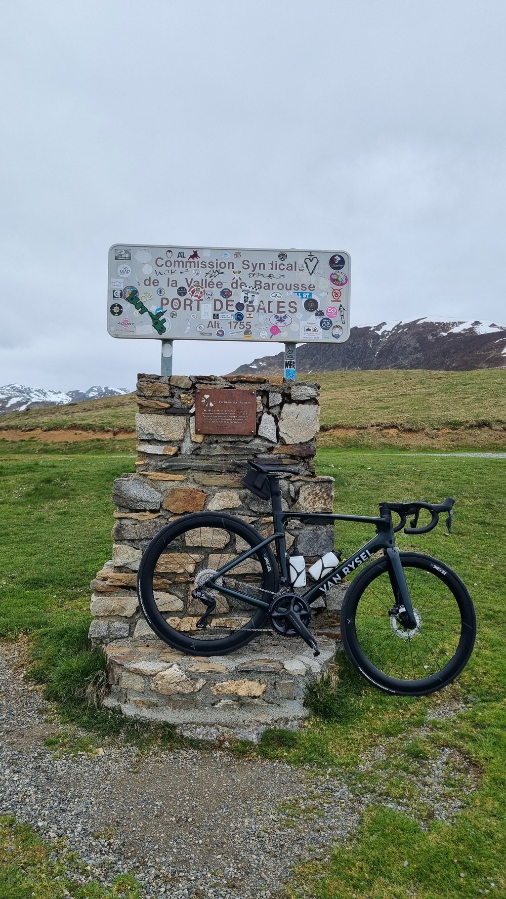
Port de Balès from Bagnères de Luchon is a climb in the region Haute-Garonne. It is 12 mi long and bridges 3724 ft of vertical ascent with an average gradient of 5.9%, resulting in a difficulty score of 834. The top of the ascent is located at 5761 ft above sea level. Climbfinder users shared 8 reviews of this climb and uploaded 25 photos.
Road names: Cours de la Casseyde, Avenue Jean Moulin, Route du Col de Peyresourde, Route de la Vallée d'Oueil, Rue de l'Antenac, Route de l'Antenac, Rue d'Oueil, Route du Mont-Né, Route de Pie
5.0 by TomJonesThis is an automatic translation, the original language is: French.The climb took place on Tuesday 9 September. It was so quiet! After the junction with the Col de Peyressourde, I was overtaken by just two cars. It's actually the few kilometres after the junction that this climb is the most difficult, but it's easily doable. The rest of the route, which is rolling for a while, allows you to build up your confidence for the last few kilometres, when the gradient gets steeper.... read more
Welcome! Please activate your account if you would like to share something. Look for the verification email in your inbox.
If you want to upload your photos, you need to create an account. It only takes 1 minute and it's completely free.
The climb took place on Tuesday 9 September. It was so quiet! After the junction with the Col de Peyressourde, I was overtaken by just two cars. It's actually the few kilometres after the junction that this climb is the most difficult, but it's easily doable. The rest of the route, which is rolling for a while, allows you to build up your confidence for the last few kilometres, when the gradient gets steeper.
Montée effectuée mardi 9 septembre. Quel calme ! Après la bifurcation avec le col de Peyressourde, je me suis fait doublé par deux voitures seulement. C'est d'ailleurs les quelques kilomètres après la bifurcation que cette montée est la plus difficile mais largement faisable, la suite roulante pendant un moment permet de se refaire la cerise en vue des derniers kilomètres où la pente se redresse.
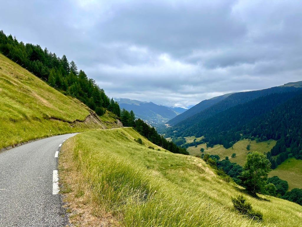
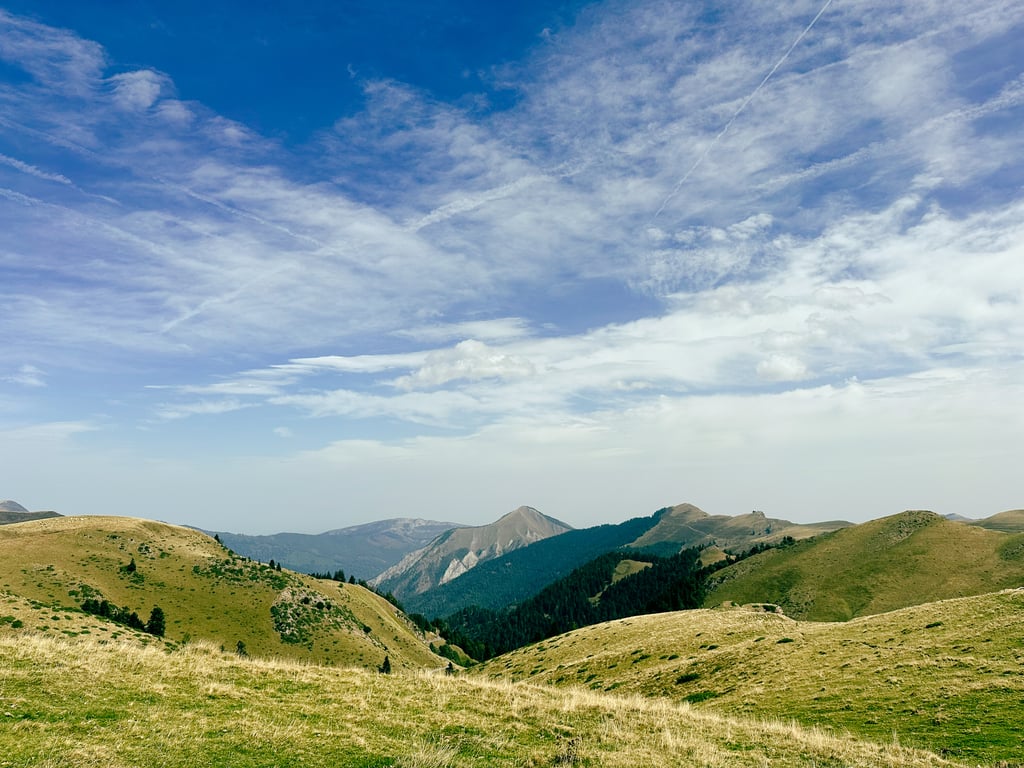
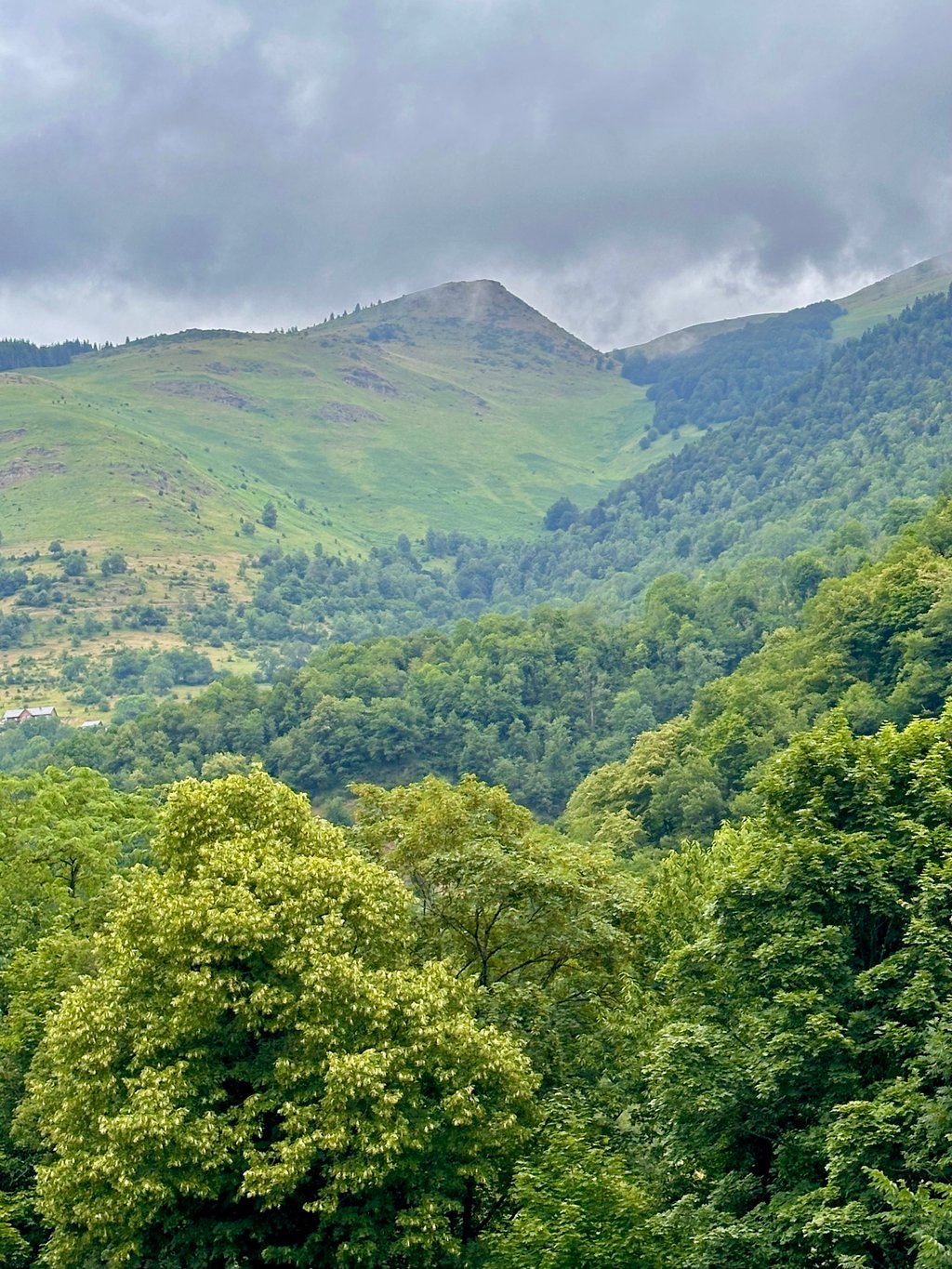
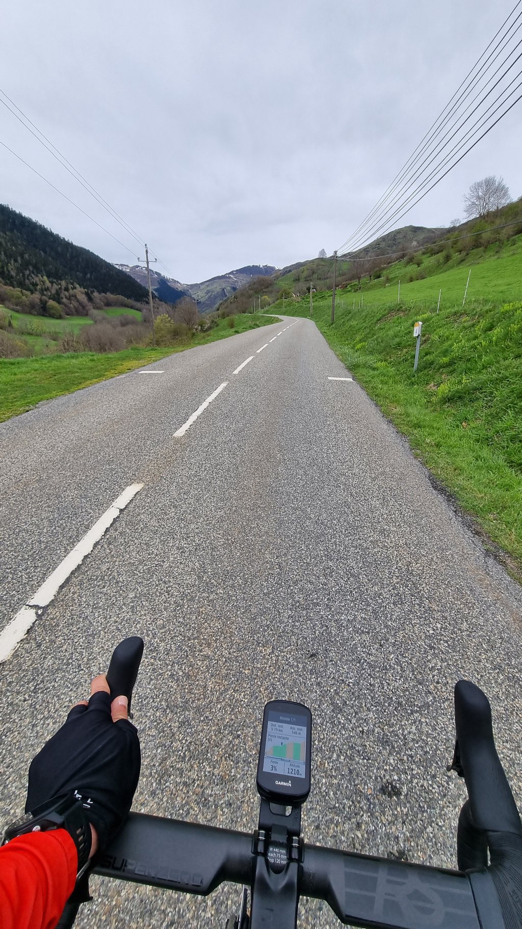
A superb pass! The first slopes are common to the Col de Peyresourde. When you go straight into the hairpin, the route de Balès comes into view, with very steep gradients for just over 2 km. Once you've passed this part, you've done the hard part: the second third of the climb is made up of false flats and even small descents as you pass through the villages perched in the valley. The last 6km are a little steeper, but nothing insurmountable. Watch out for the dangerous descent on the other side.
Superbe col ! Les premières pentes sont communes au col de Peyresourde. Quand vous filez tout droit dans l'épingle, la route de Balès s'offre à vous, avec de très gros pourcentages sur un peu plus de 2 km. Une fois cette partie passée, vous avez fait le plus dur : le deuxième tiers de l'ascension est faite de faux plats et même de petites descentes en traversant les villages perchés dans la vallée. Les 6 dernières km sont un peu plus raides mais rien d'insurmontable. Attention à la descente sur l'autre versant qui est dangereuse.
a nice climb although prettier from the Mauléon. this side consists of 3 sections: hard first few kms, especially after turn off from Peyresourde, then flat/ downhill, then last 6km are 3 at 6% and 3 at 8% on a single lane road. recommend starting early (i rode this on 11/9/24 starting at 8am) because as i descended, there were heaps of cyclists of all abilities, motorbikes and cars coming up- would have been tricky/ unpleasant in the last few kms when the single lane road narrows and you are on the steeper gradient!
a nice climb although prettier from the Mauléon. this side consists of 3 sections: hard first few kms, especially after turn off from Peyresourde, then flat/ downhill, then last 6km are 3 at 6% and 3 at 8% on a single lane road. recommend starting early (i rode this on 11/9/24 starting at 8am) because as i descended, there were heaps of cyclists of all abilities, motorcycles and cars coming up- would have been tricky/ unpleasant in the last few kms when the single lane road narrows and you are on the steeper gradient!
The first 4 km are shared with the ascent of the Col de Peyresourde.
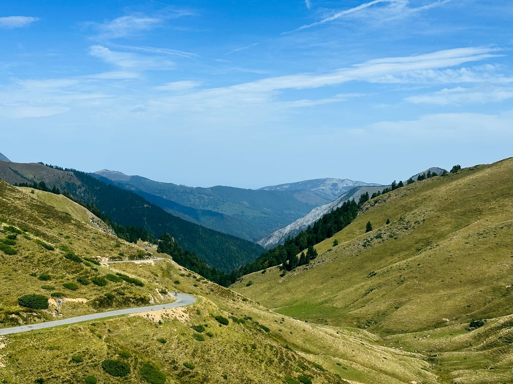
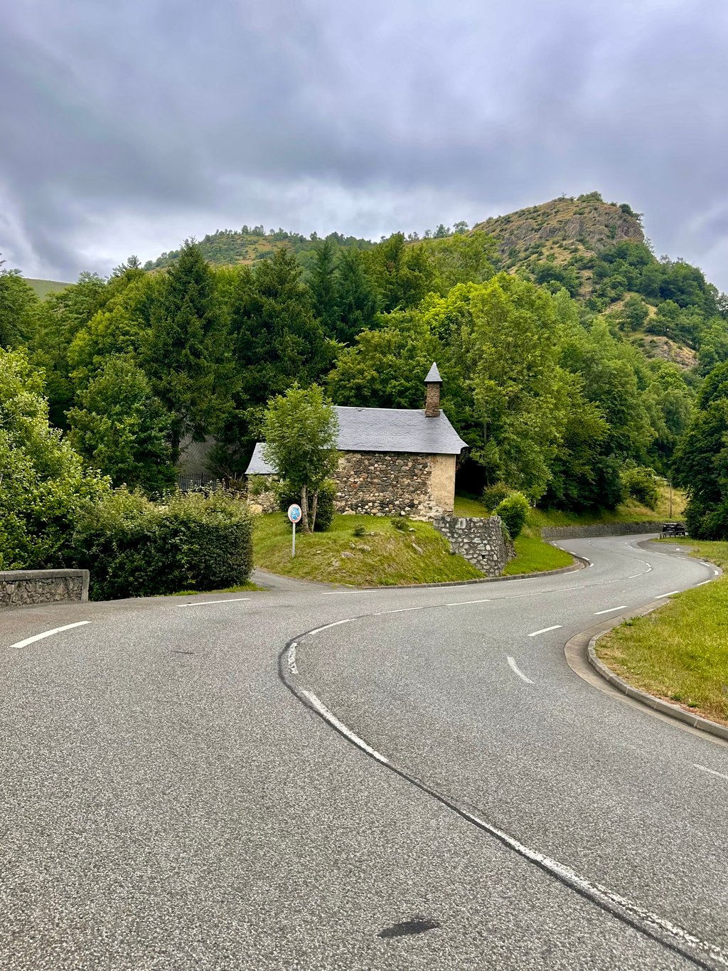
After the Chapelle de Saint-Aventin, turn right onto the D51: two km around 10% await you. After that, the slope becomes gentler, then even presents a few false flats. After Saint-Paul d'Oueil, the valley opens out into a very pleasant pastoral mountain setting.
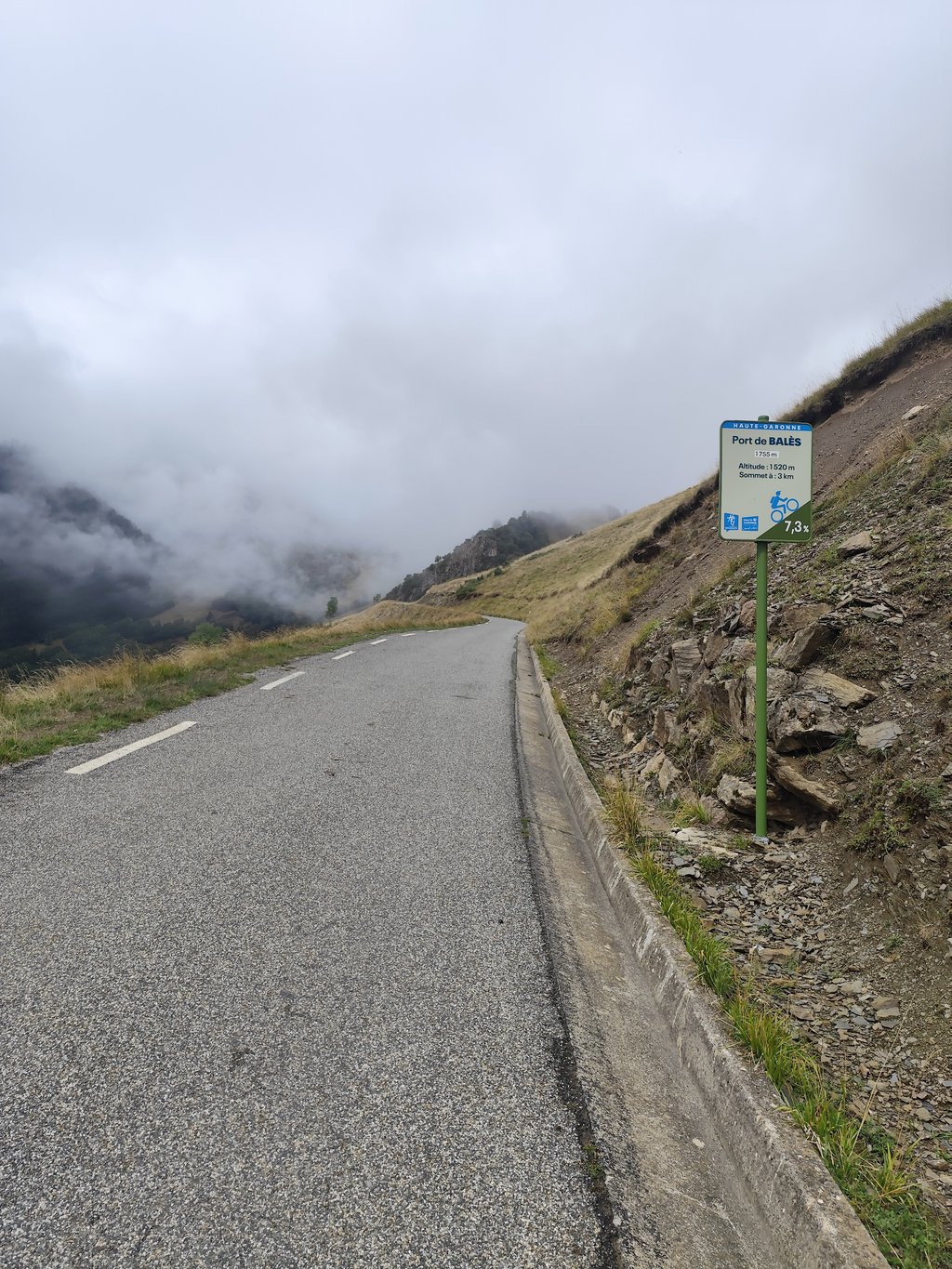
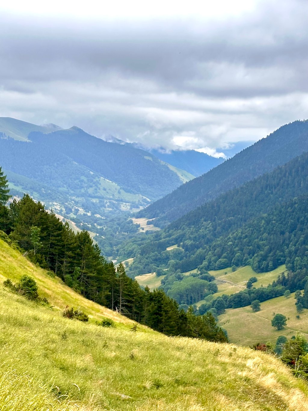
The final 6 km return to slightly more Pyrenean gradients, while remaining moderate, between 7 and 8%. The road becomes gravelly and requires great concentration on the descent.
Les 4 premiers km sont communs avec la montée du col de Peyresourde.
Après la Chapelle de Saint-Aventin, prendre à droite sur la D51 : deux km autour de 10% vous attendent. Après quoi, la pente s'adoucit, puis présente même quelques faux-plats. Après Saint-Paul d'Oueil, la vallée s'ouvre sur un décor de montagne pastorale très agréable.
Les 6 derniers km renouent avec des pourcentages un peu plus pyrénéens tout en restant modérés, entre 7 et 8%. La route devient gravillonneuse et nécessite de rester très concentré lors de la descente.
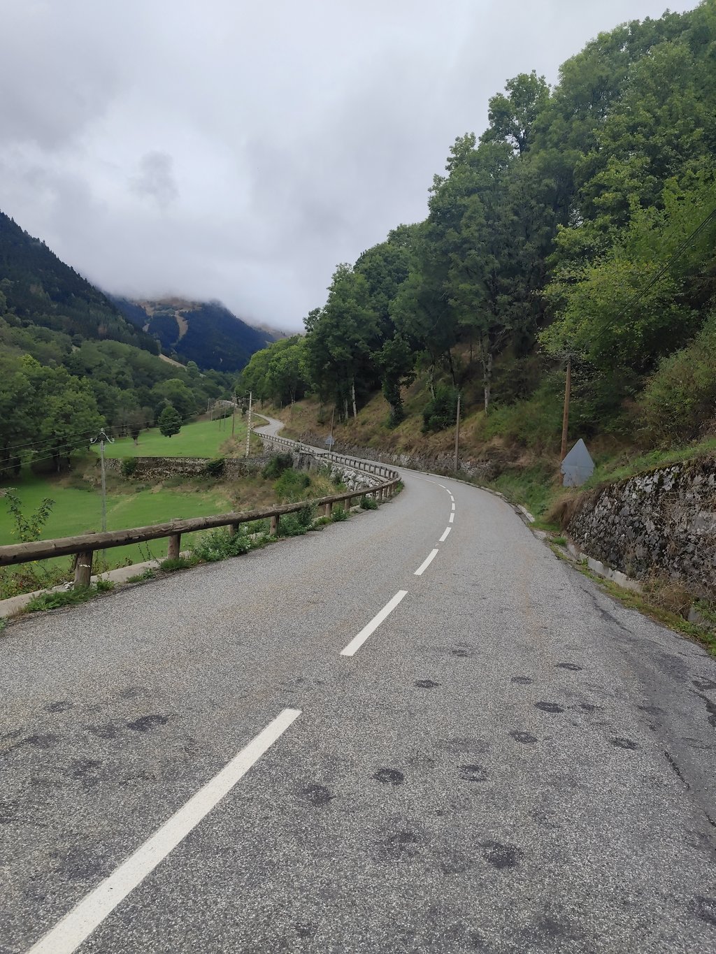
Nice climb with a somewhat easier middle section. The last 6 km there is real climbing again. Beautiful views along the way. First part of the route can be a bit busy. The further along the route, the quieter the traffic. The tarmac is well maintained but sometimes gives the impression of a patchwork with here and there some loose grit and some light bumps. Good to ride but not a smooth surface.
Mooie klim met een wat makkelijker middenstuk. De laatste 6 km wordt er weer echt geklommen. Onderweg mooie vergezichten. Eerste stuk van de route kan wat drukker zijn. Hoe verder onderweg hoe rustiger het verkeer. Het asfalt is goed onderhouden maar geeft daardoor soms een beeld van een lappendeken met hier en daar nog wat los grit en wat lichte hobbels. Goed te berijden maar geen strak wegdek.
Even before the official start of the climb, you have to overcome some difficult meters. So train and make sure you are in good condition.
Nog voor de beklimming officieel start moet men enkele moeilijke meters trotseren. Trainen dus en zorgen voor een goede conditie.
The Tour usually includes the other side of the climb in its itinerary, but also from the cycling city Bagneres de Luchon the climb is worthwhile.
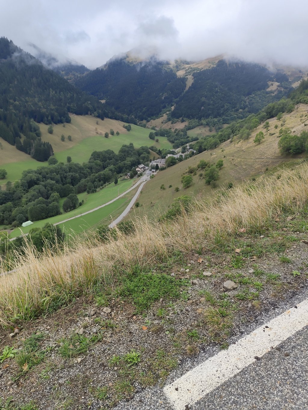
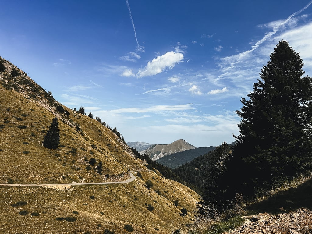
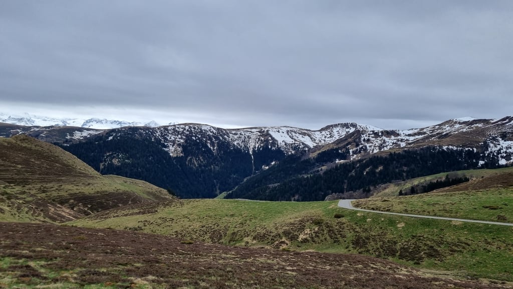
You start on the same busy route of the Col de Peyresourde to leave it after 4 km on the right side and immediately get the steepest part (12,5%) under your wheels. After that follows a less steep to flat and slightly winding part on a narrow road with hardly any traffic, meandering along the different small villages in the Vallée d'Oueil. Just before entering the last village Bourg d'Oueil, there is a right hairpin turn and the 6 km. long end of the climb starts. You cycle to the top in the uninhabited nature of a "zone pastorale" so there may be free roaming animals (cows/goats/sheep) on the road, which do not care much for a lonely cyclist. Let alone a bicycle bell!
Because of the fog and low clouds that day I could only see fragments of the barren green landscape of the central mountains on the way and on the desolate summit (no provisioning).
There were two bike information signs at 6 and 3 km from the summit.
During the descent I was confronted with 2 stray dogs in the villages and a cow in the middle of the misty road.
Beautiful natural climb without extremes which will be even more beautiful with nice weather.
De Tour heeft meestal de andere klimzijde opgenomen in zijn parcours maar ook vanuit fietsstad Bagneres de Luchon is de klim ook de moeite waard.
Starten doe je op dezelfde drukke route van de Col de Peyresourde om deze na 4 km. rechts te verlaten en direct het steilste deel (12,5%) onder de wielen te krijgen. Nadien volgt een minder stijgend tot vlak en licht bochtig tussendeel op smalle weg met amper verkeer meanderend langs de verschillende kleine dorpjes in de Vallée d'Oueil. Vlak voor het binnenfietsen van het laatste dorpje Bourg d'Oueil is er een rechtsdraaiende haarspeldbocht en start het 6 km. lange slot van de klim. Je fietst naar de top in het onbewoond natuurgebied van een "zone pastorale" waardoor er vrij loslopende dieren (koeien/geiten/schapen) op de weg kunnen staan en liggen,die zich weinig aantrekken van een eenzame fietser. Laat staan van een fietsbel!
Door de mist en lage wolken die dag kon ik onderweg en op de desolate top (geen bevoorrading) het kale groene landschap van het middengebergte maar met flarden aanschouwen.
Er waren twee fietsinfobordjes op 6 en 3 km van de top.
Tijdens de afdaling werd ik geconfronteerd met 2 loslopende honden in de dorpjes en een koe midden op de mistige weg.
Mooie natuurklim zonder extremen die bij mooi weer nog prachtiger zal zijn.
The col is also beautiful from this side, a bit less rough than from the other side. Also a lot easier. But the Port de Balès is one of my favorites. Also not so well known, which is nice. On top you can also make a nice walk.
Ook vanaf deze kant is de col mooi, iets minder ruig dan van de andere kant. Ook een stuk makkelijker. Maar de Port de Balès is toch wel één van mijn favorieten. Ook niet zo bekend, wat ook wel lekker is. Bovenop kan je ook nog mooi wandelen.
| 5 mph | 02:25:21 |
| 7 mph | 01:42:54 |
| 9 mph | 01:20:11 |
| 12 mph | 01:00:14 |
This page is better in the app