1 y 5.0 01:30:07 (8.7 mph)
This is an automatic translation, the original language is: Dutch.
Show original
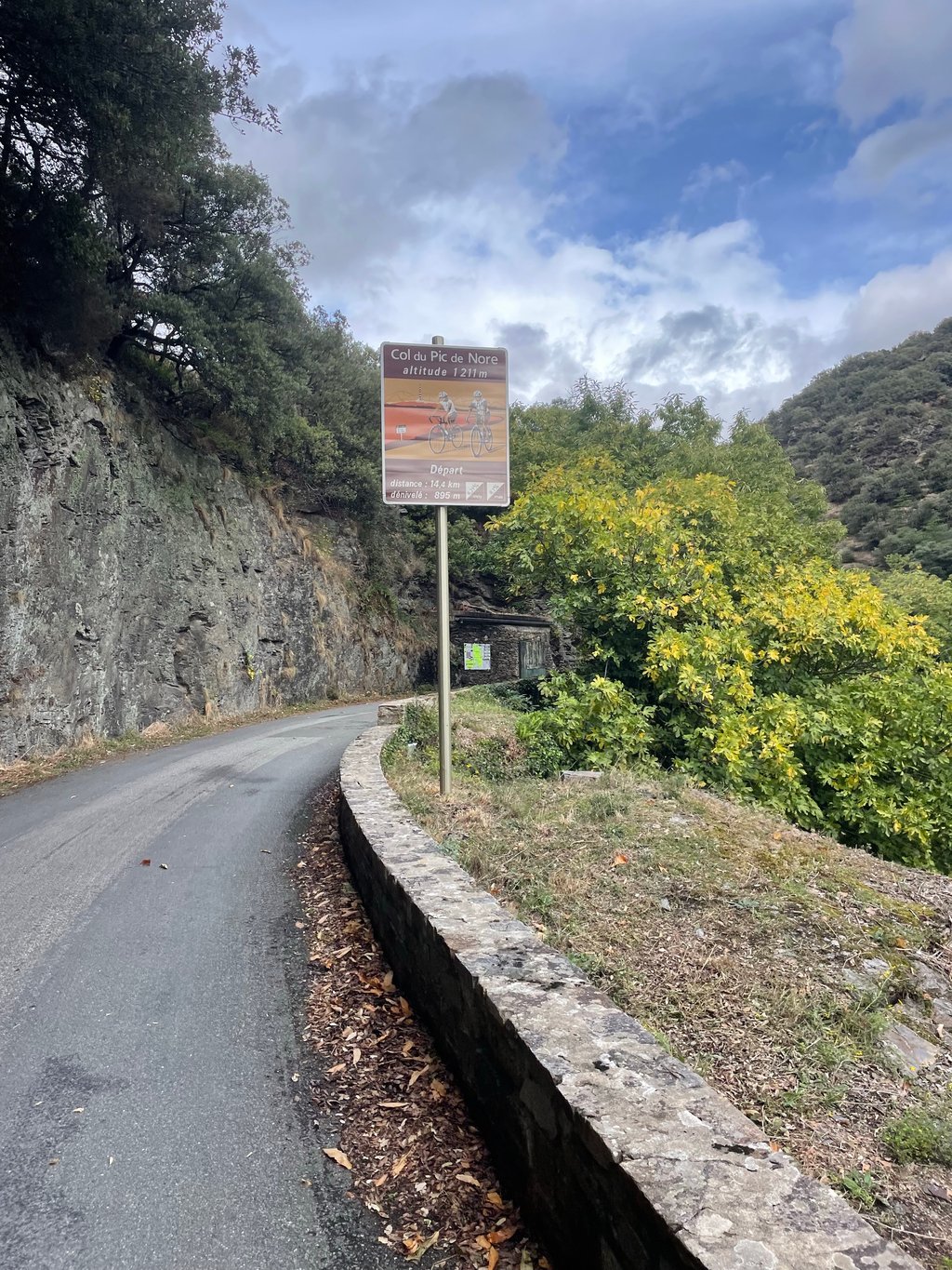
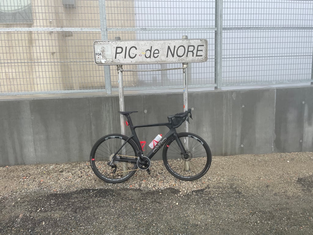
The ascent officially starts in Lastours (worth a visit for its four beautiful castles), but for the first few kilometres you ride quietly uphill through a beautiful gorge with a babbling river beside you. Nice to get into.
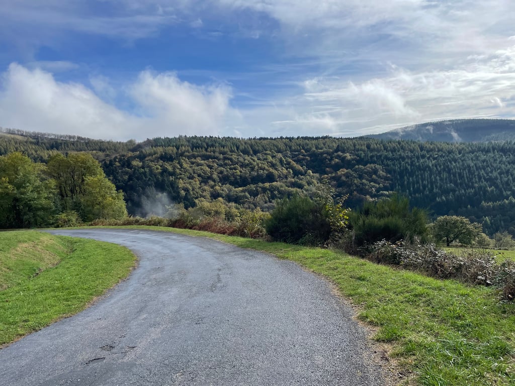
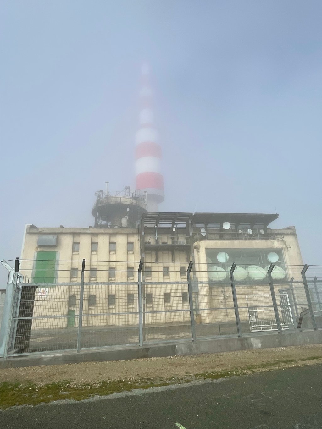
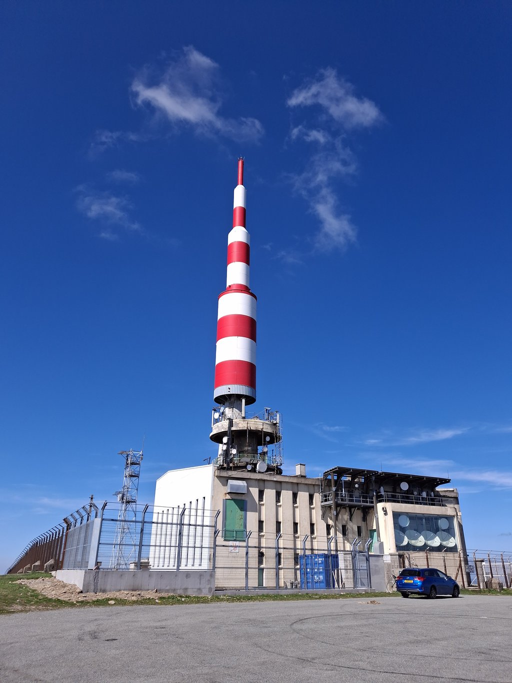
After 6.5 kilometres, you turn right and the trickiest part of the climb begins. Swinging along a forest road you grind away the metres, until after about 5 km you ride out of the forest and suddenly see the summit.
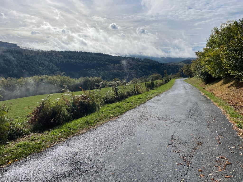
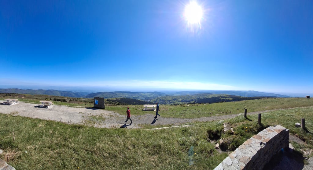
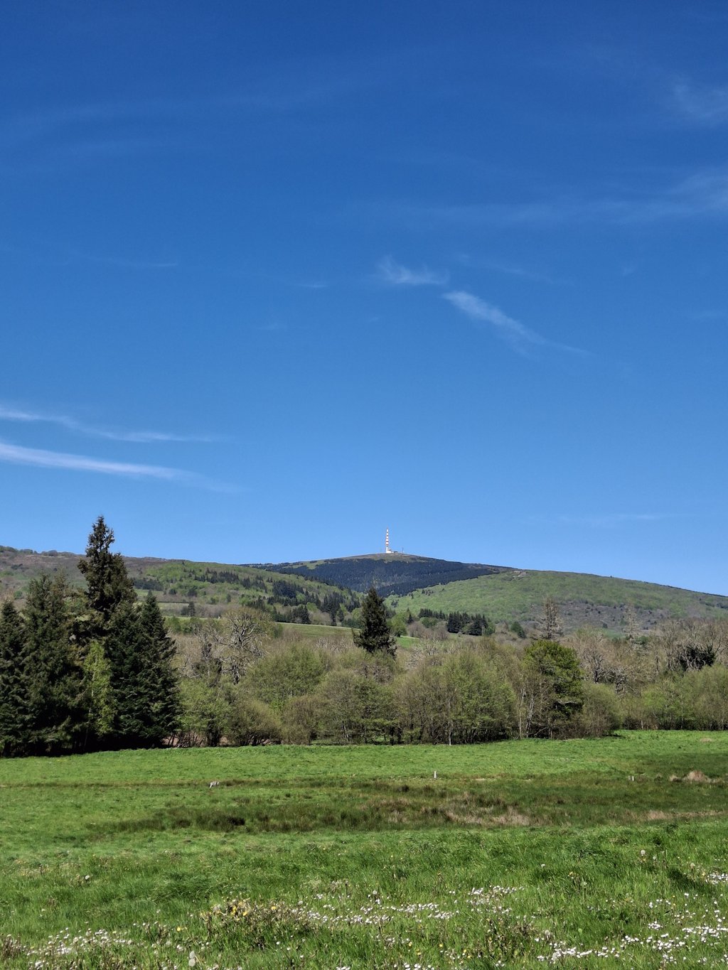
From then on, a small bit of descent and slightly friendly percentages follow, while as motivation you can almost always see the summit from this point on. You can also see the snow-capped peaks of the Pyrenees here in clear weather.
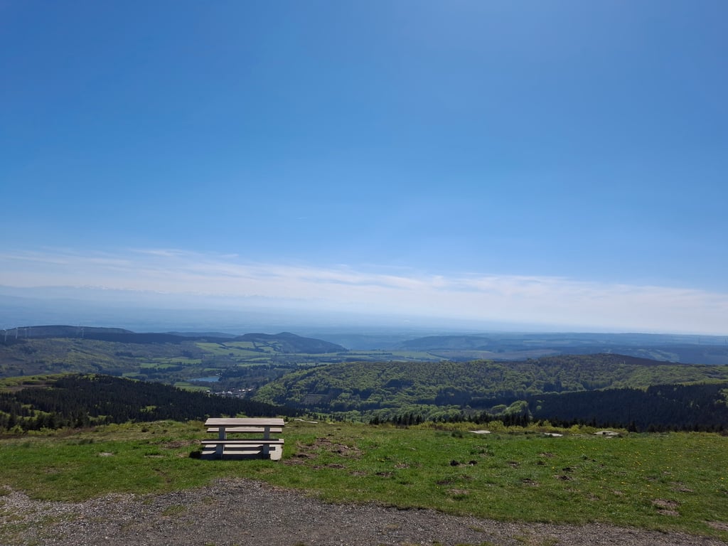
The last stretch (from Pradelles-Cabernès) takes you over beautiful highlands with views up to the snowy peaks of the Pyrenees. The percentages are slightly gentler and more constant, so you can get into a nice rhythm. It can be quite windy here though (wind force 5 when I rode there).
All in all, a beautiful climb with a bit of everything. Combined with the views at the top and the quiet roads, this was 5 stars for me. I recommend this climb to everyone.
p.s. I fortunately did not have to do the descent to Mazamet by bike. That really is a horror (narrow, gravel, holes in the road)
De beklimming begint officieel in Lastours (een bezoek waard vanwege de vier prachtige kastelen), maar de eerste paar kilometers rijd je rustig omhoog door een mooie kloof met een kabbelend riviertje naast je. Lekker om in te komen.
Na 6,5 kilometer sla je rechtsaf en begint het lastigste stuk van de klim. Al slingerend over een bosweg maal je de meters weg, tot dat je na een km of 5 het bos uit rijd en opeens de top ziet liggen.
Vanaf dat moment volgt een klein stukje afdaling en iets vriendelijke percentages, terwijl je als motivatie de top vanaf dit moment vrijwel steeds kunt zien. Ook zie je hier bij helder weer de besneeuwde toppen van de Pyreneeën.
Het laatste stuk (vanaf Pradelles-Cabernès) voert over mooie hooglanden met uitzichten tot aan de besneeuwde toppen van de Pyreneeën. De percentages zijn iets vriendelijker en constanter, dus je kunt in een mooi ritme komen. Het kan hier wel flink hard waaien (windkracht 5 toen ik er reed).
Al met al een prachtige beklimming met van alles wat. Gecombineerd met het uitzicht op de top en de rustige wegen was dit voor mij 5 sterren. Ik raad iedereen deze beklimming aan.
p.s. de afdaling naar Mazamet heb ik gelukkig niet met de fiets hoeven doen. Dat is echt een verschrikking (smal, grind, gaten in de weg)