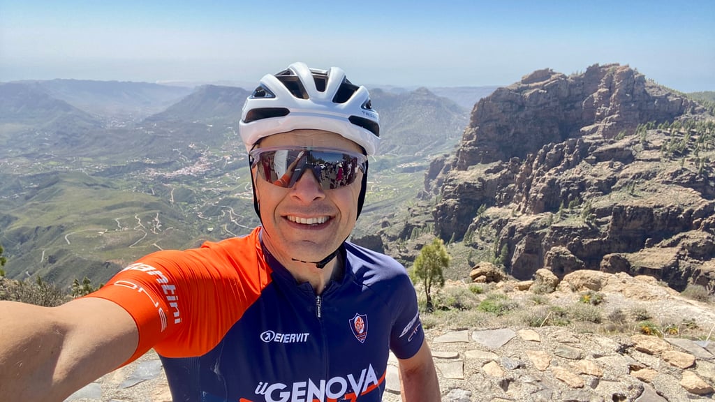
| Famous climb |
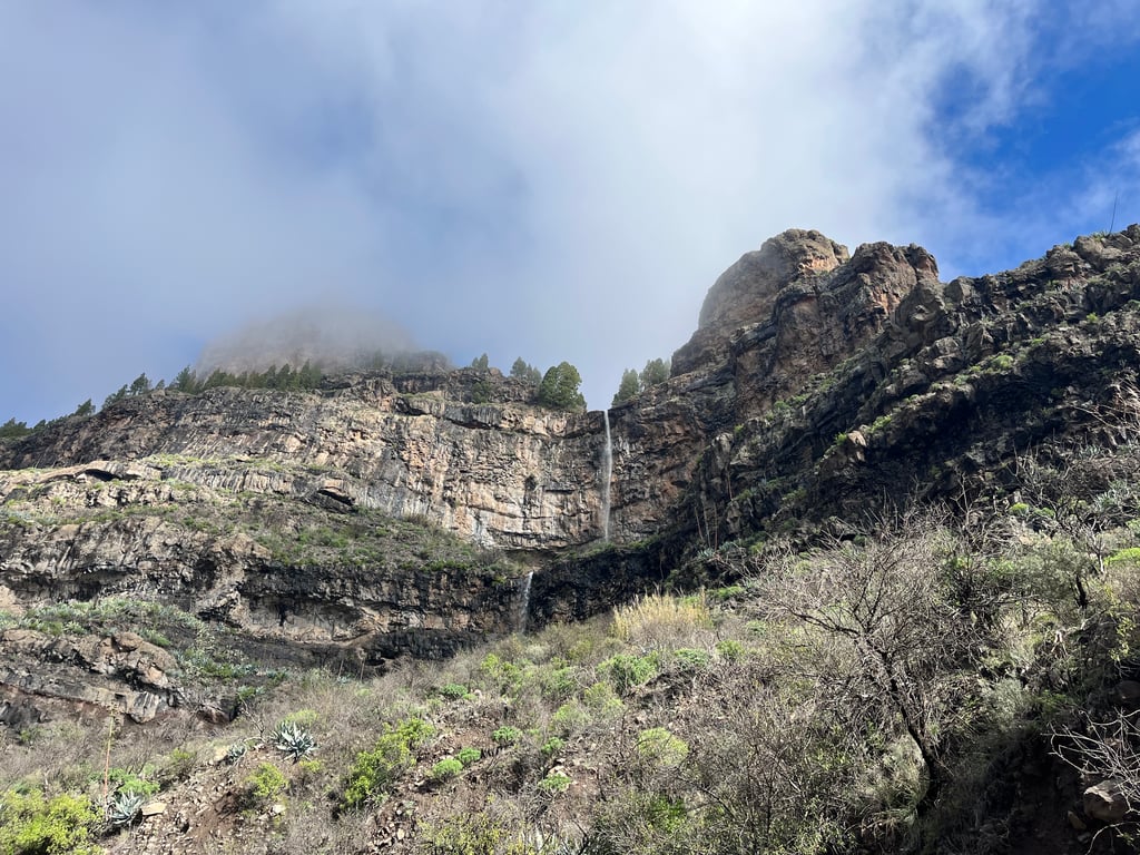
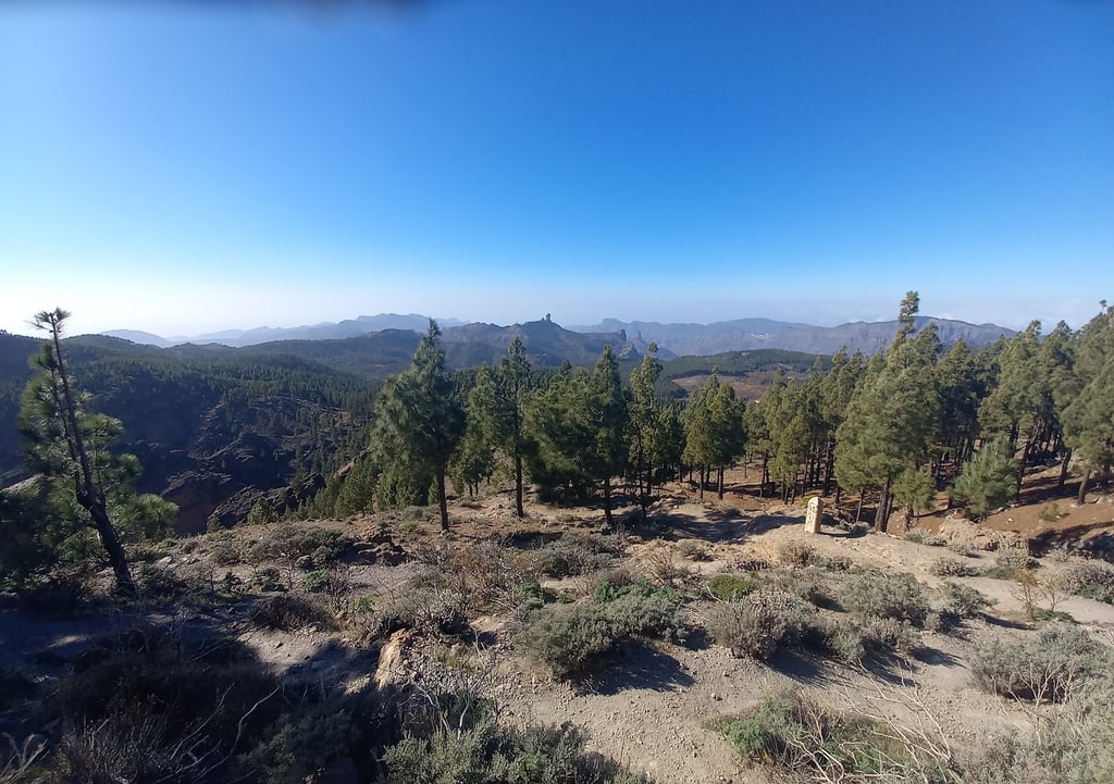
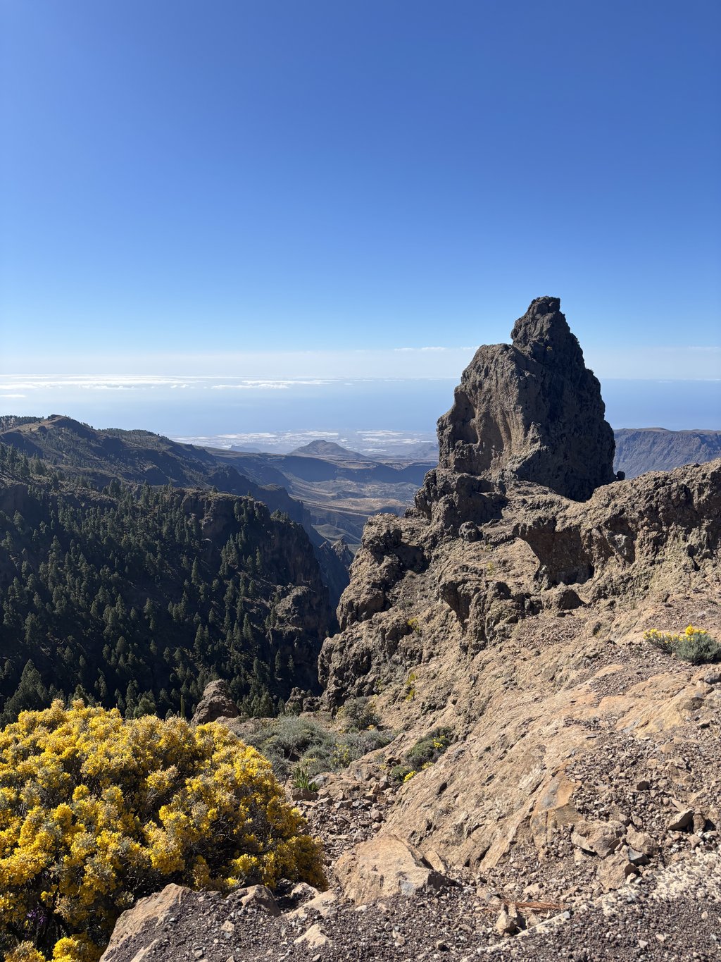
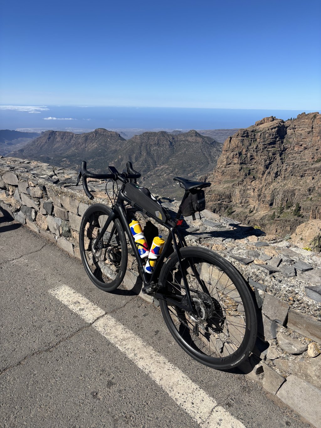
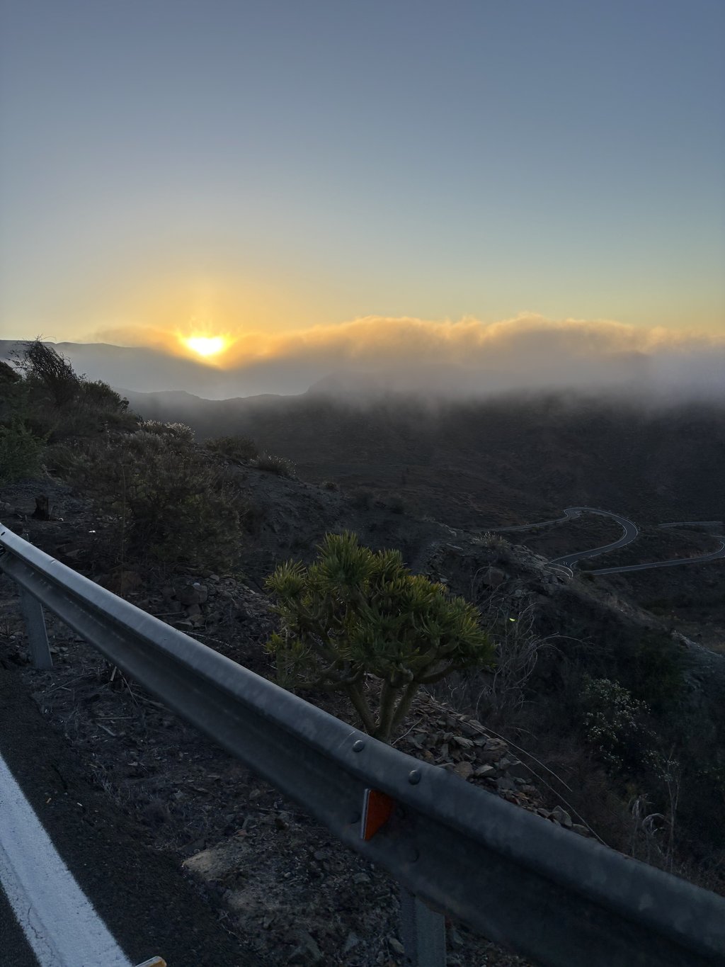
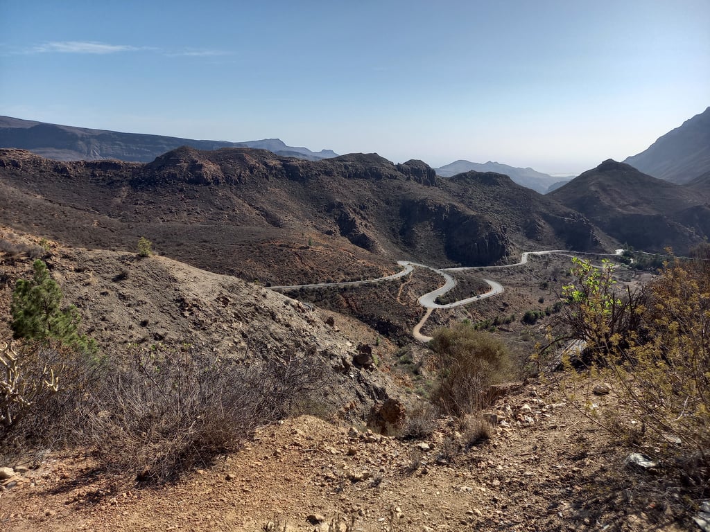
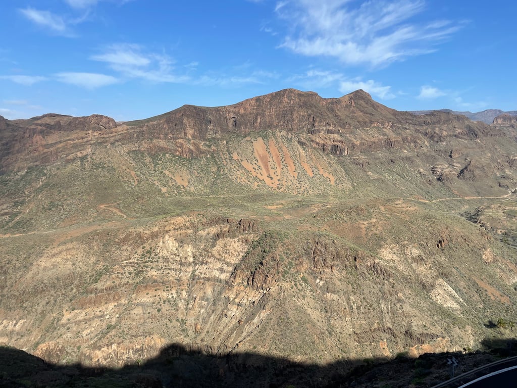
| Beautiful scenery |
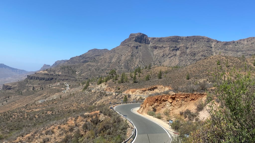
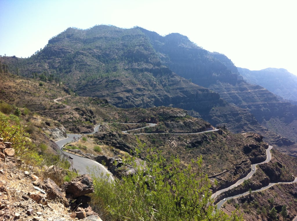
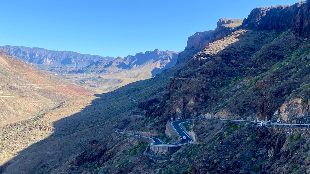
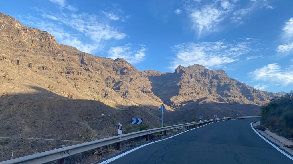
| 14 hairpin turns |
| #31 toughest climb of Spain |
| #70 most elevation gain of World |
| #91 longest climb of World |
| #42 average steepest climb of Gran Canaria |
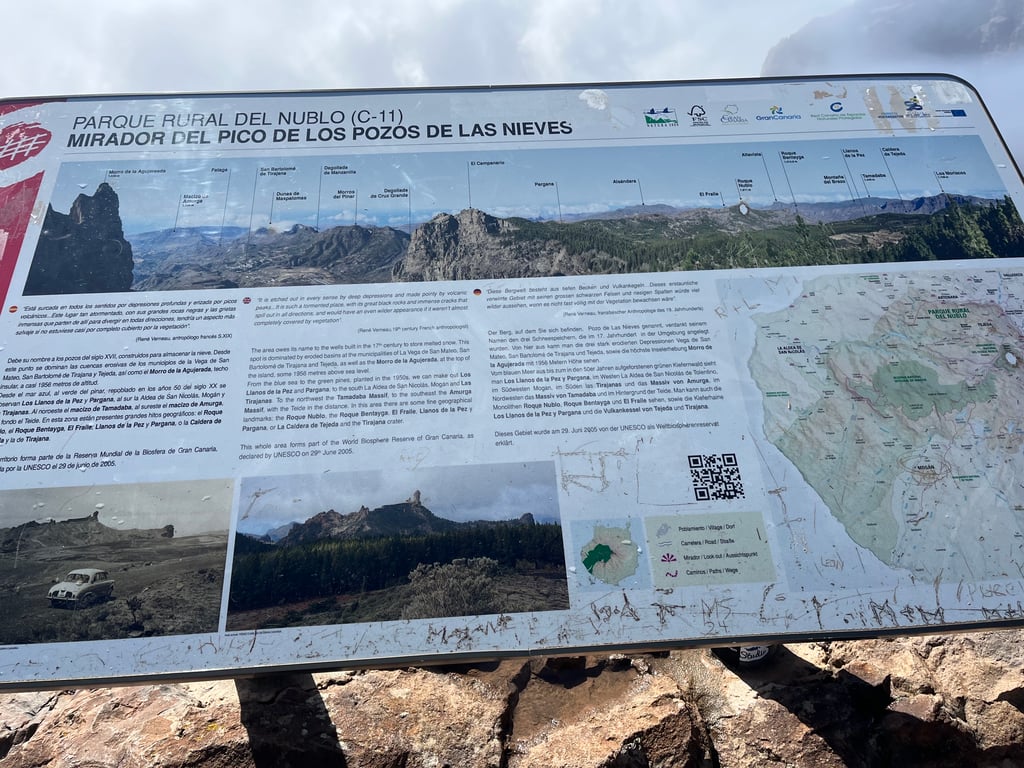
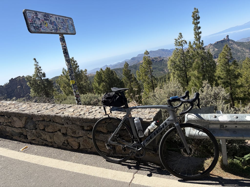
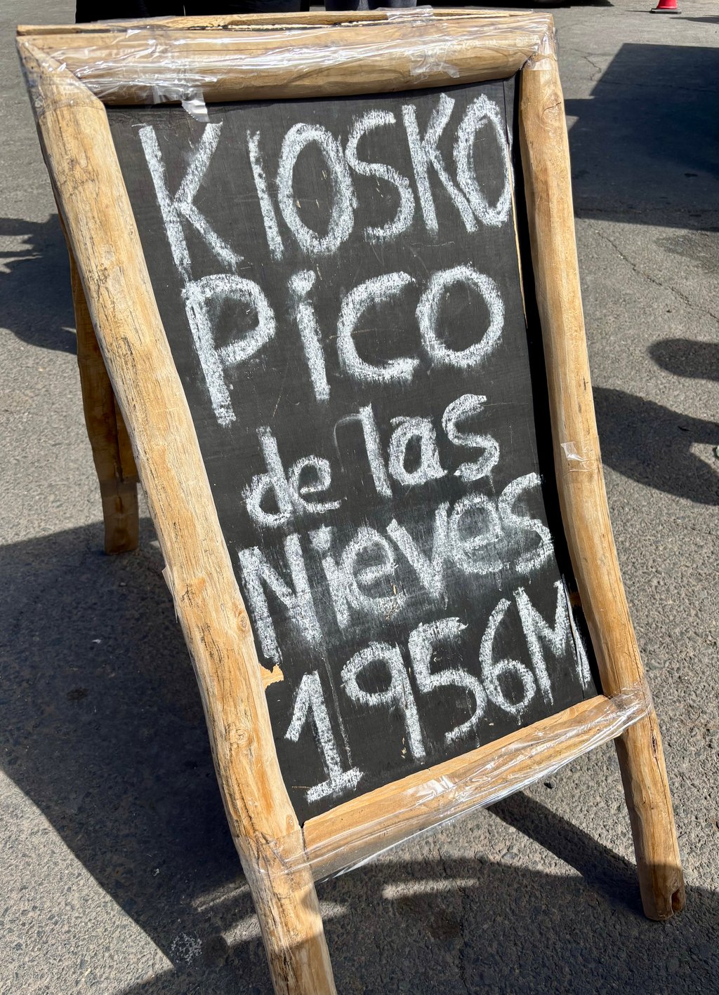
Pico de las Nieves is a climb in the region Gran Canaria. It is 27.7 mi long and bridges 6745 ft of vertical ascent with an average gradient of 4.6%, resulting in a difficulty score of 1316. The top of the ascent is located at 6306 ft above sea level. Climbfinder users shared 25 reviews of this climb and uploaded 51 photos.
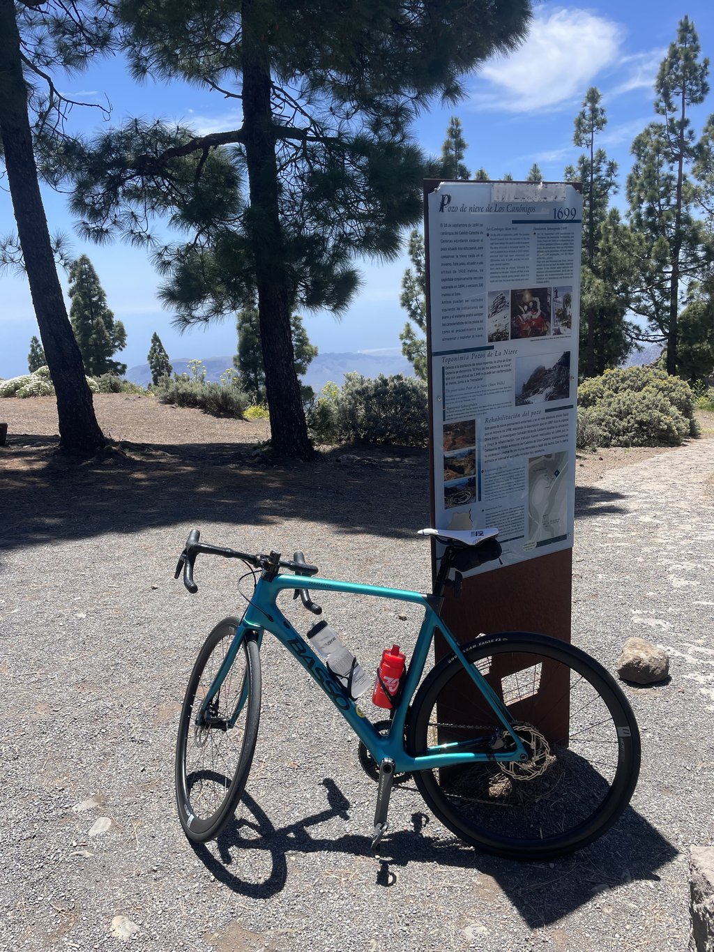
Road names: GC-60 & GC-600
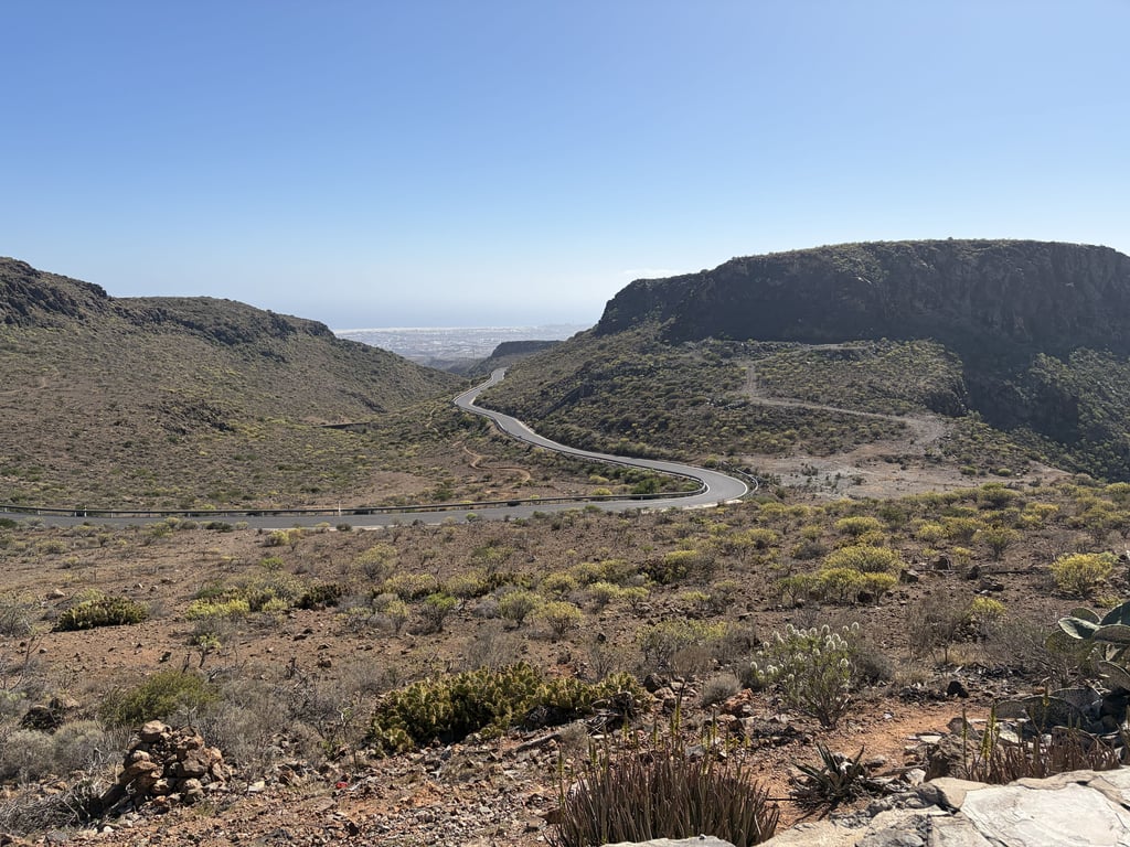
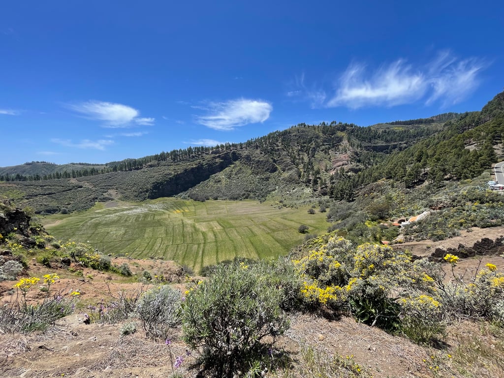
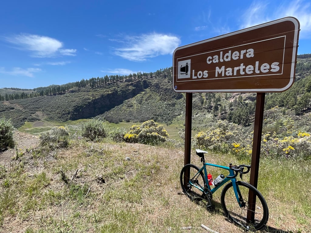
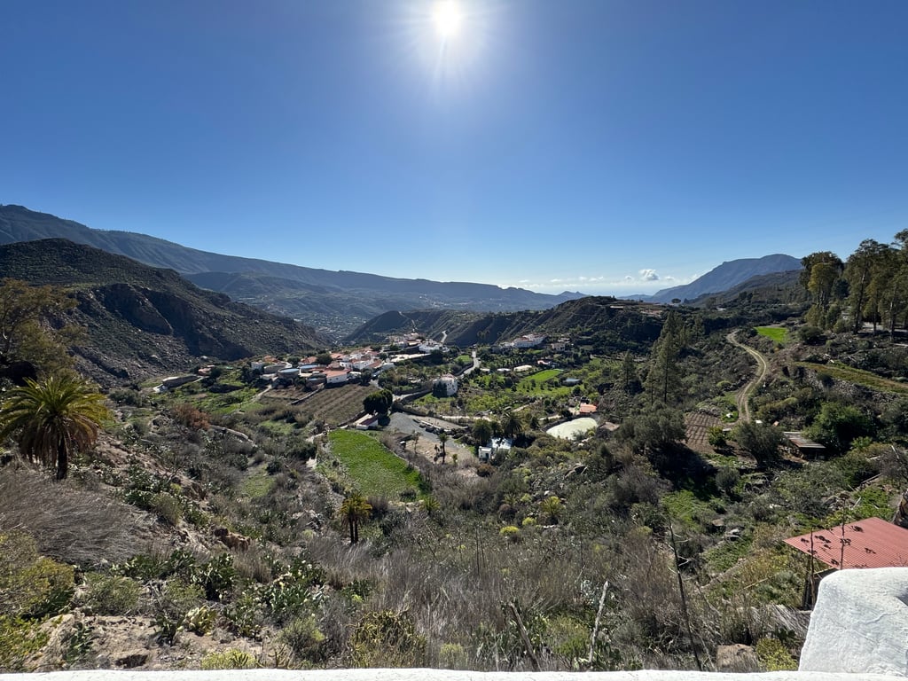
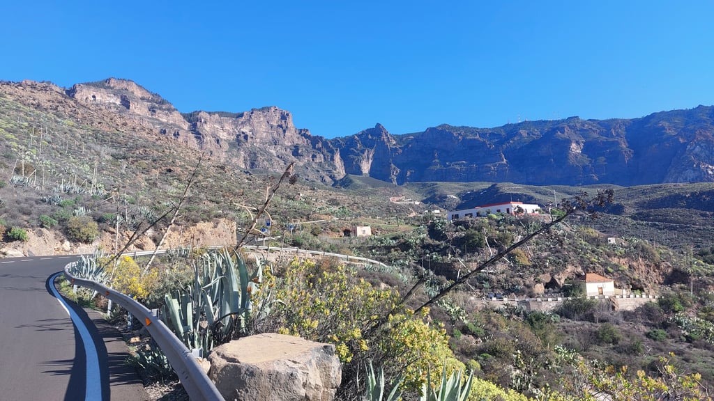
5.0 by RoanThis is an automatic translation, the original language is: Dutch.Once out of Maspalomas, it is a bit of a struggle to reach the viewpoint with possibly some traffic like touringcars and buggy's but after that it is an oasis of peace and beautiful landscapes (it looks a bit like the grand canyon). Until the viewpoint, it is easy to do, around 6% average, then you get the infamous hairpin bends down (great for the return trip). After the descents you can continue to climb until San Bartolome where it is never really steep and where there are some nice h... read more
Welcome! Please activate your account if you would like to share something. Look for the verification email in your inbox.
If you want to upload your photos, you need to create an account. It only takes 1 minute and it's completely free.
A challenging climb that just keeps going. The start is actually pretty manageable, with a few flat or downhill sections in between. About halfway up is the village of Bartelome. That’s where the real work begins—it was also very hot, so we made sure to stop regularly at local bars to refill our water. It was definitely worth it, and I’m glad I was able to ride it.
Pittige klim die blijft duren. Het begin valt heel goed mee met enkele vlakke of dalende tussenstukken. Eens halfweg dorpje bartelome. Begint het echte werk het was ook zeer warm dus regelmatig ervoor gezorgd dat we drinken konden aanvullen in lokale bars. Was zeker de moeite waard en tevreden hem kunnen oprijden.
Epic! A must do. Read some of the other reviews: it is indeed a climb in 4 parts. Total altitude back and forth for me sat at 2600m. Enjoy!
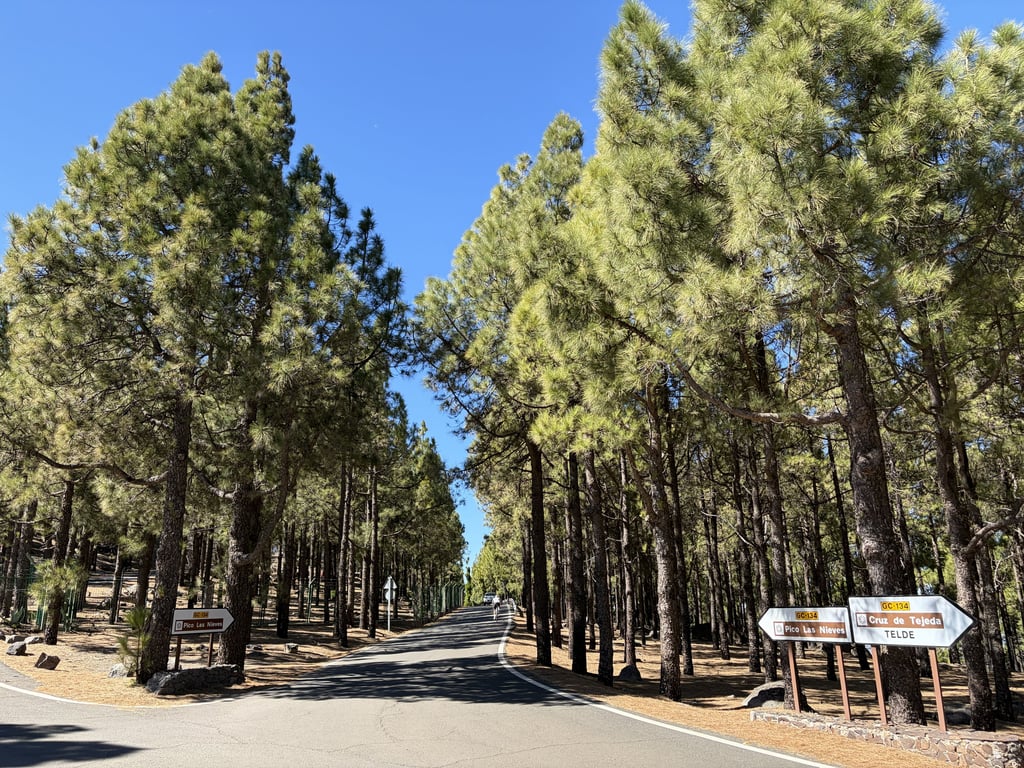
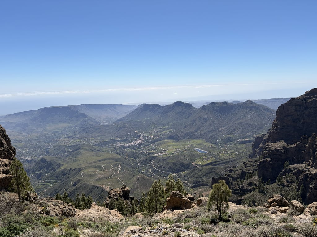
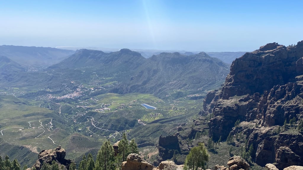
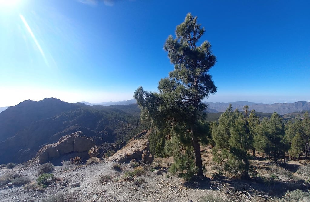
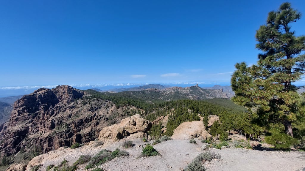
Lovely long climb that you must have done. Notable the forest section on the last part of the summit and great views with the Teide 'close by'
Heerlijke lange klim die je gedaan moet hebben. Opvallend het bos gedeelte op het laatste stuk van de top en geweldig uitzicht met de Teide 'dichtbij'
Iconic route in Gran Canaria, lots of climbing but always rideable, only a couple of km that scratch a bit more. After the first 45 minutes quite boring you enter a valley that offers breathtaking views. Second time for me.
Percorso iconico a Gran Canaria, tanta salita ma sempre pedalabile, solo un paio di Km che graffiano un po’ di piu’. Dopo i primi 45 minuti abbastanza noiosi si entra in una valle che offre panorami mozzafiato. Per me la seconda volta.
Not to hard at this time of year, go at it steady away unless you’re familiar with the route.
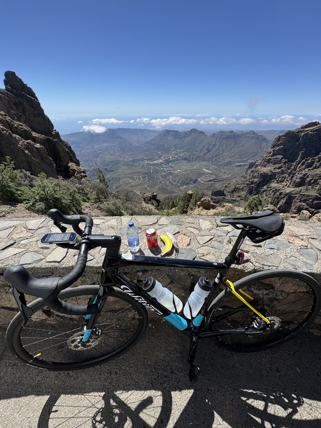
Must do…but as mentioned, dont be fooled by the average percentage. Did my climb with headwind the first approx 20 km and in more than 34 degrees this november 🤨. Beautiful ride, absolutely lovely tarmac and little traffic (even on a Sunday). Great with the foodtruck at the top 🌭🥤
Must do…both as mentioned, dont be files by the average percentage. Did my climb with headwind the first approx 20 km and in more than 34 degrees this november 🤨. Beautiful ride, absolutely lovely tarmac and little traffic (even on a Sunday). Great with the foodtruck at the top 🌭🥤
Most beaten slope both uphill and especially downhill. Long ascent but with manageable gradients and downhill sections that make you take a break
Versante più battuto sia in salita ma soprattutto in discesa. Salita lunga ma con pendenze gestibili e tratti in discesa che fanno rifiatare
I did this in August. Won't repeat other reviews. I left Maspalomas at 6am and was past the first pass before day break. I didn't stop in San Bart or Ayacata. Ran out of my 1.5lt of electrolyte and it was a mistake not stopping. The route up to Roque Nublo is v steep and I had to walk bits of it. At the pass there was a food truck so replenished but it took a while to be absorbed and my vision started to blur before normalising. There is a food truck at the top as well. The stretch from Ayatasca to is the steepest bit.
Down hill was 25mile descent always on brakes. I came down via GC120 and 130 as stayed in Bahia Feliz. 8440ft of ascent and 63m long. 4 lt of electrolyte used...
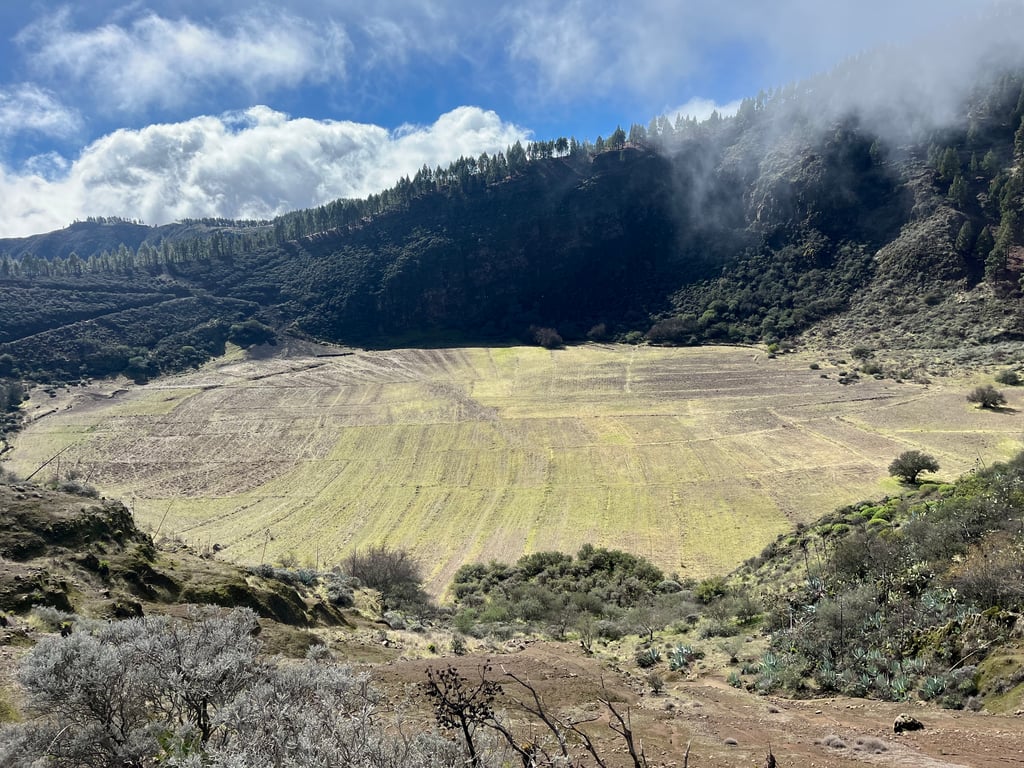
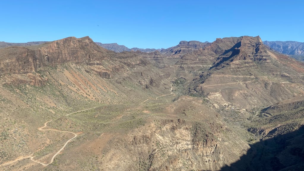
There are four sub-climbs with as many descents (to be done on the way back!). Pay no attention to the average gradient because it is affected by the descents, the climbs have peaks at 11/12% but otherwise are all at 6/7/8%. Long, it requires preparation and patience. From Maspalomas you exit fairly quickly and then start climbing. Slightly more demanding than the Teide climb in Tenerife with which it shares the length. You ride in a spectacular content (after about 10 km from Maspalomas) that is well worth seeing. One of the climbs that no cyclist should miss. Beautiful.
Salita che si articola in 4 sotto salite con altrettante discese (poi da fare al ritorno!…). Non prestate attenzione alla pendenza media perché risente delle discese, le salite hanno picchi al 11/12% ma per il resto sono tutte al 6/7/8%. Lunga, richiede preparazione e pazienza. Da Maspalomas si esce abbastanza rapidamente e poi si comincia a salire. Un po’ più impegnativa rispetto alla salita del Teide di Tenerife con cui condivide la lunghezza. Si pedala in un contento spettacolare (dopo ca.10 km da Maspalomas) che merita di essere visto. Una delle salite che non può mancare al alcun ciclista. Bella bella.
This climb is a gift to all those who give it a go. You’ll be gifted views, gradients, peace and the feeling of sublime achievement that can only come from a big challenge like this.
The route up via the Fataga climb gives you a few moments of respite at fairly evenly-spaced intervals but make no mistake - it is an effort all the way. But don’t focus on gradients and percentages. If you do that, you’re missing the point. This beast is 42kms long. If you’re considering doing it, you’re no stranger to ramps and hairpins and spicy sections. Your physical ability to overcome the gradient isn’t in question. But do you have the mental resilience to climb for +3.5hrs? Pico is a mental challenge. So here are a few tips on how to cope, mentally.
Break the climb into 4 smaller climbs and get familiar with your pacing on these climbs, because endurance is key.
The first climb is a little warm up to the viewpoint at Las Yeguas. It looks innocuous but, as is often the case with GC, it has some cheeky sections of +9%. And they come at you early-on, before you are properly warmed up. So be prepared for them. And don’t get in your head, thinking “oh God - where are my legs??” Your legs are fine. But your mind needs to be strong. Once at the ‘Mundo Aborigine’ park, the back of this climb has been broken so crack on to the top and enjoy your first ascent. Climb 1 done.
The next climb starts at Arteara, just after the camel farm. From this point, you are climbing all the way to San Bart, excepting the small descent just after the summit of the Fataga. This is a sneaky climb because you will be so focused on the upcoming Fataga that you will not pay any attention to the metres climbed before you reach Fataga village. And these sections are leg sapping because you’ll still be in your descending mindset, trying to gallop onto the foot of the Fataga. You can’t gallop this section. Respect it, don’t question it and appreciate that, often without you realising it, the garlanding camber is rising to +10%. Keep your focus until you get to Fataga village and then prepare for the magical ascent of the famous Fataga. The Fataga itself is a beautiful climb, with views and hairpins (and lots of traffic if you leave too late.) So get into a rhythm and enjoy it. As you summit and push onto San Bart, you will be safe in the knowledge that climb 2 is done and you’re not far off half way there. A wonderful bakery is nearly always open in San Bart, and it has a toilet. So a stop here is never a bad idea. But don’t get too comfortable. The work is only beginning.
The section from San Bart to Ayacata is spectacular. The first 4 kms require some concentration but drink in the views and be ready for the huge emotions that will flow over you as you tap it out, the road ahead very visible but never too overwhelming. Those tough first 4 kms are rewarded with a descent and a quick road to Ayacata. It’ll be cold now, you’ll be in the shade so be ready with some layers. Cruise into Ayacata like a boss with climb 3 under your belt, stop at the pizza cafe on the right, carb up and use the toilet because the hard work starts now.
You’ll see the average gradient mooted at 9% for the first 3 kms of climb 4 (the final climb). You need to disregard this and prepare yourself for a stretch of road that doesn’t really dip below 10%. It is very doable so don’t get in your head. Your focus needs to be more on the fact that it is a technical stretch, with tight steep hairpins and narrow transverse sections. But get into the right gear early, connect with your climbing muscles and before you know it, you’ll be past the testing sections and climbing at 7-8% again. If you are fit and mentally comfortable with tests like this, you will be fine on this section. You will enjoy it.
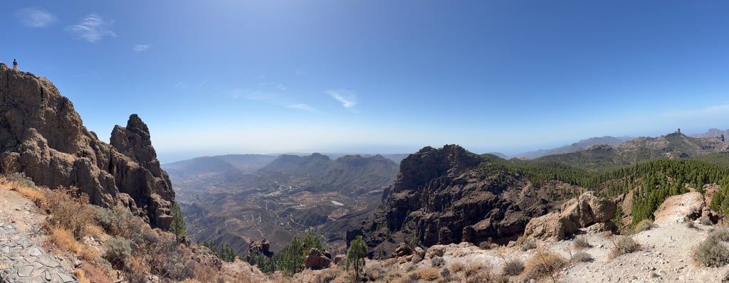
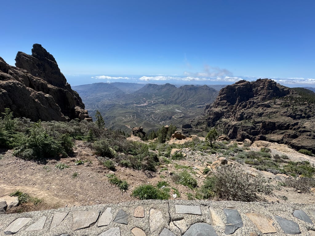
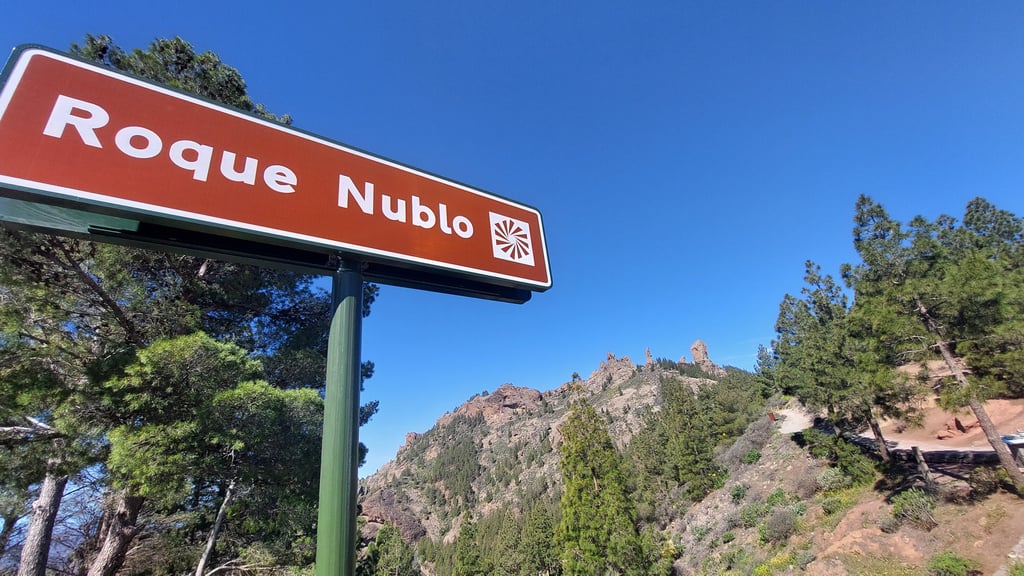
You will climb on to the Roque Nublo after which point you will be gifted with a wonderful rolling section. Recover, shake out the legs, give your saddle a break because after a series of campsites and junctions you will turn onto the last section. On any other day, you’d have this bit for breakfast. You know it. I know it. But today is different. You’ll see the road ride up to the right, a rusty chicken wire fence marking the route. Know that, once the fence ends, you’re pretty much at the top. So dig deep, don’t lose heart and tap it out until you arrive at the tiny car park.
The summit space is underwhelming, the brown summit sign totally covered in stickers. And the small car park full of vehicles. But get those photos, climb up to the upper viewpoint and bask in the glory of your effort as you look down the valley. You did it. And I hope you enjoyed it as much as I did.
A quick word on housekeeping. You need to carry layers. Even in May when the resort temperature was 29c, by San Bart I was starting to feel the cold. At the top, even in sunshine, it is nippy and the descent will be cold. Layer-up!
Leave early. I left at 5.30am, I was in San Bart by 7.40am, Ayacata by 8.45 and summit by 10. I was on my own for the majority of the climb, very few cars and lots of peace. Also, I was out of the sun’s heat for the entire climb. Had I left it later, the sun would have been a factor in May (less of a problem in the early months).
Finally, check the weather. Above San Bart, the weather is unpredictable so do not assume sunshine. If there is even the hint of clouds in the early part of the season, bring a shake dry. And clouds tended to build during the afternoon in the early season too, so a bright clear morning often led to a cloudy, showery afternoon.
Enjoy this climb. Make memories on it. Leave a bit of your heart at the top. And promise you’ll return again one day.
THE climb of Gran Canaria. Its quite long with absolutely amazing views and great smooth tarmac! The initial climb from maspalomas is quite hard, but then you get into the flow, you can have a rest in San Bartolome or Ayacata before the hardest part - the 3k 11% section from Ayacata to Viewpoint. As a heavy rider i recommend a 32 cassette for this climb, rode it on 28 and suffered greatly at the steep sections.
Climb really worthwhile. Start early and you'll still be cycling in the shade for quite a long time. Occasionally some steep sections and the length makes it gruelling. Plenty of opportunity to buy food and drink along the way.
Beklimming die echt wel de moeite waard is. Vroeg beginnen, dan fiets je nog behoorlijk lang in de schaduw. Af en toe wat steile passages en de lengte maakt hem slopend. Voldoende gelegenheid om onderweg eten en drinken te kopen.
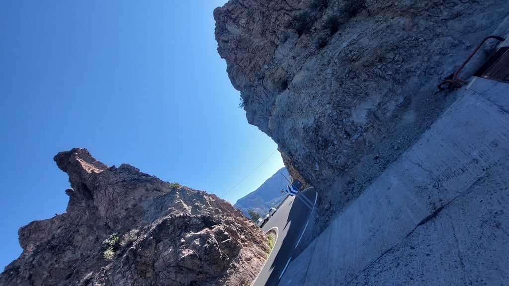
Very nice climb to do. Especially last stretch from Ayacata to the summit is equally tough. What struck me most was the poor road surface. Descending downhill is not very pleasant. This stretch is especially very bad back to Ayacata and from Ayacata to San Bartolome(60%).
Just don't let this put you off because the way up is really beautiful with all the rock formations and views around you!
Hele mooie klim om te doen. Vooral laatste stuk van Ayacata naar de top is even pittig. Wat me vooral opviel was het slechte wegdek. Naar beneden dalen is niet heel prettig. Dit stuk is vooral terug naar Ayacata zeer slecht en vanuit Ayacata naar San Bartolome(60%).
Laat dit je alleen niet afschrikken want de weg naar boven is echt mooi met alle rotspartijen en uitzichten om je heen!
Long climb that is nevertheless doable. There are a number of descents along the way and also many well-walked sections (less than 6%). Anyway, the steep sections were not too bad for me, only as mentioned before from Ayacata is a longer steep section. Road surface is very good until San Bartolome, then variable until you get on the GC-130 and then it's enjoyable again. The views on the way are already good, but at the top (where there is also a stall with water and food) are phenomenal.
Lange klim die desondanks goed te doen is. Er zijn een aantal afdalingen onderweg en ook veel goed lopende stukken (minder dan 6%). Sowieso vielen de steile stukken me erg mee, alleen zoals eerder genoemd vanuit Ayacata. Wegdek is tot San Bartolome erg goed, daarna wisselend tot je op de GC-130 komt en dan is het weer genieten. Het uitzicht onderweg is al goed, maar op de top (waar ook een kraam met water en eten staat) is het fenomenaal.
Great climb with stunning views, El Teide can be seen from the top. The gradient sometimes reaches 12-13% but not for very long. Roads with good tarmac and descents with some nice hairpins to practice your cornering technique. Most of the passing cars give you plenty of room when overtaking. There are some bars/restaurants on the way where you can rest and refuel.
A great climb, which is quite exhausting, but can be maintained thanks to the rests in between. The hardest parts are after the village of Ayacata and before the summit. Very varied landscape, quiet route, mostly good tarmac, with some very moderate kilometres in between. The view on top is a very nice reward. In the summer months, there is a cart at the top where you can get some food and drink.
Geweldige klim die je wel aardig uitput, maar door de rustpunten tussendoor wel vol te houden is. De zwaarste stukken zitten na het dorp Ayacata, en voor de top. Zeer afwisselend landschap, rustige route, grotendeels goed asfalt, met wel een aantal heel matige kilometers er tussen. Het uitzicht bovenop is wel een hele fijne beloning. In de zomermaanden staat er boven op de top een karretje waar je wat eten en drinken kunt halen.
Nice climb. The first part after Ayacata is spicy. The Garmin indicated sections of 15-16%. Past the Roque Nublo another piece of forest, then in January quickly put on some warmth.
Mooie klim. Het eerste stuk na Ayacata is pittig. De Garmin gaf stroken van 15-16% aan. Voorbij de Roque Nublo nog een stuk bos, dan in Januari snel wat warms aan.
I only did the part from San Bartalomé in combination with Alto de Fatago from Vecindario. A tough climb, especially the part from Ayacata is tough, percentages of 11% and more. At the end it's not so bad but you hope that the top is nearby. Highly recommended!
Ik heb enkel het stuk vanaf San Bartalomé gedaan in combinatie met Alto de Fataga vanuit Vecindario. Pittige klim, vooral het stuk vanaf Ayacata is zwaar, percentages van 11% en meer. Op het einde valt het terug mee maar hoop je vooral dat de top nabij is. Aanrader!
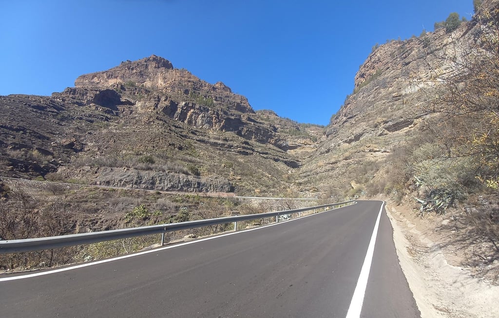
Very beautiful and certainly not an easy climb. The variant that is described is the classic approach route. There you will find everything, easy parts, but also steeper passages and 3 short descents. In total, a return trip comes to over 2400 altimeters, so it is certainly not easy. Warmly recommended is also to try the numerous other variants, whereby the northern routes are without doubt the most beautiful because of the vegetation there. There are two routes that are extremely steep: the passage through the Valley of the Tears (west side) and the passage through La Pasadille in the southeast. Both are of the Mortirolo level - extremely steep.
Erg mooie en zeker geen eenvoudige klim. De variant die beschreven staat is de klassieke aanvliegroute. Daarin vind je van alles, eenvoudige stukken, maar ook steilere passages en een 3 tal korte afdalingen. In totaal komt een retourtje op ruim 2400 hoogtemeters, dus dat is zeker niet eenvoudig. Warm aanbevolen is het ook om de talloze andere varianten eens te proberen, waarbij de noordelijke routes zonder meer de mooiste zijn door de daar aanwezige vegetatie. Er zijn twee routes is extreem steil zijn: de passage via de Valley of the Tears (westkant) en de passage via La Pasadille in het zuidoosten. Beide zijn van het niveau Mortirolo - extreem steil dus.
Did this climb via Arguineguin, Baranquillo Andrés, Salto del. Perro and then at Ayacata after a small break the final climb. It is very spicy and challenging. Too bad this variant is not available here.
Heb deze klim via Arguineguin, Baranquillo Andrés, Salto del. Perro en vervolgens bij Ayacata na een kleine pauze de laatste klim. Het is zeer pittig en uitdagend. Jammer dat deze variant hier niet te vinden is.
nice and quiet overall. I was there in the pre-season in 2018. Fantastic weather and generally a very good road surface
lekker rustig over het algemeen. Ik was er in het voorseizoen in 2018. Fantastisch weer en over het algemeen een heel goed wegdek
Once out of Maspalomas, it is a bit of a struggle to reach the viewpoint with possibly some traffic like touringcars and buggy's but after that it is an oasis of peace and beautiful landscapes (it looks a bit like the grand canyon).
Until the viewpoint, it is easy to do, around 6% average, then you get the infamous hairpin bends down (great for the return trip). After the descents you can continue to climb until San Bartolome where it is never really steep and where there are some nice hairpin bends. In San Bartolome you can get a coffee and then climb to Ayacata. In Ayacata (which is nothing like a village) there is one restaurant where you can eat a pasta and possibly warm up by the fire (especially useful if it is very cold at the top). The part from Ayacata to Roque Nublo viewpoint (+/- 2.5 km) is the toughest part of this super long climb with an average percentage of 11%. Once there, it is another 10km to the top, where the last few kilometers where you can already see the top are really tough, but once you arrive at the top you will be treated to a beautiful view on a clear day, even the Teide can be seen.
Maspalomas eenmaal uit is het even doorbijten tot het uitzichtspunt met mogelijk wat verkeer zoals touringcars en buggy's maar daarna is het een oase van rust en prachtige landschappen (het lijkt wel wat op de grand canyon).
Tot aan het uitzichtspunt is het prima te doen, rond de 6% gemiddeld, dan krijg je de beruchte haarspeldbochten naar beneden (fijn voor de terugreis). Na de afdalingen lekker doorklimmen tot aan San Bartolome waar het nooit echt stijl is en een paar leuke haarspeldbochten inzitten. In San Bartolome kun je even een koffie doen en om vervolgens naar Ayacata te klimmen. In Ayacata (wat niks voorsteld als dorp) zit 1 restaurant waar je een pasta kunt eten en mogelijk op kunt warmen bij een haardvuur (met name handig als het op de top erg koud is). Het stukje van Ayacata naar Roque Nublo viewpoint (van +/- 2.5 km) is het zwaarste stuk van deze superlange klim met een gemiddeld percentage van 11%. Eenmaal daar is het nog een kilometer of 10 naar de top, waarbij de laatste kilometers waarbij je de top al kunt zien echt nog wel even afzien is, maar eenmaal boven aangekomen word je bij helder weer getrakteerd op een prachtig uitzicht, zelfs de Teide is te zien
| 5 mph | 05:34:05 |
| 7 mph | 03:56:31 |
| 9 mph | 03:04:19 |
| 12 mph | 02:18:29 |
This page is better in the app