View on map
© MapLibre | OpenStreetMap contributors
1%
2%
4%
6%
8%
10%
12%
15%
20%

Monte Zoncolan

4.7
35 reviews | Elevation profile | 61 photos
Monte Zoncolan
Monte Zoncolan
Monte Zoncolan
Monte Zoncolan
Monte Zoncolan
Monte Zoncolan
Monte Zoncolan
Monte Zoncolan
Your achievable time
Calculating based on your best performances...
Relaxed
Maximum
W/kg
W/kg
W/kg
Analyze your climbing performance
Detailed insight into your climbing performance & automatically check off climbs
Based on your best performances.
Your best attempt:
Number of attempts:
Elevation profile Monte Zoncolan

Statistics

Difficulty points 1764
Length 6.1 mi
Average gradient 12.3%
Steepest segment 23.3%
Total ascent 3957 ft

Short recap

Famous climb
Beautiful scenery
22 hairpin turns
#77 toughest climb of World
#7 most elevation gain of Friuli Venezia Giulia
#47 longest climb of Friuli Venezia Giulia
#10 average steepest climb of Friuli Venezia Giulia
Feedback about this climb?
Show climbs nearby Export to GPS device

Monte Zoncolan is a climb in the region Udine. It is 6.1 mi long and bridges 3957 ft of vertical ascent with an average gradient of 12.3%, resulting in a difficulty score of 1764. The top of the ascent is located at 5676 ft above sea level. Climbfinder users shared 35 reviews of this climb and uploaded 61 photos.

Road names: Via pedrada SS355, Via ex Ferrovia, Via Brac, Via della Scuole, Via Lenzone & Via Liarris

This is an automatic translation, the original language is: Dutch.
The Zoncolan has the reputation of being the toughest climb ever to be included in a European cycling race. That is not for nothing. Only the Angliru, Punta Veleno and Kitzbuhler Horn are comparable. This climb is not for fun, but for the bucket list. The first 2km you ride out of Ovaro towards Liariis. Only when you leave Liariis the really steep kilometers start on a quiet road through the forest. The steepest part is about 5 km long and seems endless. The 17%-18% gradient only decreases ... read more

Photos (61)

Monte Zoncolan
Monte Zoncolan
Monte Zoncolan
Monte Zoncolan
Monte Zoncolan
Monte Zoncolan
Monte Zoncolan
Monte Zoncolan
Monte Zoncolan
Monte Zoncolan
Monte Zoncolan
Monte Zoncolan
Monte Zoncolan
Monte Zoncolan
Monte Zoncolan
Monte Zoncolan
Monte Zoncolan
Monte Zoncolan
Monte Zoncolan Monte Zoncolan Monte Zoncolan Monte Zoncolan Monte Zoncolan Monte Zoncolan Monte Zoncolan Monte Zoncolan Monte Zoncolan Monte Zoncolan Monte Zoncolan Monte Zoncolan Monte Zoncolan Monte Zoncolan Monte Zoncolan Monte Zoncolan Monte Zoncolan Monte Zoncolan Monte Zoncolan Monte Zoncolan Monte Zoncolan Monte Zoncolan Monte Zoncolan Monte Zoncolan Monte Zoncolan Monte Zoncolan Monte Zoncolan Monte Zoncolan Monte Zoncolan Monte Zoncolan Monte Zoncolan Monte Zoncolan Monte Zoncolan Monte Zoncolan Monte Zoncolan Monte Zoncolan Monte Zoncolan Monte Zoncolan Monte Zoncolan Monte Zoncolan Monte Zoncolan Monte Zoncolan Monte Zoncolan

Your uploads (max 4)

Welcome! Please activate your account if you would like to share something. Look for the verification email in your inbox.

If you want to upload your photos, you need to create an account. It only takes 1 minute and it's completely free.

  • Receive free climbfinder goodies for your reviews & photos.
  • Create a bucket list and check off conquered climbs.
  • Add missing climbs.
Continue with GoogleContinue with Google Continue with FacebookContinue with Facebook Continue with AppleContinue with Apple Sign up with email
By signing up you agree to our terms of service and confirm that you have read our privacy & content policy.

Reviews (35)

5.0
4.0
3.0
2.0
1.0
ukaszN81
3 w 5.0 via the Climbfinder app
This is an automatic translation, the original language is: Polish. Show original

Super. The top makes your legs spaghetti from the start .

Super. Góra robi z twoich nóg spaghetti od samego początku .

Monte Zoncolan
Dashboard
lollo_13
3 Mo 2.0 via the Climbfinder app
This is an automatic translation, the original language is: Italian. Show original

Very hard climb, I would not do it again for the'only reason that it is far from my home 💔

Salita durissima, non la rifarei per l'unico motivo che è lontana da casa mia 💔

Dashboard
SimonJ9
5 Mo 5.0

I went over the Zoncolan in June 25. I started early -7am and didn’t see another bike or car the whole way up. It had an almost mythical feeling zigzagging my way up with so may famous cyclists watching me. Very surreal and a memory I’ll never forget.
I did it with 32x30 gearing so I was ok but the first 20%+ section is a real shock.
Keep an eye out for the road sign to “Malaga” (that’s what I thought it said) after which it becomes manageable.
One final point, avoid doing it with a 4kg rucksack which I had to.

Monte Zoncolan
Monte Zoncolan
Monte Zoncolan
Monte Zoncolan
Dashboard
PaulG41
7 Mo 5.0

Another bucket list climg. From Ovaro up to Llaris and then steal yourself as after a short flat bit starts the climbing and it does not end. You'll ride this in the shadow of the greats who are posted every 1km or so. It's fairly narrow but I only shared it with 2 adventure bikes on my trip. The tunnels at the top are a real delight - automatic lights ! And the Refugio is well worth a coffee, cake and a wood pellet fire to warm yourself up ready for descending down back to Ovaro - or why not go down the other side and come back up...I dare you :)

Dashboard
WernerVanSteen
7 Mo 5.0 01:31:00 (4 mph)
This is an automatic translation, the original language is: Dutch. Show original

Ridden as my personal season finale on a chilly 20th of October 2025. You quickly forget the barely 9 degrees Celsius in the starting town of Ovaro because it is "warming up" right away in a 12% stretch. Just outside the village of Liariis, the first wall presents itself and you know that the next 8km will be serious... Finding your own pace and occasionally straight on the pedals to relax the lower back. Often long stretches of 17%. Matter of working corner to corner. In most bends you can catch your breath briefly and at about 4km from the summit an almost flat strip of about 100m long suddenly presents itself; ideal to quickly empty a gel in your mouth and give the legs some oxygen. Just before the summit, a few short hairpin turns to 15% and you're there! To be honest, I was at the top before I realised it properly. I was in super shape but was still unsure if I could handle the climb. I am always of the principle of overestimating climbs rather than underestimating them. I read in one of the reviews that it is comparable to the Kitzbühel Horn and I rode that a few months ago as the last climb of the Kitzbühel Radmarathon with already 200km and more than 3000 altimeters in my legs. That gave me hope. As I was all alone on this October day and the weather forecast was not good, I also used this route to descend back down to Ovaro. With brakes in perfect condition, you can do this. Of course, you make a lot of speed on excellent tarmac. A climb you absolutely must have done !!!

Gereden als mijn persoonlijke seizoens-afsluiter op een frisse 20e oktober 2025. De amper 9 graden Celsius in startplaats Ovaro vergeet je snel want het is meteen al "opwarmen" in een strookje van 12%. Net buiten het dorpje Liariis dient de eerste muur zich aan en weet je dat het menens wordt voor de volgende 8km... Eigen tempo vinden en af en toe recht op de trappers om de onderrug te ontspannen. Vaak lange stukken van 17%. Kwestie van bocht naar bocht toe te werken. In de meeste bochten kan je kort op adem komen en op ongeveer 4km van de top dient zich plots een nagenoeg vlakke strook aan van een 100m lang ; ideaal om snel een gelletje in je mond leeg te spuiten en de benen even wat zuurstof te geven. Net voor de top nog een paar kort opeenvolgende haarspeld bochtjes tot 15% en je bent er ! Eerlijk gezegd was ik boven voor ik het goed besefte. Ik verkeerde in een super vorm maar was toch onzeker of ik de klim wel zou aan kunnen. Ik ben altijd van het principe om beklimmingen beter te overschatten dan te onderschatten. In een van de reviews las ik dat hij vergelijkbaar is met de Kitzbühel Horn en die reed ik een paar maanden geleden als laatste beklimming van de Kitzbühel Radmarathon met reeds 200km en meer dan 3000 hoogtemeters in de benen. Dat gaf me hoop. Omdat ik helemaal alleen was op deze oktober dag en de weersvoorspellingen niet goed waren heb ik deze route ook gebruikt om terug af te dalen tot Ovaro. Met remmen in perfecte staat kan je dit doen. Uiteraard maak je veel snelheid op uitstekend asfalt. Een beklimming die je absoluut moet gedaan hebben !!

Monte Zoncolan
Monte Zoncolan
Monte Zoncolan
Monte Zoncolan
Dashboard
Gian64
7 Mo 5.0 via the Climbfinder app
This is an automatic translation, the original language is: Italian. Show original

Extreme but extremely satisfying climb. In addition to a good leg you need the determination that those who decide to tackle it usually already have. Done on gravel with 40-44 and 83 kg. Excellent asphalt, poor traffic (11 October). To be included in every palmares!

Salita estrema ma di estrema soddisfazione. Oltre ad una buona gamba serve la determinazione che chi decide di affrontarla di solito ha già. Fatta in gravel con 40-44 e 83 kg. Asfalto ottimo, traffico scarso (11 ottobre). Da includere in ogni palmares!.

Dashboard
sir_morabito
8 Mo 5.0 01:13:00 (5 mph)
This is an automatic translation, the original language is: Italian. Show original

Extreme climb, with 34-34 ratio you can climb even with 85kg of weight! Your back is in a lot of pain, having fun is something else but it is absolutely a climb to do at least once in a lifetime

Salita estrema, con rapporto 34-34 si sale anche con 85kg di peso! La schiena soffre parecchio, divertirsi è un'altra cosa ma è assolutamente una salita da fare almeno una volta nella vita

Monte Zoncolan
Monte Zoncolan
Dashboard
Piach
9 Mo 5.0 via the Climbfinder app
This is an automatic translation, the original language is: Italian. Show original

As soon as you get out of Liiaris the really difficult part begins, then a few kilometres from the end you have a breather in the tunnels then the last few switchbacks give you the right charge to push on to the summit. Highly recommended! Very little traffic.

Appena si esce da Liiaris inizia la parte veramente difficile, poi a qualche chilometro dalla fine hai un attimo di respiro nelle gallerie poi gli ultimi tornati ti danno la carica giusta per spintare alla cima. Consigliatissimo!! Traffico veramente poco.

Dashboard
Arhu
9 Mo 5.0 01:02:28 (5.9 mph)
This is an automatic translation, the original language is: Dutch. Show original

I had done the Marmotte 2 weeks earlier. That whole 177km and 5000 altimeters of the Marmotte were easier than the Zoncolan. Howled at reaching the top, The climb itself is mostly through a forest but at the top stunning views

Ik had 2 weken eerder de Marmotte gedaan. Die hele 177km en 5000 hoogtemeters van de Marmotte waren makkelijker dan de Zoncolan. Gejankt bij het bereiken van de top, De klim zelf gaat vooral door een bos maar boven schitterende uitzichten

Monte Zoncolan
Monte Zoncolan
Monte Zoncolan
Dashboard
RogerDb
10 Mo 5.0 via the Climbfinder app
This is an automatic translation, the original language is: Italian. Show original

Historic stage of the tour... first section from Ovaio tough, then the hairpin bends give you the right charge ...

Storica tappa del giro..primo tratto da ovaio tosto poi i tornanti ti danno la carica giusta ...

Dashboard
_superver
10 Mo 5.0
This is an automatic translation, the original language is: Dutch. Show original

Hardest climb I've done. Oh how steep. Up in the rain. Epic views at the top. The restaurant on the Sutrio side is great. Magnificent cakes and a particularly nice owner who is very interested in her guests.

The climb itself: at the start it's still doable. For a kilometre or two. You can ride on the single-lightest gear here, at least if you are not too heavy and very fit. You live off the hairpins. Work towards them corner by corner. Then there is hope and you keep pedalling. Towards the top, you'll pass through some tunnels. Look sideways, too. The views are so beautiful. And don't go taking photos here, from the bike. You'll topple over.

By the way, don't descend this either. There's nothing fun about it, there's gravel in every corner and besides, you're scaring the hell out of brave souls raking uphill. Be sensible and go down via Sutrio. That one descends much nicer too.

Moeilijkste klim die ik gedaan heb. Oh wat steil. In de regen omhoog. Bovenop epische vergezichten. Het restaurant aan de kant van Sutrio is geweldig. Magnifieke taartjes en een bijzonder aardige eigenaresse die erg geïnteresseerd is in haar gasten.

De klim zelf: bij de start is het nog te doen. Voor een kilometer of twee. Je kunt hier op de eennalichtste versnelling rijden, als je tenminste niet te zwaar bent en heel fit bent. Je leeft van de hairpins. Werk daar bocht voor bocht naar toe. Dan is er hoop en blijf je trappen. Richting de top kom je door wat tunneltjes. Kijk ook eens opzij. De uitzichten zijn zo mooi. En ga hier nou geen foto’s maken, vanaf de fiets. Dan kukel je om.

Daal dit trouwens ook niet af. Er is niks leuks aan , er ligt grind in iedere bocht en bovendien zit je dappere zielen die omhoog harken de stuipen op het lijf te jagen. Weest verstandig en ga naar beneden via Sutrio. Die daalt ook veel lekkerder af.

Monte Zoncolan
Monte Zoncolan
Dashboard
ZohiartzeA
11 Mo 5.0 via the Climbfinder app

Really tough, but you must climb it once in a lifetime

Monte Zoncolan
Monte Zoncolan
Dashboard
DikkeTInus
11 Mo 4.0 00:58:55 (6.2 mph)
This is an automatic translation, the original language is: Dutch. Show original

Really another one's climb that you feel proud of afterwards.... But while cycling, you ask yourself 100x why you are actually doing this. And then also in a race (Supergirodolomiti) where you want to ride a nice result.

Lavering the road really helps! And the signs along the side with the kilometres (and the many doping sinners) don't really motivate by the way, you are constantly reminded that you are really moving forward at a snail's pace.

Echt weer zo'n klim waar je achteraf trots op bent.. Maar tijdens het fietsen vraag je jezelf 100x af waarom je dit eigenlijk doet. En dan ook nog in een wedstrijd (Supergirodolomiti) waar je een leuke uitslag wil rijden.

Laveren over de weg helpt echt! En de borden langs de kant met de kilometers (en de vele dopingzondaars) motiveren trouwens niet echt, je wordt er steeds aan herinnerd dat je echt met een slakkengang vooruit gaat.

Dashboard
TimvanDorst
12 Mo 5.0 via the Climbfinder app
This is an automatic translation, the original language is: Dutch. Show original

Tja....with my 71kg and a 34-34, it was a joy to ride, but it is bellowingly steep. Only if you've trained really hard, fed enough carbs and have good equipment will you make it. It's mythical!

Tja….met mijn 71kg en een 34-34 was het wel een feestje om te rijden, maar het is wel loei en loei steil. Alleen als je echt hard getraind hebt, voldoende carbs hebt toegediend en beschikt over goed materiaal, ga je het halen. Het is mythisch!

Monte Zoncolan
Monte Zoncolan
Monte Zoncolan
Monte Zoncolan
Dashboard
Saliteinbici
1 y 5.0

Ok. Everyone knows Zoncolan is one of the hardest climbs, and so I confirm. There's a feeling of being lost in nowhereland as I did it at 7.30AM in May, barely alone. Panorama is nice but nothing exciting. Tarmac is narrow and good. You would come here for the challenge. Unpredictable slopes, the middle section sometimes seems kinder than 15-18% but... it never happens. I wanted to eat a snack at 1400mt and I thought "good, it seems flatter here, let's refuel carbohydrates!" and I quickly ended up climbing what I perceived as the most hard ramp here (straight over 18% and long) with half bar held between my teeth, as chewing would have caused loss of oxygen and stopping ... I did want to stop. A must, if you want to tell yourself "I did that!". By the way, surrounding towns and mountains are very simple but nice and worth a visit. Zero km food local agritourisms can be wonderful. The Monte Zoncolan climb is like local people here : essential, though and looks exactly per what it is. I won't never regret many hours spent driving to reach this place."

Monte Zoncolan
Monte Zoncolan
Monte Zoncolan
Monte Zoncolan
Dashboard
toski
1 y 5.0 via the Climbfinder app
This is an automatic translation, the original language is: French. Show original

Done in 2023 extreme dry climb really difficult to have done it is a satisfaction once at the top big percentage all the way.

Fait en 2023 montée sèche extrême vraiment difficile l’avoir fait c’est une satisfaction une fois au sommet gros pourcentage tout le long

Dashboard
SimoneMontemezzo
1 y 5.0
This is an automatic translation, the original language is: Italian. Show original

tremendous satisfaction, tough and to be done with the right ratios

tremenda soddisfazione, tosta e da fare con i rapporti adeguati

Dashboard
MarcoM26
1 y 5.0 01:30:00 (4.1 mph)
This is an automatic translation, the original language is: Italian. Show original

Every drop of sweat will be repaid in full when you manage to complete this climb ... among the most famous

Ogni goccia di sudore sarà ripagata al massimo quando si riesce a completare questa salita .. tra le piu famose

Monte Zoncolan
Dashboard
Random
John Doe
1 y 5.0

Wat een klim! Achteraf is het makkelijk praten en genieten! Maar als je aan de echte start van de klim staat vanuit het hoger gelegen dorpje dan denk vraag je jezelf af waar je aan begonnen bent. Je begint daar meteen met één van steilste stukken! Denk niet dat het na die eerste kilometer veel beter wordt....het blijft afzien maar en tegelijkertijd genieten. Wij hebben de klim gedaan met 34/30 maar 34/34 is geen luxe! De afdaling naar Sutrio is trouwens ook een pareltje. Mooi asfalt en overzichtelijk. Dus geschikt voor snelheidsduivels!

Monte Zoncolan
Monte Zoncolan
Monte Zoncolan
Monte Zoncolan
Dashboard
RenatoP
1 y 5.0
This is an automatic translation, the original language is: Italian. Show original

It's a climb to make if you are looking for a challenge. Harder than the Mortirolo from Mazzo. To find higher slopes you need Punta Veleno or the final part of the Zoncolan from Sutrio or Priola (common section). On 30 June I climbed it from Ovaro and from Priola. Today I did the triple climb: from Ovaro, from Priola and from Sutrio. I have a '90s steel bdc brought up to 34-29 and obviously it was quite a feat. However, if one is masochistic enough to go beyond cycling there would be the Stentaria (Passo della Forcella) with the cemented section that is really prohibitive.

E' una salita da compiere se si è in cerca di sfide. Più dura del Mortirolo da Mazzo. Per trovare pendenze puntuali più alte servono Punta Veleno oppure la parte finale dello Zoncolan da Sutrio o da Priola (tratto comune). Il 30 giugno lo avevo salito da Ovaro e da Priola. Oggi ho compiuto la tripla salita: da Ovaro, da Priola e da Sutrio. Ho una bdc in acciaio anni 90 portata a 34-29 e ovviamente è stata una bella impresa. Comunque se uno è masochista da andare al di là del ciclismo ci sarebbe la Stentaria (Passo della Forcella) col tratto cementato che è veramente proibitivo.

Dashboard
Salamella_Boy
1 y 5.0 00:57:14 (6.4 mph)
This is an automatic translation, the original language is: Italian. Show original

The toughest col in Europe, a title that may not correspond to absolute truth, but which was not awarded by chance; probably the toughest climb ever tackled by Great Cyclists.
If you want to tackle this climb, I think you know what you are getting into... I can only wish you good luck and assure you that the satisfaction it gives is unique

Il Colle più duro d'Europa, titolo che magari non corrisponderà a verità assoluta, ma che non è stato assegnato a caso; probabilmente la salita più dura mai affrontata dal Grande Ciclismo.
Se vuoi affrontare questa salita credo tu sappia a cosa stai andando incontro... posso solo augurarti buona fortuna e assicurarti che la soddisfazione che regala è unica

Dashboard
BartH1974
1 y 4.0 01:06:00 (5.6 mph)
This is an automatic translation, the original language is: Dutch. Show original

Done this climb today with a group of 17 cycling tourists, ranging from 30 to 72. Ok, it's a beast of a mountain, but everyone got to the top without any problems. Definitely doable if you are trained.

Vandaag deze klim gedaan met een groep van 17 wielertoeristen, van 30 tot 72 jaar. Ok, het is een beest van een berg, maar iedereen geraakte zonder problemen boven. Zeker doenbaar dus als je getraind bent.

Dashboard
LISJAK
2 y 5.0 01:45:00 (3.5 mph)
This is an automatic translation, the original language is: Italian. Show original

Leave all hope behind you who enter... :D here we go...
Climb to be done with a lot of respect, start slow and don't go off the pace, there are 6km around 20% until the tunnels don't level out
It was definitely in the TO DO list, but I won't do it again, here the motivation of the first time helps a lot... the second time I would struggle :D

Lasciate ogni speranza voi o che entrate… :D ci siamo…
Salita da fare con molto rispetto, iniziare piano e non andare fuori giri, ci sono 6km attorno ai 20% fino ai tunnel non spiana
Era sicuramente nella TO DO list, ma non la rifarò, qua la motivazione della prima volta aiuta tanto… la seconda volta farei fatica :D

Monte Zoncolan
Dashboard
Claudio7705
2 y 5.0
This is an automatic translation, the original language is: Italian. Show original

Leave all hope behind, ye who enter... all true, including the suffering that at every pedal stroke tells you "stop and turn back" and the ecstasy that at the finish line tells you "you made it!

Lasciate ogni speranza o voi che entrate... tutto vero, inclusa la sofferenza che ad ogni pedalata ti dice "fermati e torna indietro" e l'estasi che all'arrivo ti dice "ce l'hai fatta!"

Dashboard
pacovi
3 y 5.0 01:53:07 (3.2 mph)
This is an automatic translation, the original language is: German. Show original

The hardest / best climb I have ever ridden. Permanent ramps over 20%. Borderline experience. Absolute must.

Heftigster / bester Anstieg den ich je gefahren bin. Permanente Rampen über 20%. Grenzerfahrung. Absolutes muss.

Dashboard
Zafonk
3 y 5.0 01:10:00 (5.2 mph)
This is an automatic translation, the original language is: French. Show original

To be done once in a lifetime but I will never do it again ;-)
The climb is above all an exercise in strength, with no respite and no real landscape to admire.
To be approached with training, modesty and a mountain cassette!
The little restaurant, just before going into the super hard (Zoncolan arrow) is very good ;-)

A faire une fois dans sa vie mais je ne le referai plus jamais ;-)
La montée est surtout un exercice de force, sans répis et sans vraiment de paysage à admirer.
A aborder avec de l'entraînement, de la modestie et une cassette de montagne !
Le petit resto, juste avant de passer dans le super dur (flèche Zoncolan) est très bien ;-)

Monte Zoncolan
Monte Zoncolan
Dashboard
vhs
3 y 5.0
This is an automatic translation, the original language is: Dutch. Show original

It is clearly marked in Ovaro: Monte Zoncolan. The villagers have even built a special arch to emphasise it; the "gate to hell". Small warning in advance: do not do this climb if the temperature in the valley is above 30 degrees. Also think about your gear: for more than 6 kilometres the percentages are close to 20%. Are you stubborn and do you cycle up this mountain with a lowland cassette? Lucky you.
Between Orvaro and Lialis there doesn't seem to be much of a problem, yes it is steep, but so are all the roads here. In Lialis it is even flat for about one kilometre. But the many signs, painted bicycles and the occasional tribute to Pantani reveal the monster that awaits you around the corner. The climb immediately kicks in with 18%, your pace is immediately gone, your gear is immediately the lightest, your fingers hopelessly press on your shifters in the hope of being able to shift up one more gear. But nothing of the sort. And comfort yourself with the thought that the next 6.5 kilometres will not change this. Along the road there are signs of cycling heroes old and new. When the gradient at the top drops just below 10%, you can see Ovaro a kilometre below you in the valley. After 3 consecutive, dead straight, but wet and dark tunnels, you can see the top. The last kilometre is just as steep, but nothing is steeper than what lies behind you. At the top, motorcyclists high-five each other that they have ridden up. You salute Annemiek's sign and check her climbing time: she has ridden up ridiculously faster than you.
The descent is done on the other side and goes down steep for the first few kilometres, then down the lovely access road to the ski area. At the bottom, turn left (shorter but with a small col) or right (longer but busier) to complete the circuit around the massif.

In Ovaro staat het duidelijk aangegeven: Monte Zoncolan. De dorpelingen hebben zelfs een speciale boog gebouwd om het te benadrukken; de "poort naar de hel". Kleine waarschuwing vooraf: doe deze klim niet als de temperatuur in het dal boven de 30 graden is. Denk ook goed aan je verzet: ruim 6 kilometer lang zitten de percentages tegen de 20% aan. Ben je eigenwijs en fiets je met een laaglandcassette deze berg op? Mazzel vriend.
Tussen Orvaro en Lialis lijkt er niet veel aan de hand, ja het is steil, maar dat zijn alle wegen hier. In Lialis loopt het zelfs een kleine kilometer vlak. Maar de vele bordjes, beschilderde fietsen en hier en daar een eerbetoon aan Pantani verraden het monster wat om de hoek op je te wachten staat. De klim klapt meteen met 18% erin, je tempo is meteen weg, je verzet direct het allerlichtste, je vingers drukken hopeloos op je shifters in de hoop nog één tandje lichter te mogen schakelen. Maar van dat alles niets. En troost je met de gedachte dat de komende 6,5 kilometer hier niets aan gaan veranderen. Langs de weg staan borden van wielerhelden oud en nieuw. Als de stijging bovenaan even onder de 10% zakt zie je ruim een kilometer beneden je in het dal Ovaro liggen. Na 3 opeenvolgende, kaarsrechte, maar natte en donkere tunnels, zie je de top liggen. De laatste kilometer is nog even steil, maar niets is steil meer vergeleken met wat er achter je ligt. Bovenop highfiven motorrijders elkaar dat ze naar boven zijn gereden. Je salueert naar het bord van Annemiek en checkt haar klimtijd: ze is belachelijk veel sneller omhoog gereden dan jij.
Afdalen doe je aan de andere kant en gaat de eerste kilometers bloedsteil omlaag, daarna de heerlijke toegangsweg van het skigebied afrazen. Onderaan links (korter maar met kleine col) of rechts (langer maar drukker) om het rondje rondom het massief af te maken.

Monte Zoncolan
Monte Zoncolan
Monte Zoncolan
Dashboard
RogerThijs
4 y 4.0
This is an automatic translation, the original language is: Dutch. Show original

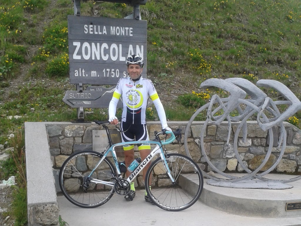
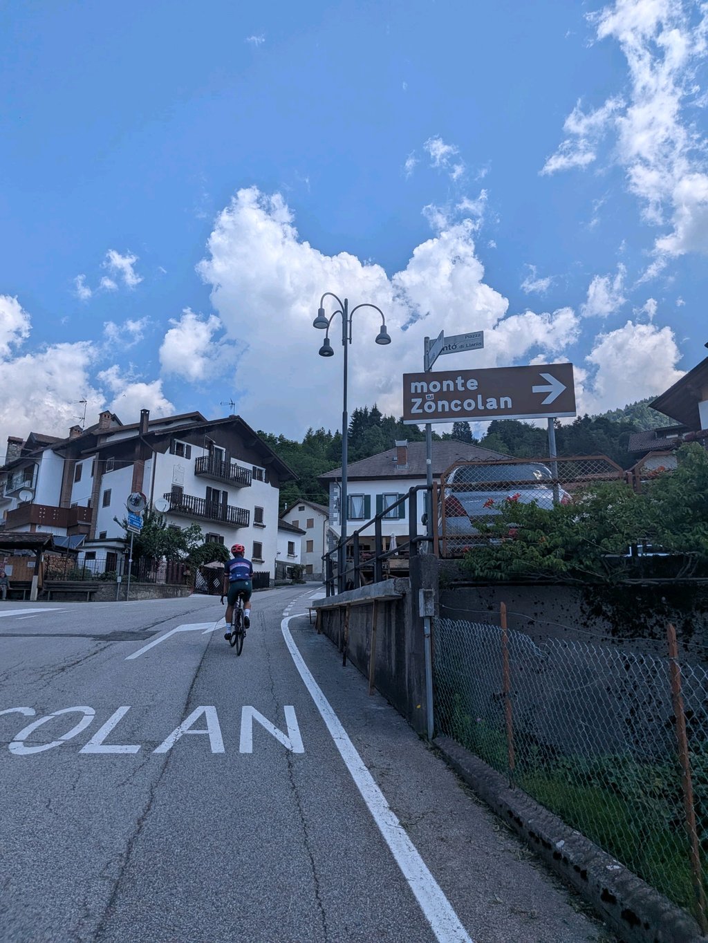
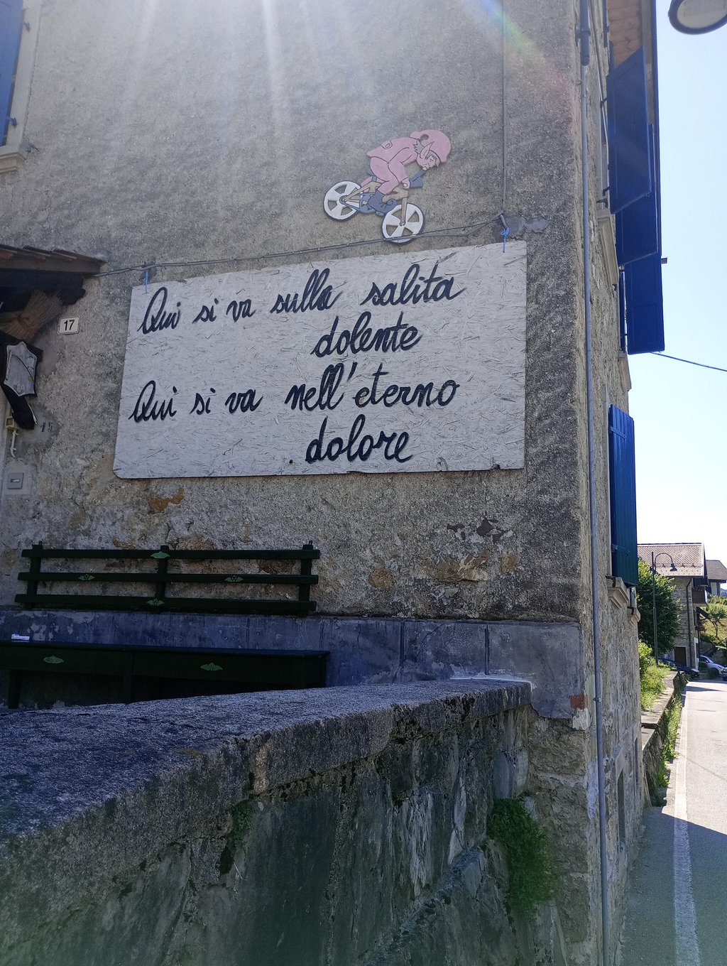
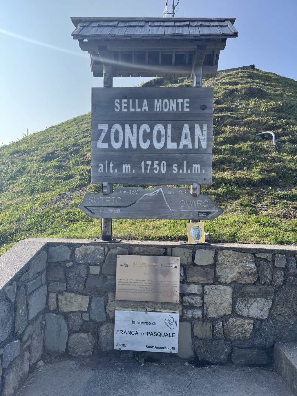
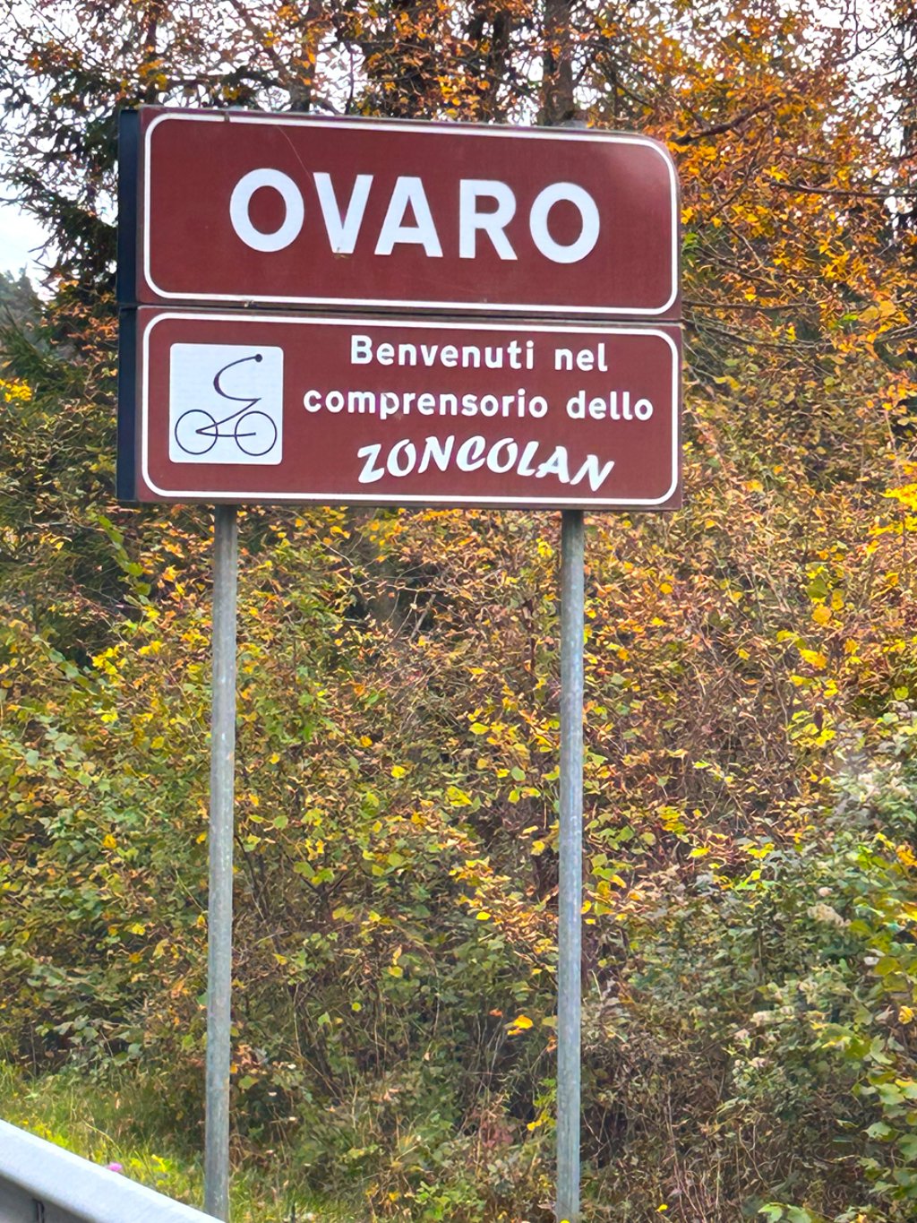
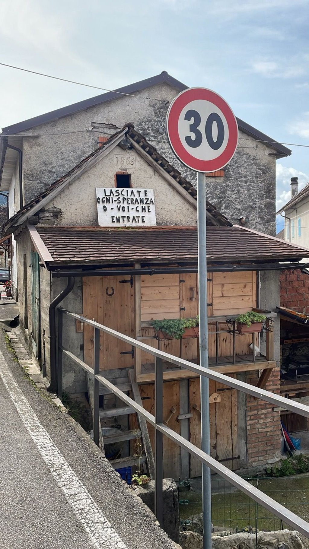
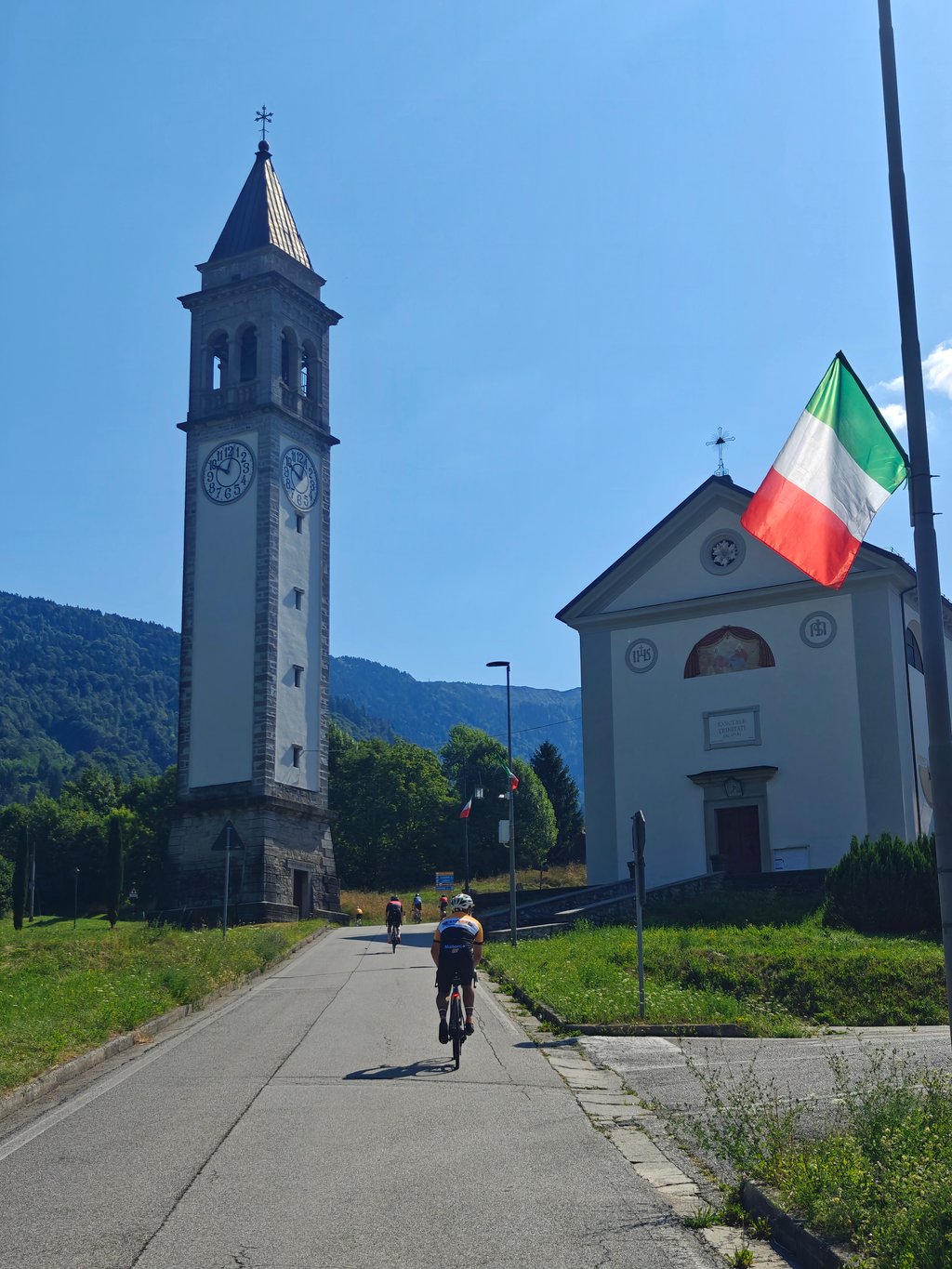
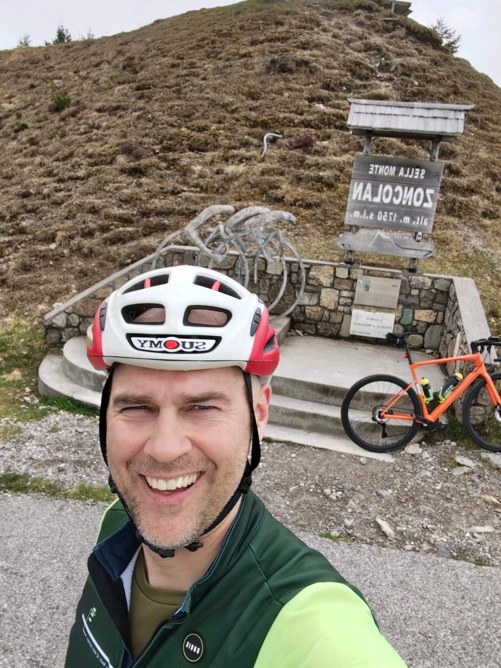
The whole thing started in August 2007 in Tolmezzo, a town in the Carnic Alps, where we were almost blown off the road by a low-flying Starfighter. The fighter flew very low, because it stood on a pedestal in the middle of a roundabout at the entrance of the village, its graceful fuselage pointed to the sky. I allowed myself two full laps to admire its slender lines, until el capitana in its own cockpit had had enough and directed us back to the streets. The wrong streets of course, so a few kilometers further we were clearly not on the route that should have been the shortest way to Cortina d'Ampezzo. Instead, we wandered further and further into the foothills of the mountains, passing insignificant villages along the way. Until the next village appeared in front of us: Ovaro. Why it made me think of ovaries I don't know, because the straw bikes and flags of the Monte Zoncolan had little to do with reproduction. Zoncolan? Legendary by name, but in my simple mind that mountain was located somewhere else, like I often think of climbs somewhere else than they actually are. As we approached the center of Ovaro I came to my senses. We rode through the unspoilt Valkenburg of the Monte Zoncolan, and that without having looked for it. I had reached 39 degrees Celsius. Goddamn. Without a bike at the foot of the Zoncolan in a sweating car.
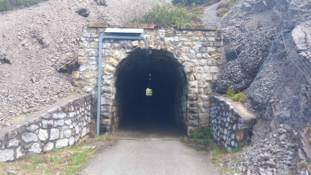
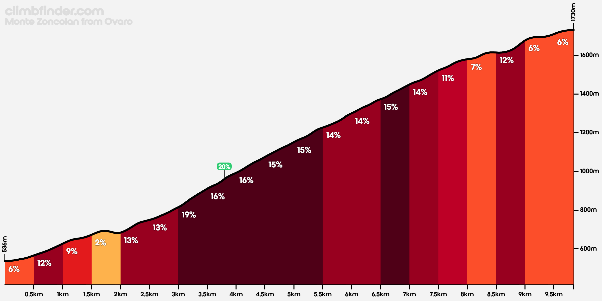
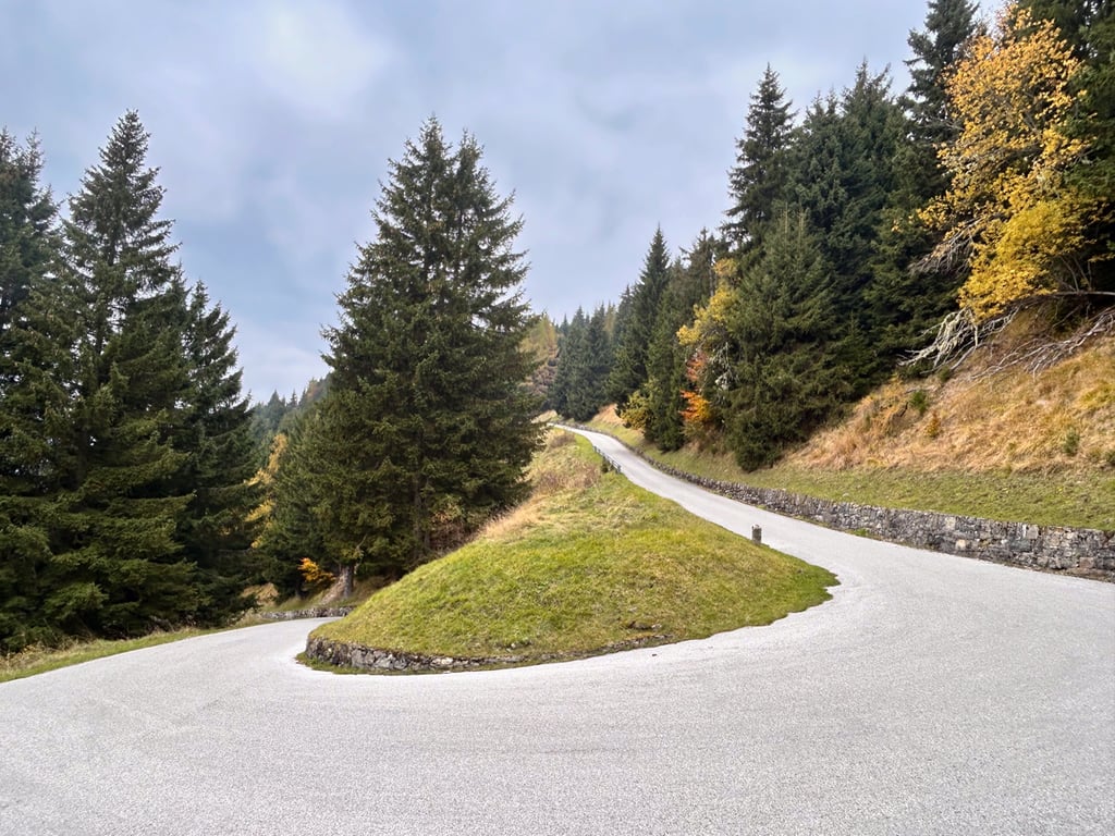
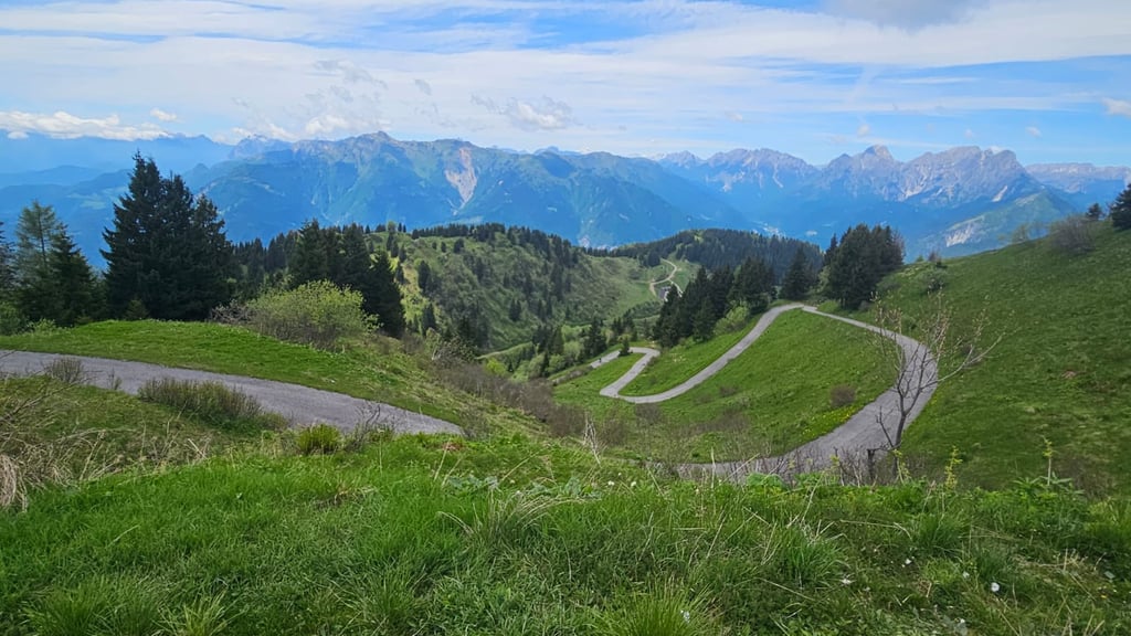
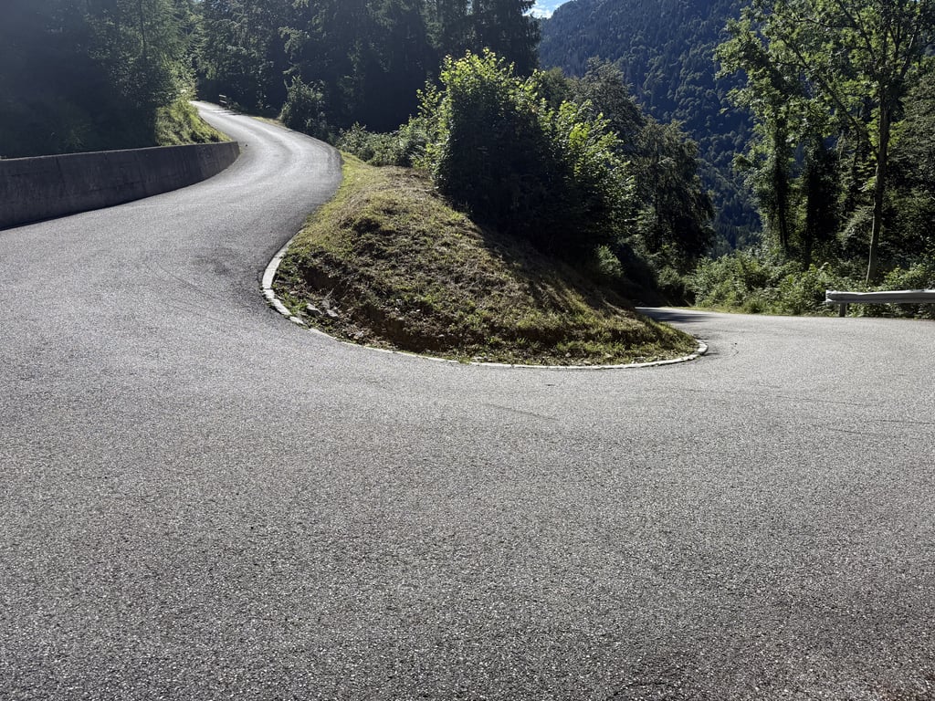
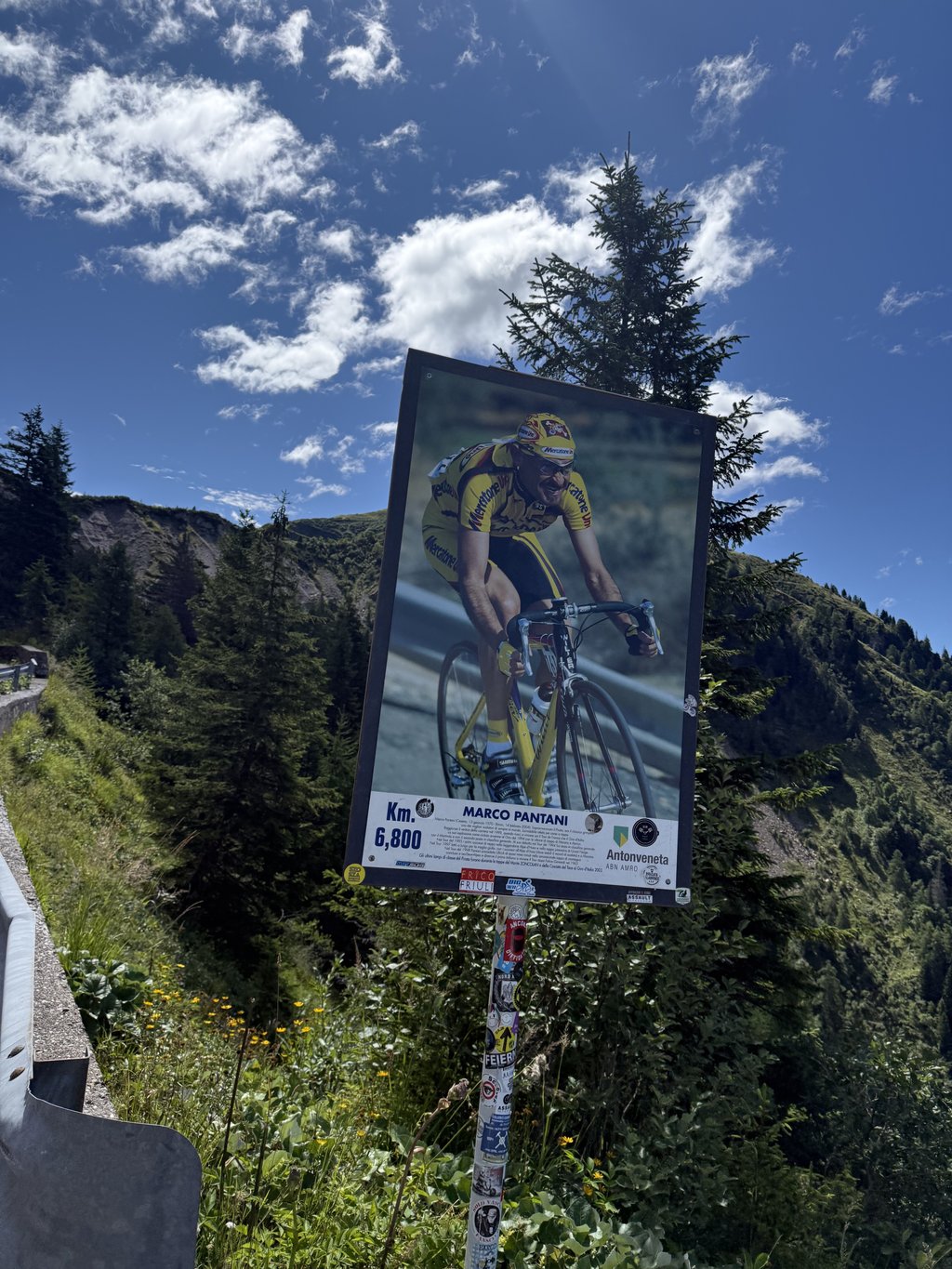
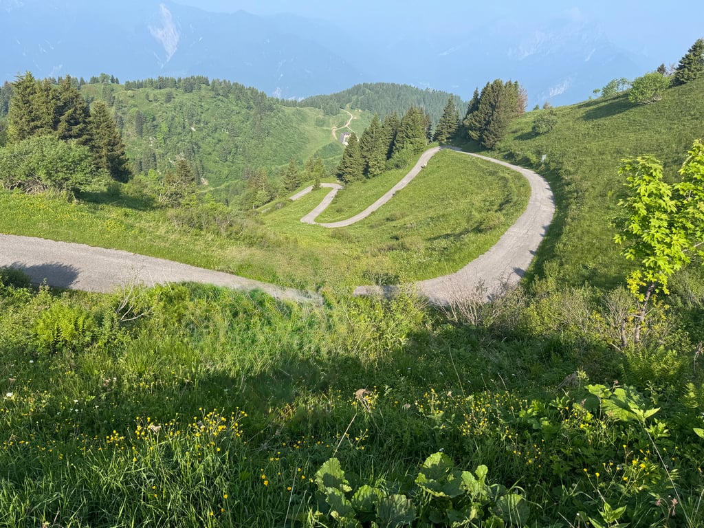
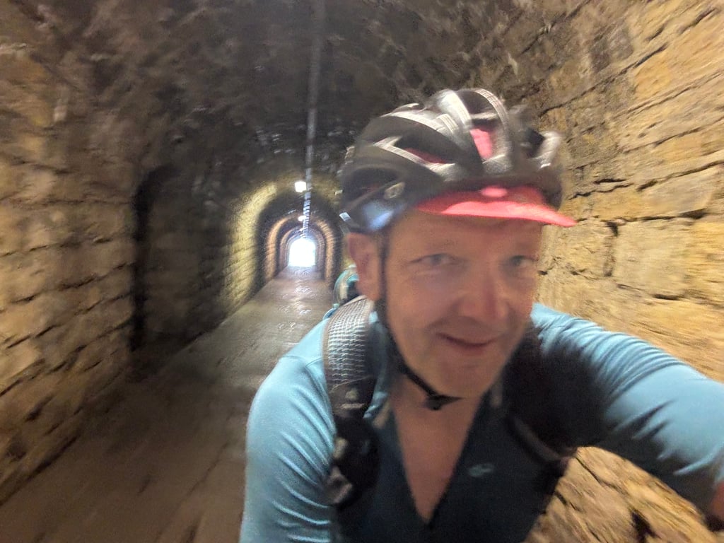
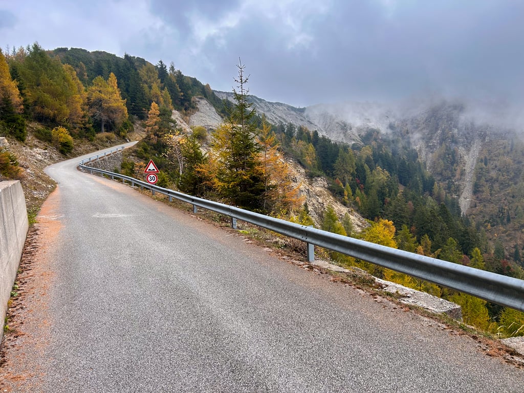
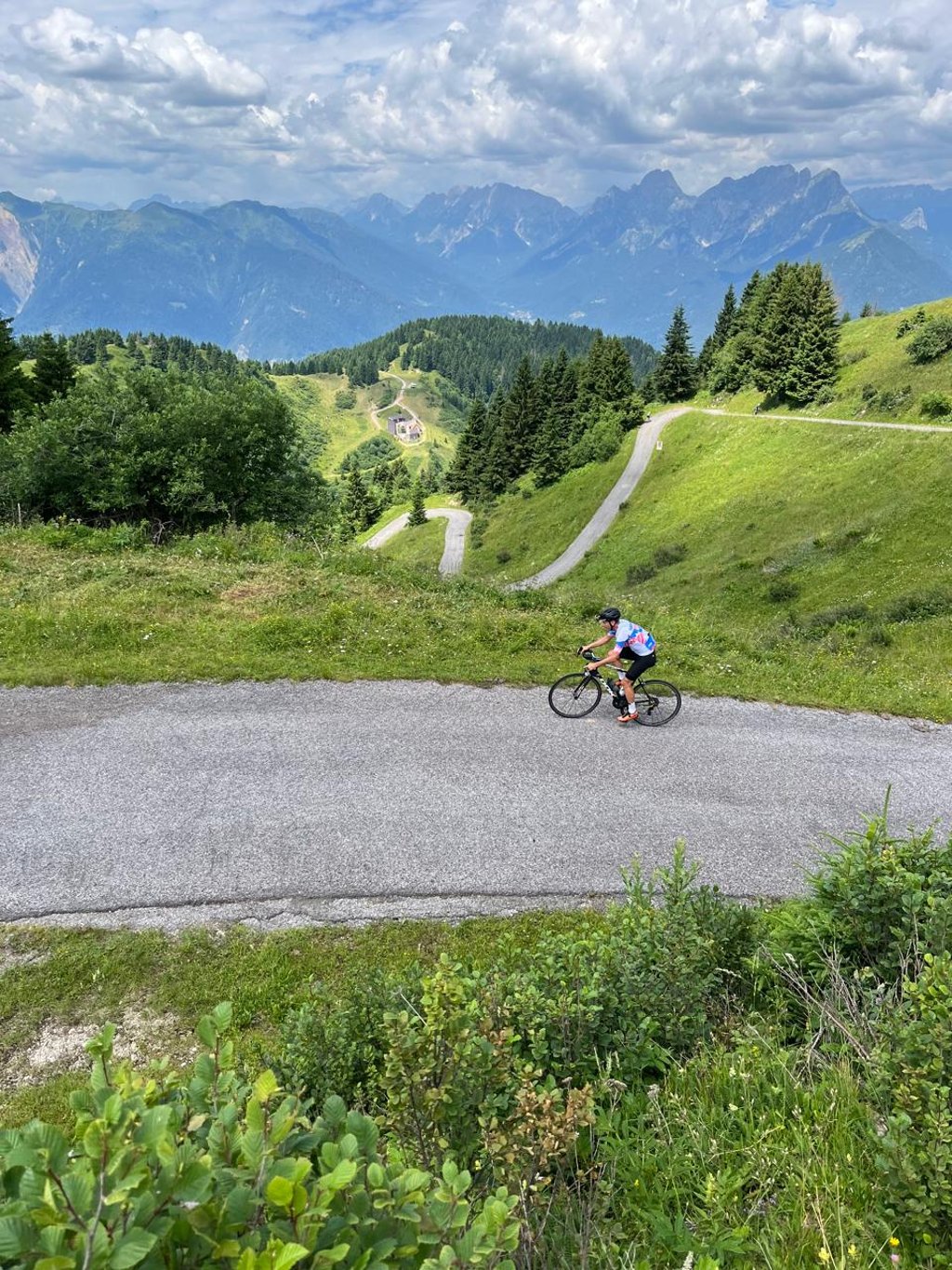
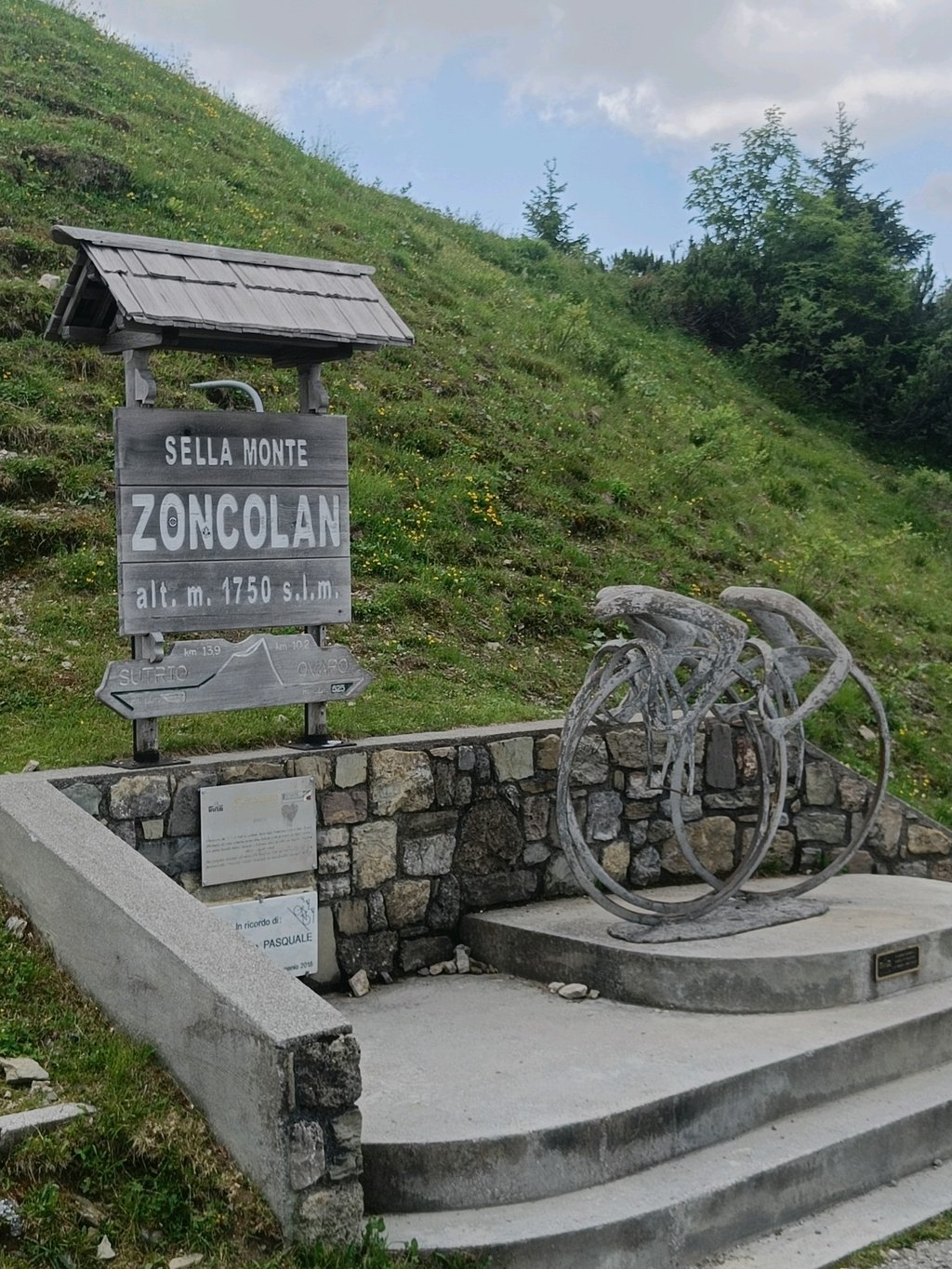
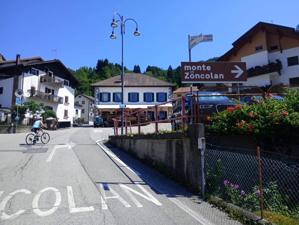
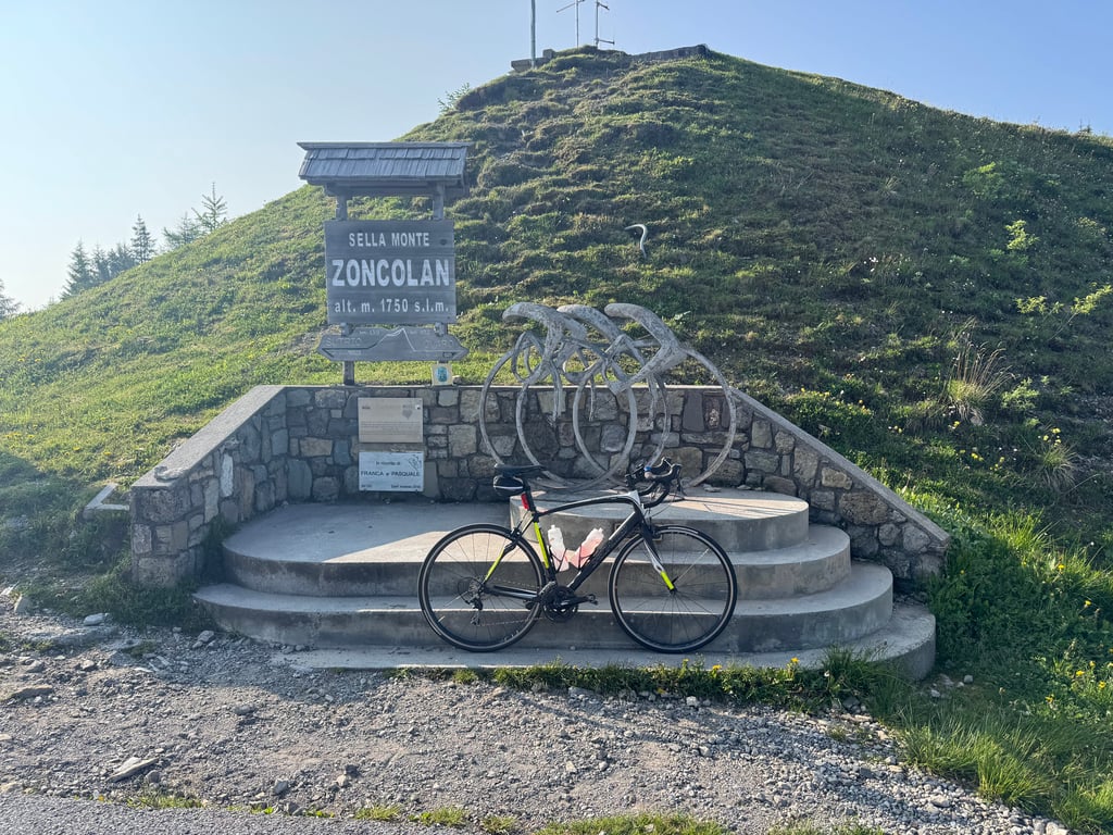
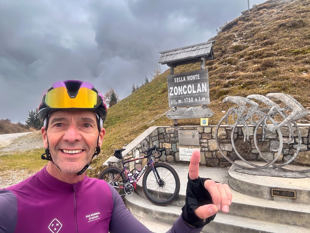
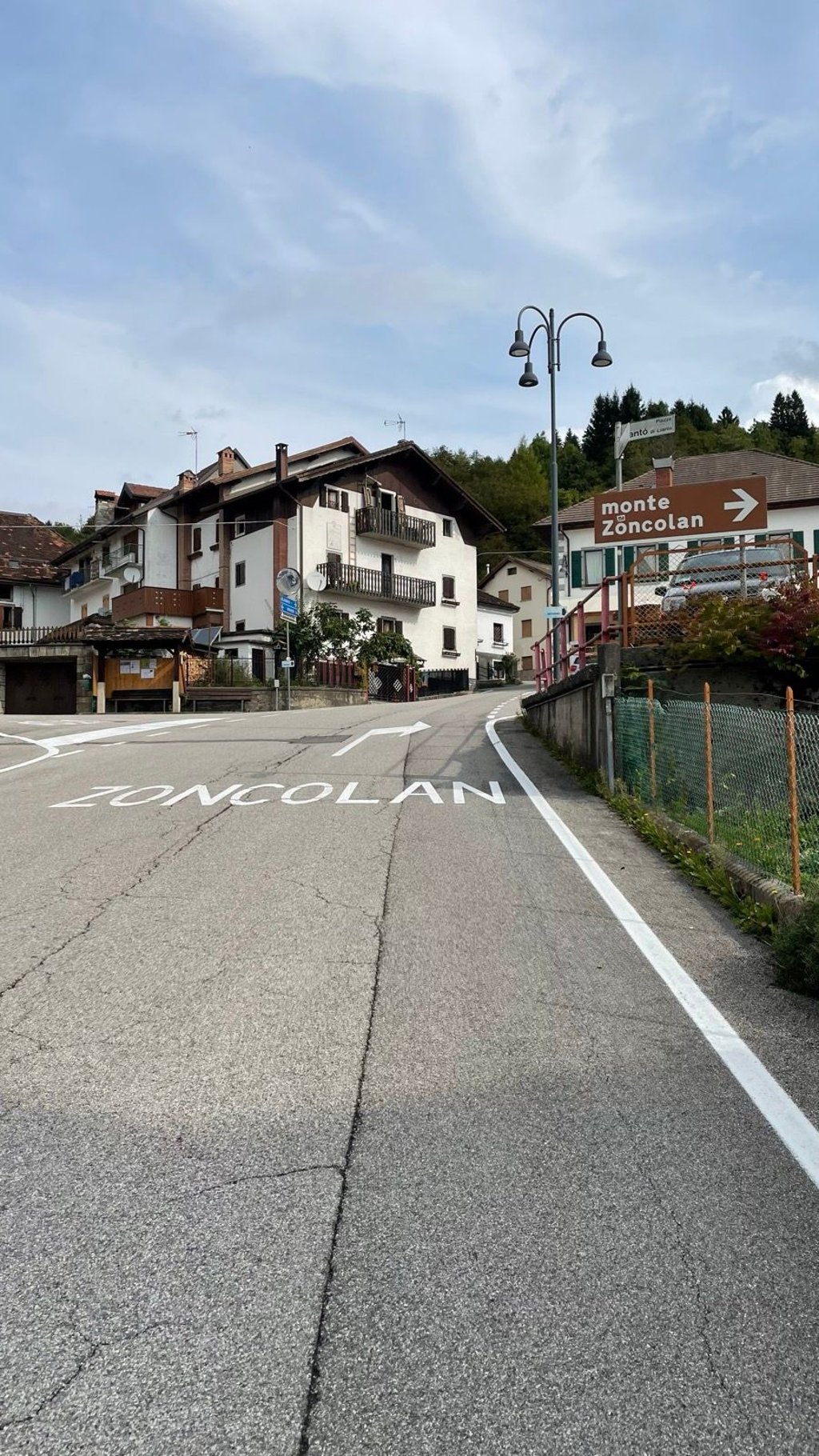
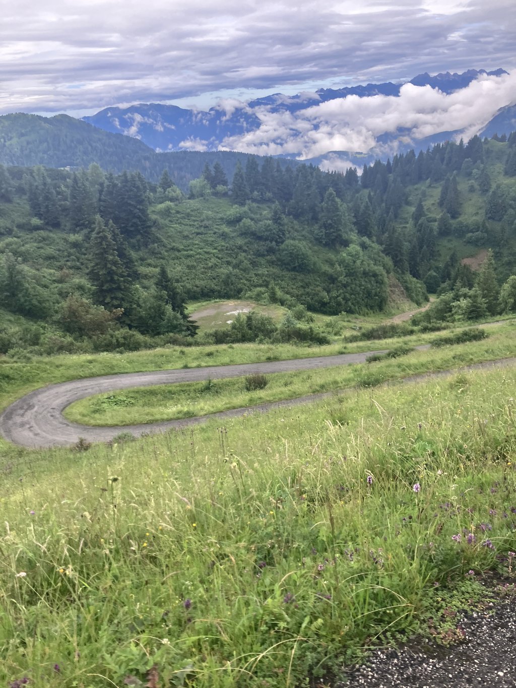
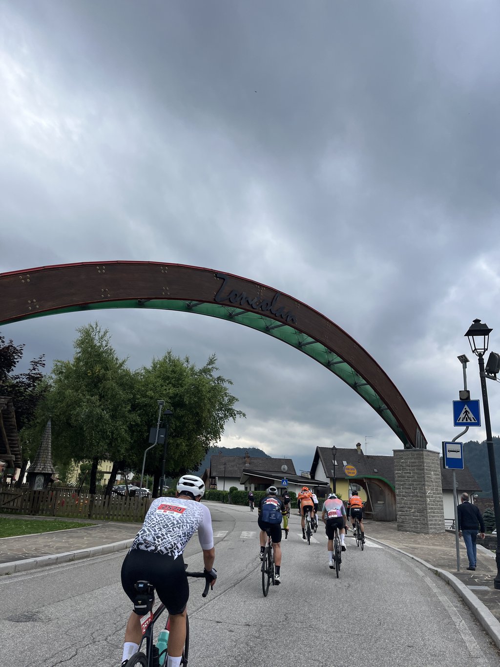
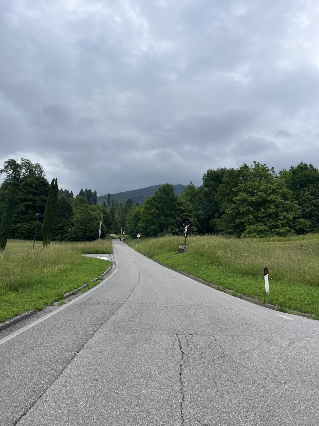
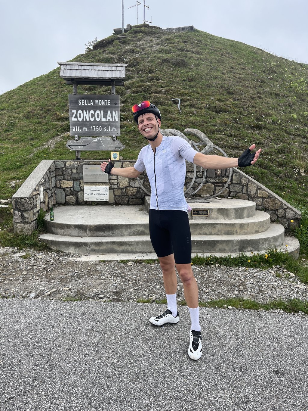
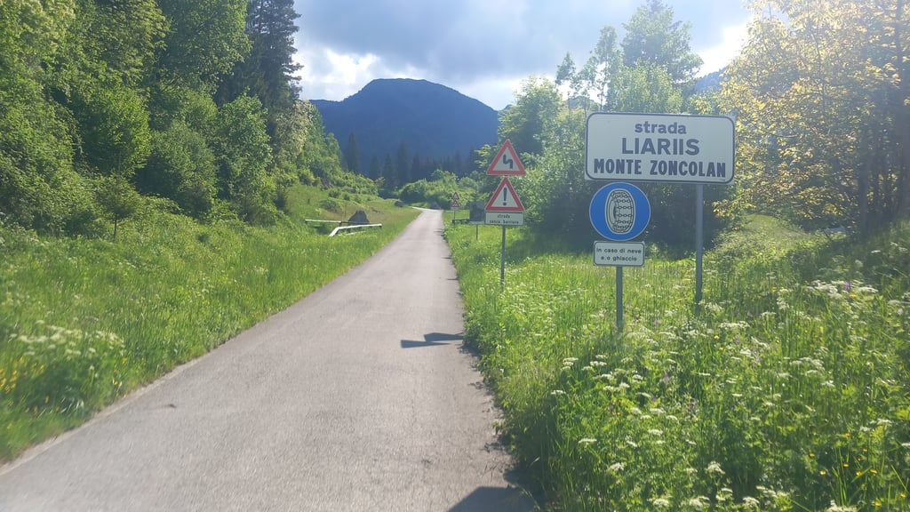
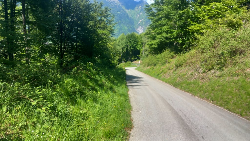
There is not much choice. We go up. From the main street right to Liariis, through narrow streets out of the hamlet, after which the rest of the climb reveals itself in all seriousness. On the way we passed a white-smoking car with its hood open, a mountain biker with his head on the handlebars, a dripping, unlit tunnel and in every bend the head of a famous champion. Merckx, Gimondi, Pantani; you name it. At the top we met two groomers, still steaming from the effort and in the short talk that followed the eldest turned out to be the uncle of Franco Pellizotti, rider of Liquigas, who had finished eighth in the 17th stage of the Giro, which ended on this mountain. His uncle had come to check on his nephew's efforts and needed no further explanation. We were asked in passing how we came to be here, four of us in a car? Sir, I did not have the bicycle with me....
My God, how I suffered on that mountain, gripping my seatbelt.

Het hele gedonder begon in augustus 2007 in Tolmezzo, een plaatsje in de Karnische Alpen, waar we door een laagvliegende Starfighter bijna van de weg werden geblazen. Verdomd laag vloog die straaljager, want hij stond op een sokkel in het midden van een rotonde bij het binnenrijden van het dorp, zijn sierlijke romp reikhalzend naar de hemel gericht. Ik permitteerde me twee volle rondjes om zijn ranke lijnen te bewonderen, tot el capitana in de eigen cockpit het welletjes vond en ons terug naar de straten dirigeerde. De verkeerde straten natuurlijk, dus een paar kilometer verder zaten we duidelijk niet op de route die de kortste weg naar Cortina d’Ampezzo had moeten zijn. In plaats hiervan doolden we steeds verder de aanloop van de bergen in, onderweg onbeduidende dorpjes passerend. Tot zich aan onze voorruit een volgend dorp aanmeldde: Ovaro. Waarom het mij aan eierstokken deed denken weet ik niet, want de strooien fietsen en vlaggen van de Monte Zoncolan hadden toch weinig met voortplanting te maken. Zoncolan? Legendarisch van naam, maar in mijn simpele denken situeerde die berg zich ergens anders, zoals ik wel meerdere beklimmingen ergens anders bedenk dan ze feitelijk liggen. Naarmate wij het centrum van Ovaro naderden kwam ik tot inkeer. Wij reden hier door het onbezoedelde Valkenburg van de Monte Zoncolan, en dat zonder ernaar gezocht te hebben. Ik zat op slag op 39 graden. Godgodgloeiende. Zonder fiets aan de voet van de Zoncolan in een zwetende auto.
Veel keuze is er dan niet. Wij omhoog. Vanaf de hoofdstraat rechts naar Liariis, door nauwe straatjes het gehucht uit, waarna de rest van de klim zich in alle ernst openbaart. Onderweg passeerden we een witrokende auto met openstaande motorkap, een mountainbiker met het hoofd bij het stuur, een druipend, onverlicht tunneltje en in elke bocht de kop van een bekende kampioen. Merckx, Gimondi, Pantani; noem maar op. Boven troffen we twee trimmers, nog dampend van de inspanning en in het korte praatje dat volgde bleek de oudste de oom te zijn van Franco Pellizotti, renner van Liquigas, die in de 17de giro-etappe, met aankomst op deze berg, achtste was geworden. Oom was de inspanningen van zijn neef komen controleren en hoefde geen verdere uitleg meer. Ons werd terloops gevraagd hoe we hier terecht kwamen, met zijn vieren in een auto? Mijnheer, ik had de fiets niet bij me…
Mijn God, wat heb ik afgezien op die berg, vretend aan mijn gordel.

Dashboard
SteveDanckers
4 y 4.0 01:45:53 (3.5 mph)
This is an automatic translation, the original language is: Dutch. Show original

End of August '21 rode from Ovaro, a climb that his name of Beast all honor. One that you should not ride for pleasure or time but purely for the kick when you get to the top. In Liariis the local "village hero" pointed us in the wrong direction. An incredibly tough climb where after Liariis while riding on the bike eating was not an option due to the steepness. Between kilometre 3 and kilometre 6 we had to slalom several times on the road surface in order to stay upright and continue. At 1.5 km from the top, there is a small piece of descending line, where I had the feeling that for the first time after Liariis I could recuperate. After this, the tunnels followed, which are easy to ride through. Because of the thick layer of clouds I was never able to see the summit. Standing on the top with some applauding unknown bikers gives goosebumps (not only from the cold).

I was equipped with front and back light which was no luxury, especially in the tunnels. During the ascent I encountered a few bikers and one descending cyclist, but no one else. Along the way we had all the weather we could think of, from summer heat to melting snow. Because of this the view on the top was rather limited and the descent towards Sutrio on wet road surface not really pleasant.

As already indicated by @Maglia_Rosa, for this climb, adjust the speed at which your Garmin automatically pauses to e.g. 2km/h.

Eind august '21 opgereden vanuit Ovaro, een klim die zijn naam van Beest alle eer aandoet. Eentje die je niet voor het plezier of de tijd moet oprijden maar zuiver voor de kik als je bovenkomt. In Liariis even de foute kant opgewezen door de lokale "dorpsheld". Een ongelooflijk zware klim waarbij na Liariis al rijdend op de fiets eten geen optie was door de steiltegraad. Tussen kilometer 3 en kilometer 6 meerdere malen over het wegdek moeten slalommen om toch maar recht te blijven en te kunnen verder rijden. Op anderhalve kilometer van de top is er een klein stukje dalende lijn, waar ik het gevoel had voor het eerst na Liariis even te kunnen recupereren. Hierna volgden de tunneltjes dewelke vlot doorrijdbaar zijn. Door de dikke laaghangende bewolking heb ik onderweg nooit de top kunnen zien. Als je dan plots op de top staat met enkele applaudisserende onbekende motards geeft dit kippenvel (niet enkel van de kou).

Zelf was ik voorzien van voor- en achterlicht wat zeker in de tunneltjes geen overbodige luxe was. Tijdens de beklimming enkele malen motards tegen gekomen en één dalende fietser verder niets of niemand gezien. Onderweg zowat alle weer gehad wat voor mogelijk te houden was van zomers warm tot smeltende sneeuw. Hierdoor was het zicht op de top ook eerder beperkt en de afdaling richting Sutrio op nat wegdek niet echt aangenaam.

Zoals reeds aangegeven door @Maglia_Rosa pas voor deze beklimming de snelheid waarbij je Garmin automatisch pauzeert aan naar bijv. 2km/h.

Monte Zoncolan
Monte Zoncolan
Monte Zoncolan
Monte Zoncolan
Monte Zoncolan
Dashboard
thijsvandoren
4 y 4.0
This is an automatic translation, the original language is: Dutch. Show original

True, @RobertS. To emphasize the seriousness of the climb, I wanted to give it a medieval touch and christen it with a neologism The Beast of Azzuria. The autocorrect threw a spanner in the works.

Klopt, @RobertS. Om de ernst van de klim te benadrukken, wilde ik hem een middeleeuwse touch geven en hem met een neologisme dopen tot Het Beest van Azzurië. De autocorrect gooide roet in het eten.

Dashboard
RobertS
4 y
This is an automatic translation, the original language is: Dutch. Show original

Rotten thing, that autocorrect! The beast of Azzuria is a very beautiful name, Thijs :D. I hope to ride it someday and still have the presence of mind to remember this nickname.

Rottig ding, die autocorrect! Het beest van Azzurie vind ik wel een hele mooi naam, Thijs :D. Ik hoop 'm een keer op te fietsen en dan nog de tegenwoordigheid van geest te hebben om deze bijnaam te onthouden.

Dashboard
thijsvandoren
5 y 4.0
This is an automatic translation, the original language is: Dutch. Show original

The Beast of Asturias... Inhuman climb, but also inhumanly beautiful. The Walloon calf bites fade to molehills compared to this wall.

Het Beest van Asturië... Onmenselijke klim, maar ook onmenselijk mooi. De Waalse kuitenbijters vervagen tot molshopen in vergelijking met deze muur.

Dashboard
RobertS
5 y
This is an automatic translation, the original language is: Dutch. Show original

I also think it is a beast of a climb, but the Beast of Asturias is the Alto de l'Angliru in Spain. The Zoncolan is in Italy.

Ik denk ook dat het een beest van een klim is, maar het Beest van Asturie is de Alto de l'Angliru in Spanje. De Zoncolan ligt in Italie.

Dashboard
Kevin
5 y 5.0 01:21:36 (4.5 mph)
This is an automatic translation, the original language is: Dutch. Show original

Zoncolan, a household name among connoisseurs. In terms of steepness virtually unparalleled. Especially the middle part of about five kilometers (from the exit of Liariis) is insane. On this stretch I met only two cyclists, both were parked on the ground. The horrendous percentages drop somewhat in the final kilometers and it is also here that you can fully enjoy the beautiful panoramic views. The moment you reach the top feels like pure ecstasy. The ultimate cross-pollination between suffering and enjoying!

Zoncolan, een begrip bij de kenners. Qua steilte vrijwel ongeëvenaard. Vooral het middenstuk van circa vijf kilometer (vanaf je Liariis uitrijdt) is waanzin. Op dit stuk slechts twee fietsers tegengekomen, beiden stonden geparkeerd aan de grond. De gruwelijke percentages zakken enigszins in de laatste kilometers en het is hier ook dat je volop kan genieten van de prachtige panoramische uitzichten. Het moment dat je de top bereikt voelt als pure extase. De ultieme kruisbestuiving tussen afzien en genieten!

Monte Zoncolan
Monte Zoncolan
Monte Zoncolan
Dashboard
Maglia_Rosa
5 y 4.0 01:15:40 (4.8 mph)
This is an automatic translation, the original language is: Dutch. Show original

The Zoncolan has the reputation of being the toughest climb ever to be included in a European cycling race. That is not for nothing. Only the Angliru, Punta Veleno and Kitzbuhler Horn are comparable. This climb is not for fun, but for the bucket list.
The first 2km you ride out of Ovaro towards Liariis. Only when you leave Liariis the really steep kilometers start on a quiet road through the forest. The steepest part is about 5 km long and seems endless. The 17%-18% gradient only decreases slightly in the bends. The trick is to find a rhythm in which you can control your heart rate and let it drop a few beats in the bends. The last 2-3 km are a pleasure. They contain some steep sections, but because you've had the hardest part, they seem like a formality. In this section are also the tunnels which are great to cycle through.

If you start with the aim of reaching the top, it is advisable to literally start as slowly as possible. Do not waste your strength in the relatively easy kilometres to Liariis. Then try to survive the first steep kilometers by zigzagging upwards at 4-5km/h. This requires a small gear. This requires a small gear. 34x30 is the minimum you need, but at 4-5km/h that is actually already too big.

Bonus tip: Adjust the speed at which your Garmin automatically pauses to e.g. 2km/h for this climb. At the default minimum speed, there is a good chance that your Garmin automatically pauses regularly and only starts again when you reach a speed of 10km / h ...

De Zoncolan heeft de naam de zwaarste beklimming te zijn die ooit is opgenomen in een Europese wielerwedstrijd. Dat is niet voor niets. Enkel de Angliru, Punta Veleno en Kitzbuhler Horn zijn enigszins vergelijkbaar. Deze klim rijd je niet voor je plezier op, maar vooral voor de bucket list.
De eerste 2km rijd je Ovaro uit richting Liariis. Pas als je Liariis uitrijdt beginnen de echt steile kilometers over een rustige weg door het bos. Het steilste deel loopt een kilometer of 5 door en lijkt oneindig. De stijgingspercentages van 17%-18% zwakken enkel in de bochten iets af. De kunst is een ritme te vinden waarin je je hartslag onder controle krijgt en deze in de bochten steeds weer een paar slagen laat zakken. De laatste 2-3km zijn genieten. Deze bevatten nog enkele steile stroken, maar doordat je het zwaarste hebt gehad lijken deze een formaliteit. In deze sectie bevinden zich ook de tunnels waar prima doorheen te fietsen is.

Als je start met als doel boven te komen is het aan te raden om letterlijk zo langzaam mogelijk te beginnen. Verspil geen krachten in de relatief eenvoudige kilometers naar Liariis. Probeer vervolgens de eerste steile kilometers te overleven door met 4-5km/h zigzaggend naar boven te rijden. Dit vereist wel een klein verzet. 34x30 heb je minimaal nodig, maar bij 4-5km/h is dat eigenlijk al te groot.

Bonustip: Pas voor deze beklimming de snelheid waarbij je Garmin automatisch pauzeert aan naar bijv. 2km/h. Bij de standaard minimumsnelheid is de kans groot dat je Garmin geregeld automatisch pauzeert en pas weer start als je een snelheid van 10km/h haalt...

Monte Zoncolan
Monte Zoncolan
Dashboard

Climbing times

5 mph 01:13:48
7 mph 00:52:14
9 mph 00:40:43
12 mph 00:30:35

Road surface condition

70% 20% 11%
Based on 56 votes
Share your knowledge. What was the road condition during your ascent?

Traffic

91% 7% 2%
Based on 46 votes
Your experience counts. How much traffic did you encounter during the climb?

Frequently Asked Questions

Monte Zoncolan can be cycled from 3 sides. Monte Zoncolan from Ovaro is the most popular side, but the summit can also be reached via Monte Zoncolan from Sutrio & Monte Zoncolan from Priola.

The Monte Zoncolan is extremely hard. We recommend that you choose the lightest possible gearing, such as a 34-tooth or smaller chainring, combined with a 34-tooth rear cog. Otherwise, there's a good chance you'll need to put a foot down sooner or later. If you think you need to go even lighter, you could consider using a gravel or mountain bike, or installing a gravel or mountain bike derailleur with a rear cog of more than 40 teeth. Good luck!

Monte Zoncolan falls into the Super Hors Catégorie, the absolute top category. These are the most extreme climbs that exist. Even with excellent fitness, there is a chance you will have to put a foot down. Only the strongest make it to the top without any problems.

Monte Zoncolan is 6.1 mi long.

The average gradient of Monte Zoncolan is 12.3%.

Monte Zoncolan has a steepest segment with an average gradient of 23.3%.

The summit of Monte Zoncolan is at 5676 ft.

At a slow pace of 5 mph, it takes about 01:13:48 to climb Monte Zoncolan. At 7 mph the time is 00:52:14, and at 9 mph 00:40:43. For the fastest cyclists, 00:30:35 is an achievable time.

Monte Zoncolan is located in the region Udine in Italy.

This page is better in the app

Climbfinder app
Climbfinder
(Free)
Open