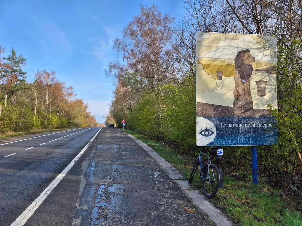
Côte du Barrage de la Gileppe from Béthane is a climb in the region Valleys of the Vesdre, de l'Amblève et de l'Ourthe. It is 1.9 mi long and bridges 492 ft of vertical ascent with an average gradient of 5%, resulting in a difficulty score of 92. The top of the ascent is located at 1230 ft above sea level. Climbfinder users shared 7 reviews of this climb and uploaded 13 photos.
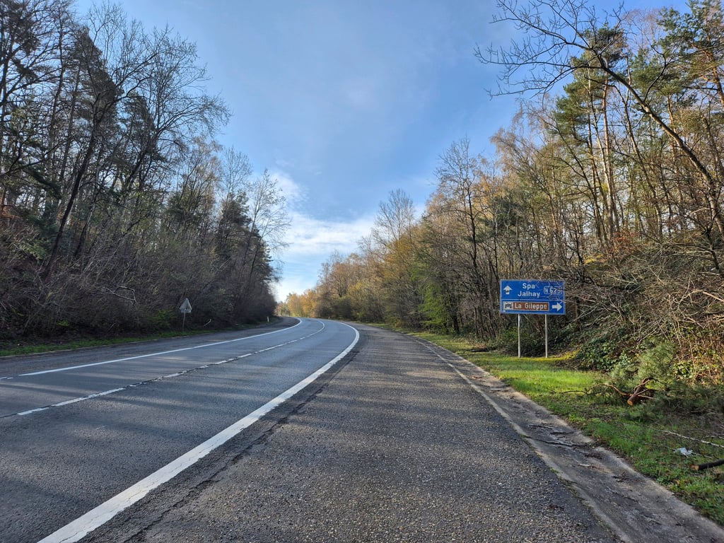
Road names: N629 & Route de la Gileppe
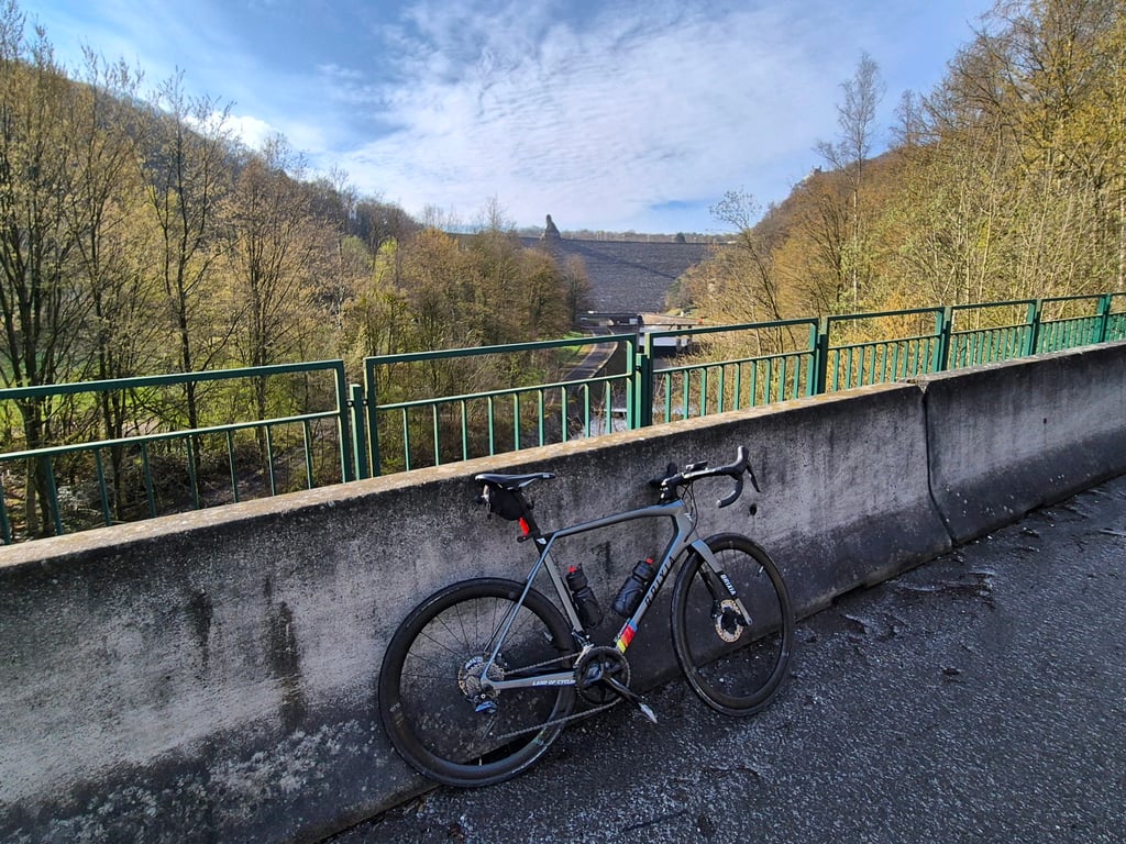
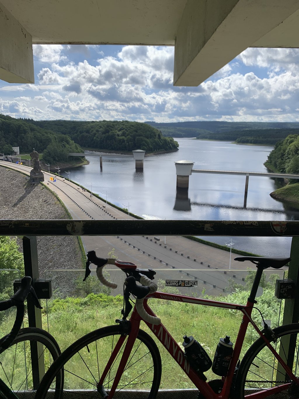
1.0 by OpekaThis is an automatic translation, the original language is: French.Very wide road, on the hard shoulder to avoid obstructing fast, frequent traffic. Nice views from the dam, but not worth the effort if the climb is from this side.... read more

Welcome! Please activate your account if you would like to share something. Look for the verification email in your inbox.
If you want to upload your photos, you need to create an account. It only takes 1 minute and it's completely free.
Very wide road, on the hard shoulder to avoid obstructing fast, frequent traffic.
Nice views from the dam, but not worth the effort if the climb is from this side.
Route très large, sur la bande d'arrêt d'urgence pour éviter de gêner le traffic rapide et fréquent.
Vues depuis le barrage jolies mais qui n'en valent pas la peine si la montée est faite par ce côté.
You don't want to drive this one. It is not necessarily unsafe (as already pointed out by others), but totally uninspiring. Cars's and motorbikes fly past you as if you were driving on the hard shoulder of a motorway. Real drama.
Deze wil je niet rijden. Het is niet per se onveilig (zoals al door anderen werd aangegeven), maar totaal niet inspirerend. Auto's en motoren vliegen langs je heen alsof je op de vluchtstrook van een snelweg rijdt. Echt drama.
A runner along a wide highway. It is not dangerous because there is plenty of room. Exactly what the description says for **: only if there is no other option.
Een loper langs een brede autoweg. Het is niet gevaarlijk, want er is ruimte zat. Precies wat de omschrijving zegt voor **: alleen als er geen andere optie is.
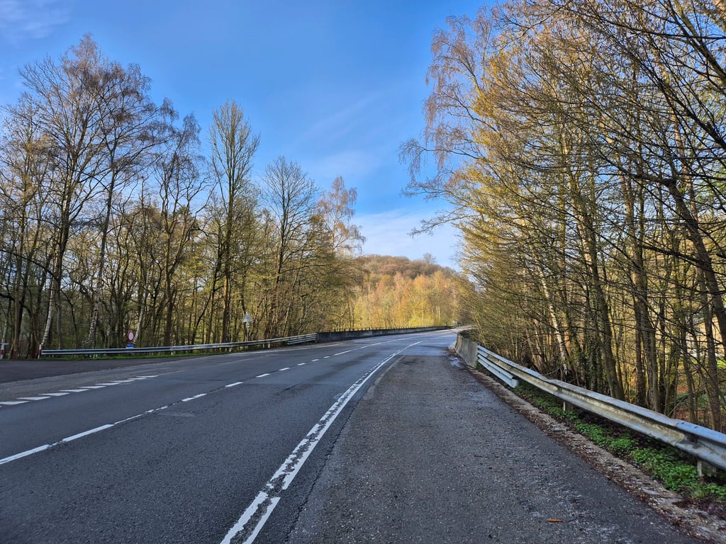
After a gentle run-up, a fine runner starts just before the bridge. The percentage is good to maintain as it goes on for a long, long time. Fortunately, there are a few more slight curves that offer a bit of variety. The road has a hard shoulder (it disappears just after the top which immediately makes the road a lot more fun) but it does often have rough tarmac. Better to cycle just inside the lines and swerve if necessary (people drive fast but quite nicely) if you hear traffic coming. The latter is fine as there is little traffic and you can't hear anything from the surrounding woods.
In itself a nice climb, but the variant via the dam offers a lot more variation.
Na een rustige aanloop begint net voor de brug een prima loper. Het percentage is goed vol te houden want het gaat lang door (ook gevoelsmatig omdat de weg zo breed is). Gelukkig zijn er nog enkele lichte bochten die een beetje variatie bieden. De weg heeft een vluchtstrook (deze verdwijnt net na de top wat de weg meteen een stuk aantrekkelijker maakt) maar die heeft wel vaak ruw asfalt. Beter is om net binnen de lijnen te fietsen en evt. uit te wijken (men rijdt hard maar best netjes) als je verkeer hoort aankomen. Dat laatste gaat prima want er is maar weinig verkeer en vanuit de omringende bossen hoor je verder niets.
Op zich best een lekkere klim, maar de variant via de stuwdam biedt wel heel veel meer variatie.
Even, not too difficult climb on a wide rather boring straight road. At the end the wide road ends and it becomes a "normal" somewhat nicer road to cycle. Unfortunately, there aren't many other options east of Verviers to cross to the south.
Gelijkmatige, niet al te moeilijke klim over een brede nogal saaie rechtdoor lopende weg. Aan het eind houdt de brede weg op en wordt het een "normale" wat leukere weg om te fietsen. Helaas zijn er oostelijk van Verviers niet veel andere opties om naar het zuiden door te steken.
As a climb for Dutch standards long, the road is boring and because of the bad emergency lanes with lots of gravel watch out for flat tires. Unfortunately, cars sometimes pass by with high speed but in general it is doable.
If you go cycling here is for the longer Barraque Michel that follows or for the view of La Gillepe.
Most do not know that for example the Eneco tour after the first turn on the service road and you so via a very steep, narrow road through the woods at the top of the dam comes.
Als klim voor Nederlandse begrippen lang, de weg is saai en door de slechte vluchtstroken met veel grint opletten voor lekke banden. Helaas komen auto's wel eens met hoge snelheid voorbij maar over het algemeen is het goed te doen.
Als je heir gaat fietsen is het voor de langere Barraque Michel die volgt of voor het uitzicht op La Gillepe.
De meeste weten niet dat bijvoorbeeld de Eneco tour na de eerste bocht de service weg opgaat en je zo via een erg steile, smalle weg door het bos boven op de dam uitkomt.
Our annual crossing from Maastricht to Malmedy. A very special road, it looks like they once wanted to build a double lane road, but later decided they didn't need that and made an emergency lane of the extra lanes. The asphalt of the emergency lanes is very bad by now, but it does give you the opportunity to drive well to the side. At the entrance from the lake you have to watch out. At the top the emergency lanes disappear again, and it suddenly seems to change into a quiet country road.
Onze jaarlijkse doorsteek vanaf Maastricht richting Malmedy. Bijzonder aangelegde weg, het lijkt alsof ze ooit een dubbelbaans weg hebben willen aanleggen, maar later hebben besloten dat toch niet nodig te hebben en van de extra banen een vluchtstrook hebben gemaakt. Het asfalt van die vluchtstroken is inmiddels wel erg slecht, maar geeft je wel de mogelijkheid om goed aan de kant te rijden. Bij de invoegstrook vanaf het meer is het altijd even goed opletten. Bovenin verdwijnen de vluchtstroken weer, en lijkt het opeens te veranderen in een rustig landweggetje.
| 5 mph | 00:22:31 |
| 7 mph | 00:15:56 |
| 9 mph | 00:12:25 |
| 12 mph | 00:09:20 |
This page is better in the app