Tips nearby


| Hidden gem |
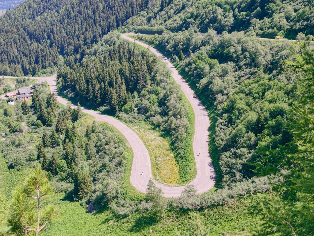
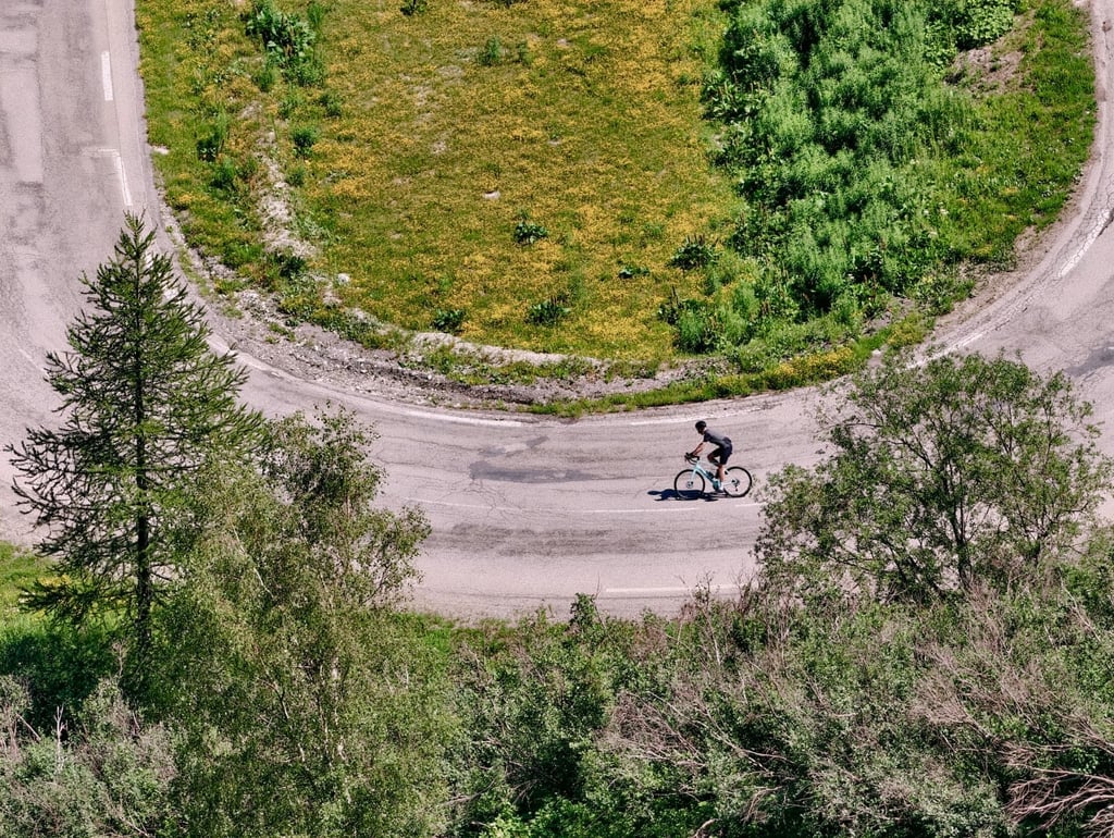
| 23 hairpin turns |
| Bad road |
| #69 toughest climb of Auvergne-Rhône-Alpes |
| #78 most elevation gain of France |
| #77 longest climb of Auvergne-Rhône-Alpes |
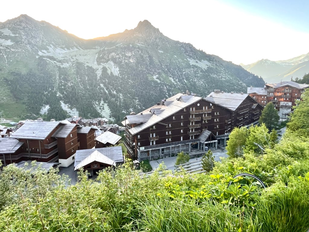
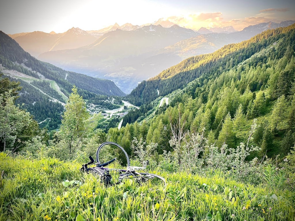
Les Arcs from Bourg Saint Maurice via Bois de Saule is a climb in the region Savoie. It is 20.5 km long and bridges 1322 m of vertical ascent with an average gradient of 6.5%, resulting in a difficulty score of 1005. The top of the ascent is located at 2126 m above sea level. Climbfinder users shared 4 reviews of this climb and uploaded 20 photos.
Road names: D 119 & Bois de Saule
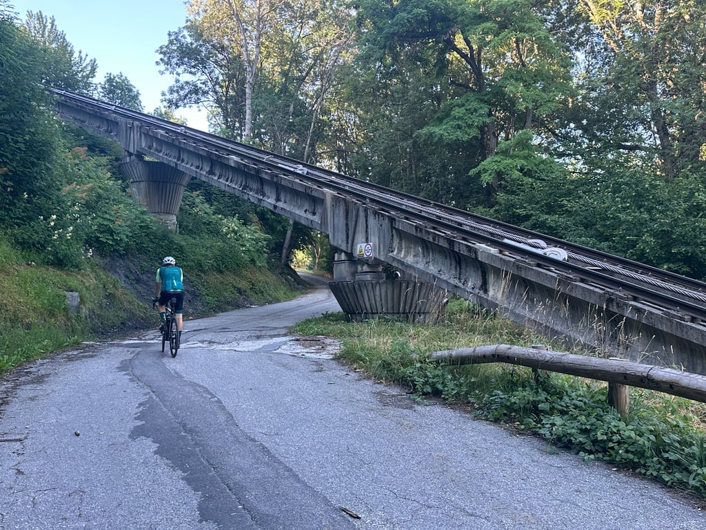
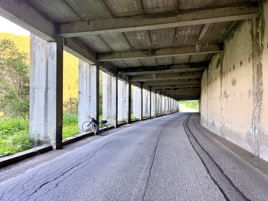
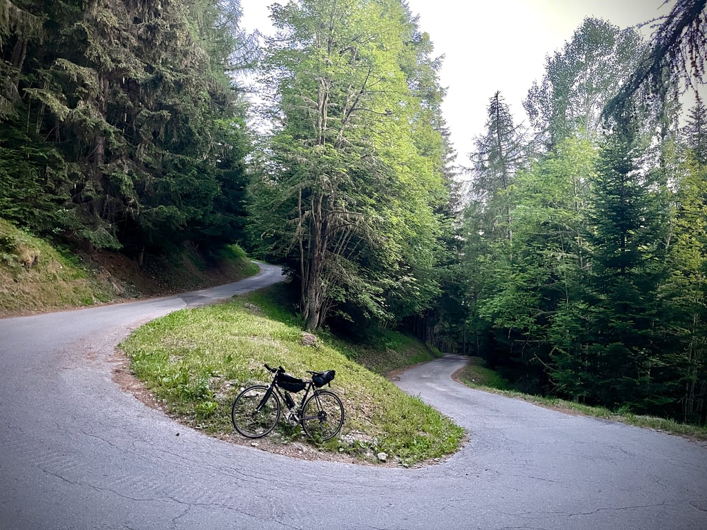
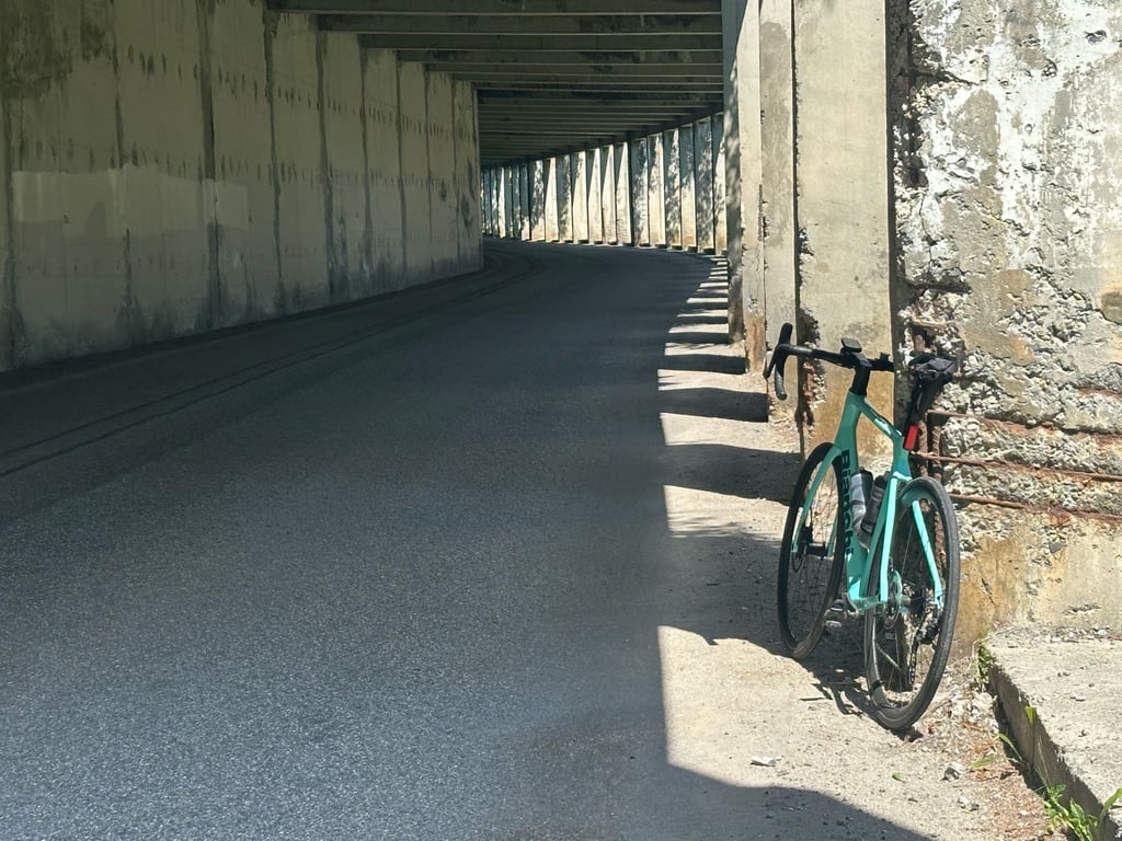
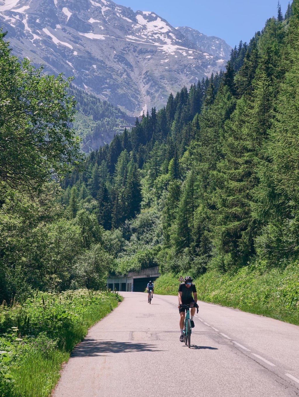
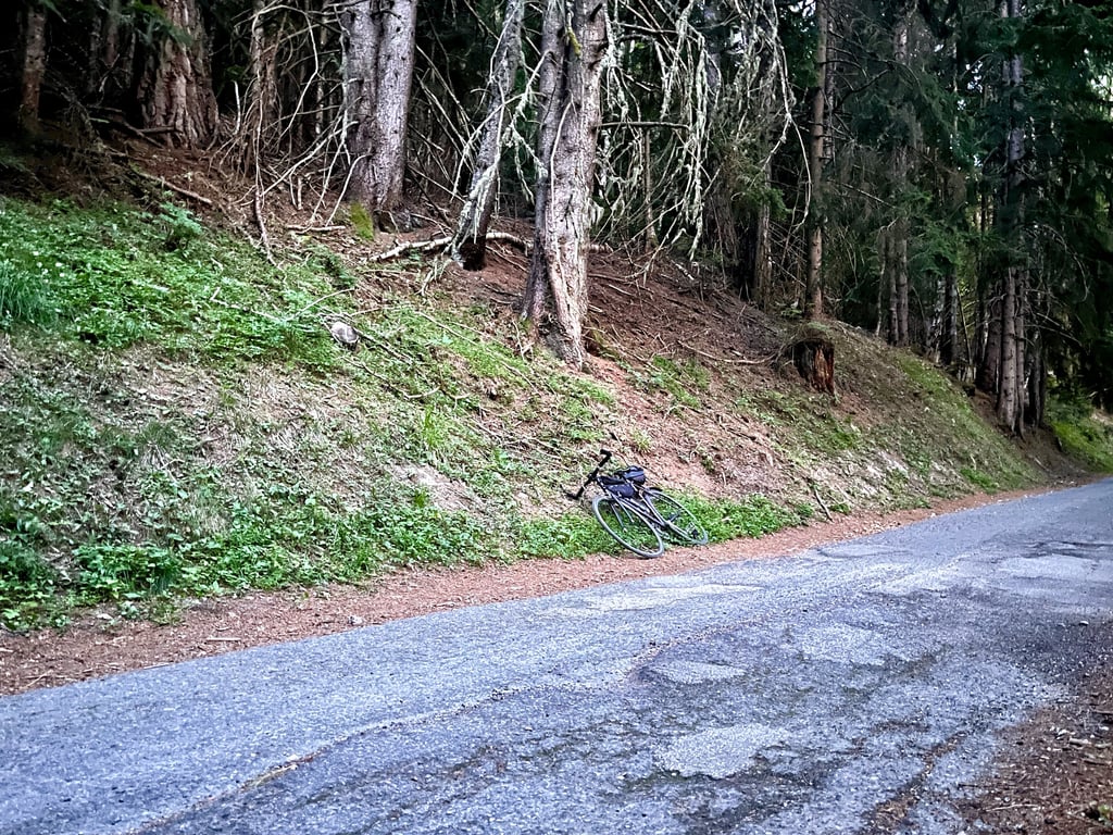
4.0 by MrtnThis is an automatic translation, the original language is: Dutch.What a surprise, this climb to Les Arcs. You have to get through the first few kilometres of poor tarmac, but then the road winds its way up through the woods beautifully. Nice and shady, with the occasional bit of pedalling, and somewhat uneven. Lovely! After a less steep section along the main road, you cycle through a tunnel, and from there it really starts to get beautiful. A rocky outcrop, a waterfall: this is where the climb is at its best. The end of the climb is the perfect place to put ... read more
Welcome! Please activate your account if you would like to share something. Look for the verification email in your inbox.
If you want to upload your photos, you need to create an account. It only takes 1 minute and it's completely free.
What a surprise, this climb to Les Arcs. You have to get through the first few kilometres of poor tarmac, but then the road winds its way up through the woods beautifully. Nice and shady, with the occasional bit of pedalling, and somewhat uneven. Lovely! After a less steep section along the main road, you cycle through a tunnel, and from there it really starts to get beautiful. A rocky outcrop, a waterfall: this is where the climb is at its best. The end of the climb is the perfect place to put in a bit of extra effort. At the top, you can catch your breath whilst enjoying the view of Mont Blanc in the distance – brilliant!
Wat een verrassing, deze klim naar Les Arcs. Je moet even door de eerste kilometers met slecht asfalt heen, maar dan slingert de weg prima door het bos naar boven. Lekker in de schaduw, af en toe in de pedalen, enigszins onregelmatig. Fraai! Na een minder steil tussenstuk via de grote weg fiets je door een galerij en vanaf daar begint het echt mooi te worden. Een rotspartij, een waterval: hier is de klim op zijn best. Het einde van de klim leent zich er goed voor om even aan te zetten. Boven kun je op adem komen met uitzicht op de Mont Blanc in de verte, geweldig!
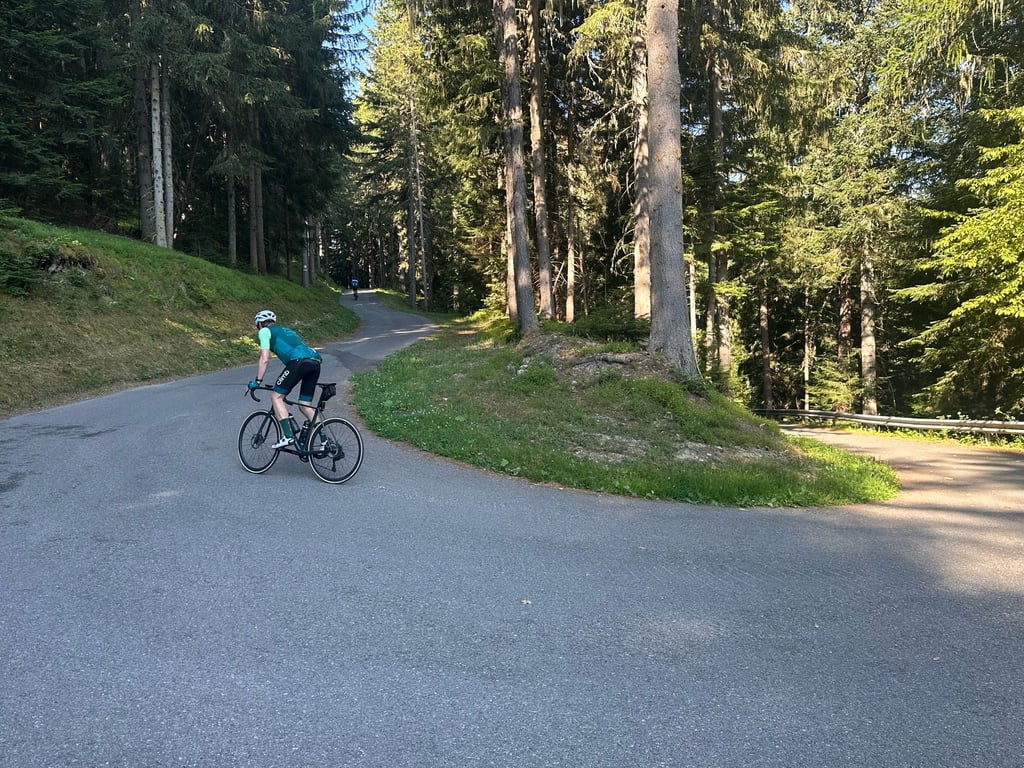
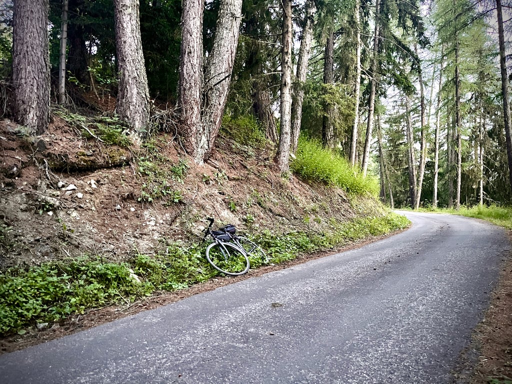
A bit tired. A bit bumpy. A bit mottled. A bit warped. A bit ribbed. A bit grubby. A bit forgotten. Yes, it’s a bit of all that. But, above all, it’s a wonderfully pleasant road that winds through a forest just like itself and is teeming with foxes that can’t quite work out what we’re doing there.
Honestly, the climb goes very smoothly and the descent is hardly a struggle.
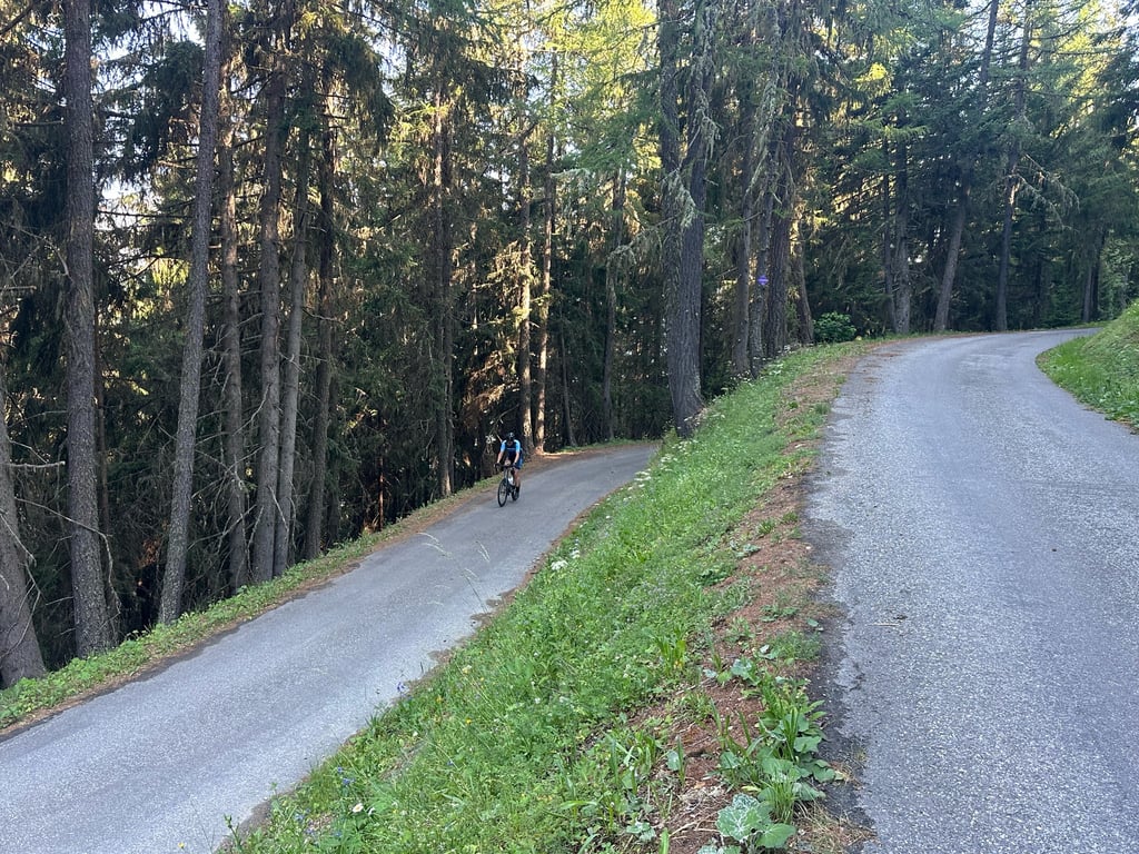
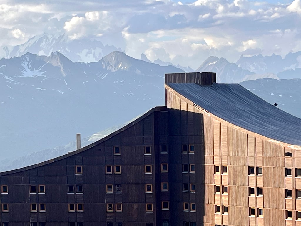
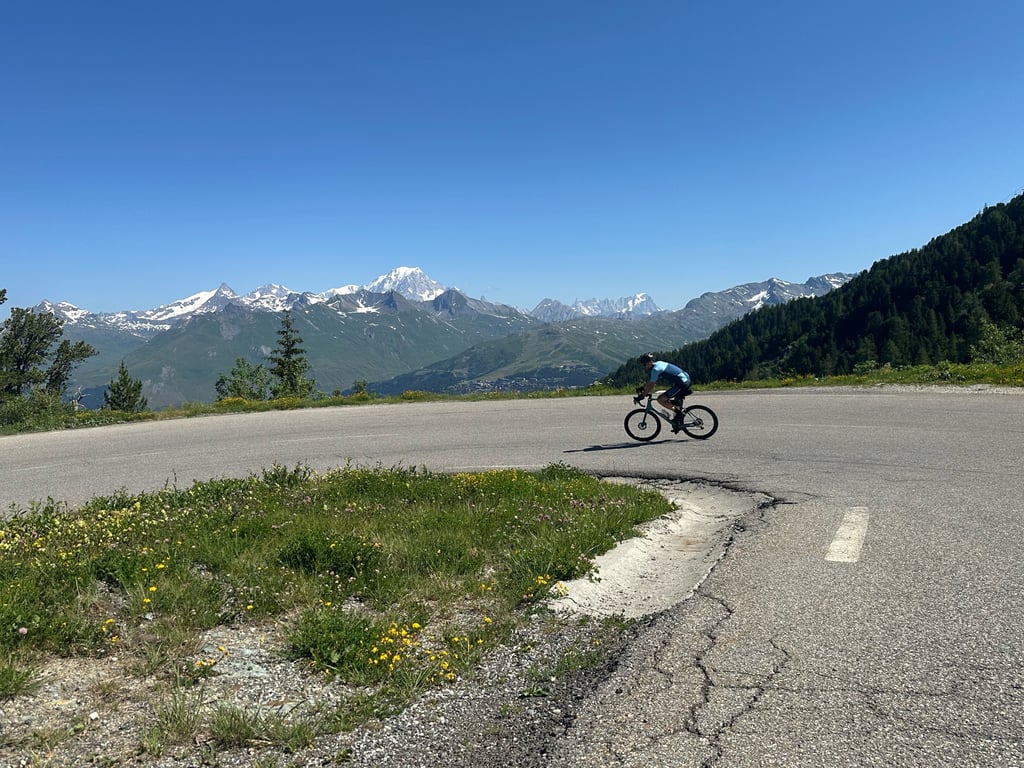
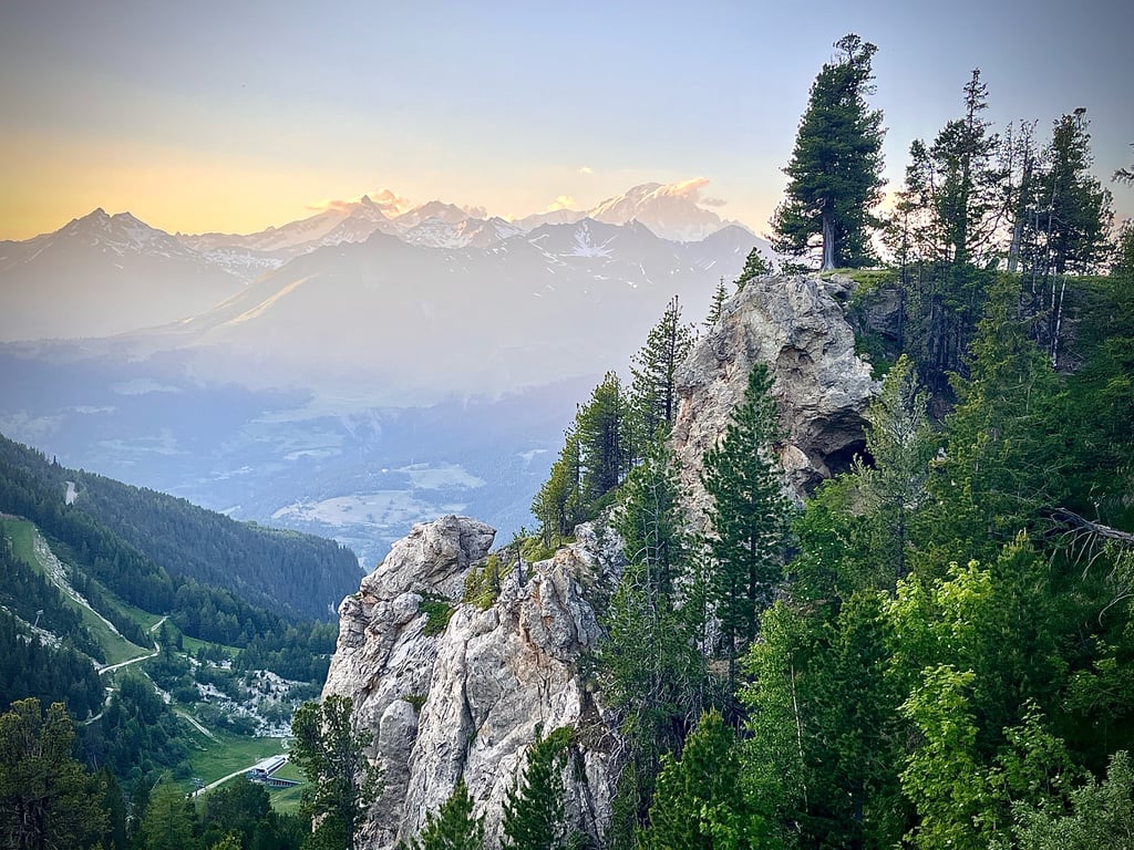
It’s a varied climb: this winding road that knows how to climb gives way to a wider, busier country road, exposed to the sun. The views of Mont Blanc begin to reveal themselves discreetly. The gradients ease off.
I found this second section less enjoyable than the part through the forest.
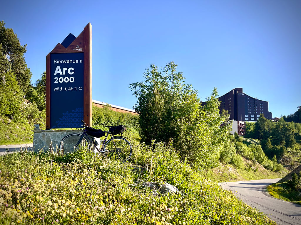
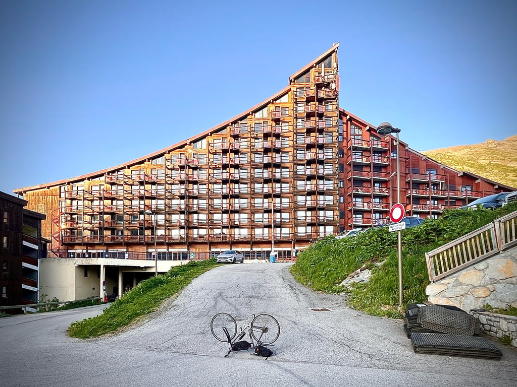
The resort of Les Arcs 2000? I’m not sure what to make of it! Bold architecture, to be sure! Les Arcs 2000 has been awarded the ‘20th-Century Heritage’ label by the Ministry of Culture for its urban planning. It’s a gargantuan complex, but clearly well thought out.
In any case, there are beautiful views of the Mont Blanc massif.
Un peu fatiguée. Un peu bosselée. Un peu marbrée. Un peu gondolée. Un peu nervurée. Un peu sale. Un peu oubliée. Oui, elle est un peu tout ça. Mais, c’est surtout une route formidablement agréable qui serpente dans une forêt à son image et qui fourmille de renards qui ne comprennent pas ce que l’on fait là.
Honnêtement, la grimpette se passe très bien et la descente tabasse à peine.
Elle est variée cette ascension : cette route biscornue qui sait grimper laisse place à une départementale plus large, plus fréquentée et exposée au soleil. Les vues sur le Mont Blanc commencent à se découvrir discrètement. Les pourcentages faiblissent.
Cette seconde partie m’a moins amusé que la partie en forêt.
La station des Arcs 2000 ? Je ne sais pas quoi en penser ! Une architecture audacieuse, assurément ! Arcs 2000 a reçu le label « Patrimoine du XXᵉ siècle » du Ministère de la Culture pour son plan d’urbanisme. Alors…
C’est un bastion gargantuesque, mais visiblement bien étudié.
En tout cas, de belles vues sur le massif du Mont Blanc.
I loved this ascent.
The first 3 km, up to Montrigon, are not spectacular (also see below). However, the following kilometers up to Arc 1600, are absolutely lovely. Lots of hairpins, nearly completely in the forest (nice if you want some shade during the summer) and very quiet. A perfect ascent if you want to ride without getting disturbed by cars. The ascent from Arc 1600 to 2000 is easier than the previous part – you cycle on wide, well-paved roads at a shallower gradient – but the fatigue may start to show. However, do continue up to Arc 2000 and the reward is a fantastic panoramic view with Mont Blanc in the distance!
Regarding the condition of the road surface: I somewhat disagree with the previous user and the data from climbfinder. The first 3km of the road, up to the village of Montrigon, are indeed not in a very good shape. However, the subsequent hairpins through the forest (route de courbaton, up to Arc 1600) are in okay shape – not better or worse than some other main roads in the area. I would not descend these routes, but for ascending at 8 to 15 kph, it is absolute fine.
| 7 km/h | 02:55:40 |
| 11 km/h | 01:51:47 |
| 15 km/h | 01:21:59 |
| 19 km/h | 01:04:43 |
This page is better in the app