Tips nearby


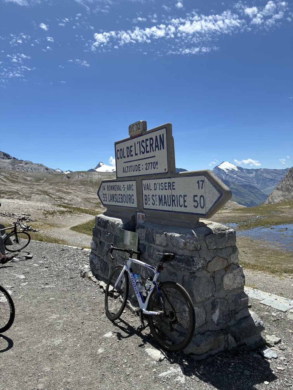
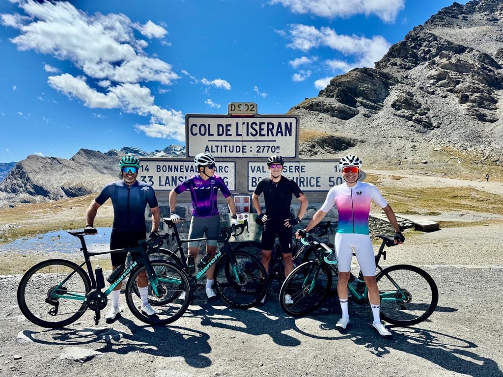
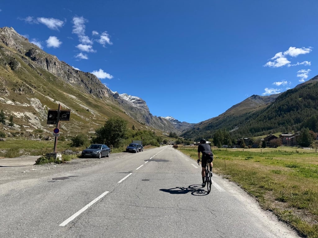
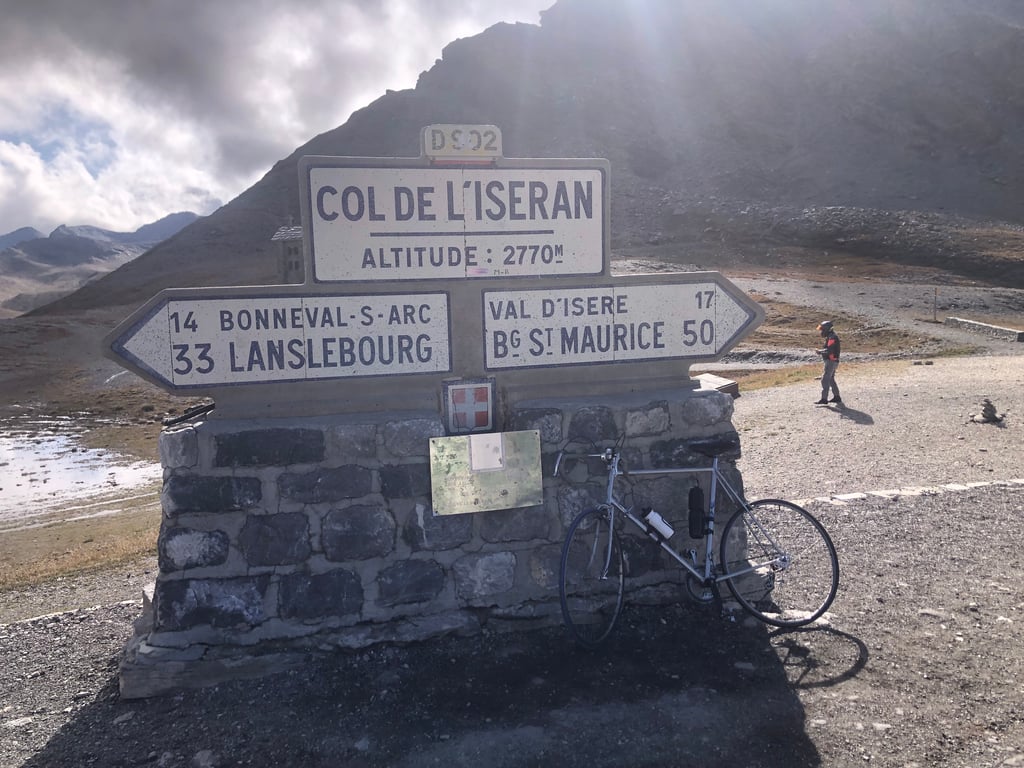
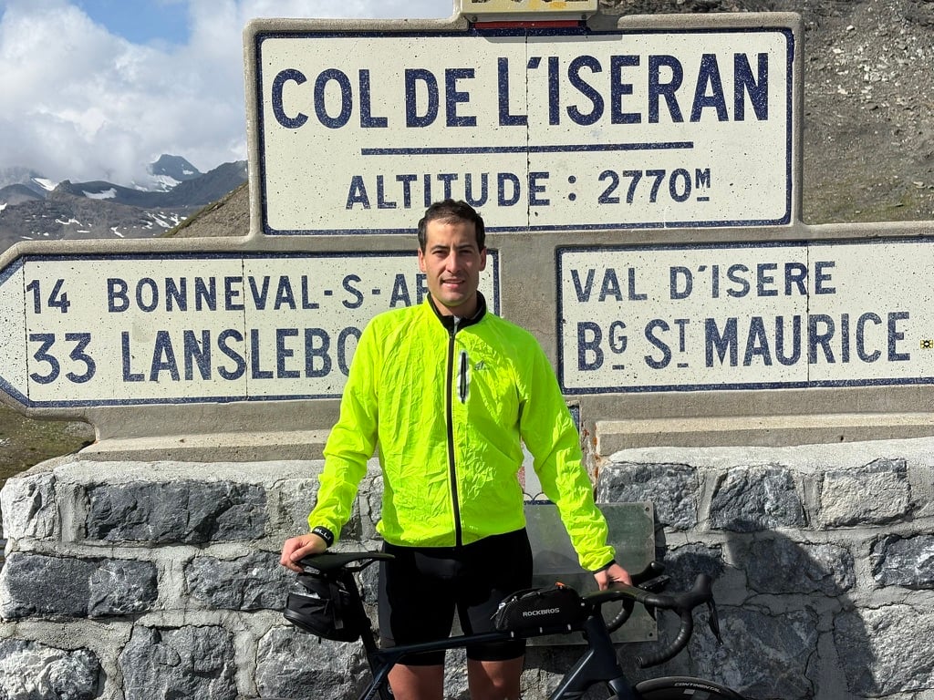
Col de l'Iséran is a climb in the region Savoie. It is 47.4 km long and bridges 2050 m of vertical ascent with an average gradient of 4.3%, resulting in a difficulty score of 1232. The top of the ascent is located at 2770 m above sea level. Climbfinder users shared 40 reviews of this climb and uploaded 81 photos.
Road names: Avenue du Stade, D1090 & D902
Tip
Be careful! On this climb you will encounter dimly lit tunnels. Use your bike lights.
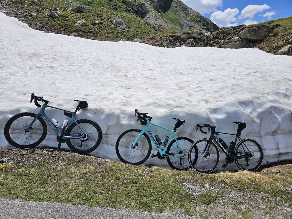
4.0 by NielsThis is an automatic translation, the original language is: Dutch.We were here in early June, a period in which it can happen that the highest col of France is still closed because of snow, but ... That did not stop us. Just past Val d'Isere, we were stopped by someone at a barrier, but stubborn as we were, we drove on. A choice that gave us an amazing climb: a road free of traffic, in the sun and as we came closer to the top, we got the cooling of the famous snow walls that are often still there in this part of the season. Beautiful pictures and a breath... read more
Welcome! Please activate your account if you would like to share something. Look for the verification email in your inbox.
If you want to upload your photos, you need to create an account. It only takes 1 minute and it's completely free.
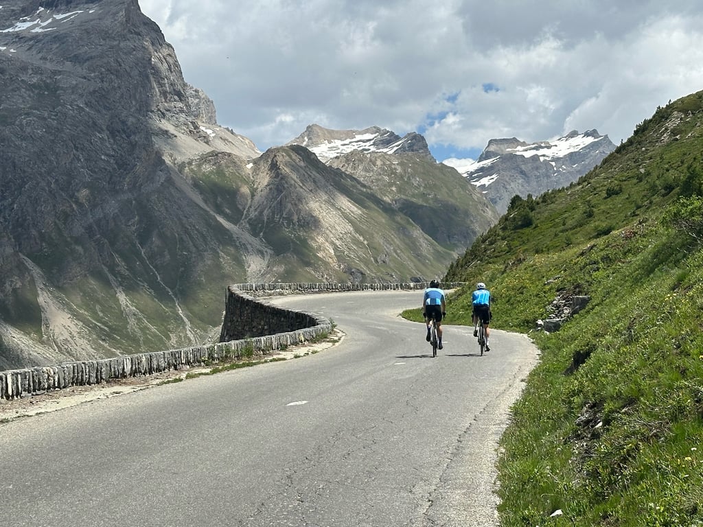
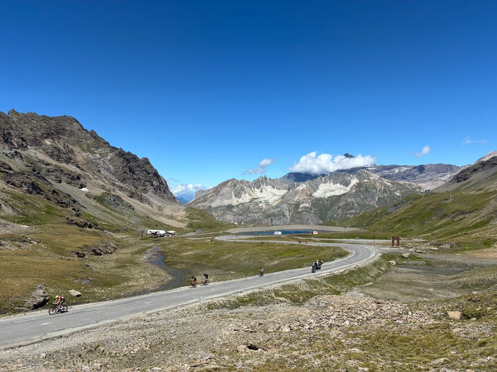
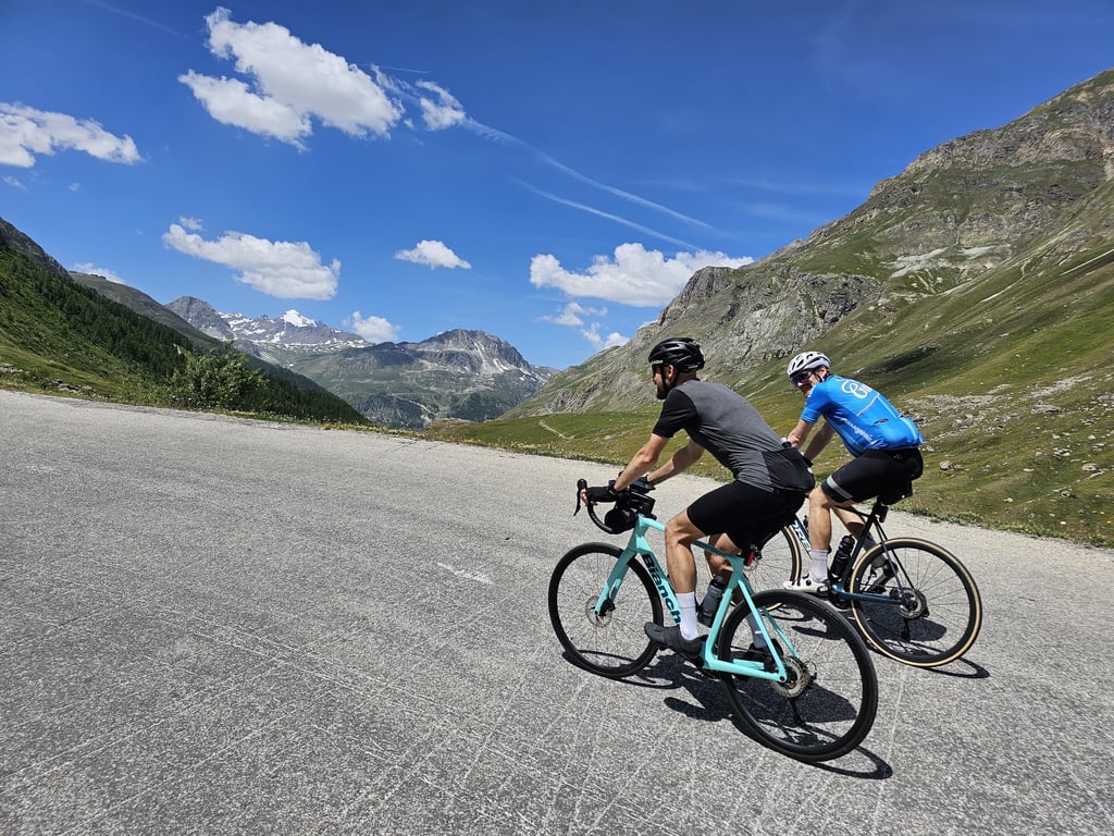
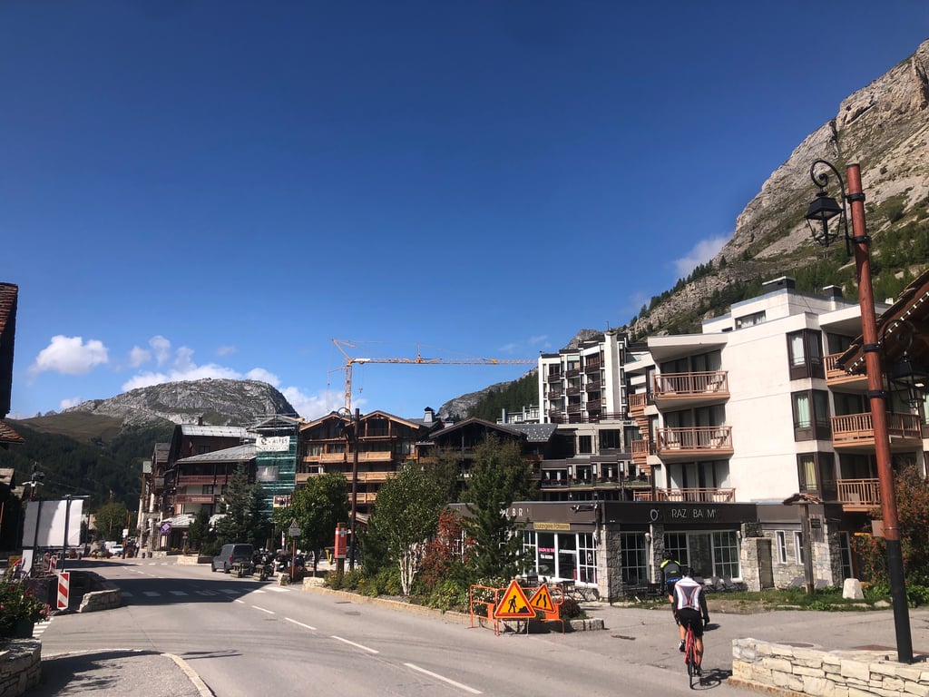
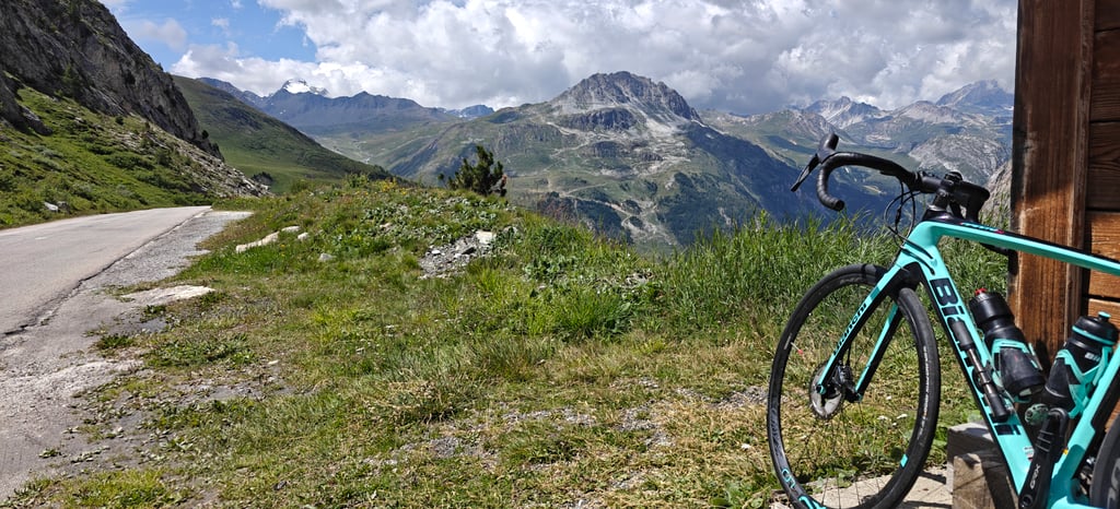
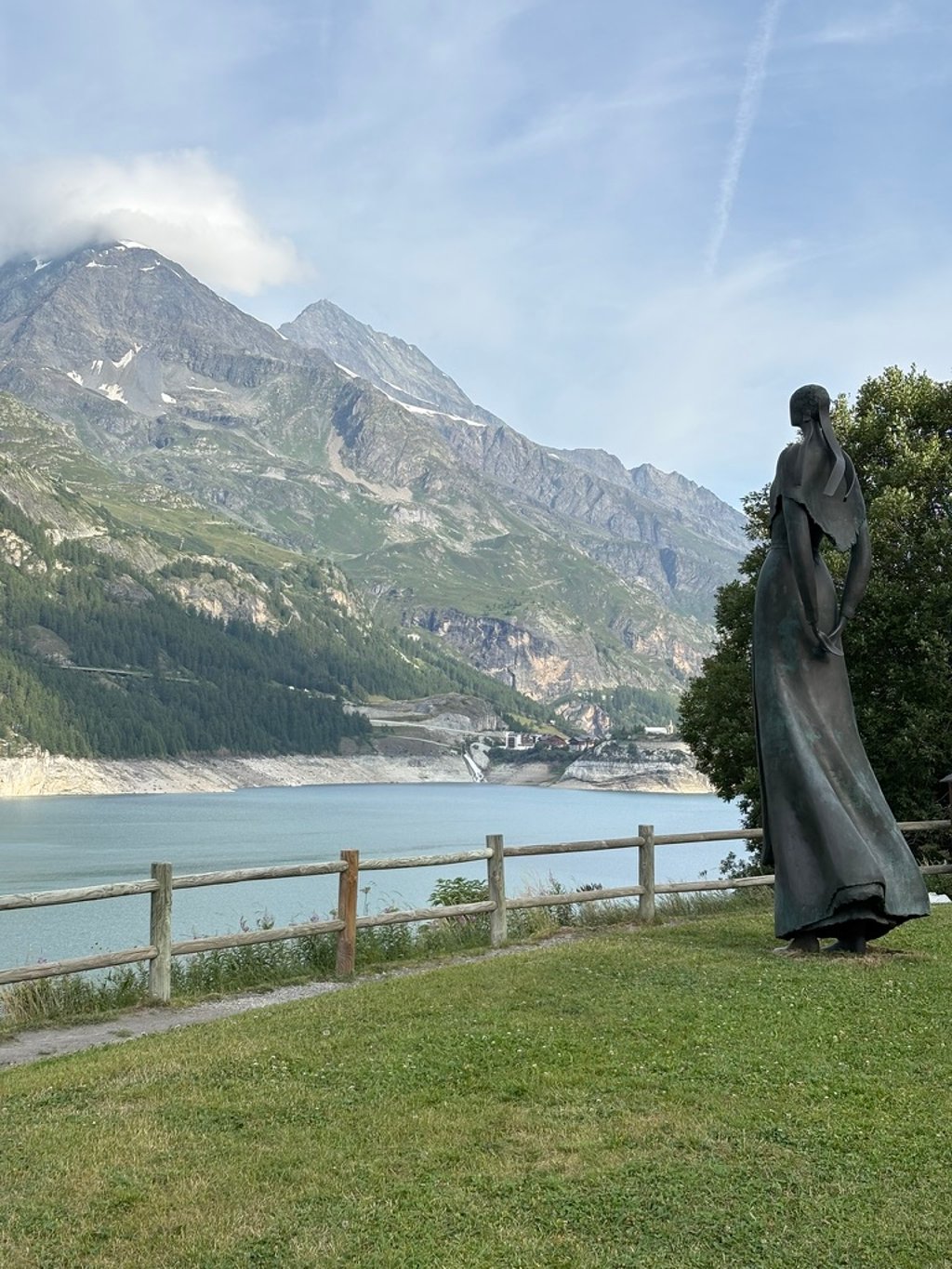
What an iconic climb! From Bourg-Saint-Maurice, the first section is a bit of a slog, mainly because of the heavy (lorrie) traffic with which you have to share the road. From the Lac du Chevril dam, the route really starts to look lovely, with rock formations, cliffs and the occasional waterfall. Val d’Isère is the perfect place to top up your water bottle (and don’t forget to grab a sweet roll at Oh Crazy Barm’s – we bumped into quite a few pro cyclists there) before the most beautiful part of the climb begins. This section is nothing short of spectacular. It never gets really steep, so cycling fun is guaranteed. For cyclists who feel a bit nervous riding alongside deep precipices without a crash barrier (myself included), the climb can be a bit nerve-wracking at times. But the reward is immense once you reach the summit.
Wat een iconische klim! Vanaf Bourg-Saint-Maurice is het eerste deel even doorbijten, met name vanwege het vele (vracht)verkeer met wie de weg moet worden gedeeld. Vanaf de stuwdam van Lac du Chevril begint de route mooi te worden met gallerijen, rotsen en een enkele waterval. Val d’Isere leent zich goed voor het bijvullen van de bidon (en vergeet ook zeker geen zoet broodje te eten bij Oh Crazy Barm’s, we kwamen er menig profrenner tegen) voordat het mooiste deel van de klim begint. Dit gedeelte is ronduit spectaculair. Echt steil wordt het nooit, fietsplezier gegarandeerd. Voor fietsers met enige angst in de benen bij het fietsen langs diepe afgronden zonder vangrail (mijzelf incluis) is de klim soms even spannend. Maar de beloning is groot wanneer de top is bereikt.
Extraordinary, endless ascent, beautiful views 💯💯💯
Salita straordinaria e infinita, bellissimo panorama 💯💯💯
The first part to Val d'Isère isn't the prettiest, but after that it's grandiose.
Là première partie jusqu’à Val d’Isère n’est pas la plus jolie mais ensuite c’est grandiose.
Bourg-Saint-Maurice / Modane via Aussois (panoramic route): an exceptional tour of the most beautiful landscapes in Savoie, in the heart of the National Park. A must-do! It is possible to leave from Val d'Isère, but much of the breathtaking route is missed. It's mainly the Bourg / Lanslebourg section that's exceptional.
Bourg-Saint-Maurice / Modane par Aussois (route panoramique) : tour exceptionnel, avec les plus beaux paysages de Savoie au coeur du Parc National. À faire absolument ! Le départ deVal d’Isère est possible, mais une bonne partie du trajet époustouflante est manquée. C’est principalement la section Bourg / Lanslebourg qui est exceptionnelle.
Another beast - you really need to be fit for these types of climbs 😇
5* for the last 1/3 of the climb. 3* for the rest. Super fun climb but not fun for long stretches where there is a lot of car traffic. Once past Val d’Isere it is an absolute dream climb, and quite humbling for the majority of us average climbers to see what real climbers look like up close!
The pass is long to Tignes 1800, not the best, then tunnels to Val d'Isère, and the finale, the real iseran, is a must-do, doing it all on the Maurienne side is nicer and harder.
Le col est long jusqu a tignes 1800, c est pas le meilleur, ensuite des tunnels jusqu’à val d Isère, et le final, le vrai iseran, est à faire absolument, le faire en entier côté maurienne est plus sympa et plus dure
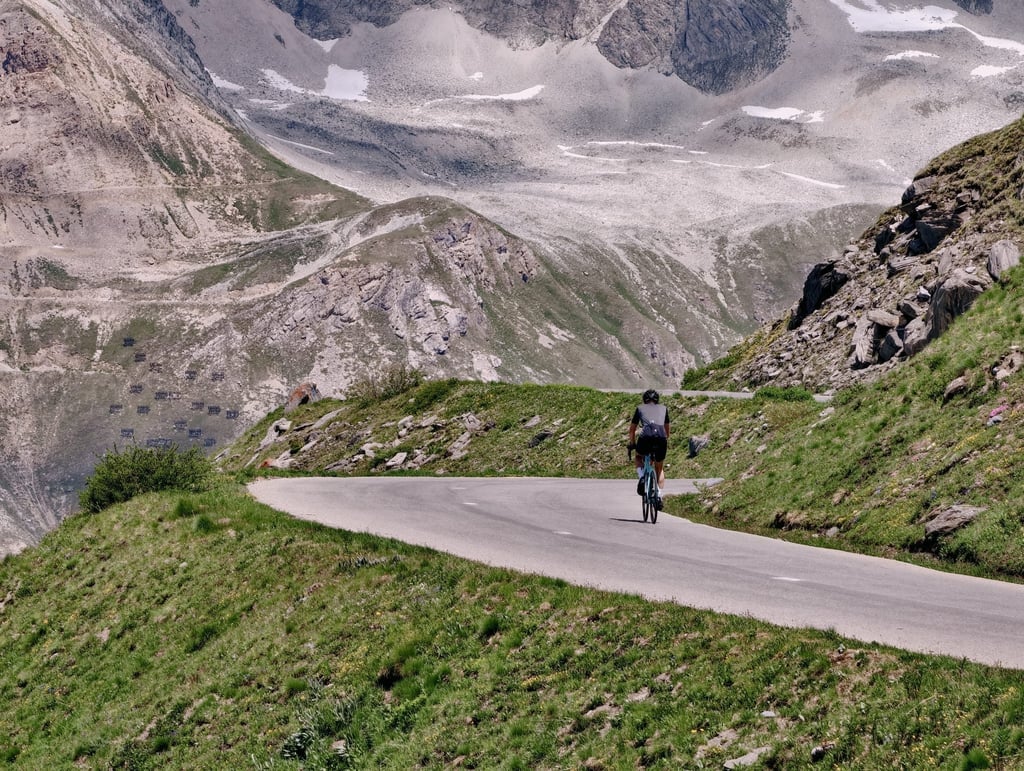
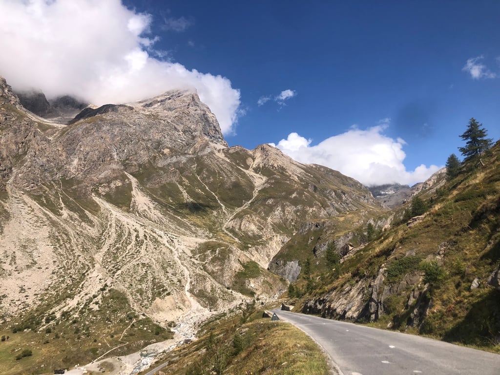
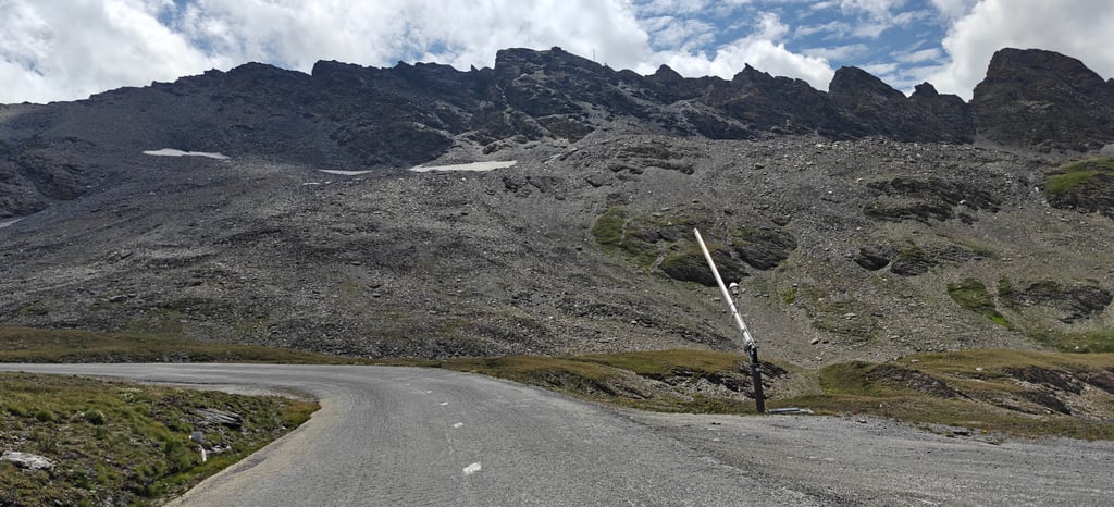
a long and iconic climb that is well worth tackling. After an initial small tear to enter Séez, the route continues for a few kilometres of ups and downs. The real climb begins at Sainte-Foy-Tarentaise, with a regular and rideable first section through the forest. You reach the dam with a few easier and flatter kilometres before resuming the climb from Val-d'Isère. From here the gradients become slightly more challenging, the vegetation disappears and you enter a wide and bare alpine landscape. The valley is exposed and the wind can make itself felt, especially in the final kilometres.
The asphalt, particularly in the final part, is quite rutted, but the spectacular views more than repay the effort. A climb that leaves its mark.
una salita lunga e iconica, che merita assolutamente di essere affrontata. Dopo un primo strappetto per entrare a Séez, si prosegue per alcuni chilometri di saliscendi. La salita vera e propria inizia a Sainte-Foy-Tarentaise, con un primo tratto regolare e pedalabile immerso nel bosco. Si raggiunge la diga con qualche chilometro più facile e pianeggiante, prima di riprendere a salire da Val-d’Isère. Da qui le pendenze si fanno leggermente più impegnative, la vegetazione scompare e si entra in un paesaggio alpino ampio e spoglio. La vallata è esposta e il vento può farsi sentire, soprattutto negli ultimi chilometri.
L’asfalto, in particolare nella parte finale, è abbastanza rovinato, ma i panorami spettacolari ripagano ampiamente la fatica. Una salita che lascia il segno.
To be done out of season. Very long but not difficult. Not as pretty as the other side.
A faire hors saison. Très long mais pas difficile. Moins joli que l'autre versant.
A very long climb from BSM, beginning with a lot of traffic, not very pretty, then as soon as the first hairpin bends, the scenery improves. The dam, the tunnels (take a torch), Val d'Isère and then the final, steeper 16km section to finish very, very high up.
A fine descent towards Bonneval, but watch out for marmots.
Très longue ascension depuis BSM, début avec beaucoup de circulation pas très joli puis dès les premiers lacets le paysage s'améliore. Le barrage, les tunnels (prenez une lampe), Val d'Isère puis la dernière partie de 16km plus pentue pour terminer très très haut.
Belle descente du côté de Bonneval, attention aux marmottes
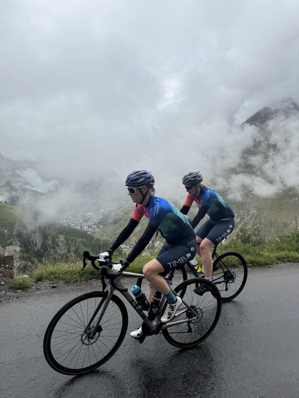
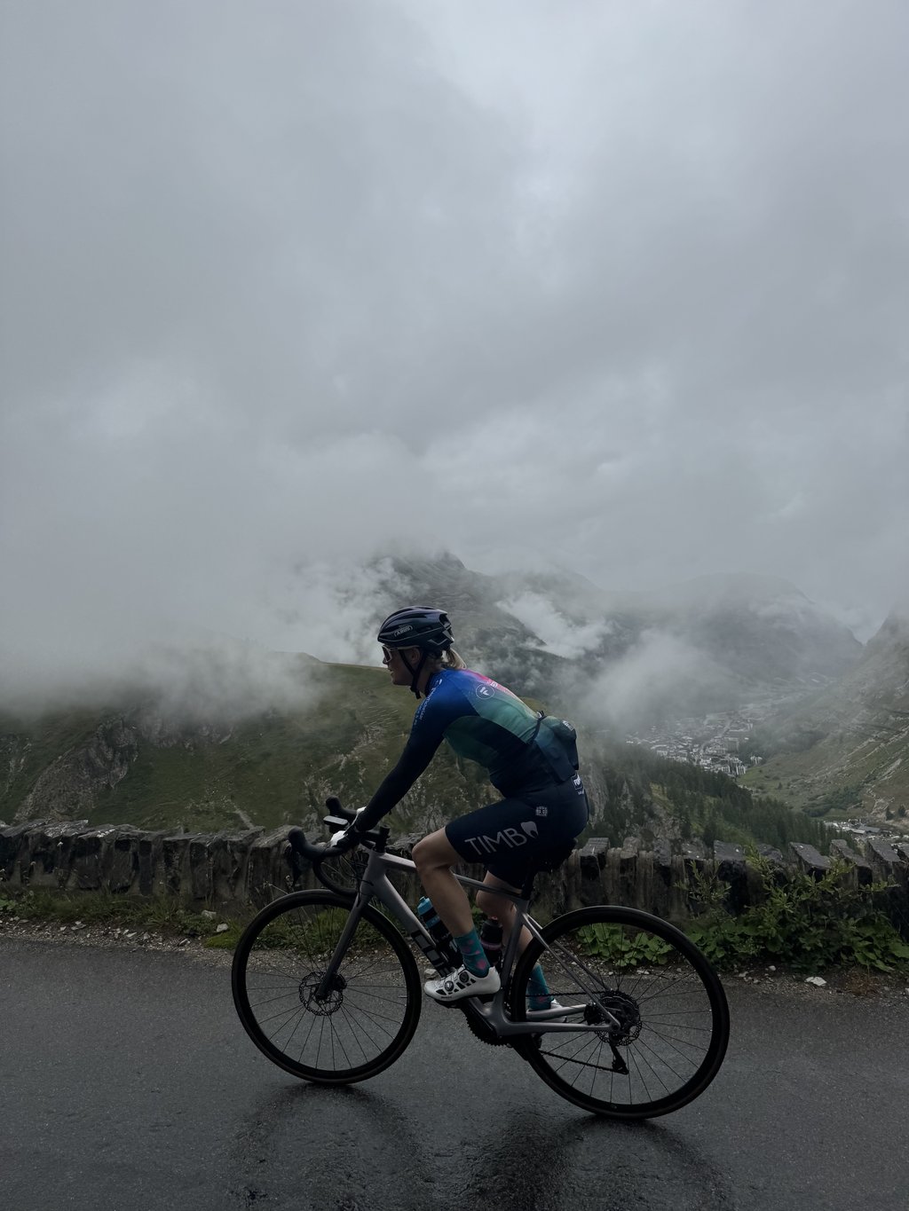
Beautiful climb despite the bad weather and low hanging clouds this was still a beautiful climb. Both gradient and underground there are good and will definitely return one to ride it again with nice weather
Prachtige beklimming ondanks het slechte weer en de laaghangende bewolking was dit nog steeds een prachtige beklimming. Zowel stijgingspercentage als onder grond zijn er goed en komen zeker een terug om met met mooi weer het nog eens te rijden
An extremely long but superb climb and a magnificent view from the summit!
Montée extrêmement longue mais superbe et vue magnifique au sommet !
Done at the beginning of September on a weekday, the traffic from Bourg St Maurice to Val d'Isère was heavy and stressful. The views of Lac de Tignes in the sunshine are worth a photo stop! But once you've passed this obligatory section and after Val d'Isère (coffee stop!), it's the great solitudes all the way to the summit.
Apart from the ski facilities, the landscape is wild and the magnificent, long, hard climb is a must for cyclists! The descent to Val-Cenis is just as spectacular!
Effectuée début septembre un jour de semaine, la circulation depuis Bourg St Maurice jusqu'à Val d'Isère était importante et stressante. Les vues sur le lac de Tignes sous le soleil valent un arrêt photo ! Mais une fois ce tronçon obligatoire passé et après Val d 'Isère (arrêt café !), c'est les grandes solitudes jusqu'au sommet.
Mis à part les installations de ski, le paysage est sauvage et la montée magnifique, longue, dure est un must cycliste !. La descente sur Val-Cenis est aussi spectaculaire !
I didn't find the traffic any more disturbing than that between Bourg St Maurice and Tignes, in any case I didn't feel in any danger. And the scenery is magnificent. On the other hand, between Tignes and Val d'Isère the state of the road is scary and the tunnels are downright dangerous, but once you reach Val d'Isère it's superb and although there is traffic it's really worth it, do it!!!!
Je n'ai pas trouvé la circulation plus dérangeante que ça entre Bourg St Maurice et Tignes, en tout cas je ne me suis pas sentie en danger. Et le paysage est magnifique. Par contre entre Tignes et Val d'Isère l'état de la chaussée fait peur et les tunnels sont franchement dangereux, mais une fois Val d'Isère atteint c'est superbe et bien qu'il y ait de la circulation ça vaut vraiment vraiment le coup, faites le !!!
I am doing this famous ascent today for the first time, starting from Seez. First kilometres downhill (light ascent then on the way back), then there is a first stretch of about 19km that is quite hard in the shade and therefore almost cold and with some traffic, especially heavy traffic. For the first few kilometres you breathe in a lot of smog. Then the two tunnels are quite long but illuminated (I still recommend a good rear light). The spectacle arrives almost as soon as you reach the village of val d' Isere. From here, the scenery becomes spectacular and the second 15km climb to the summit begins. Some criticism may be fair in the traffic and tunnels, but the positives are far more numerous. The route has a low average gradient for the initial section and some downhill sections. At least 34km, however, is pure ascent. Highly recommended
Faccio oggi per la prima volta questa famosa Salita partendo da Seez. Primi km in discesa (Salita leggera poi nel ritorno), poi c'è un primo tratto di circa 19km abbastanza duri in un tratto in ombra quindi quasi freddo e con un certo traffico soprattutto pesante. Per i primi km si respira tanto smog. Poi le due gallerie abbastanza lunghe ma illuminate (consiglio comunque una buona luce posteriore). Lo spettacolo arriva quasi si arriva al paese di val d' Isere. Da qui il paesaggio diventa spettacolare e parte la seconda salita di 15km che conduce in vetta. Qualche critica può essere giusta nel traffico e nelle gallerie ma gli aspetti positivi sono molto più numerosi. Percorso con pendenza media bassa per il tratto iniziale e alcuni tratti in discesa. Almeno 34km però sono pura Salita. Molto consigliata
We did this climb from Val D’Isere having driven up from BSM. The pass was “Ferme” closed 300m after the Col. so no through traffic, a little traffic up to the glacier for skiing. Bumped into Primoz Roglic, Bob Jungels, and some of the Visma Lease-a-bike guys. All so friendly. Awesome!
Top 10 highest cols bucket list.
Unfortunately, the route from Bourg-Saint-Maurice is very crowded and dangerous.
But a very easy and beautiful climb.
Top 10 hoogste cols bucketlist.
Helaas is de route vanuit Bourg-Saint-Maurice heel erg druk en gevaarlijk.
Maar een hele makkelijke en mooie klim.
Fantastic climb both from Val d'Isère and Borneval sur Arc. Beautiful views and pleasant gradient (from Val d'Isère very doable, Borneval is already a bit more work, especially towards the top). On the advice of locals, I also started from Val d'Isère and can confirm that the first part contains heavy traffic (with many trucks) and moderately lit tunnels.
Fantastisch beklimming zowel vanuit Val d'Isère als vanuit Borneval sur Arc. Prachtige uitzichten en aangename hellingsgraad (vanuit Val d'Isère zeer goed doenbaar, Borneval is al iets meer werken, zeker naar de top toe). Op aanraden van de locals ben ik ook gestart vanuit Val d'Isère en kan ik bevestigen dat het eerste deel druk verkeer (met veel vrachtwagens) en matig verlichte tunnels bevat.
IN-CRO-YA-BLE! There aren't enough superlatives to describe this legendary pass. A magnificent climb, splendid scenery and breathtaking flora and fauna.
Even if it's not one of the best climbs to Tignes, from Val d'Isère it's the perfect climb.
IN-CRO-YA-BLE ! Il n'y a pas assez de superlatif pour qualifier ce col de légende. Une ascension magnifique, des paysages splendide, une faune et une flore à couper le souffle.
Même si l'ascension n'est pas parmi les meilleures jusqu'à Tignes, à partir deVal d'Isère, c'est l'ascension parfaite.
We drove on a Sunday. Left early (8.30am, coming from Aime, parked near stations of Bourg s. M. And mountain train (av. Arc en Ciel). First took the bike path that runs mainly on the right side of the Isēre and is quite hilly but has very nice tarmac and few oncoming traffic. Then the road leading to Villarogier and then with a descent and ascent of 1 km each. At Le Villard turn onto the road proper. With that, cycled 11 km in peace. Up to the dam good road surface with 2 km 8-10%> Recover about 5 km 'flat' to Val d 'Isēre. Section with galleries and tunnels quite lit. Rear light 'must. Front light recommended. After the village part 2 with very long stretches at the beginning before each hairpin. Last km. Smile at the photographer! Descent with policy (make sure cars've passed that gives overview and does not necessitate taming and enjoy over the main road in the afternoon with more oncoming traffic than descending traffic.
Wij hebben op een zondag gereden. Vroeg vertrokken vroeg (8.30 uur, komende vanuit Aime, geparkeerd nabij stations van Bourg s. M. En bergtrein (av. Arc en Ciel). Eerst het fietspad genomen dat hoofdzakelijk ter rechterzijde van de Isēre loopt en behoorlijk geaccidenteerd is maar zeer mooi asfalt en weinig tegenliggers heeft. Dan de weg die naar Villarogier loopt en vervolgens met een afdaling en stijging van elk 1 km. Bij Le Villard de eigenlijke weg opdraaien. Daarmee 11 km in alle rust gefietst. Tot de dam goed wegdek met tegen het einde 2 km 8-10%> Herstellen circa 5 km 'vlak' tot Val d 'Isēre. Stuk met galerijen en tunnels behoorlijk verlicht. Achterlicht 'must. Voorlicht aan te bevelen. Na het dorp deel 2 met in het begin hele lange stukken vóór elke haarspeldbocht. Laatste km. Lachen naar de fotograaf! Afdaling met beleid (zorg dat auto's gepasseerd zijn dat geeft overzicht en noopt niet tot remmen) en genieten over de hoofdweg in de namiddag met meer opkomend verkeer dan afdalende verkeer.
A climb in 2 parts the first part up to the lac de tignes is more false flat than climbing but very busy with traffic but once you pass the tunnels to val d'isere it's pure enjoyment of the views but the gradients do increase from here it's 16 km of real climbing to the top with the steepest km being the last
Een klim in 2 delen het eerste deel tot aan het lac de tignes is het meer vals plat dan klimmen maar wel heel druk met verkeer maar een keer je de tunnels naar val d’isere voorbij bent is het puur genieten van de uitzichten maar nemen de stijgingspercentages wel toe vanaf hier is het nog 16 km echt klimmen tot de top met de steilste km als laatste
Pleasant cycling, it's not the percentages...but the length. After an hour of climbing, the sign "Col de l'Iséran 35 km" chops away. You cycle on a very busy road, through ugly villages. Only after Val-d'Isère do the views get really nice.
Prettig te fietsen, aan de percentages ligt het niet…maar de lengte. Na een uurtje klimmen het bord “Col de l’Iséran 35 km”, dat hakt erin. Je fietst over een erg drukke weg, door lelijke dorpen. Pas na Val-d’Isère wordt het uitzicht echt mooi.
Because for me cycling up a mountain should remain sporty enjoyment and I don't want to sit on my bike with mortal contempt, I left in Val d'Isère (September 2022).
The days before by car I could see for myself how cars's, motorbikes's, buses, tractors and heavy goods traffic (with trailers) and also BIKEERS all together on a hilly road (tunnels/hairpin bends/traffic inhibitors/roadworks/narrow village passages/bad asphalt.....) claim their place. Slowly climbing/descending freight traffic inhibits traffic circulation which resulted in irresponsible overtaking manoeuvres both uphill/downhill. Warning signs that cyclists are present is not going to protect them.
Coincidence or not. I found it much more significant that even the classic white and yellow cycling info kilometre markers only appear when leaving Val d'Isère.
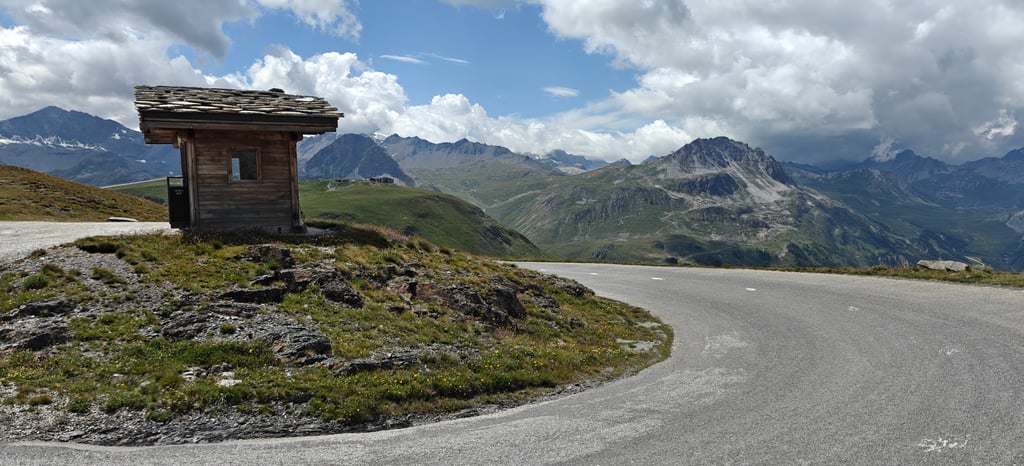
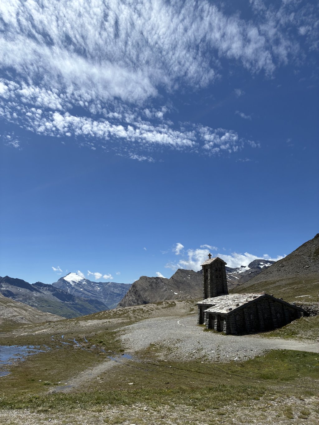
You start the 17km with almost straight route along the Isère river. After cycling over the Pont Saint Charles, you climb up the mountainside via hairpin bends, causing the popular winter sports resort to sink deeper. The panoramic high-mountain view is phenomenal but , unlike the other National Park climbing side, is marred by several ski infrastructure installations . Last slightly steeper stretch to the summit, despite the pleasant departure temperature, was cold and very windy. The last two kilometre markers had disappeared so I had the impression of not moving forward. Pass height is beautiful mountain scenery with parking,inn/shop (but was closed on 2/9) and the beautiful little highest church in the country.
Entire route is wide with fine tarmac. Tourist traffic was not too bad.
Beautiful climbing classic from the Tour de France is also worth cycling for the last part !!!
Omdat een berg opfietsen voor mij sportief genieten moet blijven en ik niet met doodsverachting op mijn fiets wil zitten vertrokken in Val d'Isère (september 2022).
De dagen ervoor met de wagen zelf kunnen vaststellen hoe auto's, moto's, bussen, tractors en zwaar vrachtverkeer (met opleggers) en ook FIETSERS allen te samen op een geaccidenteerde weg (tunnels/haarspeldbochten/verkeersremmers/wegenwerken/smalle dorpsdoorgangen/slecht asfalt.....) hun plaats opeisen. Traag klimmend/dalend vrachtverkeer remt de verkeerscirculatie waardoor er zowel bergop/af onverantwoorde inhaal maneuvers werden uitgevoerd. Waarschuwingsborden dat er fietsers aanwezig zijn gaat ze niet beschermen.
Toeval of niet. Ik vond het veel betekenend dat zelfs de klassieke wit gele fietsinfo kilometerpaaltjes pas opduiken bij het verlaten van Val d'Isère.
Je start de 17 km met nagenoeg rechte route langs de Isère rivier. Na het over fietsen van de Pont Saint Charles klim je via haarspeldbochten de bergflank op waardoor het populaire wintersportoord dieper wegzinkt. Het panoramisch hooggebergte uitzicht is fenomenaal maar wordt ,in tegenstelling tot de andere Nationaal Park klimzijde, ontsiert door verschillende ski infrastructuur installaties . Laatste iets steilere stuk tot de top was, ondanks de aangename vertrektemperatuur, koud en heel winderig. De laatste twee kilometerpaaltjes waren verdwenen zodat ik de indruk had niet vooruit te komen. Pashoogte is prachtig bergdecor met parking,herberg/winkel (maar was wel gesloten op 2/9) en het prachtig klein hoogstgelegen kerkje van het land.
Ganse route is breed met prima asfalt. Toeristisch verkeer viel best mee.
Prachtige klimklassieker uit de Tour de France is ook voor het laatste deel de fiets moeite waard !!!
Very nice climb. At least, from Val d'Isere. The first part between Bourg Saint Maurice and Val d'Isere is a very busy road with a lot of freight. I did not feel at ease on this road and was glad that I had good (flashing) lights with me. From Val d'Isere, this climb is downright beautiful! At the top is a mountain hut where you can eat and drink something. Do it!
Hele mooie beklimming. Althans, vanaf Val d'Isere. Het eerste stuk tussen Bourg Saint Maurice en Val d'Isere is een zeer drukke weg met veel vrachtverkeer. Ik voelde me op deze weg niet op mijn gemak en was blij dat ik goede (knipper) verlichting bij me had. Vanaf Val d'Isere is deze beklimming ronduit schitterend! Bovenop is een berghut waar je iets kunt eten en drinken. Doen!
The climb that was at the top of my bucket list for years is no longer on that list since 9 August 2022. I rode the complete version from Bourg Saint Maurice. Until the dam of Tignes, you have to deal with a lot of traffic. It did not bother me a bit because I was obviously very focused on the fact that a dream came true. Never very steep and especially very long. Beautiful pictures at the lake and when you leave Val-d'Isère behind you, cross the Isère and go up via some hairpin bends. You will reach the top with a great feeling. A climb in the category "very impressive".
De klim die jaren m'n bucketlist aanvoerde staat sinds 9 augustus 2022 niet meer op dat lijstje. Ik heb de volledige versie vanuit Bourg Saint Maurice gereden. Tot de stuwdam van Tignes krijg je te maken met veel verkeer. Het heeft me geen moment gedeerd omdat ik blijkbaar heel erg gefocust was op het feit dat een droom werkelijkheid werd. Nooit heel erg steil en vooral heel erg lang. Prachtige plaatjes bij het stuwmeer en als jeVal-d'Isère achter je laat, de Isère oversteekt en via enkele haarspeldbochten de hoogte in gaat. Met een heerlijk gevoel de top bereikt. Een beklimming in de categorie "zeer indrukwekkend".
Small climb from Val Cenis, the return journey is close to 70 km, small snack with the collet de la Madeleine (small col of 3rd category) then direction Bonneval sur Arc, superb mountain village, we are at 1800 m and we really start the climb of 12 km, pleasant climb, I expected much harder but keep a little under the sole because the last 2 km are steep and wind in the mouth.
The last 2 km are steep and windy, always nice afterwards to debrief with the cyclists at the top, for the anecdote a cyclist did not stop to complain about the bikes, it made me laugh, he was overtaken with a woman and her baby on the luggage rack
Petite montée depuis Val cenis ,l'aller retour frôle les 70 bornes ,petit encas avec le collet de la Madeleine (petit col de 3 ème catégorie) puis ensuite direction bonneval sur arc ,superbe village de montagne ,nous sommes à 1800 m et nous démarrons vraiment l'ascension de 12 km , montée agréable ,je m'attendais à beaucoup plus dure par contre gardez en un peu sous la semelle car les 2 derniers kms sont pentus et vent dans la gueule .
Toujours sympa après de débriefer avec les cyclistes en haut ,pour l'anecdote un cycliste n'arrêtait pas de pester contre les vae ,ça me faisait rire ,il s'était fait doubler avec une femme et son bébé sur le porte bagage
16 June 2022 from Val d'Iser, initially wanted to climb it from Bourg St. Maurice, but after the necessary research, decided to skip this route.
And on second thought, it was a good thing, because I found it a dangerous road. Lots of (big) traffic at high speed, bad road surface, fairly narrow tunnels, in other words a no go for me when cycling alone.
But then the climb, comparable with a Galibier or Gavia.
You start with a long road out of the ski resort and this is already tough in some parts, but the climb really starts when you cross the Isère and the hairpin bends appear.
Magnificent views of the mountains around you, but also of the valley where you come from.
Nowhere really killing, at most a few tough passages but you don't have to go in the red here.
Currently, they have renewed entire strips 2 km before the top.
If you cycle uphill this is no problem, downhill you really have to watch out that you don't fall down, hopefully the gravel has been broken in quickly by the vehicles.
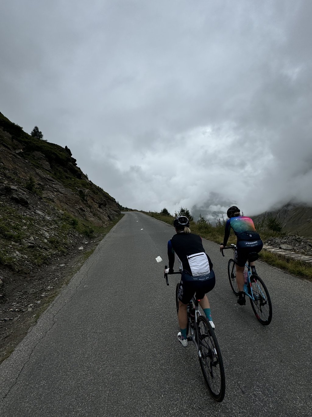
At the top, there was a strong wind, felt more like a storm, but could not spoil the fun.
As far as traffic was concerned, I didn't find it too bad, the only thing I did move aside for was the Jumbo Visma team who came crashing down at breakneck speed.
All in all, a beautiful climb despite the fact that I only did the last 17 km.
16 juni 2022 opgefietst vanuit Val d'Iser, wilde hem in eerste instantie beklimmen vanuit Bourg St. Maurice maar na het nodige naslagwerk, er ook maar voor gekozen om dit traject over te slaan.
En bij nader inzien maar goed ook, want ik vond het maar een gevaarlijke weg. Veel (groot)verkeer met flinke snelheid, slecht wegdek, redelijk smalle tunnels, oftwel voor mij een no go als je alleen fietst.
Maar dan de klim, vergelijkbaar met een Galibier of Gavia.
Je begint met een lange weg het skioord uit en deze is op sommige stukken al pittig, maar de klim begint pas echt als je de Isère oversteekt en de haardspeldbochten zich aandienen.
Schitterende uitzichten van de bergen om je heen, maar ook het dal waar je vandaan komt.
Nergens echt killing, hooguit enkele pittige passages maar je hoeft hier nergens in het rood te gaan.
Momenteel hebben ze 2 km voor de top hele stroken vernieuwd tot aan de top.
Fiets je bergop dan is dit geen probleem, bergaf moet je echt uitkijken dat je niet onderuit gaat, hopelijk is de gravel snel ingereden door de voertuigen.
Bovenop de top stond een straf windje, voelde meer als een storm, maar mocht de pret niet drukken.
Wat verkeer betreft vond ik het reuze meevallen, de enige waar ik voor aan de kant ben gegaan was de Jumbo Visma ploeg die met een rotvaart naar beneden kwamen geknald.
Al met al een prachtige klim ondanks dat ik "maar" de laatste 17km gedaan heb.
Beautiful climb which I have done from Val D'Isere. The intention was to depart from Bourg Saint Maurice, but was discouraged because of the busy traffic and the many unlit tunnels. So unfortunately not the full climb done for my feeling to the top of the highest climb in Europe.
Next time but still try. But also from Val D'Isere worth it.
Mooie klim die ik vanuit Val D'Isere heb gedaan. De bedoeling was vanuit Bourg Saint Maurice te vertrekken, maar werd afgeraden vanwege het drukke verkeer en de vele onverlichte tunnels. Dus helaas niet de volledige klim gedaan voor mijn gevoel naar de top van de hoogste klim van Europa.
Volgende keer maar toch eens proberen. Maar ook vanuit Val D'Isere de moeite waard.
1991 done as part of our cycling tour from Geneva to Nice and back from the "white booklet". Done from the north side. Beautiful but
especially long. There was still snow on the top. I think you can not miss this climb. If only for the cool and tight running descent
1991 gedaan als onderdeel van onze fietstocht van Genève naar Nice en terug uit het “ witte boekje” . Gedaan vanaf de noordzijde. Mooi wel maar
vooral lang. Er lag nog sneeuw op de top . Ik vind dat je deze klim niet mag missen. Al was het alleen al om de gave en strak lopende afdaling
At the end of June I went to Val d' Isere for the double summit (other side down to Bonneval). You start in a beautiful valley with a long road then you with some bends along the mountain goes up with ultimately beautiful view of Val. Last kilometers are more like a rugged plateau where the natural beauty and whistling marmots carry you to the top. If there is a downside then it is the many ski lifts on this side ... beautiful climb and never really difficult. Remains special above the tree line to see the landscape change
Eind juni opgestapt in Val d' Isere voor de dubbele top(andere zijde afdalen tot Bonneval). Je begint in een prachtig dal met een lange weg waarna je met aantal bochten langs de berg omhoog gaat met uiteindelijk prachtig zicht op Val. Laatste kilometers hebben meer weg van een ruige hoogvlakte waar het natuurschoon en de fluitende marmotten je naar de top dragen. Als er al een minpuntje is dan zijn het de vele skiliften aan deze zijde... prachtige klim en nooit echt moeilijk. Blijft bijzonder boven de boomgrens het landschap te zien veranderen
Typical high mountain climb. The beginning piece to val d'Isere is sometimes busy but part of the experience. After the ski village it becomes very quiet. The hairpin bends follow each other rapidly. The view to your right is great. On the top is also the middle of summer very cold. Arm pads and if it is cloudy a rain jacket is advisable. The food at the top is limited. There is a terrace, but in your short outfit it is too cold to sit there. A better alternative is to descend to Val d'Isere, and then eat something there. Here you sit just on the 1800m, so you do not sit in the oppressive heat of the valley. Once you start the second part of the descent feel the heat of the valley like a hairdryer blowing on your face and can all daaljacks and other attributes off.
Typische hooggebergte klim. Het begin stuk naar val d'Isere is soms druk maar wel onderdeel van de ervaring. Na het skidorp word het heel rustig. De haarspeldbochten volgen elkaar rap op. Het uitzicht rechts van je is geweldig. Op de top is het ook hartje zomer hartstikke koud. Armstukken mee en als het bewolkt is een regenjack is aan te raden. Het eten op de top is beperkt. Er is wel een terras, maar in je kort kort outfit is het daar te koud om te gaan zitten. Een beter alternatief is om naar Val d'Isere af te dalen, en dan daar wat te eten. Hier zit je nog net op de 1800m, waardoor je nog niet in de drukkende hitte van het dal zit. Zodra je aan het 2e gedeelte van de afdaling begint voel je de warmte van het dal als een fohn op je gezicht blazen en kunnen alle daaljacks en andere attributen uit.
very heavy Col if you start from Modane, from here it is just 56km up to the top but once you've reached the top you feel a real kick ;)
zeer zware Col als je vanuit Modane vertrekt , van hier uit is het gewoon 56km omhoog tot de top maar eens je deze bereikt hebt voel je een ware kick ;)
If you start the climb from Saint-Jean-de-Mauriennne you have a nice sporting challenge. You drive almost constantly uphill and the landscape is exceptionally beautiful. On top of the col, it can be very windy and therefore cold. Although in a limited amount is often snow in the summer months. The plateau on the photo is in reality wonderfully beautiful.
Als je de beklimming start vanuit Saint-Jean-de-Mauriennne dan heb je een mooie sportieve uitdaging. Je rijdt bijna constant bergop en het landschap is buitengewoon mooi. Bovenop de col kan het wel erg winderig zijn en bijgevolg koud. Alhoewel in een beperkte hoeveel ligt ook vaak nog sneeuw in de zomermaanden. Het plateau op de foto is in werkelijkheid wonderbaarlijk mooi.
Superb pass. Especially the part towards the other side. By the way, you can also start there for a nice walk in the direction of Refugio de Carro ! Breathtaking pictures
Supergave pas. Met name het tussenstuk richting de andere kant. Overigens kan je daar ook starten voor een mooie wandeling richting Refugio de Carro ! Adembenemdende plaatjes
At the end of August I cycled this col from Bourg-Saint-Maurice. Until Val d'Isere very much traffic, including trucks that do not all think about you. Remember the (long!) tunnels, where the road surface is sometimes dramatically bad. Good lighting front and rear NECESSARY!
After Val d'Isere the col really starts. 13km climb to the top. Great road surface and beautiful views. From there on no more trucks and a lot quieter on the road. The road does not get really steep anywhere, the length of the climb in total is what makes this col difficult.
Eind augustus deze col vanuit Bourg-Saint-Maurice gefietst. Tot en met Val d'Isere erg veel verkeer, inclusief vrachtwagens die niet allemaal evengoed om jou denken. Denk aan de (lange!) tunnels, waarin het wegdek soms dramatisch slecht is. Goede verlichting voor én achter NOODZAKELIJK!
Na Val d'Isere begint de col pas echt. 13km klimmen naar de top. Heerlijk wegdek en prachtig uitzicht. Vanaf daar ook geen vrachtverkeer meer en een stuk rustiger op de weg. De weg wordt nergens echt steil, de lengte van de klim in totaal is wat deze col lastig maakt.
We were here in early June, a period in which it can happen that the highest col of France is still closed because of snow, but ... That did not stop us. Just past Val d'Isere, we were stopped by someone at a barrier, but stubborn as we were, we drove on. A choice that gave us an amazing climb: a road free of traffic, in the sun and as we came closer to the top, we got the cooling of the famous snow walls that are often still there in this part of the season. Beautiful pictures and a breathtaking experience. And the climb? Yes, more than 45 kilometers long with varying gradients. Just sit back, relax and enjoy the show! Received at the top by a group of enthusiastic school children and seen numerous marmots in the descent. Truly an epic experience.
We waren hier begin juni, een periode waarin het kan gebeuren dat de hoogste col van Frankrijk nog gesloten is vanwege sneeuw, maar... dat liet ons niet tegenhouden. Net voorbij Val d'Isere werden we door iemand tegengehouden bij een slagboom, maar eigenwijs als we waren zijn we toch doorgereden. Een keuze die ons een waanzinnige klim opleverde: een weg vrij van verkeer, in de zon en naarmate we dichter bij de top kwamen, kregen we de verkoeling van de bekende snow walls die er in dit deel van het seizoen vaak nog zijn. Schitterende plaatjes en een adembenemende ervaring. En de klim? Ja, ruim 45 kilometer lang met wisselende stijgingspercentages. Just sit back, relax and enjoy the show! Op de top ontvangen door een groep enthousiaste schoolkinderen en talloze marmotten gezien in de afdaling. Werkelijke een epische ervaring.
Highly recommended to cycle this one! What a beautiful trip. I found the road surface and traffic on the day we cycled (30-8) not too bad and also the motorists drive properly and overtake well. It's mainly the length and the feeling that you cycle two cols (because of the 10 km 'flat' in between) that makes it hard, but the last 15 km (from Val d'Isere) are the best I've cycled. Also the view of the reservoir and Tignes is a very nice part (km 24).
Een grote aanrader om deze te fietsen! Wat een prachtige tocht. Ik vond het wegdek en verkeer op de dag dat wij fietsten meevallen (30-8) en ook de automobilisten behoorlijk rijden en ruim inhalen. Het is met name de lengte en het gevoel dat je twee cols fietst (door de 10 km 'plat' ertussen) dat het zwaar maakt, maar de laatste 15 kilometer (vanaf Val d'Isere) zijn de mooiste die ik gefietst heb. Ook het uitzicht op het stuwmeer en Tignes is een erg mooi stuk (km 24).
Biked this ride yesterday! It is absolutely not a pleasant ride! Too much traffic and bad road surface Trucks and motorhomes that continue to race past. What is nice in the beginning the D84B road to take! That is a steep climb on a very quiet forest road with good asphalt! Ultimately, this road automatically back on the D902. Do not forget to enjoy the beautiful small waterfalls!
Gister deze rit gefietst! Het is absoluut geen prettige rit! Veel te veel verkeer en slecht wegdek Vrachtwagens en campers die maar voorbij blijven razen.. Wat wel leuk is om in het begin de D84B weg te nemen! Dat is een stijle klim op een zeer rustig bos weggetje met goed asfalt! Uiteindelijk komt deze weg vanzelf weer op de D902 uit. Vergeet niet te genieten van de mooie kleine watervalletjes!
From bonnval sur arc it is much more beautiful. The most beautiful climb I've ridden so far.
Vanuit bonnval sur arc is hij veel mooier. De mooiste klim die ik gereden heb tot nu toe
| 7 km/h | 06:46:35 |
| 11 km/h | 04:18:44 |
| 15 km/h | 03:09:44 |
| 19 km/h | 02:29:47 |
This page is better in the app