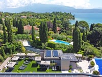
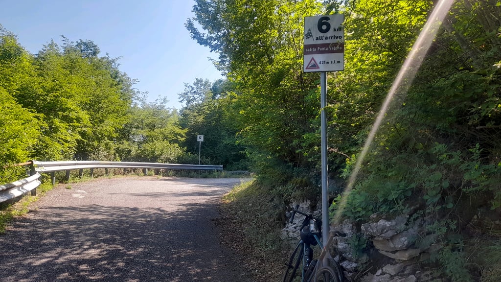
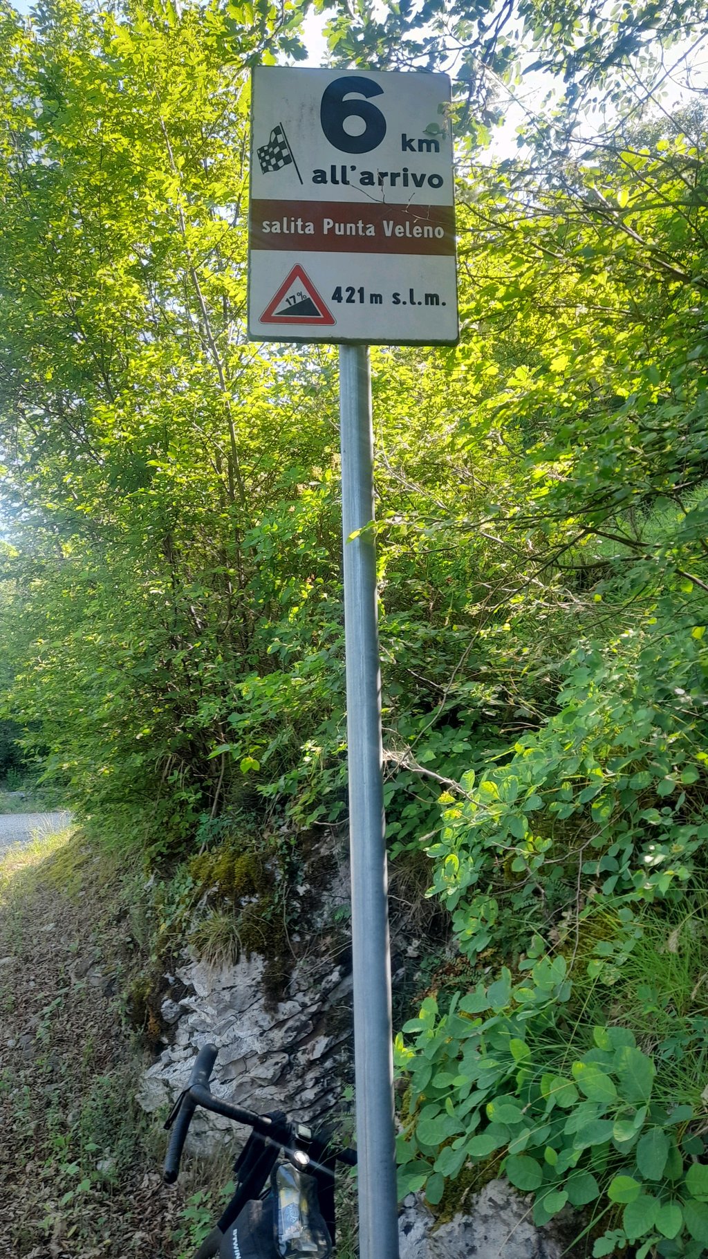
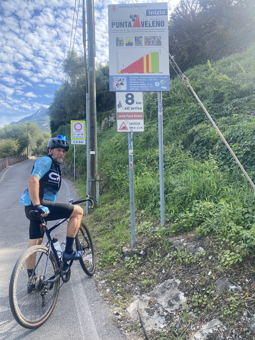
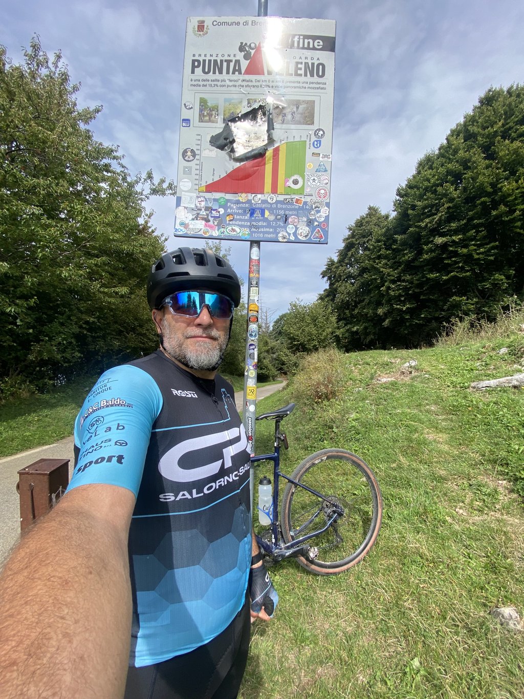
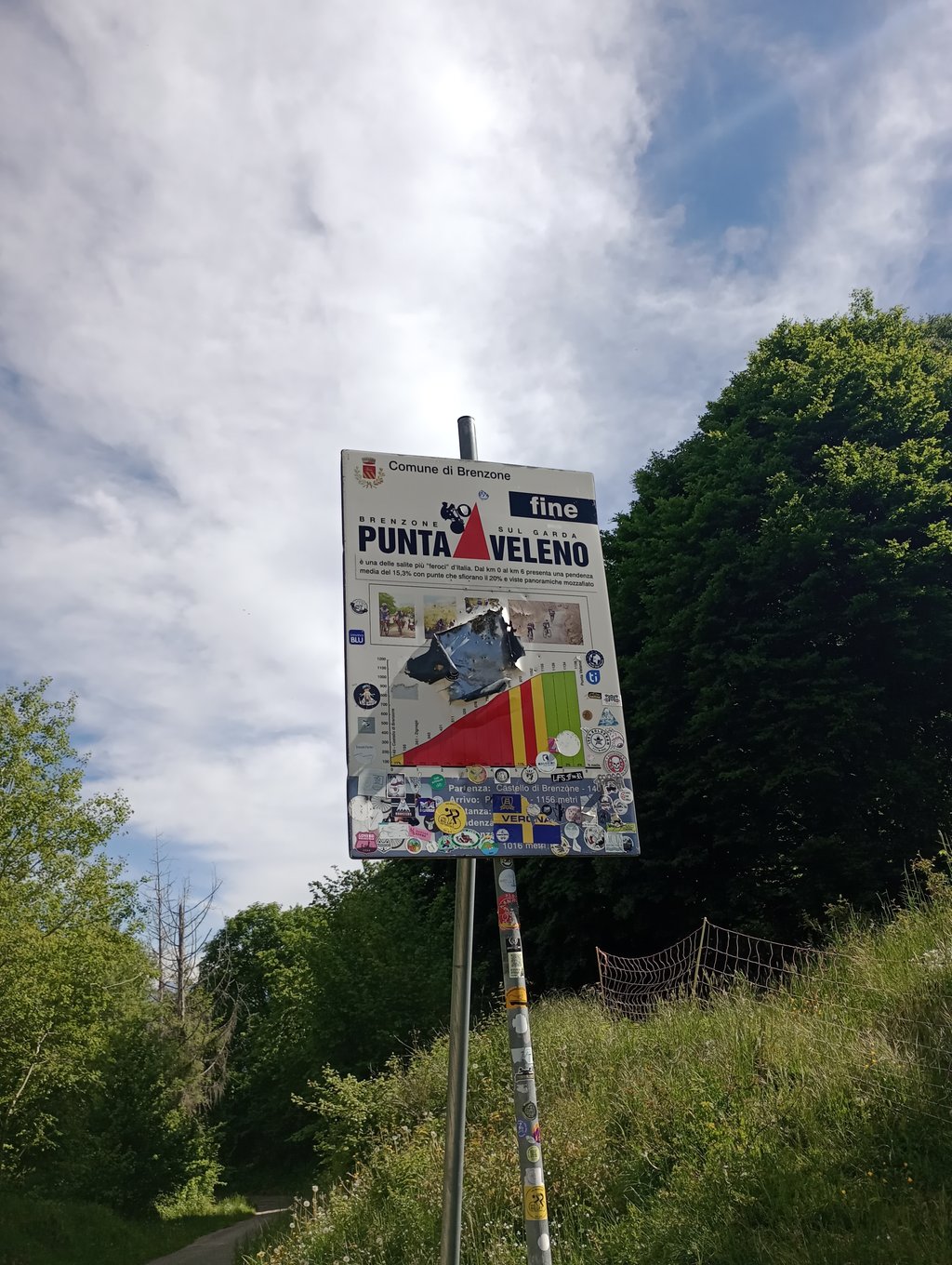
Punta Veleno is a climb in the region Verona. It is 4.9 mi long and bridges 3297 ft of vertical ascent with an average gradient of 12.7%, resulting in a difficulty score of 1541. The top of the ascent is located at 3724 ft above sea level. Climbfinder users shared 15 reviews of this climb and uploaded 25 photos.
Road name: Via del Sole
4.0 by Maglia_RosaThis is an automatic translation, the original language is: Dutch.What an incredibly tough climb! From Zignago, the climb is over 15% for 6km on average, with 4km of over 16% in between. The 17-19 sections are long and can be survived with a 10m break in the hairpins. Halfway there is a 1,3km stretch without any turns which seems endless. Once you have survived this stretch without getting off the bike, you should be able to reach the top, although it is still a long way. The next 2 km are very hard, but again contain several hairpin turns. Then you get a ... read more
Welcome! Please activate your account if you would like to share something. Look for the verification email in your inbox.
If you want to upload your photos, you need to create an account. It only takes 1 minute and it's completely free.
A test of character... Fortunately, most of the route is shaded. When the gradient drops to 15%, you get a chance to rest.
Próba charakteru... Na szczęście wiekszość drogi jest zacieniona. Gdy nachylenie spada do 15% odpoczywasz.
Done in 1 go 10 years ago, now 10 years later still 3 times just paws up and catch your breath.... What a beast! Almost as bad as the Beasts of Carinthia....
10 jaar geleden in 1 keer gedaan, nu 10 jaar later toch 3 keer even de pootjes op de grond en op adem komen.... Wat een beest! Bijna net zo erg als de Beesten van Karinthië....
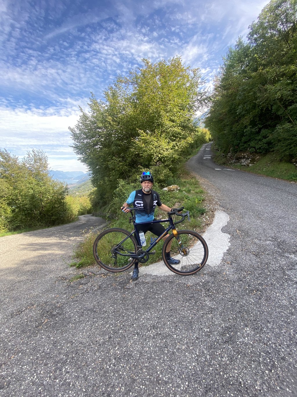
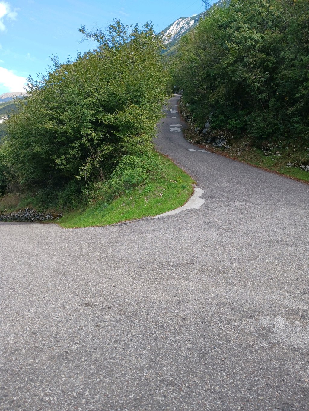
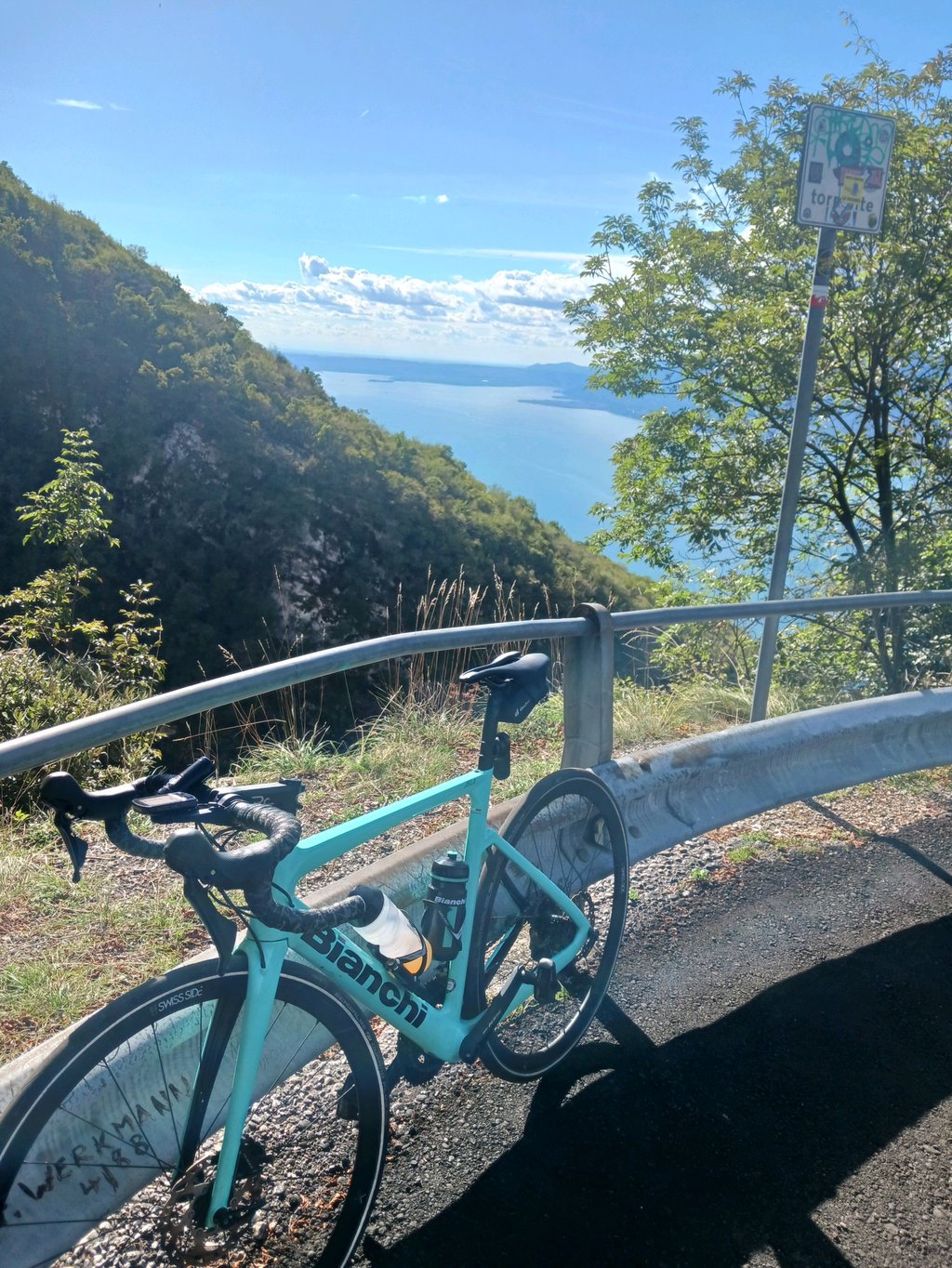
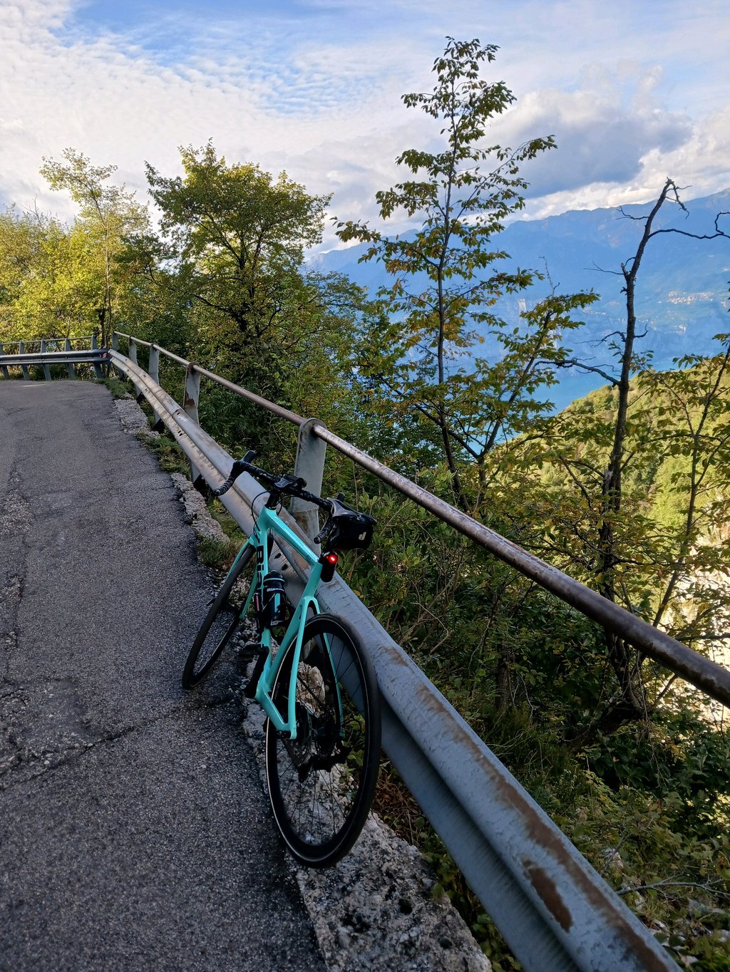
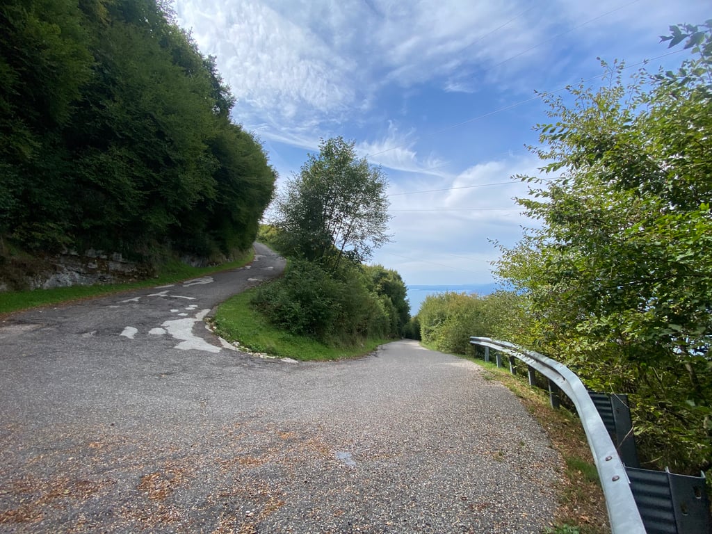
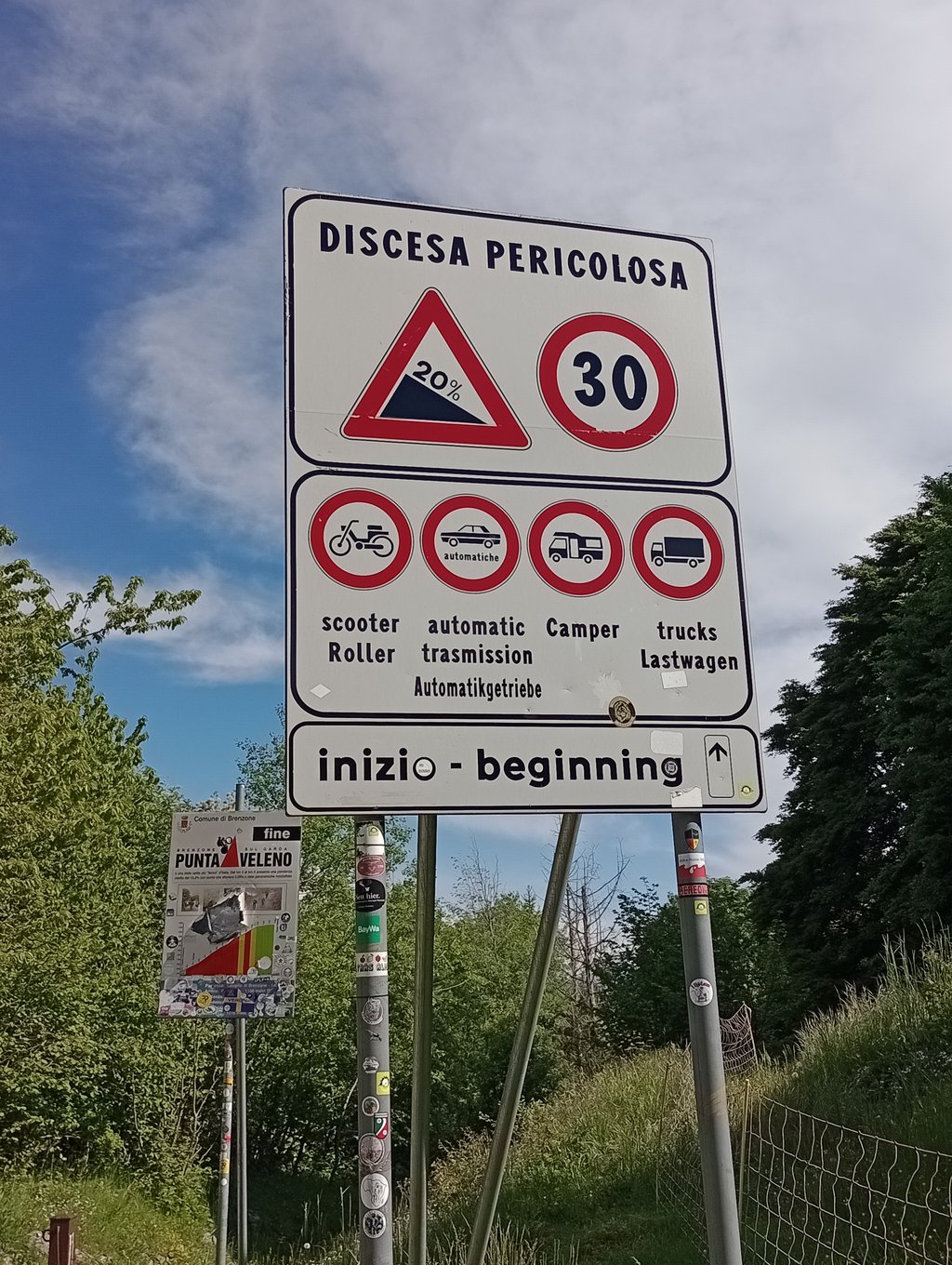
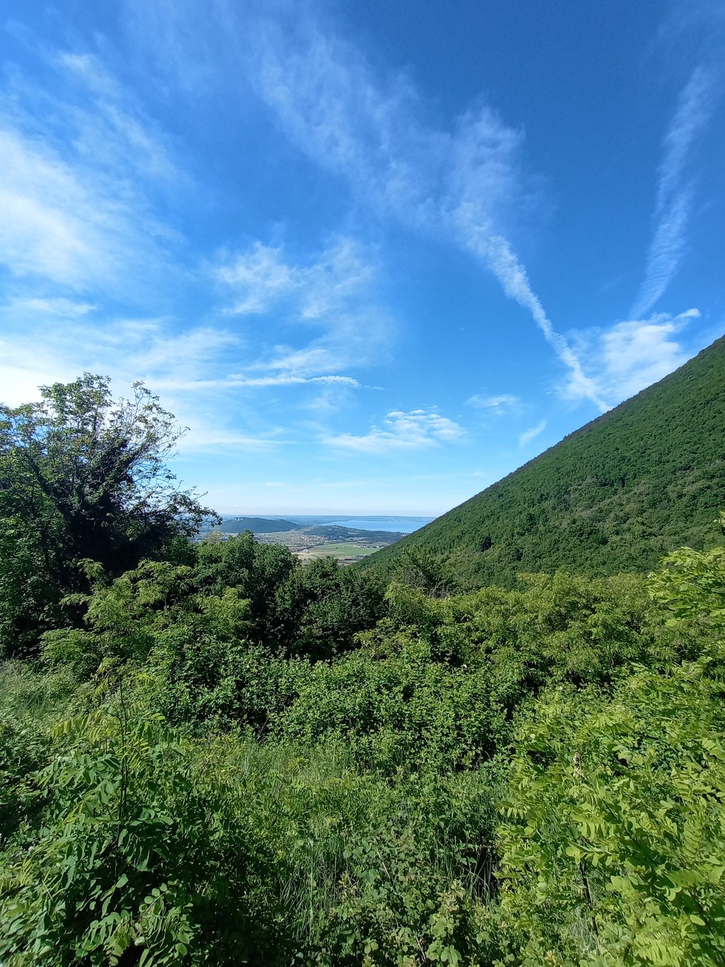
This climb is Dantesque! The gradient is unbearable, and you have to take advantage of the gentler switchbacks to stop and have a chance to get going again. The hardest part is this interminable straight without any break in the slope. You'll be on your own the whole way up, as the road is closed to cars. And don't forget the route you're planning: it's strictly forbidden to go down this road, even by bike! Although this climb is extremely demanding from a physical point of view, it's still enjoyable, with a picturesque road and a view of the lake as the reward at the top. At the top, even the signpost seems to have suffered: there's a hole in the middle 😅!
Cette ascension est dantesque ! La pente est insoutenable, il faut profiter des lacets moins pentus pour s’arrêter et avoir une chance de repartir. Le passage le plus dur est cette interminable ligne droite sans aucune rupture de pente. Vous serez seul pendant toute l’ascension car la route est interdite aux voitures. Attention également au parcours que vous prévoyez : il est strictement interdit de descendre cette route même en vélo ! Bien que cette montée soit extrêmement exigeante d’un point de vue physique, elle reste agréable à monter, avec une route pittoresques avec une vue sur le lac comme récompense au sommet. En haut, même le panneau semble avoir souffert : il est troué au milieu 😅!
Let me preface this by saying that I am a lover of climbs. I really missed this one. On the list of climbs I have done: Stentaria, Zoncolan, all the Grappa climbs, Tre Cime, etc. However, I must say that the central 4 km with an average of 17.1% are really tough. I think tougher even than the Zoncolan. The descent is also challenging because of the very bad asphalt and every so often there are cross-cuts in the road for water runoff with very deep ruts. You have to go very slowly and have good brakes, possibly check the pads beforehand. Traffic is supposed to be blocked but we found 1 van and 3 cars with German plates]: I strongly recommend staying to the left to avoid falling down the cliff.
Premetto che sono un amante delle salite. Questa proprio mi mancava. Nella lista delle salite fatte: Stentaria, Zoncolan, tuttele salite del Grappa, Tre Cime, ecc. Devo dire però che i 4 km centrali con media del 17,1% sono veramente tosti. Penso più dura anche dello Zoncolan. Impegnativa anche la discesa per l'asfalto molto brutto e ogni tanto ci sono dei tagli trasversali della strada per il deflusso acqua con solchi molto profondi. Bisogna andare molto piano ed avere ottimi freni, possibilmente controllare le pastiglie prima. Il traffico dovrebbe essere interdetto ma abbiamo trovato 1 furgone e 3 auto targate Germania]: consiglio vivamente di stare in sinistra per evitare di cadere giù per il dirupo.
Asphalt on the ascent ok. Steep, only flatter in the hairpin bends. But quiet and a challenge.
Asphalt im Aufstieg ok. Steil, nur in den Kehren flacher. Aber ruhig und eine Herausforderung.
Absolutely the hardest climb I've ever tackled, a real challenge firstly to stay on your feet because of the terrible state of the road surface and secondly the sudden wheelie of the bike. In short, a real pain for almost the entire route, you can breathe a little on the 19 hairpin bends, the only one but not to be underestimated is the splendid view (assuming you can see it) of Lake Garda.
In assoluto la salita più dura che abbia mai affrontato, una vera sfida in primis a rimanere in piedi visto il pessimo stato del manto stradale e per secondo il scontinuo impennarsi della bici insomma una vera sofferenza per quasi tutto il tragitto , si respira un po’ sui 19 tornanti unica ma non da sottovalutare uno splendido panorama (premesso che riusciate a vederlo ) sul lago di Garda INSOMMA UNA SPILLETTA CHE VALE LA PENA APPENDERE ALLA MAGLIA
What do you call this madness? A climb that cannot be improvised. I did it on a morning at the end of May. the climb was in the shade and to get to the start you take the lakeside until you cross the signs on the right. the attack of the climb is immediately aggressive and then never stops. The average gradient is bogus because it is soiled by the last two kilometres, which are much much more manageable. Before that it is an alternation between 12-25%! At one point the Garmin even gave 27. The surface conditions worsen enormously in the last two kilometres, however, when the gradients become much more manageable. done lightly in water, with less than 60kg of weight and with a 34 in the back. the fatigue was nevertheless significant. the descent from Prada was very beautiful and picturesque. absolutely must be done. I consider it less hard than the Zoncolan, much much worse than the Mortirolo
Come definire questa pazzia? una Salita non improvvisabile. L'ho fatta in una mattina di fine maggio. la salita era in ombra e per arrivare alla partenza fate il lungolago fino ad incrociare le indicazioni sulla destra. l'attacco della Salita è immediatamente aggressivo e poi non smette mai mai. la pendenza media è fasulla perché sporcata dagli ultimi due km che sono molto molto più abbordabili. prima è un alternarsi tra il 12-25%! a un tratto il Garmin dava anche il 27. per fortuna non c'è traffico e l'asfalto non è il massimo, spesso le ruote hanno slittato. rimane una Salita dispersa nel nulla quindi comprensibile. le condizioni del manto peggiorano enormemente negli ultimi due km quando però le pendenze diventano molto più abbordabili. fatta leggero di acqua , con meno di 60Kg di peso e con un 34 dietro. la fatica è stata comunque significativa. la discesa da Prada molto bella e pittoresca. da fare assolutamente. la reputo meno dura dello Zoncolan, molto molto peggio del Mortirolo
Great climb, done in June 2024, met no one climbing....
Travelled with gravel ratio 38/ 44, started at the lake, climbed for a hundred metres or so, then the real climb begins. The first 6.5 km are very hard, they never let up except for a few metres in the hairpin bends, good sections in the shade, which in summer is no bad thing. The last kilometre and a half flattens out, so the overall average goes down, the first 6.5 km averaging 17/18%. The real challenge is to tackle it on a bdc or gravel bike, on a mtb it is definitely more affordable.
Gran bella salita, più che altro per la sfida in se, l'ambiente è piacevole ma le energie sono tutte per affrontare la salita, non avrete modo di guardarvi attorno godendo del panorama, lo farete scendendo verso Prada.
Effettuata a giugno 2024, non ho incontrato nessuno che saliva...solo ebike in discesa.
Percorsa con gravel rapporto 38/ 44, partito dal lago, si sale per un centinaio di metri di dislivello e poi inizia la salita vera e propria. I primi 6,5 km sono molto duri, non mollano mai se non per pochi m nei tornanti, buoni tratti in ombra che in estate non guastano. L'ultimo km e mezzo spiana, per cui la media complessiva scende, i primi 6, 5 km in media sono sul 17/18%. La vera sfida è affrontarla in bdc o gravel, in mtb decisamente più abbordabile. Oltre ad un ottimo allenamento sono necessarie convinzione e determinazione. Alla fine sarete soddisfatti!
A very demanding climb, especially in the middle section when fatigue starts to set in and the high gradient gives no respite.
Good training is needed to get to the top while staying on the pedals and without taking breaks.
Fair asphalt with a few potholes.
It is preferable to descend the other way.
Enjoy the climb!
Salita molto impegnativa, soprattutto nel tratto centrale quando la fatica inizia a farsi sentire e la pendenza elevata non dà respiro.
Serve un ottimo allenamento per arrivare in cima stando sui pedali e senza fare pause.
Asfalto discreto con qualche buca.
È preferibile scendere dall'altra strada.
Godetevi la scalata!
Non-normal! What a steep climb! I was already warned by the owner of our flat, but stubbornly I thought; "Surely it wouldn't be that tough?". Really thought about turning around a few times. Make sure you have a light gear on it because you're going to need it. The last kilometre(s) are a bit flatter and therefore the gradient is a bit lower on average, but you'll be glad to get to the top. Make sure you're in shape, otherwise this challenge will be a real challenge.
Niet-normaal! Wat een steile klim zeg! Ik werd al gewaarschuwd door de eigenaar van ons appartement, maar eigenwijs dacht ik; "Zo zwaar zou hij toch niet zijn?". Echt een paar keer gedacht om om te draaien. Zorg dat je een lichte versnelling erop hebt liggen want je gaat het nodig hebben. De laatste kilometer(s) zijn wat vlakker en daardoor is de stijgingspercentage gemiddeld wat lager, maar je bent blij om boven te geraken. Zorg dat je in vorm bent, anders wordt deze uitdaging pas echt een uitdaging.
Tough climb, but doable with a bit of fitness if you accept that it is not fast. I would have preferred a few gears lighter and my 36x30 was a bit on the large side. I did this one on an early morning, so you can still ride in the shade. Still, nice to have ticked this one off.
The road surface is ok and certainly for climbing you have little trouble with it. Once at the top, you have an excellent descent and you may be able to catch Monte Baldo from Caprino Veronese.
Heftige klim, maar met een beetje conditie goed te doen als je je erbij neerlegt dat het niet snel gaat. Wel had ik liefst een paar tandjes lichter kunnen schakelen en was mijn 36x30 wat aan de grote kant. Ik heb deze op een vroege ochtend gedaan, waardoor je nog lekker in de schaduw rijdt. Toch leuk om deze afgevinkt te hebben.
Het wegdek is ok en zeker om te klimmen heb je er weinig last van. Eenmaal boven heb je een uitstekende afdaling en kun je eventueel Monte Baldo nog meepikken vanuit Caprino Veronese.
I fully agree with the story of Maglia Rosa. It is doable without dismounting, in my case it required a lot of my perseverance. You don't do it because it is a nice climb! 🤣
The Italian cyclist who compliments you upstairs for coming via Costello is worth his weight in gold!
Sluit me volledig aan bij verhaal van Maglia Rosa. Het is te doen zonder afstappen, in mijn geval vergde het erg veel van m'n doorzettingsvermogen. Gefietst met een 34/32.
Je doet 't niet omdat het een leuke klim is! 🤣
De Italiaanse wielrenner die je boven complimenten geeft omdat je via Costello bent gekomen is dan wel weer goud waard!
Extremely steep, hardly doable and not much to do with cycling anymore. The last 2 km reduce the gradient somewhat, but the first 6 km are really killing! Feeling satisfied when you reach the top, but descend via the other side!
Ontzettend steil, eigenlijk nauwelijks te doen en heeft niet veel meer met fietsen te maken. De laatste 2 km drukken het stijgingspercentage nog enigszins, maar de eerste 6km zijn echt killing! Wel voldaan gevoel als je boven bent, maar daal via de andere kant af!
Super hard climb. Regularly all zigzagging on the track to get to the top. Definitely fun if you're in the area and want to do a crazy ride!
Super zware klim. Regelmatig al zigzaggend over de baan gefietst om nog naar boven te geraken. Zeker tof als je de buurt bent en een zot ritje wil doen!
What an incredibly tough climb! From Zignago, the climb is over 15% for 6km on average, with 4km of over 16% in between. The 17-19 sections are long and can be survived with a 10m break in the hairpins. Halfway there is a 1,3km stretch without any turns which seems endless. Once you have survived this stretch without getting off the bike, you should be able to reach the top, although it is still a long way. The next 2 km are very hard, but again contain several hairpin turns. Then you get a few hundred meters to recharge for the last steep kilometer.
The quality of the road surface is moderate, but doable on a road bike. The holes are easy to cycle around, but the roughness of the road makes the climb extra tough. The hairpins are numbered from 20 to 1. For the views you do not have to do it. Only in the first kilometers and just before the top there is a view of the lake. The rest of the climb is in the woods. On the top there is nothing to do either. So this climb is purely for the bucket list.
Personally, I rate this climb higher than the Zoncolan. The Zoncolan is longer, but the steepest 5-6km of the Punta Veleno are just 1 or 2% steeper. In combination with the rough road surface, this climb is therefore even more of a struggle.
Wat een ongelofelijk zware klim! Vanaf Zignago stijgt het gedurende 6km gemiddeld ruim 15% met daarin 4km van ruim 16%. De stroken van 17-19% blijven duren en zijn te overleven doordat je in de haarspeldbochten 10 meter respijt hebt. Halverwege zit echter een strook van 1,3km zonder bochten die eindeloos lijkt. Eens je deze strook hebt overleefd zonder af te stappen moet je fietsend boven kunnen komen, hoewel het daarna nog een eind is. De volgende 2km blijven erg zwaar, maar bevatten opnieuw diverse haarspeldbochten. Daarna krijg je een paar honderd meter cadeau waarop je je kunt opladen voor de laatste steile kilometer.
De kwaliteit van het wegdek is matig, maar prima te doen op de racefiets. Om de gaten is prima heen te fietsen, maar de ruwheid van het wegdek maakt de klim extra zwaar. De haarspeldbochten zijn genummerd van 20 naar 1. Voor de uitzichten hoef je het niet te doen. Enkel in de eerste kilometers en vlak voor de top is er zicht op het meer. De rest van de klim is in het bos. Op de top is evenmin iets te beleven. Deze klim doe je derhalve puur voor de bucket list.
Persoonlijk schaal ik deze klim hoger in dan de Zoncolan. De Zoncolan is weliswaar wat langer, maar de steilste 5-6km van de Punta Veleno zijn net 1 of 2% steiler. In combinatie met het ruwe wegdek is deze klim daarom nóg meer harken.
| 5 mph | 00:59:12 |
| 7 mph | 00:41:54 |
| 9 mph | 00:32:39 |
| 12 mph | 00:24:32 |
This page is better in the app