| Beautiful scenery |
| 5 hairpin turns |
| #36 toughest climb of Verbano-Cusio-Ossola |
| #34 most elevation gain of Piedmont |
| #63 longest climb of Italy |
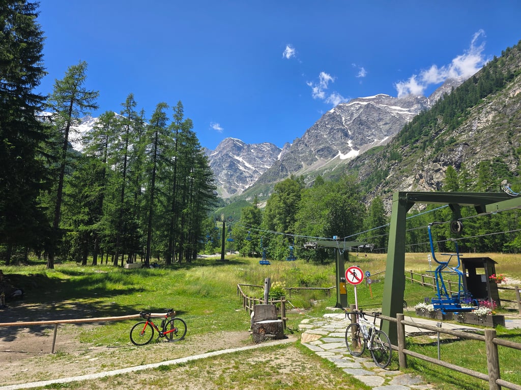
Pecetto from Piedimulera is a climb in the region Verbano-Cusio-Ossola. It is 17.7 mi long and bridges 3809 ft of vertical ascent with an average gradient of 4.1%, resulting in a difficulty score of 652. The top of the ascent is located at 4485 ft above sea level. Climbfinder users shared 9 reviews of this climb and uploaded 14 photos.
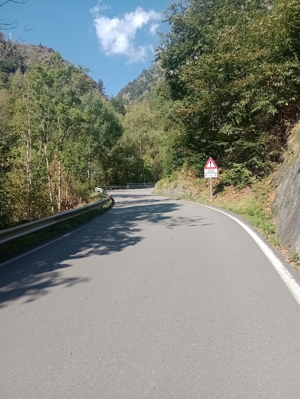
Road name: SS549
Tunnels
Be careful! On this climb you will encounter dimly lit tunnels. Use your bike lights.
3.0 by esseciThis is an automatic translation, the original language is: Italian.A very long climb that presents the toughest section in the initial stretch from Piedimulera to Cimamulera and Castiglione, with gradients close to 10% and continuous. Once past Castiglione, there is a long stretch even on a counter slope and until Pontegrande, just before the halfway point of the climb, it does not present any particular difficulties. Then it goes up in steps: first Vanzone, then Ceppo Morelli and then it becomes challenging all the way to Borca, also passing through a couple... read more

Welcome! Please activate your account if you would like to share something. Look for the verification email in your inbox.
If you want to upload your photos, you need to create an account. It only takes 1 minute and it's completely free.
A very beautiful valley with a charming mountain village at the top that has everything you need
A local insider tip
Somewhat hilly in places, but the downhill sections are great for running
Sehr schönes Tal oben süßes Bergdorf mit allem was man braucht
Geheimtipp der Locals
Stellenweise wellig, bergab läufts sehr gut
Wonderful climb! ...almost always optimal asphalt,well-lit tunnels .almost non-existent traffic,but it was a midweek day,fresh fountains very present along the route
Salita stupenda! ...asfalto quasi sempre ottimale,gallerie ben illuminate .traffico quasi inesistente,ma era un giorno infrasettimanale,fontane fresche molto presenti lungo il percorso
The climb presents the only challenging section as the first. It starts immediately with a 10% gradient and coincides with the worst part of the road. A 540m tunnel with a good gradient alternates with some fairly tight bends where cars whizz by at high speed. Done on a Saturday in late August, the traffic is moderate but all in all acceptable. There are a few drinking fountains along the route while as a bar you have to rely on a couple of them at the hamlet of Castiglione (almost immediately) and then Vanzone. Apart from these one must then wait until Borca. The view of Monte Rosa is suggestive while the valley has no particular points of interest. Macugnaga is very pretty, in between there is not much. However, the climb is not very constant but it is rideable and not tiring.
La salita presenta come unico tratto impegnativo il primo. Si attacca subito con una pendenza sul 10% e coincide con la parte peggiore della strada. Una galleria di 540m ad una buona pendenza si alterna a delle curve abbastanza strette dove le auto sfrecciano ad alta velocità. Fatta in un sabato di fine agosto, il traffico è moderato ma tutto sommato accettabile. Ci sono alcune fontanelle lungo il percorso mentre come bar bisogna confidare su un paio di essi alla frazione di Castiglione (quasi subito) e poi Vanzone. A parte questi bisogna poi aspettare fino a Borca. La vista sul Rosa è suggestiva mentre la valle non presenta particolari punti di interesse. Molto graziosa Macugnaga, nel mezzo non c'è molto. Comunque salita non molto costante ma pedalabile e non sfiancante.
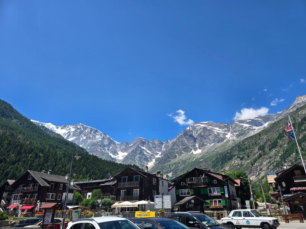
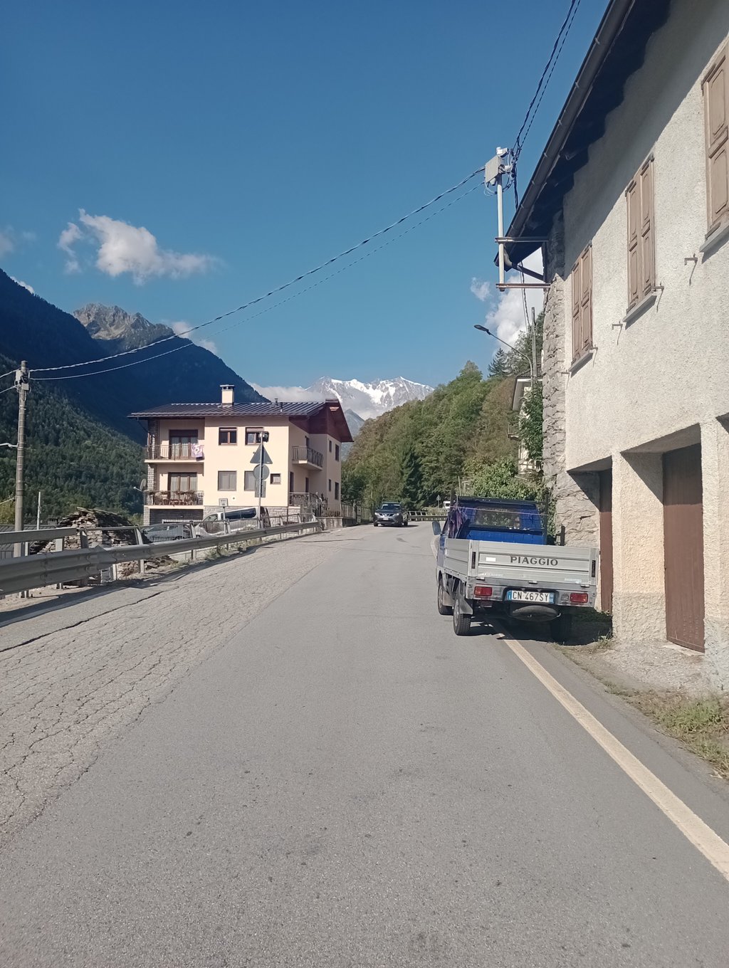
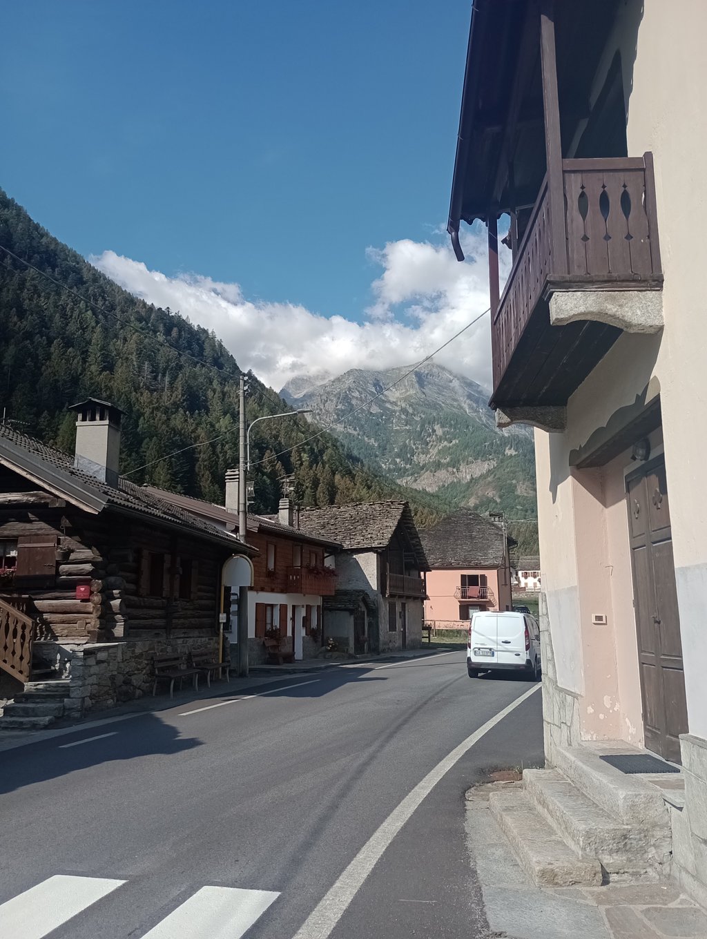
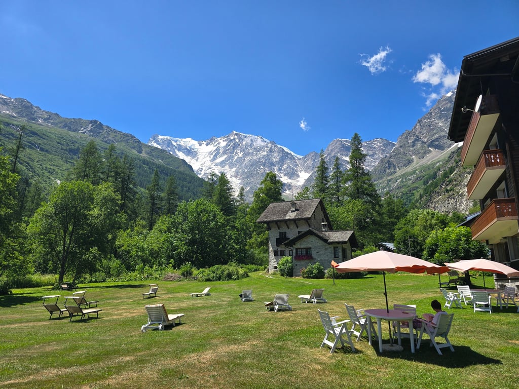
A very long climb that presents the toughest section in the initial stretch from Piedimulera to Cimamulera and Castiglione, with gradients close to 10% and continuous. Once past Castiglione, there is a long stretch even on a counter slope and until Pontegrande, just before the halfway point of the climb, it does not present any particular difficulties. Then it goes up in steps: first Vanzone, then Ceppo Morelli and then it becomes challenging all the way to Borca, also passing through a couple of tunnels that are however illuminated. The last stretch between Borca and Staffa heralds the arrival in Macugnaga, but the climb continues to Pecetto, where there are large parking areas for the chairlift to Belvedere. Macugnaga is worth a visit because of the beauty of the basin in which it stands, dominated by the east face of the Monte Rosa massif, which can be admired in all its majesty. The road from Piedimulera alternates stretches of wide, well-maintained road with other rather narrow passages, even uphill, that make any traffic present annoying. In my opinion, the diversions from Pontegrande to Bannio and then to Alpe Soi and Pià di Barranca is well worth the effort: a real climb of over 8 km in an unspoilt side valley with no traffic. All asphalted road.
Salita lunghissima che presenta nel tratto iniziale da Piedimulera a Cimamulera e Castiglione il tratto più duro per pendenze prossime al 10% e continue. Passato Castiglione si affronta un lungo tratto anche in contropendenza e fino a Pontegrande, poco prima della metà della salita, non presenta particolari difficoltà. Poi si va su a gradoni: prima Vanzone, poi Ceppo Morelli e poi diventa impegnativa fino a Borca, attraversando anche un paio di gallerie comunque illuminate. L'ultimo strappetto tra Borca e Staffa preannuncia l'arrivo a Macugnaga, ma la salita continua fino a Pecetto dove si trovano le grandi aree parcheggio per la seggiovia che porta al Belvedere. Macugnaga merita una visita proprio per la bellezza della conca in cui sorge, dominata dalla parete est del massiccio del Monte Rosa, ammirabile in tutta la sua maestosità. La strada da piedimulera alterna tratti da stradone ampio e ben tenuto ad altri passaggi piuttosto angusti anche in salita che rendono fastidioso l'eventuale traffico presente. Merita a mio avviso la deviazione da Pontegrande a Bannio e poi all'alpe Soi e al Pià di Barranca: una salita vera di oltre 8 km in una valletta laterale incontaminata e senza traffico. Strada tutta asfaltata.
Adding another review one year later. This time 5-stars instead of 3!
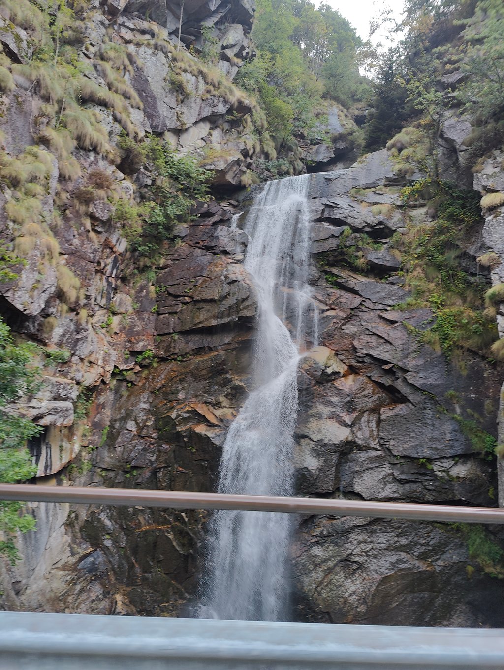
During the climb, the Monte Rosa was visible almost the entire way and it's really an amazing sight! Highest mountain face in Europe and from when you first see it, it's more than 4,000m altitude difference to the top. Along the way, there are also some narrow stretches with waterfalls and a wild river next to you.
Also, Macugnaga is a charming place with great bars and 'pasticcerie'.
The last review mentioned poorly lit tunnels. By now (May 2023), the tunnels are very wel lit and the tarmac inside is perfect. Also, hardly any traffic on the road at this time of year.
Still, this climb does involve quite a few (often long and steep) sections in tunnels, which some might find unpleasant.
A satisfying climb, never too hard over the entire stretch but persistent, road surface resurfaced over much of the route at the end of July 2022.
The ascent as well as the descent is safe. The tunnels remain poorly lit. Beware of traffic during July and August.
Salita che soddisfa, mai troppo dura su tutta la tratta ma persistente, manto stradale rifatto su gran parte del percorso a fine luglio 2022.
La salita come la discesa è sicura . Le gallerie rimango poco illuminate. Attenzione al traffico nei periodo luglio e agosto.
This climb is easy to do. In the beginning steep and then you descend a bit. The second part is longer but does not exceed 8%. Unfortunately, it is very busy in the summer and the road surface is very bad, especially on the second half. Descending is no fun. Therefore not recommended. If you go up, do not forget to take light for the galleries that are sometimes very dark.
Deze klim is goed te doen. In het begin even steil waarna je een stukje afdaalt. Het tweede deel is langer maar komt niet boven de 8%. Helaas is het erg druk in de zomer en is het wegdek vooral op de tweede helft erg slecht. Afdalen is geen pretje. Daarom geen aanrader. Als je naar boven gaat, vergeet geen licht mee te nemen voor de gallerijen die soms erg donker zijn.
| 5 mph | 03:34:06 |
| 7 mph | 02:31:34 |
| 9 mph | 01:58:07 |
| 12 mph | 01:28:45 |
This page is better in the app