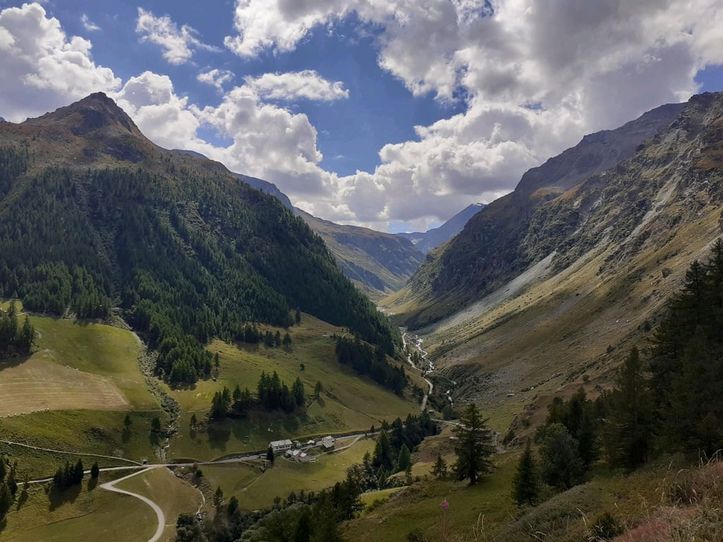
| Beautiful scenery |
| 30 hairpin turns |
| #12 toughest climb of Aosta Valley |
| #27 most elevation gain of Aosta Valley |
| #49 longest climb of Aosta Valley |
| #11 average steepest climb of Aosta Valley |
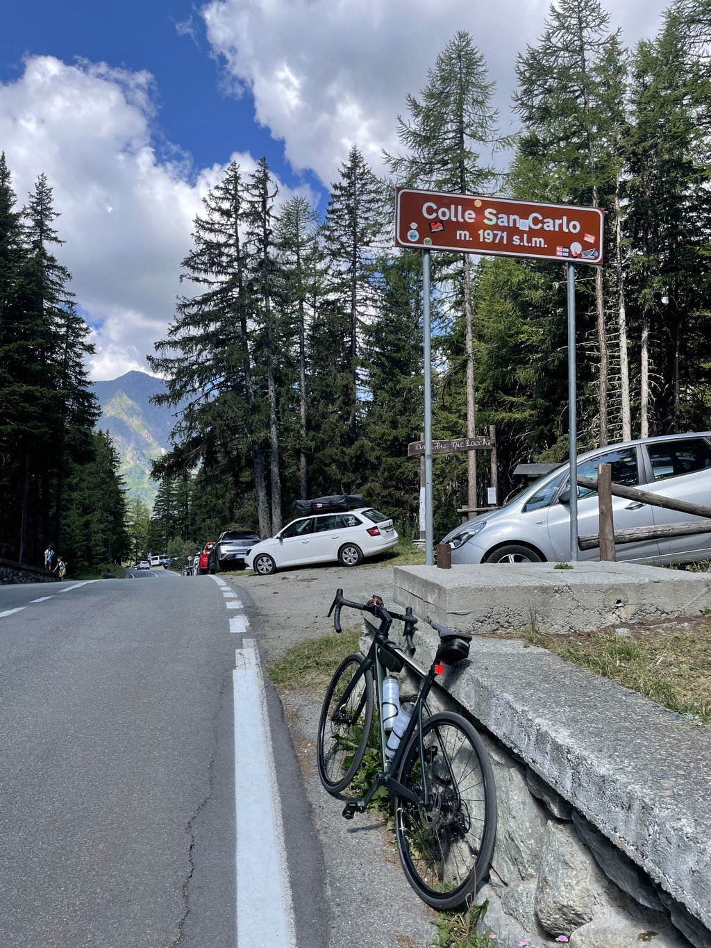
Colle San Carlo from Morgex is a climb in the region Aosta Valley. It is 6.5 mi long and bridges 3435 ft of vertical ascent with an average gradient of 10%, resulting in a difficulty score of 1073. The top of the ascent is located at 6427 ft above sea level. Climbfinder users shared 12 reviews of this climb and uploaded 16 photos.
Road name: SR39
5.0 by renatolThis is an automatic translation, the original language is: Italian.Tough climb. Average 10% with peaks ol 14. It is 10 km for well-trained legs.... read more

Welcome! Please activate your account if you would like to share something. Look for the verification email in your inbox.
If you want to upload your photos, you need to create an account. It only takes 1 minute and it's completely free.
A classic route in the Aosta Valley, the climb is definitely challenging but has the advantage of being extremely consistent. Be aware of the south-facing exposure, which makes it particularly hot on summer afternoons.
Grande Classica valdostana, la salita è decisamente impegnativa con però il pregio di essere estremamente regolare. Attenzione all'esposizione a sud che la rende particolarmente calda nei pomeriggi estivi
A grueling climb, but it gets under your skin—you feel every single pedal stroke because it makes you “breathe” Only on very rare stretches does the gradient drop to 9%... a mental and physical challenge against yourself... it’s best not to look at the bike computer because the 13%–14% sections are nonstop... it’s worth doing, but you have to prepare well....
salita tremenda ma ti entra nell'anima senti ogni singola pedalata perchè di fa "respirare" solo in rarissimi tratti dove la pendenza scende al 9% ... una sfida con te stesso a livello mentale e muscolare .. meglio non guardare il ciclo computer perchè i tratti al 13% - 14% sono continui ... da fare ma bisogna prepararla bene ....
Steep, tough but damn beautiful climb. Once you get to the top you forget about the fatigue and, if your legs aren't trained, all the times you've inconvenienced the saints of heaven😂
Salita ripida, tosta ma dannatamente bella. Una volta arrivato in cima ti dimentichi della fatica e, se non hai la gambe allenate, di tutte le volte che hai scomodato i santi del paradiso😂
Tough climb. Average 10% with peaks ol 14. It is 10 km for well-trained legs.
Salita tosta. Media 10% con punte ol il 14. Sono 10 km per gambe ben allenate.
Very tough! Back after a year to do it again, on a very windy day in the valley, slightly windy on the way up. Impeccable asphalt, average traffic (3 August early afternoon). One hairpin bend after another leaves little to recover from. The beginning and the end seemed to me to be the most difficult points. Fortunately, it is mostly shaded by vegetation. Beautiful view only at the beginning on the white, then many trees. Highly recommended
Moooolto ostica! Torno dopo un anno a rifarlo, in una giornata molto ventosa in valle, leggermente ventosa la salita. Asfalto impeccabile, traffico medio (3 agosto primo pomeriggio). Un tornante dopo l'altro lascia poco per recuperare. Mi sono sembrati l'inizio e la fine i punti più ostici. Per fortuna è perlopiù in ombra per la vegetazione. Vista bella solo all'inizio sul bianco, poi tanti alberi. Stra consigliato
My first challenging climb, I found it quite trying, I have been cycling for two to three months, the road is quite good and the car traffic is not excessive, the gradient I think varies little along the way.
La mia prima salita impegnativa, l’ho trovata abbastanza provante, vado in bici da 2/3 mesi, la strada è abbastanza buona ed il traffico auto non eccessivo, la pendenza credo subisca poche variazioni lungo il percorso.
Spectacular in its extreme fatigue. We give it a 4 but leaning towards a 5. The only flaw is the view, which is not great. You can appreciate Mont Blanc just the first few hairpin bends. Having said that, the climb is exhausting and does not allow a moment's rest. One aspect that can help, however, is that it remains very constant, without excessive jerks. Always regularly hard. You descend from La Thuile with smaller gradients and much shorter duration
Spettacolare nella estrema fatica. Diamo un 4 ma tendente al 5. Unica pecca è la vista che non è un granché. Si apprezza il monte Bianco giusto i primi tornanti. Detto ciò la salita è estenuante, non permette un attimo di riposo. Un aspetto che però può essere d'aiuto è che rimane molto costante, senza strappi eccessivi. Sempre regolarmente dura. Si scende da La Thuile con pendenze minori e durata decisamente inferiore
One of the most challenging climbs in the Aosta Valley, it never lets you rest.
The road is magnificent with perfect fir trees, picnic tables along the way
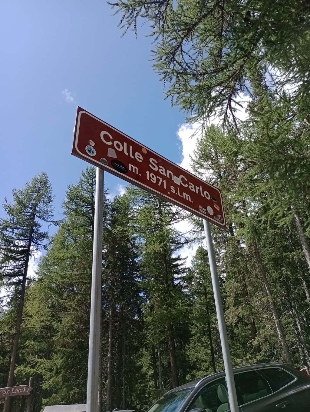
There are wooden signs at every kilometre giving directions to the next kilometre of road.
At the top you can refresh yourself, you will find no fountains along the way,
For an epic day, I recommend that you descend and continue on the ascent to Petit St Bernard
I parked my car at the roundabout before the village of Morgex.
Una delle salite più impegnative della Valle d'Aosta, non lascia mai riposare.
La strada è magnifica con abeti fondo perfetto, tavoli da picnic lungo la strada
Ci sono i cartelli di legno ad ogni chilometro che forniscono indicazioni sul km di strada successivo.
In cima potrete ristorarvi, lungo il percorso non troverete fontane,
Per una giornata epica vi consiglio di scollinare e proseguire per la salita al Piccolo S.Bernardo
Io ho parcheggiato l'auto alla rotonda prima dell'abitato di morgex.
Really enjoyed this climb. Challenging and lots of tree cover from the heat... but the main reason i enjoyed it was I rode ahead of the Giro race (2019) and the climb was lined with fans shouting and cheering, and even giving a little helpful push :-).
There are some really tough stretches, and the about 1km/1.5km from the top there is a straight 10% ahead of you which just saps the legs. there are plenty of steep sections, but when it's just a straight road ahead, it looks like a wall.
It's good to heave km markets as well, but these are wooden signs that add a real charm to this lovely climb.
Done on Friday August 6, 2010.
I find the Climbfinder profile a bit less difficult than it really is.
Morgex foot of Colle San-Carlo.
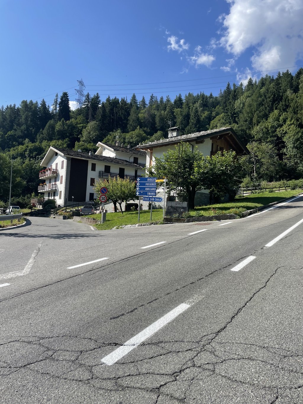
To find the access road, coming from Pré St Didier, you have to take the most right possible in Morgex, then look for and cross the level crossing, the start is a few dozen meters further.
After, it's gone for the climb, a sign on the left of the road announces the color: Colle San-Carlo 10,436km altitude 922M, the slope is immediately very strong more than 9% of average..
The road is magnificent with a nickel coating, the whole climb is lined with fir trees and the traffic is low, the dream what!
The slope is so rough that the passages in dancer are obligatory.
The magnificent wooden signs positioned at each kilometer sometimes on the right and sometimes on the left of the road and which provide useful indications to the cyclists attest to the difficulty, the 3rd kilometer 11,45% with the 2nd very hard part, another kilometer a little higher at 10,77%, except for the last kilometer at 8,76% never the slope is announced lower than 9%.
Superb picnic spots are arranged in the undergrowth, one a little before the summit the other at the summit ,wooden tables are numerous.
Make this pass you will return enchanted, good road and be careful
Fait le vendredi 6 aout 2010.
Je trouve le profil Climbfinder un peu moins difficile que réellement.
Morgex pied du Colle San-Carlo.
Pour trouver la route d'accès, en venant de pré St Didier, il faut prendre le plus à droite possible dans Morgex, puis chercher et traverser le passage à niveau, le départ est quelques dizaines de mètres plus loin.
Après, c'est parti pour la grimpette, un panneau à gauche de la route annonce la couleur : Colle San-Carlo 10,436km altitude 922M, la pente est tout de suite très forte plus de 9% de moyenne..
La route est magnifique avec un revêtement nickel, toute la montée est bordée de sapins et la circulation automobile est faible, le rêve quoi!
la pente est si rude que les passages en danseuse sont obligatoires.
Les magnifiques panneaux en bois positionnés à chaque kilomètres tantôt à droite tantôt à gauche de la route et qui fournissent les indications utiles aux cyclistes attestent de la difficulté, le 3ème kilomètre 11,45% avec la 2ème partie très dure, un autre kilomètre un peu plus haut à 10,77% , à part le dernier kilomètre à 8,76% jamais la pente n'est annoncée inférieure à 9%.
Des superbes coins pique-nique sont aménagés en sous-bois, l'un un peu avant le sommet l'autre au sommet ,les tables en bois sont nombreuses.
Faites ce col vous en reviendrez enchanté, bonne route et soyez prudents
Deadly heavy. Constantly around 10% which means that you do not have a moment of rest. The advantage is that it is regular, so you can find a rhythm from the bottom to the top. The kilometre markings are wooden works of art, but not that easy to read, even at a slow climbing pace :)
Dodelijk zwaar. Voortdurend rond de 10% waardoor je geen moment van rust hebt. Het voordeel is dat hij daardoor wel regelmatig is en je dus van aan de voet een ritme kunt zoeken dat je tot boven kunt aanhouden. De kilometermarkeringen zijn houten kunstwerkjes, maar niet zo duidelijk leesbaar, zelfs aan traag klimtempo :)
| 5 mph | 01:18:41 |
| 7 mph | 00:55:42 |
| 9 mph | 00:43:24 |
| 12 mph | 00:32:37 |
This page is better in the app