Tips nearby


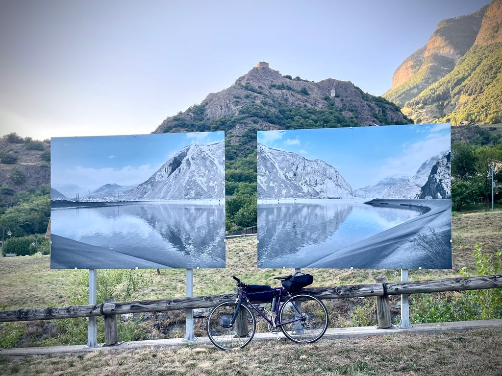
| Beautiful scenery |
| 26 hairpin turns |
| #34 toughest climb of La Maurienne |
| #40 most elevation gain of La Maurienne |
| #41 longest climb of La Maurienne |
| #37 average steepest climb of La Maurienne |
Col du Sapey from Hermillon is a climb in the region La Maurienne. It is 6.5 mi long and bridges 2612 ft of vertical ascent with an average gradient of 7.6%, resulting in a difficulty score of 676. The top of the ascent is located at 4308 ft above sea level. Climbfinder users shared 10 reviews of this climb and uploaded 27 photos.
Road names: Route de la Cascade & Route de Montandré
2.0 by PolitiskTeoriFanThis is an automatic translation, the original language is: English.Starting out from Saint Jean de Maurienne, I rode this as the first climb on a day that also included Col du Mollard and La Toussuire. I did not have too many expectations, and to be honest, the first part of the climb was also fairly non-distinct. Obviously, the road is quiet with all the traffic going on in the Maurienne valley. There are some switchback sections on the way and you remain mostly hidden underneath the trees. The last part of the climb is what sticks out in my memory, as the gra... read more
Welcome! Please activate your account if you would like to share something. Look for the verification email in your inbox.
If you want to upload your photos, you need to create an account. It only takes 1 minute and it's completely free.
Starting out from Saint Jean de Maurienne, I rode this as the first climb on a day that also included Col du Mollard and La Toussuire. I did not have too many expectations, and to be honest, the first part of the climb was also fairly non-distinct. Obviously, the road is quiet with all the traffic going on in the Maurienne valley. There are some switchback sections on the way and you remain mostly hidden underneath the trees. The last part of the climb is what sticks out in my memory, as the gradient suddenly rises violently to 15-20% in the last 1,5 kilometer. As if this isn't diabolical enough this steep section of road is on gravel surface, meaning that my 36-32 gearing was put to the test to hold momentum and grip over the loose surface. The summit of the climb is hidden in the trees and you have no real sense that you have reached the top, meaning that you will not be rewarded with spectacular panorama, that many other alpine passes tend to offer. Overall, a decent climb, but I would probably skip it the next time I am in the area. My rating would probably be better if the road surface was better, but given that this was my experience, I can only award it 2 stars.
Nice climb, very quiet with traffic. The road surface is very poor in some parts. The last part, after the Y-junction, is really killing. Large parts there are 20+%.
Mooie klim, erg rustig met verkeer. Het wegdek is op sommige stukken erg matig. Het laatste deel, na de Y-splitsing, is echt killing. Grote delen zijn daar 20+%.
I'll remember the last 1,300 metres!
If you haven't taken the trouble to look at the profile of the climb, they'll pick you up and suck out what's left of your energy.
The surface is not pleasant at all. It's even more obvious on the descent. It's a descent that's no fun at all: the state of the road, the water gutters, the pine cone residue and the gravel prevent you from picking up speed.
Back to the climb: the gradients are steady but never nasty until the fork to the right for the last hellish metres. There, a wall with sections over 15%. Around here, they call that a "catch"!
The scenery isn't unpleasant but it's not exceptional either.
The undergrowth sections are pleasant.
The Col de Chaussy is definitely more spectacular.
On the other hand, if you're looking for a pass all to yourself, you've found it.
Je me souviendrai des 1300 derniers mètres !
Si tu n’as pas pris la peine de jeter un œil au profil de l’ascension, ils te cueillent et te pompent ce qui te reste d’énergie.
Le revêtement n’est pas agréable du tout. C’est encore plus évident lors de la descente. Une descente qui ne permet pas de s’amuser : l’état de la route, les gouttières d’évacuation d’eau, les résidus de pommes de pin, les gravillons empêchent de prendre de la vitesse.
Revenons à l’ascension : les pourcentages sont soutenus mais jamais méchants jusqu’à la bifurcation vers la droite pour les derniers mètres infernaux. Là, un mur avec des passages à plus de 15%. Par ici, ils appellent ça une « prise » !
Les paysages ne sont pas désagréables mais pas non plus exceptionnels.
Les parties en sous bois sont plaisantes.
Le Col de Chaussy est tout de même nettement plus spectaculaire.
Par contre, si vous cherchez un col pour vous tout seul, vous l’avez trouvé.
Very nice pass. Virtually no traffic. Rolling at the start but a little wall on the last km with passages at 20% and an average of 15/16%. There are actually a few gullies at the top, not a worry on the way up but you have to descend carefully.
Col très sympa. Quasi pas de circulation. Roulant au début mais petit mur sur le dernier km avec des passages à 20% et une moyenne à 15/16%. Il y a effectivement quelques goutieres en haut, pas un souci en montant mais il faut descendre prudemment.
A small pass on a little-travelled road, a fairly straightforward first section but the finish is very difficult with percentages above 12%, you need to save some for a good finish.
Petit col sur une route peu fréquentée, une première partie assez simple mais la fin est très difficile avec des pourcentage supérieurs à 12%, il faut en garder pour bien terminer.
Did this climb in early August. Nice climb to combine with the Lacets de Montvernier. The Lacets are really just a warm-up then, the Col du Sapey is quite tough. You'll have to save a bit at the start for the last kilometre, because the bit over 12% is really tough, especially if it's hot. At the top, a nice statue and fine views (but in full sun). Descent quite tricky, rough tarmac and sometimes some loose fallen stones on the road here and there.
Deze klim begin augustus gedaan. Mooie klim om te combineren met de Lacets de Montvernier. De Lacets zijn dan eigenlijk maar een opwarmertje, de Col du Sapey is best pittig. Je zult aan het begin een beetje moeten sparen voor de laatste kilometer, want het stukje meer dan 12% is echt pittig, zeker als het warm is. Op de top een mooi beeldje en fijn uitzicht (maar wel in de volle zon). Afdaling best tricky, ruw asfalt en hier en daar soms wat losse gevallen stenen op de weg.
Addition after transit June 2023 :
Found that super bad last section to the summit is now beautifully paved. Still have to watch out for wide metal drains in the road surface across the road.
Toevoeging na doortocht Juni 2023 :
Vastgesteld dat superslecht laatste deel naar de top nu prachtig is geasfalteerd. Het is wel nog opletten voor brede metalen afvoergoten in het wegdek dwars over de weg.
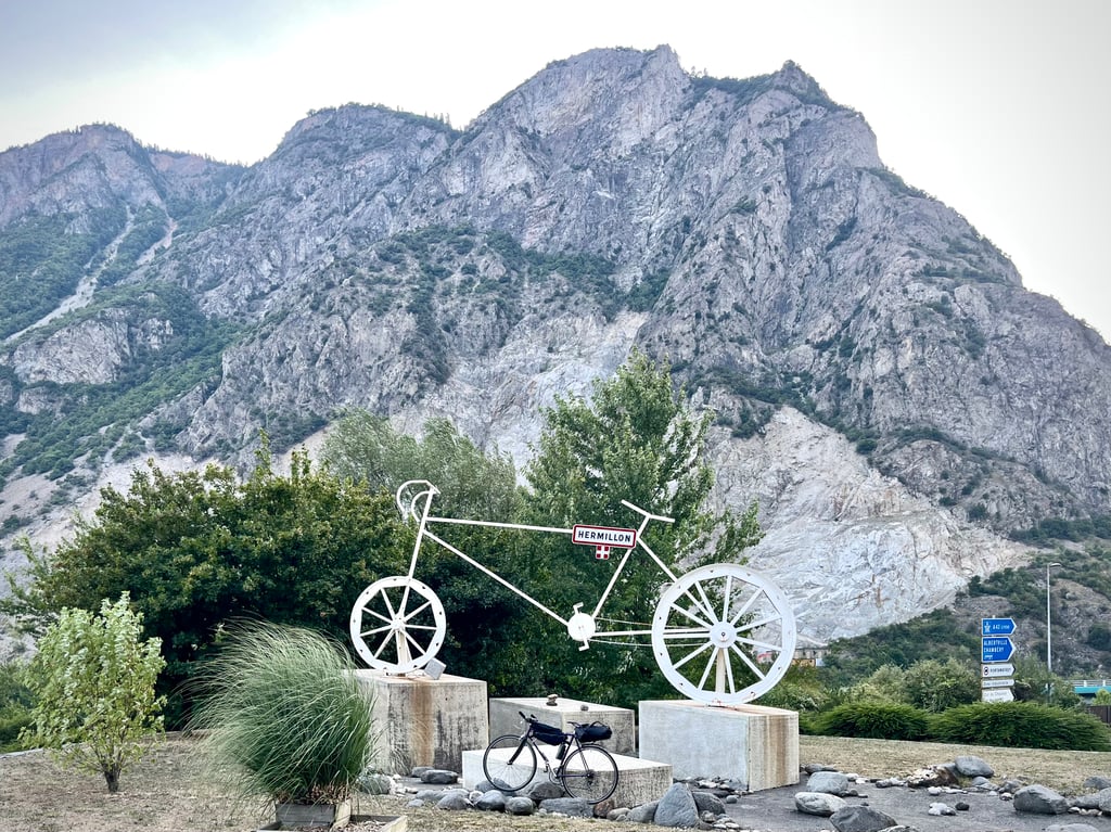
Fairly unknown climb starts at the roundabout (with big bike) in Hermillon just outside St.Jean de Maurienne. Initially parallel to the Col du Chaussy route for a while, but after climbing up along the bank of the mountain river the paths separate.
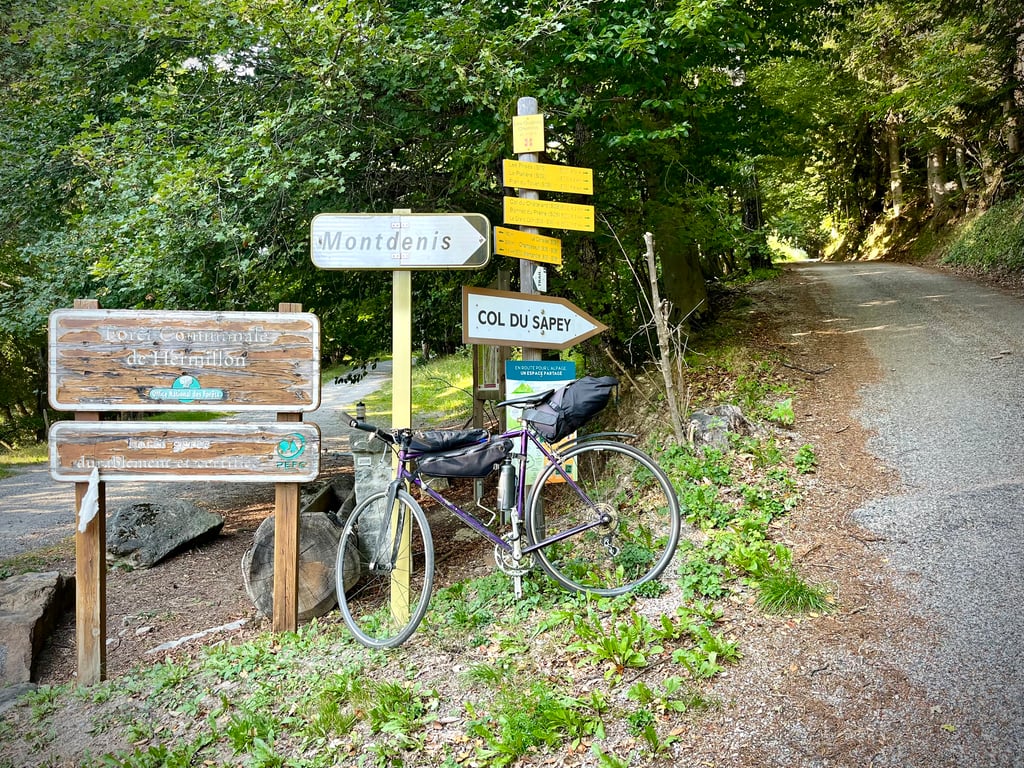
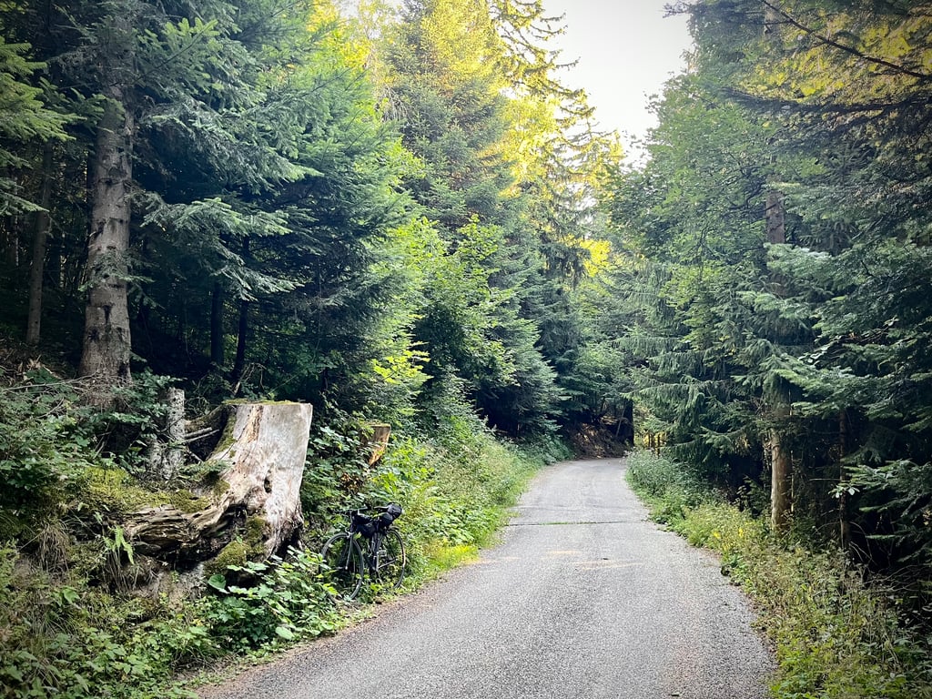
Signposts on the right send you briefly downhill past the village hall before climbing up the valley flank via narrow road with many hairpin bends through the dense forest. Occasionally the landscape briefly pulls open for a panoramic view of the valley.
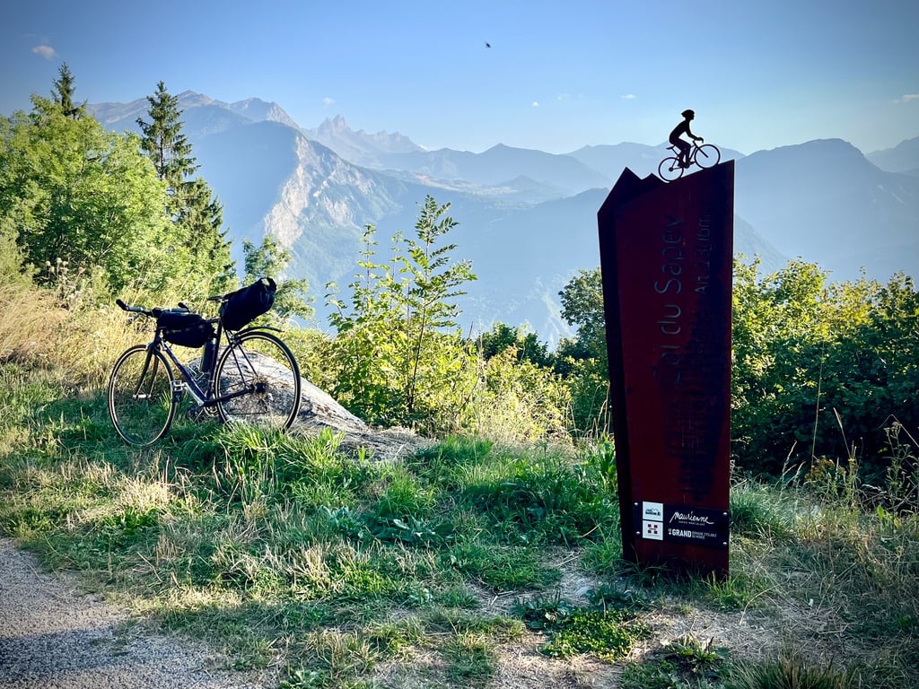
The devil is in the finale. Explosive finale with the last 2 km.a killer wall of double digits (10-15%) on bad asphalt full of potholes . The previously surfaced gutters and asphalt rises,to drain water, right across the road do not ease the matter. Summit is desolate with only painted finish line and small monument,but with beautiful vista.
There was nothing along the way. No houses, cars's, walkers, cyclists, road markings or kilometre markers.
Those who enjoy cycling uphill in peace and serenity will find their hidden treasure in the forest here.
Unknown has not become unloved after cycling up!
Vrij onbekende klim begint aan de rotonde (met grote fiets) in Hermillon even buiten St.Jean de Maurienne. Eerst even gelijklopend met de Col du Chaussy route, maar na het opklimmen langs de oever van de bergrivier scheiden de wegen.
Wegwijzer stuurt je rechts even bergaf langs de dorpsfeestzaal om dan via smalle weg met vele haarspeldbochten door het dichte woud de valleiflank op te klimmen. Af en toe trekt het landschap even open voor een panoramisch zicht op de vallei.
Het venijn zit in het slot. Explosieve finale met de laatste 2 km.een moordende muur van dubbele cijfers (10-15%) . De eerder op de route opgedoken goten en asfaltverhogingen,om water af te voeren, dwars over de weg vergemakkelijken de zaak niet. Top is desolaat met alleen geschilderde finishlijn en klein monument,maar met prachtig vergezicht.
Er was (Augustus 2022) onderweg niets. Geen huizen, auto's, wandelaars, fietsers, wegmarkeringen of kilometerpalen.
Wie graag in alle rust en sereniteit bergop fietst vind hier zijn verborgen schat in het woud.
Onbekend is na het opfietsen niet onbemind geworden!
I did it on Wednesday after having climbed the Lacets de Montvernier in PMA, so my legs were getting tired and the night had been short (it's hard to cook for 4 days at the gite), so the pass climbed by 30° in full sun was complicated, but the climb makes me want to do it again;The last two kilometres are a real wall complicated by a degraded and dusty surface which sometimes forces me to stay seated on the saddle which complicates the whole thing (and I am 1m68-46 kg so climber). But as Serge underlines it is a bump to discover.
Fait mercredi après avoir monté les Lacets de Montvernier en PMA, donc les jambes tiraient d'autant que la nuit avait été courte (c'est dur de faire la cuisine pour 4j au gite), donc le col gravit par 30° en plein soleil a été compliqué, mais l'ascension me donne envie de la refaire, les deux derniers kilomètres étant un vrai mur compliqué par un revêtement dégradés et poussiéreux qui oblige parfois à rester assis sur la selle ce qui complique le tout (et je fais 1m68-46 kg donc grimpeur). Mais comme le souligne Serge c'est une bosse à découvrir. .
The Col du Sapey is not very well known, and for good reason: it's not listed on the IGN or Michelin maps.
However, there is a sign indicating the summit, and having climbed it myself, I can confirm that it really is a pass.
It is 10.5 km long and has an average gradient of 7.6 %, with some sections over 20 %.
The start is at the roundabout at the bottom of Hermillon ( Maurienne ) a few kilometres from ST Jean de Maurienne.
The surface is good except for the last 1.5 km
At the start the road descends briefly to the football pitch before the climb begins, often in the woods in the first part and then in the open.
The gradient is steady between 7-8 % with a few passages between 11 and 13 %
The 6th kilometre allows you to take a breather, and you'll need to because the end proves to be very complicated, the last 2.5 km are explosive with passage over 20 on a very small road with numerous water crossings.
There is also the option of doing a loop down the road to ST Julien Montdenis.
Ps: To get off the beaten track and away from the traffic of the major passes, the Col du Sapey would benefit from being better known.
As well as a few photos taken on Ascension Day on 14 July 2020.
Be careful if you go down the other side, as I've seen a lot of hares, very happy to race you ( La Tortue )
Le col du Sapey n’est pas très connu et pour cause ce n’est pas un col répertorié sur les cartes IGN et Michelin.
Pourtant un panneau en indique bien le sommet et pour l’avoir monté je puis vous confirmer qu’il est bien réel.
D’une longueur de 10,5 km et de pente moyenne de 7,6 % avec des passages supérieurs à 20 %
Le départ se situe au rond-point en bas de Hermillon ( Maurienne ) à quelques kilomètres de ST Jean de Maurienne.
Le revêtement est bon sauf le 1,5 dernier Km
Au départ la route descend brièvement jusqu’au terrain de foot avant le début de l’ascension, souvent dans les bois dans la première partie et ensuite à découvert.
La pente est soutenue entre 7-8 % avec quelques passages entre 11 et 13 %
Le 6ème kilomètre permet de souffler un peu et il le faudra car la fin s’avère très compliquée, les 2,5 derniers km sont explosifs avec passage supérieur à 20 sur une toute petite route avec de nombreuses traverses pour l’eau.
Il y a possibilité de faire une boucle en descendant par la route de ST Julien Montdenis.
Ps : Pour sortir des sentiers battus et à l’écart de la circulation des grands cols, le Col du Sapey gagnerait à être plus connu.
Ainsi que quelques photos effectué le jour de l’ascension le 14 juillet 2020.
Attention si vous descendez sur l'autre versant car j'ai pu constater la présence de nombreux lièvres, très heureux de faire la course avec vous ( La Tortue )
| 5 mph | 01:18:59 |
| 7 mph | 00:55:55 |
| 9 mph | 00:43:35 |
| 12 mph | 00:32:44 |
This page is better in the app