Tips nearby


| Famous climb |
| 6 hairpin turns |
| #1 toughest climb of Grand Est |
| #5 most elevation gain of Grand Est |
| #41 longest climb of Grand Est |
| #46 average steepest climb of Upper Rhine |
Col du Grand Ballon from Saint-Amarin is a climb in the region Upper Rhine. It is 7.9 mi long and bridges 3163 ft of vertical ascent with an average gradient of 7.6%, resulting in a difficulty score of 911. The top of the ascent is located at 4400 ft above sea level. Climbfinder users shared 30 reviews of this climb and uploaded 43 photos.
Road names: Rue de Fistelhaeusser, Rue de Saint Amarin & Rue de Ballon
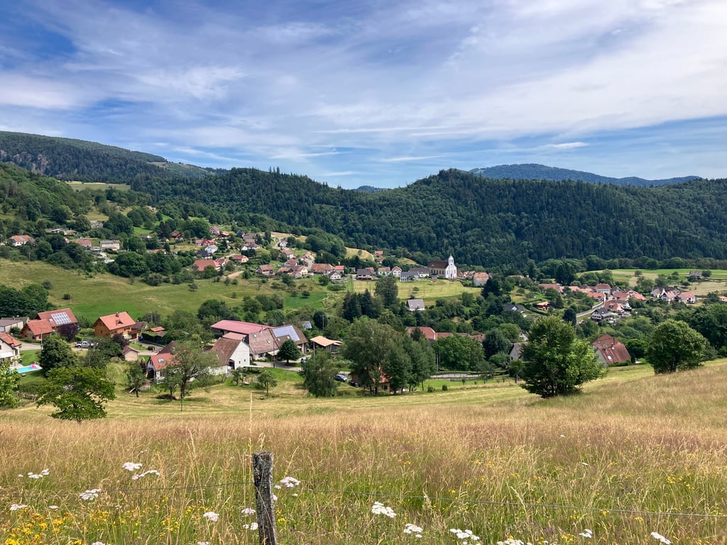
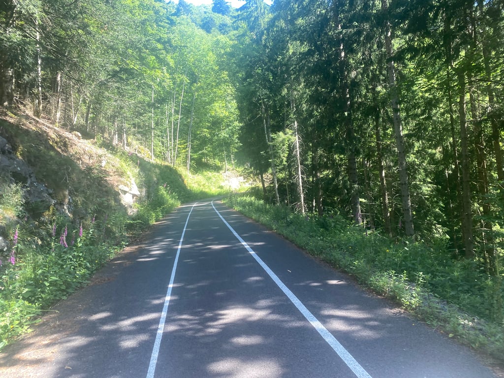
5.0 by WalputThis is an automatic translation, the original language is: Dutch.From the village of Saint - Amarin, there is an immediate brisk climb between the houses. Then the road continues through the forest until the next village of Geishouse. Until then, the road is not great but certainly doable. Once in Geishouse, the view of the village is beautiful. You continue cycling on the upper edge of the village until you reach a traffic-free cycle path and climb further up. This is very fine and super gentle climbing. It does have firm percentages that should be manageabl... read more
Welcome! Please activate your account if you would like to share something. Look for the verification email in your inbox.
If you want to upload your photos, you need to create an account. It only takes 1 minute and it's completely free.
It's just tough all the way through. There's one short downhill stretch where you can try to catch your breath.
Gewoon overal lastig. Éen kleine afdaling waar je kan proberen tot rust komen.
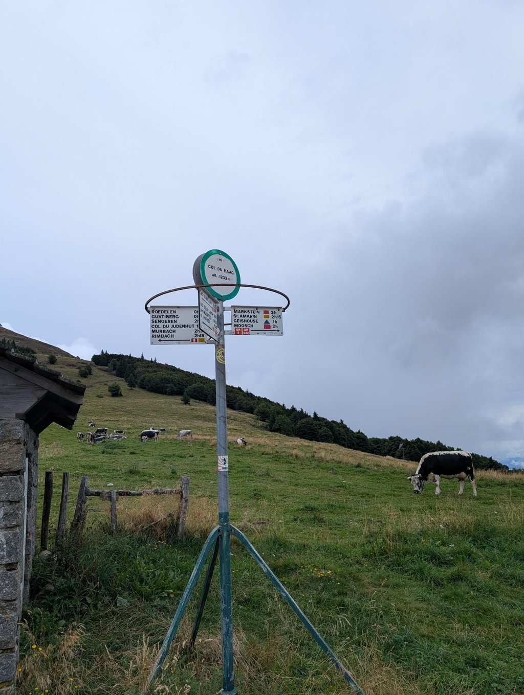
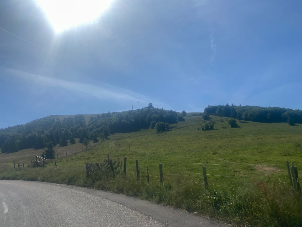
An incredible climb. You don't expect it to be this tough. It's uneven, with very steep gradients. The end of the Haag seems to go on forever, just like the approach. The effort leading up to the Grand Ballon is intense. The greenway is a real treat because there are no cars!
Une ascension incroyable. On ne s'attend pas à une montée aussi dure. Irrégulière, des pourcentages très difficiles. La fin du Haag est interminable tout comme le pied. L'effort jusqu'au Grand Ballon est intense. La voie verte offre un véritable confort car sans voiture !
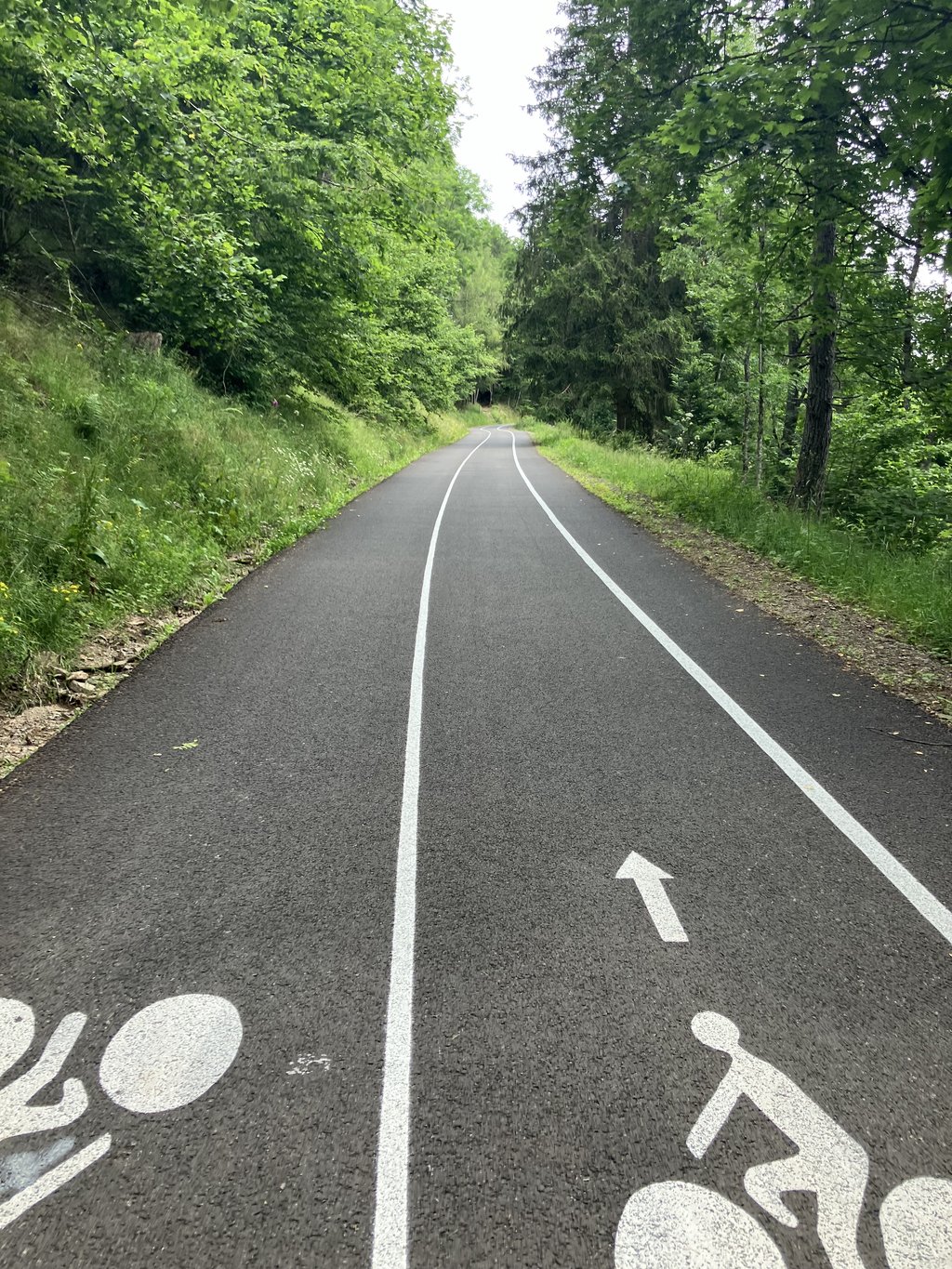
Redone road reserved for cyclists and pedestrians. Now quite busy from Geishouse to La ferme du haag. 5 years ago, the road was in a sorry state but not at all busy.
Route refaite réservée aux cyclistes et piétons. Du coup pas mal fréquenté de Geishouse à la ferme du haag. Il y a 5 ans la route était en piteux état mais pas du tout fréquentée.
A beautiful, fairly uneven climb, but free of all traffic from Geishouse, which makes it even more magical.
Très belle montée à faire assez irrégulière mais libre de tout trafic a partir de Geishouse ce qui rend la montée encore plus magique
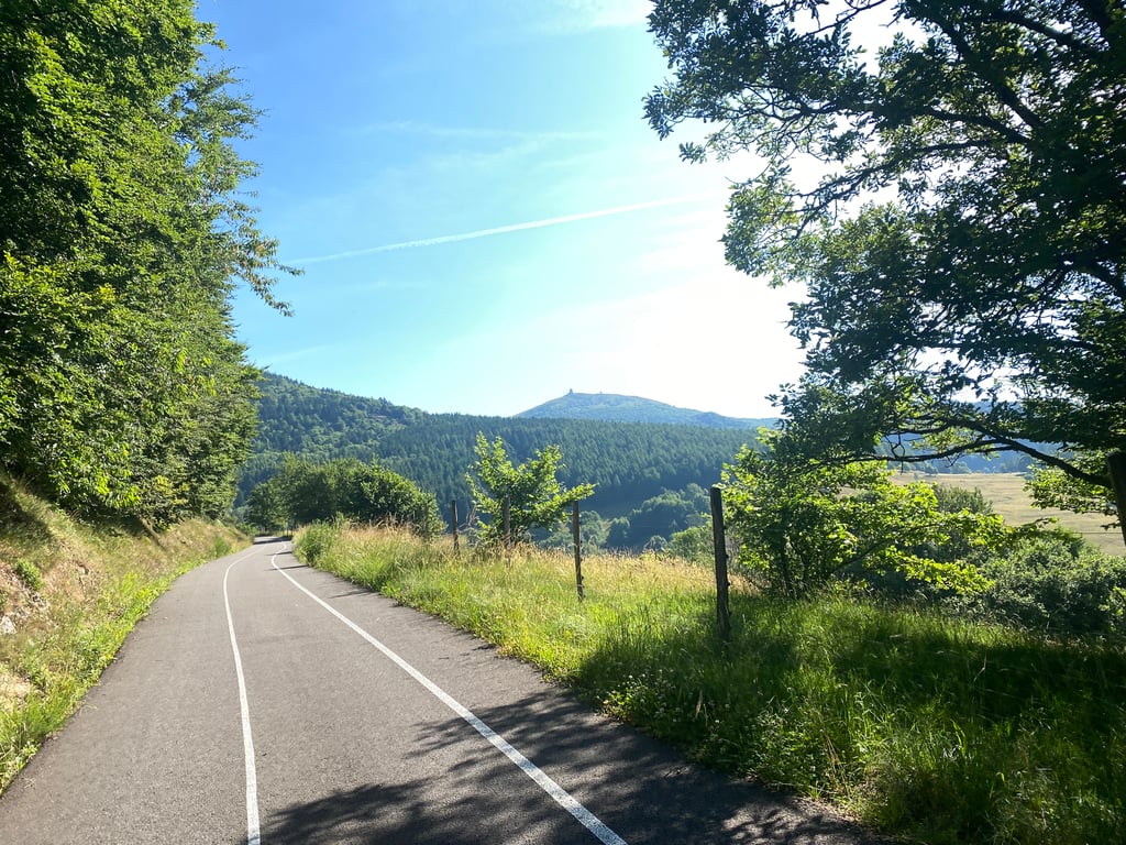
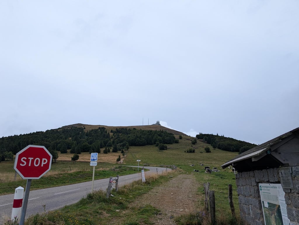
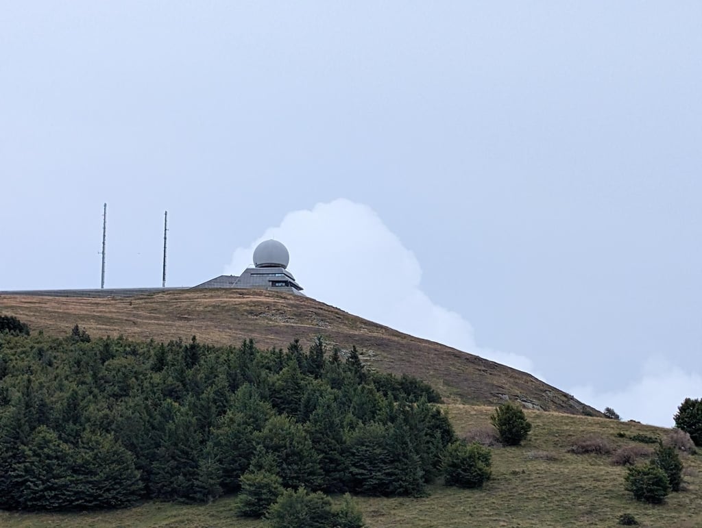
From the village of Saint - Amarin, there is an immediate brisk climb between the houses. Then the road continues through the forest until the next village of Geishouse. Until then, the road is not great but certainly doable. Once in Geishouse, the view of the village is beautiful. You continue cycling on the upper edge of the village until you reach a traffic-free cycle path and climb further up. This is very fine and super gentle climbing. It does have firm percentages that should be manageable for an average climber. Once at the top of the cycle path you come to the main road of the Grand Ballon and it is another 2 km climb to the summit. This takes some getting used to the traffic but once you get to the top it's a great view of the region in good weather. You can also relax with a drink and a snack available there (for a fee). This side is definitely recommended.
Vanuit het dorp Saint - Amarin, is het direct al stevig klimmen tussen de huizen. Daarna vervolgt de weg zich door het bos tot in het volgende dorp Geishouse. Tot dan is de weg niet super maar zeker doenbaar. Eens in Geishouse aangekomen het je een prachtig zicht op het dorp. Je fiets verder op de bovenste rand van het dorp tot je bij een verkeersvrij fietspad verder naar boven klimt. Dit is zeer fijn en super rustig klimmen. Wel met stevig percentages die voor een gemiddelde klimmer zeker moeten lukken. Eens boven op het fietspad kom je op de grote weg van de Grand Ballon is is het nog 2 km klimmen naar de top. Dit is even wennen aan het verkeer maar eens je boven bent het je bij goed weer een mooi uitzicht op de streek. Je kan er ook even bekomen met een drankje en een hapje die daar (tegen betaling) te verkrijgen zijn. Deze kant is zeker een aanrader.
A climb that lives up to its reputation. Not much to say apart from the fact that the most complicated gradients are to be found on the way out of Saint Amarin, with sections regularly over 15%.
Montée à la hauteur de sa réputation. Pas grave chose à dire hormis que les pourcentages les plus compliqués se trouvent à la sortie de Saint Amarin avec des passages régulièrement à plus de 15%.
Wb distance and percentage similar to Alpe d'Huez (the 12km chrono), but found this one more difficult. More uneven, with longer, steeper sections, hardly any hairpins to rest, and a bit of descent with bad road surface. Very nice though that +/- 6km is a car-free cycle path with very good road surface! But just within the hour...
Wb afstand en percentage vergelijkbaar met Alpe d'Huez (de 12km chrono), maar vond deze lastiger. Onregelmatiger, met langere, steilere stukken, nauwelijks haarspelden om even bij te komen, en een stukje afdaling met slecht wegdek. Wel heel fijn dat +/- 6km een autovrij fietspad is met heel goed wegdek! Maar net binnen het uur...
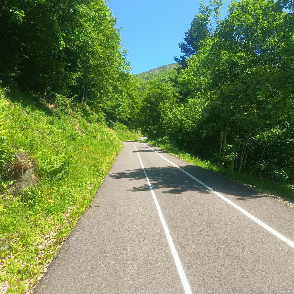
Nice climb on a nicely shaded cycle path. Nice variation between steep and flatter.
Mooie klim over een mooi beschaduwd fietspad. Lekker afwisseling tussen steil en vlakker.
Steepest variant of the Grand Ballon. After a few kilometres, a short descent, then it continues on a cycle-goat path. Irregular but a beautiful road.
Steilste variant van de Grand Ballon. Na enkele kilometers een korte afdaling, daarna gaat het verder op een fiets- geitenpad. Onregelmatig maar een prachtige weg.
done at the beginning of November before the Ballon d'Alsace, very nice quiet climb. The first few kilometres are quite tough, but the short descent helps you recover. The cycle path to finish is very pleasant. despite the various flat spots, you need to keep your energy up for the last km before the farm, which is regularly around 14%. lovely view from the summit.
faite début novembre avant le ballon d'alsace, très belle montée tranquille. Les premiers km sont assez difficiles mais la petite descente permet de récupérer. La piste cyclable pour finir est très agréable. malgré les différents replats, il faut garder de l'énergie pour le dernier km avant la ferme qui est régulièrement au alentours des 14%. belle vue au sommet.
Beautiful climb, which is definitely the most challenging side of the GB as far as I am concerned. The steep first section from the village eventually turned out to be just a taste of what was to come. I've never done such an irregular climb as this one. Fantastic experience!
Prachtige klim, die wat mij betreft absoluut de meest uitdagende kant is van de GB. Het steile eerste stuk vanuit het dorp bleek uiteindelijk slechts een voorproefje van wat nog komen zou. Ik heb nog nooit zo'n onregelmatige klim gedaan als deze. Fantastische ervaring!
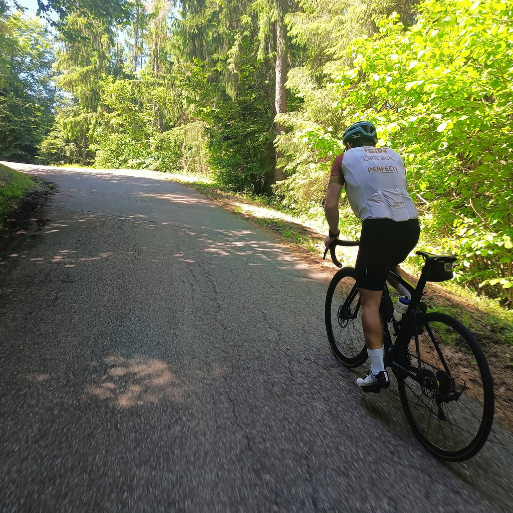
Road surface from Geishouse is incredible, perfect tarmac without cars (except for a few French locals who are allowed to drive there). Some very steep parts, but a very rewarding climb. Only HC in northern France, so as a Dutchie you're not gonna find any HC mountains closer than this one.
What a climb say. 7.5% including descent says it all. I arrived at the top all cooked (and proud), the last 1.5 (relatively easy) kilometres went for no more metres after the violence of the last hairpin to the col du Haag.
Other than that, fine tarmac indeed, except for the bit of descent after 4 km.
Tip: don't ride yourself to death to have some energy left for the last part to the col du Haag
Wat een beklimming zeg. 7.5% inclusief afdaling zegt genoeg. Ik kwam helemaal gekookt (en trots) boven, de laatste 1,5 (relatief eenvoudige) kilometers gingen voor geen meter meer na het geweld van de laatste haarspeldbocht tot aan de col du Haag.
Verder inderdaad prima asfalt, behalve het stukje afdaling na 4 km.
Tip: rij jezelf niet kapot om wat energie over te houden voor het laatste stuk naar de col du Haag
Overall, a very nice climb. You come off the main track to the local town of Saint-Amarin where there is a tough climb right from the start with sections around 12 per cent. After 4 km, you come to the small town of Geishouse. Here it is slightly downhill, but the road is in very poor condition full of potholes and covers. After the town, you start climbing back with nice lanes. From km 6 you end up on a very nice asphalt lane where no cars're allowed between the trees. Very nice, too bad there is a bit of flat in between in the middle. The last kilometre and a half you come out on the big busy lane towards the top of the Grand Ballon.
Over het algemeen een zeer mooie beklimming. Je komt van de grote baan naar het lokaal stadje Saint-Amarin waar het direct al stevig klimmen is met stukken rond de 12 procent. Na 4 km kom je in het stadje Geishouse terecht. Hier is het lichtjes afdalen, maar de weg is in zeer slechte staat vol met putten en deksels. Na het stadje begin je terug te klimmen met mooie banen. Vanaf km 6 kom je op een heel mooi asfalt baantje terecht waar geen auto's mogen rijden tussen de bomen in. Zeer mooi, jammer dat er middenin een stukje vlak tussen zit. De laatste kilometer en een half kom je op de grote drukke baan uit richting de top van de Grand Ballon.
Best,
What would you recommend? Taking the first part of the Grand Ballon from Moosch or from Saint-Amarin?
Thanks in advance for an answer.
Beste,
Wat zouden jullie aanraden? Het eerste deel van de Grand Ballon vanuit Moosch nemen of vanuit Saint-Amarin?
Alvast bedankt voor een antwoord.
Nice climb with good/new asphalt after Geishouse. Last 1.5 km (after the barrier, turn right) as well as almost the entire descent to Kruth have been resurfaced. As a result, there is a lot of gravel and the descent in particular is very dangerous.
Mooie beklimming met goed/nieuw asfalt na Geishouse. Laatste 1,5km (na slagboom rechtsaf) evenals nagenoeg de volledige afdaling naar Kruth zijn voorzien van en nieuwe split laag. Daardoor ligt er veel split en is met name de afdaling erg gevaarlijk.
The first part is hell haha. Very steep and the road surface is sometimes good but sometimes dreadful. Don't blow your mind here. Once you've had the first part you come out of a forest and have a nice view of the village. After a short downhill section, the perfect road surface begins. A challenging stretch with peaks above 10%, but also a flat section. The stretch after the hairpin and before the Auberge is raking. After that it is 'bulging' to the top
Het eerste deel is een hel haha. Erg steil en het wegdek is soms goed maar soms ook bagger. Blaas je hier niet op. Als je het eerste deel gehad hebt kom je uit een bos en heb je een mooi uitzicht op het dorpje. Na een kort stukje in dalende lijn begint het perfecte wegdek. Een uitdagend stuk met uitschieters boven de 10%, maar ook een vlak deel. Het stuk na de haarspeldbocht en voor de Auberge is harken. Daarna is het 'uitbollen' tot de top
Having ridden it 5 years ago, I can say that this pass was really difficult and has nothing to envy an alpine pass in terms of difficulty. If the TDF were to pass through here, I'd have no problem classifying it as a HC. According to the comments, the asphalt is brand new since Geishouse, so much the better, because at the time this section was in a really bad state and I swore I'd never go through this place again (lots of holes, very unpleasant) even though the surroundings are great: a large, very quiet forest. Maybe I'll do it again.
Pour l'avoir effectué il y a 5 ans, je peux dire que ce col était vraiment difficile et n'a rien à envier à un col alpestre en termes de difficulté. Si le TDF devait passer par là, je le classerais HC sans problème. D'après les commentaires, l'asphalte est toute neuve depuis Geishouse, tant mieux car à l'époque ce tronçon était vraiment en très mauvais état et m'étais juré de ne plus jamais repasser par cet endroit (énormément de trous, très désagréable) bien que l'environnement soit top : grande forêt très calme. Peut-être le referais-je.
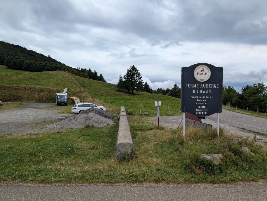
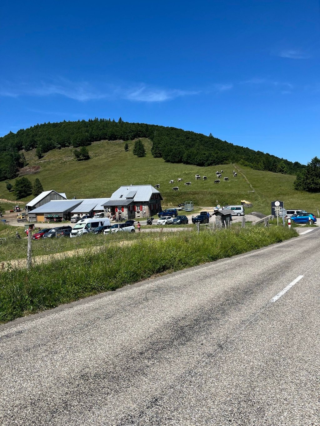
A pleasant climb through the forest and pretty countryside. In and after Saint Amarin, there are a few steep sections, then it becomes more regular before the slight descent into Geishouse for 1 km. Once over the barrier, it's 6km through the woods to the Häagen-Dazs farm. It's a great way to start, despite one or two authorised vehicle crossings. The last kilometre before the farm is very steep! The last kilometre is then easy. A climb I would recommend.
Ascension agreable a travers la foret et dans de jolis paysage. A Saint Amarin et après, il y a quelques passages bien pentus puis cela détient plus regulier ensuite avant la légère descente sur Geishouse sur 1 km. Une fois la barrière franchie sur la route du grandballon, il y a 6km dans les bois jusqu'à la ferme du Häag sur une route réservéeaux usagers faibles. Le pied malgré l'un ou l'autre passage de véhicules autorisés. Le dernier km avant la ferme est fort pentu (entre 9 et 15%)! Le dernier km se fait ensuite facilement. Une ascension que je recommande.
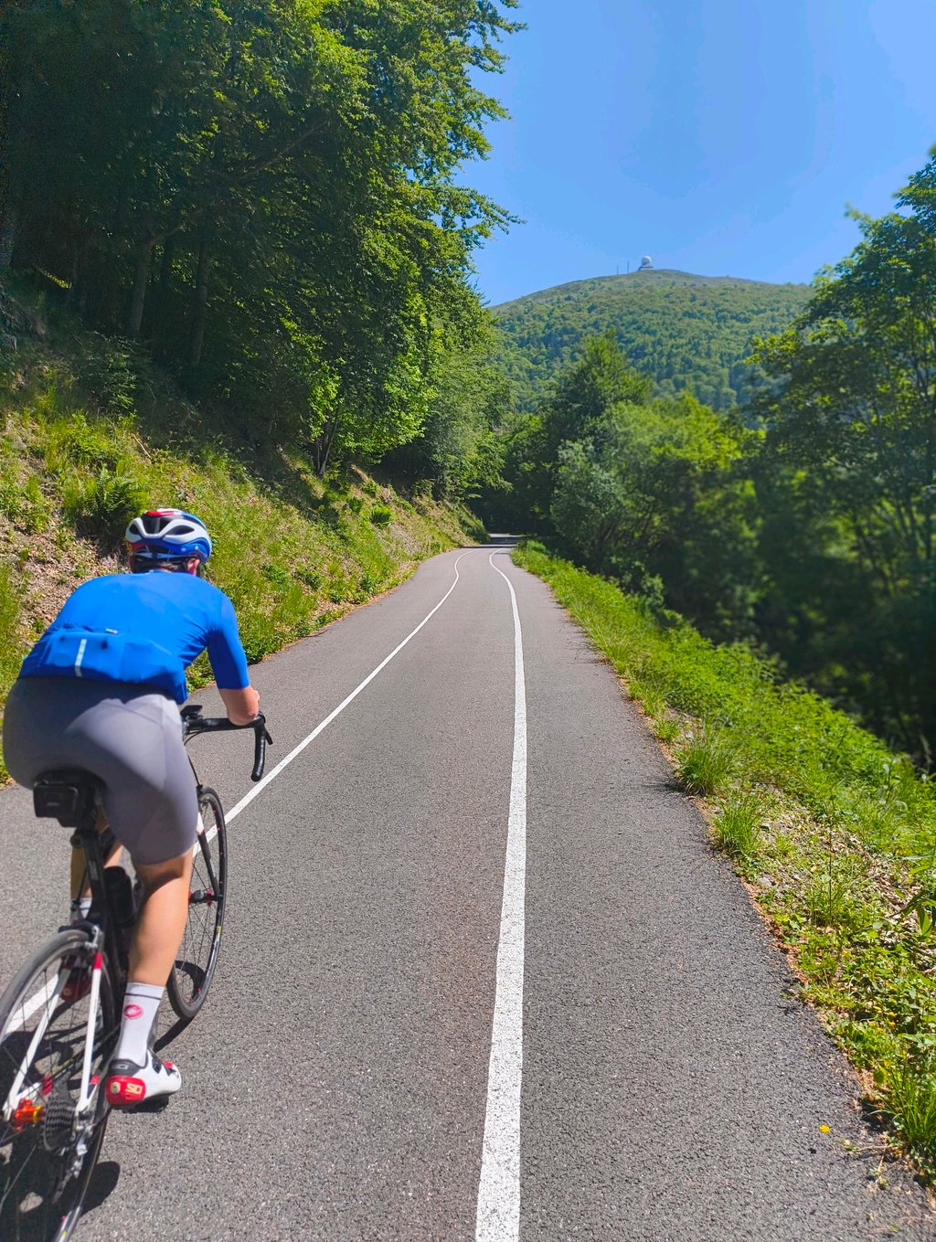
Really nice climb, love the scenery. Yes, it’s quite steep in some places, but there are multiple bits where it levels off so you can recover. From Saint-Amarin it immediately starts steep with bits around 15%. After the second hairpin at the carpark it levels off to about 3%, which gives you your first breather. After the carpark it never drops below 9% until you reach Geishouse. Immediately after the bend it goes down for about 1 km which gives you a nice breather again. After this decent you go up steadily at around 5% until you have to get off your bike to go under the barrier. From here until the Du Haag farm is car free, but be careful as some locals have a permit to use this path anyways (which is what happend to me, luckily I could avoid a collision). The pavement here is immaculate, so absolutely no problems there. Gradient rises above 15% regularly, but mostly it’s around 10%. Again there are multiple bits where it flattens out to 3% or even less. The last bit towards the farm was quite challenging to me as this stretch felt like it never dropped below 15%. At the farm you connect with the Route de Crêtes with one more hairpin to go to get you over the col. Spectacular views await. Managed to do it just within the hour on a 29er. Overall a must do when in the region.
I found it more difficult than I'd imagined. And even then, I didn't have the old surface. It's a steep climb from the start. Thanks to those who made the flat spot in the middle! I was wondering what a HC pass was doing in the Vosges. I've got the answer.
I went there on the day the Tour arrived at Le Markstein. Lots of cyclists were going up too. It was great.
Je l’ai trouvée plus difficile que ce que j’avais imaginé. Et encore, je n’ai pas connu l’ancien revêtement. Dès le début, ça grimpe fort. Merci à ceux qui ont fait ce replat au milieu ! Je me demandais ce que faisait un col HC dans les Vosges. J’ai eu la réponse.
J’y suis allé le jour de l’arrivée du Tour au Markstein. Beaucoup de cyclistes montaient aussi. C’était chouette.
From St Amarin the gradient is very severe in places, as far as Geishouse after a short descent, we start the main course 7 last km between 8 and 9%, for years that I go up by this slope there, It's great to have brand-new tarmac under your wheels 😉👏👍, so make the most of the few flat spots, because the slope starts to steepen again, with a magnificent view from the top of the Col du Haag, where it's rumoured that the Tour de France will do a time trial ⏱, something to keep an eye on!!!.
Time taken to climb 1h10 minutes 😉
Depuis St Amarin la pente est très sévère par endroits, jusqu'à Geishouse après une courte descente, on entame le plat de résistance 7 derniers km entre 8 et 9% , depuis des années que je monte par ce versant là, quel bonheur d´avoir un bitume flambant neuf sous les roues 😉👏👍, conseil profitez des rares replat, car la pente repart de plus belle, vue magnifique au sommet du col du Haag, il se murmure que le tour de France y fera 1 étape chrono ⏱, affaire à suivre !!!.
Temps de la monté 1h10 minutes 😉
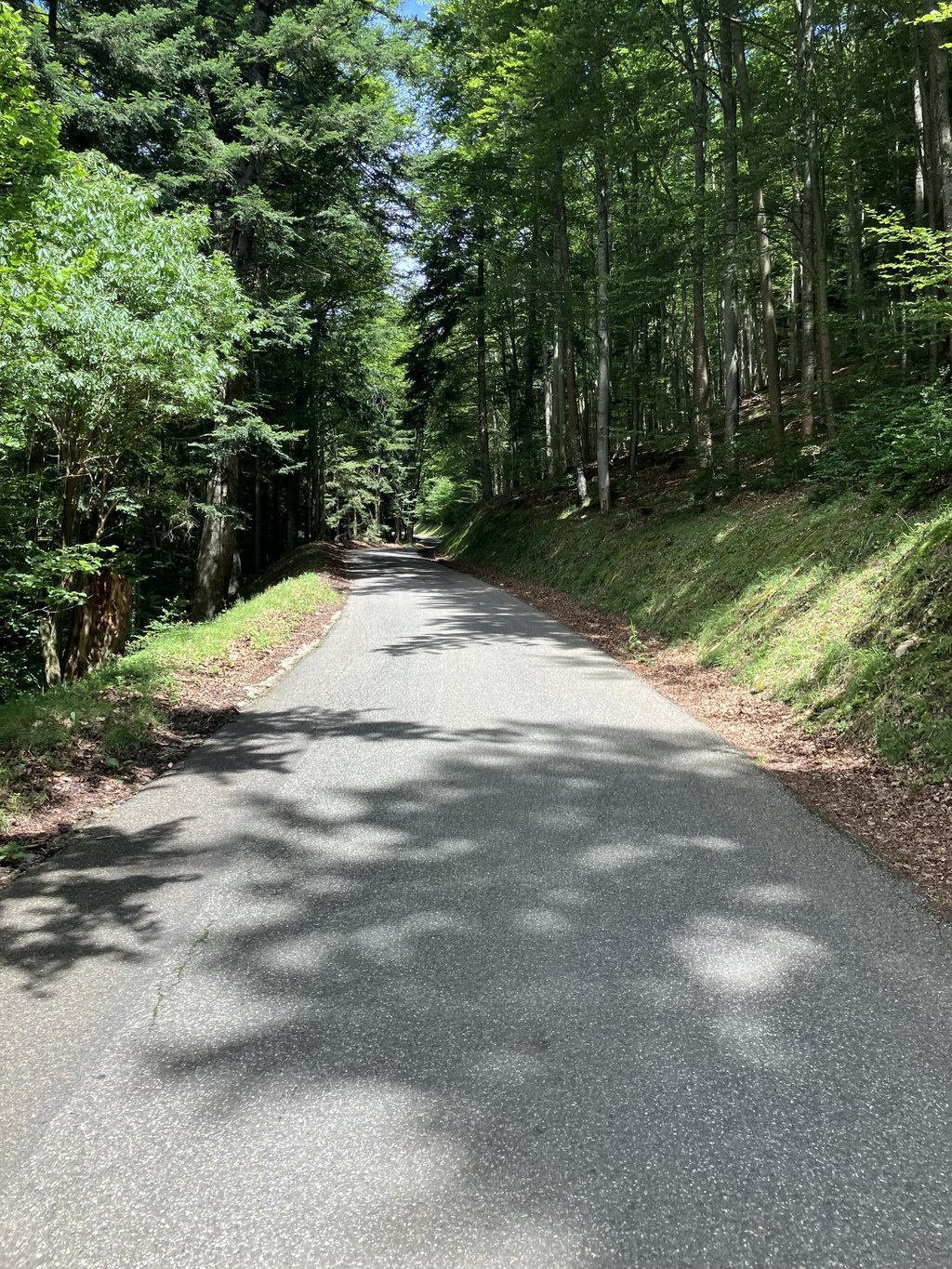
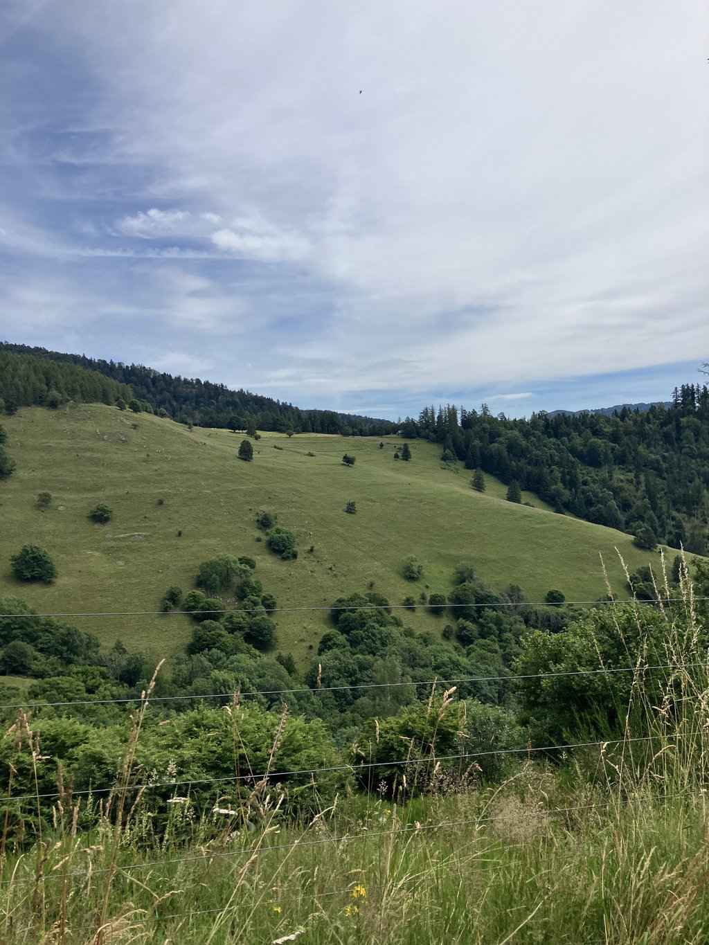
A demanding and uneven climb. Just after the church of St Amarin, a few very dry climbs set the scene in the village and before Geishouse too. Then, after a short descent into the village of Geishouse, the route du Haag begins, which has just been completely renovated (2023) and is only accessible by bike. The asphalt is a real billiard table, and the peace and quiet away from cars and motorbikes is much appreciated. Nevertheless, the climb remains steady and, after a short respite and a hairpin bend, the last stretch before the Haag farm is really testing. The rest of the way along the route des crêtes to the grand ballon is much more accessible. As far as the scenery is concerned, the section through Geishouse is nice, then there's a thick forest and the panorama becomes clear once you reach the Col du Haag.
This is the most difficult ascent to the grand ballon (classified out of category) but since the road has been renovated, it is well worth the diversions.
Montée exigeante et irrégulière. Juste après l'église de St Amarin quelques montées bien sèches annoncent la couleur dans le village puis avant Geishouse également. Ensuite, après une courte descente dans le village de Geishouse débute la route du Haag qui vient d'être totalement rénovée (2023) et dont l'accès est réservé aux vélos. L'asphalte est un vrai billard et le calme loin des autos et motos est appréciable. Néanmoins l'ascension reste soutenue et après un court répit et un virage en épingle, le dernier tronçon avant la ferme du Haag est vraiment éprouvant. La suite sur la route des crêtes jusqu'au grand ballon est beaucoup plus abordable. Question paysages, la traversée de Geishouse est sympa, en suite c'est une forêt épaisse et le panorama se dégage arrivé au col du Haag.
C'est la montée la plus difficile pour accéder au grand ballon (classée hors catégorie) mais depuis la rénovation de la route, elle vaut vraiment le détour.
If you like cycling through holes an absolute must. Plus, the short but technical descent to geishouse lets you show your poorly descending friends your back nicely. Overall a fun climb, but watch out for the cows on the steepest part of the climb!
Als je houdt van door gaten fietsen een absolute aanrader. Bovendien kun je in de korte maar technische afdaling naar geishouse je slecht afdalende vrienden mooi je rug laten zien. Overall een leuke klim, maar pas wel op voor de koeien op het steilste stuk van de klim!
After Geishouse, there are no more holes in the bitumen, the bitumen has been removed.
It's a Gravel climb now.
The road is quite smooth and not so bad.
Obviously the performance is poor especially in this wet period. It goes well with 32" road tyres.
Otherwise it's obviously difficult but the regularity allows you to find your rhythm and you end up reaching the top...
Après Geishouse, Il n’y a plus de trous dans le bitume, le bitume a été enlevé.
C’est une montée Gravel maintenant.
Le chemin est assez lisse et pas si mauvais.
Évidemment le rendement est médiocre surtout en cette période humide. Ça passe bien avec des pneus route en 32
Sinon c’est évidemment difficile mais la régularité permet de trouver son rythme et on fini par arriver en haut…
Serious and nice climb. Close to undrivable surface though with numerous potholes (african road...) so I would recommend to wait for a new layer of asphalt and do another grand ballon climb next time
Serious and nice climb. Close to undrivable surface though with numerous potholes (african road…) so I would recommend to wait for a new layer of asphalt and do another grand ballon climb next time
Wonderful climb, right through nature. Pity about the bad road surface, but definitely worth the effort or diversions. Make sure you get to the top, because descending is indeed not an option.
Prachtige klim, dwars door de natuur. Jammer van het slechte wegdek, maar zeker de moeite of een omweg waard. Zorg er wel voor dat je boven komt, want afdalen is inderdaad geen optie.
From the start you have to work hard. Nice climb with several pieces of 14-15%. Until Geishouse, the tarmac is reasonable. Between Geishouse and Ten Haag it is very bad. Going up you can cycle reasonably well between the holes. Last 200 meters to Ten Haag the top layer is completely gone. I would not recommend this one for the descent. Lovely quiet road though.
Vanaf de start moet je gelijk aan de bak. Mooie klim met meerdere stukken van 14-15%. Tot Geishouse is het asfalt redelijk. Tussen Geishouse en Ten Haag erg slecht. Omhoog kan je nog wel redelijk tussen de gaten door fietsen. Laatste 200 meter tot Ten Haag is de toplaag er helemaal af. Voor de afdaling zou ik deze afraden. Wel heerlijk rustige weg.
The last 200m before you leave St Amarin the road is very steep. There is hardly any traffic and up to Geishouse the road is good. The forest road between Geishouse and Ten Haag is very bad (summer 2020). I have therefore not cycled it. From St Amarin to Geishouse is ok, therefore 2 stars. See also many comments on climb from Moosch.
De laatste 200m voor je St Amarin verlaat is de weg erg steil. Er is nauwelijks verkeer en tot Geishouse is de weg goed. De bosweg tussen Geishouse en Ten Haag is heel erg slecht (zomer 2020). Die heb ik daarom niet gefietst. Vanuit St Amarin tot Geishouse is ok, daarom 2 sterren. Zie ook vele commentaar bij klim vanuit Moosch.
| 5 mph | 01:35:24 |
| 7 mph | 01:07:32 |
| 9 mph | 00:52:38 |
| 12 mph | 00:39:32 |
This page is better in the app