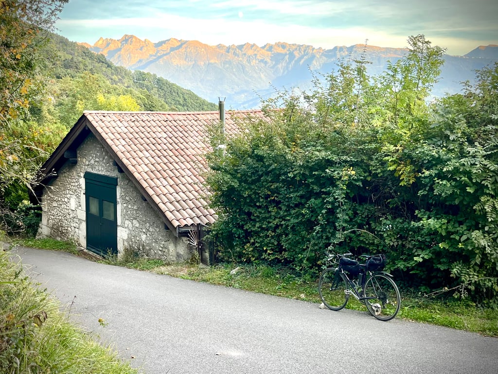
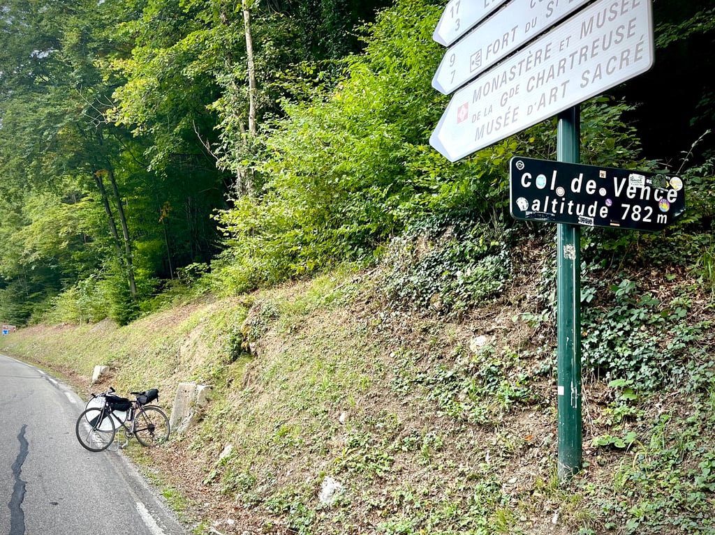
Col de Vence from Grenoble via Chantemerle is a climb in the region Grenoble. It is 3.4 mi long and bridges 1798 ft of vertical ascent with an average gradient of 10%, resulting in a difficulty score of 619. The top of the ascent is located at 2631 ft above sea level. Climbfinder users shared 4 reviews of this climb and uploaded 13 photos.
Road names: Chemin Charles Pajon & Chemin de Chantemerle
4.0 by Niels1987This is an automatic translation, the original language is: Dutch.I rode a slightly different variant of the Col de Vence that is perhaps even tougher than this one. The last part over the Chemin de Chateau Pilon is the same and I can confirm that this stretch is indeed super-heavy and a bit 20%. However, I came from Meylan via the Chemin du Bachais, Chemin Saint Bruno (already a kind of Mur of Huy of 1.8 km), Chemin des Escoliers (super steep elephant path), Chemin de Pre Morin (almost entirely between 15-20%, unfortunately last part not entirely paved un... read more

Welcome! Please activate your account if you would like to share something. Look for the verification email in your inbox.
If you want to upload your photos, you need to create an account. It only takes 1 minute and it's completely free.
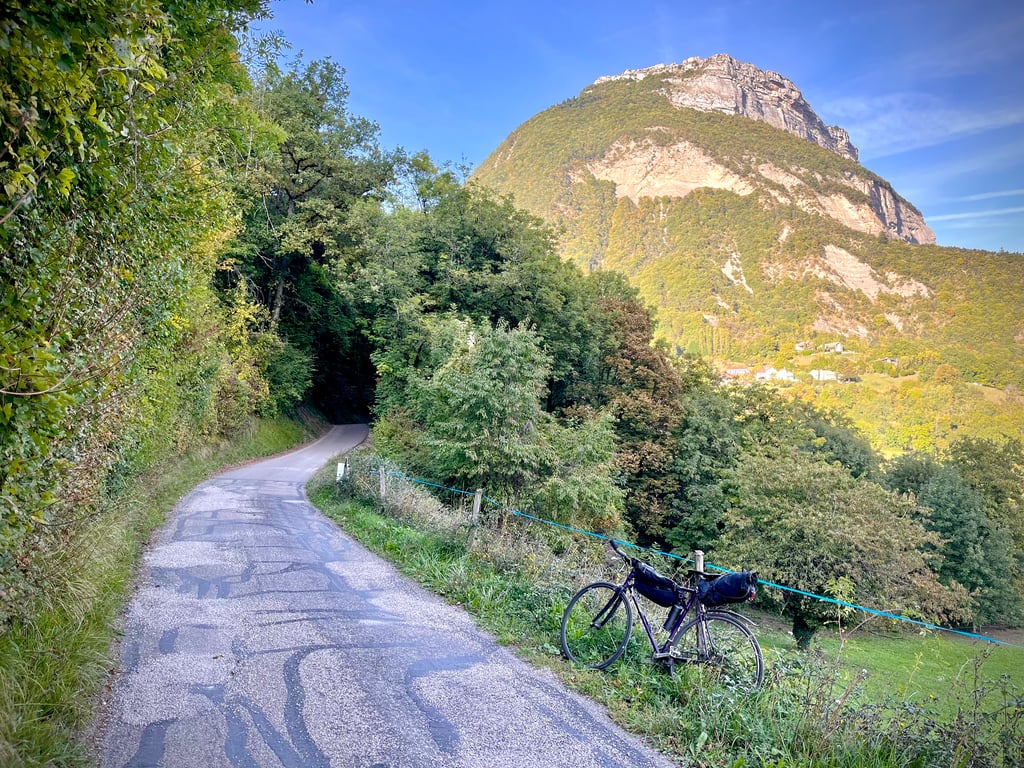
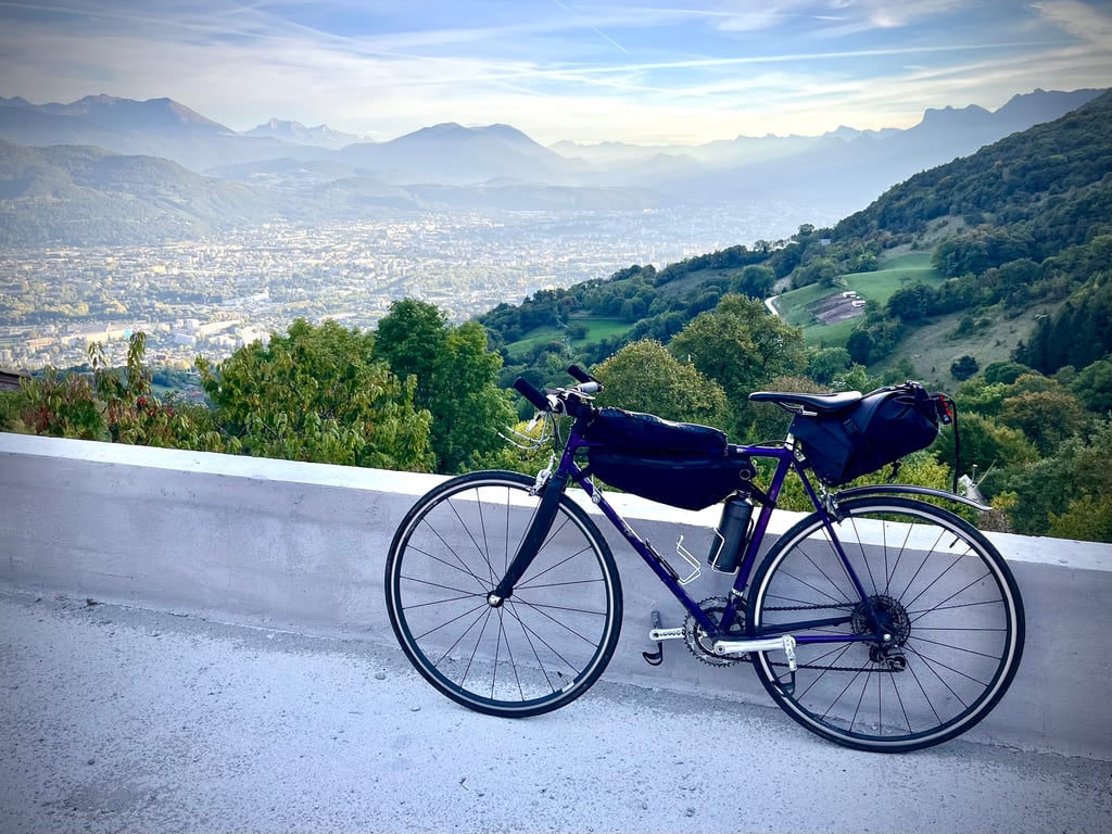
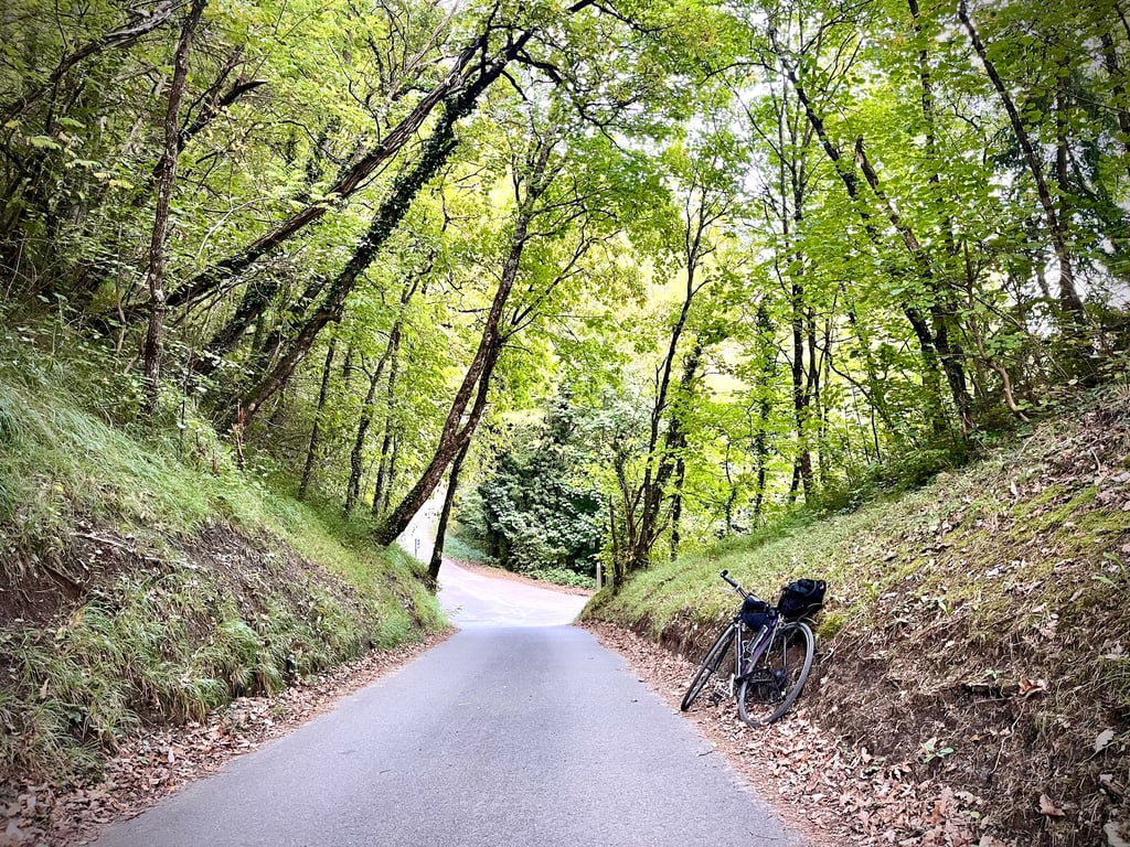
A steep climb, tracking back roads up to the Col. The first part is pretty dull, with high walls and a relatively narrow width. It’s also a bit of a cut through for traffic, meaning I had to stop and wait for several cars to squeeze past an oncoming bus. It was just after 5pm on a weekday, so probably a busier time of day, but a warning for anyone who wants to ride the climb. After crossing the main route up the Col de Porte, the road is much quieter, and the views over the city and mountains emerge. This is just as steep, but much quieter, and it’s simply access to the residential area. At the top, between Batonnièrre and Chateau Pilon, the road is partially closed due to a landslip. A small path for pedestrians is maintained, meaning it is still possible to ride up, but the inhabitants have to drive up and down the climb to access the village. If you try and plot the climb on Strava, it thinks the road is impassable, and tries to send you up a small track. The track is probably not passable, except by foot, or a mountain bike with a huge climbing gear (and probably still needing a motor). Overall, a fun climb, but at the time I did it, a bit too busy with cars.
What a spicy little pass! Short, but very tough.
The gradients range from difficult to very difficult!
I can also confirm that the Château Pilon path is really steep, probably well over the 17.4% announced on the profile.
Part of the road was closed this day due to a subsidence in the carriageway. It just forces you to make a small loop via the D512 and it's possible to return to this Château Pilon road if you want to laminate your calves.
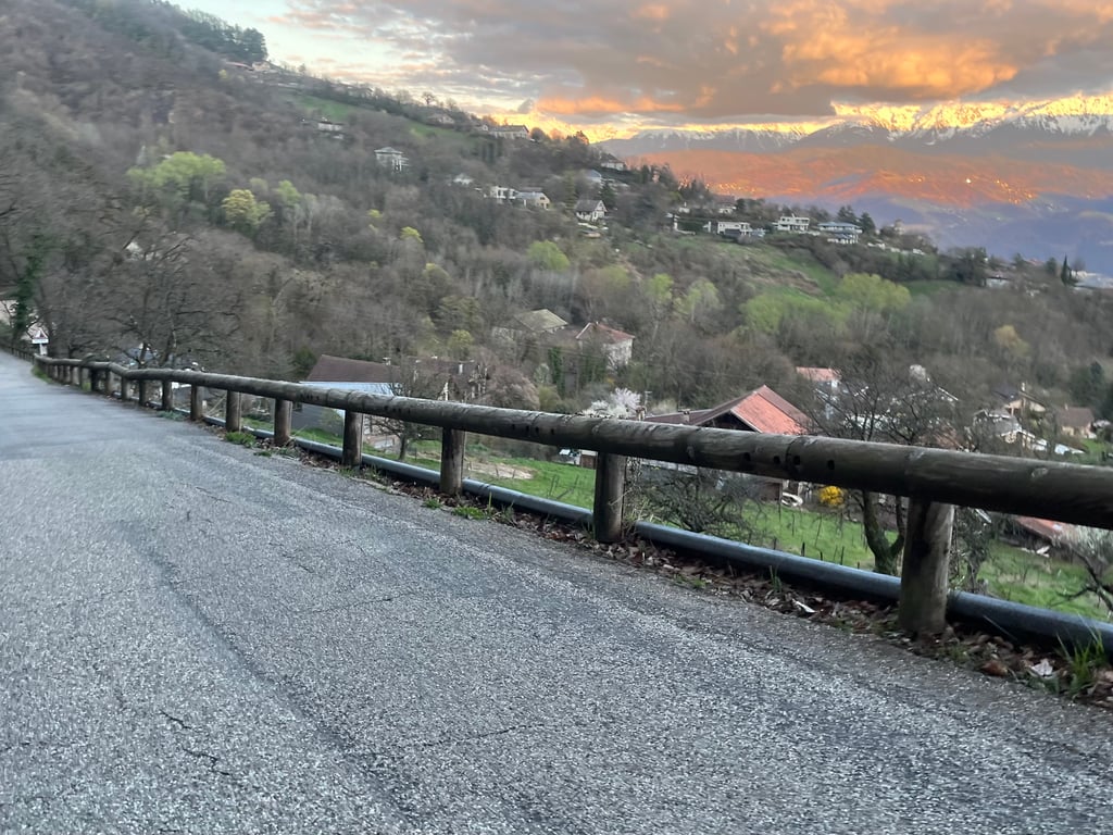
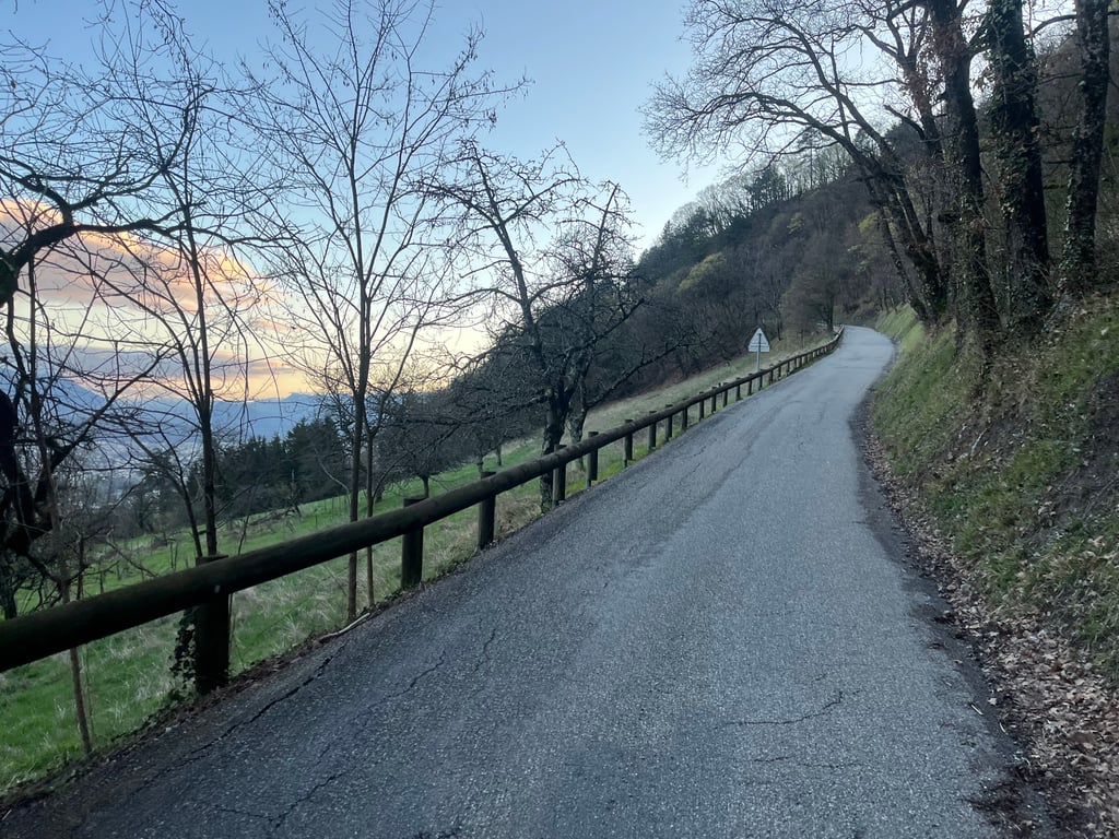
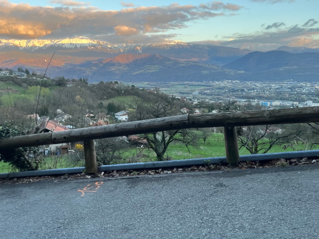
Little traffic. Narrow but decent road. Some panoramic views over Grenoble.
Mine de rien, il est épicé ce petit col ! Court, mais bien costaud.
Les pourcentages vont de difficiles à très difficiles !
Je confirme également que le chemin de Château Pilon est vraiment très pentu, probablement bien au delà des 17,4% annoncés sur le profil.
Une partie de la route était fermée, ce jour, en raison d’un affaissement de la chaussée. Ça oblige juste faire une petite boucle par la D512 et il est possible de revenir sur ce chemin de Château Pilon si l’on veut laminer ses mollets.
Peu de circulation. Route étroite mais correcte. Quelques vues panoramiques sur Grenoble.
I rode a slightly different variant of the Col de Vence that is perhaps even tougher than this one. The last part over the Chemin de Chateau Pilon is the same and I can confirm that this stretch is indeed super-heavy and a bit 20%. However, I came from Meylan via the Chemin du Bachais, Chemin Saint Bruno (already a kind of Mur of Huy of 1.8 km), Chemin des Escoliers (super steep elephant path), Chemin de Pre Morin (almost entirely between 15-20%, unfortunately last part not entirely paved until route de la Chartreuse) , Chemin de Chateau Pilon (downhill for a while to get back on the route de la Chartreuse with 20% slope). As the Chemin de Pre Morin is not fully paved (here I had to walk myself because it was too steep with large stones on the road) this route is unsuitable for climbfinder, however, the Chemin de Bachais and Chemin Saint Bruno can be combined with this route or the normal way to the Col de Vence via the route de la Chartreuse.
Ik reed een iets andere variant van de Col de Vence die misschien nog wel zwaarder is dan deze. Het laatste deel over de Chemin de Chateau Pilon is hetzelfde en ik kan bevestigen dat dit stuk inderdaad superzwaar en een stukje 20% is. Ik kwam echter vanuit Meylan via de Chemin du Bachais, Chemin Saint Bruno (al een soort Mur van Huy van 1,8 km), Chemin des Escoliers (supersteil olifantjepaadje), Chemin de Pre Morin (vrijwel geheel tussen 15-20%, jammer genoeg laatste stuk niet geheel verhard tot route de la Chartreuse) , Chemin de Chateau Pilon (even afdalen om weer met 20% helling op de route de la Chartreuse terug te komen). Omdat de Chemin de Pre Morin niet geheel verhard is (hier moest ik zelf even lopen omdat het er te steil was met grote stenen op de weg) is deze route ongeschikt voor climbfinder, echter zijn de Chemin de Bachais en Chemin Saint Bruno wel te combineren met deze route of de normale weg naar de Col de Vence via de route de la Chartreuse.
This is an ascent that I usually make in a more irregular variation: first the normal road (route de la Chartreuse, D512), then very quickly the path of the Black Madonna (which leads to the eponymous chapel, a local curiosity) and then the path of Maubec, which joins the path of Chantemerle shortly before the hamlet of the same name.
Whichever option you choose, the road is narrow and therefore requires a certain amount of caution, even if the traffic is generally light (unlike the D512).
Be careful, the last hundred or two hundred meters of the Château Pilon road, just before joining the main road (D512), are terribly steep. Given the speed at which I pass them, I estimate them at well over 20%. So don't rely on the average of the last five hundred metres (13%): it's just an average (underestimated?).
C'est une ascension que je fais habituellement selon une variante plus irrégulière : la route normale d'abord (route de la Chartreuse, D512), puis très vite le chemin de la Vierge Noire (qui mène à la chapelle éponyme, une curiosité locale) puis le chemin de Maubec, qui rejoint le chemin de Chantemerle peu avant le hameau du même nom.
Quelle que soit la variante choisie, la route est étroite et demande par conséquent une certaine prudence, même si le trafic est généralement réduit (contrairement à celui de la D512).
Attention, les cent ou deux cent derniers mètres du chemin de Château Pilon, juste avant de rejoindre la route principale (D512), sont terriblement raides. Vu la vitesse à laquelle je les passe, je les évalue à largement plus de 20%. Ne pas se fier donc à la moyenne des cinq cent derniers mètres (13%) : ce n'est justement qu'une moyenne (sous-estimée ?).
| 5 mph | 00:41:01 |
| 7 mph | 00:29:02 |
| 9 mph | 00:22:38 |
| 12 mph | 00:17:00 |
This page is better in the app