Tips nearby


| 5 hairpin turns |
| #76 toughest climb of Hautes Alpes |
| #48 most elevation gain of Hautes Alpes |
| #35 longest climb of Hautes Alpes |
| #86 average steepest climb of Briançon |
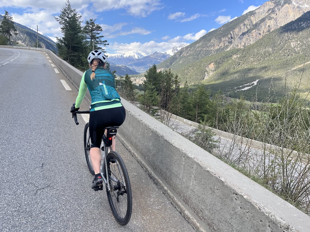
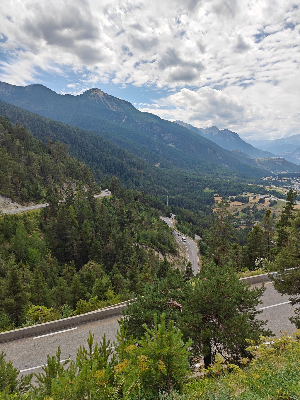
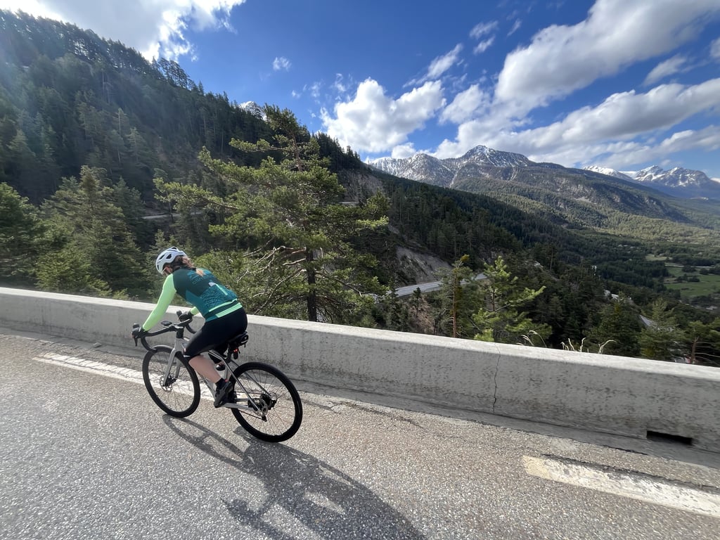
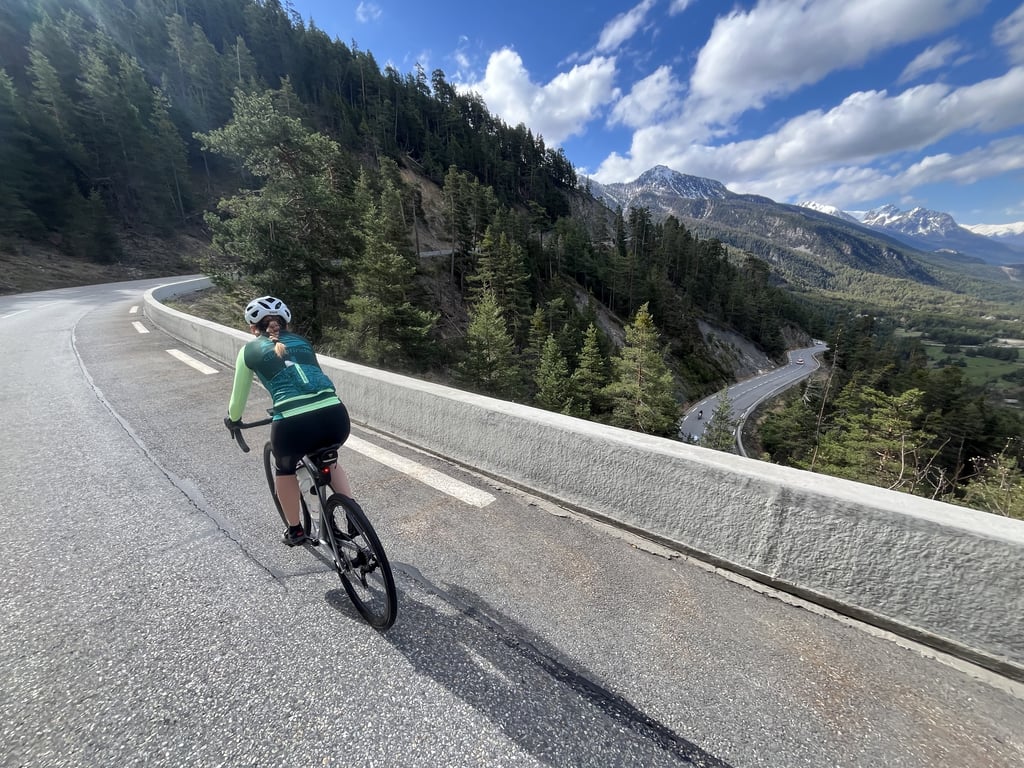
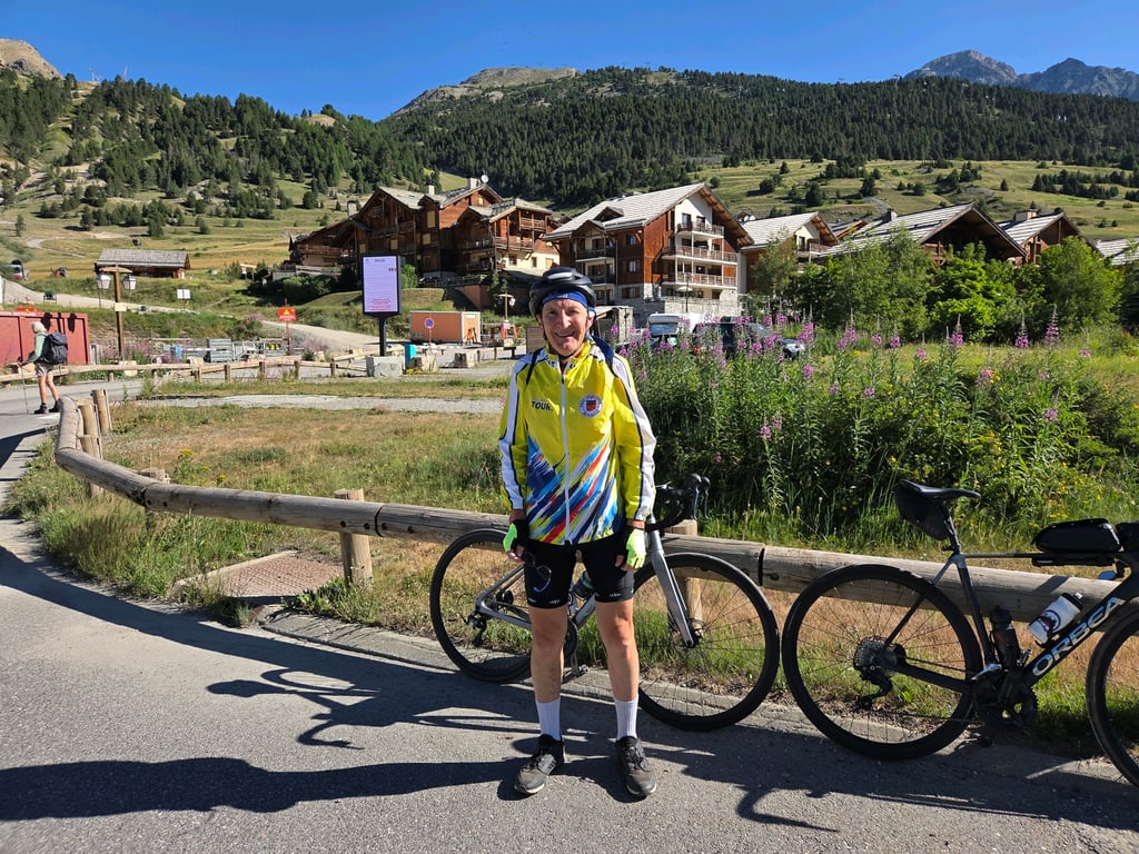
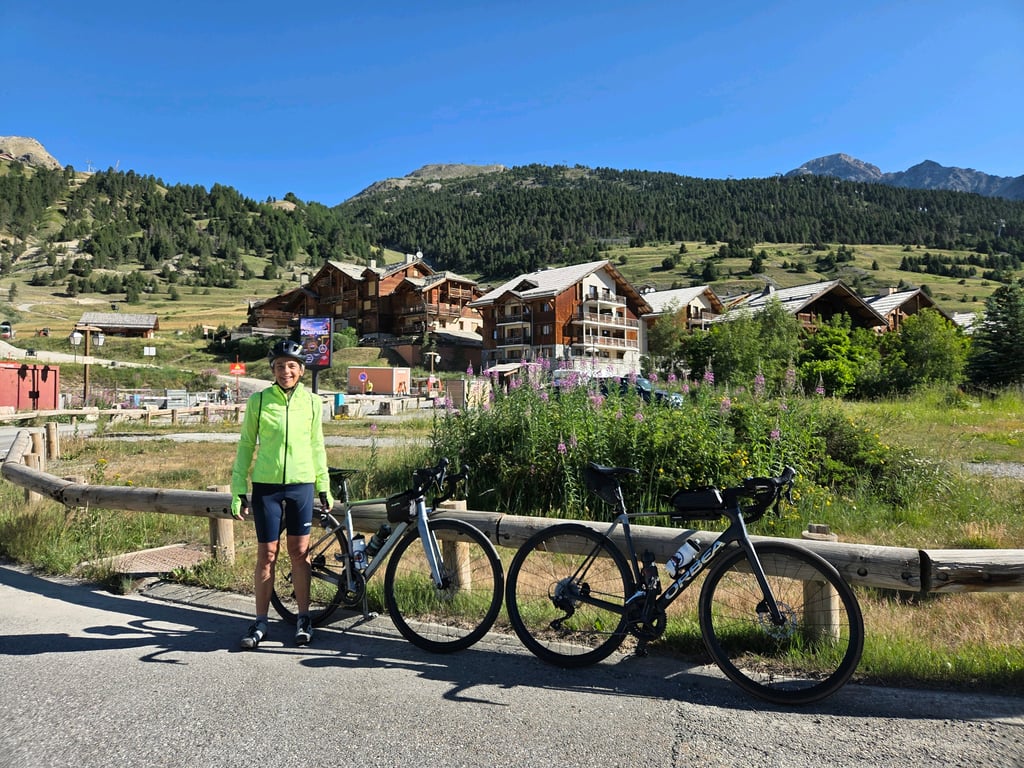
Col de Montgenèvre from Briançon is a climb in the region Briançon. It is 6.9 mi long and bridges 1775 ft of vertical ascent with an average gradient of 4.8%, resulting in a difficulty score of 354. The top of the ascent is located at 6083 ft above sea level. Climbfinder users shared 11 reviews of this climb and uploaded 9 photos.
Road name: Rue Champ de Mars, N94
3.0 by Greg37This is an automatic translation, the original language is: French.The climb is fairly easy. There are a lot of cars and motorcycles, and the road is in very good condition on the French side. The descent toward Oulx for cyclists, however, is disrupted.... read more

Welcome! Please activate your account if you would like to share something. Look for the verification email in your inbox.
If you want to upload your photos, you need to create an account. It only takes 1 minute and it's completely free.
The climb is fairly easy. There are a lot of cars and motorcycles, and the road is in very good condition on the French side. The descent toward Oulx for cyclists, however, is disrupted.
Montée assez facile. Beaucoup de voitures et de motos, route en très bon état, côté français. La descente pour les vélos vers Oulx en revanche est perturbée.
A climb to get you between Briançon and Cesana Torinese. Having climbed it a few times over a week in early July, I can offer the following tips regarding traffic: mostly it’s moderate, but weekends the traffic is heavy, especially during the day. Scenery is nice with views over the forts and mountains, gradients steady, and the road surface is good. However, I wouldn’t ride this except as part of a longer ride to do another climb.
Nice switchbacks and constant ascent, unfortunately a lot of traffic
Mooie switchbacks en constante stijging, helaas heel veel verkeer
A steady and magnificent climb, but unfortunately there is a lot of road traffic all the way up.
Montée régulière et magnifique, malheureusement le trafic routier est très important tout au long de la montée.
The climb itself could be beautiful, too bad about the huge traffic flow that can be encountered on weekends.
As for the climb, it has a constant gradient with several switchbacks, but the traffic spoils the whole thing, which is a shame. A climb to do to end a tour of France from Italy
La salita di per se potrebbe essere stupenda, peccato per il flusso di traffico enorme che si può incontrare nei weekend.
Per quanto riguarda la salita ha una pendenza costante con diversi tornati, ma il traffico rovina il tutto un vero peccato. Salita da fare per chiudere un giro in Francia partendo dall'Italia
I agree with the other comments: it's a nice little climb, not difficult, on a very good road, but the flow of vehicles is non-stop (at least in the middle of the day, on a Saturday in the middle of summer).
So you can't really enjoy the surroundings, which are nevertheless very beautiful.
Perhaps do it out of season.
Je rejoins les autres commentaires : joli petite montée pas difficile sur une très bonne route, mais le flot de véhicules est ininterrompu (du moins en milieu de journée, un samedi en plein été).
On ne peut donc pas vraiment profiter de l'environnement qui pourtant est très beau.
A faire peut-être hors saison.
A climb that would also be nice if it wasn't constantly full of traffic. In the afternoon, it is very hot. If you have to return to Italy from Briançon, the Col de l'Echelle is much more pleasant.
Salita che sarebbe anche carina se non fosse costantemente piena di traffico. Al pomeriggio è molto calda. Se devi rientrare in Italia da Briançon è molto più piacevole il Col de l'Echelle.
A very wide but busy road. The surface is excellent, the gradient even and never too difficult. In Montgenèvre, there are plenty of options for eating and drinking. The descent on the Italian side is fast on a very wide road.
Une route très large mais très fréquentée. Le revêtement est excellent, la pente est régulière, jamais trop difficile. À Montgenèvre, vous aurez de nombreuses options pour vous restaurer et boire un verre. La descente côté italien est rapide sur une route très large.
I climbed this side of the pass about 20 years ago. I remembered a wide road, in good condition and relatively steep in places, but very, very busy, and an unwelcoming summit. Apparently it hasn't changed much...
Col grimpé il y a une vingtaine d'années par ce versant. J'en ai gardé le souvenir d'une route large façon boulevard, en bon état et relativement pentue par endroits mais très, très fréquentée, et d'un sommet peu accueillant. Apparemment ça n'a guère changé…
Staying in cycle junction Briançon I cycled, next to the 3 big climbs (Izoard/Galibier/Granon) this climb to the border crossing France-Italy.
Wide connecting road implies heavy traffic (also trucks/buses) with accompanying exhaust fumes.
The first 3 kilometers are a mixture of short steep parts, flat road, slightly downhill and false flat uphill.
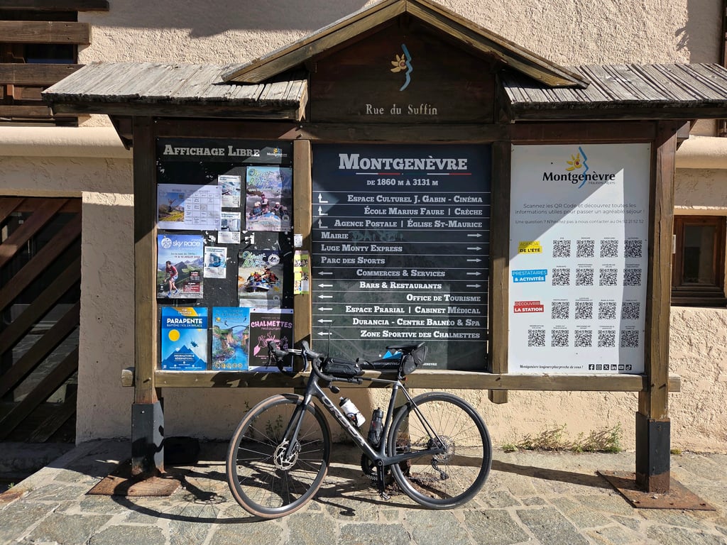
After crossing the Durance river at La Vachette follows a beautiful series of 6 hairpin bends followed by fairly straight road with reasonable percentages to the roundabout for the pass height where the through motorized traffic into a tunnel dives. Summit is a modern low-traffic ski village with summer activity (restaurants/shops).
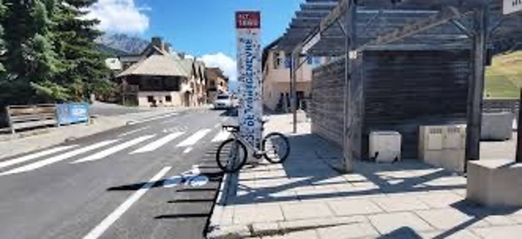
Border post is located at the end of the village.
Without heavy traffic, this is a beautifully landscaped pass to cycle on, so try to avoid the peak moments.
In a distant past, this might have been the pass where Hannibal crossed the border with his elephants. Presumably it was less crowded then!!!
Verblijvend in fietsknooppunt Briançon heb ik, naast de 3 grote kleppers (Izoard/Galibier/Granon) deze klim naar de grensovergang Frankrijk-Italië op gefietst.
Brede verbindingsweg impliceert druk verkeer (ook vrachtwagens/bussen) met bijbehorende uitlaatgassen.
De eerste 3 aanloopkilometers zijn een mengeling van korte stukjes steil, vlakke weg, licht bergaf en vals plat naar omhoog.
Na de oversteek van de Durance rivier thv. La Vachette volgt een prachtige serie van 6 haarspeldbochten gevolgd door vrij rechte weg met redelijke percentages tot het rondpunt voor de pashoogte alwaar het doorgaand gemotoriseerd verkeer een tunnel induikt. Top is een modern verkeersarm skidorp met zomerse activiteit (horeca/winkels).
Grenspost ligt aan het einde van het dorp.
Zonder druk verkeer is dit een prachtig aangelegde pas om op te fietsen.Trachten de piekmomenten te vermijden is dus de boodschap.
In een heel ver verleden zou dit mogelijk (niet historisch zeker) de pas geweest zijn waar Hannibal met zijn olifanten de grens overstak. Vermoedelijk was het dan minder druk!!!
Actually a pretty boring climb with often a lot of traffic. Is good to do with the Italian side of the col Echelle in a nice circle. But the descent on the Italian side is not harmless and the Italians drive like crazy.
Eigenlijk een vrij saaie klim met vaak veel verkeer. Is goed te doen met de Italiaanse zijde van de col Echelle in een mooi rondje. Maar de afdaling aan de Italiaanse kant is niet ongevaarlijk en de Italianen rijden als gekken.
| 5 mph | 01:23:46 |
| 7 mph | 00:59:18 |
| 9 mph | 00:46:13 |
| 12 mph | 00:34:43 |
This page is better in the app