| Famous climb |
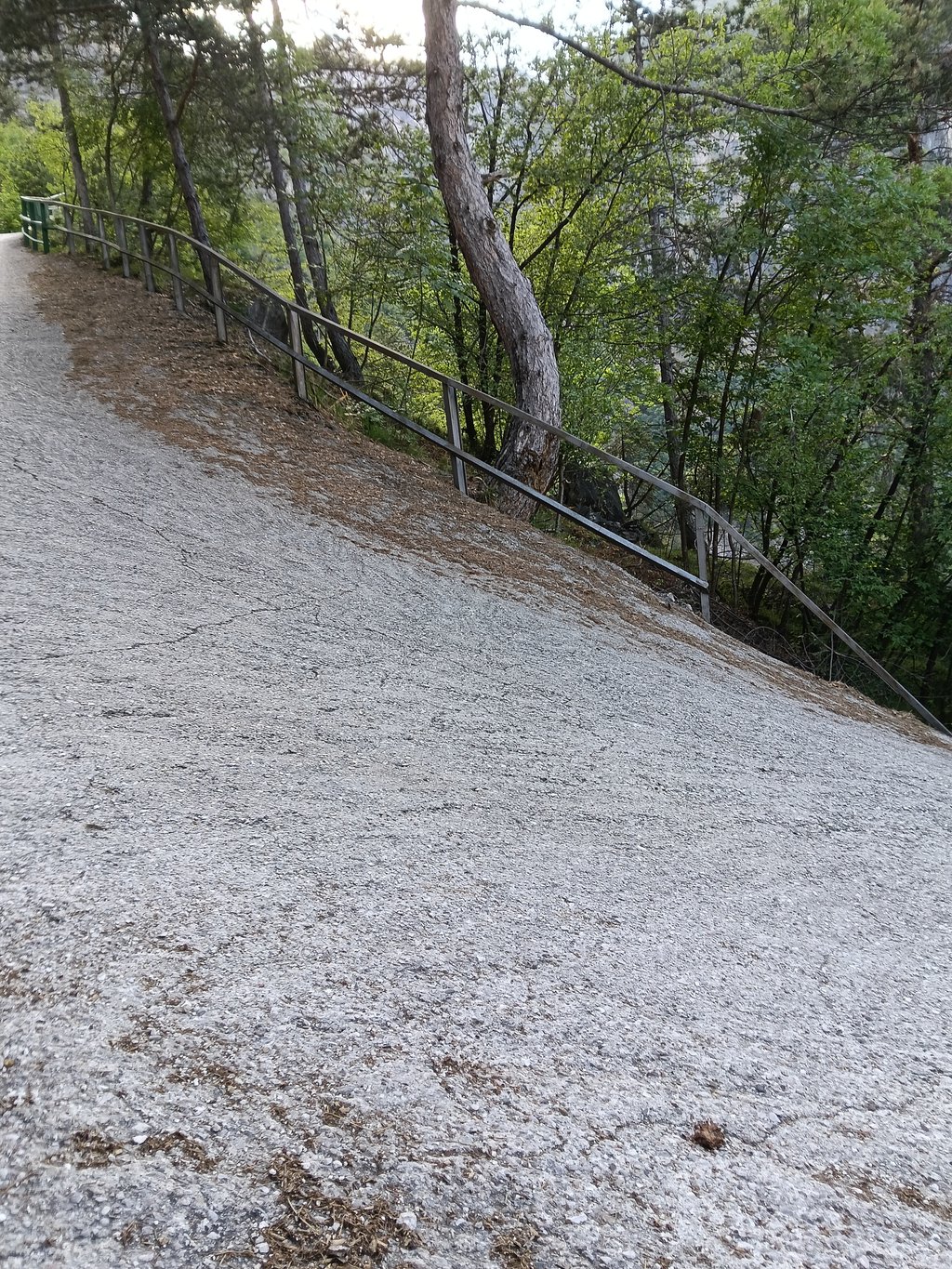
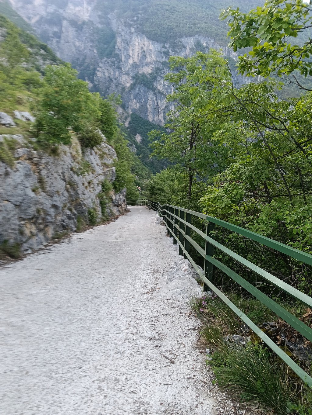
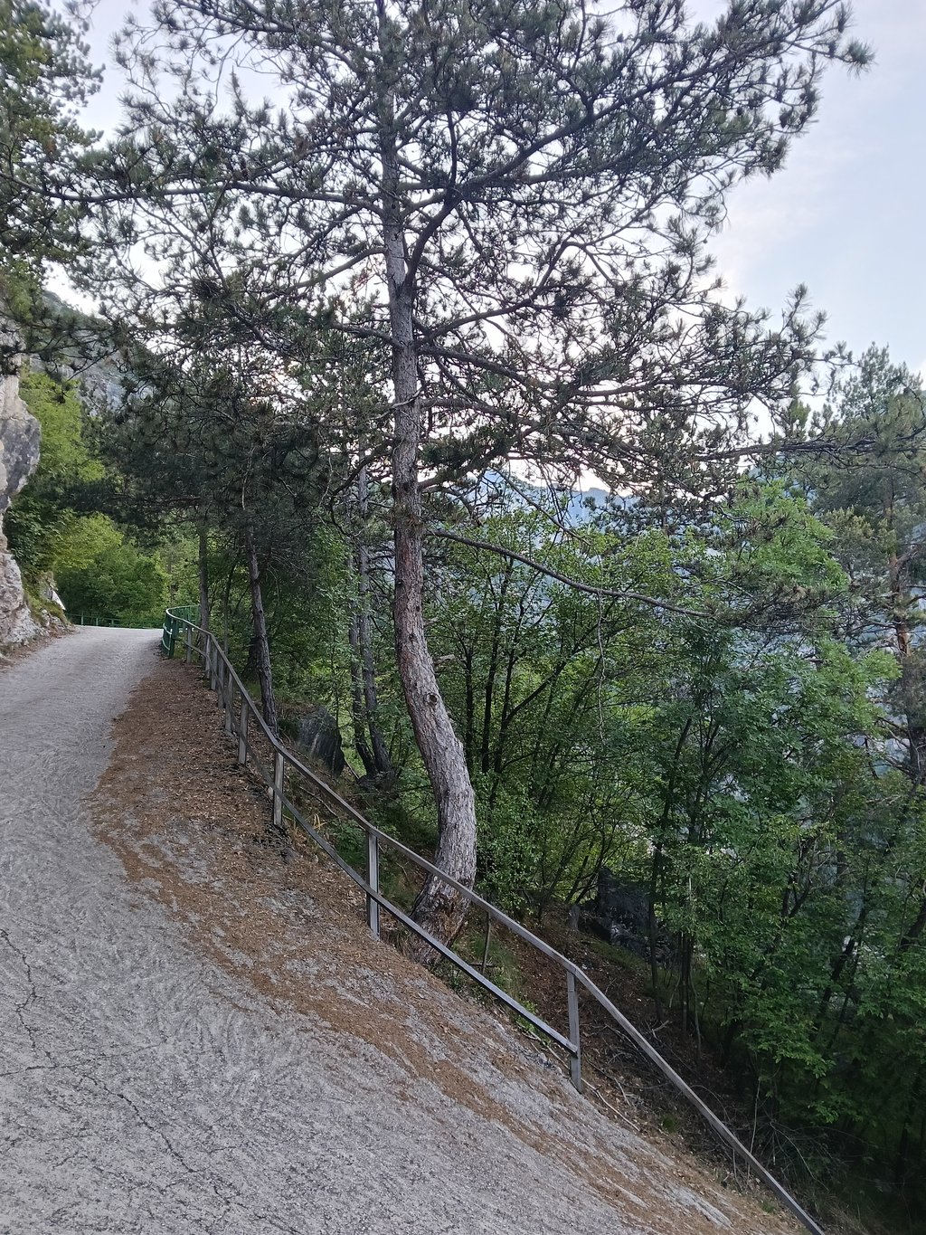
| Beautiful scenery |
| 19 hairpin turns |
| #39 toughest climb of World |
| #62 most elevation gain of Trentino-South Tyrol |
| #91 average steepest climb of Italian Alps |
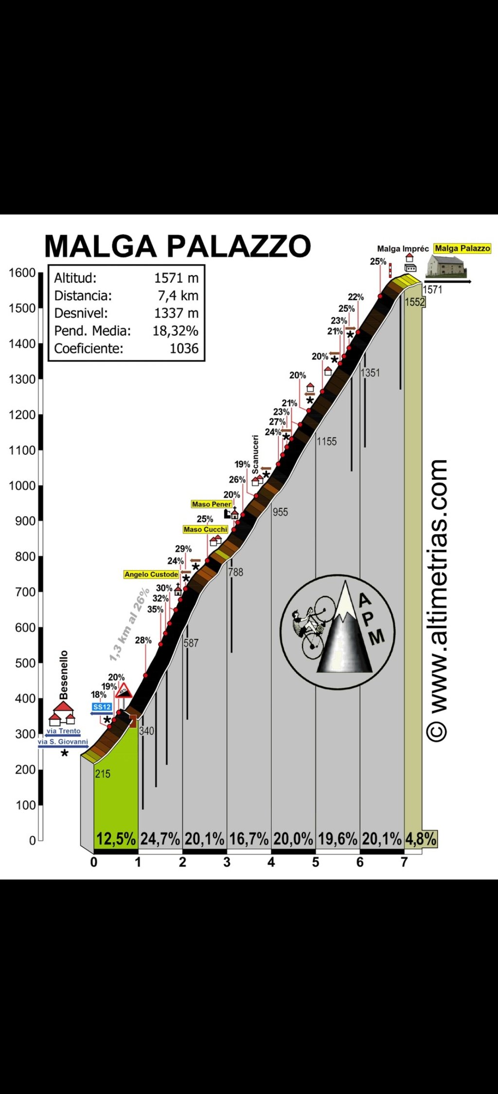
Scanuppia / Malga Palazzo is a climb in the region Trento. It is 9.2 km long and bridges 1196 m of vertical ascent with an average gradient of 13%, resulting in a difficulty score of 2124. The top of the ascent is located at 1390 m above sea level. Climbfinder users shared 28 reviews of this climb and uploaded 11 photos.
Road name: Va della Posta Vechia
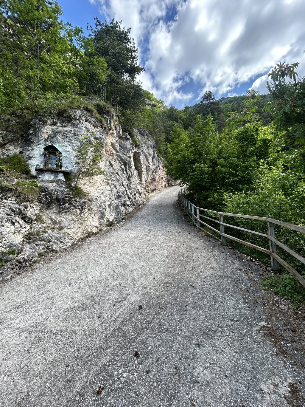
by Scanuppiose; 22-05-2008This is an automatic translation, the original language is: Dutch.Very appropriately, the Scanuppia features the 14 stations of Christ's dying journey to Golgotha. Higher powers have pre-emptively arranged for you not to notice the chapels immediately. The first station is near the little bridge: Jesus is sentenced to death. Then the steepness increases: Jesus takes the cross on his shoulders. At the first bend must be the station where He falls under the cross for the first time. At station five, Simon of Cyrene helps Him carry the cross, but the lonelin... read more

Welcome! Please activate your account if you would like to share something. Look for the verification email in your inbox.
If you want to upload your photos, you need to create an account. It only takes 1 minute and it's completely free.
I have been wanting to try it for a long time, the first 2 km are the craziest, scariest, very difficult. After that the climb to 20% feels like a false floor.A good experience definitely to be repeated.
Da tempo volevo provarla,i primi 2 km sono i piu pazzeschi,paurosi,molto difficile .Dopo questo la salita al 20% ti sembra un falso piano.Una bella esperienza sicuramente da ripetere.
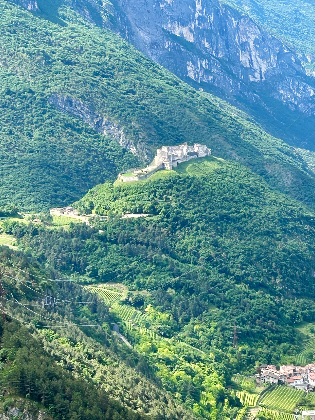
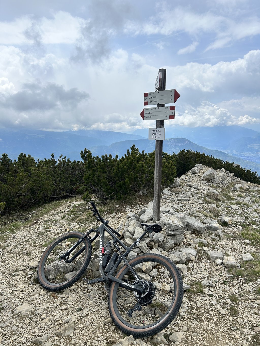
I had been meaning to go and try out the Scannippia for some time. I did so on Saturday 24 May 2025. Mtb S-Works Epic 30t 10-50. I had made Punta Veleno two weeks earlier as a reference, and well: Punta Veleno is flat by comparison. The first 3 km leave one incredulous, luckily the ground is good and in some sections one can zigzag. After arriving at Malga Palazzo, I continued on to anticima Monte Cornetto and descended to Folgaria. The scenery is very beautiful on Val Lagarina and Castel Beseno, the passage of cars is very low, I recommend doing it early in the morning or on a cool day.
Da tempo mi proponevo di andare a provare la Scannippia. L’ho fatto sabato 24 Maggio 2025. Mtb S-Works Epic 30t 10-50. Avevo come riferimento Punta Veleno fatta due settimane prima, ebbene: al confronto Punta Veleno è pianeggiante. I primi 3 km lasciano increduli, per fortuna il fondo è buono e in alcuni tratti si può andare a zig zag. Arrivato a Malga Palazzo, ho proseguito per anticima Monte Cornetto e sono sceso a Folgaria. I paesaggi sono molto belli sulla Val Lagarina e su Castel Beseno, il passaggio di auto è bassissimo consiglio di farla al mattino presto o in giornate fresche.
bike specialized turbo levo expert gearing rear largest assist max 100%...time about 1h , battery 700 gone all !!!!! mate fell off the bike backwards a few times and landed on his back!!!!
from 16:20 scanuppia
https://www.youtube.com/watch?v=vABZDMfcwN8
rower specialized turbo levo expert przełozenie z tyłu największe wspomaganie max 100%...czas ok 1h , bateria 700 poszła cała !!!!! kolega kilka razy odpadł na rowerze do tyłu i wylądował na plecach!!!!
od 16:20 scanuppia
https://www.youtube.com/watch?v=vABZDMfcwN8
Very appropriately, the Scanuppia features the 14 stations of Christ's dying journey to Golgotha. Higher powers have pre-emptively arranged for you not to notice the chapels immediately. The first station is near the little bridge: Jesus is sentenced to death. Then the steepness increases: Jesus takes the cross on his shoulders. At the first bend must be the station where He falls under the cross for the first time. At station five, Simon of Cyrene helps Him carry the cross, but the loneliness of your own way of the cross is not broken with outside help. Station nine is somewhere in the middle of the steepest section: Jesus falls under the cross for the third time. The copper bas-relief shows a stumbled and beaten man being pulled up by raucous Romans. A tragic scene, especially if you have just rolled off your bike yourself, roaring. ( https://www.youtube.com/watch?v=44mAZXiB0Jo )
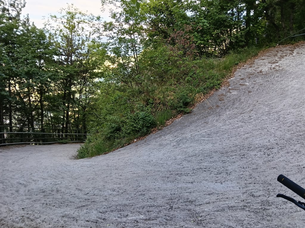
How on earth do you describe 25 or 28 per cent? You can describe the road surface. Rough mixed concrete poured over the mountain straight from the mill and still most reminiscent of coarse corrugated sand at a retreating sea. But that steepness? Before I realised it myself, shortly after the start of the really steep section, I was standing like a circus horse with the front wheel in the air. One nice thing about the Scanuppia is that you are alone in the forest. Nobody watching you and that's just as well; the antics required to get back on your bike do not fall under normal human motor skills. My stumbling on the steepest part, therefore, deserves no prize. Cycling a bit, hitting the road, almost falling over, walking up a bit to find a pick-up spot, not getting off, cursing, cycling another bit. Why did I have to go up here at 28-32 if I had to? Haughtiness comes before standstill. The last two kilometres it started raining, drizzling, but enough to bring me to a halt several times with the wheel slipping. What a bummer. And did I, almost at the top, choose the wrong direction at the last junction? Because a little further on: end of the road, closed gate; openable but unpaved and unclimbable with a road bike. The cows in the cold-clammy fog I reached on foot. Ice cold they stayed down, not even a moo was possible.
In the book "De Renner" by Tim Krabbé, an alpinist is asked why he climbs a mountain.
Because that mountain is there, the alpinist replies.
Keeping the Scanuppia in mind the only correct answer.
In a wonderful reflection on the alpinist's will and being, we are then introduced to the true alpinist. To him the question: why don't you climb a mountain? His answer: because there are mountains.
After the Scanuppia, the only correct answer.
Although.
This climb crossed my path too late.
Roger Thijs
Zeer toepasselijk is de Scanuppia voorzien van de veertien staties van Cristus’ stervenstocht naar Golgotha. Hogere machten hebben preventief geregeld dat je de kapelletjes niet meteen in de gaten hebt. De eerste statie staat in de buurt van het bruggetje: Jezus wordt ter dood veroordeeld. Dan neemt de steilte toe: Jezus neemt het kruis op zijn schouders. Bij de eerste bocht moet de statie zijn waar Hij voor de eerste maal onder het kruis valt. Bij statie vijf helpt Simon van Cyrene Hem het kruis te dragen, maar de eenzaamheid van je eigen kruisweg wordt niet met hulp van buitenaf doorbroken. Statie negen staat ergens in het midden van het steilste gedeelte: Jezus valt voor de derde maal onder het kruis. Het koperen bas-reliëf toont een gestruikelde en afgeranselde mens die door rauwe Romeinen overeind wordt getrokken. Een tragisch tafereel, zeker als je net zelf rochelend van je fiets bent gerold. ( https://www.youtube.com/watch?v=44mAZXiB0Jo )
Hoe beschrijf je in godsnaam 25 of 28 procent? Het wegdek kun je beschrijven. Ruw gemengd beton dat zo vanuit de molen over de berg is gegoten en nog het meest doet denken aan grof ribbelzand bij een terugtrekkende zee. Maar die steilte? Voor ik het zelf in de gaten had stond ik kort na het begin van het echt steile gedeelte als een circuspaard met het voorwiel in de lucht. Een prettige bijkomstigheid van de Scanuppia is dat je alleen bent in het bos. Niemand die je gadeslaat en dat is maar goed ook; de capriolen die nodig zijn om terug op je fiets te komen vallen niet onder de normale menselijke motoriek. Mijn gestrompel op het steilste gedeelte verdient dan ook geen prijs. Een stukje fietsen, langs de weg raken, bijna omvallen, een stukje omhoog lopen om een opstapplek te vinden, niet van plaats komen, vloeken, weer een stukje fietsen. Waarom moest ik hier zonodig omhoog met 28-32? Hoogmoed komt voor de stilstand. De laatste twee kilometer begon het te regenen, miezerig, maar genoeg om me meermaals met slippend wiel tot stilstand te brengen. Wat een gesukkel. En koos ik, bijna boven, de verkeerde richting bij de laatste splitsing? Want even verder: end of the road, gesloten hek; weliswaar te openen maar onverhard en met een racefiets niet te beklimmen. De koeien in de koudklamme mist bereikte ik lopend. IJskoud bleven ze liggen, zelfs geen loei kon er vanaf.
In het boek “De Renner” van Tim Krabbé wordt aan een alpinist gevraagd waarom hij een berg beklimt.
Omdat die berg er is, antwoordt de alpinist.
Met de Scanuppia voor ogen het enige juiste antwoord.
In een prachtige beschouwing over de wil en het wezen van de alpinist worden we vervolgens voorgeleid aan de ware alpinist. Aan hem de vraag: waarom beklimt u geen berg? Zijn antwoord: Omdat er bergen zijn.
Na de Scanuppia het enige juiste antwoord.
Alhoewel.
Deze klim heeft te laat mijn pad gekruist.
Roger Thijs
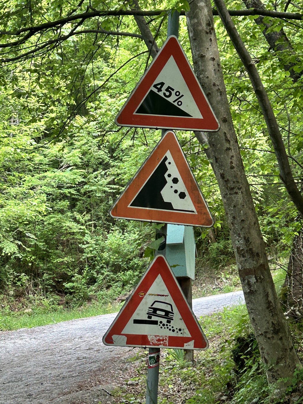
I came along there this summer from the Stelvio, first the wrong mountain when I drove to a road that was closed to traffic, apparently the route to a castle, also pretty, also steep but doable. Then found the scanuppia. After the abandoned company you encounter, the bridge ... After the turn with the sign 45% it gets ridiculously steep, with 34/32T it was doable for a bit but after a good 100m I had to break off because falling is not an option here...
Ik kwam er deze zomer langs vanuit de Stelvio, eerst de verkeerde berg op gereden toen ik een weg tegen wak die afgesloten was voor verkeer, blijkbaar de route naar een kasteeltje, ook best mooi, ook stijl maar goed te doen. Daarna de scanuppia gevonden. Na het verlaten bedrijf wat je tegenkomt, de brug over... daar wordt het na de bocht met het bord 45% belachelijk stijl, met 34/32T was het een stukje te doen maar na een goede 100m afgebroken want vallen is hier geen optie...
I have included this one in my holiday tour. Although it has little to do with what I like to cycle. Read a lot of different info. Most of which comes from 'recreational' colleagues.....
I would have liked to have seen: distance - time - W/kg - VSM - bike type - resistance (i.e. m/rev)
Strange that I haven't come across such obvious tips as fitting bars, putting the saddle in the front position and drinking through a hose supply..... So here it is.
The downhill doesn't seem to work for me, despite discs and dropper post. (Another tip, lower the saddle!)
Ik heb deze opgenomen in m'n vakantie tour. Ondanks dat het weinig met wat ik lekker fietsen vind te maken heeft. Lees erg uiteenlopende info. Die vooral afkomstig is van 'recreatieve' collega's.....
Ik had graag gezien: afstand - tijd - W/kg - VSM - fietstype - verzet (dus m/omw)
Vreemd dat ik voor de hand liggende tips als barends monteren, zadel in voorste stand zetten en drinken dmv slangtoevoer nergens ben tegengekomen..... Bij deze dus.
De afdaling lijkt me niks, ondanks schijven en dropper post. (nog een tip, zadel lager zetten!)
Climbed this climb yesterday, took 4.5 hours! It is such a steep mountain, you can't get up it. If they include it in the Giro d'Italia, I wonder who stays on his bike!
Gisteren deze klim beklommen, deed er 4.5 uur over! Het is zo verschrikkelijk steile berg, je komt er niet op. Als ze deze in de Giro d'Italia opnemen, benieuwd wie er op z'n fiets blijft zitten!
Another one we can tick on our bucket list. I wouldn't call this a beautiful climb, you just have to be crazy enough to do it. The first 4 kilometers are hell to do and don't have much to do with cycling anymore.
Weer eentje die we kunnen aankruisen op onze bucket list. Mooi zou ik deze beklimming niet noemen, ge moet er gewoon gek genoeg voor zijn voor deze te doen. De eerste 4 kilometer is gewoon een hel voor te doen en heeft niet veel meer met fietsen te maken.
Would be a nice one day classic: a time trial from the foot of the scanuppa to the top. I wonder who will keep their feet off the ground :)
zou een mooie eendags klassieker zijn: een tijdrit van de voet van de scanuppa tot de top. ben benieuwd wie er allemaal met zijn voetjes van de grond blijft :)
I did this climb last summer. It is indeed forbidden to cycle here, but apart from the forester and some locals, you really won't run into anyone here.
The climb starts terribly steep and on the worst parts I just started walking. Then it flattens out a little, but it is still terribly steep. It took me over 2 hours in total and I had an average speed of 3.3 kilometres per hour.
The descent is life-threatening and you have to do this one extremely slowly. Stop regularly to let your brake disc or rims cool down and, if necessary, walk down the steepest sections.
I did this climb on a hot summer day, which is definitely not recommended as it is hard enough without the heat. However, there are some water taps where you can refill your water bottles.
If you really want to do a fun climb then I would definitely advise against this climb. If, like me, you are looking for crazy challenges then I would definitely give it a try if you are in the area.
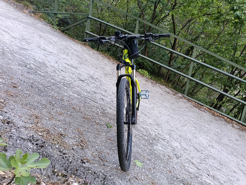
Also, do NOT try this climb on a road bike, but on a mountain bike with a very light gear.
Ik heb deze klim afgelopen zomer gedaan. Het is inderdaad verboden om hier te fietsen, maar op de boswachter en wat lokale bewoners na zul je hier echt niemand tegen komen.
De klim begint verschrikkelijk steil en op de ergste stukken ben ik maar gaan lopen. Daarna vlakt het een klein beetje af, maar het blijft nog steeds verschrikkelijk steil. Ik had er in het totaal ruim 2 uur voor nodig en ik had een gemiddelde snelheid van 3,3 kilometer per uur.
De afdaling is levensgevaarlijk en deze moet je extreem rustig doen. Stop regelmatig om je remschijf of je velgen te laten afkoelen en loop desnoods de steilste stroken omlaag.
Ik deed deze klim op een warme zomerdag en dat is zeker af te raden, want het is al zwaar genoeg zonder de hitte. Wel zijn er enkele watertappunten waar je je bidons kunt bijvullen.
Als je echt een leuke klim wilt doen dan zou ik deze klim zeker afraden. Ben je net als ik op zoek naar idiote uitdagingen dan zou ik het zeker is proberen als je in de buurt bent.
Probeer deze klim ook NIET op een racefiets, maar op een mountainbike met een heel licht verzet.
As far as I know, this road is now forbidden for cyclists... :-(
Voor zover ik weet is deze weg nu verboden voor fietsers… :-(
Guys, my sloping roof on the house is 45 degrees! That's already hard for me to walk on, those times it's necessary.
But a challenge, except for me with my compact. :(
Mannen, mijn schuine dak van het huis is 45 graden! Daar loop ik al moeilijk tegen op, die keren dat het nodig is.
Maar wel een uitdaging, behalve voor mij met mijn compact. :(
Hello, I used to ride motorcycles a lot in Italy. I had friends in Rovereto and one of them, Luciano Marsilli, was a contractor, who had a country house upstairs. He paved the road with his machines attached to the mountain with chains. According to him, the slope in some turns is 100% (45 deg) My bike didn't get up it with him on the back.
Gr Herman
Hallo, ik reed vroeger veel motor in Italë. Ik had vrienden in Rovereto en één van hen, Luciano Marsilli, was aannemer, die boven een buitenhuis had. Hij heeft de weg verhard met zijn machines die met kettingen waren vastgemaakt aan de berg. Volgens hem is de helling in enkele bochten 100 % (45 gr) Mijn motor kwam er niet op met hem achterop.
Gr Herman
This climb is so hard!
wat is deze klim zwaar zeg!
I haven't cycled it myself but man, man, man 45%..... that's not to do.... (I find Keutenberg hard enough)
ik heb hem zelf niet gefietst maar man,man,man 45 procent..... das toch niet te doen.... ( keutenberg vind ik al zwaar)
This is a hell of a climb
I got off after 3 KM
Dit is een helse klim
Ik stapte dan ook naar 3 KM af
By chance I knew someone who had a summer house up there. That man was contractor in Rovereto (Marsilli), He has paved the road in the past, the machines were attached to chains on the rocks. According to him, some bends had a gradient of 100%. I have been up several times in 1990-2000 with my bike, but only without a passenger. I had a Moto Guzzi 850 GT. Best regards H
Toevallig kende ik iemand die daarboven een zomerhuis had. Die meneer was aannemer in Rovereto (Marsilli) , Hij heeft de weg vroeger verhardt, daarbij zaten de machines aan kettingen aan de rotsen bevestigd. Volgens hem hadden sommige bochten een stijgingspercentage van 100 %. Ik ben een aantal keren in 1990- 2000 met mijn motor boven geweest .maar dat ging alleen zonder duopassagier. Ik had een Moto Guzzi 850 GT. Met vr grt H
A few years ago, in 2008, I already did this climb. A killer. Actually not to compare with other climbs. It doesn't really have much to do with cycling anymore. That's why it has been taken off the list of the Challange.big-eu and replaced by another climb in the same area. Passo Coe. I thought because of the accidents in the descent. But an experience in itself that you once in your life must do.
Een aantal jaren geleden , in 2008 al eens deze klim gedaan. Een moordenaar. Eigenlijk niet te vergelijken met andere klimmen. Het heeft eigenlijk niet zoveel meer met fietsen te maken. Hij is dan ook van de lijst van de Challange.big-eu gehaald en vervangen door een andere klim in die buurt. Passo Coe. Ik meende i.v.m.de ongelukken in de afdaling. Maar een belevenis op zich die je eens in je leven moet doen.
Kenny Van Hummel? Isn't that the sprinter? :)
Kenny van Hummel?? Dat is toch die sprinter? :)
Ha ha, that KOM. Maximum heart rate 147. Looks very believable.
Ha ha, die KOM. Maximale hartslag 147. Ziet er erg geloofwaardig uit.
@Mark van Yesterday No, not yet. But now that I know this climb, and have an acquaintance who has done it, I 'must' do it of course. I don't know yet if I'll take the MTB or the road bike for this ;-)
@Mark van Gisteren Nee nog niet. Maar nu ik deze klim ken, en een kennis heb die het wel gedaan heeft, 'moet' ik het natuurlijk wel doen. Ik weet nog niet of ik hiervoor de MTB pak of de racefiets ;-)
@ Rogier: Are you 'm also driven?
@ Rogier: Ben je 'm zelf ook op gereden?
@Alberto probably their car fell over because it became top-heavy ;-)
@Alberto waarschijnlijk viel hun wagentje om omdat ie topzwaar werd ;-)
Even google maps stops at the base with street view shots....
Zelfs google maps stopt aan de voet met street view opnames...
@Jeroen not of the whole climb, which turns into a mountain bike/goat trail on Strava. But the steepest part: https://www.strava.com/segments/4193689 With a bowl holder who doesn't go faster than 6.3 km/h that says enough I think...
@Jeroen van de gehele klim niet, die gaat over in een mountainbike/geitenpad op Strava. Maar het steilste deel: https://www.strava.com/segments/4193689 Met een komhouder die niet harder gaat dan 6,3 km/h dat zegt genoeg lijkt mij...
Anyone have a strava segment of this? Quite a challenge to have done once in a lifetime
Iemand een strava segment hiervan? Wel een uitdaging om eens in je leven gedaan te hebben
I rode it, this is a perfect little bump for the novice cyclist.
Ik heb hem gereden, dit is een perfect bultje voor de beginnende wielrenner
You don't go cycling on that for fun, do you?
Looking forward to the first experience here on climbfinder, but it won't come from me....
Dat ga je toch niet voor je plezier op fietsen?
Ben benieuwd naar de eerste ervaring hier op climbfinder, maar van mij zal die niet komen...
| 7 km/h | 01:18:33 |
| 11 km/h | 00:49:59 |
| 15 km/h | 00:36:39 |
| 19 km/h | 00:28:56 |
This page is better in the app