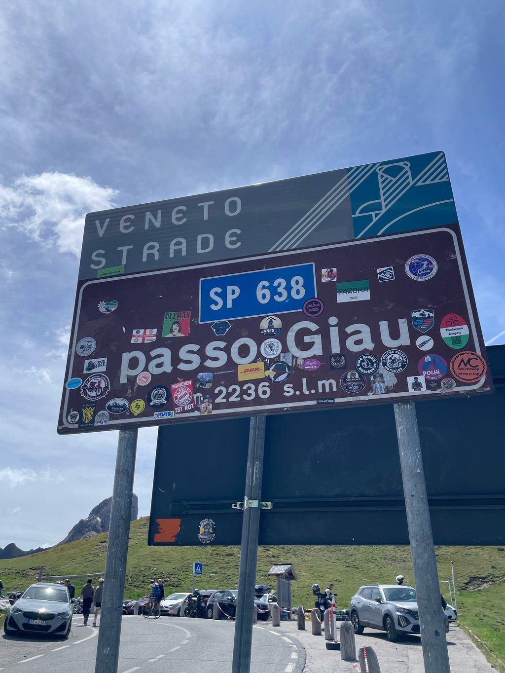
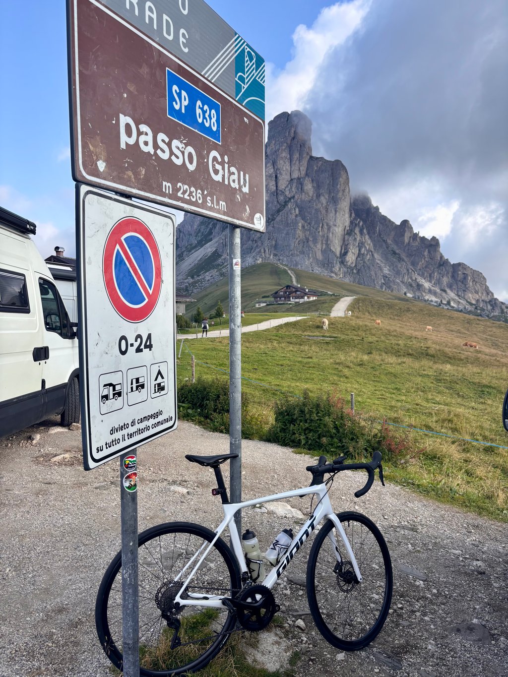
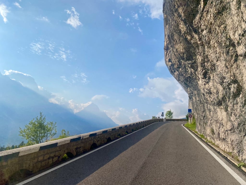
Passo Giau from Cortina d'Ampezzo is a climb in the region Belluno. It is 15.9 km long and bridges 1071 m of vertical ascent with an average gradient of 6.7%, resulting in a difficulty score of 838. The top of the ascent is located at 2238 m above sea level. Climbfinder users shared 18 reviews of this climb and uploaded 49 photos.
Road name: SR48 SP638
5.0 by patrickbaertThis is an automatic translation, the original language is: Dutch.Cycled up one of the monuments of the Giro d'Italia from Cortina. First kilometres to climb out of departure town are identical to the Passo Falzarego climb (see Climbfinder). After a few hairpin turns you leave the busy Dolomites road N48 by turning left in Pocol. Then it is wonderfully downhill for a while to start the continuous steep climb with little recuperation possibilities over 25 hairpin bends in an uninhabited mountain world. The first part through densely wooded mountain slop... read more
Welcome! Please activate your account if you would like to share something. Look for the verification email in your inbox.
If you want to upload your photos, you need to create an account. It only takes 1 minute and it's completely free.
A magnificent climb. It’s a bit busy leaving Cortina, but it gets quieter from the turn-off to Giau. Even then, though, there are still plenty of motorbikes and cars (on an early Wednesday morning in June). The climb is challenging and somewhat uneven, meaning the gradient regularly exceeds the average per kilometre shown on the graph. The views are fantastic and spectacular at the top. Don’t forget to look back regularly.
Prachtige klim. Cortina uit is wat druk, vanaf de afslag naar Giau rustiger. Maar ook dan nog veel motoren en auto's (op een vroege woensdagochtend in juni). De klim is pittig en ook wat onregelmatig, waardoor klim% geregeld uitkomt boven het km-gemiddelde van de grafiek. Uitzicht is fantastisch en bovenop spectaculair. Vergeet vooral niet regelmatig achterom te kijken.
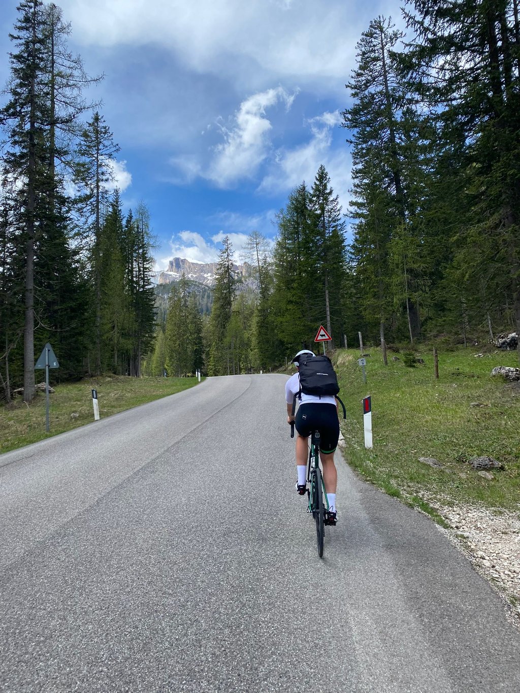
Traffic from Cortina till the crossroad Faluarego/Giau.After is much more peaceful. Last 2 km with great views.
Did it in the morning in July 2024. When you finally leave the city after 1.5 Km, the road opens up, and you have a nice panorama, after a cozy forest road with two major hairpins. When you reach Pocol, you get a Km of respite, before you get 1.5 km of downhill. Then the hard part begins. The last 8 km is almost 8.5%, with kilometres of over 9%. Sometimes you get a glimpse of the high mountains, and in the end, all the trees are gone, so you have great views of the surroundings. When I reached the top, all parking spaces were gone, and people were parking in the side of the road a kilometre down from the top. But the views and the long winding road make the entire climb worth it. When you descend the other side, it's fast and technical, fun to do.
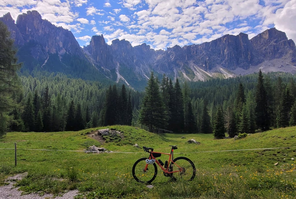
Beautiful climb. Really nice gradient the entire way, with a slight descent/flat section in the middle to rest the legs. The views of Cortina are stunning and as you get higher up the climb, the dolomite walls are something incredible. Really fun climb, with some great switchbacks as you near the top and a great summit rifugio at the top.
Lovely climb. There is a nice break with a long downhill after the initial climb out of Cortina, which breaks up the overall climb.
Superb climb, with many variations in gradient and a few passages at 12-13% a real pain in the arse... The magnificent panorama of the Dolomites is well worth it!
Superbe ascension, avec de nombreuses variations de pente et quelques passages à 12-13% bien casse-pattes… Le magnifique panorama sur les Dolomites se mérite!
The iconic Passo Giau is becoming more and more frequented due to its iconicity, so if you're stressed by crowded roads, avoid this place. But if you're willing to undergo at least a little discomfort, go for it. Upstairs, good strudel and coffee await as a reward.
Would recommend. Great mix of scenery. Good road, not too crowded (in the early morning at least).
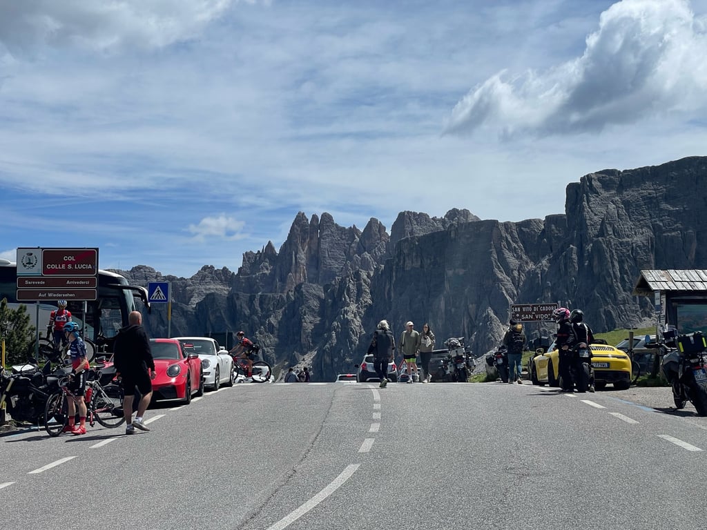
Stunning view of Tofane and Dolomites. Heavily trafficked during July-August, better starting in the early morning
A great climb! The tarmac is in good condition, and there are some nice hairpins and steep gradients to contend with! Watch out for the heavy traffic!
Une belle ascension ! Le bitume est en bon état, il y a de belles épingles, et de beaux pourcentages à affronter ! Attention à la circulation dense !
Een van de mooiste beklimmingen in de dolomieten. Vooral de laatste 2 km wanneer je boven de boomgrens uitkomt en een weidsuitzicht krijgt. De eerste beklimming is goed te doen, na de afdaling is het wel 8.5 km zwoegen naar de top maar het is het zeker waard. De weg is ook minder druk dan bij de sella ronda
Superb climb that is quite tough. Particularly the sections in the forest give little prospect of relief.
Once you come out of the forest you get a view of 1 of the Dolomites' most beautiful passes (along with Passo Sella).
See off and enjoy,
Schitterende beklimming die behoorlijk zwaar is. Met name de stukken in het bos geven weinig perspectief op verlichting.
Zodra je uit het bos komt krijg je zicht op 1 van de mooiste passen van de Dolomieten (samen met Passo Sella).
Zie af en geniet,
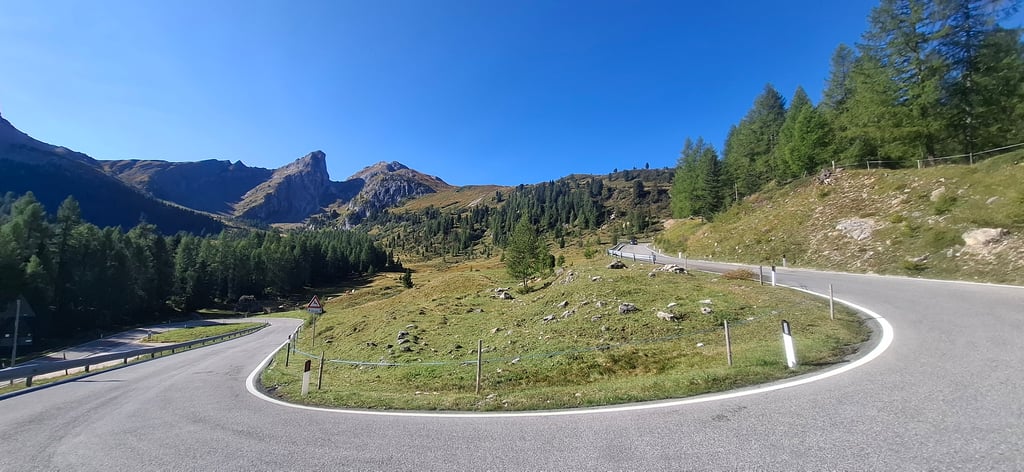
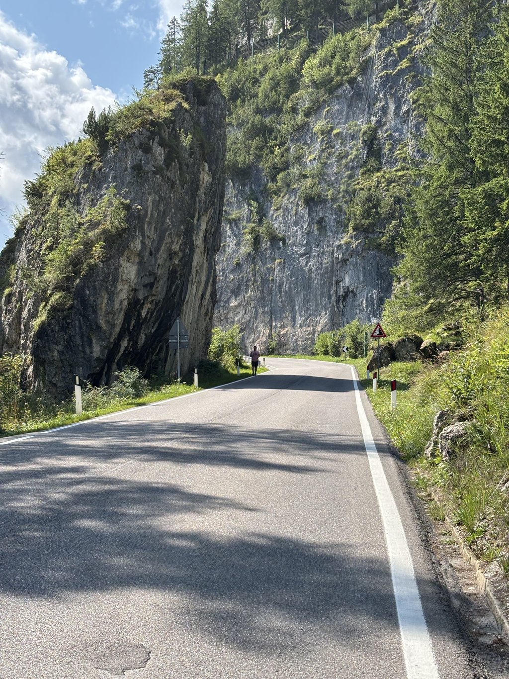
Passo Giau from this side can be divided into two sections. In the first kilometre, you leave Cortina d'Ampezzo. It is not too difficult. The tarmac is fine, but there is a lot of traffic. In the village of Pocol, you then turn left and the road becomes a lot quieter than the more through route to the top of Passo Falzarego. After a short descent, the tricky part of the Giau begins. The percentages are fairly constant on average per kilometre, but do fluctuate. Steep sections (10+%) alternate with more running sections.
De Passo Giau van deze zijde is op te delen in twee stukken. In de eerste kilometer verlaat je Cortina d'Ampezzo. Het is niet al te lastig. Het asfalt is prima, maar er is veel verkeer. In het dorpje Pocol sla je vervolgens linksaf en wordt de weg een stuk rustiger dan de meer doorgaande route naar de top van de Passo Falzarego. Na een korte afdaling begint het lastige stuk van de Giau. De percentages zijn gemiddeld per kilometer vrij constant, maar schommelen wel degelijk. Steile stroken (10+%) worden afgewisseld met meer lopende stukken.
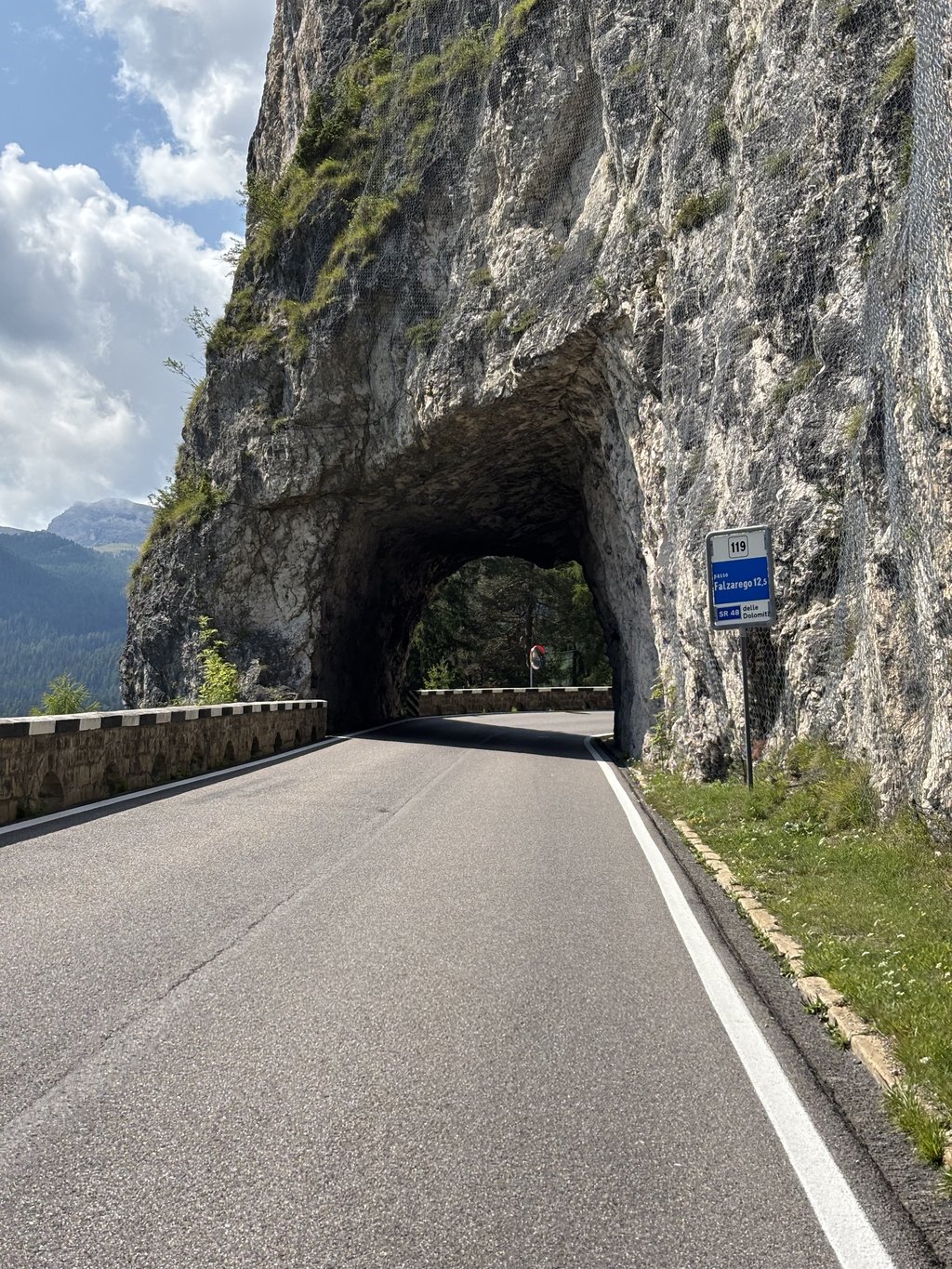
The Giau Pass from the Cortina side can be described as a diversified ascent. It comprises two different roads, the Grande Strada delle Dolomiti up to Pocol, the actual Giau road and a link between the two with 2 kilometres of descent. All the stretches are very diverse: the Dolomite road, which is normally very regular in other areas (think for example of the Falzarego from Andraz or even the Pordoi) here has to overcome natural obstacles in the first part and therefore has variations in gradient just before Pecol in particular before the tunnel. The second part, i.e. the actual Giau road, is an old road that was later asphalted, but which has an absolutely uneven gradient interspersed with hairpin bends. If you run out of energy, it risks being deadly as stretches where you can breathe alternate with dry ramps over 10%. This is particularly true in the first part which is mostly in the woods and does not allow you to see your destination. The last 4 km are instead a little more humane with fewer hairpin bends and a few rest pieces. But you still have to suffer to the end! In return, the views are truly sumptuous on both sides. The restaurant at the summit is in a beautiful spot but is very expensive, so if possible I recommend going down a bit and stopping at another place.
Il passo Giau dal versante di Cortina può essere definita una salita diversificata. Comprende due strade diverse, la Grande Strada delle Dolomiti fino a Pocol, la strada vera e propria del Giau e un collegamento tra le due con 2 chilometri di discesa. Tutti i tratti sono molto diversificati: la strada delle Dolomiti, che normalmente in altre zone è molto regolare (pensate ad esempio al Falzarego da Andraz o anche al Pordoi) deve qui superare nella prima parte degli ostacoli naturali e quindi ha delle variazioni di pendenza proprio prima di Pecol in particolare prima della galleria. La seconda parte ossia la strada del Giau vera e propria è una vecchia strada che è stata successivamente asfaltata ma che presenta un percorso assolutamente non costante a gradoni intervallato da tornanti. Se si è a corto di energie rischia di essere micidiale in quanto a tratti in cui si respira si alternano secche rampe oltre il 10%. Questo vale in particolare nella prima parte che è perlopiù in bosco e non permette di vedere la meta. Gli ultimi 4 km sono invece un po' più umani con meno strappi e alcuni pezzi di riposo. Ma comunque bisogna soffrire fino alla fine! In compenso il panorama è veramente sontuoso in ambo i versanti. Il ristorante in Cima è in uno splendido posto ma è molto caro, se possibile consiglio di scendere un po' e fermarsi in un altro locale.
Climbed the other side of the Giau two years back, but both sides are very rewarding on this iconic climb. Different in character, where on the other side it is constantly gruelling around 10% it is much more varied on this side. Heavy stretches are interspersed with short moments of recuperation. The satisfaction at the top with the stunning views is equally great.
Twee jaar terug de andere kant van de Giau beklommen, maar beide kanten zijn erg de moeite bij deze iconische klim. Anders qua karakter, waar het aan de andere kant constant afzien is rond de 10% is het aan deze zijde veel meer afwisselend. Zware stroken worden afgewisseld met korte recuperatiemomenten. De voldoening boven met het prachtige uitzicht is even groot.
Today I did this climb with my wife. Started via Valparego and Falzarego. We do agree with Rudi. This side of the Giau is known as the easier side. That may be so. But this side is not bad either. We agree with his (Rudi's) opinion above (below?). The average percentages may be 10 or less, our Garmin often went above 12 % after Pocol with an occasional outlier to 17-18%. Then it flattened out again to 8 %. Real climbers feel at home here. The stumbling blockers also get up here. But the easy side? Perhaps for the lighter climbers.
At the top, there is a cosy restaurant where many people have a pasta meal. And then the descent. The descent was terrible by our standards. We did not make up any time. Few straights. Lots of blind turns.
Is it beautiful? Certainly. Do you have to experience it? Yes, it is.
Nature and views are des Dolomites.
Disc brakes are a must.
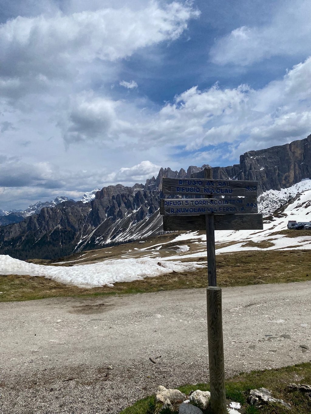
A sign with Passo Giau is not available at the summit. You have to look for a pole with that name
Vandaag deze beklimming gedaan met mijn echtgenote. Gestart via Valparego en Falzarego. Wij zijn het wel met Rudi eens. Deze kant van de Giau staat bekend als de makkelijkere kant. Dat kan zeker zo zijn. Maar deze zijde is ook niet misselijk. Wij onderschrijven zijn (Rudi) mening hierboven (beneden?). De gemiddelde percentages mogen 10 of minder zijn, onze Garmin kwam na Pocol vaak boven de 12 %met een enkele uitschieter naar 17-18%. Daarna weer afvlakkend naar 8 %. Echte klimmers voelen zich hier thuis. Stoempers komen ook boven. Maar makkelijke kant? Voor lichtgewichten misschien.
Boven een gezellig restaurant, waar velen een pastamaaltijd nemen. Om daarna de afdaling te starten. Afdaling was voor onze maatstaven verschrikkelijk. Wij maakten hier geen tijd goed. Weinig rechte stukken. Erg veel onoverzichtelijke bochten.
Is het mooi? Zeker. Moet je het meegemaakt hebben? Ja.
Natuur en uitzichten zijn des Dolomieten
Schijfremmen zijn een aanrader.
Een bord met Passo Giau is op de top niet beschikbaar. Je moet op zoek naar een paaltje met die naam
If you compare the two climbs in the profile, the climb from Cortina is the easiest. But the reality is a bit different. Where from the other side you can climb almost steadily at the same pace and rhythm, from Pocol the percentage changes continuously. The first kilometer is flat and even slightly downhill, but after that it's just a matter of constantly changing gears. My Garmin regularly indicated 12), short steep parts alternated with slightly less steep parts. Very difficult to get into a rhythm. This is more of a climb for lightweights who like an interval climb. The last two kilometers are 'normal' again. But if the weather is good, a beautiful view, like almost everywhere in this region. Still definitely a must if you are in the area, depending on how hard you want to make it fine to combine with some other classics like the Valparola, Falzarego, Fedaia.
Als je de twee beklimmingen vergelijkt in het profiel, is de beklimming vanaf Cortina de makkelijkste. Maar de realiteit is toch een beetje anders. Waar je vanaf de andere zijde bijna gestaag aan het zelfde tempo en in hetzelfde ritme kan blijven klimmen, wisselt het percentage vanaf Pocol continu. Waar de eerste kilometer nog vlak is en zelfs lichtjes bergaf, is het daarna alleen maar een kwestie van voortdurend schakelen, je krijgt het gevoel of je een aantal Caubergjes na mekaar aan het klimmen bent. Mijn Garmin gaf regelmatig 12% aan, korte steile stukjes afgewisseld met iets minder steile passages. Zeer moeilijk om in een ritme te geraken. Dit is meer een klim voor de lichtgewichten die houden van een interval beklimming. De laatste twee kilometer zijn dan weer 'normaal'. Maar als het weer goed is wel een schitterend uitzicht, zoals trouwens bijna overal in deze regio. Toch absoluut een aanrader als je in de buurt bent, afhankelijk van hoe zwaar je het wil maken prima te combineren met een aantal andere klassiekers zoals de Valparola, Falzarego, Fedaia.
Cycled up one of the monuments of the Giro d'Italia from Cortina.
First kilometres to climb out of departure town are identical to the Passo Falzarego climb (see Climbfinder).
After a few hairpin turns you leave the busy Dolomites road N48 by turning left in Pocol. Then it is wonderfully downhill for a while to start the continuous steep climb with little recuperation possibilities over 25 hairpin bends in an uninhabited mountain world.
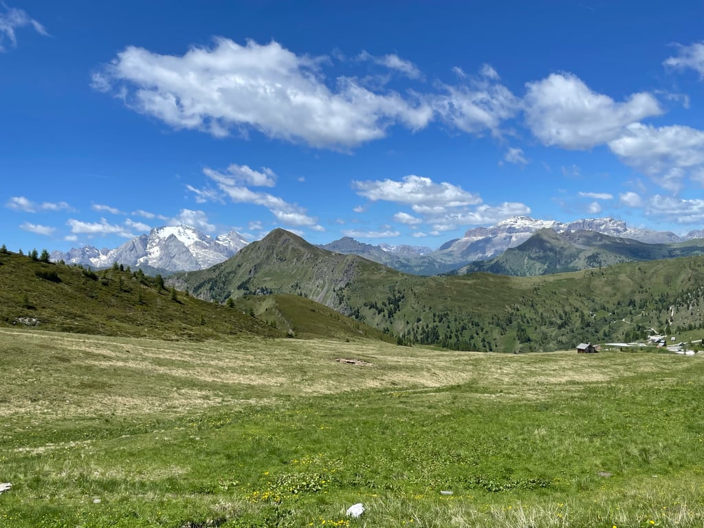
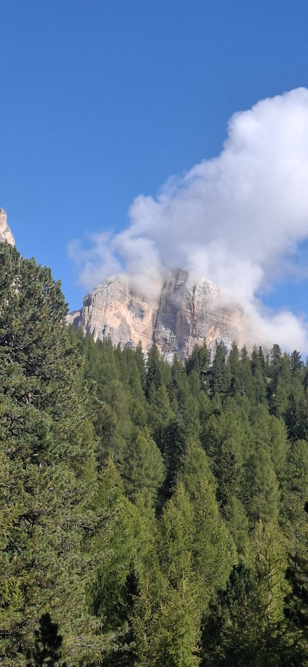
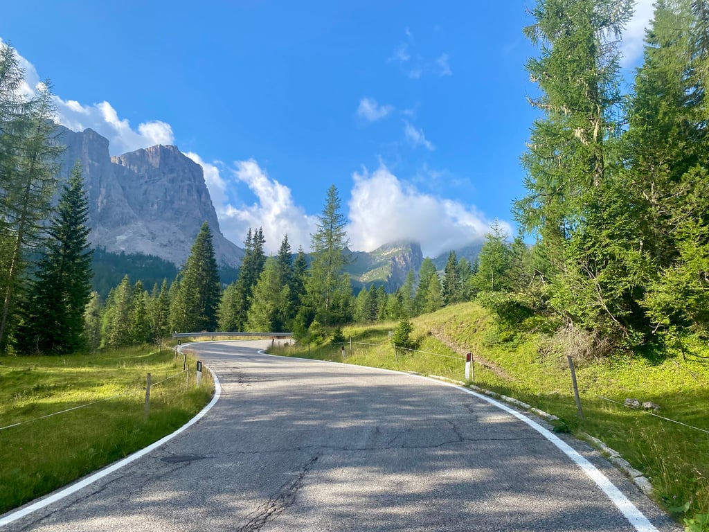
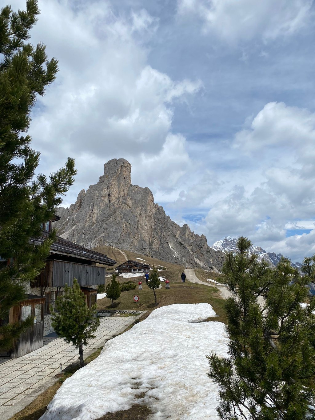
The first part through densely wooded mountain slopes gradually changes into alpine meadows with cows and towards the end above the tree line the top comes into view between the rocks.
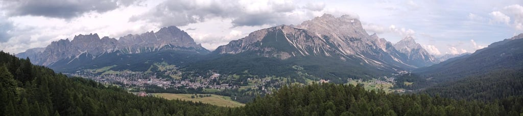
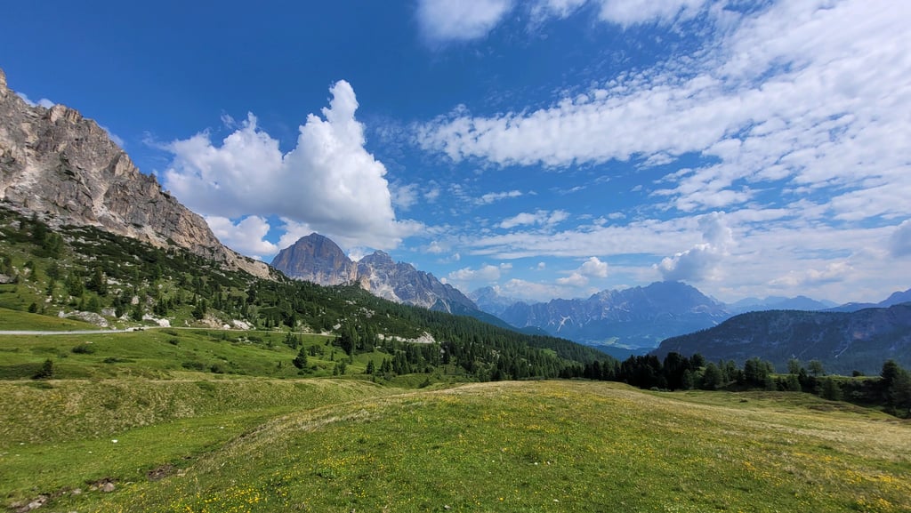
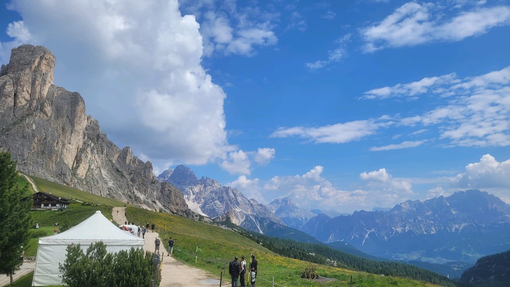
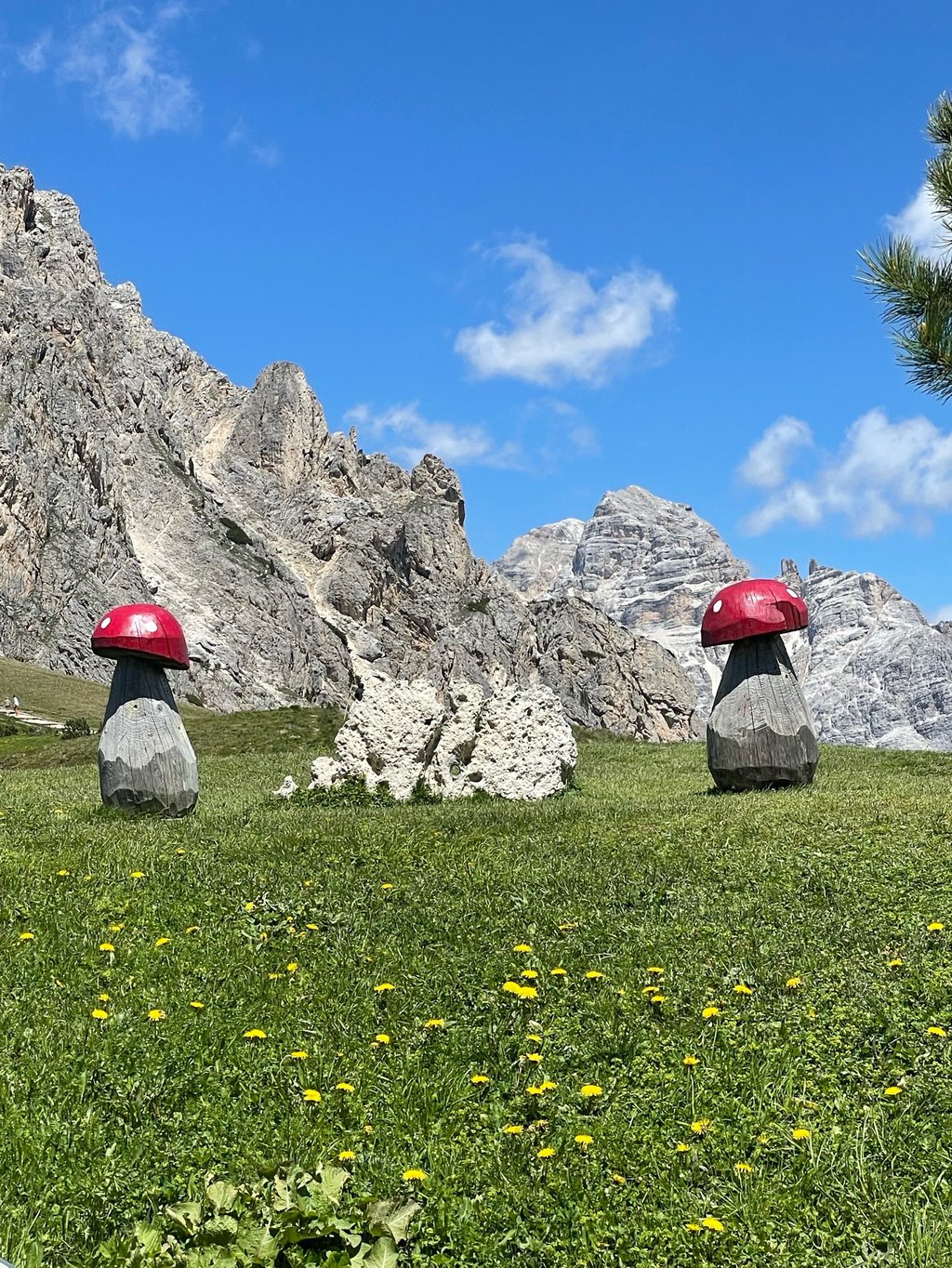
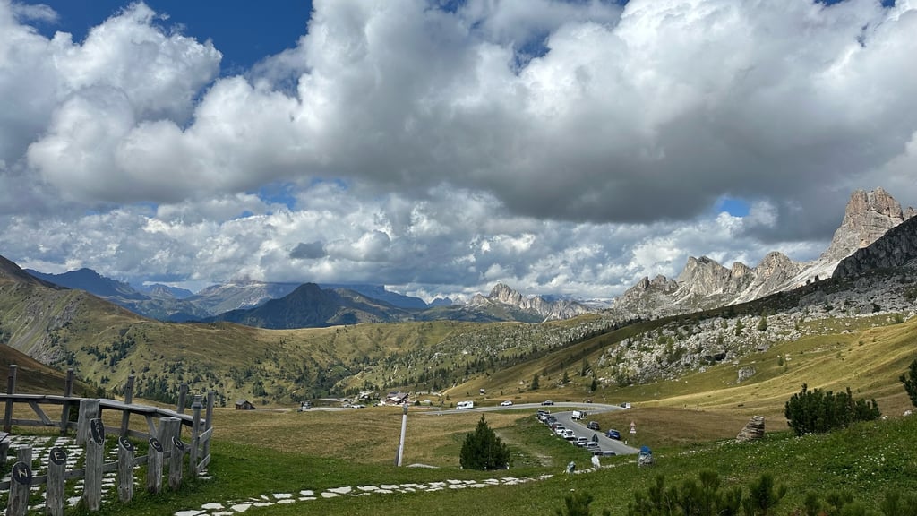
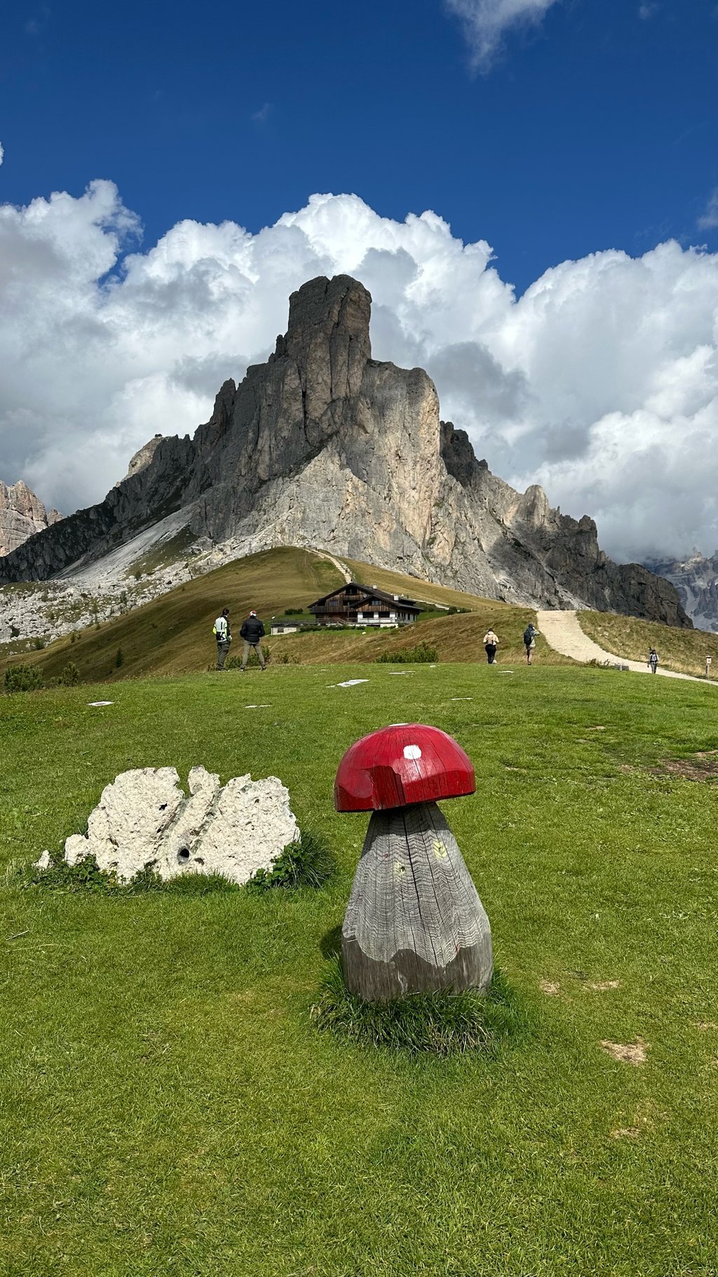
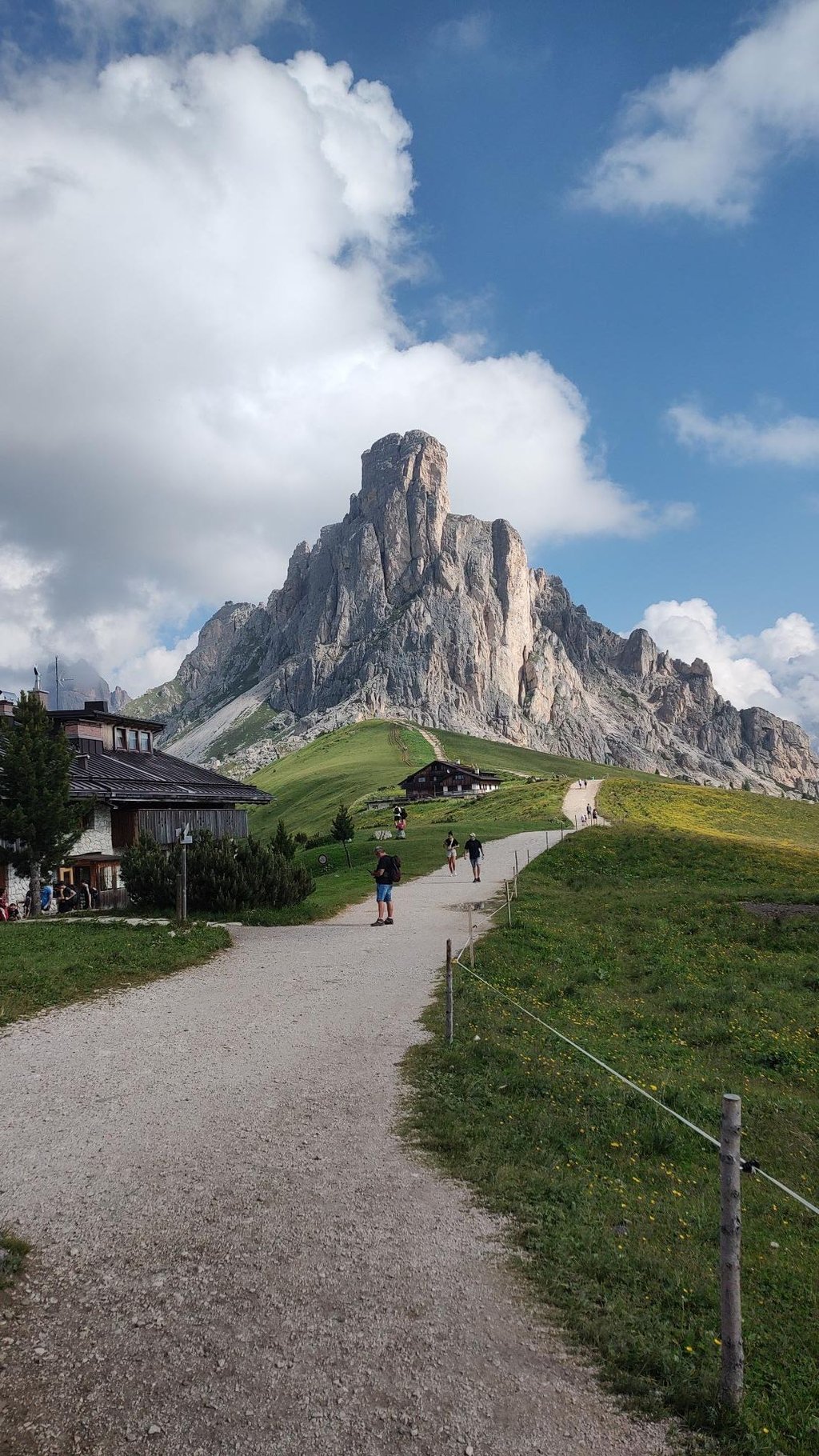
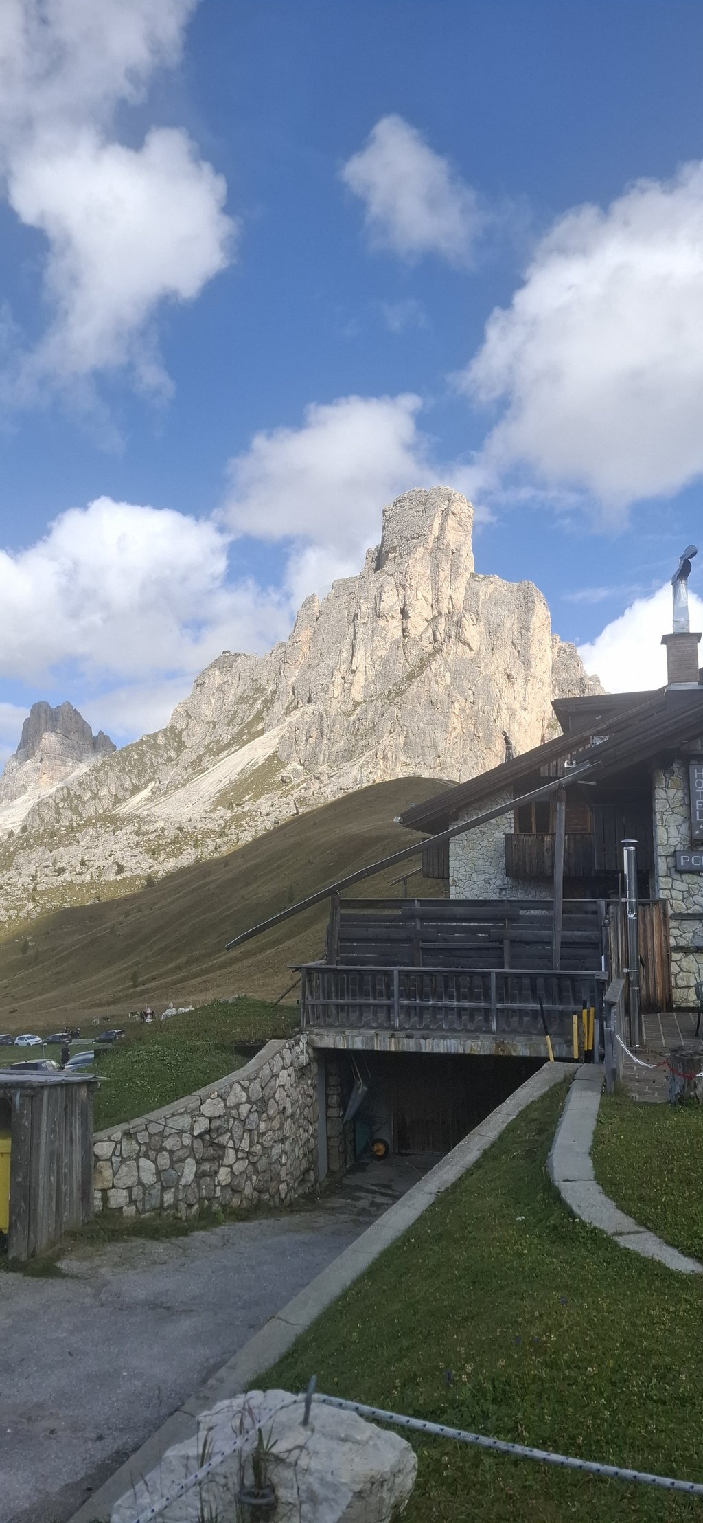
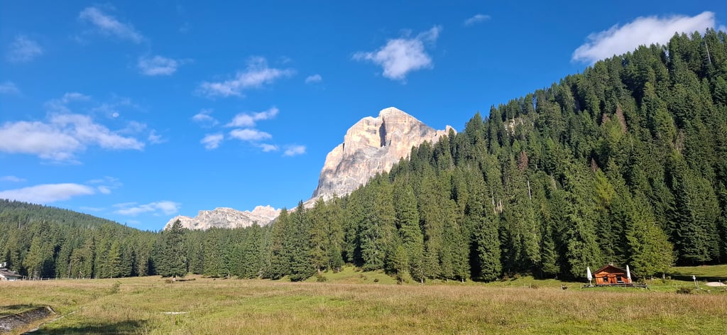
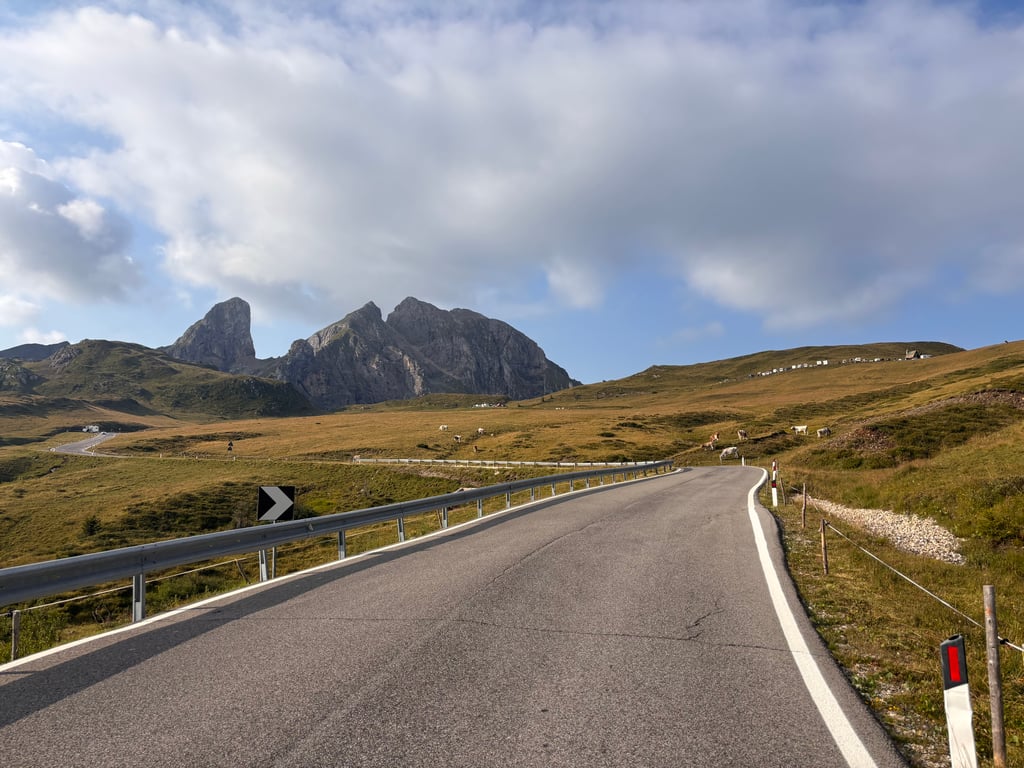
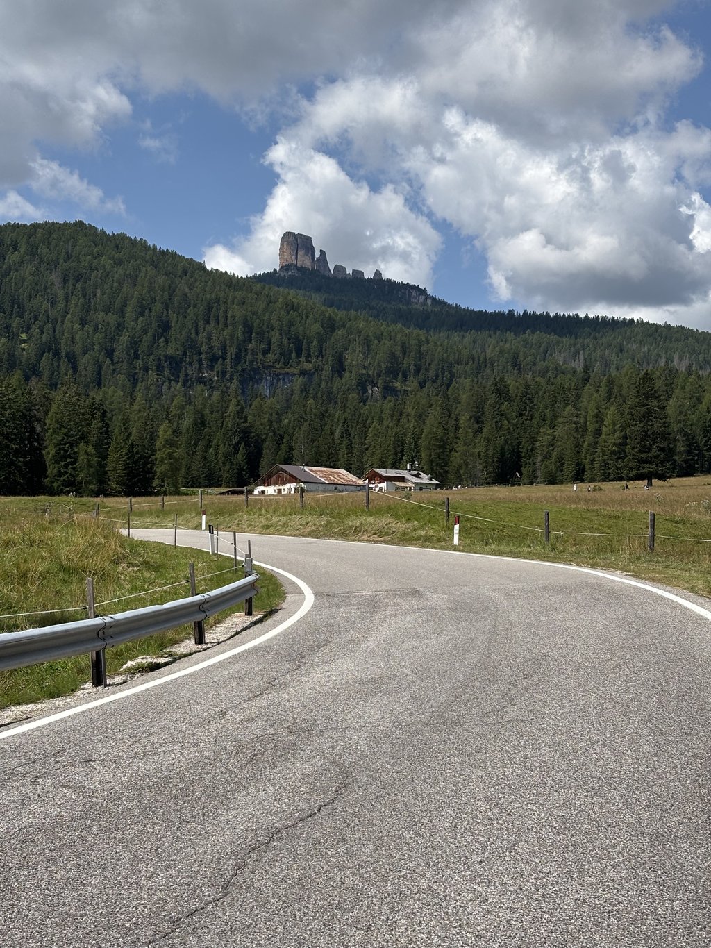
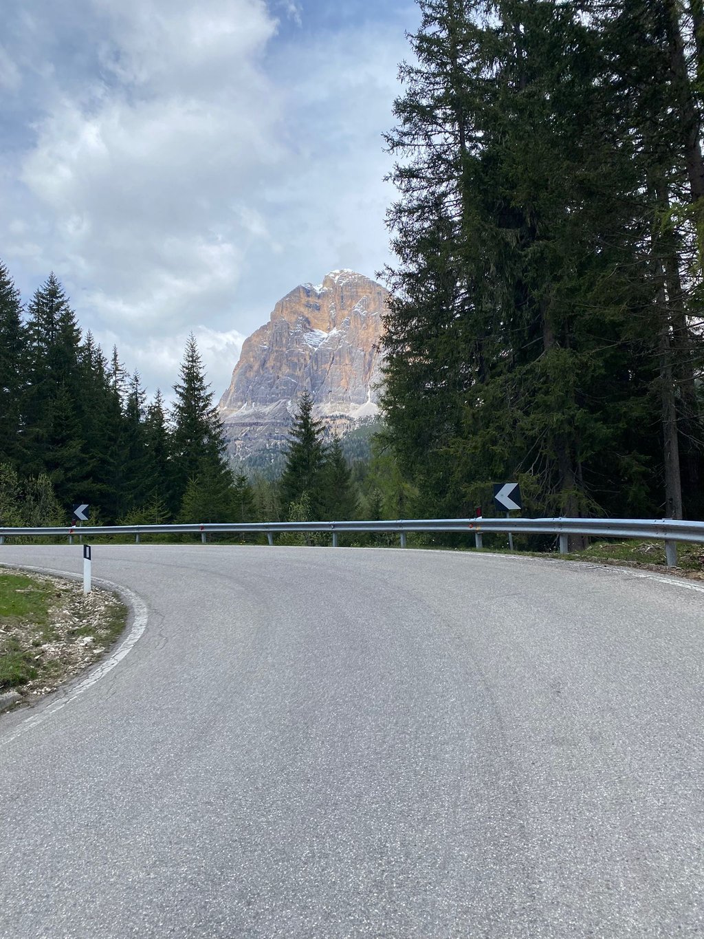
Next to a cafe/restaurant and a chapel, the pass height for me offers one of the most beautiful panoramic views of the Dolomites with the top of the Nuvolau as eye-catcher.
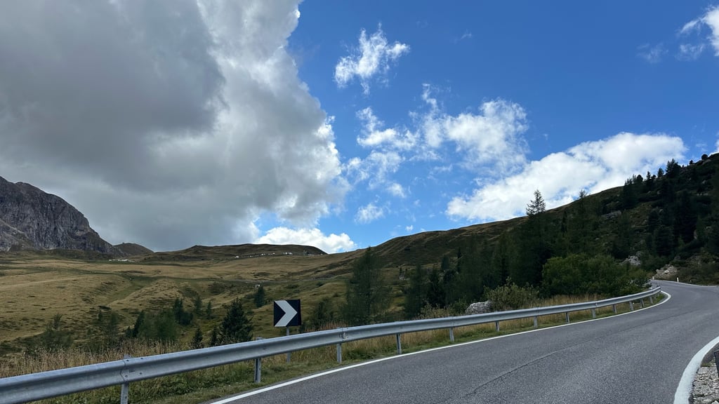
There are kilometre markers with the distance to the top. The road surface is fine but there is sometimes summer tourist traffic.
Beautiful summit climb from both sides!
Eén van de monumenten uit de Giro d'Italia op gefietst vanuit fietsknooppunt Cortina.
Eerste kilometers om vertrekstad uit te klimmen zijn identiek aan de Passo Falzarego klim (zie Climbfinder).
Je verlaat na enkele haarspeldbochten de drukke Dolomietenweg N48 door in Pocol links af te draaien. Dan is het wonderwel even bergaf om daarna te starten met het continue stevige steil klimwerk met weinig recuperatiemogelijkheden over 25 haarspeldbochten in een onbewoonde bergwereld.
Eerste deel door dichtbeboste bergflanken geleidelijk overgaande in alm weiden met koeien en naar het einde toe boven de boomgrens komt tussen de rotsen de top in zicht.
Naast een cafe/restaurant en een kapel biedt de pashoogte voor mij één van de mooiste panoramisch uitzichten van de Dolomieten met de top van de Nuvolau als blikvanger.
Er zijn kilometerpalen met de afstand tot de top. Het wegdek is prima maar er is soms zomers toeristisch verkeer.
Prachtige topklim langs beide kanten!
| 7 km/h | 02:16:05 |
| 11 km/h | 01:26:36 |
| 15 km/h | 01:03:30 |
| 19 km/h | 00:50:08 |
This page is better in the app