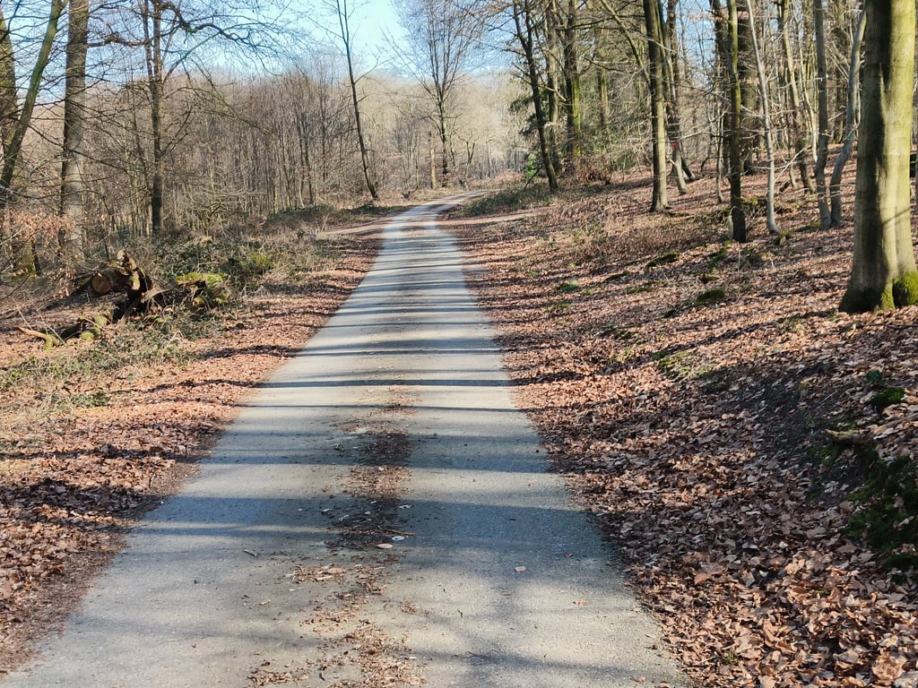
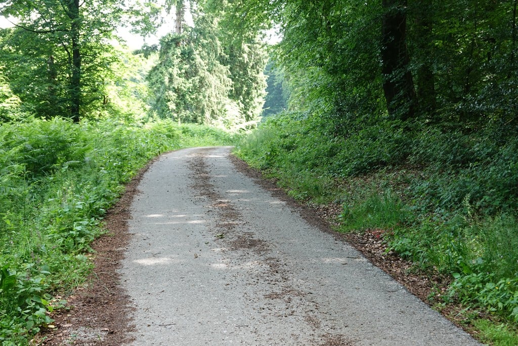
Geldenberg from Frasselt is a climb in the region Niederrheinischer Höhenzug. It is 1.3 km long and bridges 53 m of vertical ascent with an average gradient of 4%, resulting in a difficulty score of 29. The top of the ascent is located at 84 m above sea level. Climbfinder users shared 15 reviews of this climb and uploaded 28 photos.
This is an automatic translation, the original language is: Dutch.
Can't we start a petition to have the Geldenberg asphalted again? Just like that piece of forest near Frasselt, near the Brandenberg. The asphalt is not maintained anymore :(...read more
Photos (28)
Welcome! Please activate your account if you would like to share something. Look for the verification email in your inbox.
This is an automatic translation, the original language is: Dutch.
Show original
Nice short climb, long sought after. Did it 6 times last Sunday on both sides. Working on my climbing fitness a bit. Road surface was not too bad, although you have to be careful when going down. What a rest when there are no cars pushing you into the verge, like on the Oude Holleweg. The peace that I share with others, which is lovely.
Mooie korte klim, lang naar gezocht. Heb hem afgelopen zondag 6 x gedaan aan beide zijdes. Beetje aan mijn klimconditie werken. Wegdek vond ik wel meevallen, al moet je goed oppassen als je naar beneden gaat. Wat een rust als er geen auto's zijn die je de berm induwen, zoals bij de Oude Holleweg. De rust dat deel ik met anderen, die is heerlijk.
This is an automatic translation, the original language is: Dutch.
Show original
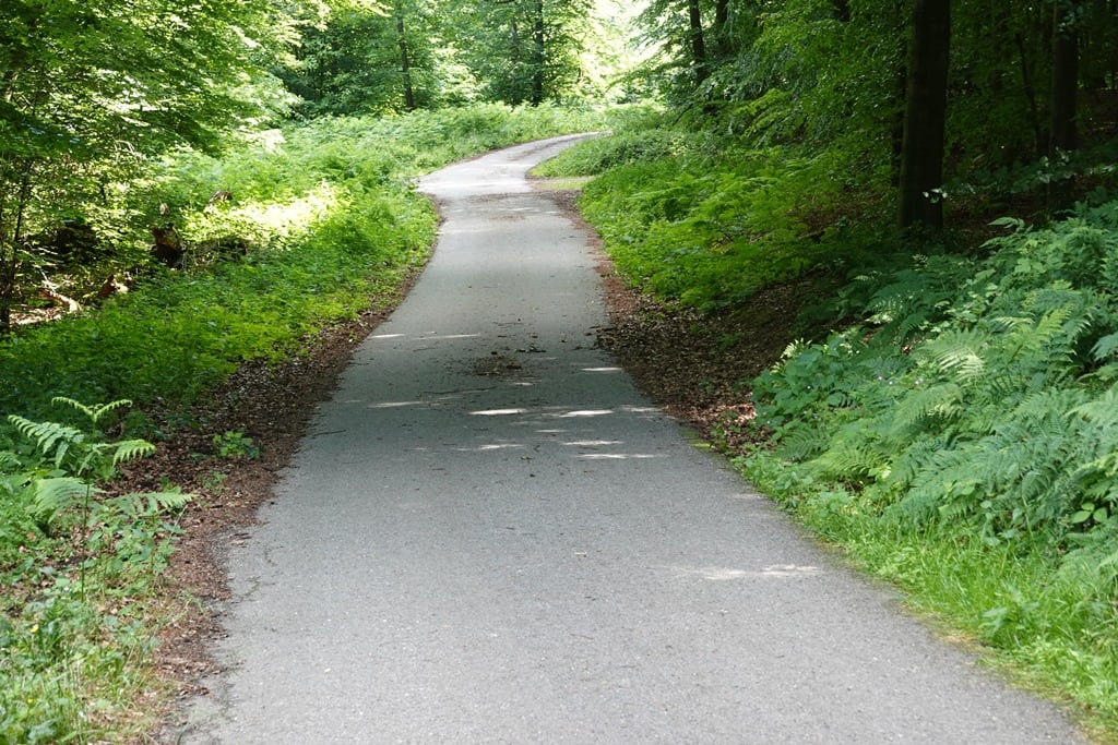
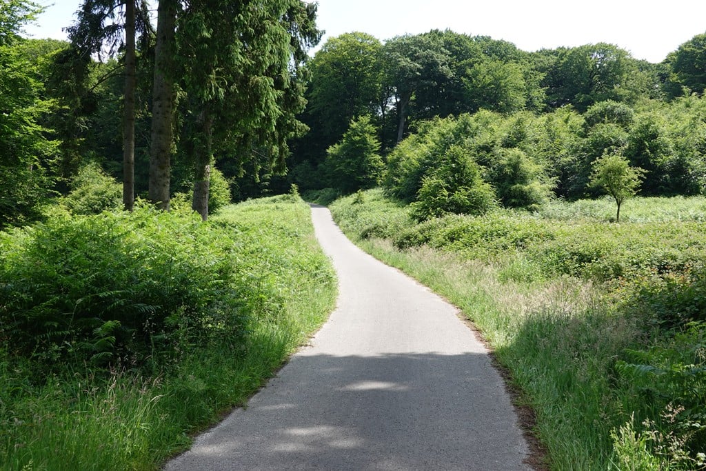
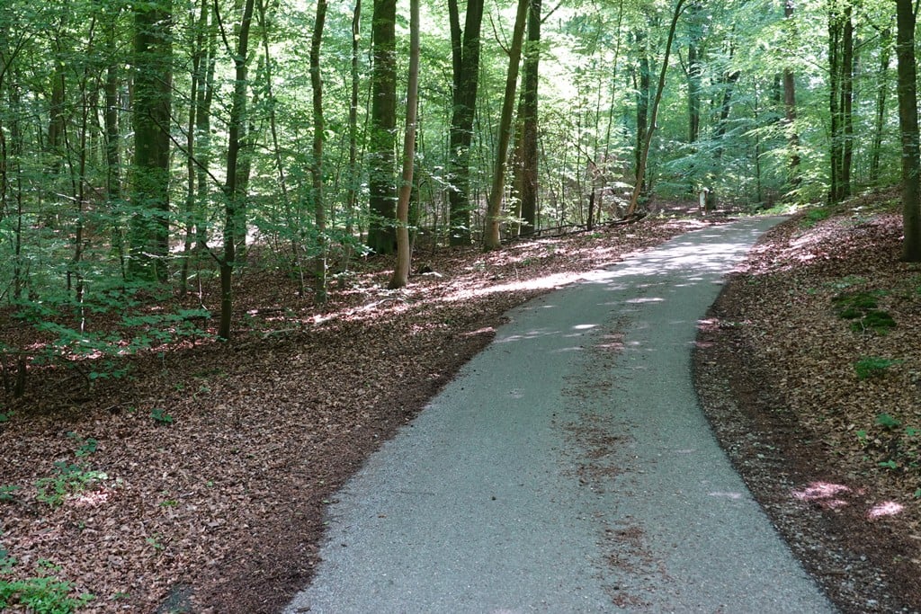
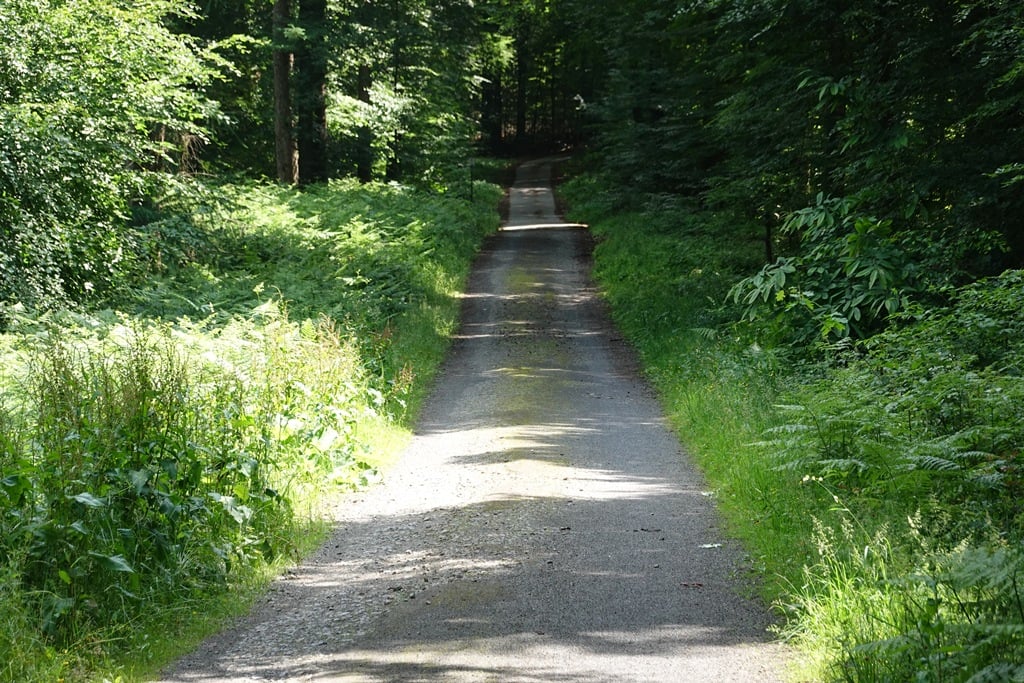
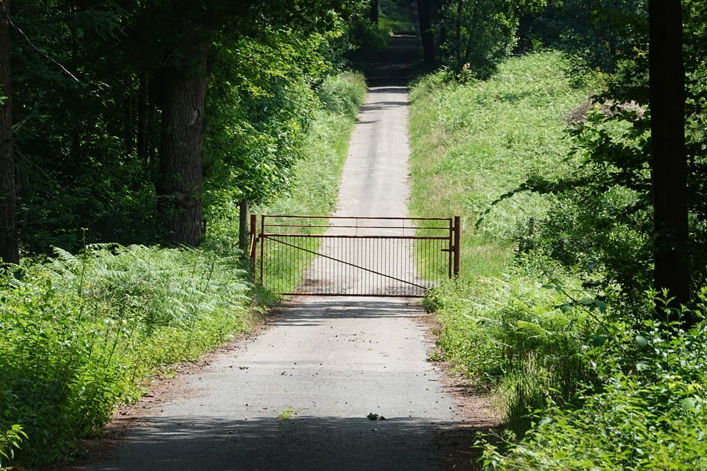
This climb already has a lot of pictures's and that is not unjustified because it is a mighty fine climb - which is also nicely spicy. The gravel at the start is a bit of a struggle but not too much to handle, after which the rest is a lovely winding tarmac road through the forest. The gate at the start is easy to get around, no need to dismount for that.
Deze klim heeft al heel veel foto's en dat is niet onterecht want het is een machtig mooie klim - die ook lekker pittig is. De gravel in het begin is even doorbijten maar goed te doen waarna de rest een heerlijk bochtig asfaltweggetje door het bos is. Het hek aan het begin is prima te omzeilen, daar hoef je niet voor af te stappen.
This is an automatic translation, the original language is: Dutch.
Show original
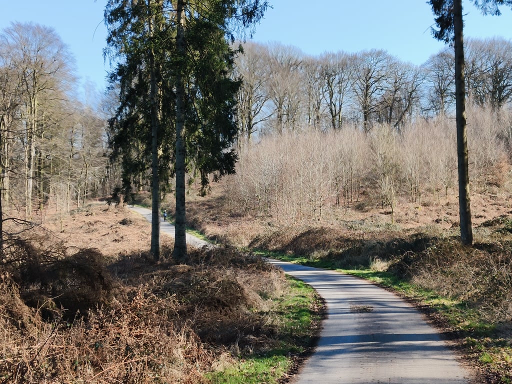
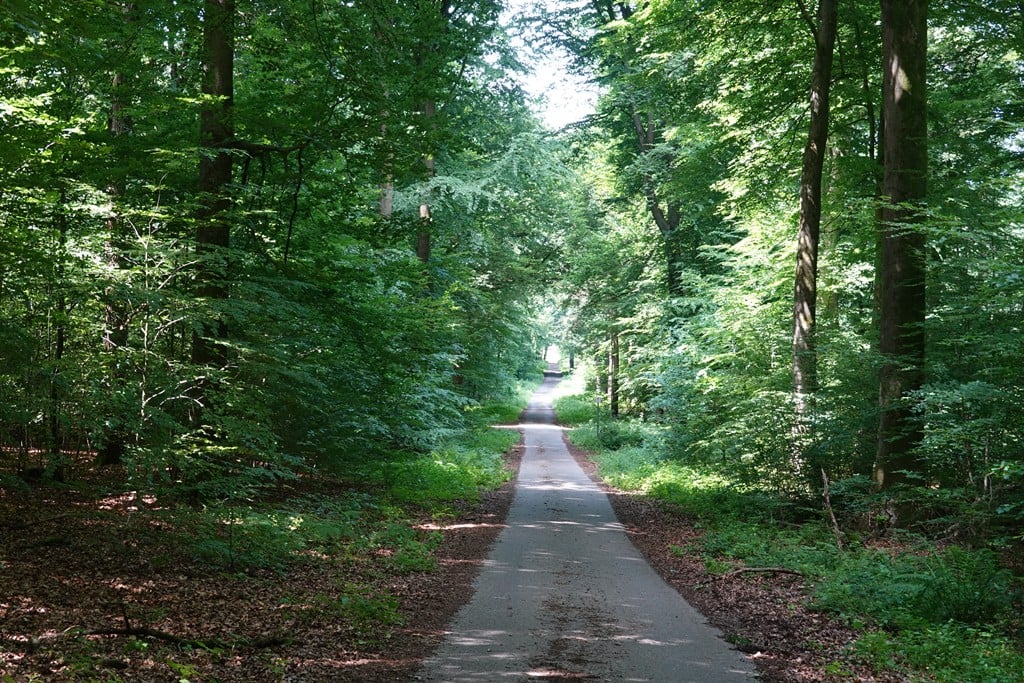
The Geldenberg is compulsory fare if you wander in the Reichswald. This variant is often used as a crossing to Kleve or as a diversion back to St Jansberg in NL.
Worthwhile because there are so few paths in this forest anyway, and then because it is a quiet, beautiful climb. The silence. You discover how crowded it can be on the climbs on the Nijmegen side.
Doesn't matter much which side you take. This side is the nice, winding one, less steep than from Kleef.
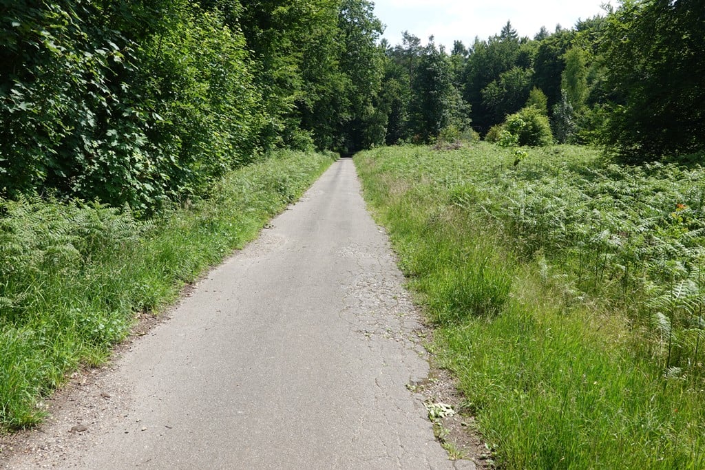
Road surface on two sides moderate. Goes quite well with the road bike if you pay attention.
De Geldenberg is verplichte kost als je in het Reichswald dwaalt. Deze variant vaak als doorsteek naar Kleef of als omweg terug naar de St Jansberg in NL.
De moeite waard omdat er zo wie zo weinig paden zijn in dit bos, en dan omdat het een rustige, mooie klim is. De stilte. Je ontdekt hoe druk het op de klimmetjes aan Nijmeegse zijde kan zijn.
Maakt niet veel uit welke kant je neemt. Deze kant is de fraaie, kronkelende variant, minder steil dan vanuit Kleef.
Wegdek aan twee kanten matig. Gaat best met de racefiets als je oplet.
This is an automatic translation, the original language is: Dutch.
Show original
In dry weather, this climb is a real must as far as I am concerned. Because of the amazing scenery the limited view of the summit/finish, always make this climb a surprise for me.
Bij droge weer is deze beklimming wat mij betreft een echte must. Door de geweldige omgeving het beperkte zicht op de top/finish, maken deze beklimming voor mij altijd een verrassing.
This is an automatic translation, the original language is: Dutch.
Show original
Mandatory in the Reichswald as far as I'm concerned. Road is only so-so, scenery a big ten with a pin. Climb is a bit spicier than the percentages suggest. Other side seems to be slightly trickier, but yours truly disputes that.
Verplichte kost in het Reichswald wat mij betreft. Weg is maar zozo, de omgeving een dikke tien met een griffel. Klimmetje is iets pittiger dan de percentages doen vermoeden. Andere zijde schijnt iets lastiger te zijn, maar dat betwist ondergetekende.
This is an automatic translation, the original language is: Dutch.
Show original
nice climb, in good weather fine to do on the road bike. in bad weather, or in winter, I would 'avoid. found the climb more challenging than expected, did not 'just' pedal up.
mooie klim, met goed weer prima te doen op de racefiets. in slecht weer, of in de winter, zou ik 'm mijden. vond de klim pittiger dan verwacht, trapte niet 'zomaar' naar boven.
This is an automatic translation, the original language is: Dutch.
Show original
Generally, it is doable, although I would not recommend going over it in winter/with bad weather. A bit of gravel should not be a problem, and the climb itself is extremely beautiful and not to be missed.
Over het algemeen prima te doen, al zou ik niet aanraden om er in de winter/met slecht weer hard overheen te gaan. Stukje gravel moet geen probleem zijn, en de klim zelf is enorm mooi en mag je eigenlijk niet missen.
This is an automatic translation, the original language is: Dutch.
Show original
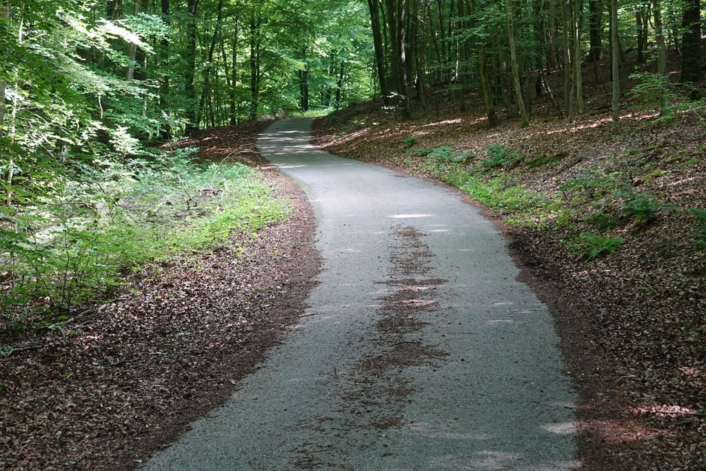
At the moment this climb is a real challenge on a racing bike. For hundreds of meters there are 10 layers of leaves on top of each other, there is no asphalt to be seen. Add to that the unpaved part just after the start and the mediocre asphalt (you can't see through the leaves if there is a hole in the road) and you know; watch out. This applies especially to the descending part after the climb; here the road is significantly worse than on the climb.
Momenteel is deze klim echt een grote uitdaging op racefiets. Gedurende honderden meters liggen er wel 10 lagen bladeren boven op elkaar, er is geen asfalt te zien. Tel daar het onverharde gedeelte net na de start en het matige asfalt bij op (je ziet het door de bladeren niet als er een gat in de weg zit) en je weet; oppassen geblazen. Dit geldt voornamelijk voor het dalende stuk na de klim; hier ligt de weg er beduidend slechter bij dan op de klim.
This is an automatic translation, the original language is: Dutch.
Show original
The road surface is sometimes very bad, so especially downhill you have to be careful. Yet I give the climb 5 stars, because the winding and at times quite steep climb through the woods is very beautiful and for the area completely unique.
Het wegdek is bij vlagen erg slecht, dus zeker heuvel af is het oppassen geblazen. Toch geef ik de klim 5 sterren, omdat de slingerende en bij vlagen best steile klim door het bos zeer mooi en voor de omgeving volkomen uniek is.
This is an automatic translation, the original language is: Dutch.
Show original
If you are not afraid of 300 meters of gravel, this climb is a gem in the region. In the beautiful spring light, with the sound of birds, this is a nice climb to cycle up.
Als je een meter of 300 gravel niet schuwt dan is deze klim een pareltje in de regio. In het mooie voorjaarslicht, met het geluid van vogels is dit een leuke klim om lekker tegenop te fietsen.
This is an automatic translation, the original language is: Dutch.
Show original
The Reichswald is a - for Dutch standards - large forest with few roads for road cyclists to climb. This is one of the few climbs through the forest, but also a beautiful one. The gravel part is not too bad and after that there is good tarmac until the top. The road is deserted except for a few hikers. I found the descent quite doable with the bad tarmac after the top. Just hang in there and slalom between the holes.
Het Reichswald is een - voor Nederlandse begrippen - groot bos met weinig wegen voor racefietsers om te klimmen. Dit is een van de weinige beklimmingen door het bos, maar ook meteen een mooie. Het gravelstuk valt heel erg mee en daarna volgt prima asfalt tot de top. De weg is uitgestorven op misschien een paar wandelaars na. Ik vond de afdaling nog wel goed te doen met het slechte asfalt na de top. Gewoon goed in de beugels hangen en slalommen tussen de gaten.
This is an automatic translation, the original language is: Dutch.
Show original
This is a challenging climb Poor road surface for road bikes and I think some parts the percentages are much higher than reported here. Beautiful through piece reichswald what many do not know and can find
Dit is een uitdagende klim Slecht wegdek voor racefiets en volgens mij zijn sommige stukken de percentages stukken hoger dan hier gemeld. Mooi door stuk reichswald wat velen niet kennen en kunnen vinden
This is an automatic translation, the original language is: Dutch.
Show original
Can't we start a petition to have the Geldenberg asphalted again? Just like that piece of forest near Frasselt, near the Brandenberg. The asphalt is not maintained anymore :(
Kunnen we geen petitie starten om de Geldenberg weer geasfalteerd te hebben? Net zoals dat stuk bos bij Frasselt bij de Brandenberg. Het asfalt wordt niet meer bijgehouden :(
Nice climb through the forest with no cars, but be aware of the road conditions. In the lead up to this climb, there is a section with loose gravel, it mostly sits in the middle of the road, and ascending is fine. After this gravel section the rest of the climb has descent asfalt. Descending this climb can be very tricky, as you will hit the loose gravel at full speed, be very careful. The descent on the other side is doable, no gravel, but overall very bad road conditions. Fine if you do it alone, but I would be very careful with a group.
You don't need special gearing for Geldenberg from Frasselt. The slope isn't long or steep enough to require much shifting down. You can conquer this climb on power alone. However, a compact gearing system with a smallest front chainring of 34 and largest rear sprocket of 28 or 30 is always nice if you enjoy cycling uphill. This helps maintain a smooth cadence.
Geldenberg from Frasselt falls into the 5th category. With good fitness, you can ride it up with speed and power. If you have less training, shift down and climb smoothly.
Geldenberg from Frasselt is 1.3 km long.
The average gradient of Geldenberg from Frasselt is 4%.
Geldenberg from Frasselt has a steepest segment with an average gradient of 8.1%.
The summit of Geldenberg from Frasselt is at 84 m.
At a slow pace of 7 km/h, it takes about 00:11:07 to climb Geldenberg from Frasselt. At 11 km/h the time is 00:07:04, and at 15 km/h 00:05:11. For the fastest cyclists, 00:04:05 is an achievable time.
Geldenberg from Frasselt is located in the region Düsseldorf in Germany.