Heerenweg via Peutgensweg is a climb in the region South Limburg. It is 1.9 km long and bridges 52 m of vertical ascent with an average gradient of 2.8%, resulting in a difficulty score of 20. The top of the ascent is located at 111 m above sea level. Climbfinder users shared 4 reviews of this climb and uploaded 12 photos.
Road names: Peutgensweg & Heerenweg
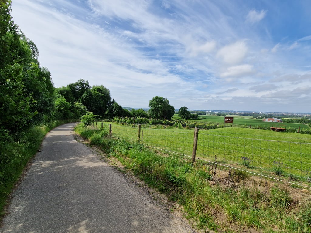
3.0 by JarinThis is an automatic translation, the original language is: Dutch.Road surface is indeed moderate and quite dirty due to agricultural traffic. The last 150 metres are also unpaved. The first part is rather false flat, but the devil is in the tail. The beautiful views of Maastricht make the climb worthwhile anyway.... read more
Welcome! Please activate your account if you would like to share something. Look for the verification email in your inbox.
If you want to upload your photos, you need to create an account. It only takes 1 minute and it's completely free.
Road surface is indeed moderate and quite dirty due to agricultural traffic. The last 150 metres are also unpaved. The first part is rather false flat, but the devil is in the tail. The beautiful views of Maastricht make the climb worthwhile anyway.
Wegdek is inderdaad matig en nogal vies door landbouwverkeer. De laatste 150 meter zijn ook onverhard. Het eerste deel is eerder vals plat, maar het venijn zit in de staart. Het prachtige uitzicht op Maastricht maakt de klim toch zeker de moeite waard.
I wanted to turn up here and start the climb. But immediately stopped when I saw how bad it was. I had already had a puncture that day: once is enough. So to be avoided with the racing bike I would say.
Ik wilde hier opdraaien en starten aan de beklimming. Maar meteen gestopt toen ik zag hoe slecht het lag. Ik was die dag al eens lek gereden: 1 keer is genoeg. Dus te mijden met de koersfiets zou ik zeggen.
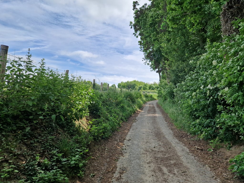
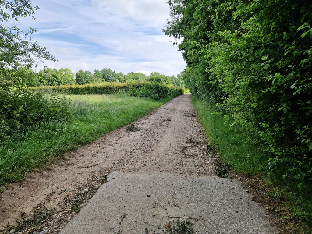
A moderately ascending road through the field. At the end, it suddenly gets steeper and meanders a bit. Road is traffic-free but the road surface is far from ideal. There is quite a bit of gravel on it so for those afraid of punctures it is best avoided.
Een gematigd oplopend weggetje doorheen het veld. Op het einde wordt het plots steiler en slingert het een beetje. Weg is verkeersvrij maar het wegdek is verre van ideaal. Ligt redelijk wat steengruis op dus voor degenen die schrik hebben van lekke banden best mijden.
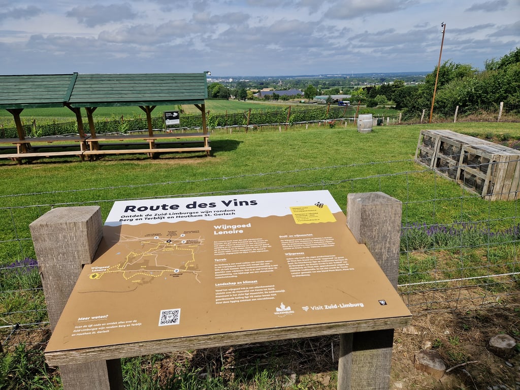
First, a bit on a good and nice clean road, then a left into a small road with more mediocre tarmac and quite a bit of grit on the road. This road is clearly less used and therefore very quiet. The road rises only very slightly at first. You start thinking: when will it start because I still have to go up somewhere? That slope does come but rather late and the transition is reasonably smooth. Just push on until you reach the benches (they are not accessible) and just after that the tarmac stops. What follows is a short stretch of good gravel, after which the asphalt returns to the main road. On top of the steeper part (near the benches), there is a nice view in the direction of Maastricht. For a gravel bike, a nice and quiet alternative for the provincial road.
Eerst een stukje over goede en een mooi schone weg, daarna linksaf een klein weggetje in met wat matiger asfalt en behoorlijk wat gruis op de weg. Deze wordt duidelijk minder gebruikt en is dus ook heerlijk rustig. De weg stijgt eerst slechts zeer lichtjes. Je begint te denken: wanneer begint het want ik moet nog ergens omhoog? Die helling komt wel maar behoorlijk laat en de overgang is redelijk vlot. Even aanzetten tot je bij de bankjes (die zijn niet toegankelijk) bent en vlak daarna stopt het asfalt. Wat volgt is een kort stukje goede gravel waarna je weer via asfalt op de provinciale weg uitkomt. Bovenaan het steilere deel (bij de bankjes dus) mooi uitzicht richting Maastricht. Voor een gravelbike een mooi en rustig alternatief voor de provinciale weg.
| 7 km/h | 00:16:05 |
| 11 km/h | 00:10:14 |
| 15 km/h | 00:07:30 |
| 19 km/h | 00:05:55 |
This page is better in the app