3 y 4.0 01:24:55 (12.1 mph)
This is an automatic translation, the original language is: Dutch.
Show original
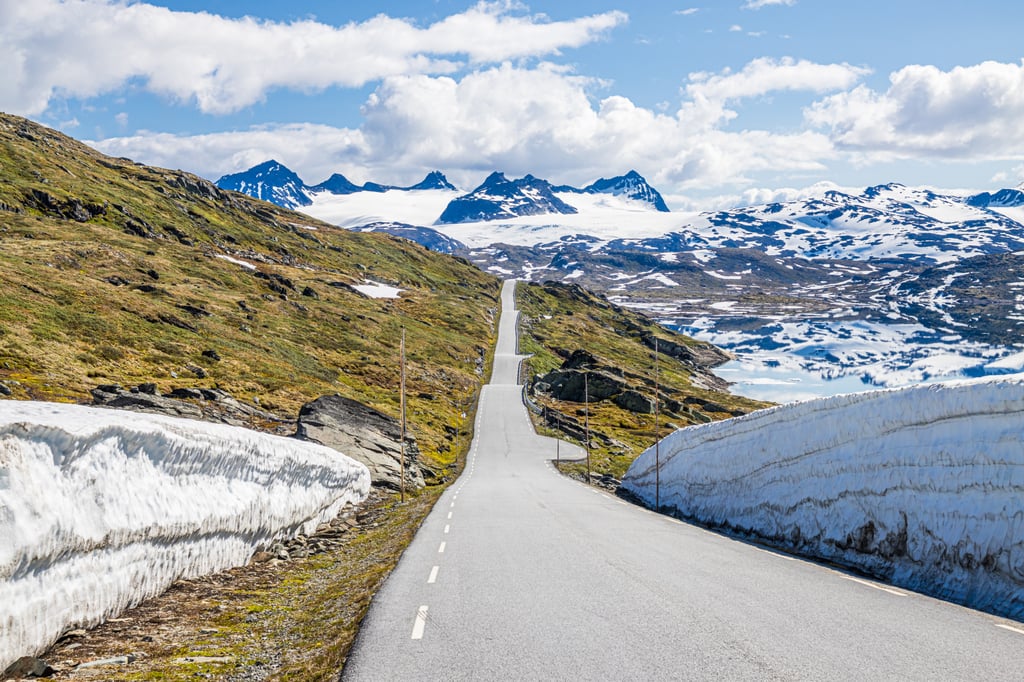
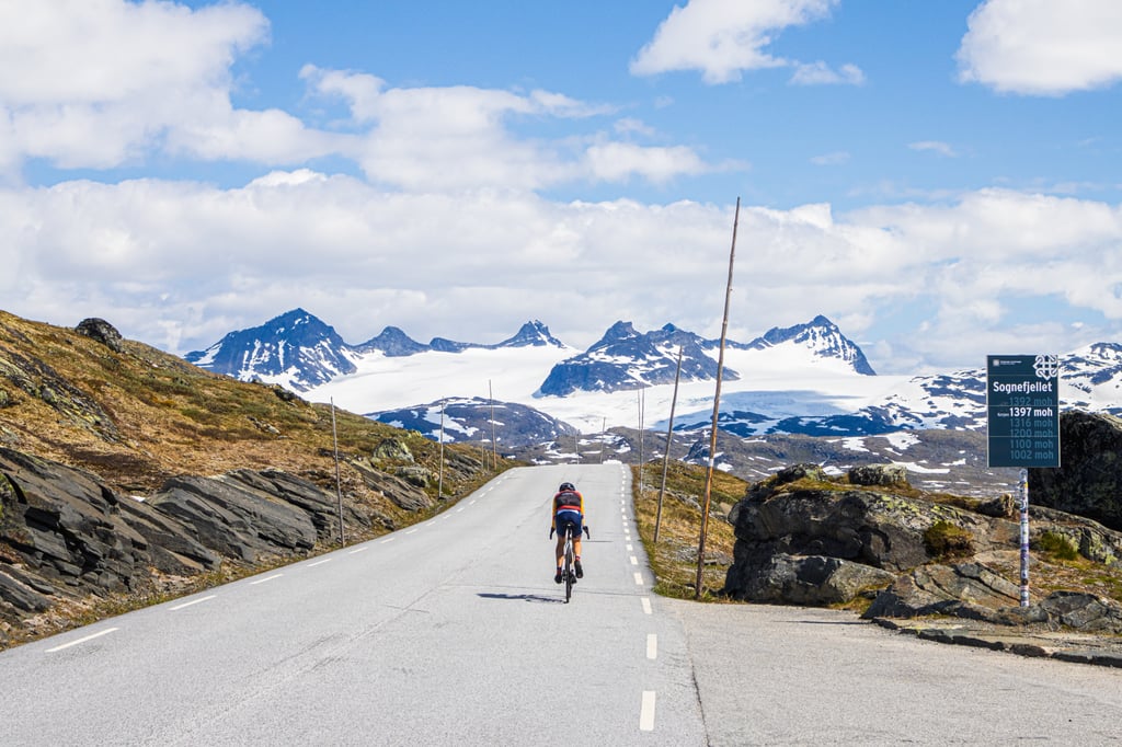
Sognefjellet is Norway's Col du Galibier. For centuries it has been the trade route between East and West Scandinavia. You can see this clearly at the top with the many ancient 'varden' - or stone towers - marking the way across the mountain range.
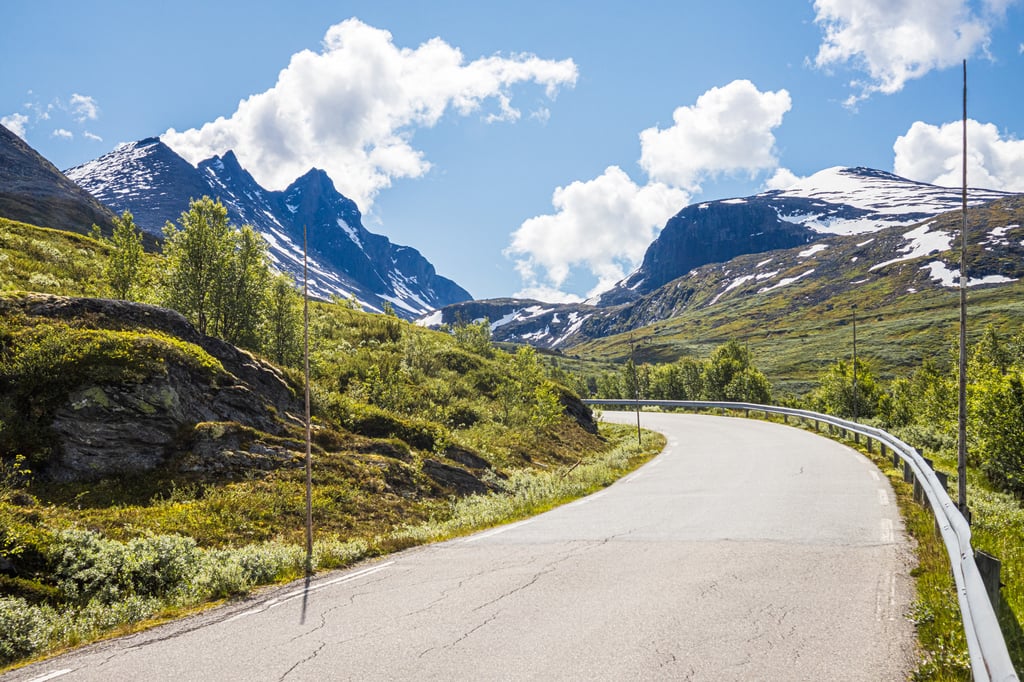
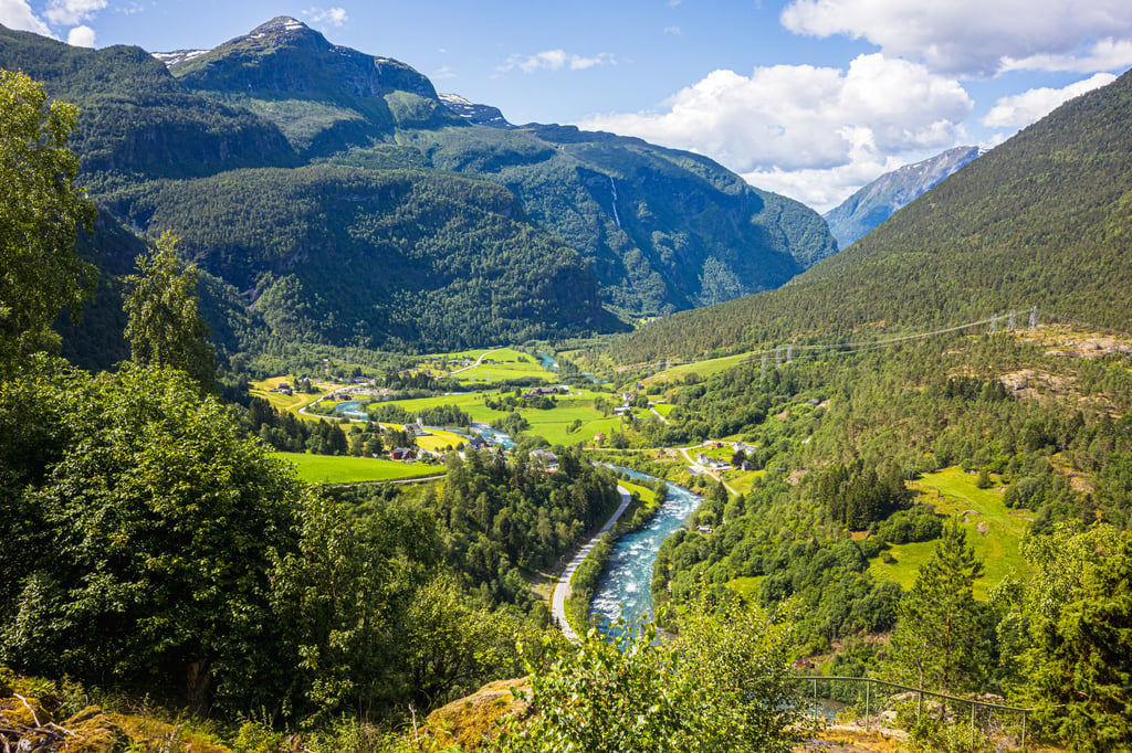
The top of this road is really the reason why you want to climb this mountain. As I said before, this pass is like the Galibier in the French Alps, the road from Fortun (or Skjolden if you want to start from sea level like me) is not very remarkable in itself. The view of Sognefjorden is sparse, but Norway's highest mountains are clearly in sight.
This includes the necessary doom clouds, as the weather can change quite often on this mountain pass. I started in the rain in Skjolden, which quickly changed to normal clouds. Halfway up, the real storm clouds came over the mountain, which suddenly broke open to let the sun through for the final stretch. Here too, one or two extra layers, a mackintosh and some leg warmers are no luxury. After all, it won't be the first time that it snows on the pass in the middle of July!
The locals strongly recommend the weather forecast app "YR.no"! This is really a must have on your phone when you go cycling in the Norwegian mountains. This app uses the many weather stations around the mountain passes and gives you current, and by-far the most accurate weather forecasts compared to any other app!!! Check for Sognefjellethytta for example, or open the map and check the weather in the surrounding mountains.
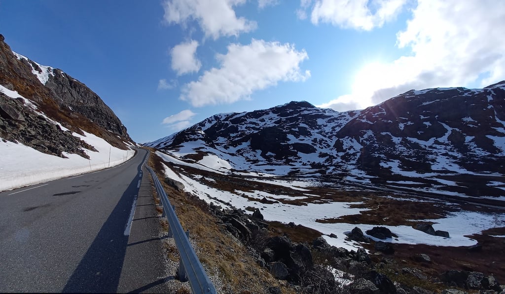
Well, the road surface is excellent, there is a lot of traffic for Norwegian standards, but it is still very little in absolute terms.
We were very bothered by the dozens of flies that attacked you on the way up, they are impossible to get rid of!!! Only when you pass the tree line can you continue to climb.
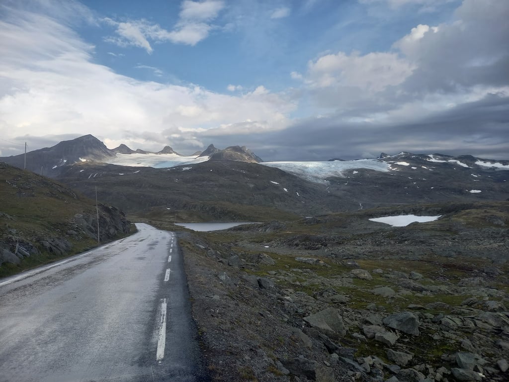
Once you are above the trees, you have some signs that indicate the altitude 1000 moh, 1100moh etc...
At about 1200 metres over havet the first glacier comes into view and the race over the rolling last 10 kilometres can begin. Don't forget to look to the right as there are several beautiful glaciers to enjoy.
Descending is easy because of the nice wide road surface. Beware of the wet roads that are very common here!
Sognefjellet is zo’n beetje de Col du Galibier van Noorwegen. Al eeuwen lang is het de handelsweg tussen Oost en West Scandinavië. Boven aan de top is dit goed te zien met de vele eeuwenoude ‘varden’ - ofwel stene torens - om de weg over de het gebergte te markeren.
Deze top van deze weg is toch wel echt de rede waarom je deze berg wilt beklimmen. Zoals ik eerder zei, is deze pas net zoals de Galibier in de Franse alpen, de weg vanuit Fortun (of Skjolden als je uit principe vanaf zeeniveau wilt starten zoals ik) is ansich niet heel opmerkelijk. Het uitzicht op Sognefjorden is spaarzaam, maar de hoogste bergen van Noorwegen zijn duidelijk in zicht.
Daarbij hoort ook de nodige doemswolken, want het weer wil nogal eens omslaan op deze bergpas. Ik begon in de regen in Skjolden, dat snel veranderde in gewone bewolking. Halverwege omhoog kwamen de echte stormwolken over de berg, die opeens openbraken om de zon door te laten voor het laatste stuk. Ook zeker hier is dus een of twee extra lagen, een regenjas en wat beenwarmers geen overbodige luxe. Het zal namelijk niet de eerste keer zijn dat het sneeuwt op de pas midden in Juli!
De locals raden de weervoorspellings app “YR.no” sterk aan! Deze is echt een must have op je telefoon als je in het Noorse gebergte gaat fietsen. Deze app maakt gebruik van de vele weerstations rondom de bergpassen en geven je actueel, en by-far de meest accurate weersvoorspellingen vergeleken met welke andere app dan ook!!! Check bijvoorbeeld voor Sognefjellethytta, of open de kaart en kijk naar het weer in de rondom gelegen bergen.
Nou goed, het wegdek is uitstekend, er is relatief veel verkeer voor Noorse standaarden, maar dat is nogsteeds bijzonder weinig in absolute termen.
Wij hadden erg veel last van de tientallen vliegen die je belaagde op de weg omhoog, ze zijn niet weg te krijgen!!! Pas als je de boomgrens passeert kun je rustig doorklimmen.
Als je dan eenmaal boven de bomen bent heb je wat bordjes die de hoogte aangeven 1000 moh, 1100moh etc…
Bij zo’n 1200 meter over havet komt de eerste gletsjer in beeld en kan de race over het de glooiende laatste 10 kilometers beginnen. Vergeet niet naar rechts te kijken want er zijn verschillende prachtige gletsjers om van te genieten.
Afdaling is goed te doen door het mooie brede wegdek. Pas wel op de natte wegen die je hier heel vaak tegen komt!!