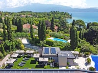
| Beautiful scenery |
| Hidden gem |
| 21 hairpin turns |
| #27 toughest climb of Trentino-South Tyrol |
| #51 most elevation gain of Trentino-South Tyrol |
| #59 longest climb of Trento |
| #63 average steepest climb of Trento |
Passo delle Fittanze della Sega from Sdruzzinà is a climb in the region Trento. It is 8.6 mi long and bridges 4045 ft of vertical ascent with an average gradient of 8.9%, resulting in a difficulty score of 1283. The top of the ascent is located at 4521 ft above sea level. Climbfinder users shared 3 reviews of this climb and uploaded 4 photos.
Road name: SP211
3.0 by BianchiPeterThis is an automatic translation, the original language is: Dutch.Quite a tough climb, with an average of 10% the first 10 km. after that it flattens out. Halfway there is a very difficult part that reminded me of the Thier de Coo in the Ardennes, but then a bit longer. Despite the low altitude, you still get on top of an alpine meadow and thus have a nice view on the mountains far to the north. Attention: On the map you would think that you can descend along the SP57 to Rivalta (described here on climbfinder as Monte Cornetto), but that descent is forbi... read more
Welcome! Please activate your account if you would like to share something. Look for the verification email in your inbox.
If you want to upload your photos, you need to create an account. It only takes 1 minute and it's completely free.
Quite a tough climb, with an average of 10% the first 10 km. after that it flattens out. Halfway there is a very difficult part that reminded me of the Thier de Coo in the Ardennes, but then a bit longer.
Despite the low altitude, you still get on top of an alpine meadow and thus have a nice view on the mountains far to the north.
Attention: On the map you would think that you can descend along the SP57 to Rivalta (described here on climbfinder as Monte Cornetto), but that descent is forbidden for cyclists because of the bad state of the road (gravel). So you have to go back along the same road, or go south to Sant' Ambrogio di Valpolicella.
Behoorlijk pittige klim, met gemiddeld 10% op de eerste 10 km. daarna vlakt het af. Halfweg zit een heel lastig stuk dat mij wat deed denken aan de Thier de Coo in de Ardennen, maar dan nog wat langer.
Ondanks de geringe hoogte, kom je toch boven op een alpenweide en heb je dus een mooi zicht op de bergen tot ver in het noorden.
Opgepast: Op de kaart zou je denken dat je kunt afdalen langs de SP57 naar Rivalta (Hier op climbfinder beschreven als Monte Cornetto), maar die afdaling is verboden voor fietsers wegens de slechte staat van de weg (gravel). Je moet dus terug langs dezelfde weg, ofwel naar het zuiden naar Sant' Ambrogio di Valpolicella.
Final climb of the 17th stage in this year's Giro, nice.
They also go up Monte Baldo on the other side of the valley.
Slotklim van de 17e etappe in de Giro dit jaar, mooi.
Ook gaan ze eerst aan de andere andere kant van het dal Monte Baldo op.
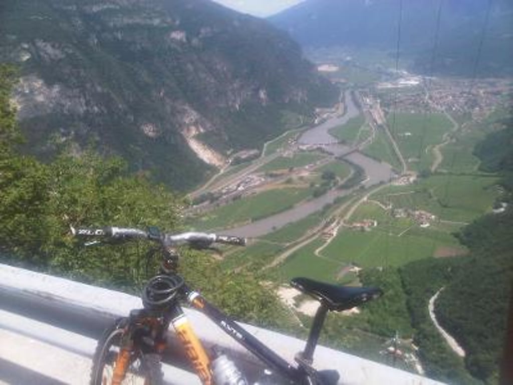
If you drive towards Lake Garda and you pass the town of Ala, you see the road on your left winding up against what seems to be a vertical forest wall.
4 Years ago this may climb in the post season and came dirty on the coffee.
When leaving the village towards the bridge over the stream I had the feeling I was cycling through treacle. A bit further on I saw the first sign with 20% and that explained a lot.
The first 6km are hard work and you soon climb high above the valley with nice views on the valley, Monte Baldo and Monte Zugna.
If you go through a small and narrow natural tunnel then it flattens out a bit, but actually this is a calm before the storm.
A little further on you dive into the forest but not before you pass the second sign with 20%.
This part is really brutal and typically Italian, narrow and steep.
Once you have survived this, it is free-wheeling to the end.
At the top you can have a local beer in the wooden bar and have a look at the war monument on the other side of the street.
After this I kept following the SP14 and then the SP13 to Fosse.
In Fosse I took the second part of Monte Cornetto where the descent at the back ends on Passo delle Fittanze.
All in all a not to underestimate Italian climb which you can easily put in a round trip and that makes it attractive.
Als je richting het Gardameer rijdt en je komt voorbij het plaatsje Ala dan zie je links de weg omhoog kronkelen tegen, een wat lijkt, verticale boswand.
4 Jaar geleden deze mogen beklimmen in het naseizoen en kwam vies op de koffie.
Bij het uitrijden van het dorp richting het bruggetje over het beekje had ik het gevoel door stroop te fietsen, het liep voor geen meter. Iets verderop stond het eerste bord met 20% en dat veklaarde veel.
De eerste 6km zijn stevig aanpoten en klim je vrij snel hoog boven de vallei uit en heb je mooie uitzichten op de vallei, Monte Baldo en Monte Zugna.
Als je door een klein en smal natuurlijk tunneltje gaat dan vlakt hij even af, maar eigenlijk is dit een stilte voor de storm.
Iets verderop duik je het bos in maar niet voordat je voorbij het tweede bord komt met 20%.
Dit gedeelte is echt bruut en typisch Italiaans, smal en steil.
Heb je dit overleefd dan is het freewheelen tot het eind.
Op de top kun je in de houten bar een plaatselijk biertje nemen en een kijkje nemen bij het oorlogsmonument aan de andere kant van de straat.
Ik ben hierna de SP14 blijven volgen en aansluitend de SP13 richting Fosse.
In Fosse heb ik het tweede gedeelte van Monte Cornetto gepakt waar de afdaling aan de achterzijde op Passo delle Fittanze uitkomt.
Al met al een niet te onderschatten Italiaanse beklimming die je makkelijk in een rondje kunt plaatsen en dat maakt hem aantrekkelijk.
| 5 mph | 01:43:23 |
| 7 mph | 01:13:11 |
| 9 mph | 00:57:02 |
| 12 mph | 00:42:51 |
This page is better in the app