Tips nearby


| Gravel |
| #92 toughest climb of Auvergne-Rhône-Alpes |
| #39 most elevation gain of La Maurienne |
| #49 longest climb of La Maurienne |
| #40 average steepest climb of Savoie |
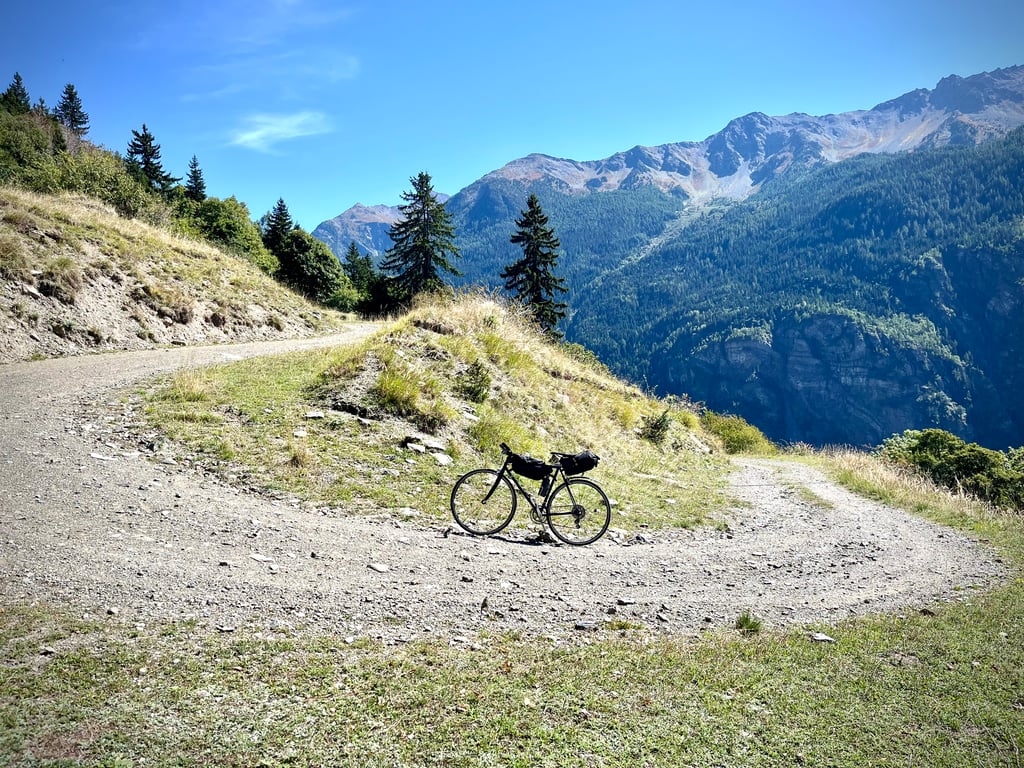
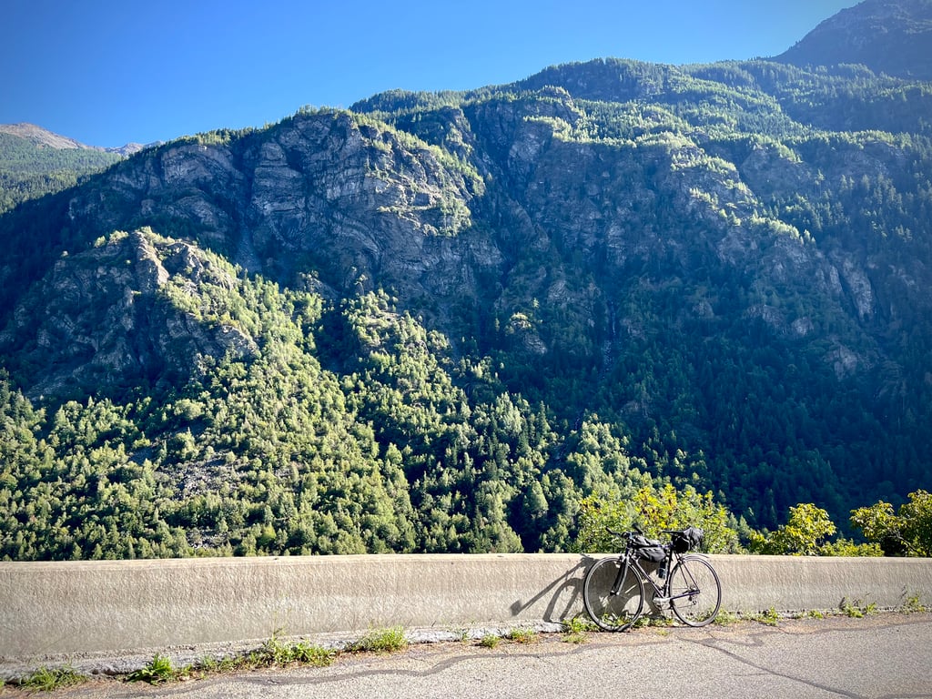
L'Arpont from La Maurienne is a climb in the region La Maurienne. It is 5.6 mi long and bridges 2615 ft of vertical ascent with an average gradient of 8.8%, resulting in a difficulty score of 943. The top of the ascent is located at 5344 ft above sea level. Climbfinder users shared 1 review/story of this climb and uploaded 15 photos.
Road names: Route d'Orelle (D215C) (D 215C), Route d'Orellette & Piste de l'Arpont
4.0 by CromagnonThis is an automatic translation, the original language is: French.943 points for 9km!?!? It makes you wonder. And then all those twists and turns on the map, it makes you want to. The profile is somewhat intimidating: gravel at 10% with a maximum up to 21.8%! The first part goes very well. The road is pretty good and the gradients are serious, but reasonable. Then this pretty red sign "L'Arpont" appears and it starts to climb really hard, but the road remains good... Well, a few dozen metres. Then, the real hostilities begin: this ... read more

Welcome! Please activate your account if you would like to share something. Look for the verification email in your inbox.
If you want to upload your photos, you need to create an account. It only takes 1 minute and it's completely free.
943 points for 9km!?!?
It makes you wonder.
And then all those twists and turns on the map, it makes you want to.
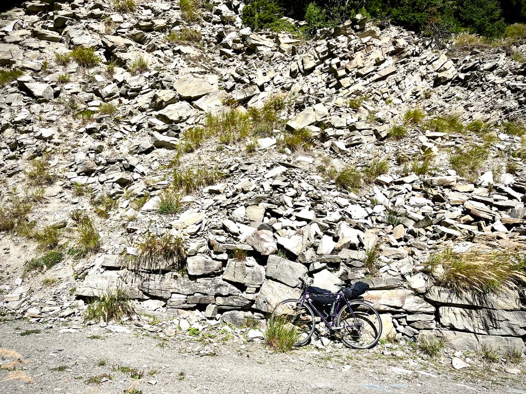
The profile is somewhat intimidating: gravel at 10% with a maximum up to 21.8%!
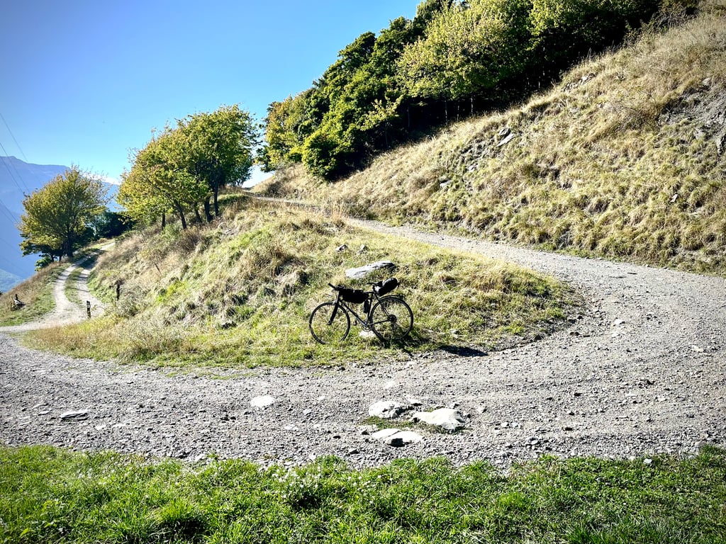
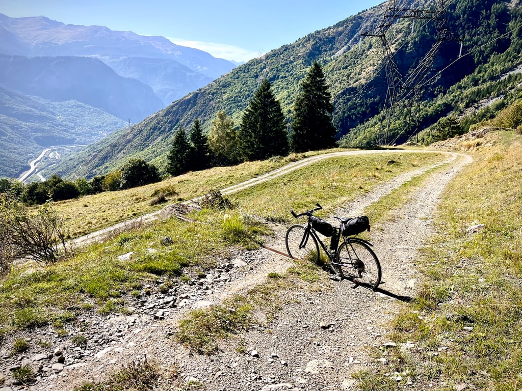
The first part goes very well.
The road is pretty good and the gradients are serious, but reasonable.
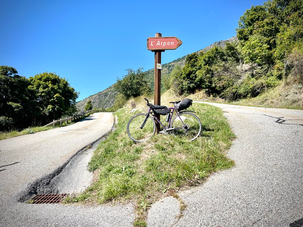
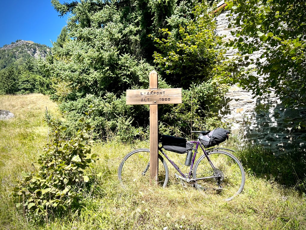
Then this pretty red sign "L'Arpont" appears and it starts to climb really hard, but the road remains good...
Well, a few dozen metres.
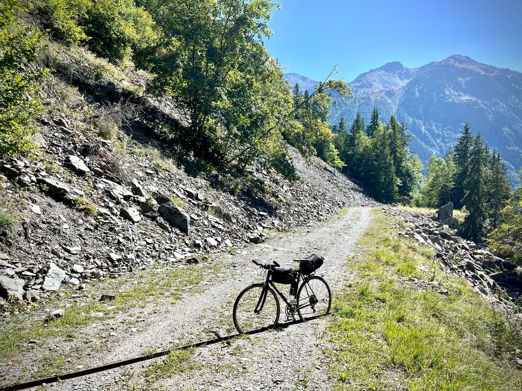
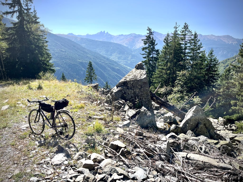
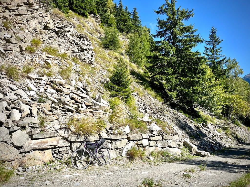
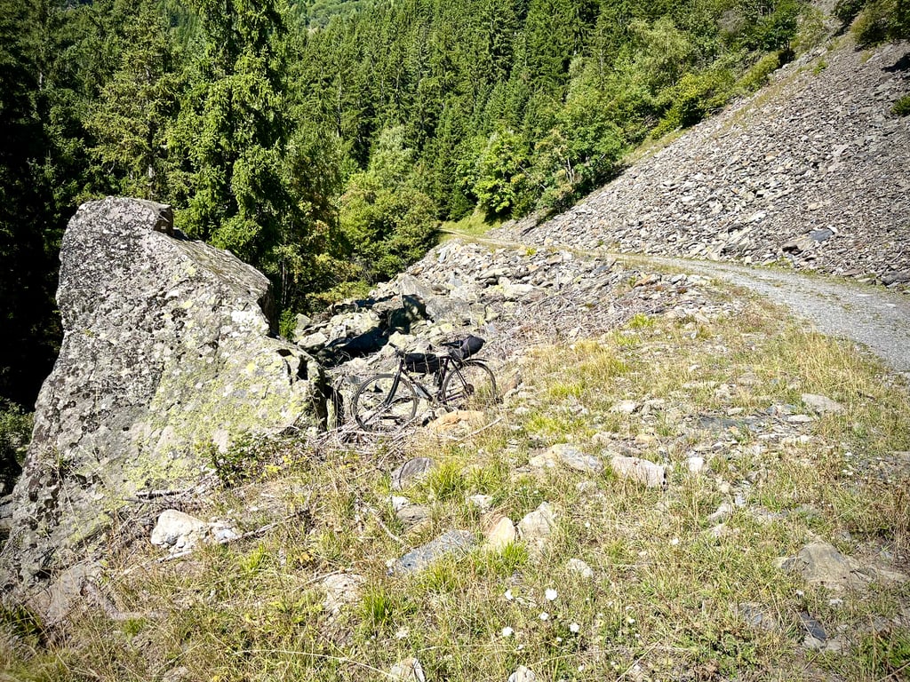
Then, the real hostilities begin: this is serious gravel, gravel that offers all types of gravel and, of course, the gradients go wild!
It's tough stuff. The last 4 kilometres are really tough.
You have to keep a constant eye on your front wheel while taking care to anticipate the least rocky trajectory. The bends are difficult, particularly as they are cut by gullies and 4x4 tracks.
You climb at a ridiculous pace, but you climb. Some sections are a little easier than others.
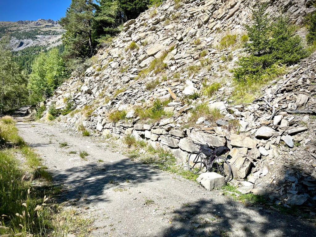
At the end, a difficult section in the 16% zone: it's so rocky that the tyres lose all grip.
We pass dozens of water drainage gullies. They punctuate the descent which, in any case, is done slowly in trial mode.
Of course, this forest track is deserted. No one will see you wiggling your way through the stones.
Speaking of stones, I don't know how rocks don't fall. Besides, there's no proof that they stay in place.
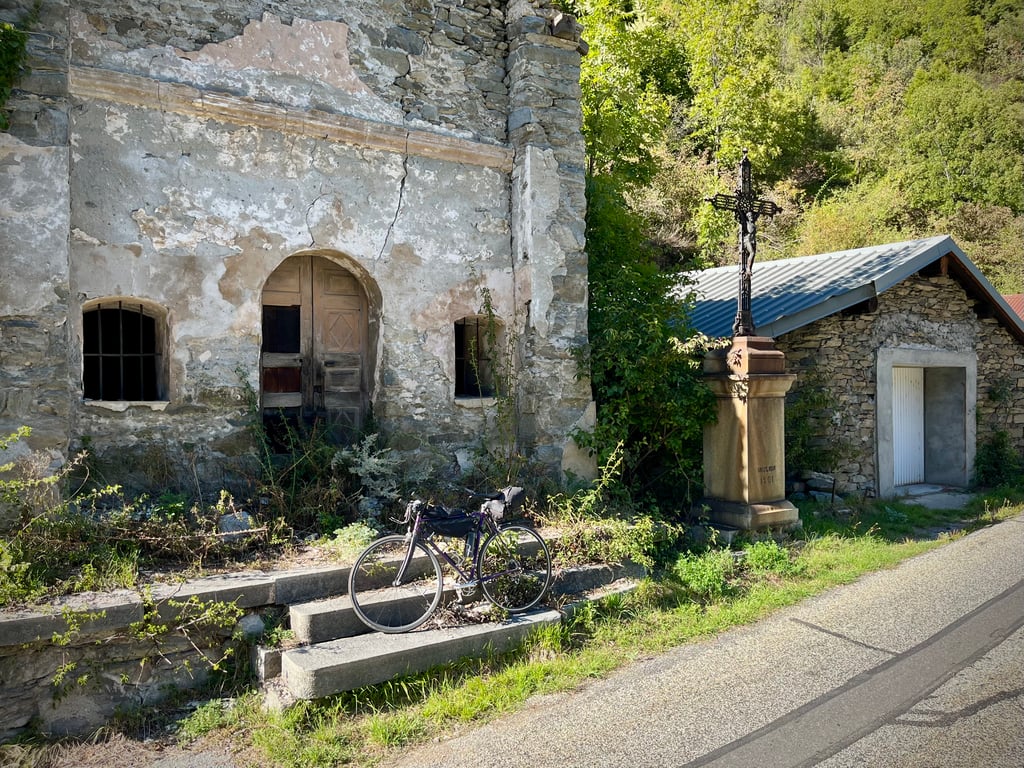
At the top, there's a sign indicating that you've reached a pretty little shack that's probably a gîte.
This climb is a fine piece of work, a fine challenge for those who like gravel and steep gradients.
L'Arpont, horrible or delicious?
Horrible AND delicious!
That's for you to decide.
The photos will help you decide if you're up for it.
PS: I rode a road bike fitted with Continental 4-season 23mm tyres.
In short, it's OK if you're motivated by this type of atypical climb.
So far, so close to the Galibier...
943 points pour 9km !?!?
Ça interpelle.
Et puis tous ces lacets sur la carte, ça donne envie.
Le profil intimide quelque peu : du gravel à 10% avec un maximum jusqu’à 21,8% !
La première partie se passe très bien.
La route est plutôt très bonne et les pourcentages sont sérieux, mais raisonnables.
Et puis voilà que surgit ce joli panneau rouge « L’Arpont » et là, ça se met à grimper vraiment fort, mais la route reste bonne…
Enfin, quelques dizaines de mètres.
Puis, les vraies hostilités débutent : c’est bien du gravel et du sérieux, du gravel qui propose tous les formats de cailloux et évidemment, afin que la fête soit complète, les pourcentages s’affolent !
C’est costaud. Les 4 derniers kilomètres sont franchement éprouvants.
Il faut surveiller sa roue avant en permanence tout en prenant soin d’anticiper sur la trajectoire la moins caillouteuse.
Les virages sont difficiles notamment parce qu’ils sont creusés par les ravinements et les traces de 4x4.
On grimpe à une cadence proprement ridicule, mais on grimpe. Certains tronçons sont un peu plus faciles que d’autres.
Sur la fin, un passage difficile dans la zone à 16% : c’est si caillouteux que les pneus perdent toute adhérence.
On croise des dizaines de rigoles d’évacuation d’eau. Elles ponctuent la descente qui, de toute façon, se fait lentement en mode trial.
Bien entendu, cette piste forestière est déserte. Personne ne vous verra vous tortiller pour vous faufiler à travers les caillasses…
En parlant de cailloux, je ne sais pas comment les roches ne se décrochent pas des parois. D’ailleurs, rien ne prouve qu’elles tiennent en place…
Là-haut, un panneau matérialise l’arrivée devant une jolie petite bicoque qui est sans doute un gîte.
Cette montée est un joli morceau, un beau défi pour qui aime le gravel et les forts dénivelés.
L’Arpont, horrible ou délicieux ?
Horrible ET délicieux !
Ce sera à chacun d’en juger.
Les photos vous aideront à décider si vous êtes volontaire.
PS : je suis monté avec un vélo de route équipé de Continental 4 saisons en 23mm.
Bref, ça passe, si on est motivé par ce type d’ascensions atypiques.
Si loin, si proche du Galibier…
| 5 mph | 01:07:41 |
| 7 mph | 00:47:55 |
| 9 mph | 00:37:20 |
| 12 mph | 00:28:03 |
This page is better in the app