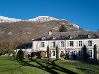
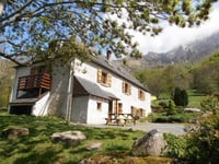
| Beautiful scenery |
| Hidden gem |
| 19 hairpin turns |
| #38 toughest climb of Nouvelle-Aquitaine |
| #37 most elevation gain of Nouvelle-Aquitaine |
| #51 longest climb of Nouvelle-Aquitaine |
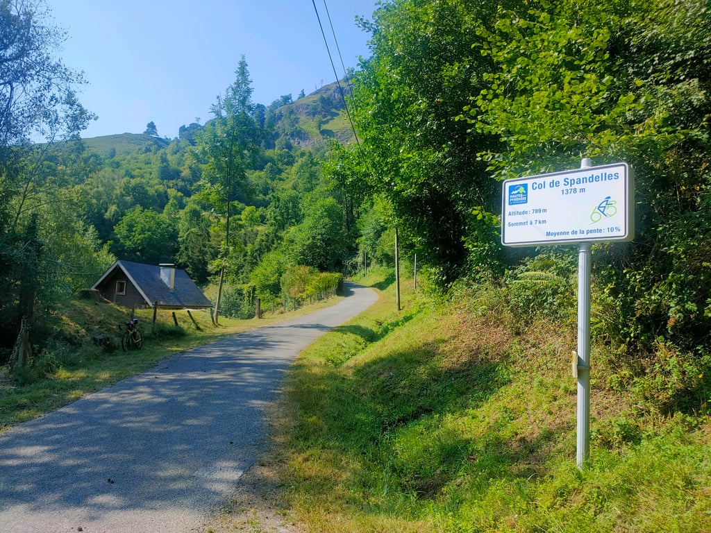
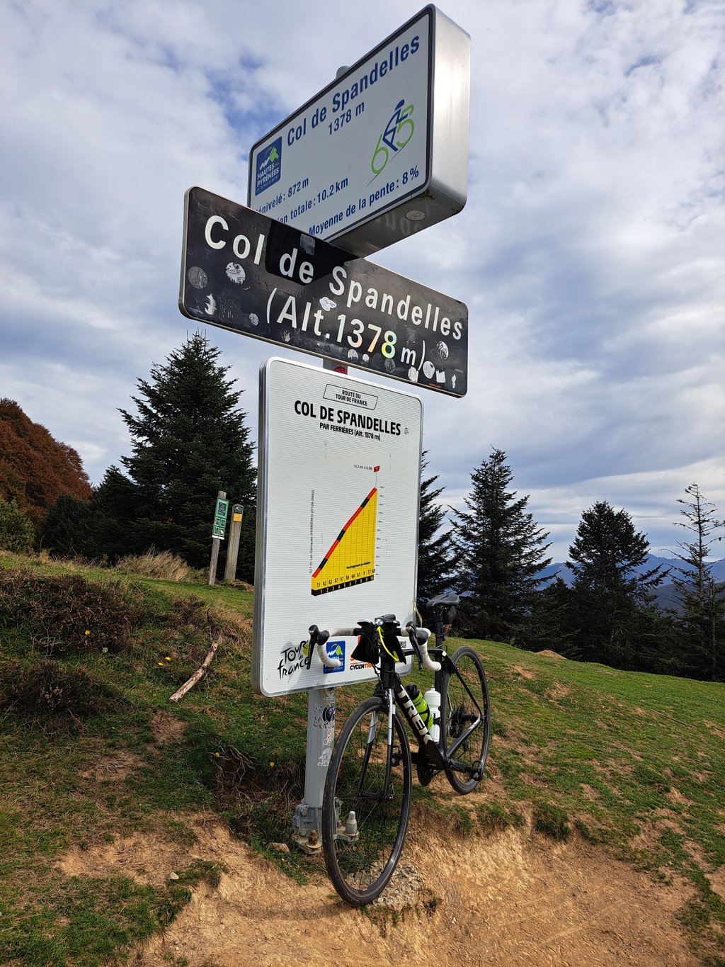
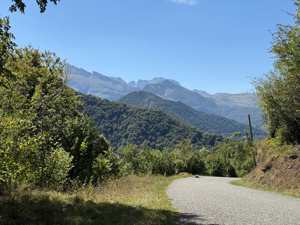
Col de Spandelles from Las Ganques is a climb in the region Pyrénées-Atlantiques. It is 6.4 mi long and bridges 2815 ft of vertical ascent with an average gradient of 8.3%, resulting in a difficulty score of 771. The top of the ascent is located at 4518 ft above sea level. Climbfinder users shared 11 reviews of this climb and uploaded 36 photos.
Road name: Route du Spandelle
5.0 by SausThis is an automatic translation, the original language is: Dutch.Beautiful climb! If your legs don't explode, it's like a fairy tale!... read more
Welcome! Please activate your account if you would like to share something. Look for the verification email in your inbox.
If you want to upload your photos, you need to create an account. It only takes 1 minute and it's completely free.
An underrated Col. It’s the stepsister of the monster climbs of d’Aubisque and Soulor nearby. It was a hot day with a lot of exposure making it difficult for all. The exposure, however, provides good views of the valley and views of two valleys at the top. The tarmac is chip and seal but consistent making me wonder if they used a steam roller in prep for the Tour when it passed through. A pleasant surprise. No amenities so pack more water than I did. I paid a price for not being adequately prepared and failing to cool down prior to the start. Would I ride it again? Yes. Would I do it tomorrow? Not a chance
Very nice climb, nice narrow tarmac road, very little traffic unless some cows or donkeys 😉. Descent to Argeles also nice with lots of cornering.
Zeer mooie klim, leuk smal asfaltwegje, zeer weinig verkeer tenzij wat koeien of ezels 😉. Afdaling naar Argeles ook mooi met heel wat bochtenwerk.
This is an unbelievably good climb which I did as a result of a route error. I went down to Ferrieres from Soulor and needed to get back to Argeles Gazost. It is a quiet climb, I saw one other cyclist, on perfect tarmac and with stunning views. The descent is perfect and I barely pedalled back into AG. Well worth doing!
Pooh, very nice climb on a narrow quiet road. But quite tough with the Soulor and Aubisque already in the legs. Nothing to do at the top and nowhere to drink.
Poeh, hele mooie klim op een smalle rustige weg. Maar behoorlijk pittig met de Soulor en Aubisque al in de benen. Niks te beleven aan de top en nergens een mogelijkheid om te drinken.
Depending on where you stay, this one is a little out of the way and your best option - besides starting somewhere near Arthez-d'Ansson - is to get down from the (Aubisque-)Soulor (or do the other end from Argelès-Gazost first).
Quiet, but hard, even more so under the scorching sun. As usual around here, flocks of cows and donkeys - they will never move out of the way 😂 - and a deserted summit.
Under the heading, once but never again, got to tick off this calf biter.
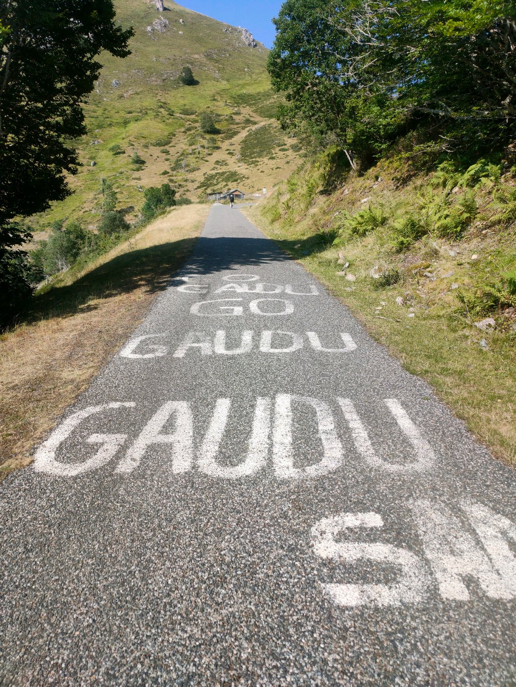
The big Tour de France sign at the foot of the climb completely puts you on the wrong track.
Max 9.7% but the first 2km go well into the double digits and on the way at least 3x saw a kilometre sign with an average of 10% on it.
This climb was just brutal, with almost no views and unimaginable that a Tour caravan went over here.
Well, it was on the route shall we say.
Onder de noemer, eens maar nooit meer, deze kuitenbijter mogen afvinken.
Het grote bord van de Tour de France aan de voet van de klim, zet je volledig op het verkeerde been.
Max 9,7% maar de eerste 2km gaan goed in de dubbele cijfers en onderweg zeker 3x een kilometerbord gezien met gemiddeld 10% erop.
Deze klim was gewoon bruut, met bijna geen uitzichten en niet voor te stellen dat hier een Tourkaravaan overheen is gegaan.
Tja, hij lag op de route zullen we maar zeggen.
Super nice col, this col de Spandelles. Quieter than the big well-known cols in the area, the occasional car on the way, the occasional cyclist, a fairly narrow road, very pleasant and tight tarmac (both the ascent from Ferrieres and the descent to Argeles, probably courtesy of last year's TDF), and neatly provided with kilometre signs. Highly recommended if you want to cycle in peace and yet climb briskly!
Superleuke col, deze col de Spandelles. Rustiger dan de grote bekende cols in de buurt, af en toe en auto onderweg, een enkele fietser, een vrij smalle weg, zeer prettig en strak asfalt (zowel de beklimming vanuit Ferrieres als de afdaling naar Argeles, waarschijnlijk met dank aan de TDF van vorig jaar), en netjes voorzien van kilometer borden. Aanrader voor als je in de rust wil fietsen en toch stevig wil klimmen!
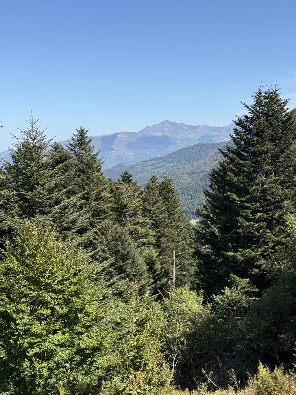
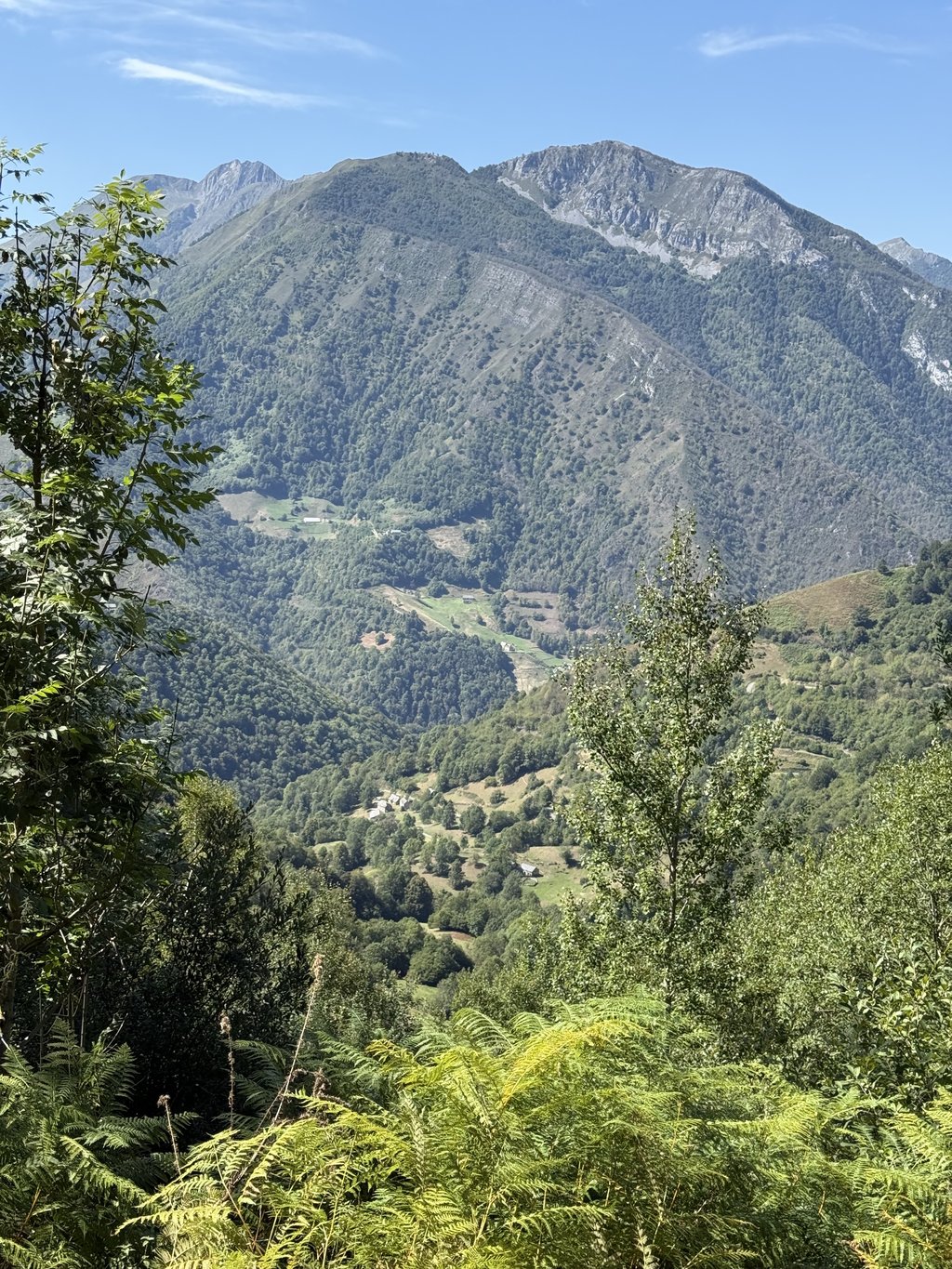
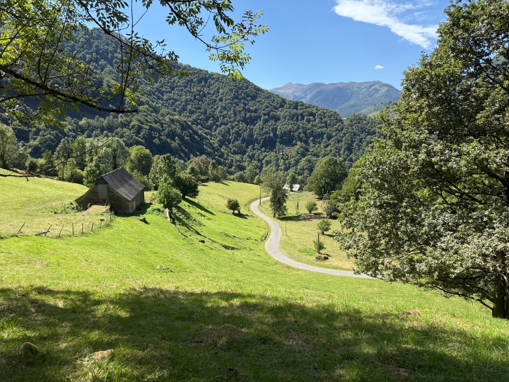
The climb starts just past an unsightly village called Ferrières, in the middle of the Parque national des Pyrenèes. You are still in the middle of the wonderful descent of its more famous neighbour, the col du Soulor, when a few hundred metres past the last house on the diagonal right of the D602 it goes straight uphill. So you have to downshift and go full speed immediately. There you do get caught a bit cold and that transition is quite a brutal attack on your calves and thighs. In 2014, the road was of moderate quality but passable. It has since been rebuilt because, for the first time in history, the Tour caravan will pass it in 2022 during the 18th stage, after the Aubisque and before Hautacam. It is also very narrow, but apart from the few locals and a possible stray tourist, no one passes there. Never did I ride up a col quieter than this one. On the whole climb, as on an earlier climb from Argelès, I did not see a single car. All you hear are whistling birds and the gurgling stream. The road winds with about 15 hairpin bends over the total distance to the summit at 1378m altitude. And the higher you climb, the more beautiful the view becomes of the "cirque du Litor" and the hotel-restaurant at the top of an even more famous neighbour, the col d'Aubisque. He who arrives at the top with an empty drinking can is eraan for the trouble because, you will find nothing there beyond a horde of annoying flies. The views, on the other hand, are stunning. The descent to Argelès was quite dangerous at the time with holes in the road, loose gravel etc. That side too must have been repaved by now. Also, the constant alternation between sun and shade is not obvious. Be careful.
De klim start net voorbij een onooglijk dorpje met de naam Ferrières, midden in het Parque national des Pyrenèes.. Je zit nog volop in de wondermooie afdaling van zijn meer bekende buur, de col du Soulor als het een paar honderd meter voorbij het laatste huis schuin rechts de D602 meteen bergop gaat. Je moet dus terugschakelen en onmiddellijk vol aan de bak. Daar wordt je toch wel even koud gepakt en is die overgang toch wel een brutale aanslag op je kuiten en dijen. De weg was in 2014 van matige kwaliteit maar goed berijdbaar. Ondertussen werd hij heraangelegd want, voor het eerst in de geschiedenis passeert de Tourkaravaan er in 2022 tijdens de 18de etappe, na de Aubisque en voor Hautacam. Hij is ook zeer smal, maar buiten de enkele lokale bewoners en een eventueel verdwaalde toerist komt er niemand. Nooit reed ik een col op die stiller was dan deze. Op de hele klim zag ik, net als op een vroegere beklimming vanuit Argelès niet een auto. Het enige wat je hoort zijn fluitende vogels en het klaterende beekje. De weg slingert met een vijftiental haarspeldbochten over de totale afstand tot de top op 1378m hoogte. En Hoe hoger je klimt, hoe mooier het zicht wordt op de “cirque du Litor” en het hotel-restaurant op de top van een nog bekendere buur, de col d’Aubisque. Hij die boven komt met een lege drinkbus is eraan voor de moeite want, je vindt er niets buiten een horde vervelende vliegen. Het uitzicht daarentegen is prachtig. De afzink naar Argelès was toen vrij gevaarlijk met gaten in de weg, los grind e.d. Ook die zijde zal ondertussen wel heraangelegd zijn. Ook de constante afwisseling tussen zon en schaduw is niet evident. Toch wel opletten.
It is a beautiful climb. The road has a new layer of wear (gravel) but almost all of it has been driven on so it is easy to cycle. It is narrow, no car's can pass each other without going through the grass. It is also a very irregular climb. Pieces of 4% are guaranteed to be followed by pieces of 10 to 12%. This makes it a tough climb from start to finish. If you look back on the open parts you have a beautiful view over the valley with the top of the Aubisque on the other side. 2 Km before the top you have plenty of time to admire this and look straight down where you came from. During the trip you can hear the bells of the cows and the goats in the bushes everywhere. during the last Km I was surrounded by a herd of goats on their way to the farm just before the last hairpin bend.
Het is een prachtige beklimming. De weg is pas voorzien van een nieuwe slijtlaag (grind) maar dat is bijna allemaal al vast gereden zodat er prima te fietsen is. Het is er smal, er kunnen geen auto's elkaar passeren zonder door het gras te gaan. Het is ook een heel onregelmatige klim. Stukken van 4% worden gegarandeerd opgevolgd door stukken van 10 tot 12%. Dat maakt het een pittige beklimming van begin tot het einde. Als je op de openstukken achterom kijkt heb je een prachtig uitzicht over het dal met aan de andere kant nog de top van de aubisque. 2 Km voor de top heb je hier ook nog ruim de tijd on dit te bewonderen en recht naar beneden te kijken waar je vandaan komt. Tijdens de tocht hoor je overal de bellen van de koeien en de geiten in de bosjes. tijdens de één na laatste Km werd ik omringt door een kudde Geiten die op weg waren naar de boerderij vlak voor de laatste haarspeldbocht.
For me an unknown climb where I had to dig deep into the reserves. I had already climbed the Soulour and the Aubisque and decided to go back to Argeles via the Spandelles. It is a beautiful, winding climb on a narrow road with hardly any traffic. It was hot, it was long and it was tough. In 51' minutes I could do it, but it was fun for hours :). But we had great views over the valley and other impressive mountains. If you are around there an absolute must to cycle. Watch out for descents, bad tarmac, I was still bouncing that night ...
Voor mij onbekende klim waar ik toch diep in de reserve moest tasten. Had de Soulour en Aubisque al achter de kiezen en besloot via de Spandelles terug naar Argeles te gaan. Het is een prachtig, slingerende klim over een smalle weg met nauwelijks verkeer. Het was heet, het was lang en het was taai. In 51' minuten kunnen afleggen, maar het leuk uren te duren :). Wel prachtig uitzicht over vallei en andere indrukwekkende bergpartijen. Als je daar in de buurt bent een absolute must om te fietsen. Kijk uit met afdalen, slecht asfalt, ik lag die avond nog te stuiteren...
| 5 mph | 01:17:33 |
| 7 mph | 00:54:54 |
| 9 mph | 00:42:47 |
| 12 mph | 00:32:09 |
This page is better in the app