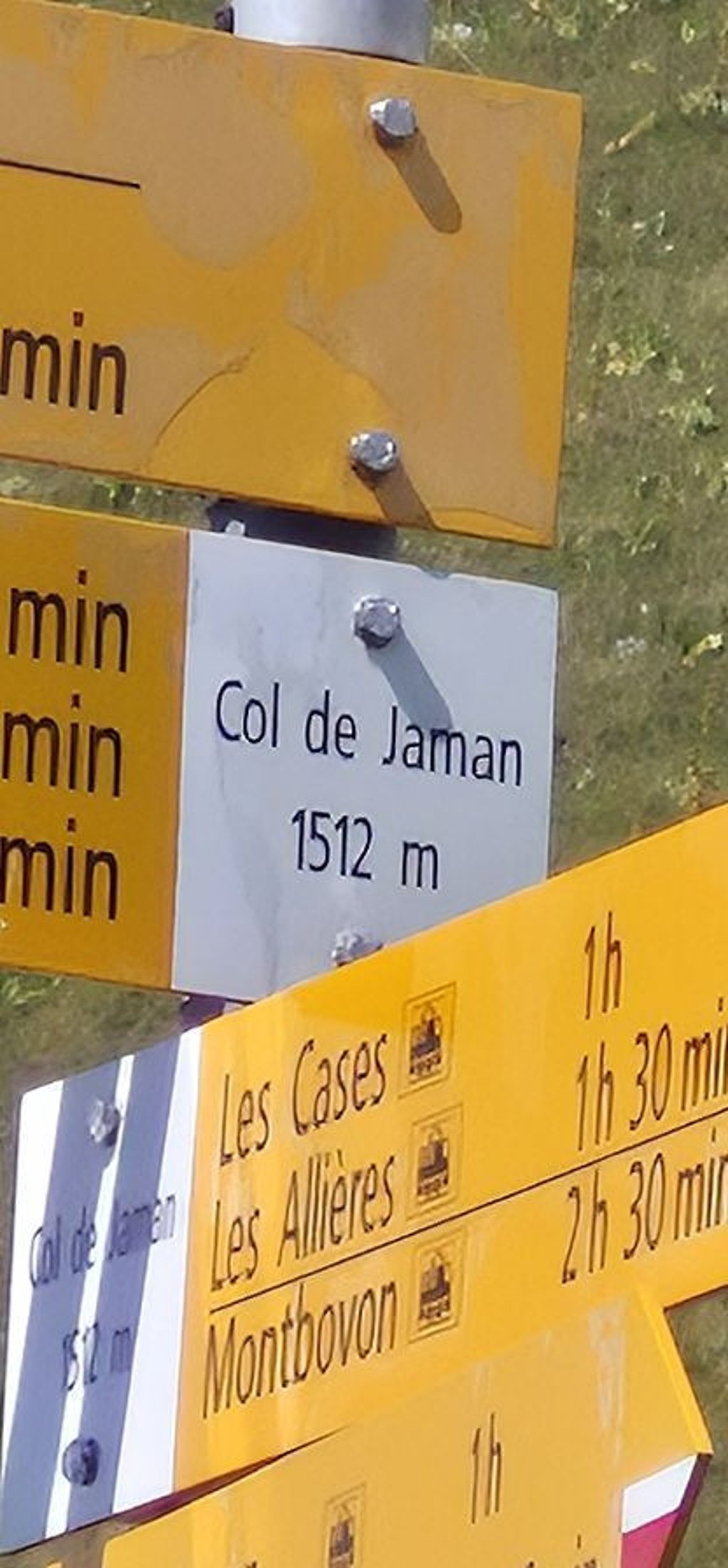
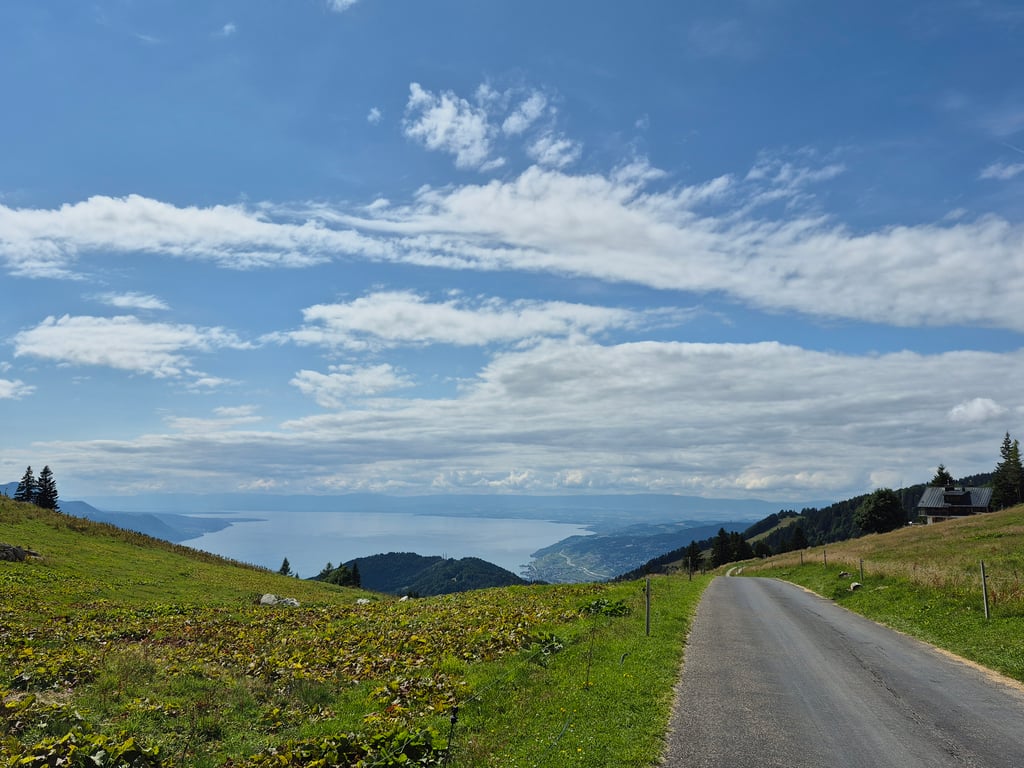
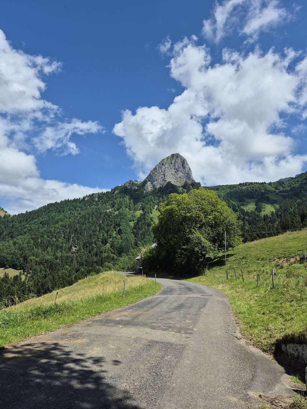
Col de Jaman from Montreux via Caux is a climb in the region Vaud. It is 8.7 mi long and bridges 3510 ft of vertical ascent with an average gradient of 7.6%, resulting in a difficulty score of 995. The top of the ascent is located at 4957 ft above sea level. Climbfinder users shared 7 reviews of this climb and uploaded 21 photos.
Road names: Route de Glion, Route de Caux, Route des Monts & Route de Jaman
5.0 by WllmerHAThis is an automatic translation, the original language is: English.I did it from Clarens from 8 am to avoid the heat in this period of extreme climate. The hardest section is in Glion. Very steep and the traffic doesn't allow you to stop. You have no choice but keeping going. At the end it's hard again but manageable when used to steep climbs.... read more
Welcome! Please activate your account if you would like to share something. Look for the verification email in your inbox.
If you want to upload your photos, you need to create an account. It only takes 1 minute and it's completely free.
I did it from Clarens from 8 am to avoid the heat in this period of extreme climate. The hardest section is in Glion. Very steep and the traffic doesn't allow you to stop. You have no choice but keeping going. At the end it's hard again but manageable when used to steep climbs.
Nice climb with good surface. 500m very difficult at the start with 15% gradients. The end is also prickly, but the scenery at the finish is worth it.
Montée belle avec bon revêtement. 500m très difficile au début avec des pentes à 15%. La fin aussi piquante mais le paysage à l’arrivée en vaut la peine
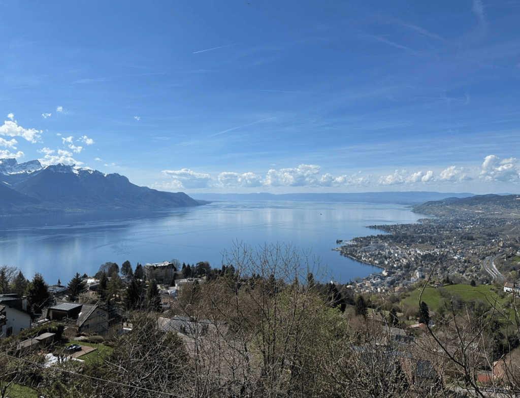
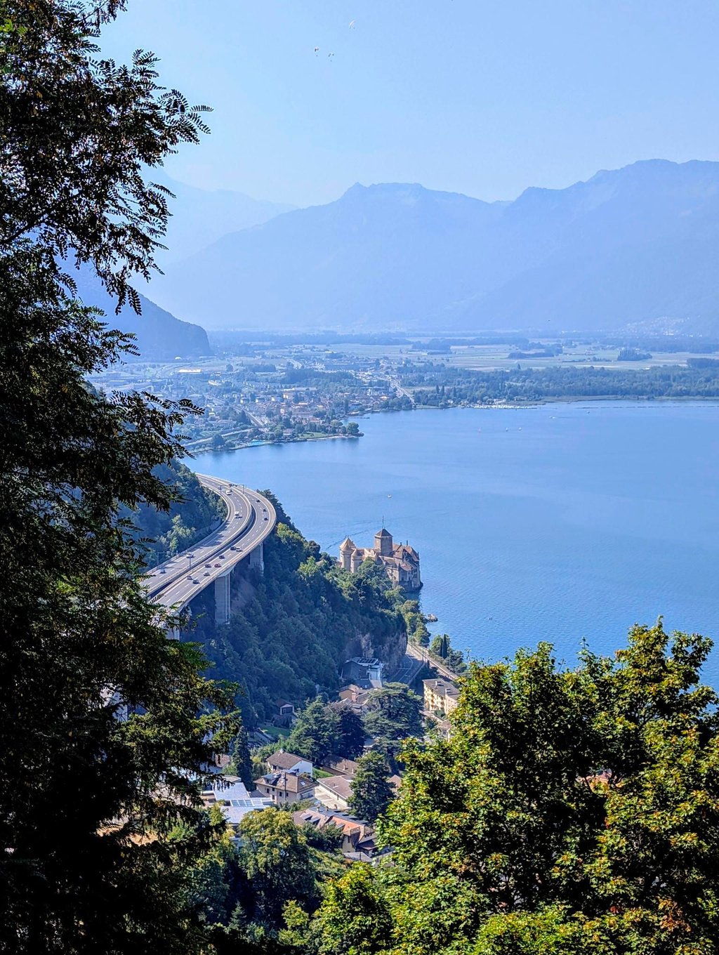
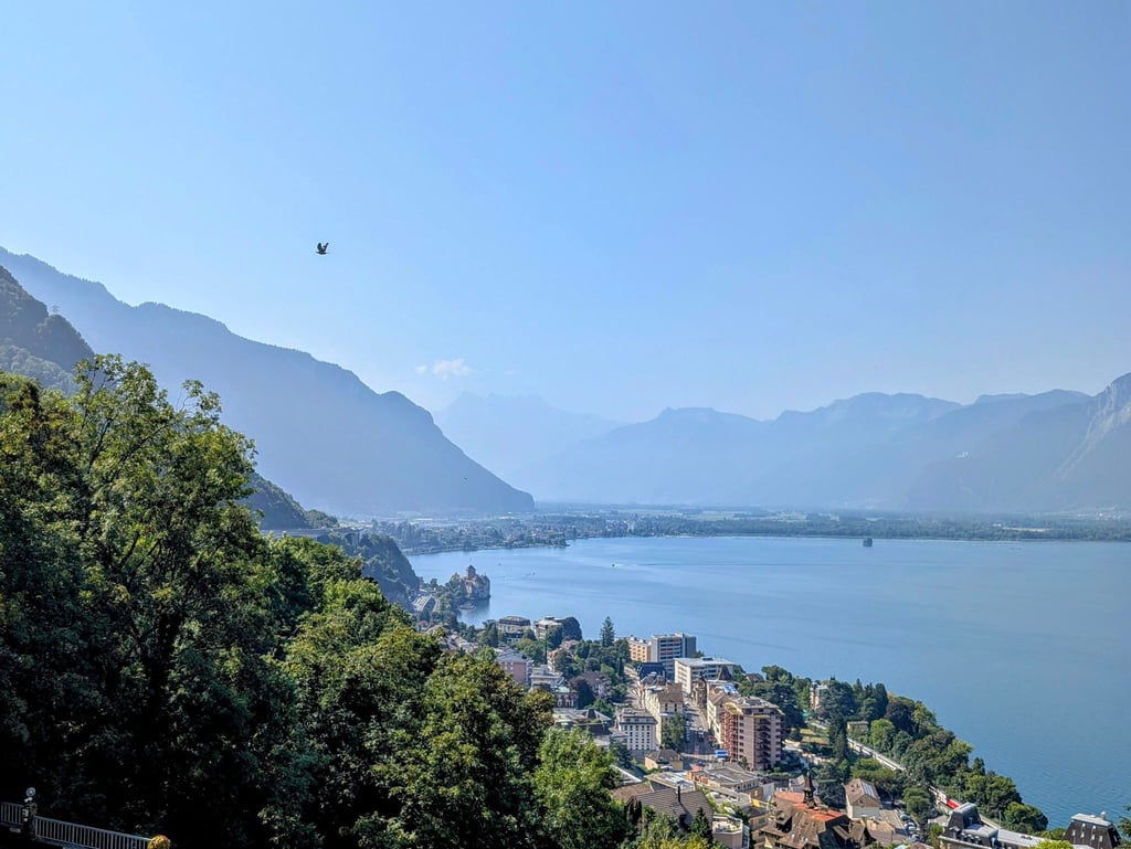
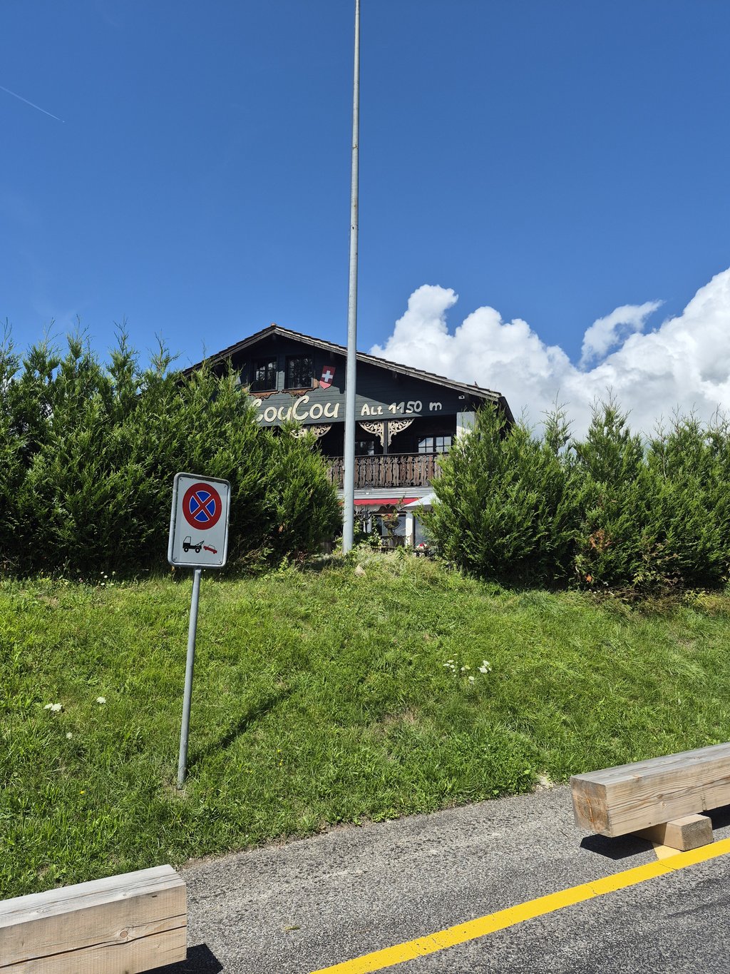
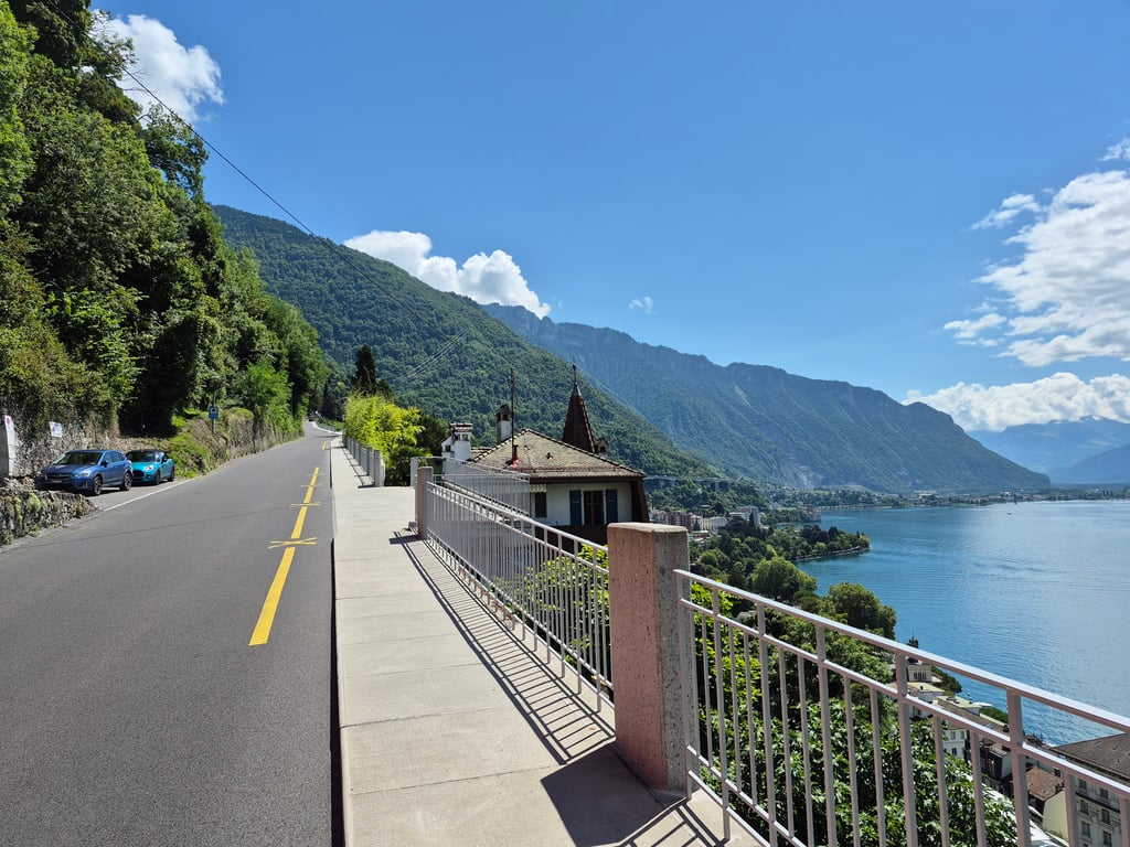
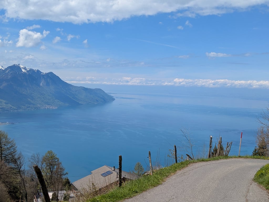
Steep, steep and more steep. The lower roads can be a little busy but you can avoid about 2 km of them by turning right after the train tunnel. The detour is quieter but also a little steeper too. Views are outstanding, Montreux shines below on the lakeside and the higher you go the better it gets. Just after Caux Palace the bar Coucou Montreux the gradient eases giving your legs a much needed rest. This middle stretch is tree-lined but the bends open up to sweeping views across the mountains and down to the lake. The final 1.6 km is savage with, 16% average incline with ramps up to 23% and the broken tarmac makes the descent just as testing. Still the scenery makes the suffering worth it.
Steep, steep and more steep. The lower roads can be a little busy but you can avoid about 2 km of them by turning right after the train tunnel. The detour is quieter but also a little steeper too. Views are outstanding, Montreux shines below on the lakeside and the higher you go the better it gets. Just after Caux Palace the bar Coucou Montreux the gradient eases giving your legs a much needed rest. This middle stretch is tree-lined but the bends open up to sweeping views across the mountains and down to the lake. The final 1.6 km is savage with, 16% average incline with ramps up to 23% and the broken tarmac makes the descent just as testing. Still the scenery makes the suffering worth it.
Steep, steep and more steep. The lower roads can be a little busy but you can avoid about 2 km of them by turning right after the train tunnel. The detour is quieter but also a little steeper too. Views are outstanding, Montreux shines below on the lakeside and the higher you go the better it gets. Just after Caux Palace the bar Coucou Montreux the gradient eases giving your legs a much needed rest. This middle stretch is tree-lined but the bends open up to sweeping views across the mountains and down to the lake. The final 1.6 km is savage with, 16% average incline with ramps up to 23% and the broken tarmac makes the descent just as testing. Still the scenery makes the suffering worth it.
Steep, steep and more steep. The lower roads can be a little busy but you can avoid about 2 km of them by turning right after the train tunnel. The detour is quieter but also a little steeper too. Views are outstanding, Montreux shines below on the lakeside and the higher you go the better it gets. Just after Caux Palace the bar Coucou Montreux the gradient eases giving your legs a much needed rest. This middle stretch is tree-lined but the bends open up to sweeping views across the mountains and down to the lake. The final 1.6 km is savage with, 16% average incline with ramps up to 23% and the broken tarmac makes the descent just as testing. Still the scenery makes the suffering worth it.
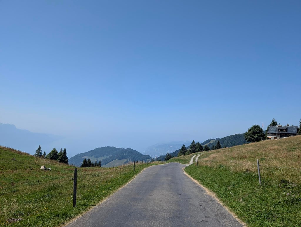
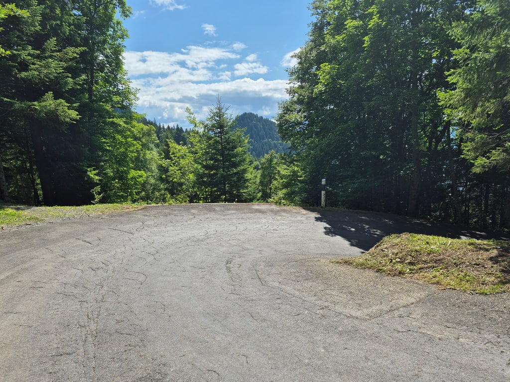
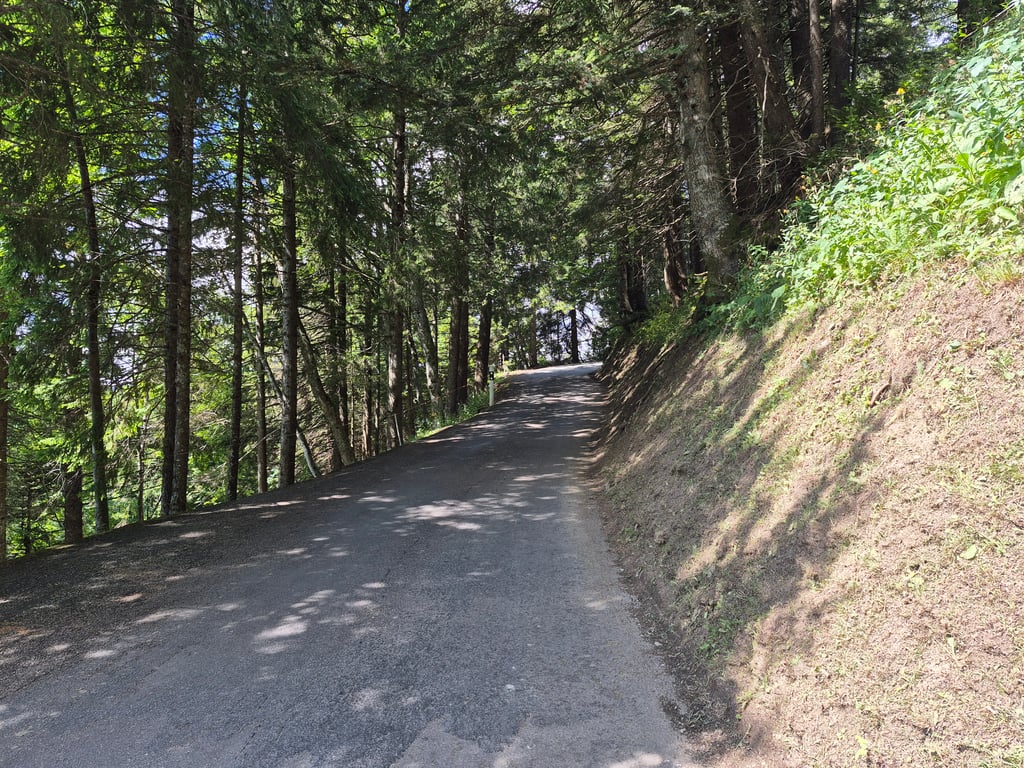
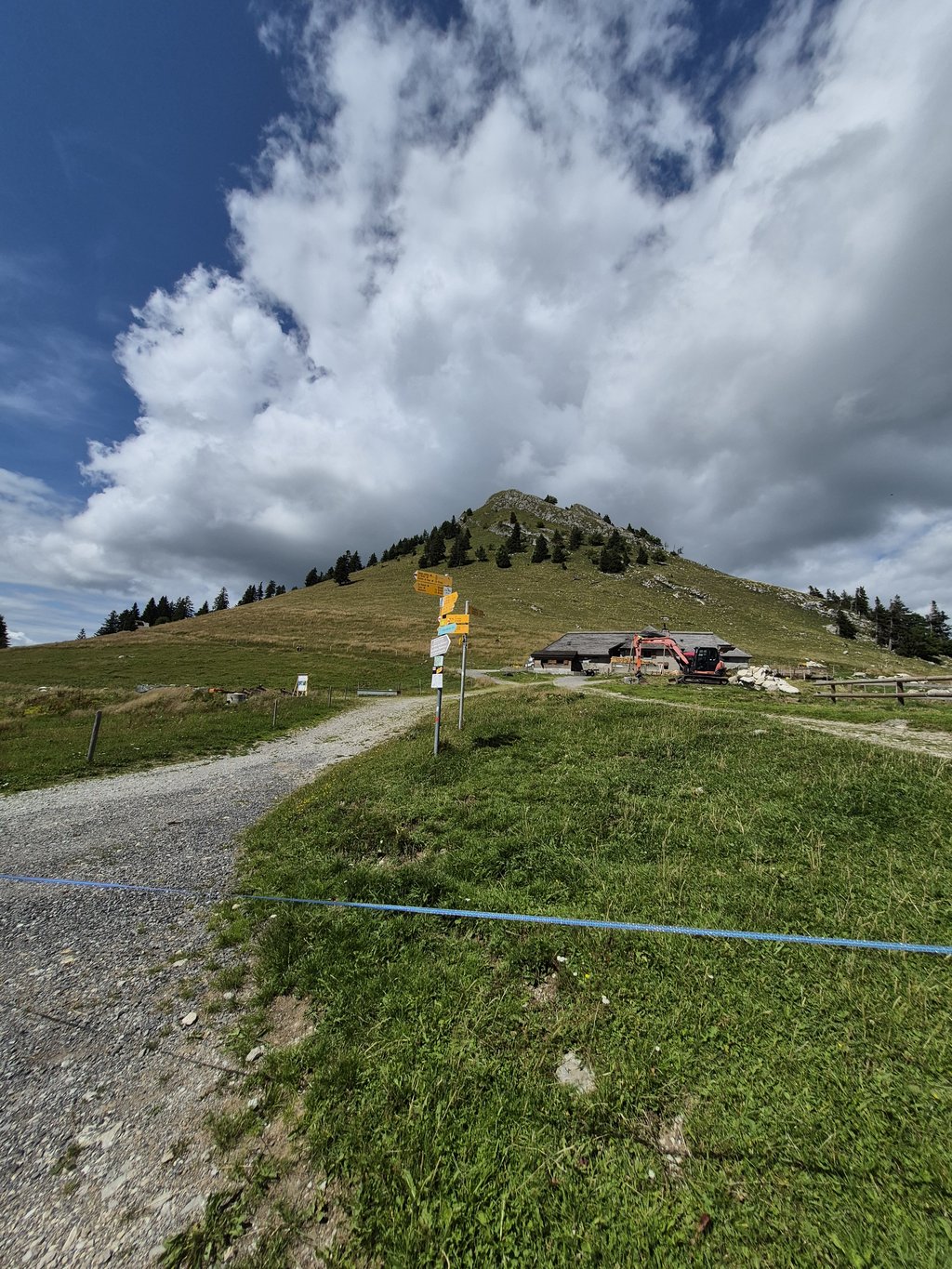
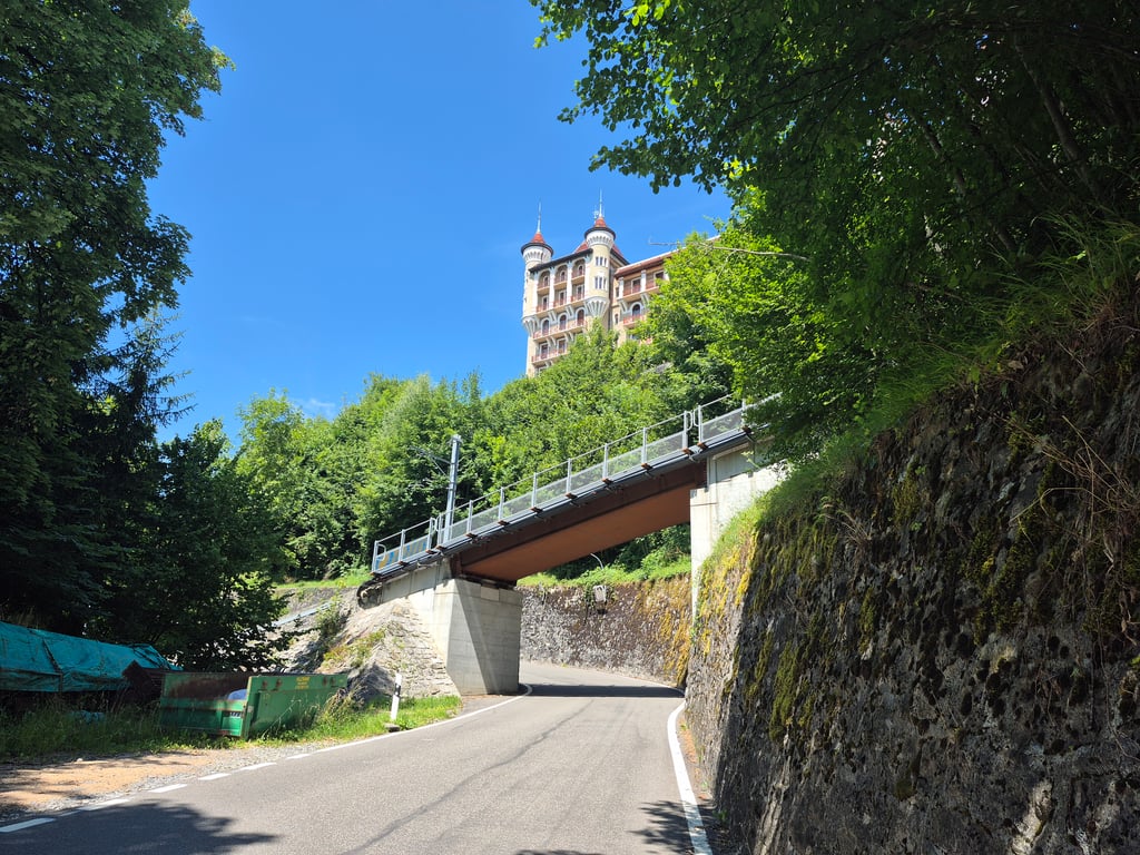
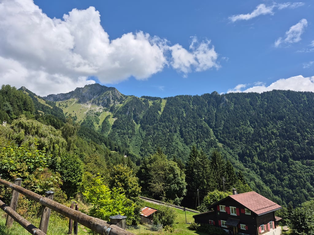
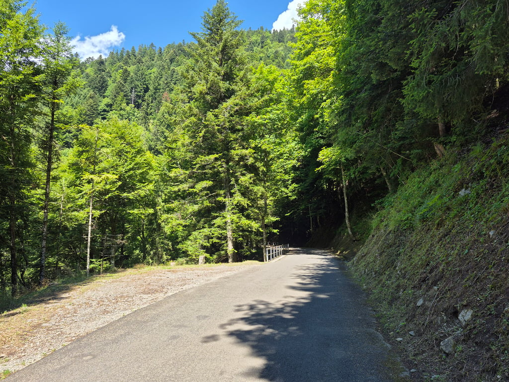
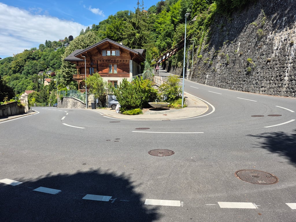
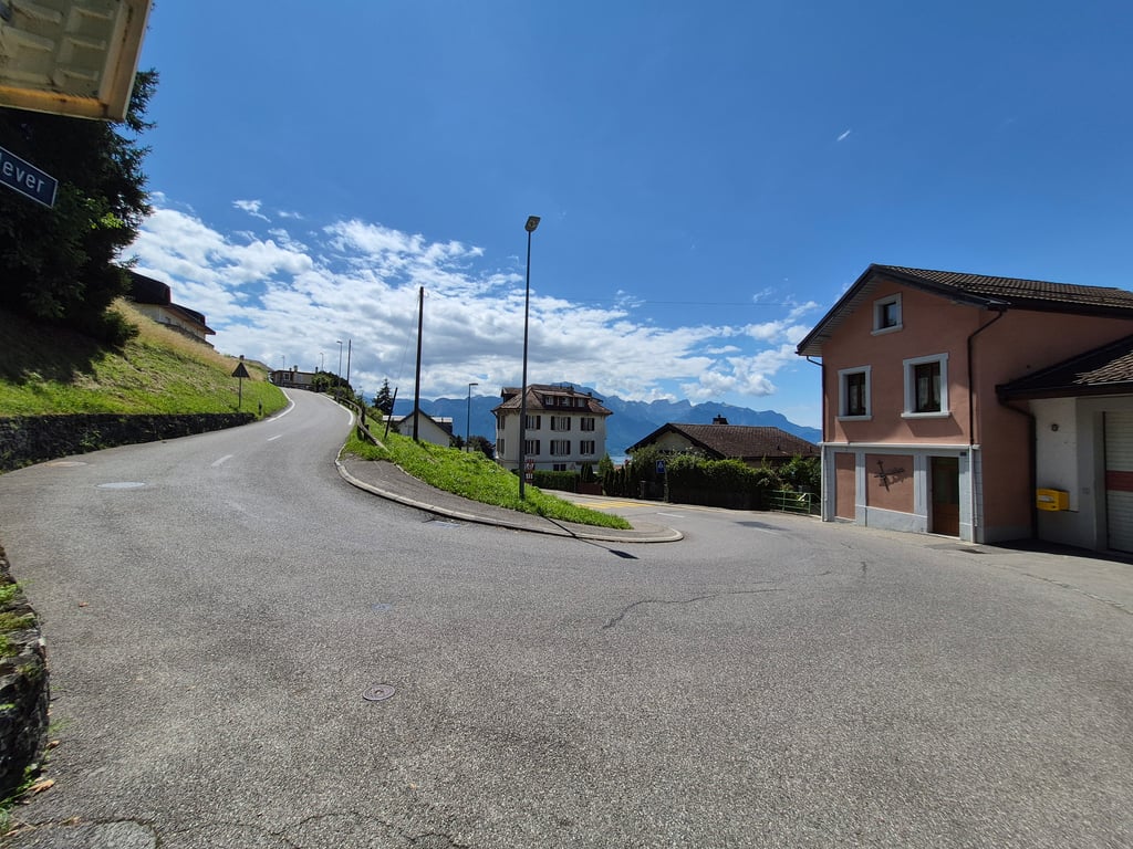
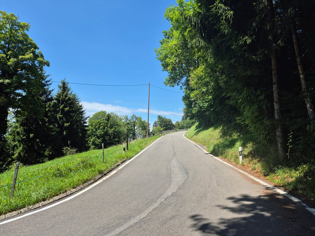
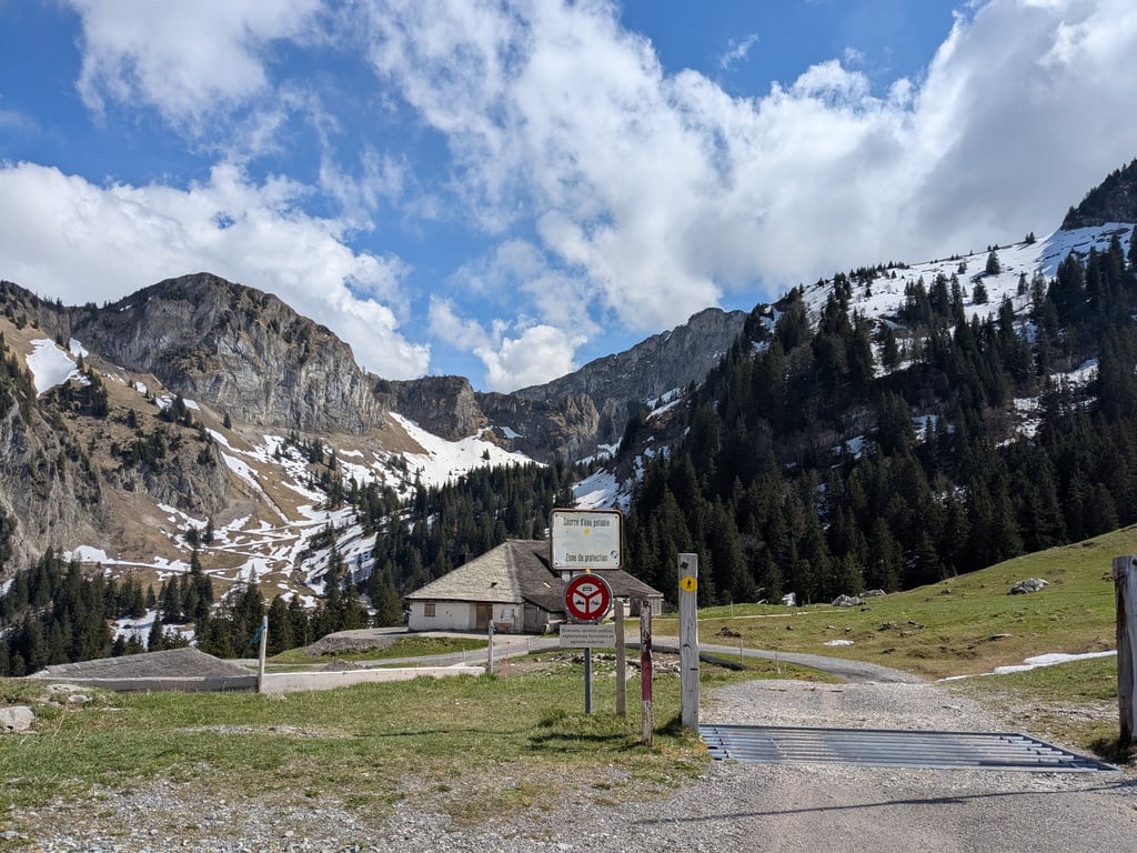
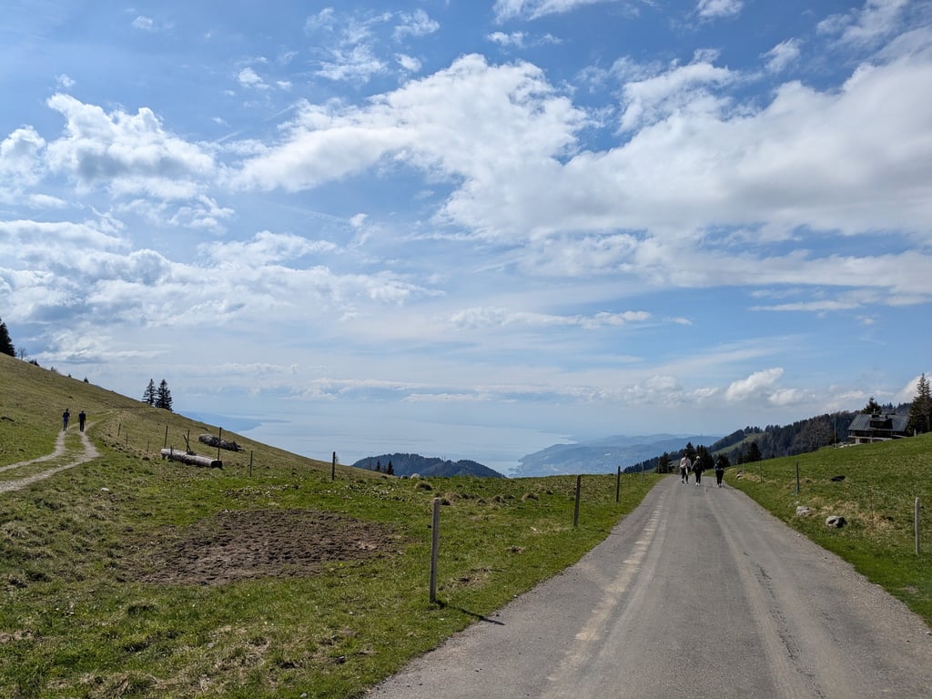
Coming from the old town of Montreux, you first drive up to Glion. On this short section, you have an excellent view of the lake on the right. In Glion, it gets really steep for the first time for a short time until you reach the Hotel Victoria. Afterwards, the gradient is again less than 10% to Caux, where you can already see the old hotel complex from below, very impressive. Take the signposted path to the right towards Col de Jaman. The first two kilometres after Caux are still quite steep. At an altitude of 1050 metres (at Coucou), the path flattens out abruptly to a pleasant gradient of around 5%. Here you pass through a wooded area. In contrast to the stretch to Caux, which is always unprotected in the sun, it is almost always shady on this section. The road surface gets worse the higher you go, but remains tarmac and easy to ride on. The last kilometre begins at the junction to Les Avants, where you turn right to the Col de Jaman. This is steep, 13.5% on average, with ramps that are significantly steeper. Once at the top, there is an excellent view of the Dent de Jaman and, above all, of the lake from above. Unfortunately, there is no large pass sign. There is relatively heavy traffic between Montreux and Glion, rather little on the col itself, but overtaking is difficult, especially on the last kilometre on the narrow road. As a racing cyclist, you have to turn round at the top, as the rest of the route is gravel.
Aus der Altstadt von Montreux kommend fährt man zunächst hinauf nach Glion. Auf diesem kurzen Abschnitt hat man rechts einen hervorragenden Blick auf den See. In Glion wird es zum ersten Mal für kurze Zeit richtig steil, bis das Hotel Victoria erreicht ist. Danach wieder Steigungen unter 10% bis Caux, wo man von unten bereits den alten Hotelkomplex sieht, sehr eindrucksvoll. Man nimmt dort nach rechts den ausgeschilderten Weg Richtung Col de Jaman. Die ersten beiden Kilometer hinter Caux bleiben noch recht steil. In 1050 m Höhe (am Coucou) flacht der Weg abrupt ab auf angenehme Steigungen um die 5%. Hier durchfährt man ein Waldgebiet. Im Gegensatz zur Stecke bis Caux, die man immer ungeschützt in der Sonne fährt ist es auf diesem Abschnitt quasi immer schattig. Der Straßenbelag wird umso schlechter, je höher man kommt, bleibt aber asphaltiert und gut befahrbar. An der Abzweigung nach Les Avants, wo man rechts zum Col de Jaman abbiegt, beginnt der letzte Kilometer. Dieser ist steil, 13.5% im Schnitt, mit Rampen,die deutlich steiler sind. Oben angekommen bietet sich ein hervorragender Blick auf die Dent de Jaman und vor allem von oben auf den See. Ein großes Passschild gibt es leider nicht. Zwischen Montreux und Glion ist relativ viel Verkehr, auf dem Col selbst eher wenig, aber das Überholen wird insbesondere auf dem letzten Kilometer auf der engen Straße schwierig. Als Rennradfahrer muss man oben umkehren, der weitere Weg ist Schotter.
For the lovers of strong percentages, there's a short 17% ramp in Glion. Then it gets easier, it flattens out after Caux for a while (the asphalt gets a bit worse), then climbs again up to the col de Jaman. It's all in the shade! It's also easy to pair up with additional steep climbs nearby (Sonchaux, Col de Chaude, Pléiades)
A very difficult climb at times, particularly the last kilometre. The incredible views of Lake Geneva and the Alpine environment are absolutely worth the effort to get there. Restaurant at the summit.
Take care on the descent to Hauts de Caux (also a restaurant) on a narrow, uneven mountain road. The rest of the road is of good quality.
Montée très difficile par moments, en particulier le dernier kilomètre. La vue incroyable sur le lac Léman et l'environnement alpin vaut absolument l'effort pour y parvenir. Restaurant au sommet.
Attention dans la descente qui se déroule jusqu'aux Hauts de Caux (restaurant aussi) sur une route de montagne étroite et inégale. Le reste de la route est de bonne qualité
| 5 mph | 01:45:09 |
| 7 mph | 01:14:27 |
| 9 mph | 00:58:01 |
| 12 mph | 00:43:35 |
This page is better in the app