View on map
© MapLibre | OpenStreetMap contributors
1%
2%
4%
6%
8%
10%
12%
15%
20%

Fêchereux from Val-Dieu

4.0
3 reviews | Elevation profile | 13 photos
Tips nearby
Fêchereux from Val-Dieu
Your achievable time
Calculating based on your best performances...
Relaxed
Maximum
W/kg
W/kg
W/kg
Analyse your climbing performance
Detailed insight into your climbing performance & automatically check off climbs
Based on your best performances.
Your best attempt:
Number of attempts:
Elevation profile Fêchereux from Val-Dieu

Statistics

Difficulty points 64
Length 2.8 km
Average gradient 4.2%
Steepest 100 metres 7.9%
Total ascent 118 m
Feedback about this climb?
Show climbs nearby Export to GPS device

Fêchereux from Val-Dieu is a climb in the region Pays de Herve. It is 2.8 km long and bridges 118 m of vertical ascent with an average gradient of 4.2%, resulting in a difficulty score of 64. The top of the ascent is located at 238 m above sea level. Climbfinder users shared 3 reviews of this climb and uploaded 13 photos.

Road names: Fêchereux & Rue du Colonel d'Ardenne
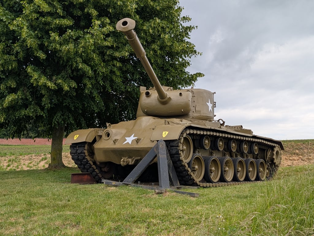
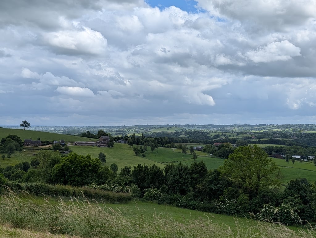
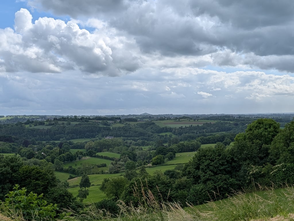
4.0 by Fedor
This is an automatic translation, the original language is: Dutch.
Nice climb. The first part coincides with Les Waides but after that it follows its own - and pleasant - route. From the school to the museum it is steep, then more or less flat (with beautiful views to the right and the fort and a tank on the left) and then a short but perceptible climb to the junction. Beautiful surroundings with lots of visible history.... read more

Photos (13)

Fêchereux from Val-Dieu
transparant thumb
transparant thumb
transparant thumb
transparant thumb
transparant thumb

Your uploads (max 4)

Welcome! Please activate your account if you would like to share something. Look for the verification email in your inbox.

If you want to upload your photos, you need to create an account. It only takes 1 minute and it's completely free.

  • Receive free climbfinder goodies for your reviews & photos.
  • Create a bucket list and check off conquered climbs.
  • Add missing climbs.
Continue with GoogleContinue with Google Continue with FacebookContinue with Facebook Continue with AppleContinue with Apple Sign up with email
By signing up you agree to our terms of service and confirm that you have read our privacy & content policy.

Reviews (3)

5.0
4.0
3.0
2.0
1.0
Fedor
4 y 4.0
This is an automatic translation, the original language is: Dutch. Show original

Nice climb. The first part coincides with Les Waides but after that it follows its own - and pleasant - route. From the school to the museum it is steep, then more or less flat (with beautiful views to the right and the fort and a tank on the left) and then a short but perceptible climb to the junction. Beautiful surroundings with lots of visible history.

Mooie klim. Het eerste deel valt samen met Les Waides maar daarna wordt een eigen - en aangename - route gevolgd. Vanaf de school tot het museum is het pittig, daarna min of meer vlak (met daarbij prachtige uitzichten naar rechts en het fort en een tank op links) en daarna een kort maar toch voelbaar klimmetje tot de kruising. Mooie omgeving met veel zichtbare historie.

Fêchereux from Val-Dieu
Dashboard
kgdg
5 y 4.0
This is an automatic translation, the original language is: Dutch. Show original

Nice climb with good tarmac. If you arrive at the tank you're not really top, but to pass it is also something. This preferred to 'Les Waides' because it has no descent in the climb and Les Waides does. Les Wadies has therefore slightly steeper slopes and this (Fecheruex) is fairly gradual.

Mooie klim met goed asfalt. Als je bij de tank aankomt ben je eigenlijk nog niet boven, maar om deze voorbij te rijden is ook zo wat. Deze verkozen boven 'Les Waides' omdat deze geen afdaling in de klim heeft en de Les Waides wel. Les Wadies heeft daardoor wel iets steilere hellingen en deze (Fecheruex) loopt redelijk geleidelijk.

Fêchereux from Val-Dieu
Dashboard
Dannes
5 y 4.0
This is an automatic translation, the original language is: Dutch. Show original

Very nice climb and runs long. At the top is a cemetery (water!) And there is a tank. Known route, was also visited by "The Alternative" and "MH2D".

Hele aardige klim en loopt lekker lang door. Boven is een begraafplaats (water!) en er staat een tank. Bekende route, werd aangedaan oa door "De Alternatieve" en "MH2D".

Fêchereux from Val-Dieu
Dashboard

Climbing times

7 km/h 00:24:08
11 km/h 00:15:21
15 km/h 00:11:15
19 km/h 00:08:53

Road surface condition

0% 0% 0%
Based on 0 votes
Share your knowledge. What was the road condition during your ascent?

Traffic

0% 0% 0%
Based on 0 votes
Your experience counts. How much traffic did you encounter during the climb?

Frequently Asked Questions

Fêchereux can be cycled from 8 sides. Les Waides from Val-Dieu is the most popular side, but the summit can also be reached via Fêchereux from Val-Dieu, Aubin, Les Waides from Mortroux, Fêchereux from Mortroux, La Heydt, Bois de Winerotte from Warsage & Affnay from Warsage.

You don't need special gearing for Fêchereux from Val-Dieu. The slope isn't long or steep enough to require much shifting down. You can conquer this climb on power alone. However, a compact gearing system with a smallest front chainring of 34 and largest rear sprocket of 28 or 30 is always nice if you enjoy cycling uphill. This helps maintain a smooth cadence.

Fêchereux from Val-Dieu falls into the 5th category. With good fitness, you can ride it up with speed and power. If you have less training, shift down and climb smoothly.

Fêchereux from Val-Dieu is 2.8 km long.

The average gradient of Fêchereux from Val-Dieu is 4.2%.

Fêchereux from Val-Dieu has a steepest segment with an average gradient of 7.9%.

The summit of Fêchereux from Val-Dieu is at 238 m.

At a slow pace of 7 km/h, it takes about 00:24:08 to climb Fêchereux from Val-Dieu. At 11 km/h the time is 00:15:21, and at 15 km/h 00:11:15. For the fastest cyclists, 00:08:53 is an achievable time.

Fêchereux from Val-Dieu is located in the region Liège Province in Belgium.

This page is better in the app

Climbfinder app
Climbfinder
(Free)
Open