Côte de Desnie is a climb in the region Valleys of the Vesdre, de l'Amblève et de l'Ourthe. It is 6.5 km long and bridges 320 m of vertical ascent with an average gradient of 4.9%, resulting in a difficulty score of 198. The top of the ascent is located at 537 m above sea level. Climbfinder users shared 17 reviews of this climb and uploaded 18 photos.
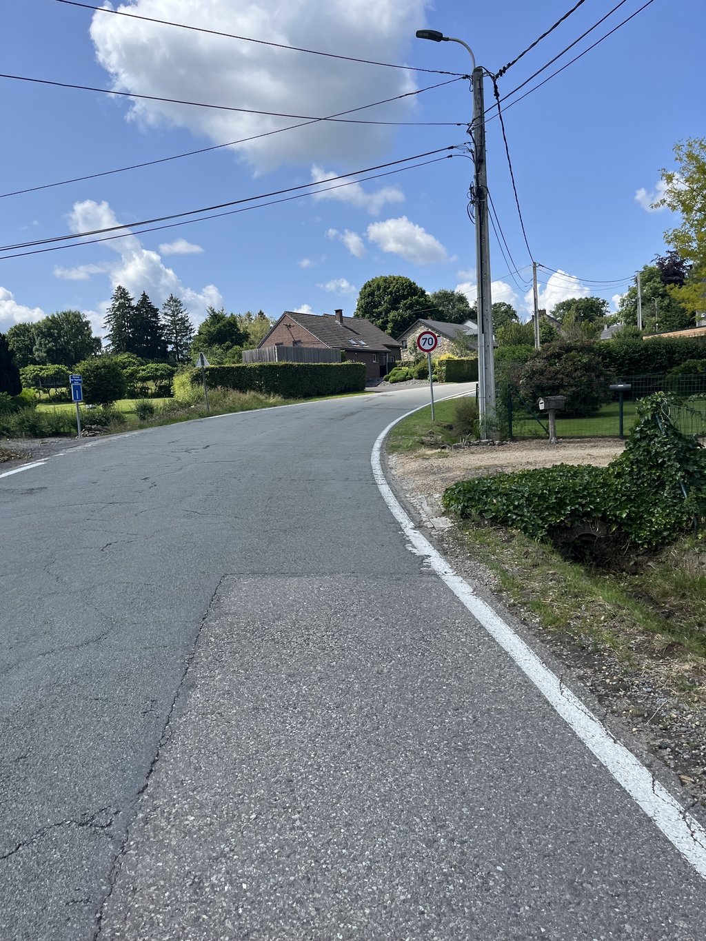
Road names: Route des Wallons de Suède, Rue Winamplanche, Rue Basse Desié & Route de Stoumont (N606)
4.0 by BikerJohanThis is an automatic translation, the original language is: Dutch.Longer climb from west side Spa via Winamplanche and Desnié towards Stoumont. The first 2 km is false flat. Between km 2 and 4 follows the steeper middle section. From km 4 to the top there is then a tight climb in terms of gradient.... read more
Welcome! Please activate your account if you would like to share something. Look for the verification email in your inbox.
If you want to upload your photos, you need to create an account. It only takes 1 minute and it's completely free.
Longer climb from west side Spa via Winamplanche and Desnié towards Stoumont. The first 2 km is false flat. Between km 2 and 4 follows the steeper middle section. From km 4 to the top there is then a tight climb in terms of gradient.
Langere klim vanaf westkant Spa via Winamplanche en Desnié richting Stoumont. De eerst 2 kilometer is vals plat. Tussen km 2 en 4 volgt dan het steilere midden deel. Vanaf km 4 tot de top volgt v.w.b. stijgingspercentage dan een strakke klim.
Little to say about this climb, really. Relatively busy, and a crossroads during the climb. Nice summit though, but no real views anywhere. The asphalt is fine again, though, which is nice. You can detour, but I would adjust the ride accordingly.
Weinig over deze klim te zeggen, eigenlijk. Relatief druk, en een kruispunt tijdens de klim. Wel een mooie top, maar nergens echt uitzichten. Het asfalt is wel weer prima, en dat is ook wel weer fijn. Omfietsen kan, maar ik zou de rit er op aanpassen.
I prefer to do this climb in the opposite direction, via La Vecquée.
Ik doe deze klim liever in de omgekeerde richting, via La Vecquée.
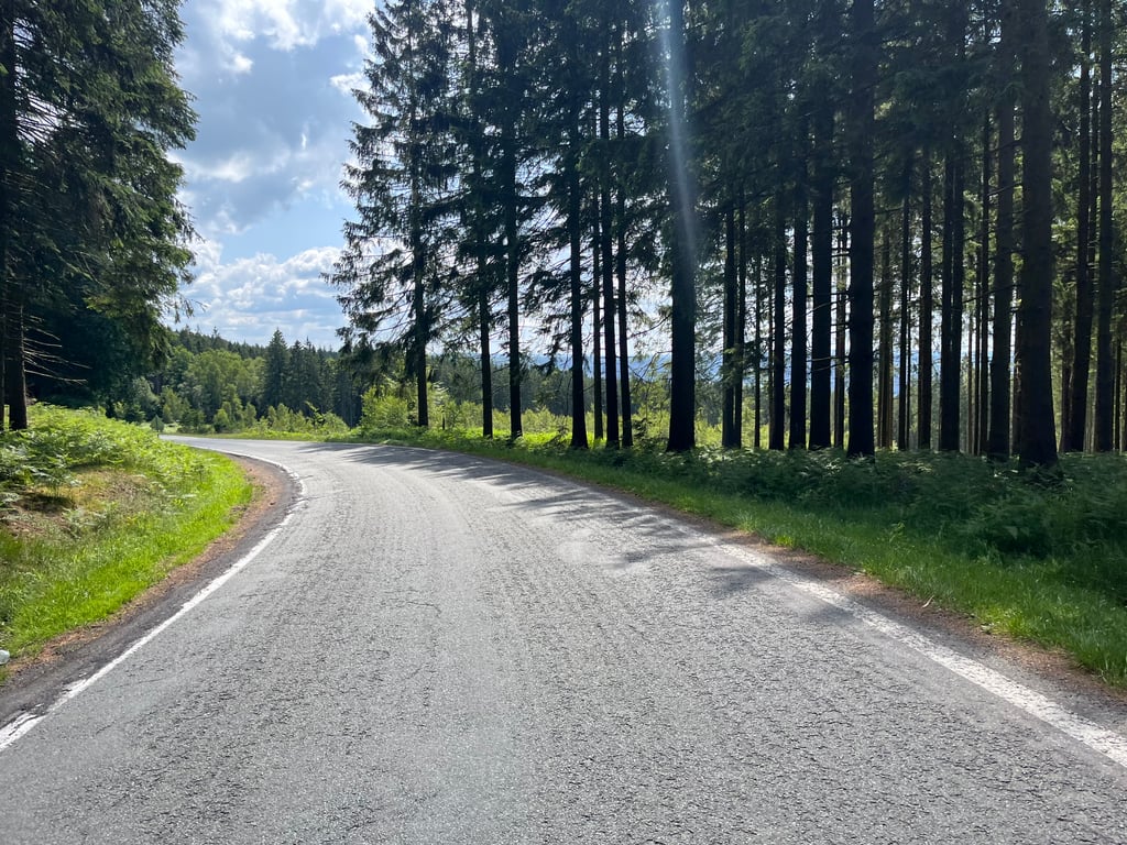
The last stretch between the pine trees is especially beautiful. Not to be underestimated in terms of length. The descent to Stoumont is a gift after the ascent and is certainly worth it.
Vooral het laatste stuk tussen de dennenbomen is erg fraai. Qua lengte niet te onderschatten. De afdaling naar Stoumont krijg je na de beklimming cadeau, die mag er zeker wezen.
The first two kilometres are nice, but after that it takes some effort. After the steeper part, it continues at a more comfortable percentage. In terms of surroundings, nothing special I found and the traffic is quite heavy. Not my'n favourite climb in the area 2,5/5
Eerste twee kilometer fietst nog lekker, daarna is het even aanpoten. Na het steilere stuk loopt ie op een comfortabeler percentage door. Qua omgeving niks speciaals vond ik en het verkeer rijdt er best hard. Niet m'n favoriet beklimming in de omgeving 2,5/5
Quite a nice climb and still quite long and steep - you may encounter some traffic, but on such a wide track you won't really be bothered by it. The descent of the Vecquée is also a great descent
Best een leuke klim en toch nog behoorlijk lang en steil - je kan wel wat verkeer tegenkomen, maar op zo een brede baan heb je daar niet echt last van. De afdaling van de Vecquée is alvast ook een geweldige afdaling
The pain is in the middle. You come along a nice tarmac road gradually uphill until you exit Winamplanche. Then it goes up hard until you exit Desnié. Once in the forest, the percentages decrease but you still have quite a bit to go until you really reach the top.
De pijn zit hem in het midden. Je komt over een lekkere asfaltweg geleidelijk omhoog tot je Winamplanche uitrijdt. Dan gaat het hard omhoog tot je Desnié uitkomt. Eenmaal in het bos nemen de percentages af maar moet je nog best een stuk tot je écht boven bent.
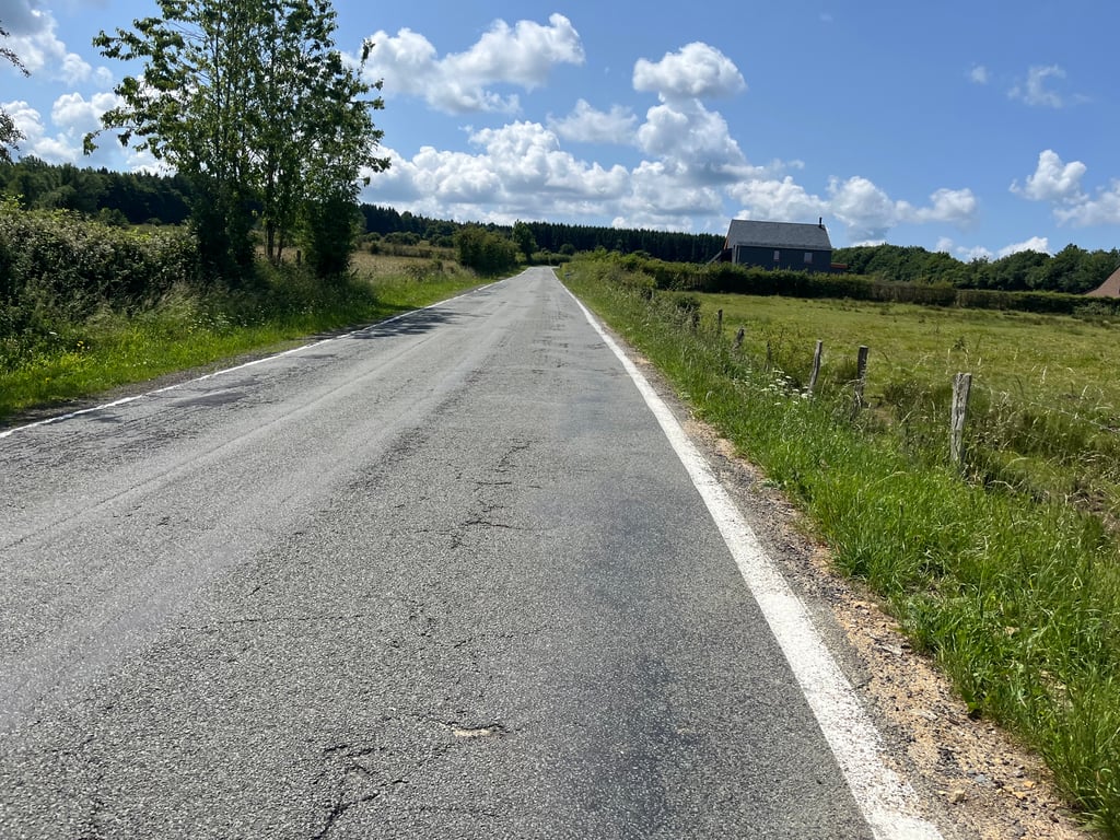
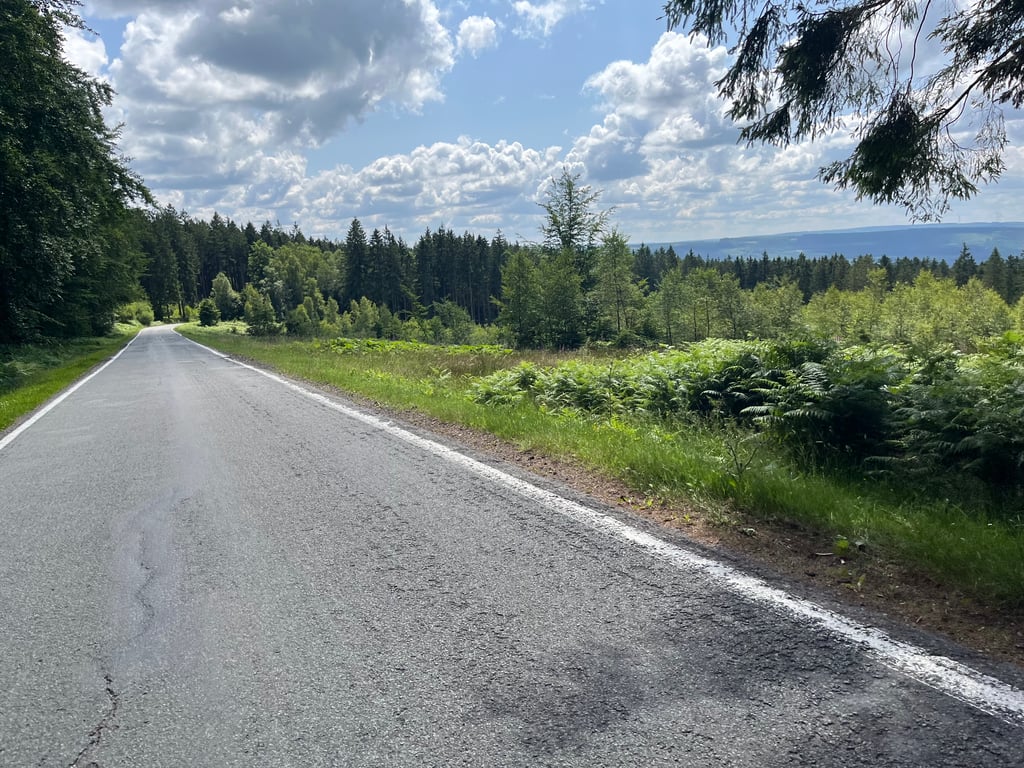
Up to Winamplanche is a relaxed approach over perfect tarmac (after that, the tarmac gets a little less, but it remains at least reasonable). Immediately after leaving that village, the road goes up a bit harder. This is followed by another flat section for a while but then it gets really tough. A long piecea at considerable percentages until well into Desnié. Then the slope flattens out a bit but you certainly feel it. When you enter the forest, you are already close to the end. You will soon see a summit but the real summit is a bit further on. The scenery is nice but apart from to the back you don't have very many views.
Tot aan Winamplanche is een een relaxte aanloop over perfect asfalt (daarna wordt het asfalt iets minder, maar het blijft op zijn minst redelijk). Meteen na het verlaten van dat dorp gaat de weg wat harder omhoog. Daarna volgt weer even een vlakker stuk maar dan wordt het echt stevig. Een lang stuka aan flinke percentages tot ver in Desnié. Daarna wordt de helling iets vlakker maar voelen doe je hem zeker. Als je in het bos komt zit je al dicht aan het eind. Je ziet dan al snel een top maar de echte top ligt nog iets verder. De omgeving is aardig maar behalve naar achteren heb je niet heel veel uitzicht.
Climb is tougher than the profile suggests. Because it is a long straight road, it seems like you are not moving forward. The length also makes it spicy. There seems to be no end to it. Found the Vecquee , Maquisard and Rosier nicer to climb.
Klim is zwaarder dan het profiel doet geloven. Doordat het een lange rechte weg is lijkt het alsof je niet vooruit komt. Ook de lengte maakt het pittig. Er lijkt maar geen einde aan te komen. Vond de Vecquee , Maquisard en Rosier fijner om te beklimmen.
Surely you better choose classic for the Maquisard than this one if you are in Winamplanche. Pretty boring busy road.
Je kiest toch beter klassiek voor de Maquisard dan voor deze als je in Winamplanche staat. Redelijk saaie drukke weg.
Quite a heavy one, long too. But I would always choose another if possible. The traffic isn't too bad, but they do flame often. Always straight ahead. I do it often as a descent of the Vecquee. Ideal, speeds up to 80 km/h.
Best een zware, lang ook. Maar ik zou altijd kiezen voor een andere als dit mogelijk is. Het verkeer valt mee, maar ze vlammen wel vaak. Ook altijd rechtdoor. Ik doe hem vaak als afdaling van de Vecquee. Ideaal, snelheden tot 80 per uur.
This climb is not that steep, but it is quite long by Ardennes standards. It is the ideal climb for those who like to climb on power without falling over. You can enjoy sprinting against each other. There is also a nice descent on a road as wide as the one leading up.
Deze klim is niet zo steil, maar wel behoorlijk lang naar Ardense normen. Het is de ideale klim voor wie graag klimt op de kracht zonder stil te vallen. Je kan er lekker sprintjes trekken tegen elkaar. Er hoort trouwens ook een lekkere afdaling bij op een even brede weg als die naar boven.
The Côte de Desnié is a nice and not easy climb. It all starts quite easy, but after about three kilometers there is a tough middle part with percentages around 10%. The climb is quite long so you can run out of energy completely. Because there is hardly any shade, this can happen in several ways during the summer months.
The road surface is significantly better than its neighbour, the Rosier. Although the road is quite wide, you do not encounter much traffic. If you are passed by a car, it is unfortunately often well over 80 km per hour.
De Côte de Desnié is een leuke en niet gemakkelijke klim. Het begint allemaal vrij rustig, maar na een kilometer of drie volgt een stevig middenstuk met percentages rond de 10%. De klim is vrij lang waardoor je helemaal leeg kunt lopen. Omdat er vrijwel geen beschutting is kan dat leeglopen in de zomermaanden op meerdere vlakken gebeuren.
Het wegdek is beduidend beter dan de buurman, de Rosier. Hoewel de weg vrij breed is, kom je er niet veel verkeer tegen. Áls je gepasseerd wordt door een auto gaat dat helaas wel vaak dik boven de 80 in het uur.
Little traffic.
Nice climb. A bit heavier in the beginning. Good to train because of the length!
Weinig verkeer gehad.
Leuke beklimming. In het begin wat zwaarder. Goed om te trainen vanwege de lengte!
Had little traffic here, road surface was indeed good. The 10% part made the next kilometer feel like 10% too. After the village I was able to recover and continue pedalling.
Had hier weinig verkeer, wegdek was inderdaad goed. Het stuk 10% zorgde ervoor dat de volgende kilometer ook als 10% voelde. Na het dorp wel kunnen herstellen en lekker door kunnen trappen.
| 7 km/h | 00:55:53 |
| 11 km/h | 00:35:34 |
| 15 km/h | 00:26:05 |
| 19 km/h | 00:20:35 |
This page is better in the app