| Beautiful scenery |
| Hidden gem |
| 9 hairpin turns |
| #15 toughest climb of Haute-Garonne |
| #15 most elevation gain of Haute-Garonne |
| #18 longest climb of Haute-Garonne |
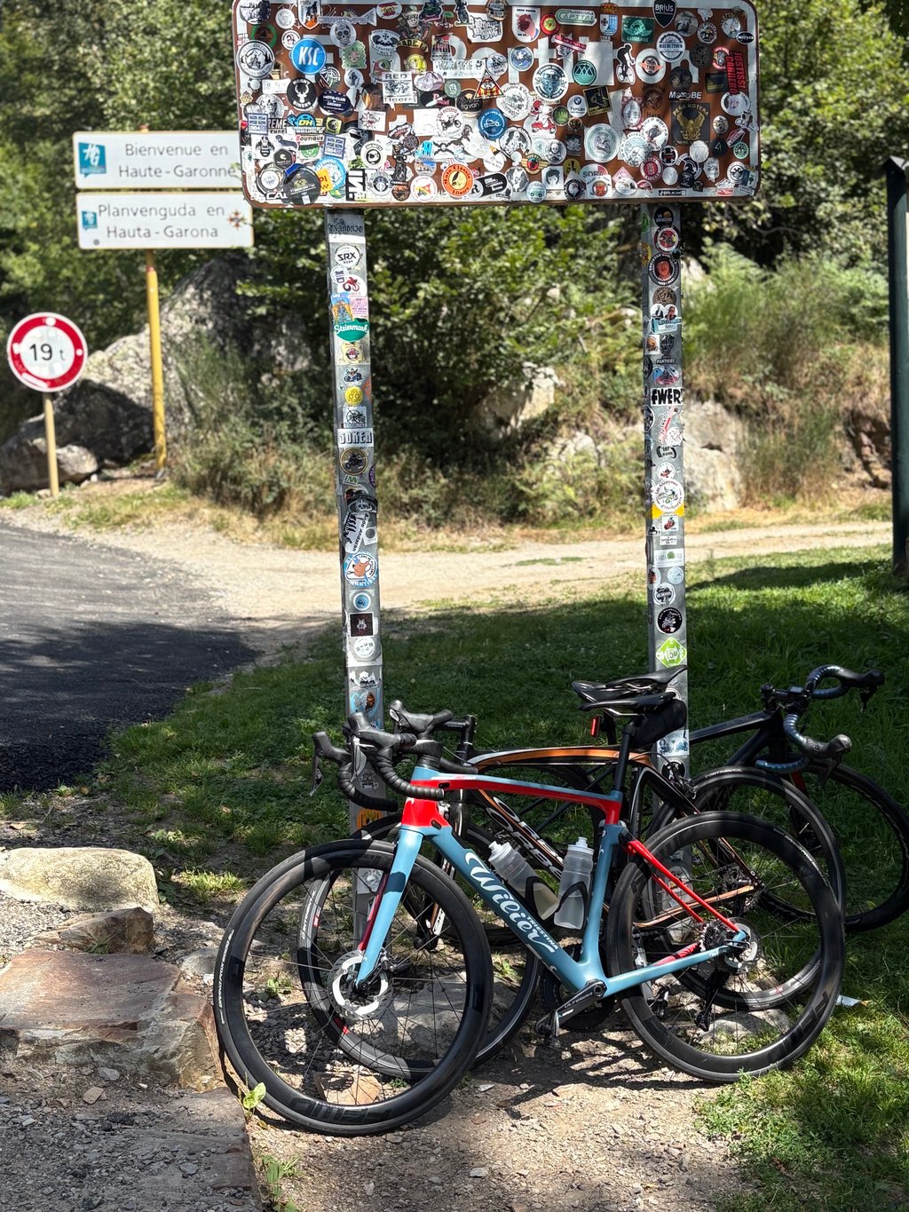
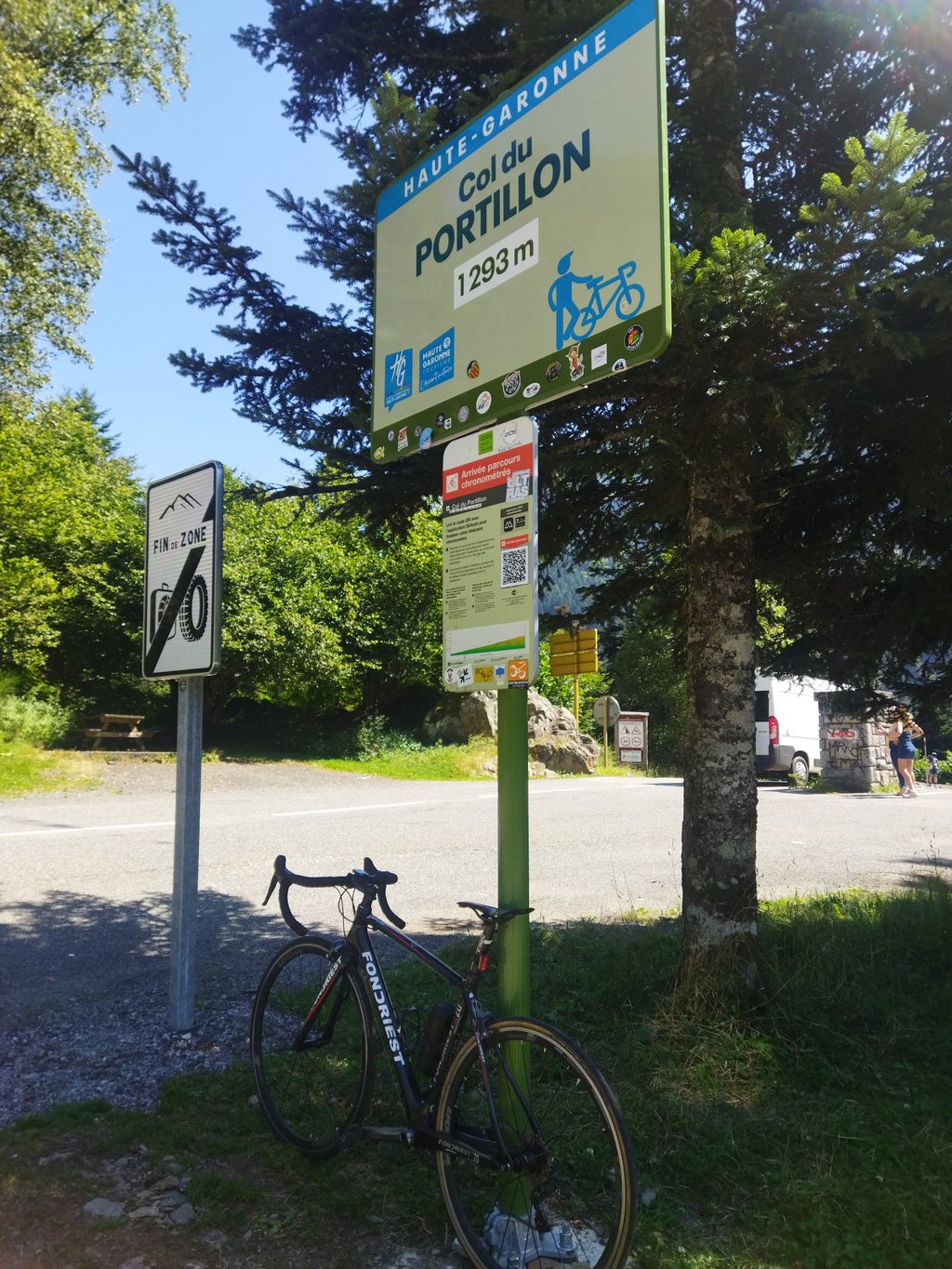
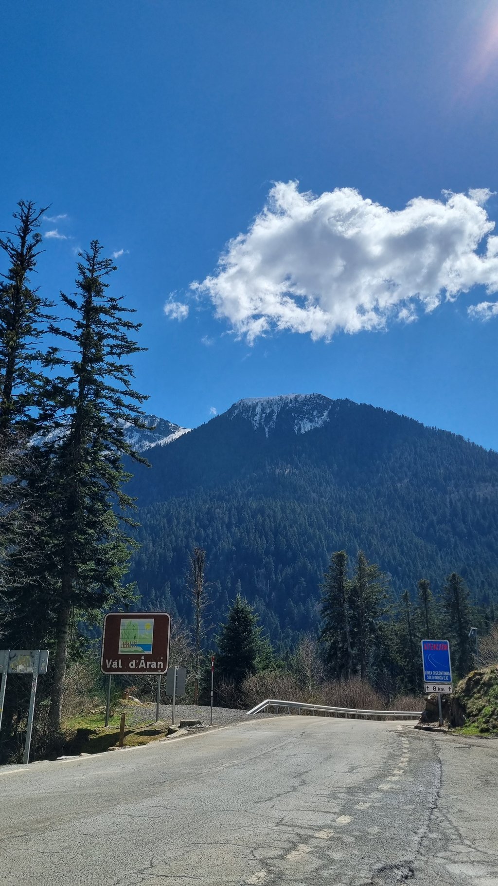
Col du Portillon from Bagnères de Luchon is a climb in the region Haute-Garonne. It is 8.1 km long and bridges 636 m of vertical ascent with an average gradient of 7.9%, resulting in a difficulty score of 567. The top of the ascent is located at 1294 m above sea level. Climbfinder users shared 7 reviews of this climb and uploaded 11 photos.
Road names: aveneu des pyrénées & vieux chemin du Portillon
4.0 by patrickbaertThis is an automatic translation, the original language is: Dutch.On a scorching hot day (August 2016) cycled the French side of the literally cross-border Col du Portillon . Started in the touristy and ideal cycling base Bagnères de Luchon via hamlet St.Marnet where the real climb starts as indicated by a cycling info board with all the numerical information. It was strange at the time that I didn't encounter any more cycling information on the rest of the climb along this side. After the opening kilometre there is an irregular and at times steep climb... read more

Welcome! Please activate your account if you would like to share something. Look for the verification email in your inbox.
If you want to upload your photos, you need to create an account. It only takes 1 minute and it's completely free.
Super quiet, beautiful road through the forest. Tough pass for a 2nd category. The descent to Spain is on a brand new road in the first half, then on a very decent road.
Super calme, belle route dans la forêt. Col dur pour un 2eme catégorie. La descente vers l'Espagne se fait sur une route toute neuve dans la première moitié, puis sur une route très correcte.
A mythical French pass with great charm due to its landscapes and waterfalls along the pass. The asphalt is in good condition, better than on the Spanish side. Highly recommended for those looking for a short but intense pass in the French Pyrenees.
Puerto mítico francés con gran encanto por sus paisajes y cascadas a lo largo del puerto. El asfalto se encuentra en buenas condiciones, mejores que en la vertiente española. Muy recomendable para quien busque hacer un puerto corto pero intenso en el pirineo francés.
A beautiful climb through woods and waterfalls. Fewer viewpoints than the climb up to Superbagnères, but you'll be won over by the peace and quiet of the forest. Little traffic and a good quality surface. I found some sections very difficult (the counter sometimes read 14%), the climb is very uneven but that adds to the difficulty. Be careful on the descent on the Spanish side: the road is much worse.
Une très belle montée à travers les bois et les cascades. Moins de points de vue que pour la montée de Superbagnères mais vous serez conquis par le calme de la forêt. Peu de circulation et un revêtement de bonne qualité. J'ai trouvé certains passages très difficiles (le compteur affichait parfois 14%), la montée est très irrégulière mais cela ajoute de la difficulté. Attention lors de la descente côté espagnol : la route est beaucoup moins bonne.
Mythical and especially to be ridden downhill. Will you go faster than Alaphilippe? Will you fall like Adam Yates? Joking aside, the descent has a few hairpin bends but mostly gravel so be careful!
On the climb, a difficult sector, otherwise clear...
Mythique et surtout à faire en descente. Irez-vous plus vite qu’Alaphilippe? Est ce que vous tomberez comme Adam Yates? Blague à part, la descente présente quelques virages en épingles mais surtout des gravillons alors prudence!
En montée, un secteur difficile sinon RAS…
A beautiful climb through the woods. Occasionally we encountered a car but that could not spoil the fun. I did it on a scorching hot day and the coolness of the forest is pleasant.
Prachtige klim door de bossen naar boven. Af en toe een auto tegengekomen maar dat mag de pret niet drukken. Op een snikhete dag gedaan en dan is de koelte door het bos wel aangenaam.
A rainy day, not too hot (7-Aug-2021) . Good weather for another climb. At the bottom of the mountain, still within the built-up area, is a sign: Route Barrée'.
I am stubborn and pedal on. Through a misty forest, along very few buildings on the -because of the roadblock- quiet road. At the start (9 km to the top), at 6 km before the top and 3 km before the top there are signs indicating the height and distance to the top.
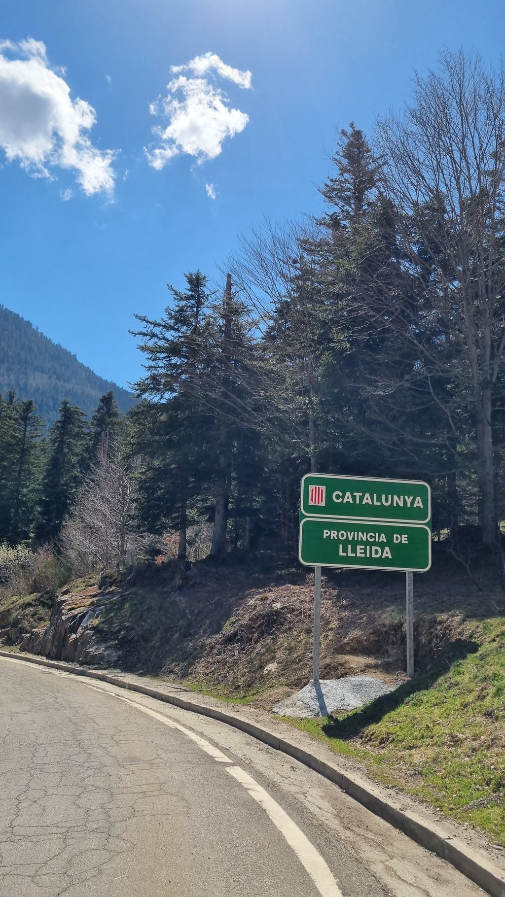
The road surface is fine, although in some places there is quite loose gravel on the road. About half a km before the summit (and the Spanish border), the road is blocked by a pile of gravel, which I pass with my bike on my shoulder. Behind it is a piece of brand new asphalt. At the top there are some more cyclists, a couple of bikers and a camper. It is foggy and woody (so enjoying the view is out of the question) and the border crossing passes almost unnoticed, were it not for the fact that the road right behind the border descends steeply again.
Tip: bring your own food and drinks.
Een regenachtige dag, niet te warm (7-aug-2021) . Prima weertje om weer een beklimming te doen. Onderaan de berg, nog binnen de bebouwde kom staat een bord: Route Barrée'.
Ik ben eigenwijs en trap door. Door een mistig woud, langs zeer spaarzame bebouwing over de -door de wegblokkade- rustige weg. Aan het begin, (nog 9km tot de top), op 6km voor de top en 3km voor de top staan borden die de hoogte en de nog af te leggen afstand tot de top.
Het wegdek is prima, hoewel er op sommige plaatsen vrij los split op de weg ligt. Ongeveer een halve km voor de top (en de Spaanse grens) is de weg geblokkeerd door een berg split, waar ik met de fiets op de schouder langs loop. Daarachter ligt nog een stukje gloednieuw asfalt. Boven aan de top staan nog wat fietsers, een tweetal motorrijders en een camper. Het is mistig en bosrijk (dus genieten van het uitzicht is er niet bij) en de grensovergang passeer je haast ongemerkt, ware het niet dat de weg direct achter de grens weer steil omlaag gaat.
Tip: neem je eigen eten en drinken mee.
On a scorching hot day (August 2016) cycled the French side of the literally cross-border Col du Portillon . Started in the touristy and ideal cycling base Bagnères de Luchon via hamlet St.Marnet where the real climb starts as indicated by a cycling info board with all the numerical information. It was strange at the time that I didn't encounter any more cycling information on the rest of the climb along this side.
After the opening kilometre there is an irregular and at times steep climb on wide road with good tarmac and hairpins spread over the whole route. There is hardly any traffic or habitation. In one of the bends you pass the impressive Cascade de Sidonie. The entire climbing route is through forest and woods, which was very welcome in these high temperatures.
At the top, also hidden in the forest, there is only a picnic place with the remains of the old French/Spanish border post. It is best to stock up at the start.
Not to be underestimated whimsical beautiful climb.
Op een snikhete dag (Augustus 2016) de Franse kant van de letterlijk grensoverschrijdende Col du Portillon gefietst . Vertrek in het toeristische en de ideale fietsuitvalbasis Bagnères de Luchon via gehucht St.Marnet waar de echte klim start zoals aangegeven door een fietsinfobord met alle cijfergegevens. Het was toen vreemd dat ik op de rest van de beklimming langs deze zijde niks meer tegenkwam van fietsinformatie.
Na de openingskilometer volgt een onregelmatige bij momenten steile klim op brede weg met goed asfalt en haarspeldbochten verspreidt over de hele route. Er is amper verkeer en bewoning . In één van die bochten fiets je voorbij de imposante Cascade de Sidonie. Volledige klimroute fiets je continu door bos en woud wat bij die hoge temperaturen welgekomen was.
Op de top, eveneens verscholen in het woud, is er alleen een picknickplek met restant van de oude Frans/Spaanse grenspost. Bevoorraden doe je dus best aan de start
Niet te onderschatten grillige mooie klim.
| 7 km/h | 01:09:07 |
| 11 km/h | 00:43:59 |
| 15 km/h | 00:32:15 |
| 19 km/h | 00:25:27 |
This page is better in the app