Tips nearby


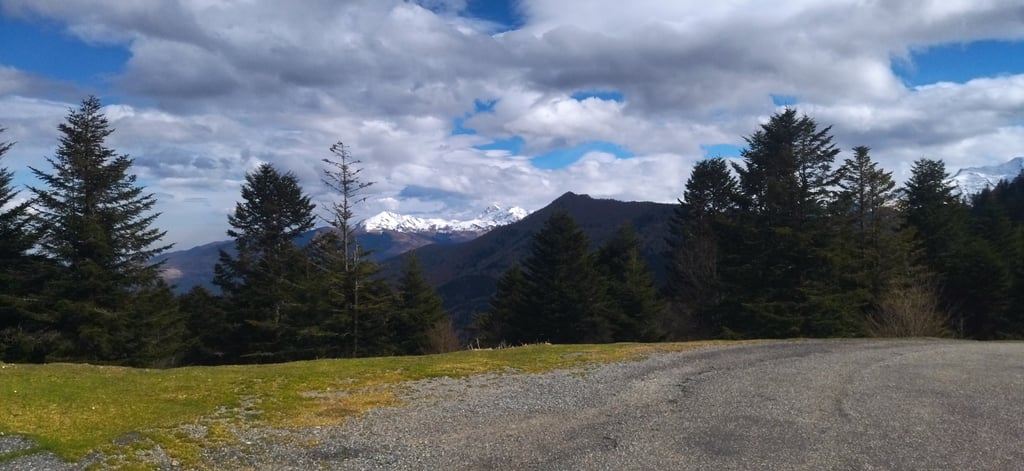
| Beautiful scenery |
| Hidden gem |
| 8 hairpin turns |
| #62 toughest climb of Occitania |
| #90 most elevation gain of Occitania |
| #96 longest climb of French Pyrenees |
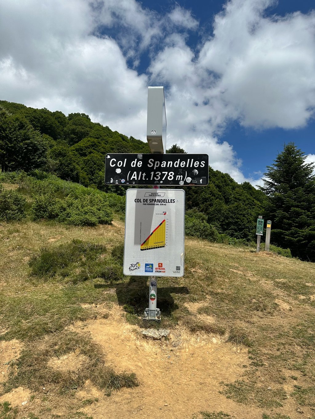
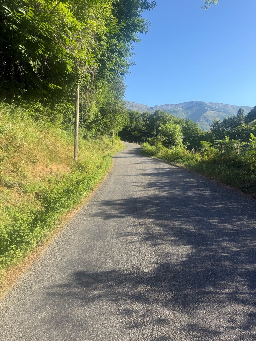
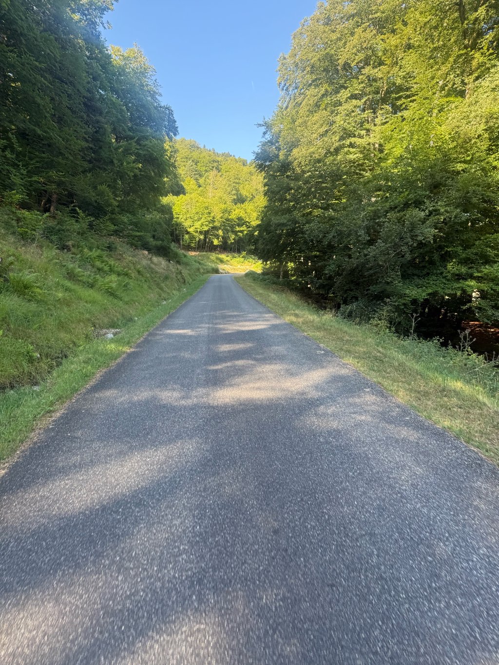
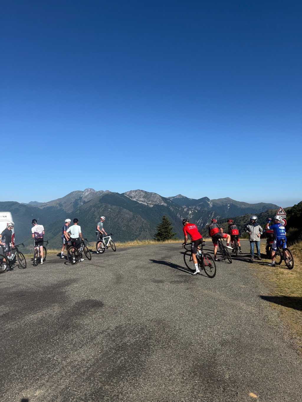
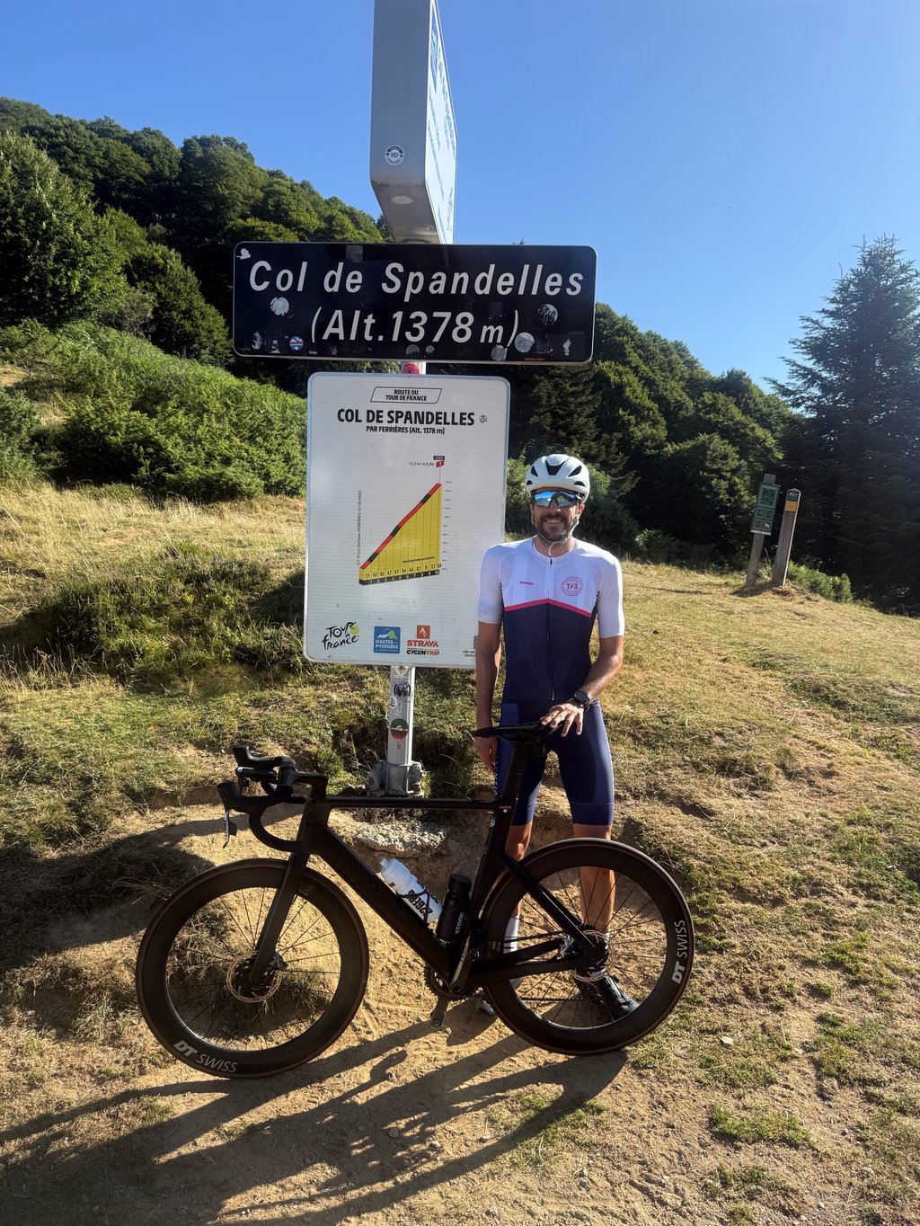
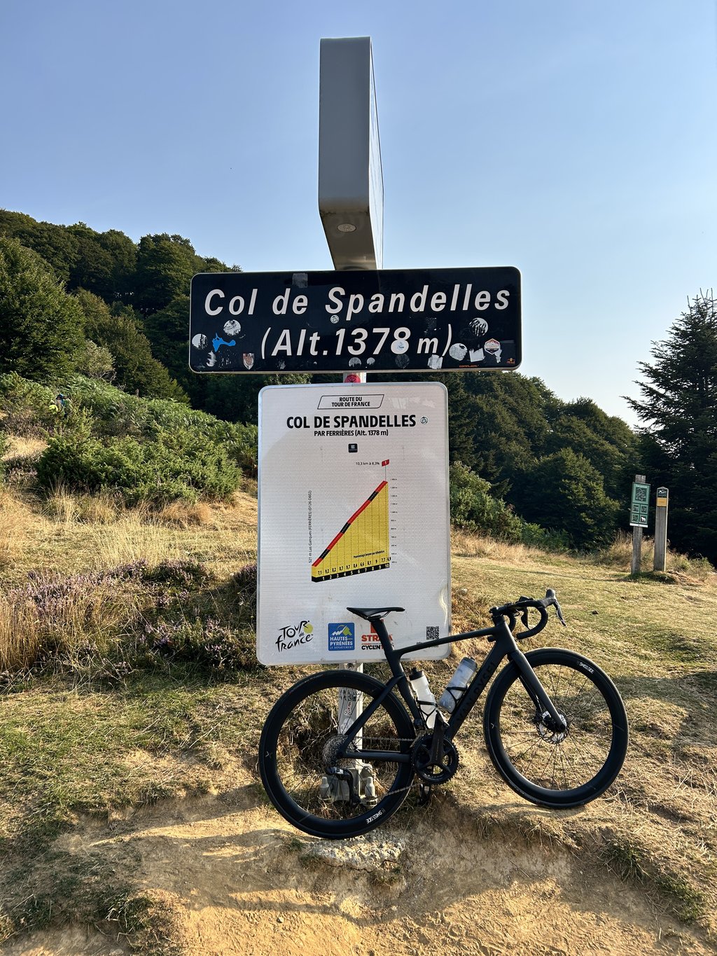
Col de Spandelles from Argelès-Gazost is a climb in the region Hautes-Pyrénées. It is 14.7 km long and bridges 878 m of vertical ascent with an average gradient of 6%, resulting in a difficulty score of 729. The top of the ascent is located at 1377 m above sea level. Climbfinder users shared 11 reviews of this climb and uploaded 16 photos.
Road names: Route de Gez, D102, Rive du Bergons & Route du Spandelle
3.0 by RobertThis is an automatic translation, the original language is: Dutch.A typical Pyrenean climb: very irregular, with quite steep parts, but also some parts to relax. I find that the disadvantage is that you lose your rhythm and that you notice it immediately at the next rising percentages. It is really a must because it is also typical Pyrenees in terms of environment. Especially in the second part you ride through a quiet and deserted forest, you meet almost nobody and when we were there it was raining; almost a magical effect. It is a narrow and sometimes very b... read more

Welcome! Please activate your account if you would like to share something. Look for the verification email in your inbox.
If you want to upload your photos, you need to create an account. It only takes 1 minute and it's completely free.
Very uneven – impossible to get into a rhythm. The Aubisque is almost easier
Très irréguliers, impossible de trouver son rythme. L’aubisque est presque plus facile
A pass linking sections with gradients of 8–9 per cent and 2–3 per cent. It’s a good idea to tackle it before the Aubisque
Puerto que enlaza tramos del 8-9% y del 2-3%. Buena idea hacerlo antes del Aubisque
Nice, very uneven climb with lots of shady parts but 13% and 15% raidars.
Belle montée très irrégulière avec beaucoup de parties ombragées mais des raidars de 13% et 15%
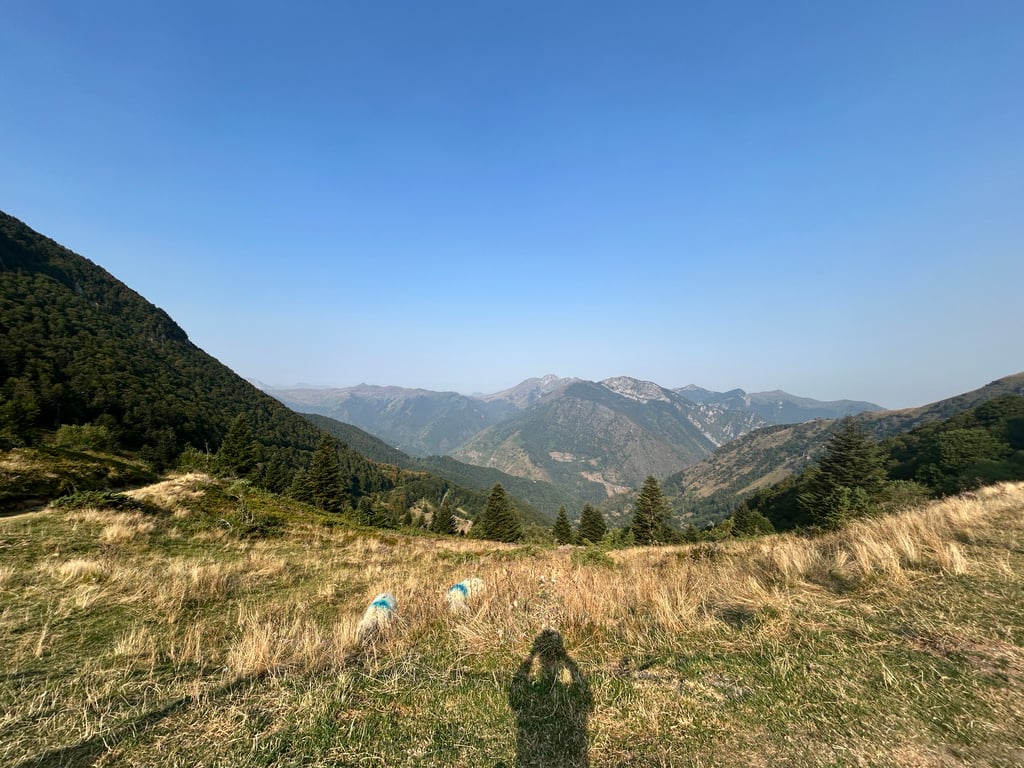
Nice climb, with rest areas. Some nice sections around the 10/11% mark though! A magnificent view at the top, especially when you have the privilege of being alone in the mild sunshine!
Belle montée, avec des replats pour le repos. De belles sections autour des 10/11% quand même ! Une vue magnifique en haut, surtout quand on a le privilège d'être seul sous un soleil doux!
An excellent climb to start the day. Yes irregular, but not too long. Nowhere do you really have fantastic views, except surely at the summit itself!
Een prima klim om de dag mee te starten. Ja onregelmatig, maar niet te lang. Nergens heb je echt fantastische uitzichten, behalve toch zeker op de top zelf!
If you think Hautacam is uneven, try Les Spandelles via Argelès! An alternation of very steep climbs and flats and even descents. A beautiful road slaloming through the forest, so there's plenty of shade in the morning. The surface is of good quality (August 2024).
The descent to Les Eschartès is winding and narrow, but the views are splendid.
Continuing towards Soulor, there's a water point and toilet in the village square at Ferrières.
Si vous pensez que Hautacam est irrégulier, essayez Les Spandelles par Argelès! Une alternance de coups de culs très raides et de replats voire de descentes. Une belle route slalomant dans la forêt donc à l'ombre le matin. Le revêtement est de bonne qualité (Août 2024).
La descente vers les Eschartès est sinueuse et étroite mais les vues sont splendides.
En continuant vers le Soulor, on trouve un point d'eau et des toilettes sur la place du village de Ferrières.
Agree with previous posts: a very irregular climb that saps the power from your legs when it suddenly goes from cruisy 6% to ramps >11%. however the climb is lovely. Some traffic initially especially through Gez. OK views at summit. (sorry 1st photo is wrong place but i cant delete it)
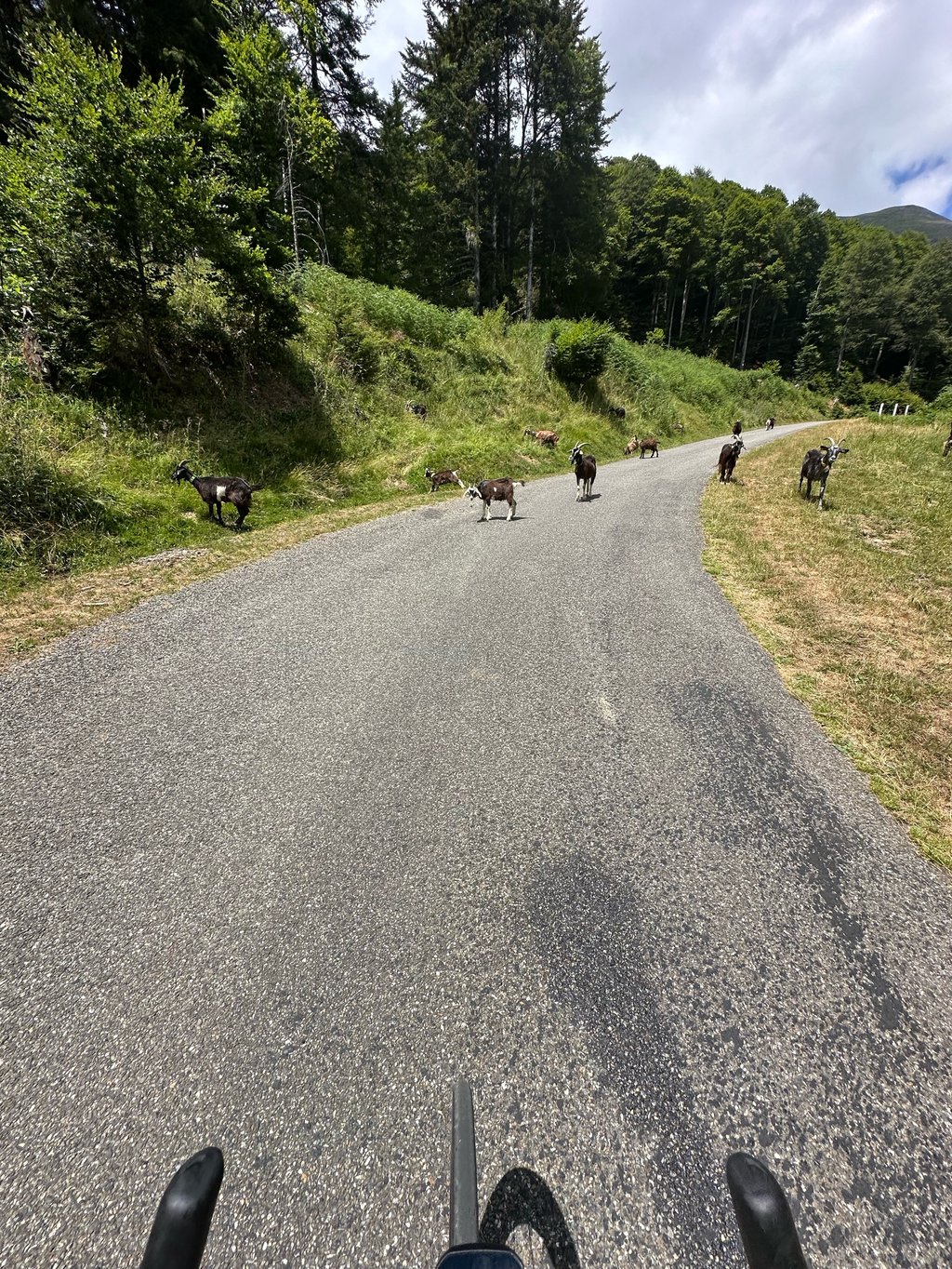
Climbed this one yesterday, what variations in the percentages nice those <5>10% sections opposite. Very quiet and good road surface after TDF22, at the top many goats quietly tapping their horns against the cars's!!! Down the other side, just as quiet but steeper and sharp bends through to the Soulor and the Aubisque. After the Soulor from the Aubisque side down to Argeles Gazost. Beautiful weather and the views, with the griffon vultures skimming low overhead, are priceless.
Gisteren deze beklommen, wat een variaties in de procenten leuk die <5>10% stukken tegenover. Heel rustig en goed wegdek n.a.v. TDF22, boven veel geiten die rustig met de hoorns tegen de auto's aan tikken!! Aande andere kant naar beneden, net zo rustig maar steiler en scherpe bochten door naar de Soulor en de Aubisque. Na de Soulor vanaf de Aubisque kant afgedaald naar Argeles Gazost. Prachtig weer en de vergezichten zijn, met de laag over scherende vale gieren, onbetaalbaar.
This was a very nice climb to start the holiday. A kind of interval training. Lots of 10-14% sections, interspersed with 3-6% sections. The surroundings are beautiful. I did it after the Tour, so the road surface was very good.
Dit was een hele mooie klim om de vakantie te starten. Een soort intervaltraining. Veel stukjes van 10-14%, afgewisseld met stukjes van 3-6%. De omgeving is prachtig. Ik reed hem na de Tour, dus het wegdek lag er erg goed bij.
Nice climb. Some nice steep sections, but good recovery sections.
Surfacing ok, redone for the TDF 2022.
Jolie montée. Quelques beaux passages bien pentus, mais de bonnes portions de récupération.
Revêtement ok, refait pour le TDF 2022.
A typical Pyrenean climb: very irregular, with quite steep parts, but also some parts to relax. I find that the disadvantage is that you lose your rhythm and that you notice it immediately at the next rising percentages. It is really a must because it is also typical Pyrenees in terms of environment. Especially in the second part you ride through a quiet and deserted forest, you meet almost nobody and when we were there it was raining; almost a magical effect. It is a narrow and sometimes very bad road. We descended the other side in the direction of Les Eschartes. I think that side is more regular (spicy, I think). There you come to the foot of the Soulor from the north which is a very nice climb and then we ended the day with the Borderes (less difficult, but beautiful); in my experience you experience the Pyrenees at its best in terms of landscape and culture.
Een typische Pyreneeën-klim: heel onregelmatig, met best steile stukken, maar ook echt stukken om bij te komen. Ik vind zelf dan ook gelijk het nadeel dat je je ritme kwijt bent en dat gelijk merkt bij de volgende oplopende percentages. Het is wel echt een aanrader omdat het ook typisch Pyreneeën is qua omgeving. Je rijdt vooral in het tweede gedeelte veel door een stil en verlaten bos, komt verder echt bijna niemand tegen en toen wij er waren regende het ook; bijna een magisch effect. Het is wel een smalle en soms hele slechte weg. Wij zijn de andere kant afgedaald richting Les Eschartes. Volgens mij is die zijde regelmatiger (wel pittig, denk ik). Je komt daar aan de voet van de Soulor vanuit noordelijke richting wat een hele fijne klim is en hebben de dag toen afgesloten met de Borderes (minder zwaar, wel mooi); in mijn beleving ervaar je de Pyreneeën zo wel op zijn best qua landschap en cultuur.
| 7 km/h | 02:06:00 |
| 11 km/h | 01:20:10 |
| 15 km/h | 00:58:48 |
| 19 km/h | 00:46:25 |
This page is better in the app