Tips nearby


| 45 hairpin turns |
| #54 toughest climb of La Maurienne |
| #43 most elevation gain of La Maurienne |
| #36 longest climb of La Maurienne |
| #71 average steepest climb of La Maurienne |
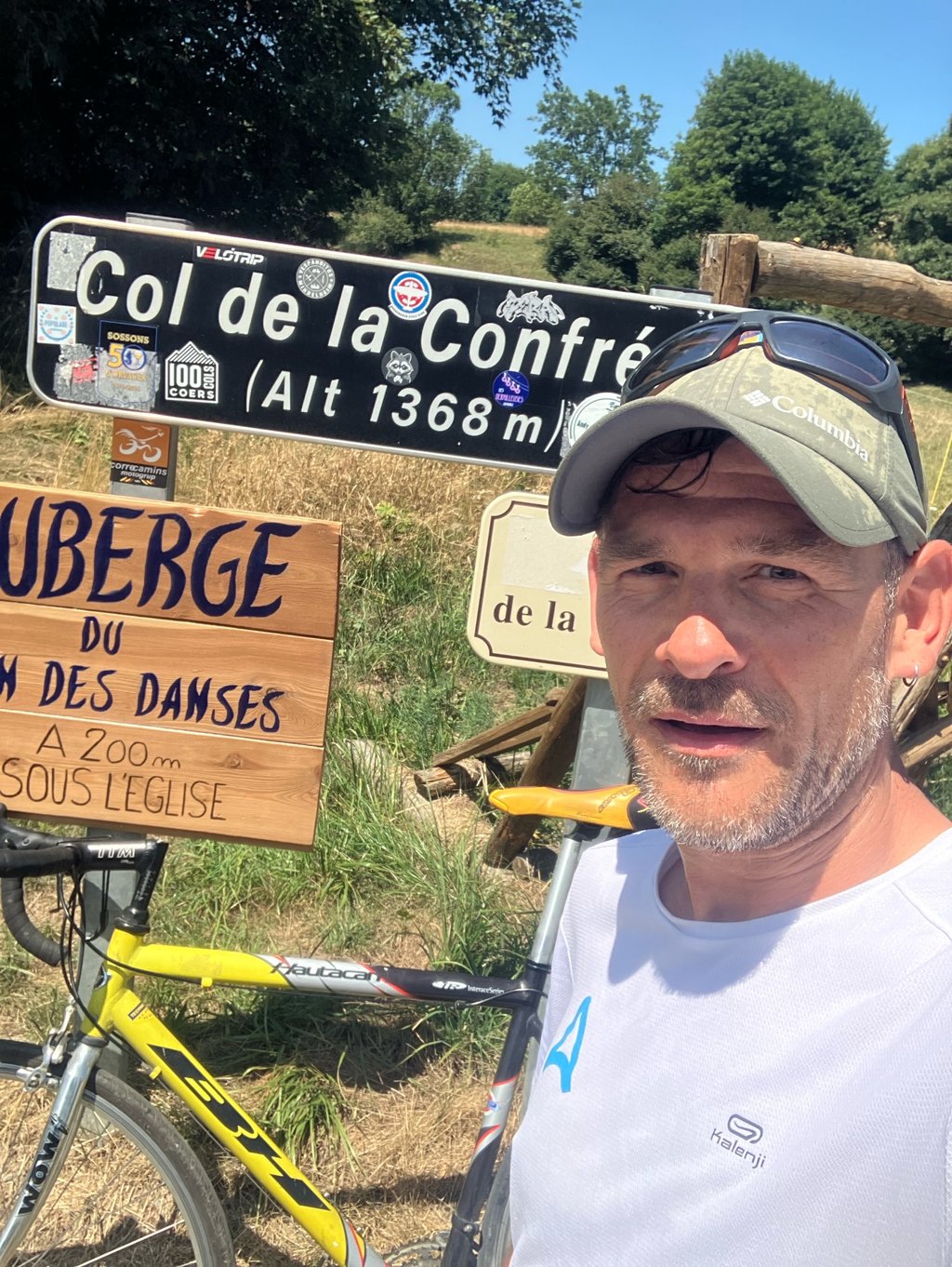
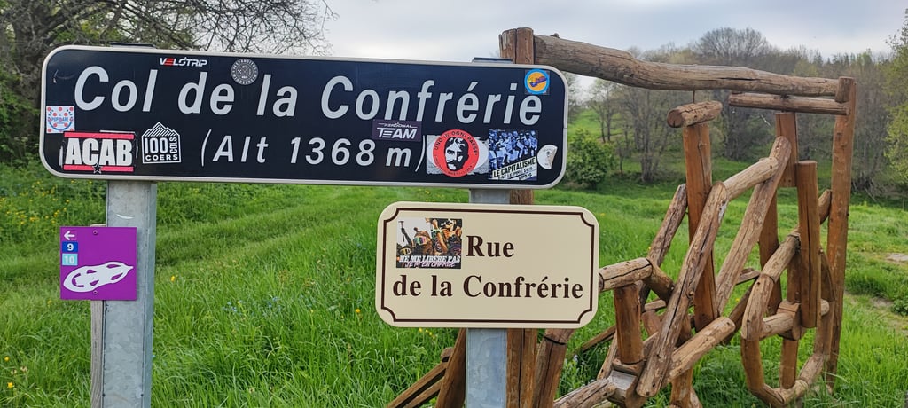
Col de la Confrérie from Villargondran is a climb in the region La Maurienne. It is 11.3 km long and bridges 755 m of vertical ascent with an average gradient of 6.7%, resulting in a difficulty score of 530. The top of the ascent is located at 1368 m above sea level. Climbfinder users shared 7 reviews of this climb and uploaded 4 photos.
Road names: Rue du 2 Septembre 1944 & D 80
4.0 by aurelienSuperbe col assez accessible , attention néanmoins à la route qui est assez granuleuse par endroit... read more
Welcome! Please activate your account if you would like to share something. Look for the verification email in your inbox.
If you want to upload your photos, you need to create an account. It only takes 1 minute and it's completely free.
A superb, fairly accessible mountain pass – do bear in mind, however, that the road is quite gravelly in places
Superbe col assez accessible , attention néanmoins à la route qui est assez granuleuse par endroit
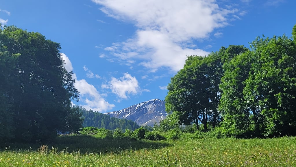
Very nice climb. No vistas, but a forest that shelters you well from the elements. Lots of hairpin bends with an even gradient. After this, you can cross over to several other climbs.
Heel leuke klim. Geen vergezichten, wel een bos dat je goed tegen de elementen beschut. Veel haarspeldbochten met een gelijkmatige hellingsgraad. Hierna kan je naar verschillende andere klimmen doorsteken.
Very nice climb with the dozens of hairpin bends. The asphalt on almost all corners was renewed this spring (2025) and last year. Road surface is generally good now, except for a few sections.
Erg leuke klim met de tientallen haarspeldbochten. Het asfalt van nagenoeg alle bochten is dit voorjaar (2025) en vorig jaar vernieuwd. Wegdek is nu in het algemeen goed, op een aantal stukjes na.
Passed here on my way to the mollard like most I think. This is actually a bit of the same climb nice among the trees lots of hairpins and shade but a less tarmac but it is certainly rideable
Ben hier gepasseerd op weg naar de mollard zoals de meeste denk ik. Dit is eigenlijk een beetje dezelfde klim mooi tussen de bomen veel haarspeldbochten en schaduw maar een minder asfalt maar het is zeker wel berijdbaar
A good climb, with lots of hairpins, a great climb despite the road being in (very) poor condition, especially in the middle of the climb. I did it once in the morning and once in the afternoon, followed by the Col du Mollard. It's a steep climb, but it's easy to do and fairly regular, so you can find a good rhythm.
Une bonne montée, avec des épingles à cheveux (nombreuses) super montée malgré une route en (très) mauvaise état surtout sur sur le milieu de la montée. Faite une fois le matin plus une fois l'après midi suivit du col du Mollard c'est une montée raide mais qui est facile a faire, plutôt régulière ce qui permet de trouver un bon rythme.
I can confirm that it's a horrible pass to ride, this year during the Trilogie de Maurienne for the second half of the stage, the surface is bad even in the car, it's so bumpy, 52 bends, but there's often little respite because of the road, otherwise it would be nice with a nice road and a man who doesn't decide to have a tile in it every time. This year I got food poisoning and a bee sting in my gearshift finger. Otherwise a pleasant view over the valley when the panorama clears and lots of medicinal plants along the edge. Worth doing if you have time, but I wouldn't recommend going downhill.
Je confirme un col horrible à faire, cette année passé lors de la Trilogie de Maurienne pour la seconde demi étape, le revêtement même en voiture est mauvais, tellement c'est cahoteux, 52 virages, mais souvent peu de répit à cause de la route, car sinon il serait sympa avec une belle route et un bonhomme qui ne décide pas à chaque fois d'avoir une tuile dedans. Cette année into alimentaire et piqure d'abeille dans le doigt qui change les vitesses. Sinon vue agréable sur la vallée quand le panorama se dégage et plein de plantes médicinales sur le bord. A faire si on a le temps par contre je déconseille en descente.
Climbed in July 2020 at the Trilogie de Maurienne, one of my worst moments on the bike, at 38° and at the beginning of a hunger pangs with a big ache in my legs, I passed everything at 8 km/h, I managed to get caught up by riders I had dropped at the foot of the Glandon 80 km further. In short, a beautiful hell, otherwise the road has a dream that is much better than the slope by Saint Jean where the road is rotten (I almost flew on Sunday in the descent, besides there were a lot of scratches on the Tour).
Grimpé en Juillet 2020 à la Trilogie de Maurienne, un de mes pires moments sur le vélo, par 38° et en début de fringale avec un gros mal de jambes, j'ai tout passé à 8 km/h, j'ai réussi à me faire remonter par des coureurs que j'avais lâché au pied du Glandon 80 km plus loin. Bref un bel enfer, sinon la route a un rêvetement qui est nettement meilleur que le versant par Saint Jean où la route est pourrie (j'ai failli voler dimanche dans la descente, d'ailleurs il y a eu un paquet de gamelle sur le Tour dedans).
| 7 km/h | 01:37:02 |
| 11 km/h | 01:01:45 |
| 15 km/h | 00:45:17 |
| 19 km/h | 00:35:45 |
This page is better in the app