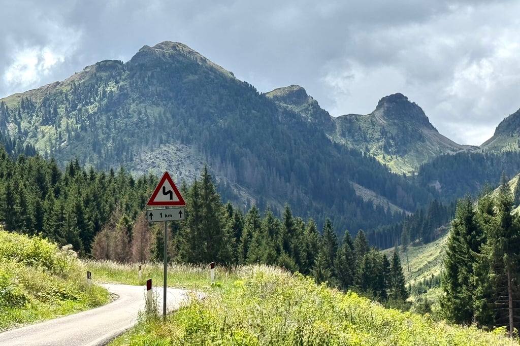
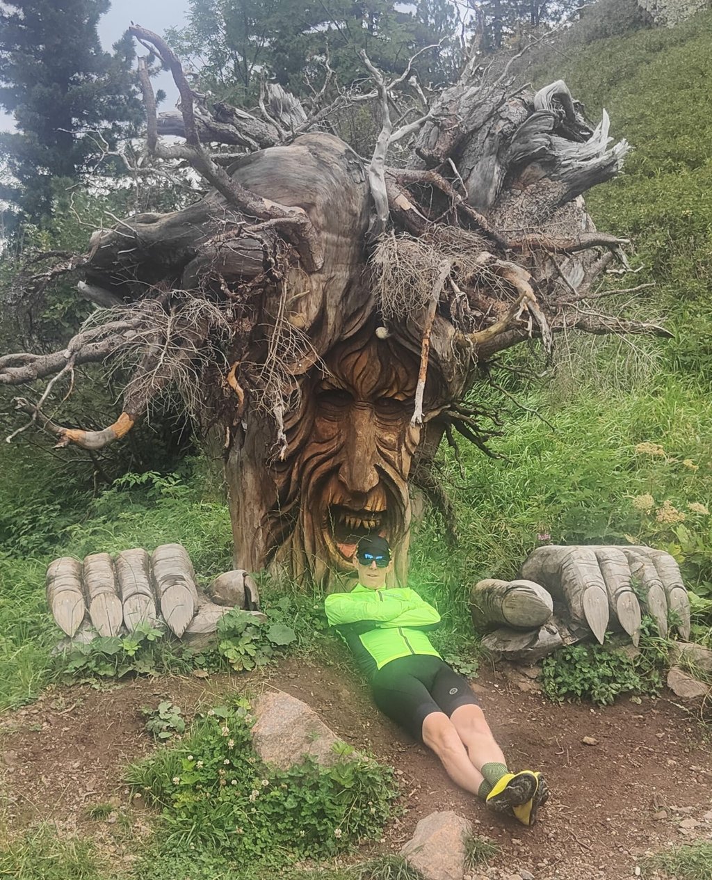
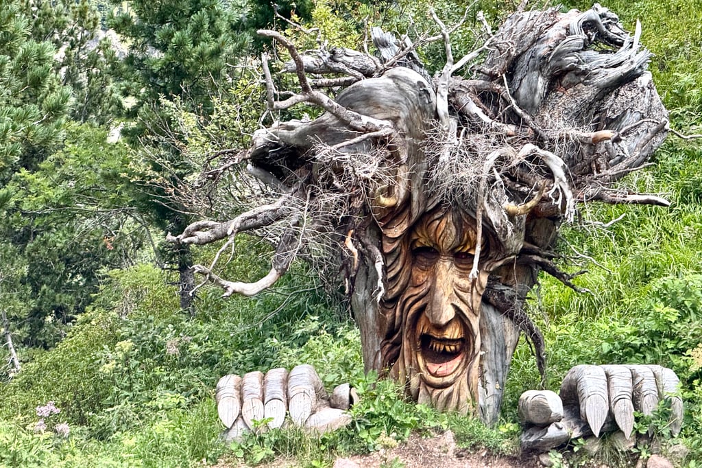
| Beautiful scenery |
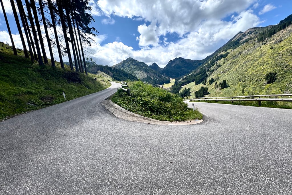
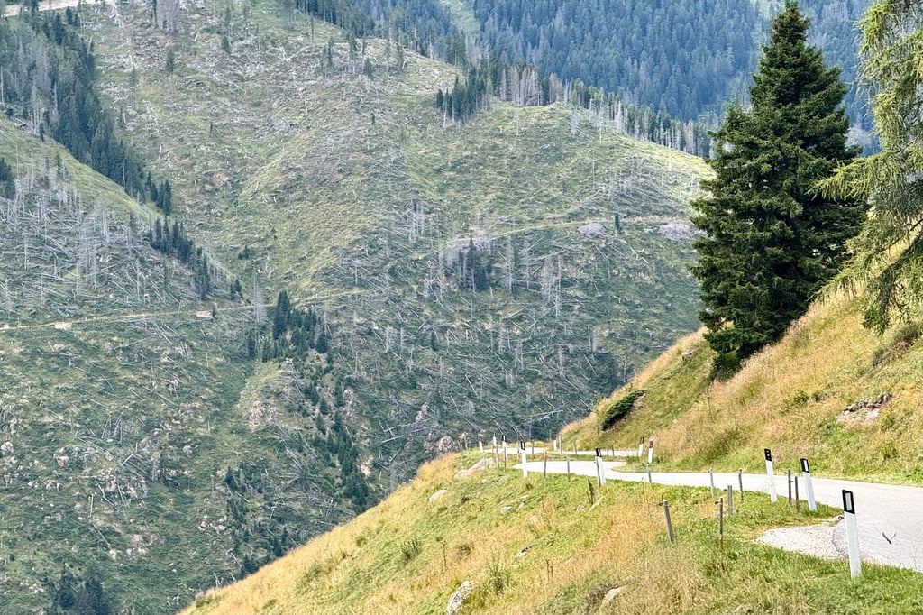
| 14 hairpin turns |
| #58 toughest climb of Trentino-South Tyrol |
| #60 most elevation gain of Trentino-South Tyrol |
| #71 longest climb of Trentino-South Tyrol |
| #98 average steepest climb of Trento |
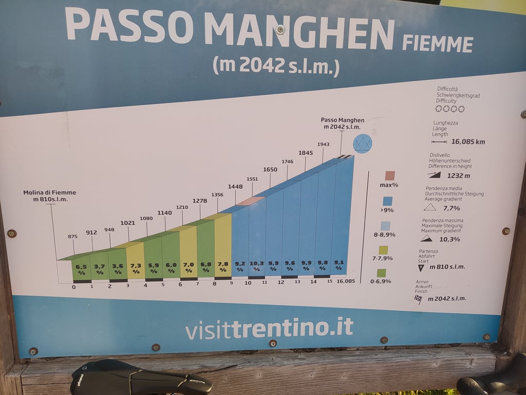
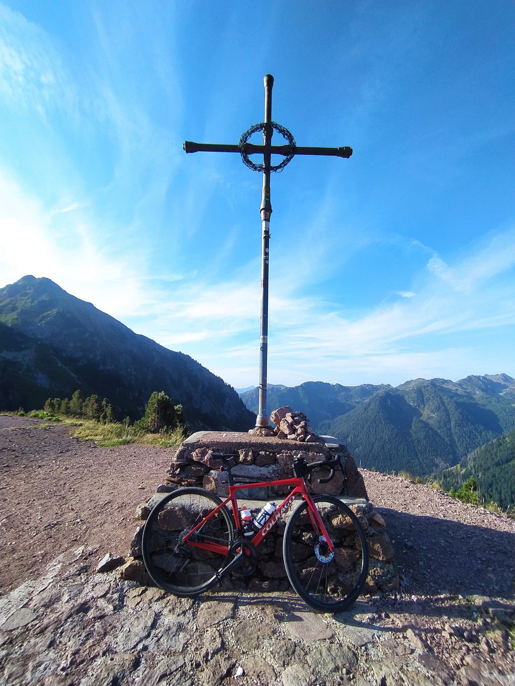
Passo Manghen from Molina di Fiemme is a climb in the region Trento. It is 9.9 mi long and bridges 3957 ft of vertical ascent with an average gradient of 7.6%, resulting in a difficulty score of 1144. The top of the ascent is located at 6699 ft above sea level. Climbfinder users shared 7 reviews of this climb and uploaded 23 photos.
Road name: SP 31
5.0 by GiacoThis is an automatic translation, the original language is: Italian.Beautiful climb, with little traffic and a very hard finish (last 6 km at 10% average) that takes you to high altitude.... read more
Welcome! Please activate your account if you would like to share something. Look for the verification email in your inbox.
If you want to upload your photos, you need to create an account. It only takes 1 minute and it's completely free.
Beautiful climb, with little traffic and a very hard finish (last 6 km at 10% average) that takes you to high altitude.
Bellissima salita, con poco traffico e finale molto duro (ultimi 6 km al 10% di media) che ti porta in alta quota.
Beautiful climb with a very tricky finish. The climb has hardly any traffic, so you can fully enjoy the peace and beautiful scenery.
Prachtige klim met een zeer lastig slotakkoord. De klim heeft nauwelijks verkeer, dus je kan ten volle genieten van de rust en de mooie omgeving.
The north side of Passo Manghen starts at Molina di Fiemme and is about 16 km long with an average gradient of 7.5%. The road rises over 1,240 altimeters through lovely forested terrain and follows a beautiful mountain stream. As a result, you cycle quite large sections in the shade. Very nice waterfalls can occasionally be seen between the trees. The small signs along the route show the remaining kilometres per kilometre and the gradient, which is nice. The road surface is good and traffic is minimal.
The Manghen is a beautiful climb, much nicer than the nearby Rolle, for example. A gentle start is followed by longer sections of 9-10% with peaks of up to 15-16% in the hairpin bends. The climb ends at 2,047 metres altitude, at a simple pass with sign and a nice restaurant a little lower down.
De noordzijde van Passo Manghen start bij Molina di Fiemme en is ongeveer 16 km lang met een gemiddeld stijgingspercentage van 7,5%. De weg stijgt over 1.240 hoogtemeters door heerlijk bosrijk terrein en volgt een prachtige bergstroom. Hierdoor fiets je best grote gedeeltes in de schaduw. Tussen de bomen door zijn af en toe hele mooie watervallen te zien. De kleine bordjes langs de route tonen per kilometer het resterende aantal kilometers en het stijgingspercentage, dat is fijn. Het wegdek is goed en het verkeer is minimaal.
De Manghen is een prachtige klim, veel mooier dan bijvoorbeeld de nabijgelegen Rolle. Na een rustige start volgen langere secties van 9–10% met pieken tot 15–16% in de haarspeldbochten. De klim eindigt op 2.047 meter hoogte, bij een eenvoudige pas met bord en iets lager gelegen een mooi restaurant.
Done several times and my sciatic pain has always made me stop at least once. After the bridge it's really hard on my 80 kilos, but I'll try again.
Fatta più volte ed il mio dolore allo sciatico mi ha sempre fatto fermare almeno una volta. Dopo il ponte e’ davvero dura per i miei 80 chili, ma tenterò di nuovo.
The first time over two thousand, the Manghen is a myth. Climbing with an old steel Wilier, always with thirty behind. The first ten kilometres are as hard as a normal climb, then it gets nasty with several peaks around 15% and a hundred metre stretch that oscillates around 18%, to cry over. The hairpin bends seem never-ending and only the view of the Val di Fiemme and the high peaks around distracts a little from the fatigue. Huge. At the top, as many mountains as you want. An experience to be had.
La prima volta sopra i duemila, il Manghen è un mito. Scalata con una vecchia Wilier in acciaio, sempre col trenta dietro. I primi dieci chilometri sono duri come una salita normale, poi diventa cattiva con diverse punte intorno al 15% e un tratto di cento metri che oscilla intorno al 18%, da piangere. I tornanti sembrano non voler finire e solo lo sguardo verso la val di Fiemme e le alte cime intorno distrae un po' dalla fatica. Enorme. In cima, montagne fin quante ne vuoi. Un'esperienza da fare.
My first time above 2000 metres, taking advantage of a road with a beautiful road surface, lonely, silent and surrounded by ancient trees. The first part is easier, then the climb steepens after the bridge over the Rio Cadino, after about 6 km of ascent. From there remain the toughest 10 km, with an average gradient always around 8%-9%, a little more in the final part, but with a climb that is not impossible because it is very regular: only the very last ramps are really steep (signpost 15% on arrival at the pass) but by now it is done and when we begin to glimpse the light above us from the other side the enthusiasm is sky-high.
13 hairpin bends in the beauty of Val di Fiemme and from the summit a glimpse of the other side, the Valsugana.
Recommended!
La mia prima volta sopra i 2000 mt, approfittando di una strada dal bellissimo manto stradale, solitaria, silenziosa e contornata da alberi secolari. La prima parte è più facile, poi la salita si inasprisce dopo il ponte (Rivo dello Stue), dopo circa 6 km di ascesa. Da lì rimangono i 10 km più duri, con pendenza media sempre intorno al 8%-9%, qualcosa di più nel finale, ma con una salita non impossibile perché molto regolare: solo le ultimissime rampe sono davvero ripide (cartello 15% all'arrivo al passo) ma ormai è fatta e quando si comincia a intravedere sopra di noi la luce dall'altro versante l'entusiasmo è alle stelle.
13 tornanti nella bellezza dalla Val di Fiemme e dalla cima una sguardo sull'altro versante, la Valsugana.
Consigliata!
Beautiful climb, perhaps a little too much for me after 60 km and 1600 metres of elevation gain in my legs. Last 5 km or so never below 10 % and stretches up to 15%. The finish an ordeal, but at the top you quickly forget the effort made
Salita bellissima, forse un po' tropp per me dopo 60 km e 1600 metri di dislivello nella gambe. Ultimi 5 km circa mai sotto il 10 % e tratti fino al 15%. Il finale un calvario, ma in cima si dimentica in fretta la fatica fatta
| 5 mph | 01:59:19 |
| 7 mph | 01:24:28 |
| 9 mph | 01:05:50 |
| 12 mph | 00:49:27 |
This page is better in the app