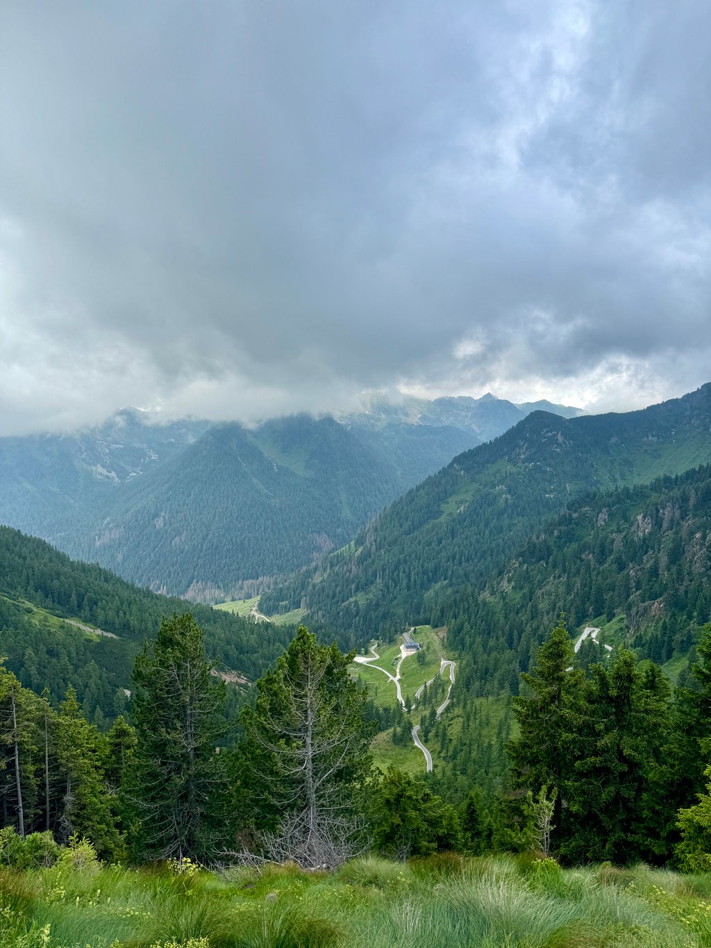
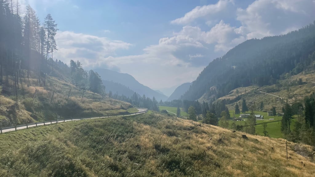
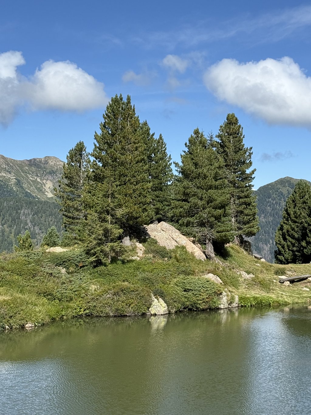
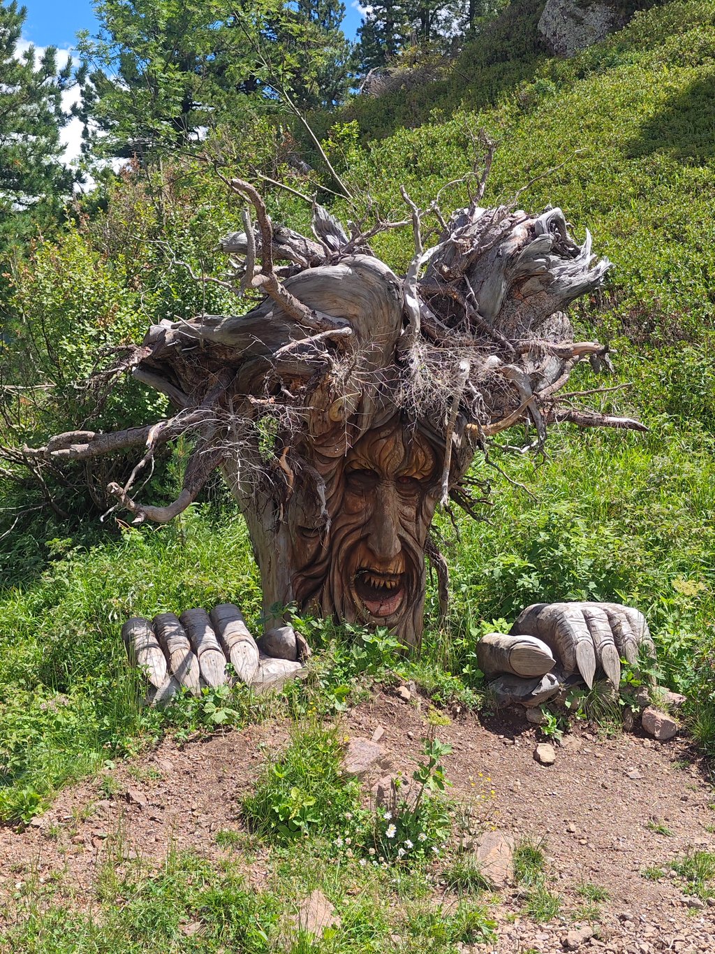
| Beautiful scenery |
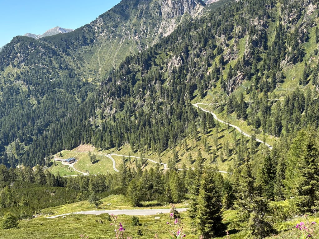
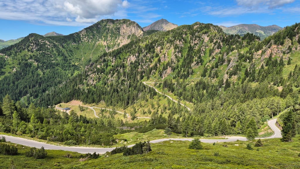
| 14 hairpin turns |
| #80 toughest climb of Italy |
| #33 most elevation gain of Italy |
| #77 longest climb of Italian Alps |
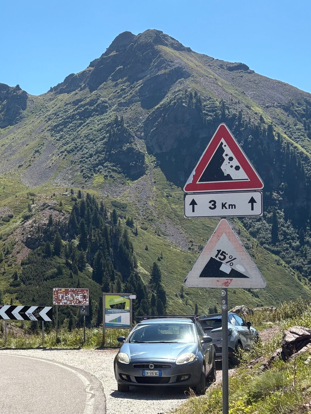
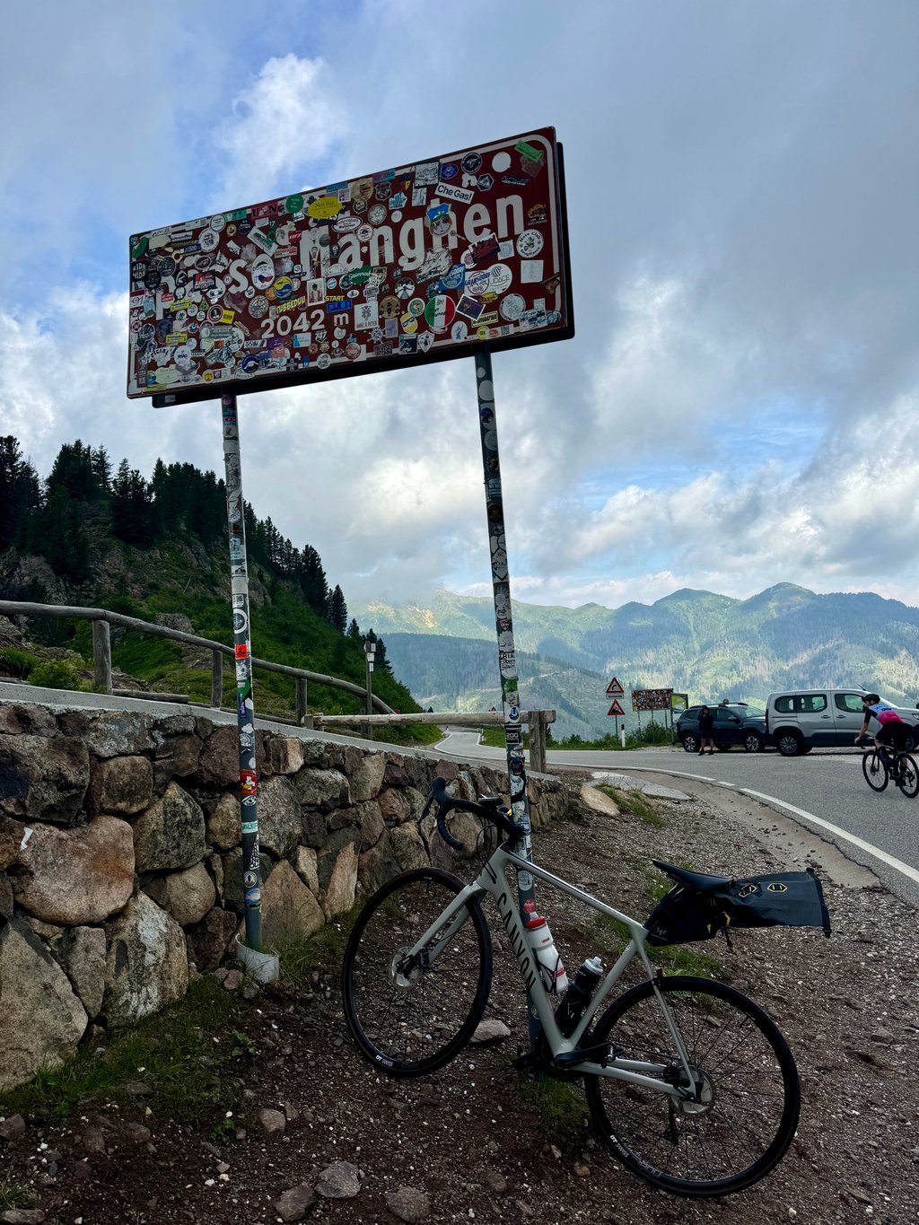
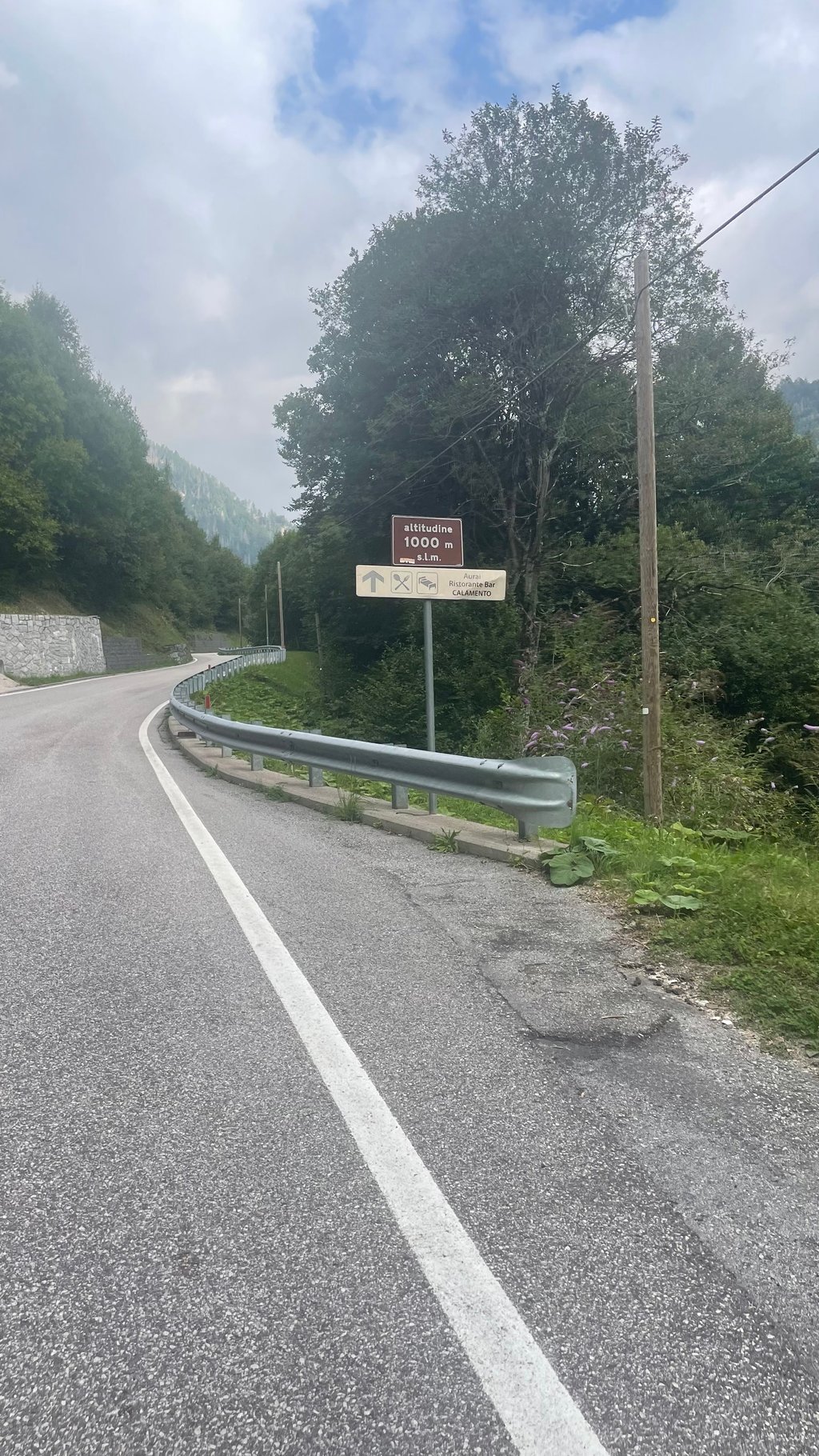
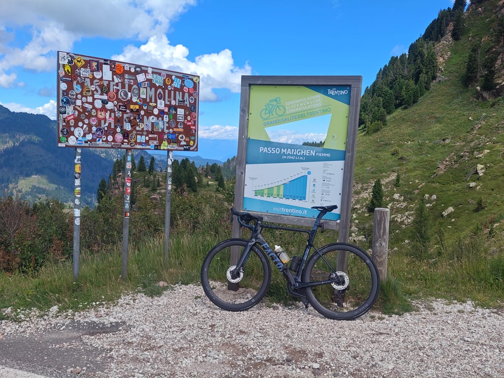
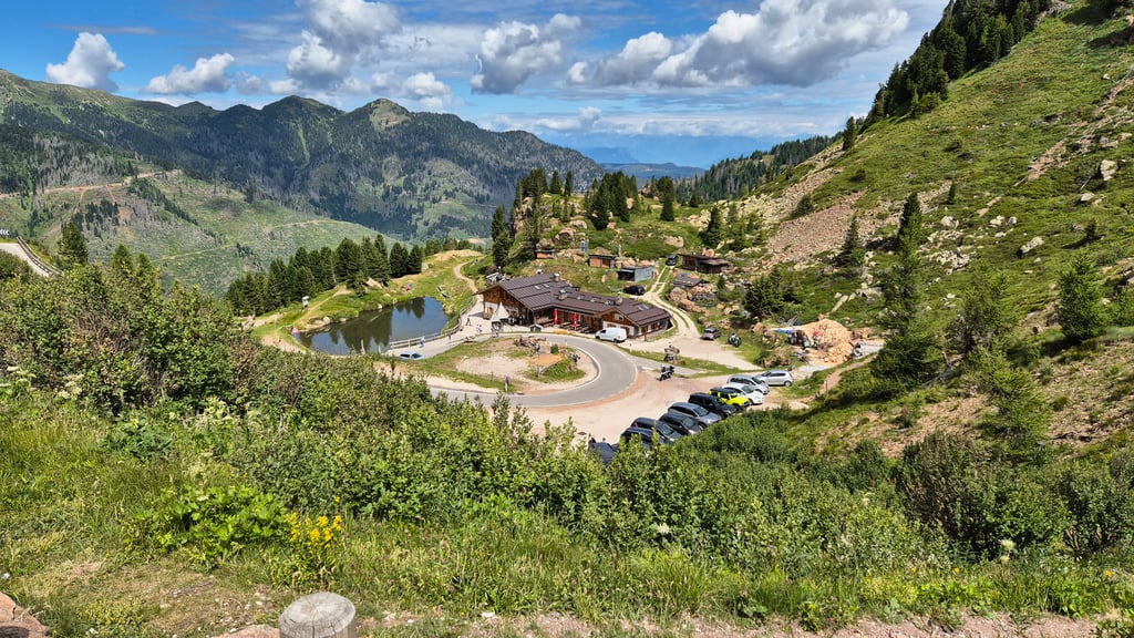
Passo Manghen from Castelnuovo via Telve is a climb in the region Trento. It is 14.3 mi long and bridges 5525 ft of vertical ascent with an average gradient of 7.3%, resulting in a difficulty score of 1383. The top of the ascent is located at 6699 ft above sea level. Climbfinder users shared 6 reviews of this climb and uploaded 23 photos.
Road names: Via Rivatelve, Strada Provinciale del Passo del Manghen & Ponte del Salton
4.0 by SamueleTThis is an automatic translation, the original language is: Italian.Really tough and long climb, the first part up to the middle is quite rideable with even six moments of breathing space but the last km are an endless ramp. Finished in 1h 40min... read more
Welcome! Please activate your account if you would like to share something. Look for the verification email in your inbox.
If you want to upload your photos, you need to create an account. It only takes 1 minute and it's completely free.
A very scenic but long and challenging climb, especially the final hairpin turns. I recommend it to anyone who enjoys climbing.
Salita molto bella ma lunga e difficile, soprattutto gli ultimi tornanti. La consiglio a chi piace pedalare in salita.
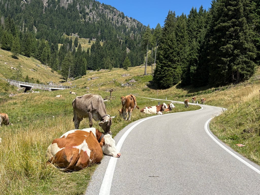
I would recommend the ascent, it is long and difficult, but beautiful, especially in the upper part. You always have a view of the upcoming hairpin bends that snuggle into the mountain. There is relatively heavy car traffic at the bottom. It gets better at the top, with the occasional cow on the way.
Ich würde den Anstiege empfehlen, er ist lang und schwer, aber gerade im oberen Teil wunderschön. Man hat immer einen Blick auf die kommenden Serpentinen, die sich in den Berg hineinschmiegen. Unten ist relativ starker Autoverkehr. Oben wird es besser ab und zu steht auch mal eine Kuh auf dem Weg.
Really tough and long climb, the first part up to the middle is quite rideable with even six moments of breathing space but the last km are an endless ramp. Finished in 1h 40min
Salita davvero tosta e lunga, la prima parte fino a metà è abbastanza pedalabile con anche sei momenti di respiro ma gli ultimi km sono una rampa infinita. Chiusa in 1h e 40min
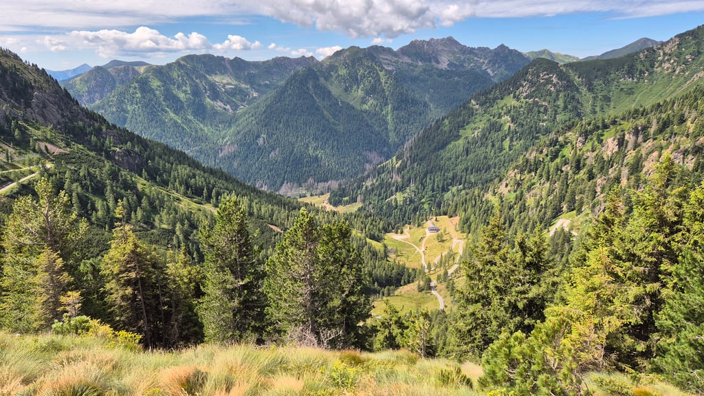
The route was really very beautiful. You start at about 400m asl and go up to 2042m asl. The landscape is breathtaking. The higher you go, the more beautiful it becomes. Difficulty of the climb 8/10. You need to have some good legs to be able to tackle it comfortably. The road is not very crowded, I have passed a few bikes but also a few motorbikes, and on the whole the climb is easy. Recommended route! At the top of the pass there is a bar where you can relax for 5 minutes.
Il percorso era veramente molto bello. Si parte da circa 400m slm e si arriva fino a 2042m slm. Il paesaggio è mozzafiato. Più si sale più diventa molto bello. Difficoltà della salita 8/10. Bisogna avere un po' di gamba allenata per affrontarla con tranquillità. Strada non molto affollata, ho incrociato qualche bici ma anche qualche moto, nel complesso si sale con tranquillità. Percorso consigliato! In cima al passo c'è un bar per potersi rilassare 5 min
A beautiful and long climb!
I did it as part of a loop and can definitely say that this side is much more scenic — the views and landscape are absolutely stunning.
I recommend starting early in the morning, as most of the climb is exposed to the sun and it's best to get ahead of the motorcycle traffic.
Make sure to save energy for the final 7 km, as the gradient stays consistently tough all the way to the top.
Beautiful, long, tough climb. From bevalt area, you climb first through the forest and later through meadows. Fairly regular and the final kilometres are continuously steep. Halfway there is a restaurant where you can fill water bottles. Just over the top ok a restaurant.
Prachtige, lange, pittige klim. Vanuit bevalt gebied klim je eerst door het bos en later door de weilanden. Vrij regelmatig en de laatste kilometers zijn continu steil. Halverwege is een restaurant waar je bidons kunt vullen. Net over de top ok een restaurant.
| 5 mph | 02:52:48 |
| 7 mph | 02:02:20 |
| 9 mph | 01:35:20 |
| 12 mph | 01:11:37 |
This page is better in the app