Passo Gouta from Pigna is a climb in the region Imperia. It is 8.5 mi long and bridges 3320 ft of vertical ascent with an average gradient of 7.4%, resulting in a difficulty score of 837. The top of the ascent is located at 3999 ft above sea level. Climbfinder users shared 3 reviews of this climb and uploaded 8 photos.
This is an automatic translation, the original language is: Italian.
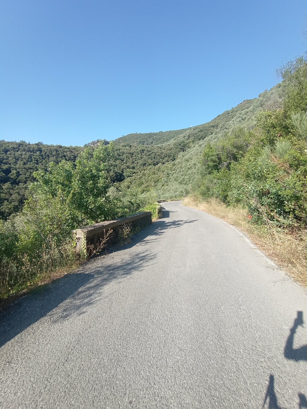
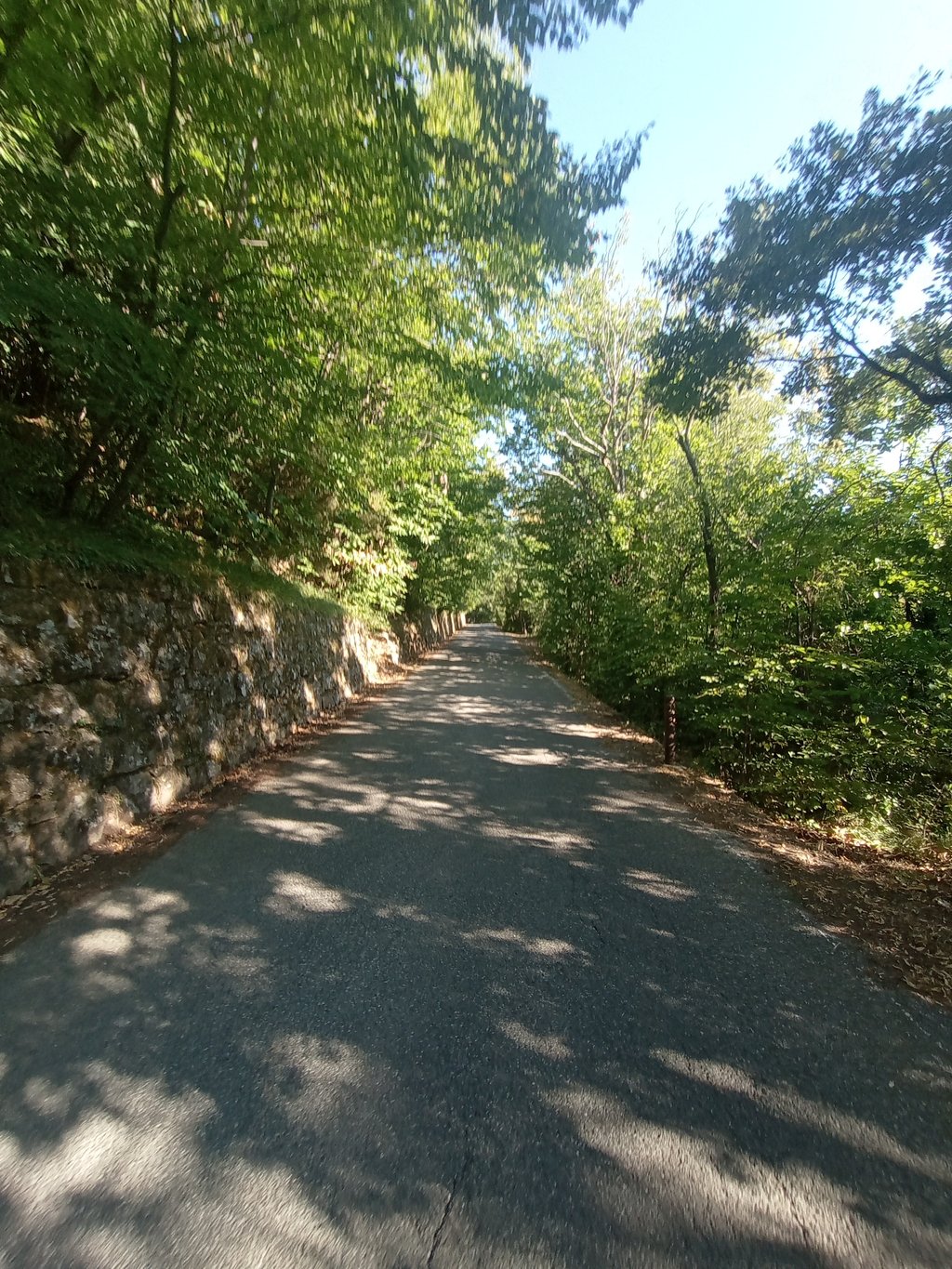
A very special, hidden, wild climb. At Monterosso , on the Aurelia, buy the sign that says " Gouta" after about fifteen kilometres of falsopiano, just before arriving at Pigna, here is a second sign that makes you turn left off the main road. The climb immediately makes itself felt. The first 4 km are totally exposed to the sun and are the ones with the best road quality. Then you enter the forest and the coolness is joined by a less than perfect road surface. Nothing dramatic, as one ...read more
Photos (8)
Welcome! Please activate your account if you would like to share something. Look for the verification email in your inbox.
This is an automatic translation, the original language is: Italian.
Show original
A very special, hidden, wild climb. At Monterosso , on the Aurelia, buy the sign that says " Gouta" after about fifteen kilometres of falsopiano, just before arriving at Pigna, here is a second sign that makes you turn left off the main road. The climb immediately makes itself felt. The first 4 km are totally exposed to the sun and are the ones with the best road quality. Then you enter the forest and the coolness is joined by a less than perfect road surface. Nothing dramatic, as one might expect from a small mountain road lost in the Ligurian hinterland. The climb is not a regular one, alternating numerous double-digit climbs with false flats or areas of "recovery". On a hot July day, it was 22° at the summit in mid-morning. The descent is to be done with attention to the pebbles that one occasionally encounters. Big flaw there are practically no fountains at Dolceacqua!
Salita molto particolare, nascosta, selvaggia. A Monterosso , sull Aurelia comprare il cartello con scritto " Gouta" , dopo una quindicina di km di falsopiano, poco prima di arrivare a Pigna, ecco un secondo cartello che fa deviare a sinistra dalla strada principale. La Salita si fa subito sentire. I primi 4 km sono totalmente esposti al sole e sono quelli con una qualità di strada migliore. Dopo si entra nel bosco e al fresco si unisce un manto stradale non perfetto. Nulla di drammatico, da come ci si può aspettare da una stradina di montagna sperduta nell entroterra ligure. La salita non è regolare, alterna numerosi strappi in doppia cifra, a falsi piani o comunque zone di "recupero". In una calda giornata di Luglio, in cima a metà mattina c'erano 22°. La discesa è da fare con attenzione ai sassolini che ogni tanto si incontrano. Grossa pecca non ci sono fontane praticamente da Dolceacqua!
This is an automatic translation, the original language is: Italian.
Show original
The climb is challenging, and the average gradient can be misleading: there are stretches where it almost flattens out alternating with sections that are more or less flat.
The first section was the most tiring for me, as it is not protected by trees and, having tackled it at lunchtime in August, I suffered quite a bit from the heat. Then you enter the forest and continue pleasantly.
The quality of the road surface is just sufficient, and there are no problems on the ascent, but on the descent it was a bit of a struggle (at least with a mountain bike, people with mountain bikes overtook me without any problems).
Traffic was almost non-existent, probably also due to the fact that once up there are no other paved roads.
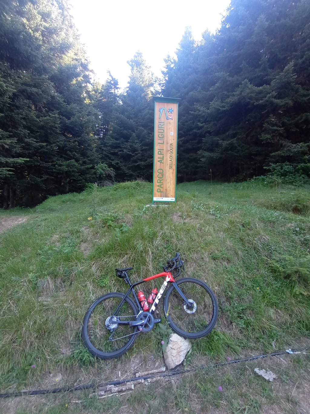
At the top there is a refuge where you can get some refreshments.
The views are nice, but other climbs in the area offer much better.
Climbing at about 3.13w/kg took me one hour and 5min.
An ascent that I recommend if you are passing through, otherwise there are others in the area that I think deserve more
La salita è impegnativa, la pendenza media può trarre in inganno: ci sono tratti in cui quasi spiana alternati a settori >10%.
Il primo tratto è stato per me il più faticoso, infatti non è protetto dagli alberi ed avendolo affrontato all'ora di pranzo ad agosto ho sofferto non poco il caldo. Poi si entra nel bosco e si prosegue piacevolmente.
La qualità del manto stradale è appena sufficiente, non presenta problemi in salita ma in discesa c'è stato un po' da tribolare (quantomeno con una bdc, gente con mtb mi ha superato senza problemi).
Traffico quasi inesistente, probabilmente anche complice il fatto che, una volta su, non ci siano altre vie asfaltate.
In cima c'è un rifugio dove potersi rifocillare.
I panorami sono carini, ma altre salite in zona regalano molto di meglio.
Salendo a circa 3,13w/kg ho impiegato un'ora e 5min.
Salita che consiglio se se è di passaggio, altrimenti ce ne sono altre in zona che penso meritino di più
This is an automatic translation, the original language is: Dutch.
Show original
Did this climb on a full-suspension mtb. Was punchy, but doable.
You mainly ride some open sections at first. Soon you go between the trees, leaving little view. This remains so until just before the summit. Score for the scenery: 3/5.
Overall, the road is good. On a few stretches, you will have to pick your way a bit as the tarmac is a bit battered. Score 4/5.
Traffic density is minimal. Five cars passed me in total. Score 5/5.
The climb itself is fairly even, with some outliers here and there in the double digits. On a road bike it will be a bit easier than on a heavy (16kg) mountain bike.
Heb deze klim gedaan op een full-suspension mtb. Was pittig, maar goed te doen.
Je rijdt in het begin vooral wat open stukken. Al snel ga je tussen de bomen, waardoor er weinig uitzicht is. Dit blijft zo tot net voor de top. Score voor de omgeving: 3/5.
Over het algemeen is de weg goed. Op enkele stukken zul je je weg een beetje moeten kiezen omdat het asfalt wat gehavend is. Score 4/5.
Verkeersdrukte is miniem. Vijf auto’s zijn me in totaal gepasseerd. Score 5/5.
De klim zelf is redelijk gelijkmatig, met hier en daar wat uitschieters in de dubbele getallen. Op een racefiets zal het wat makkelijker gaan dan op een zware (16kg) mountainbike.
Share your knowledge. What was the road condition during your ascent?
Traffic
100% 0% 0%
Based on 5 votes
Your experience counts. How much traffic did you encounter during the climb?
Frequently Asked Questions
Passo Gouta from Pigna is a challenging ascent. For this type of climbing, we recommend mountain gearing, specifically a compact system. This means a small front chainring of 34 teeth, combined with a rear cassette where, depending on your level, strength, and experience, you choose a sprocket with 30, 32, or even 34 teeth. Remember that a smooth cadence is always more efficient!
Passo Gouta from Pigna is a first-category climb: long and tough. Do not underestimate this climb. Many famous Tour de France cols fall into this category. Prepare for a long, challenging ride. Only well-trained riders will reach the top smoothly. Make sure you have a road bike with climbing gears and enough training; otherwise, it will be a struggle.
Passo Gouta from Pigna is 8.5 mi long.
The average gradient of Passo Gouta from Pigna is 7.4%.
Passo Gouta from Pigna has a steepest segment with an average gradient of 15.2%.
The summit of Passo Gouta from Pigna is at 3999 ft.
At a slow pace of 5 mph, it takes about 01:42:18 to climb Passo Gouta from Pigna. At 7 mph the time is 01:12:25, and at 9 mph 00:56:26. For the fastest cyclists, 00:42:24 is an achievable time.
Passo Gouta from Pigna is located in the region Imperia in Italy.