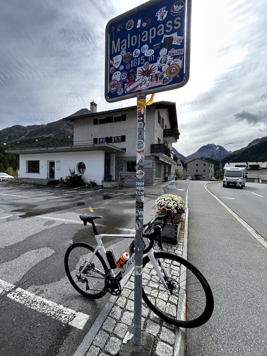
Passo del Maloja from Chiavenna is a climb in the region Sondrio. It is 19.9 mi long and bridges 4882 ft of vertical ascent with an average gradient of 4.7%, resulting in a difficulty score of 925. The top of the ascent is located at 5955 ft above sea level. Climbfinder users shared 9 reviews of this climb and uploaded 25 photos.
Road names: SS37, 3 & Passo del Maloja
5.0 by EmanueleproserpioThis is an automatic translation, the original language is: Italian.A long and beautiful climb across the Swiss-Italian border through the Engadin, beautiful scenery everywhere you look! Technically tricky, it climbs unevenly with long stretches where you can rest, but you have to "save yourself" because the last 10 km are tough and in particular the iconic last few kilometres full of hairpin bends also climb over 10% , stupendous! Pity the also very heavy (but respectful) traffic. Must do!... read more
Welcome! Please activate your account if you would like to share something. Look for the verification email in your inbox.
If you want to upload your photos, you need to create an account. It only takes 1 minute and it's completely free.
Nice climb to have done once, but lots of traffic on this road. Also last part with the curves is very nice
Mooie klim om keer gedaan te hebben, maar wel veel verkeer op deze weg. Ook laatste stuk met de bochten is erg mooi
A beautiful climb surrounded by breathtaking scenery.
For almost all of it, the route is not very difficult, but do not underestimate the last 2/3 km with double-digit gradients (in that stretch, watch out for bus turns because of the tight hairpin bends).
I would like to point out that near Spino there are a few hundred metres of gravel (with caution, passable by bike) due to asphalt resurfacing (28 July 2024).
Climb definitely to be redone.
Una bella salita immersa in un paesaggio mozzafiato.
Per la quasi totalità il percorso non si presenta difficilissimo, ma non sottovalutate gli ultimi 2/3 km con pendenze a doppia cifra (in quel tratto attenzione alle svolte dei pullman per via dei tornanti stretti).
Segnalo che nei pressi di Spino c'è qualche centinaio di metri di ghiaia (con cautela percorribile con bdc) per rifacimento asfalto (28 luglio 2024).
Salita sicuramente da rifare.
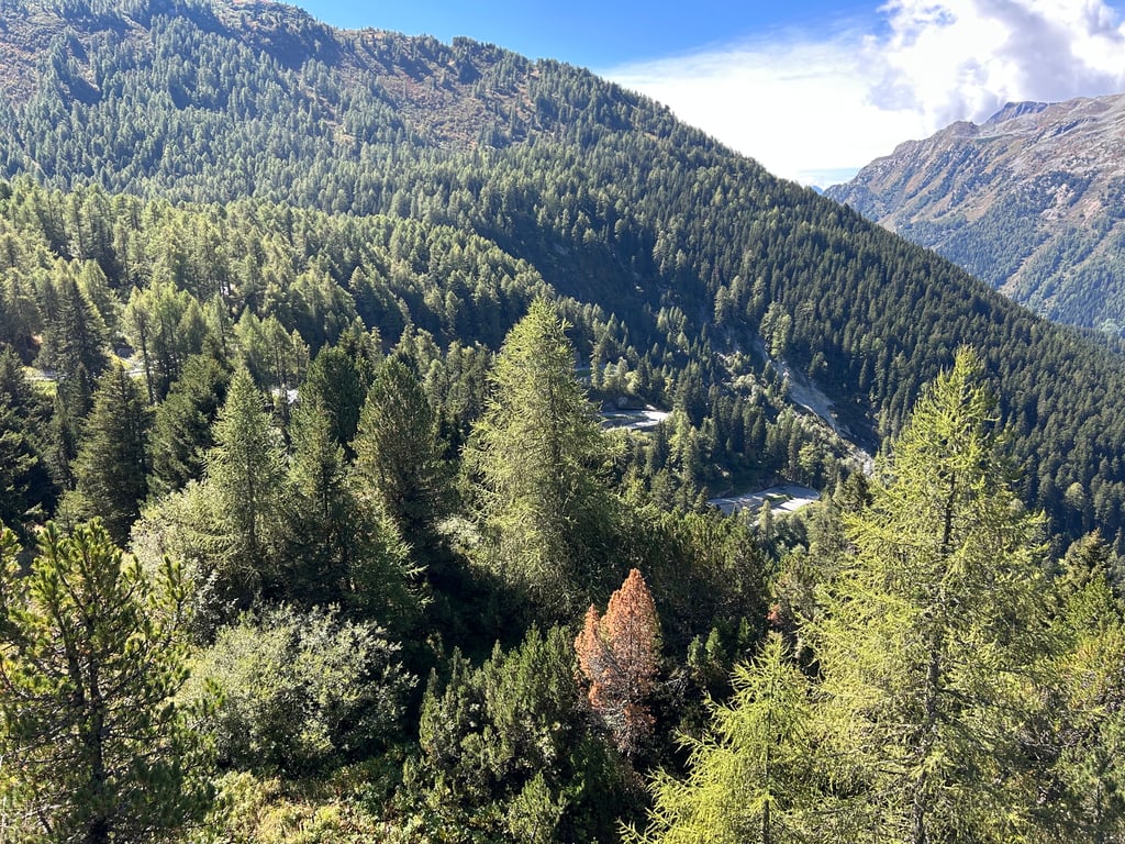
In this climb, you cross the border from Italy into Switzerland.
The final kilometres are the best as a series of hairpin bends loom up.
The curves are stuck to the wall, which is beautiful to see.
In deze klim ga je over de grens van Italië naar Zwitserland.
De laatste kilometers zijn het mooiste als een serie haarspeldbochten opdoemen.
De bochten zitten tegen de wand geplakt en dat is prachtig om te zien.
A long and beautiful climb across the Swiss-Italian border through the Engadin, beautiful scenery everywhere you look! Technically tricky, it climbs unevenly with long stretches where you can rest, but you have to "save yourself" because the last 10 km are tough and in particular the iconic last few kilometres full of hairpin bends also climb over 10% , stupendous! Pity the also very heavy (but respectful) traffic. Must do!
Salita lunga e bellissima che attraversa il confine italo-svizzero attraverso l'Engadina, bellissimi paesaggi ovunque posiamo l'occhio! Tecnicamente difficile da gestire, sale in modo irregolare con lunghi tratti dove riposare, ma bisogna "risparmiarsi" perchè gli ultimi 10 km sono tosti ed in particolare gli iconici ultimi km zeppi di tornanti salgono anche oltre il 10% , stupenda! Peccato il traffico anche molto intenso (ma rispettoso). Da fare!
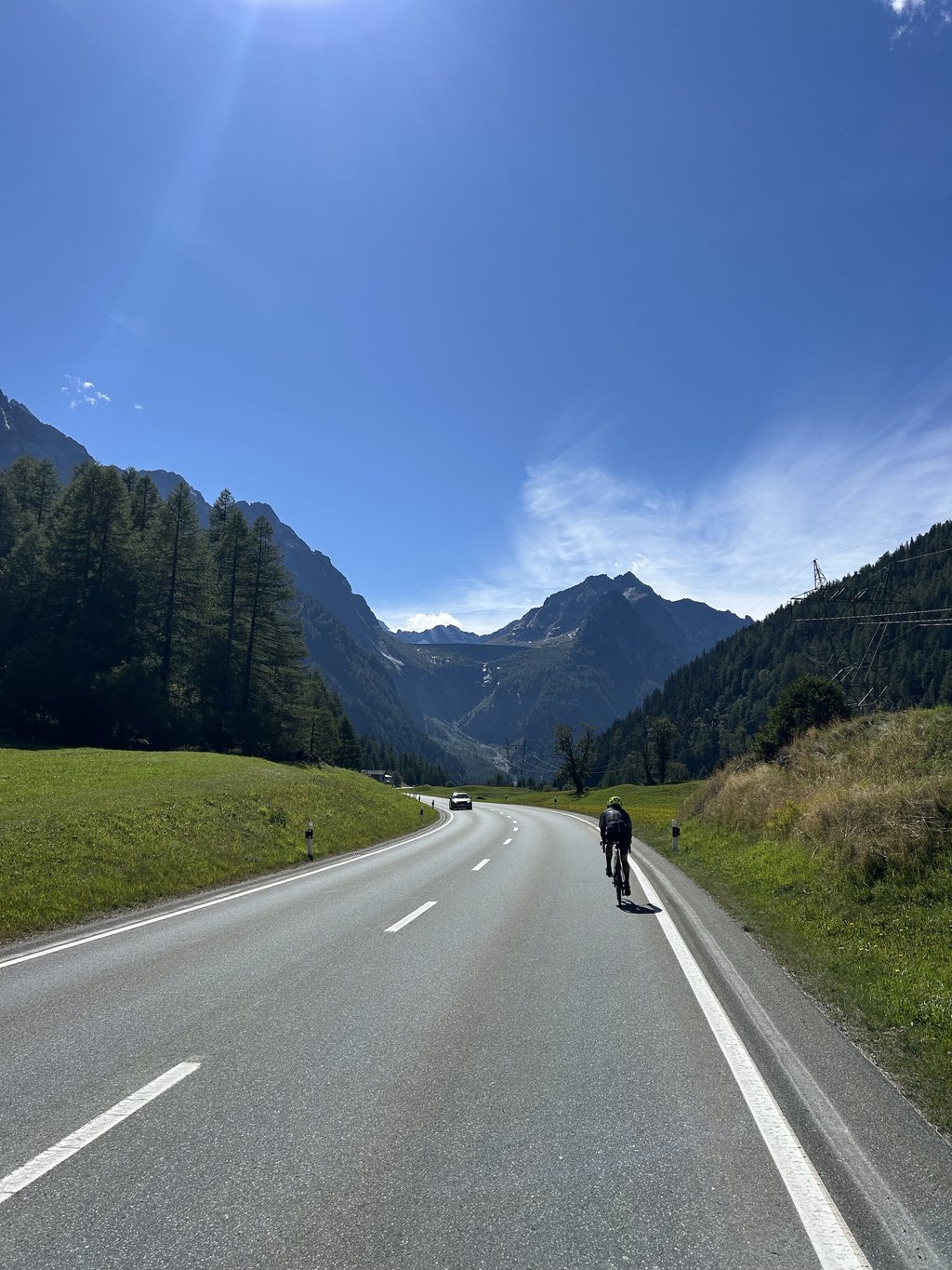
Slopes change often, road is sunny after 9AM (end July), traffic may be heavy (weekend bikers, weekdays trucks). Very long cllimb, persistent headwinds in early morning. On top the rewards are Alps, a beautiful lake, quiet towns, an amazing descent.
I did nearby climb Val Fex from Sils in Engadin that is worth the Maloja effort in itself, for beautiful landscape and quiet road.
There is a beautiful tarmac bike path from Chiavenna up to the Swiss border, variant to avoid some traffic (I did it while descending), path number 17.
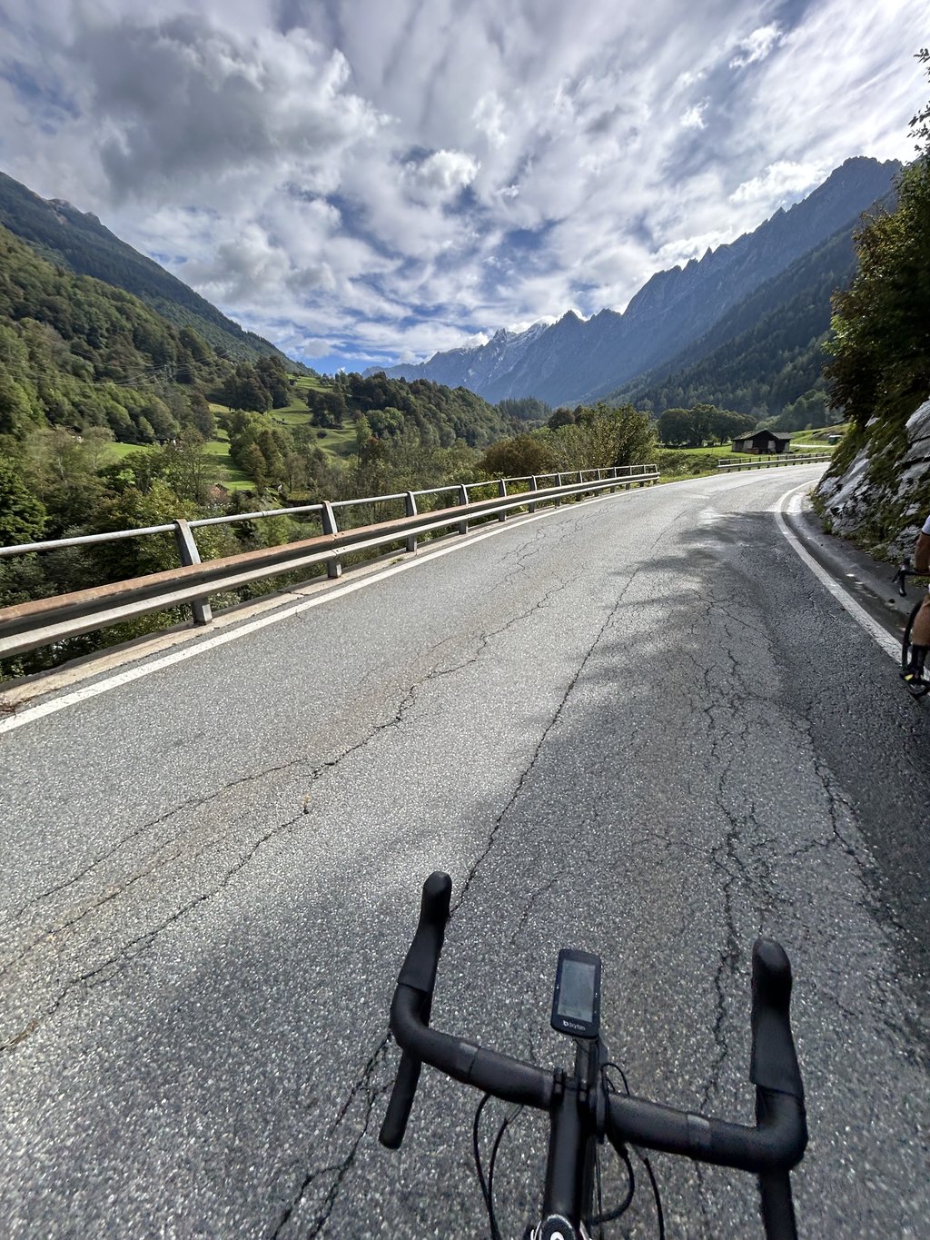
Maloja Pass (cycled July 2022) is a long literal cross-border climb (1/3 Italian - 2/3 Swiss) without extremes that follows the course of the river Maira upstream.
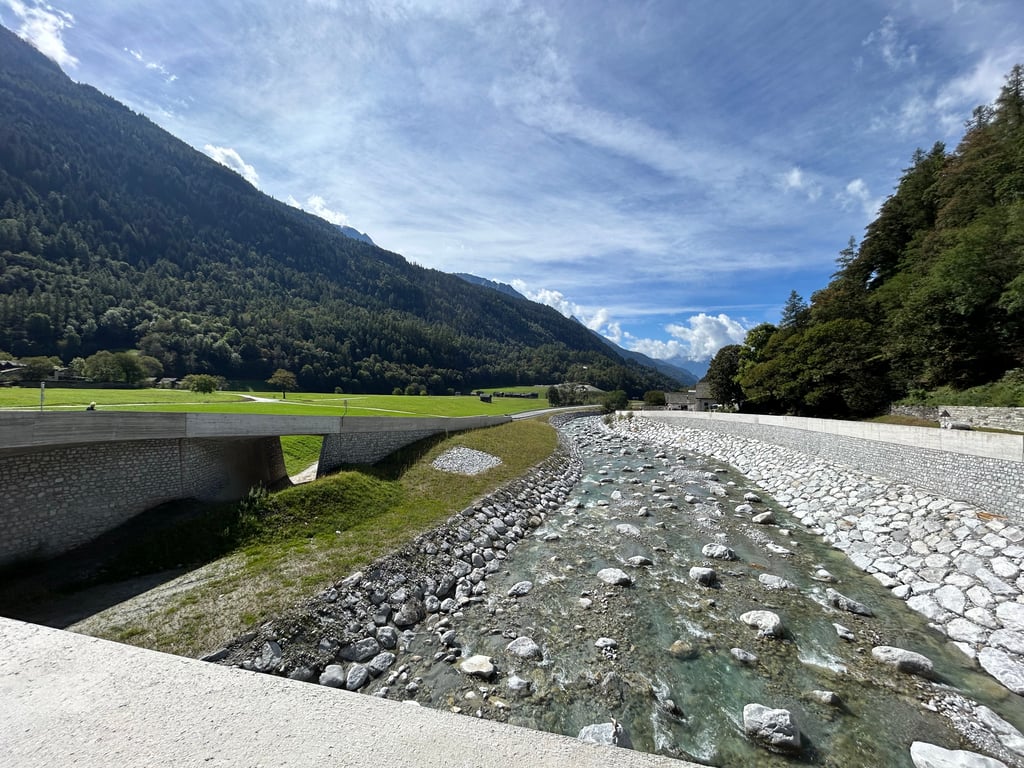
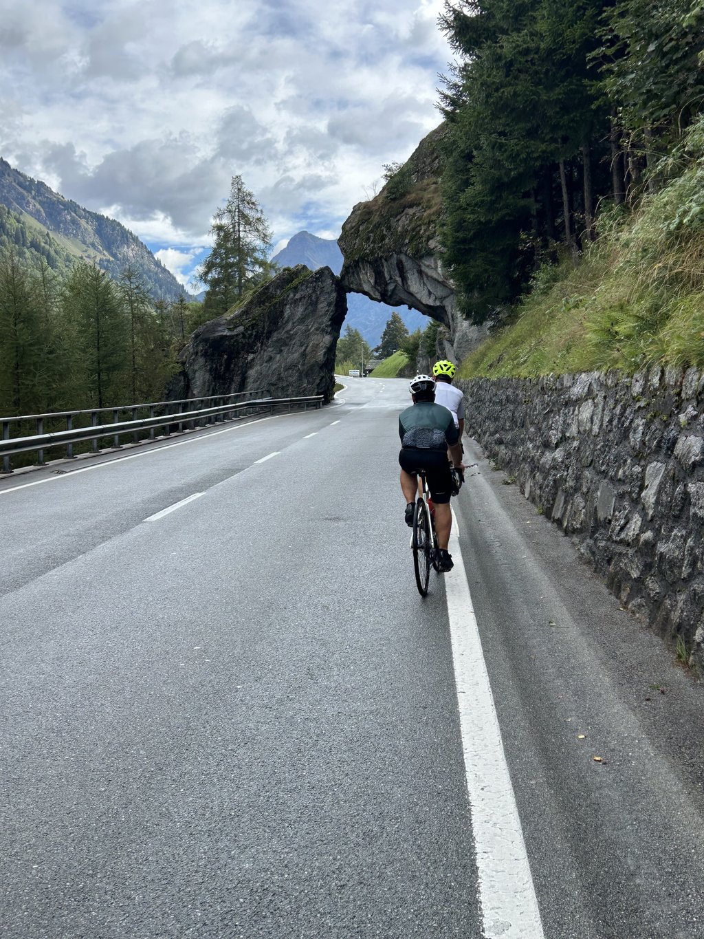
The approach is a wide road with long, slightly uphill stretches. There is a lot of (heavy) traffic which is not pleasant but which is distracted by the beautiful natural scenery along the valley slopes. You pass the Acquafraggia waterfalls just outside Chiavenna and the Albignasee dam can be seen high above you.
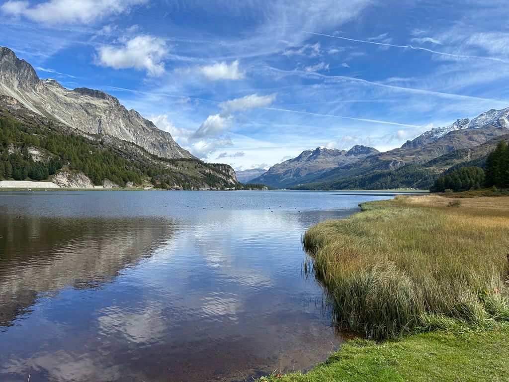
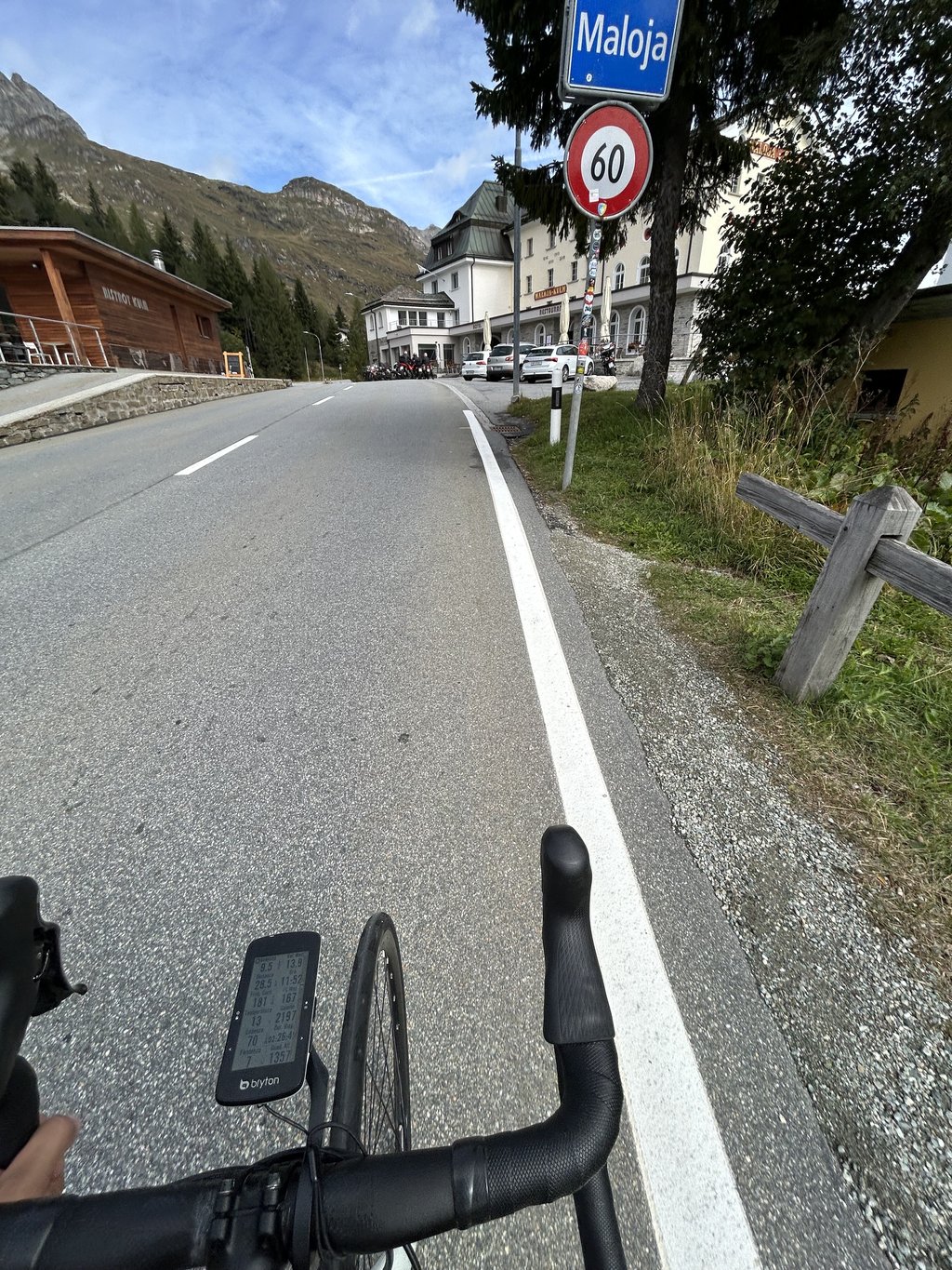
From Vicosoprano follow the first steep winding kilometres and after cycling through Casaccia the final chord with the beautiful hairpin series in good asphalt until the top right in front of the Maloja-Kulm hotel. The highest point is the edge of a horizontal plateau around Lake Sils, which gives the pass its unique characteristic of having only one climbing side.
Provisioning is not a problem either on the way or at the summit.
!!!! In Promontogno, the tunnel is forbidden for cyclists. You will be redirected through the cobblestone streets of the village.
The climb is long and has a tough finish.
Malojapas (gefietst July 2022) is een lange letterlijk grensoverschrijdende klim (1/3 Italiaans - 2/3 Zwitsers), zonder extremen, die de loop van de rivier Maira stroomopwaarts volgt.
De aanloop is een brede weg met lange licht stijgende rechte stukken. Er is geweldig druk (vracht)verkeer wat niet prettig is maar waar de aandacht wordt van afgeleid door het prachtige natuurdecor langs de valleiflanken. Je passeert oa. de Acquafraggia watervallen net buiten Chiavenna en de stuwdam van de Albignasee zie je hoog boven jou.
Vanaf Vicosoprano volgen de eerste bochtige steilere kilometers en na het doorfietsen van Casaccia het slotakkoord met de mooie haarspeldbochtenreeks in prima asfalt tot de top recht voor het Maloja-Kulm hotel. Hoogste punt is de rand van een horizontaal plateau rond de Silsersee waardoor de pas de unieke eigenschap heeft dat er slechts één klimkant is.
Bevoorrading is onderweg en op de top geen probleem.
!!!! In Promontogno is de tunnel verboden voor fietsers. Je wordt omgeleid door de kassei straatjes van het dorpje.
Klim die door zijn lengte en pittig slot toch wel in de benen kruipt.
Beautiful climb, the end is hard to bear after having climbed 30 km but the view from the hairpin bends makes up for everything...
Prachtige klim, het einde is wel stevig afzien na 30 km geklommen te hebben maar het uitzicht vanaf de haarspeldbochten maakt alles goed...
| 5 mph | 03:59:38 |
| 7 mph | 02:49:39 |
| 9 mph | 02:12:12 |
| 12 mph | 01:39:19 |
This page is better in the app