Actually, this is not an alternative route up to Calaone, but a climb that starts right from Calaone. Therefore, the ascent to Monte Cero must be added to one of the options that one can choose to climb up to Calaone, and as can be seen from what has been described, there are some rather challenging ones.
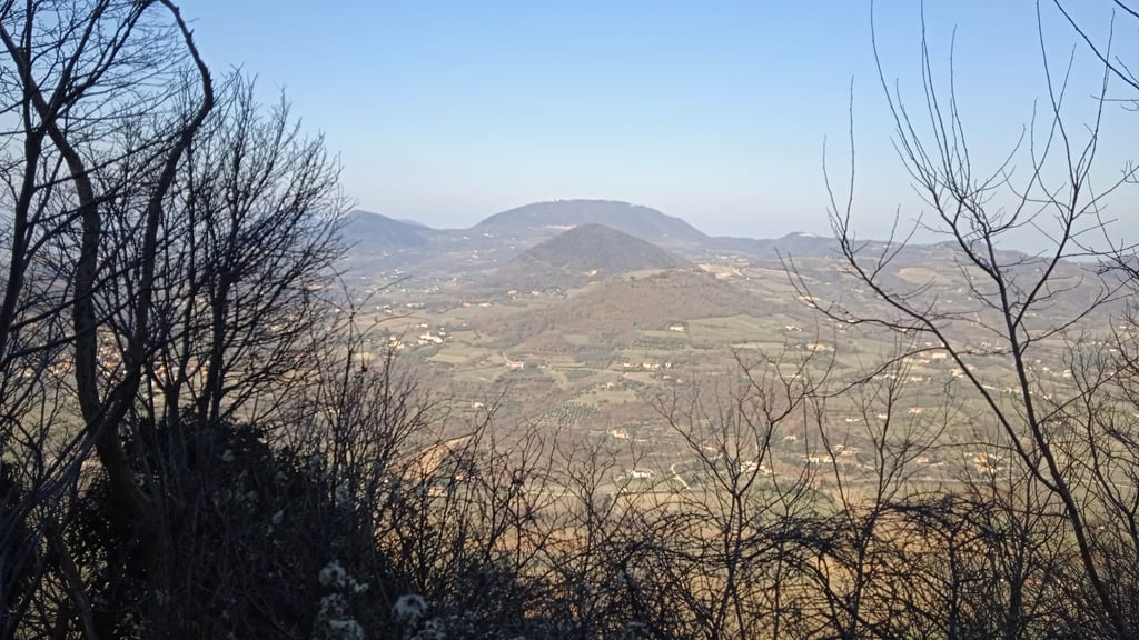
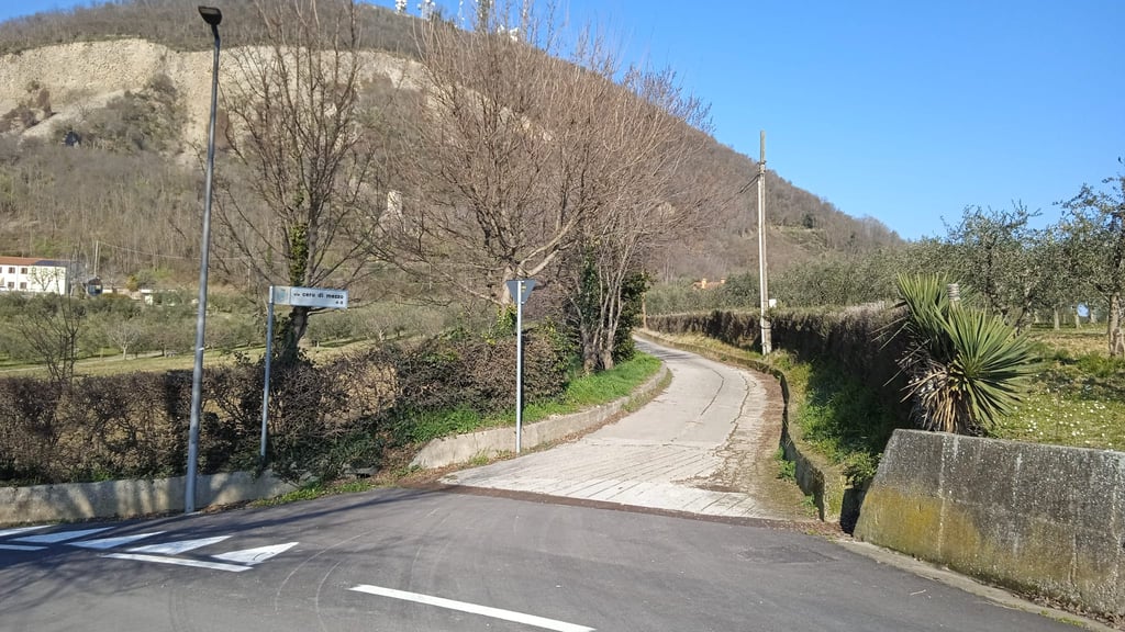
The ascent from Calaone to the summit of Monte Cero has numerous peculiarities. First of all, it allows you to reach the very top of the hill (a fairly rare occurrence), where you will come up against a huge telecommunications plant that does not, however, prevent exceptional views, both to the south and to the northwest. Then it is a climb that climbs up the pass making a right-handed spiral around the summit, allowing exposure to all cardinal points and somewhat reminiscent of other famous ramps such as the Puy de Dome. Lastly, it winds along a very narrow road, where it is possible to pull alongside another bike, or a hiker, but it is already almost impossible to swap with a car or an antenna repair vehicle (encounters that are actually quite rare).
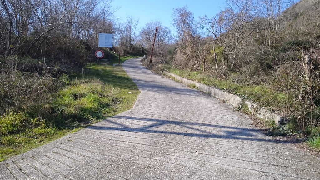
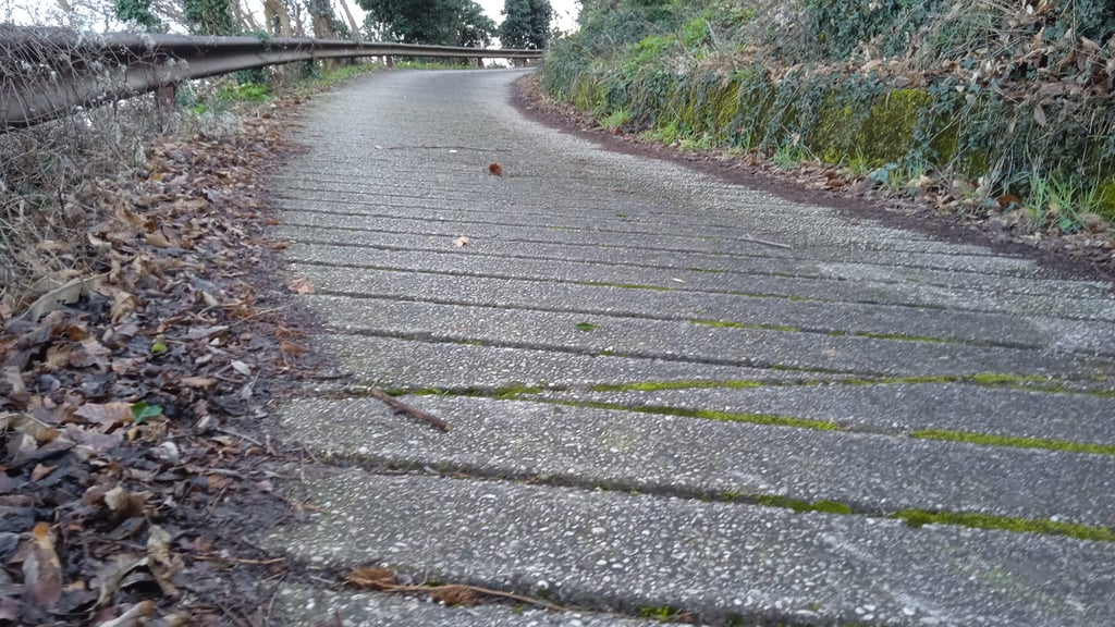
The surface is concrete, etched with transverse grooves that make it quite difficult to climb up a slope that is in itself quite hard.
From the point of view of the alimetry, the profile says it all: it is a succession of short, rather violent tears, fortunately interspersed with easier stretches, but there is no real interval to recover, to the point that it will be no small comfort to glimpse the signs indicating the approach to the plant, preceded by the steepest fifty metres of the entire climb, those of the last bend.
All in all, not a small effort, made heavier by the narrowness of the road and the uneven surface, often covered with branches and leaves.
Obviously, the descent must be taken with great caution and attention to unevenness.
I did not give it five stars only because the summit is disfigured by antennas, otherwise it would certainly have deserved top marks.
A dire il vero non si tratta di un'alternativa per salire a Calaone, ma di una salita che parte proprio da Calaone. Quindi all'ascesa al Monte Cero va aggiunta una delle opzioni che si possono scegliere per salire fino a Calaone, e come si vede da quanto descritto, ce ne sono di piuttosto impegnative.
L'ascesa da Calaone alla vetta del Monte Cero presenta numerose peculiarità. Intanto permette di raggiungere proprio la cima del colle (evento abbastanza raro), dove si impatta in un'enorme impianto per le telecomunicazioni che però non impedisce vedute eccezionali, sia verso sud che verso nord ovest. Poi è una salita che si inerpica sul colle compiendo una spirale destrorsa intorno alla cima, permettendo di esporsi a tutti i punti cardinali e ricordando un po' alla lontana altre rampe famose come il Puy de Dome. Infine si snoda su una strada strettissima, in cui è possibile affiancare un'altra bici, o un escursionista, ma è già pressochè impossibile scambiarsi con un'auto o un mezzo per la riparazione delle antenne (incontri per la verità piuttosto rari).
Il fondo è in cemento, inciso da solchi trasversali che ostacolano non poco la salita su una pendenza di per sè abbastanza dura.
Dal punto di vista dell'alimetria il profilo dice tutto: si tratta di un susseguirsi di brevi strappi piuttosto violenti, per fortuna intervallati da tratti più facili, ma un vero e proprio intervallo per recuperare non c'è, al punto che sarà di non poco conforto intravedere i cartelli che segnalano l'approssimarsi dell'impianto preceduto per l'appunto dai cinquanta metri più ripidi di tutta la salita, quelli dell'ultima curva.
Nel complesso una faticata di non poco conto, resa più pesante dalla ristrettezza della strada e dal fondo sconnesso, spesso ricoperto da rami e foglie.
Ovviamente la discesa va presa con grande cautela e attenzione alle sconnessioni.
Non ho dato cinque stelle solo perchè la vetta è deturpata dalla antenne, altrimenti avrebbe meritato sicuramente il massimo dei voti.