| Beautiful scenery |
| Hidden gem |
| #93 toughest climb of Belgium |
| #10 most elevation gain of Pays de Herve |
| #84 average steepest climb of Liège Province |
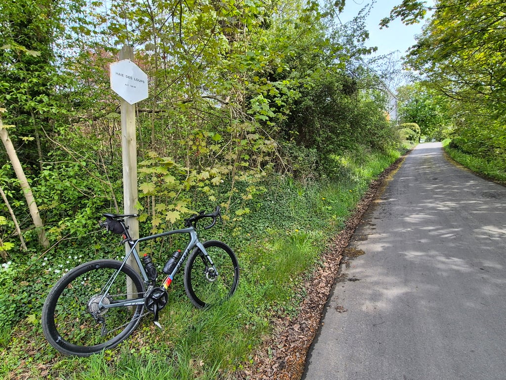
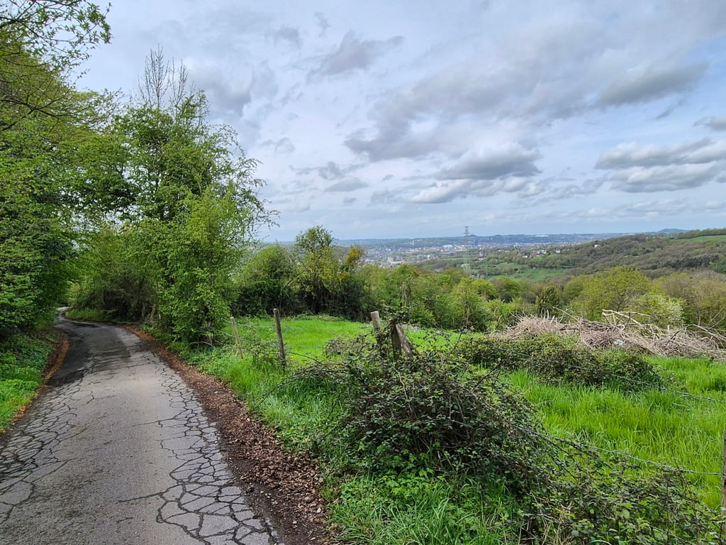
Haie des Loups is a climb in the region Pays de Herve. It is 1.1 mi long and bridges 548 ft of vertical ascent with an average gradient of 9.6%, resulting in a difficulty score of 171. The top of the ascent is located at 804 ft above sea level. Climbfinder users shared 6 reviews of this climb and uploaded 7 photos.
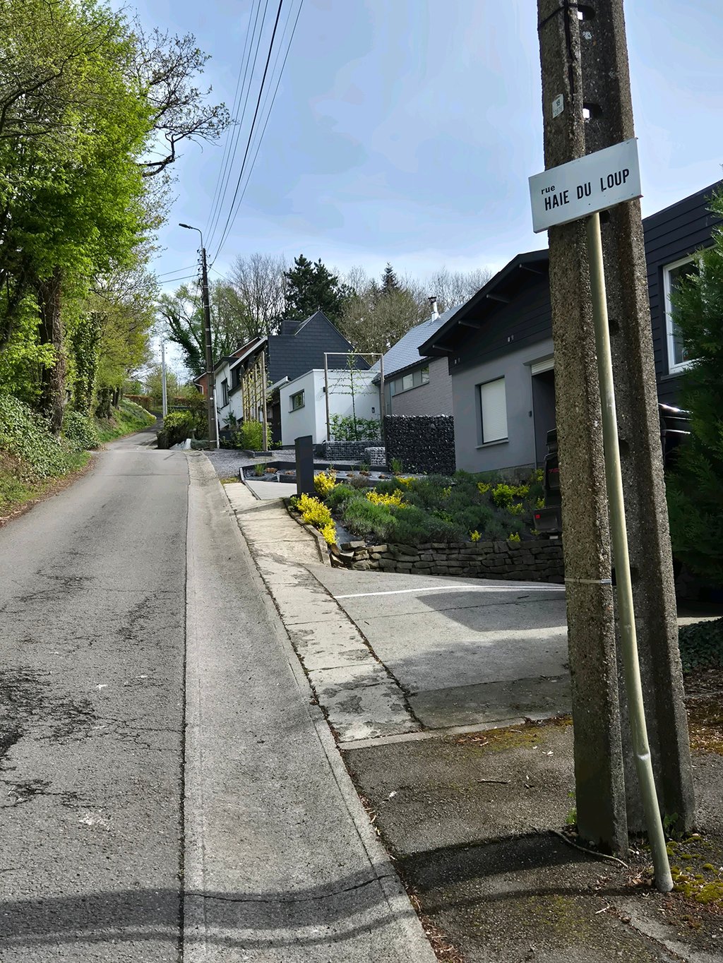
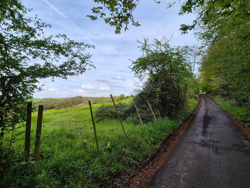
Road names: Rue des combattants (N621), Rue du Cimentière, Rue Haie des Loups & rue pireux
5.0 by RogerThijsThis is an automatic translation, the original language is: Dutch.Vaux-sous-Chèvremont is one of those Walloon municipalities which have the luxury of a painful choice between serious climbs. From the roundabout under the gigantic TGV monstrosity, a sort of oversized above ground tunnel which crosses the Vesdre here, your passion for the steepness is tested. Shall I go left, straight ahead or right around the valley? For the real doubters there is no escape: all three or the gladioli. To do the trio you will have to descend the N61 a couple of times, a dizzy... read more
Welcome! Please activate your account if you would like to share something. Look for the verification email in your inbox.
If you want to upload your photos, you need to create an account. It only takes 1 minute and it's completely free.
Nice climb that starts in not very attractive surroundings but after you pass a cemetery on your left the houses become nicer and the road correspondingly steeper. At a kink to the left you have to stand on the pedals for a while, but otherwise it is doable in terms of gradient. Incidentally, you pass a crossing sign indicating the top of the Haie des Loups, but the climb then continues for quite a bit through a more wooded area with over your left shoulder a beautiful view of the Ourthe Valley. I think it's a top climb!
Mooie klim die begint in een niet echt aantrekkelijke omgeving maar nadat je aan je linkerhand een begraafplaatsen gepasseerd worden de huizen mooier en de weg navenant steiler. Bij een knik naar links moet je even op de pedalen staan, maar verder is het qua stijgingspercentages wel te doen. Overigens passeer je bij een kruisingen bord dat de top van de Haie des Loups aanduidt, maar de klim gaat dan nog een flink stuk door door een bosrijkere omgeving met over je linkerschouder een prachtig uitzicht op de Ourthevallei. Ik vind het een topklim!
Vaux-sous-Chèvremont is one of those Walloon municipalities which have the luxury of a painful choice between serious climbs. From the roundabout under the gigantic TGV monstrosity, a sort of oversized above ground tunnel which crosses the Vesdre here, your passion for the steepness is tested. Shall I go left, straight ahead or right around the valley?
For the real doubters there is no escape: all three or the gladioli. To do the trio you will have to descend the N61 a couple of times, a dizzy slope where the daredevils can easily get over 70. But watch out for the easy looking bends.
To complete the test, the slopes are neatly arranged by gravity, although they are very similar. The most difficult one for me is the left one; the Haie des Loups (in the course of the climb the climber gets treated with different spellings).
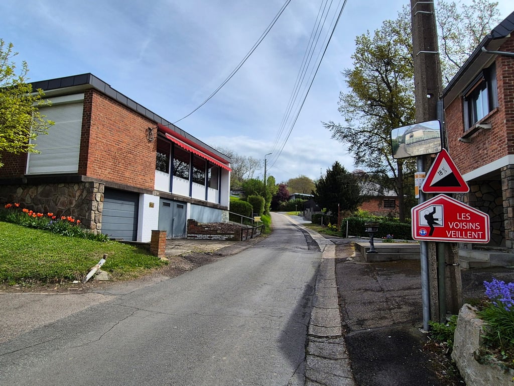
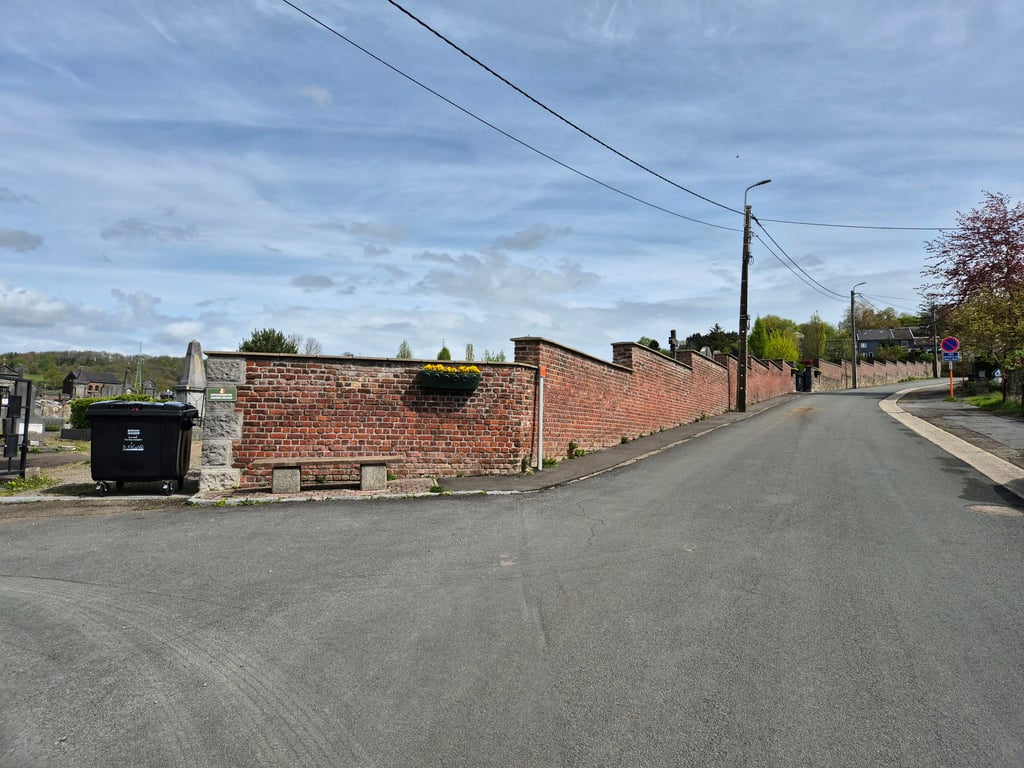
A hundred meters after the roundabout you turn left into Rue du Cimétiere. Another hundred meters further on a fork in the road forces you to choose: keep left and go straight to the cemetery (the gate is often invitingly open); on the right side you find the Wolvenhaag. At first the approach seems easy, provided that you are already in the neighbourhood of the smallest one, but after a hundred meters the steepness of the path is overwhelming, stimulated by a traffic sign that proudly states 18%. To the left and right, detached houses and green slopes glide by; below you, the road surface becomes more Walloon by the hectometre, even though civilisation has also taken hold here. To comfort you, the Haie meets you three times with a short plateau, just enough to calm your calves. Two kilometers after the roundabout you'll find yourself in the messy inner court of Romsee where you can enjoy the charming old buildings between the alleys.
Vaux-sous-Chèvremont is een van die Waalse gemeenten die de luxe kennen van de pijnlijke meerkeuze tussen serieus klimwerk. Vanaf de rotonde onder het draculeuze gedrocht voor de TGV, een soort overbemeten bovengrondse tunnel die hier de Vesdre passeert, wordt je passie voor de steilte stevig op de proef gesteld. Zal ik langs links, rechtdoor of rechtsom de vallei ontstijgen?
Voor de echte twijfelaars is er geen ontkomen aan: alledrie of de gladiolen. Om het trio te doen zul je een paar keer de N61 omlaag moeten, een duizelhelling waar de durvers met gemak boven de 70 raken. Maar kijk uit voor de gemakkelijk ogende bochten.
Om het proefstuk compleet te maken liggen de hellingen keurig gerangschikt op zwaarte, al doen ze weinig voor elkaar onder. De venijnigste voor mij is de linkse; de Haie des Loups (in de loop van de klim wordt de klimmer overigens op verschillende schrijfwijzen getrakteerd).
Honderd meter na de rotonde sla je links de Rue du Cimétiere in. Weer honderd meter verder dwingt een splitsing je te kiezen: links aanhoudend rij je recht het kerkhof op (de poort staat vaak uitnodigend open); rechts de Wolvenhaag. Aanvankelijk lijkt de aanloop gemoedelijk, vooropgesteld dat je al in de buurt van de kleinste geschakeld staat, maar na honderd meter slaat de steilte je om de oren, aangewakkerd door een verkeersbord met een trotse vermelding van 18%. Links en rechts glijden vrijstaande huizen en groen bestruikte taluds voorbij, onder je wordt het wegdek per hectometer Waalser, al heeft de beschaving ook hier toegeslagen. Om je te troosten komt de Haie je tot driemaal toe tegemoet met een kort plateau, net genoeg om de kuiten even tot bedaren te brengen. Twee kilometer na de rotonde beland je op het rommelige binnenpleintje van Romsee waar je tussen de steegjes van aandoenlijke bouwsels van weleer kan genieten.
I did this climb today after the Côte des Trixhes, and it is indeed anything but regular. At the start, there is a 18% sign, and where you can go left (Le Vert chemin), it gets much steeper on average than indicated.
As for the climb, it is terrible because of the variation. After the crossroads, when you have left the first overgrowth and ride on a flatter part, you think you've had the worst of it, but twice very steep parts are waiting for you in succession after some faint bends. Because of this, there seems to be no end to it. Worthy of a second place in Land van Herve!
Deze klim vandaag gedaan aansluitend op Côte des Trixhes, en hij is inderdaad allesbehalve regelmatig. Aan het begin een bordje van 18%, en waar je naar links kunt (Le Vert chemin) wordt het gemiddeld veel steiler als aangegeven.
Wat betreft de klim: vreselijk door de afwisseling. Als je na het kruispunt de eerste overgroei uit bent en op een vlakker stukje rijdt denk je het ergste gehad te hebben, maar tot twee keer toe staan je hele steile stukjes te wachten in opvolging van elkaar na flauwe bochtjes. Hierdoor lijkt er geen einde aan te komen. Tweede plaats in Land van Herve waardig!
The description that this is a regular climb is absolutely not correct. Sections of 15% or maybe even more are constantly alternated with sections of 'false flat'. This makes it absolutely impossible to get into your rime. Road surface is indeed bad, the road is however very quiet.
De beschrijving dat dit een regelmatig klim is klopt absoluut niet. Stukken van 15% of misschien zelfs meer worden constant afgewisseld met stukken 'vals plat'. Hierdoor kun je absoluut niet in je rimte komen. Wegdek is inderdaad slecht, de weg is echter wel heerlijk rustig.
What a wretched thing. Came across it on the way back from La Redoute. Road surface is as you are used to around Liege ... not the best. View on the Ourthe is beautiful.
Wat een ellendig ding. Kwam hem tegen op de terugweg vanaf La Redoute. Wegdek is zoals je gewend bent rond Luik...niet best. Uitzicht is op de Ourthe is fraai.
Nice climb, with very steep parts. There is no traffic and the road surface is ok, but the climb is also quite short. I think it is only worthwhile to combine it with the Haute Folie and the Bois de Beyne, then you have 6 km of climbing.
Mooie beklimming, met zeer steile stukjes. Er is geen verkeer en het wegdek is oké, maar de beklimming is ook redelijk kort. Volgens mij enkel de moeite waard als je hem combineert met de Haute Folie en de Bois de Beyne, dan heb je toch 6 klimkilometers.
| 5 mph | 00:13:02 |
| 7 mph | 00:09:14 |
| 9 mph | 00:07:11 |
| 12 mph | 00:05:24 |
This page is better in the app