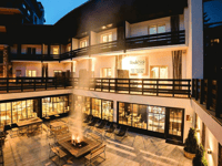
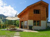
Tips nearby


| Famous climb |
| 9 hairpin turns |
| #48 toughest climb of Provence-Alpes-Côte d'Azur |
| #58 most elevation gain of France |
| #90 longest climb of Europe |
| #92 average steepest climb of Briançon |
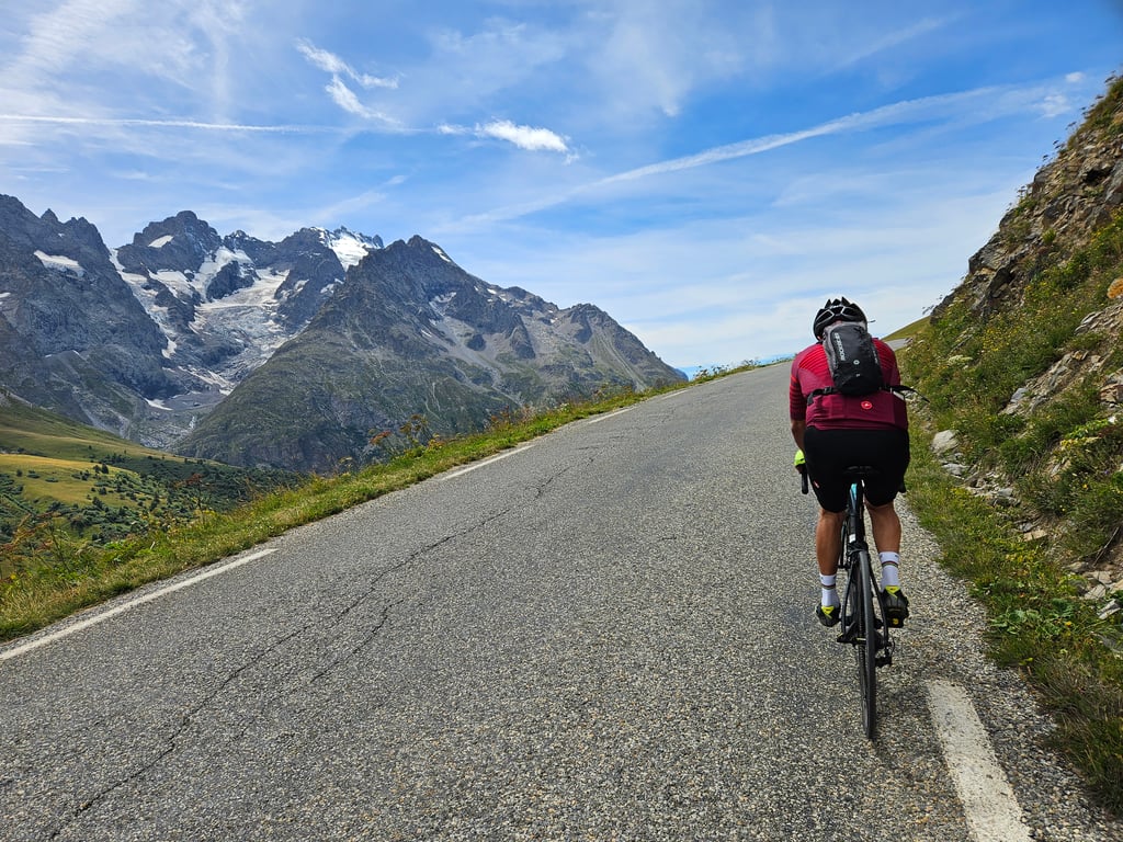
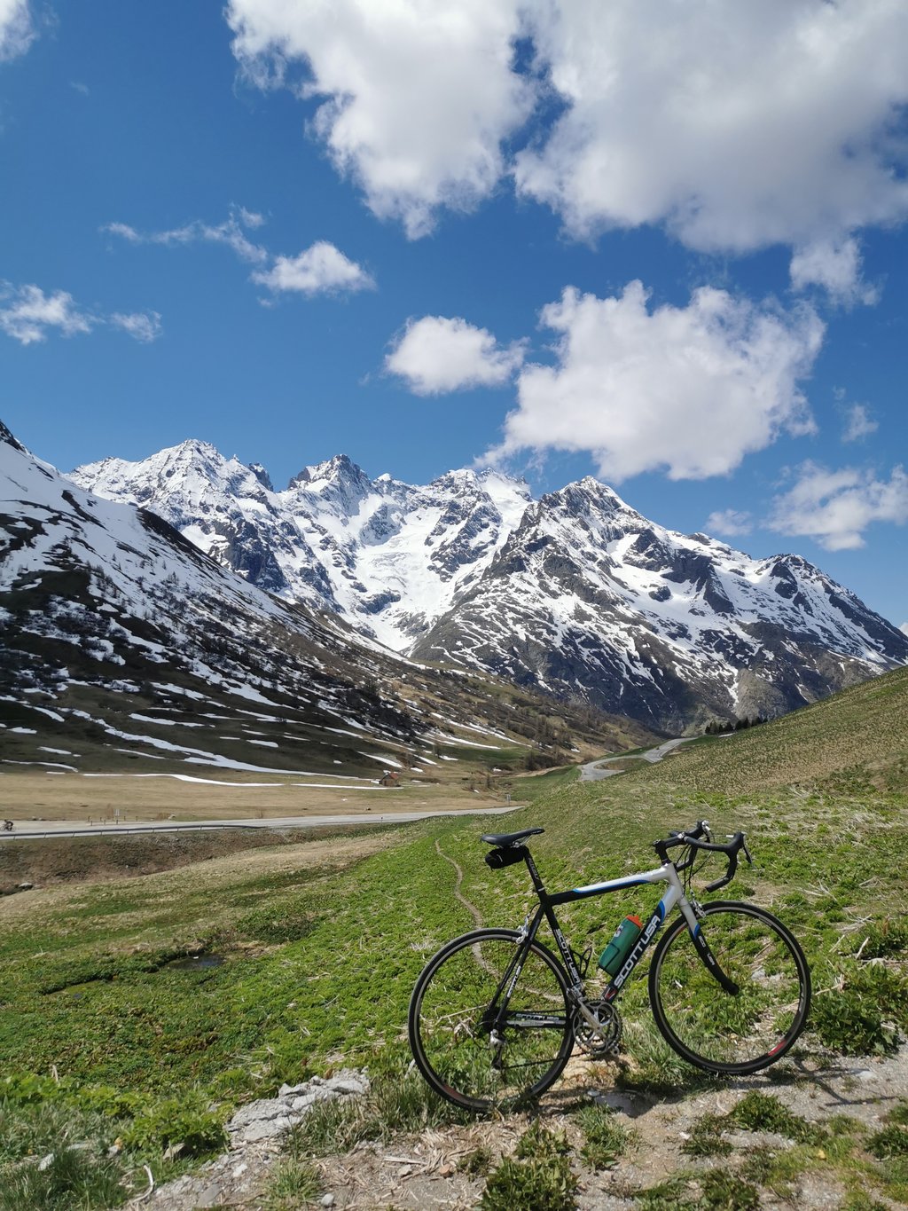
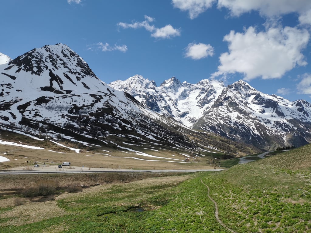
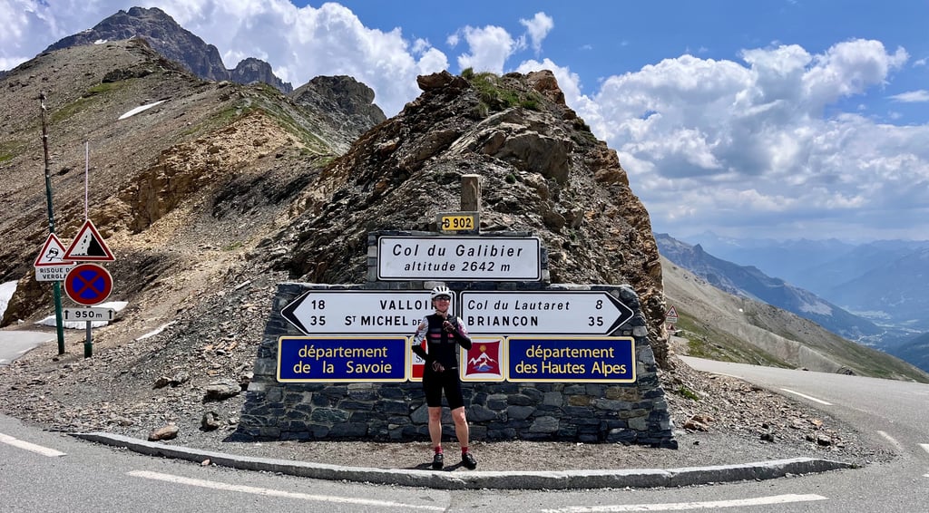
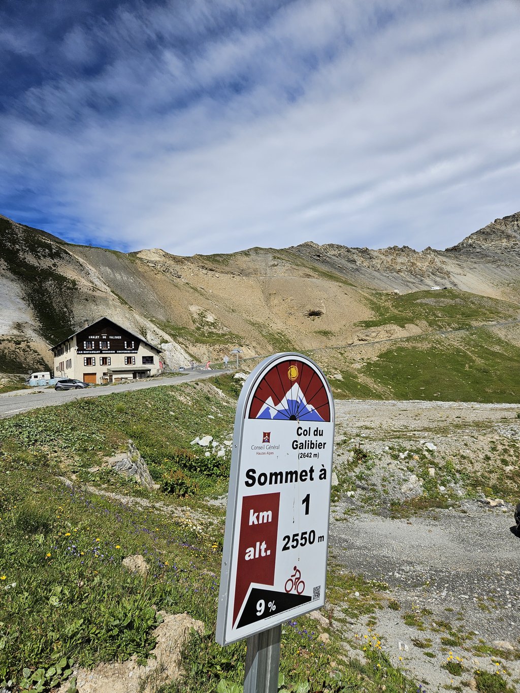
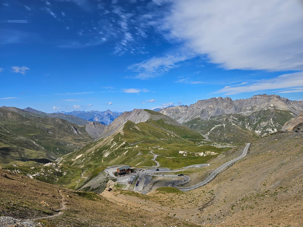
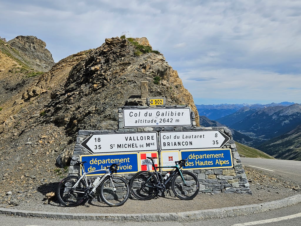
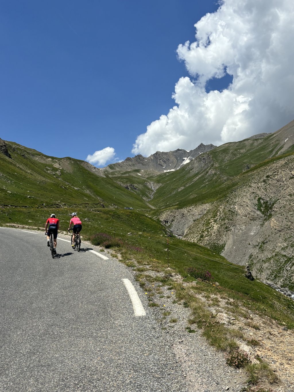
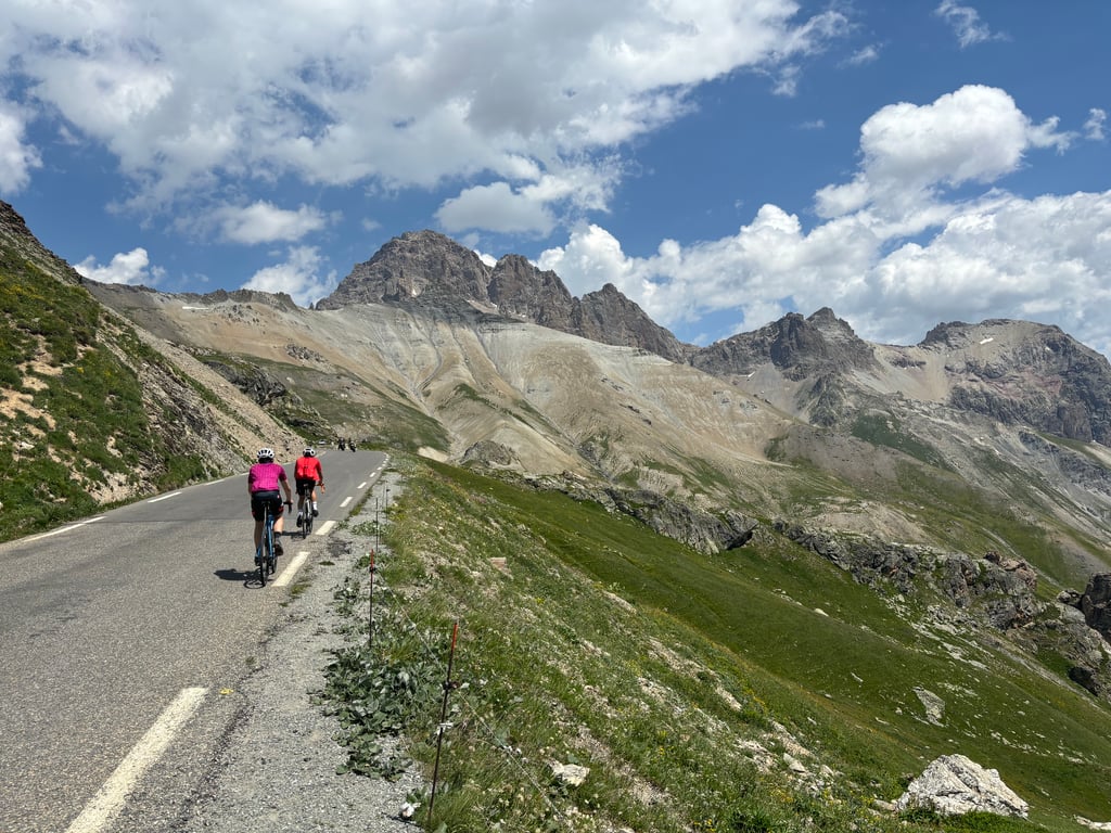
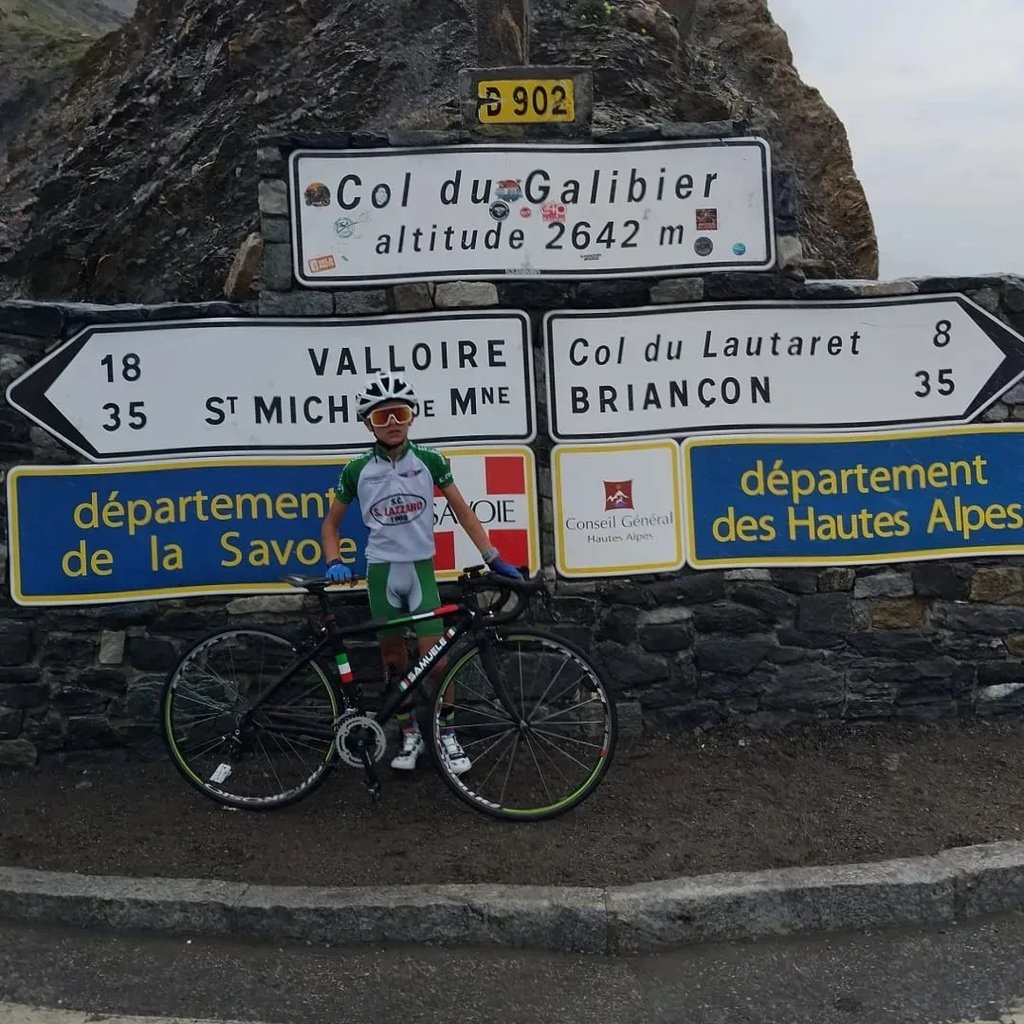
Col du Galibier from Briançon is a climb in the region Briançon. It is 21.6 mi long and bridges 4587 ft of vertical ascent with an average gradient of 4%, resulting in a difficulty score of 782. The top of the ascent is located at 8668 ft above sea level. Climbfinder users shared 17 reviews of this climb and uploaded 47 photos.
Road name: D1091
5.0 by MauroBrescianiThis is an automatic translation, the original language is: Italian.A climb to do at least once in your life. Up to the Lautaret it is quite obnoxious, climbs very little and with traffic and headwind it was unbearable for me except that on the return you do it all at an easy 65kmh with no particular bends. From the Lautaret at 2000m (where you find bars and kiosks) the real climb begins, never hard except for the last km where I saw a few stretches at 13%. Unmissable views. Always good asphalt... read more
Welcome! Please activate your account if you would like to share something. Look for the verification email in your inbox.
If you want to upload your photos, you need to create an account. It only takes 1 minute and it's completely free.
Long but not difficult climb, with sublime scenery especially from just before the Lautaret and up to the Col du Galibier. After the Col du Lauteret you really breathe the air of great cycling, it is a climb that must be done at least once!
Salita lunga ma non difficile, dal paesaggio sublime soprattutto da poco prima del Lautaret e fino al Col du Galibier. Dopo il Col du Lauteret si respira davvero l'aria del grande ciclismo, è una salita che va fatta almeno una volta!
The climb to Lautaret is not necessarily the prettiest climb, but given that it is very runnable, it is also not very tough.
However, the climb from Lautaret to Galibier is incredibly beautiful, with nicer gradients.
You can see the birds of prey circling right above your head here. And you have very nice views of the peaks of the Ecrins. Very impressive.
De klim naar Lautaret is niet per sé de mooiste klim, maar gezien deze zeer lopend is, is dit ook niet zeer zwaar.
De klim van Lautaret naar Galibier is echter ongelooflijk mooi, met leukere stijgingspercentages.
Je ziet de roofvogels hier vlak boven je hoofd cirkelen. En je hebt een zeer mooi uitzicht op de toppen van de Ecrins. Zeer indrukwekkend.
A climb to do at least once in your life. Up to the Lautaret it is quite obnoxious, climbs very little and with traffic and headwind it was unbearable for me except that on the return you do it all at an easy 65kmh with no particular bends. From the Lautaret at 2000m (where you find bars and kiosks) the real climb begins, never hard except for the last km where I saw a few stretches at 13%. Unmissable views. Always good asphalt
Salita da fare almeno una volta nella vita. Fino al Lautaret è abbastanza odiosa, sale davvero poco e con traffico e vento contrario è stata per me insopportabile se non che al ritorno la fai tutta a 65kmh facili facili senza curve particolari. Dal Lautaret a 2000m (dove trovi bar e chioschi) parte la vera salita, mai dura se non nell'ultimo km dove ho visto qualche tratto al 13%. Imperdibile la vista. Asfalto sempre buono
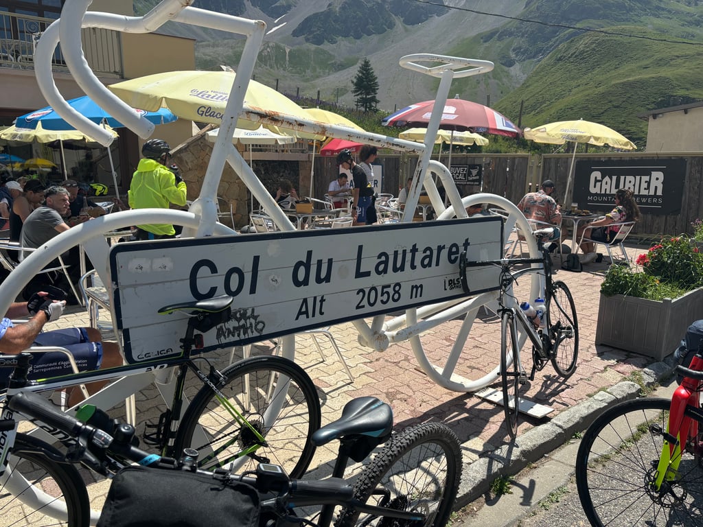
The easiest way to climb the Galibier. It is a gentle ascent to the summit of the Lautaret and only the last few kilometres are really strenuous. Great views but a lot of traffic.
Die einfachste Möglichkeit, den Galibier zu erklimmen. bis zum Gipfel des Lautaret ist es eine sanfte Steigung und nur die letzten Kilometer sind wirklich anstrengend. Tolle Aussichten aber sehr viel Verkehr.
It's an easy climb, but one that can get you started before you go to the Galibier. Best done before July and August, as there are a lot of cars. The finish on the Meije remains one of the most beautiful places in France!
Une rampe facile mais qui peut déjà entamer avant d'aller au Galibier. À faire avant juillet-Août car beaucoup de voitures. L'arrivée sur la Meije reste un des endroits les plus beaux de France !
ridden several times after an accident to rehabilitate with a 39x26
17 minutes gained in 8 days
thank you Galibier
monté à plusieurs reprises après un accident pour me rééduquer avec un 39x26
17mn de gagnés en 8 jours
merci Galibier
Col Du Galibier at 10 in the rain finished in the hut drinking warm milk !!!
Beautiful climb.
Col Du Galibier a 10 anni sotto la pioggia finiti nel rifugio bevendo un latte caldo !!!
Bellissima salita.
inevitable in a cyclist's CV. impossible to climb and not think of Pantani's exploits
immancabile nel curriculum di un ciclista. impossibile salire e non pensare alle imprese di Pantani
A good idea to do before the cars pass through; the valley from Serre Chevalier to Le Lautaret is a boulevard, but the road has wide cycle lanes. The view from the top of Le Lautaret is magnificent, with a panoramic view of the Meije. Once past Le Lautaret, the traffic is very calm.
A faire avant le passage des voitures, la vallée de Serre Chevalier jusqu'au Lautaret est un boulevard, mais la route comprend des bandes cyclables larges. La vue à partir de l'arrivée sur le Lautaret est magnifique, avec un panorama sur la Meije. Passé le Lautaret, le trafic est très calme.
The climb has always been on my short list along with Bonette and Mont Ventoux. An absolutely stunning place, worth recommending. I expected more difficulty, but I didn't expect such beautiful views. The only drawback is a lot of car and motorbike traffic. I will be back here next year!
Podjazd od zawsze był na mojej krótkiej liście razem z Bonette i Mont Ventoux. Absolutnie wspaniałe miejsce, wart polecenia. Spodziewałem się większych trudności, ale nie spodziewałem się tak pięknych widoków. Jedynym mankamentem jest spory ruch samochodów i motocykli. Wróce tu za rok!
The south side is much easier than the north side (via the Télégraphe).
The first section from Briançon serves as a warm-up. The road is wide and good, but very busy. At times, it's like a motorway :( The first few kilometres to Mônetier are a very easy false flat. In the last few km before the Col du Lautaret, the gradient gently steepens: 4 to 6%. Already at Le Lautaret, the view of the Ecrins is magnificent.
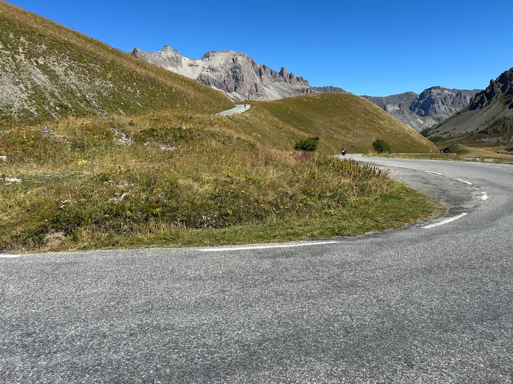
The last 8km, above Le Lautaret and towards Galibier, evolve between 5 and 8%. It's never really difficult, but if you're looking to climb at full power (remembering Pogi's attack this year in the TDF...), don't forget that you'll be limited by the lack of oxygen at this altitude.
Nevertheless, this section up to the col is sublime and the view of the Meije is absolutely fantastic. One of the most beautiful panoramas in the Alps!
NB: I did this climb on a Saturday morning (02/08/24) and was pleasantly surprised by the fact that there weren't too many vehicles between Le Lautaret and Le Galibier. On another occasion, I climbed this pass in a constant stream of cars, motorbikes and camper vans. So choose your day carefully and try to leave early enough in the morning not to be bothered.
Le versant sud est beaucoup plus facile que l'intégrale (via le Télégraphe) côté nord.
La première partie depuis Briançon sert d'échauffement. La route est large et bonne, mais très fréquentée. A certains moments, c'est une vraie autoroute :( Les premiers km jusqu'au Mônetier sont un faux-plat très facile. Dans les derniers km avant le col du Lautaret, la pente s'accentue doucement : 4 à 6%. Déjà au Lautaret, la vue sur les Ecrins est magnifique.
Les 8 derniers km, au-dessus du Lautaret et vers le Galibier, évoluent entre 5 et 8%. Ce n'est jamais vraiment difficile, mais si vous cherchez à monter à pleine puissance (en vous souvenant de l'attaque de Pogi cette année dans le TDF...), n'oubliez pas que vous serez limités par le manque d'oxygène à cette altitude.
Néanmoins, cette section jusqu'au col est sublime et la vue sur la Meije est absolument fantastique. Un des plus beaux panoramas des Alpes !
NB : j'ai fait cette montée un samedi matin (02/08/24) et j'ai été agréablement surpris par le fait qu'il n'y avait pas trop de véhicules entre le Lautaret et le Galibier. Il m'est arrivé une autre fois de gravir ce col dans un flot continu de voitures, de motos et de camping cars. Donc choisissez bien votre jour et essayez de partir assez tôt le matin pour ne pas être embêtés.
These are two successive climbs, each with its own character: up to the Lautaret it is not steep, if you are unlucky the wind is a bigger obstacle than the ascent. You spend the whole time on a busy through road, with cars's, motorhomes and even buses and trucks sometimes skimming past you. For this part, I would hesitate between 1 or 2 stars. But once on the Lautaret, you turn right to the Galibier, from where you climb a quiet, narrow mountain road, with beautiful views of Les Ecrins. This section is definitely worth 5 stars!
Dit zijn twee opeenvolgende klimmen met elk een eigen karakter: tot aan de Lautaret is het niet steil, als je pech hebt is de wind een grotere hindernis dan de stijging. Je rijdt de hele tijd op een drukke doorgaande weg, met auto's, campers en zelfs bussen en vrachtwagens die soms rakelings langs je scheren. Voor dit deel zou ik twijfelen tussen 1 of 2 sterren. Maar eenmaal op de Lautaret draai je rechtsaf naar de Galibier, vanwaar je een rustig, smal bergweggetje beklimt, met prachtige uitzichten op Les Ecrins. Dit deel is absoluut 5 sterren waard!
This is not the difficult part. The climb to Lautaret is very easy, but what a view! The final stretch towards the Galibier, after the bend, is already more difficult. Be careful with the altitude and the slope after the stele.
Ce n'est pas le côté difficile. La montée jusqu'au Lautaret est très roulante, mais quelle vue ! Le final vers le Galibier, après le virage est déjà plus corsé. Attention à l'altitude, et à la pente après la stèle.
The climb is long but not difficult, following a wide and good road to the Col du Lautaret before turning right onto the narrower Galibier road. Once over the Lautaret, at each change of direction you can see an exceptional panorama in the middle of a peaceful nature.
Ascension longue mais pas difficile. évoluant sur une route large et en bon état jusqu'au col du Lautaret avant de tourner à droite et prendre la route plus étroite du Galibier. Une fois le Lautaret franchi, à chaque changement de direction on peut voir un panorama exceptionnel au sein d'une nature paisible.
Beautiful and as the first mythical pass to go for when you are not yet a seasoned cyclist, it's perfect. The views are obviously breathtaking, especially on the Galibier.
Splendide et comme premier col mythique à aller décrocher quand on n'est pas encore un cycliste chevronné, c'est parfait. Les vues sont évidemment époustouflantes, surtout dans le Galibier.
Mythical ascent, you'll be amazed! Done in July, overcast, on a Sunday. I would separate it in 3 parts.
1. Up to the summit, flat and flat uphill, a fairly rolling part but be careful not to lose too much strength.
2. From Monetier to Lautaret. Gentle slope, with small bends at the beginning, the road is quite wide and allows to be overtaken quite easily by cars. The glacier du monetier stretches on the left, the Meije and the Galibier appear on the right.
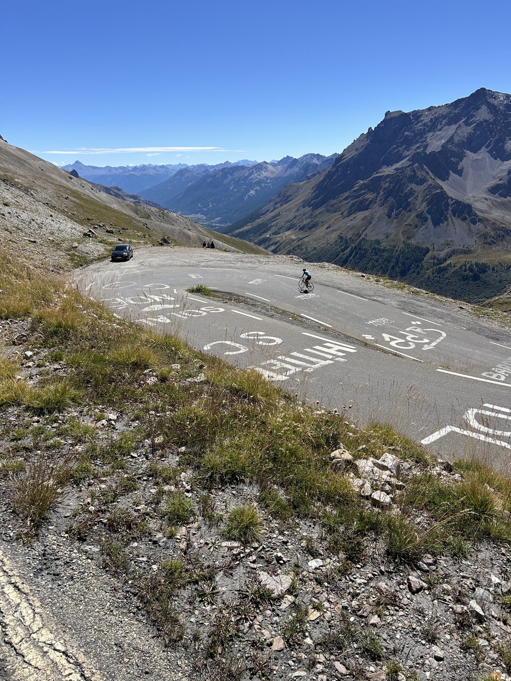
3. From Lautaret to Galibier. The slopes become steeper, the temperature drops and the wind appears. There are many hairpin bends, which are almost restful because they are less steep. The last kilometer is for my taste the most difficult, both in terms of power (linked to the fatigue of the previous ones) and inclination (between 10 and 12%), it leaves time to admire the view over the valley and to savor the work once you reach the top.
Montée mythique, on en prend plein les yeux! Réalisée en juillet, temps couvert, un dimanche. Je la séparerais en 3 parties.
1. Jusqu'au monetier, plat et faux plat montant, une partie assez roulante mais attention à ne pas y laisser trop de forces.
2. Du monetier au Lautaret. Pente douce, avec des petits virages au début, la route est assez large et permet de se faire dépasser assez facilement par les voitures. Le glacier du monetier s'étend sur la gauche, la Meije et le Galibier font leur apparition au loin toit droit.
3. Du Lautaret au Galibier. Les pentes s'accentuent, la température diminue et le vent fait son apparition. De nombreux lacets, qui sont presque "reposants" puisque moins pentus. Le dernier kilomètre est à mon goût le plus difficile, tant en termes de puissance (liée à la fatigue des précédents) que de l'inclinaison (entre 10 et 12%), cela laisse le temps d'admirer la vue sur la vallée et de savourer le travail une fois arrivée en haut.
Mythical climb to do absolutely, especially on days reserved for cycling 👍
Superb Guisane valley with a busy but quite wide road, then Lautaret pass with magnificent view on the Meije😱. Then sublime👍👍👍👍 ascent of Galibier.
Montée mythique à faire absolument, surtout les jours réservés aux vélo 👍
Superbe vallée de la Guisane avec une route fréquentée mais assez large, puis col du Lautaret avec vue magnifique sur la Meije😱. Puis montée du Galibier sublime👍👍👍
| 5 mph | 04:20:55 |
| 7 mph | 03:04:43 |
| 9 mph | 02:23:57 |
| 12 mph | 01:48:09 |
This page is better in the app