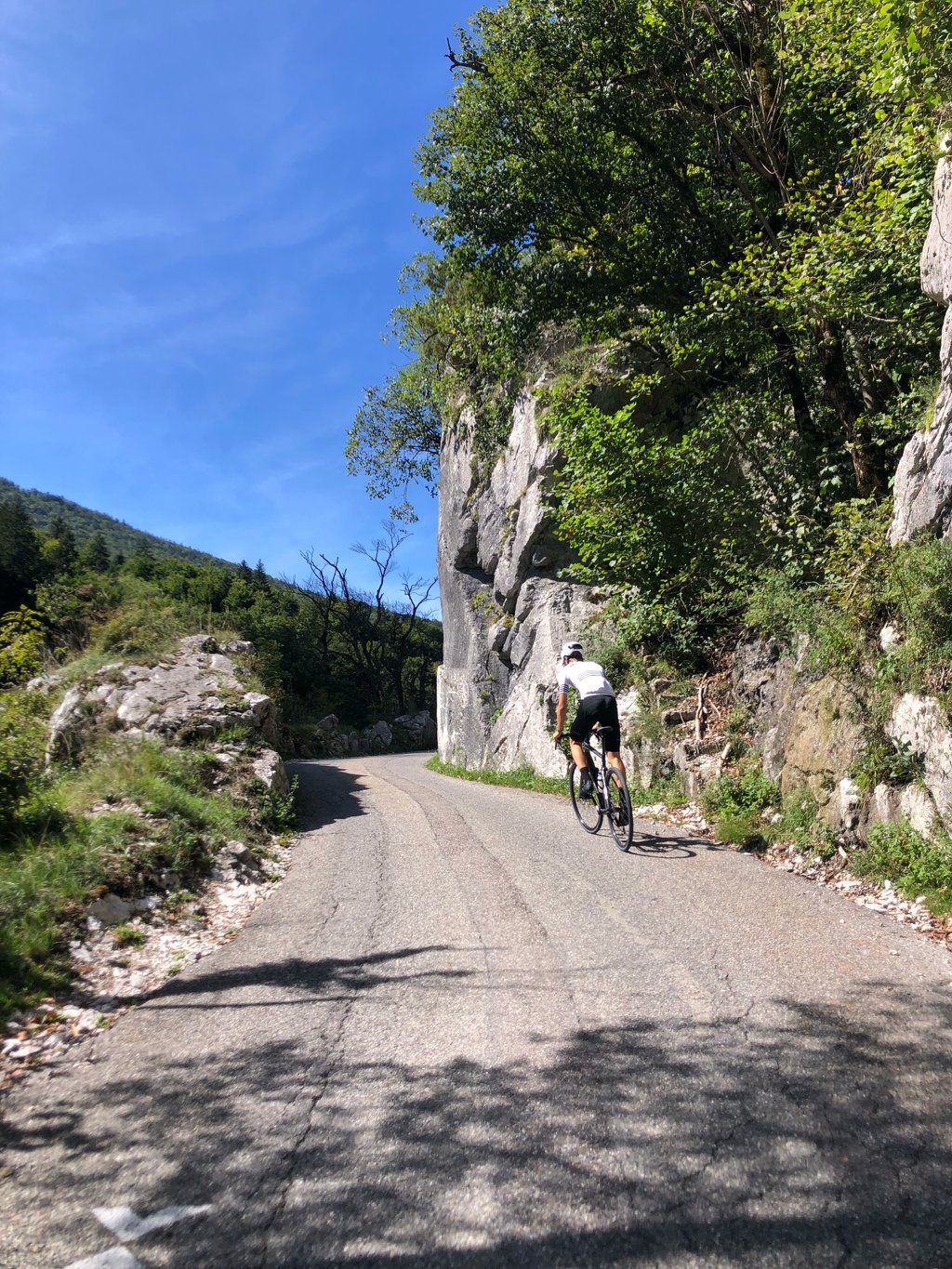
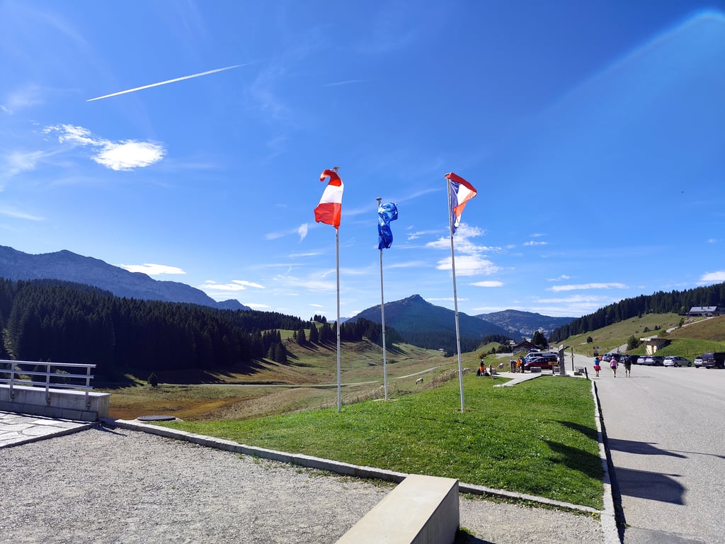
| Beautiful scenery |
| 12 hairpin turns |
| #45 toughest climb of Haute Savoie |
| #26 most elevation gain of Haute Savoie |
| #24 longest climb of Haute Savoie |
Col des Glières from Thorens-Glières is a climb in the region Annecy. It is 8.5 mi long and bridges 2687 ft of vertical ascent with an average gradient of 6%, resulting in a difficulty score of 656. The top of the ascent is located at 4744 ft above sea level. Climbfinder users shared 8 reviews of this climb and uploaded 21 photos.
Road name: D55
5.0 by LeflippeThis is an automatic translation, the original language is: English.Nice climb up a gorgeous calm and non tourist valley, easy at first and tough half way up. Opens up to the last 3km on the plateau des Glieres... read more
Welcome! Please activate your account if you would like to share something. Look for the verification email in your inbox.
If you want to upload your photos, you need to create an account. It only takes 1 minute and it's completely free.
very nice climb with 10 hairpins and a good climb. the road performance is good. not very busy.
très belle montée avec 10 épingles et bons dénivelé positif. le rendement de la route est bon. peu fréquenté.
Done on 6 September 2025 on a beautiful day. Very good surface, the climb takes place mainly in a shaded area, with a great view of the Plateau des Glières at the top, and there wasn't too much traffic that day. Before the tough descent to Entremont, there was a section of gravel track on the plateau.
Fait le 6 eptembre 2025 par une belle journée. Très bon revêtement, la montée se fait pricnipalement dans une partie ombragée, super point de vue en haut sur le plateau des Glières, pas trop de circulation ce jour là. Avant la descente costaud sur Entremont, passage sur piste type gravel sur le plateau.
It's a good climb up to the Plateau des Glières. The climb only really begins after Nant-le-sec (or Nant-sec). From there, it's a good but winding road that's regular around 10 % that awaits you. After the intermediate collet pass, there's a short descent and then the last kilometre is accessible, compared to the rest of the climb. At the top, you can cross the plateau and descend to Thorens-Glières on a beautiful descent, but the only access is a path where gravel tyres are a must!
C'est une bonne ascension qui permet d'arriver au plateau des Glières. L'ascension commence réellement qu'après Nant-le-sec (ou Nant-sec). Ensuite, c'est une route en bon état mais sinueuse qui est régulière autour des 10 % qui vous attend. Après le col intermédiaire du collet, il y a une petite redescente puis le dernier kilomètre est accessible, comparé au reste de l'ascension. En haut, il y a possibilité de traverser le plateau pour redescendre sur thorens-glières avec une belle descente, mais le seul accès est un chemin où les pneus de gravel s'imposent !
Nice climb up a gorgeous calm and non tourist valley, easy at first and tough half way up. Opens up to the last 3km on the plateau des Glieres
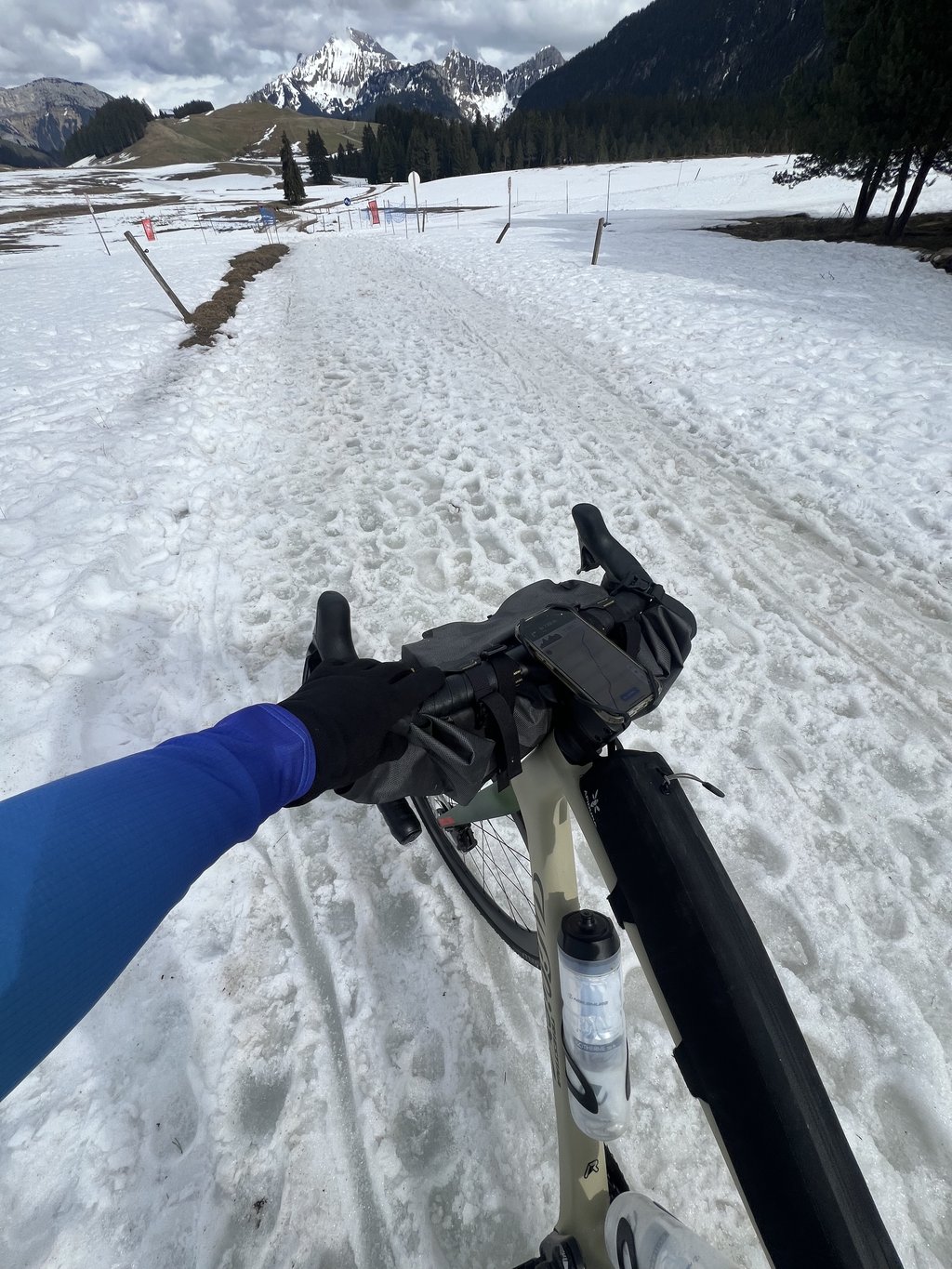
Climb in a gorgeous calm valley, starts very easy and then becomes painful halfway, to end on the beautiful plateau des Glieres. Did it end of March so had to walk by bike through the snow covered way to make my descent into le Petit Bornand
Made on 28 May 2024 with Éric.
A calm day in a rainy spring and we set off from Thônes for the Col des Glières via La Balme de Sillingy and Thorens Glières.
After a long approach on small, weary roads, we arrived at Thorens Glières at 11.30am for a snack before the real start of the Col.
At 12:20, we set off for the ascent on a gradient of 4-5% for 4.5km, passing through the villages of Usillon and Nant-Sec. 800m after the village of Nant-Sec, a hairpin bend to the left marks the start of the 7km climb at an average of 9%, with many sections at 11-12-13%;The tarmac is good and the road wide, with a lot of woodland, but there are a few gaps where you can enjoy the views, particularly of a waterfall and the Salève massif, around 20km away as the crow flies.
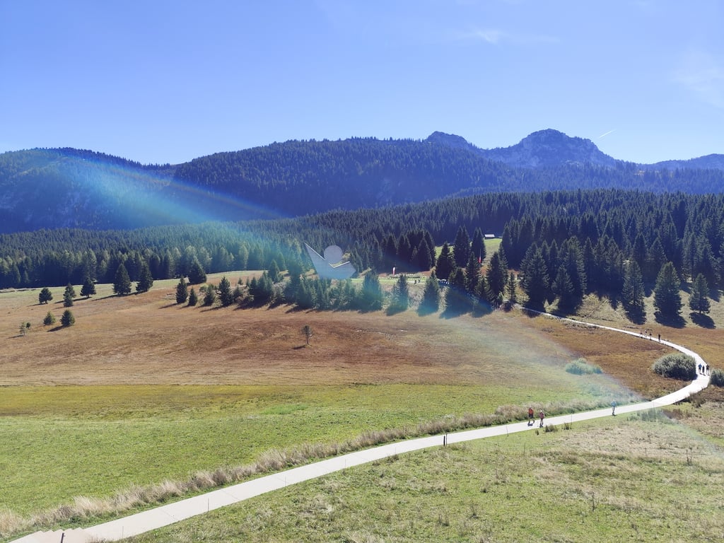
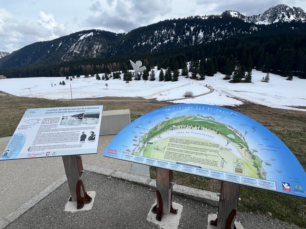
Normally, the end of the difficult section is at the Col du Collet, but there are no signs to indicate this, followed by a short but steep descent before the final straight ( 7% ) to the Plateau des Glières, a major Resistance site during the Second World War.
The monument itself is not accessible by car or bicycle, but only on foot via a wooden footbridge, which can be seen in the photo.
A number of French presidents have visited the monument to commemorate the 80th anniversary, including Emmanuel Macron on 7 April.
Ps: Traffic was moderate on this day, which is to say that it was a Tuesday and outside the summer period, otherwise in the middle of the holidays and at weekends there must be a lot of traffic.
The Climbfinder graph shows average percentages per kilometre, but there used to be a more accurate graph for 500m (from Nant Sec) that I kept and put on a photo, which better reflects the reality of the terrain.
Fait le 28 Mai 2024 avec Éric.
Une journée d’accalmie dans un printemps pluvieux et nous voilà partis nous installer à Thônes pour un départ vers le Col des Glières via la Balme de Sillingy et Thorens Glières.
Après une longue approche par de petites routes usantes, nous voilà à 11h30 à Thorens Glières pour une pause casse croûte avant l'entame réelle du Col.
12h20 c'est parti pour l’ascension dans une pente entre 4-5% pendant 4,5km avec traversée des villages de Usillon puis Nant-Sec , 800M après ce dernier village, un lacet sur la gauche amorce le départ de 7Km à 9% de moyenne avec de nombreux passages à 11-12-13%, seul les lacets pris à l'extérieur permettent une récupération salutaire, le bitume est bon et la route large, beaucoup dans les bois mais quelques trouées permettent d'avoir des points de vues, notamment sur une cascade et sur le massif du Salève situé à environ 20km à vol d'Oiseau.
Normalement la fin de la partie difficile se situe au Col du Collet mais aucun panneau n'indique ce dernier, ensuite une courte mais pentue descente avant la dernière ligne droite ( 7% ) d'arrivée sur le Plateau des Glières Haut lieu de la Résistance de la seconde guerre mondiale.
Le monument en lui même n'est pas accessible aux véhicules ni aux vélos, seulement à pied par une passerelle en bois que l'on aperçoit sur la photo.
Plusieurs présidents de la république y sont venus pour des commémorations dont Emmanuel Macron le 7 avril dernier pour les 80 ans.
Ps : La circulation automobile était modérée ce jour, à savoir que c'était un mardi et en dehors de la période estivale, sinon en pleine vacances et les week-end ça doit beaucoup circuler.
Le graphique Climbfinder présente des pourcentages moyens au kilomètre mais il existait un graphique plus précis sur 500M ( depuis Nant Sec ) que j'avais gardé et mis en photo, ce dernier correspond mieux à la réalité du terrain.
Starts from Thorens-Glières ... totaling ~14km..but the real climb starts from Nant Sec. The road itself is in good condition, and no real dangerous spots (eg. narrow with cars passing by to close etc). Pretty early in the climb you pass a waterfall... look up ...because it comes from really high up ...lots of hikers. as it often goes..you've a beautiful scenery when at the top.
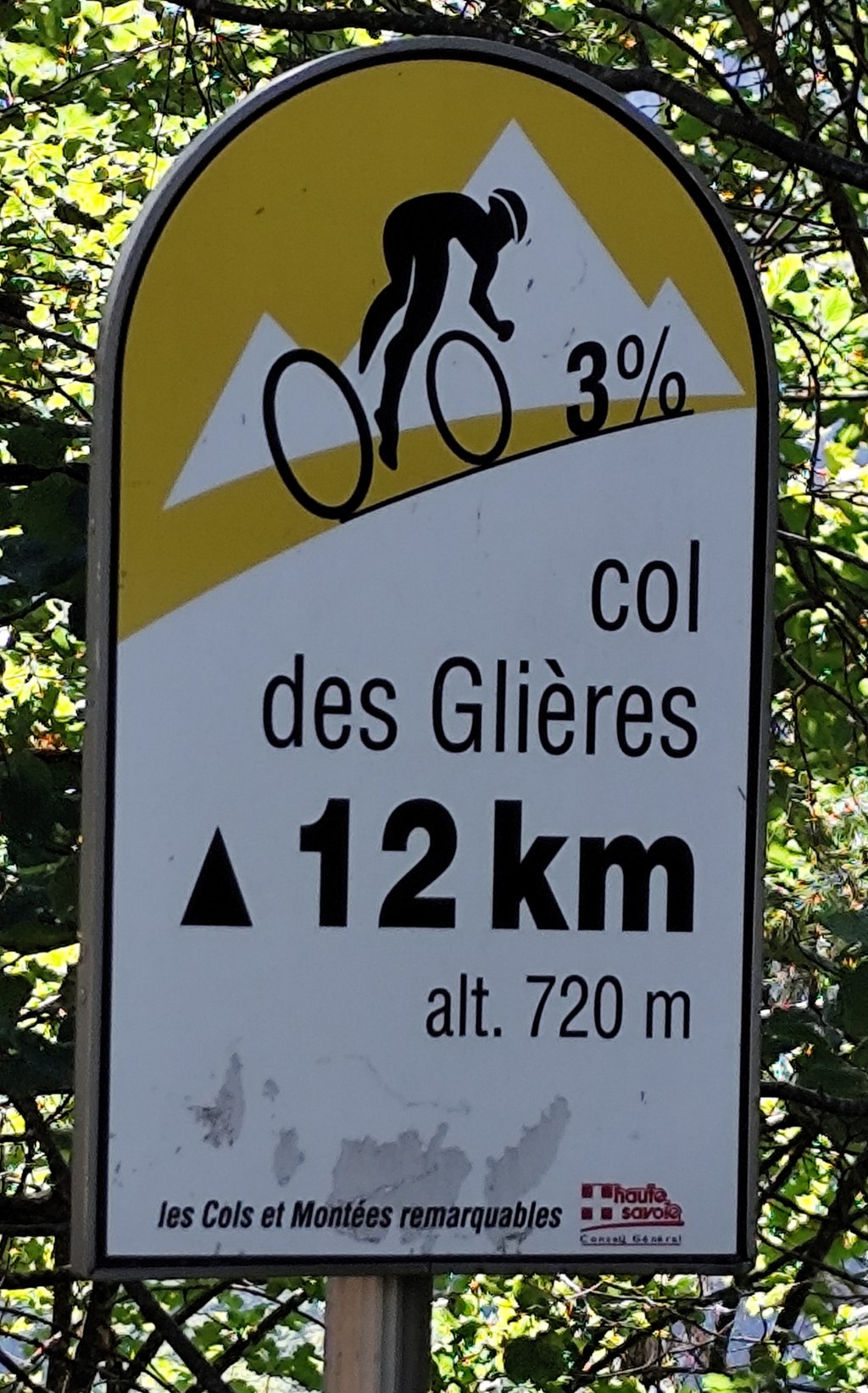
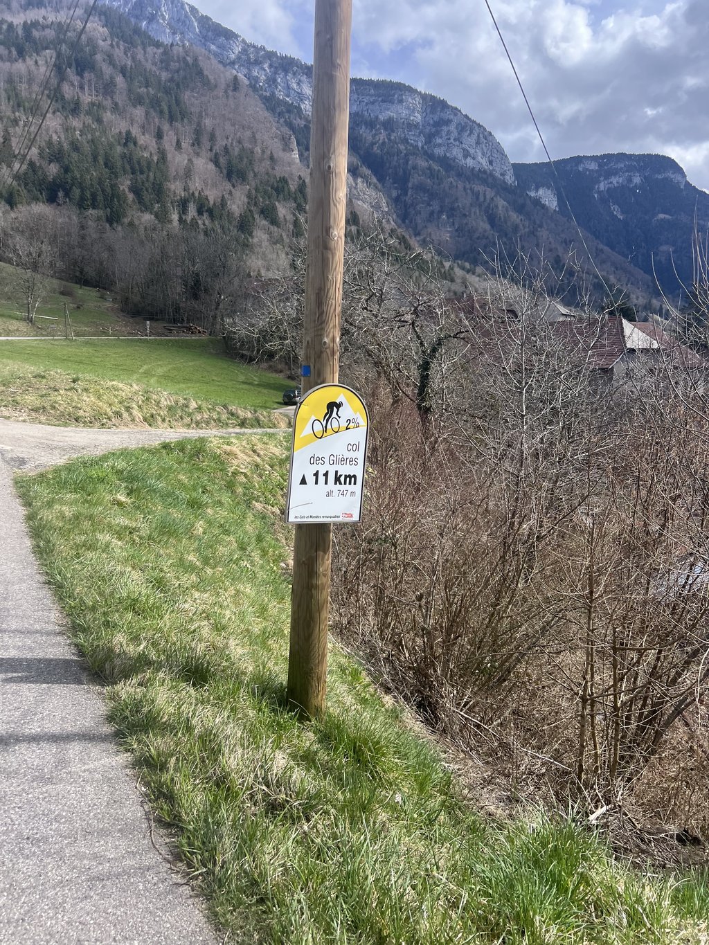
The little brother of the better known variant from Petit Bornand. Still a tough climb, where Climbfinder the climb slightly differently estimated than the local tourist office. The road climbs already from Thorens-Glières, and there are also already the famous signs along the way that prepare you for more than 13 kilometers of climbing. Not steep at first, but your legs will be full already if you try to speed up to Nant Sec. The climb itself is steep, but not so steep that your legs go lame. You're mostly between the trees, but sometimes you get a beautiful view of the valley you just came through. At the top, you turn around a corner, arrive quite suddenly at a sort of intermediate col and get a short descent. Because you can look far ahead here, you'll be doing 60+ km/hr into the climb and the last bit is quite easy. At the top is a large monument to the French resistance in WW2 (recommended to take a look) and you can use a terribly bad gravel-and-stone road to the other side of the plateau for the descent (recommended to first look at your tires).
Het kleine broertje van de bekendere variant vanuit Petit Bornand. Evengoed een pittige klim, waarbij Climbfinder de klim iets anders inschat dan de lokale VVV. De weg klimt al vanuit Thorens-Glières, en daar staan ook al de bekende bordjes langs de weg die je voorbereiden op dik 13 kilometer klimmen. In het begin nog niet steil, maar je benen lopen al wel flink vol als je probeert tempo te rijden naar Nant Sec. De klim zelf is steil maar niet zo steil dat je benen lamslaan. Je zit veel tussen de bomen, maar soms krijg je een prachtig uitzicht op de vallei waar je net doorheen bent komen fietsen. Boven sla je de bocht om, kom je toch vrij plotseling bij een soort tussencol en krijg je een korte afdaling. Omdat je hier ver voor je uit kunt kijken neem je 60+ km/u mee de klim in en is het laatste stukje vrij eenvoudig. Boven staat een groot monument voor het Franse verzet in WO2 (aanrader om even te kijken) en kun je via een vreselijk slechte gruis-en-stenenweg naar de andere kant van het plateau voor de afdaling (aanrader om hiervoor eerst even naar je banden te kijken).
| 5 mph | 01:42:08 |
| 7 mph | 01:12:19 |
| 9 mph | 00:56:21 |
| 12 mph | 00:42:20 |
This page is better in the app