Tips nearby


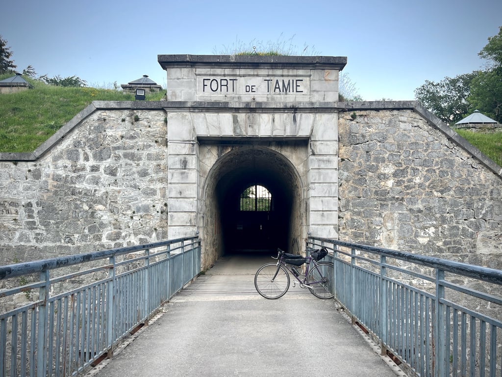
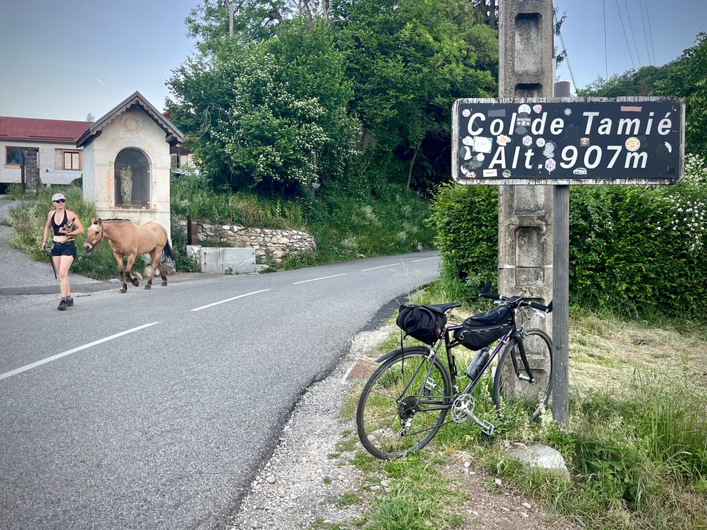
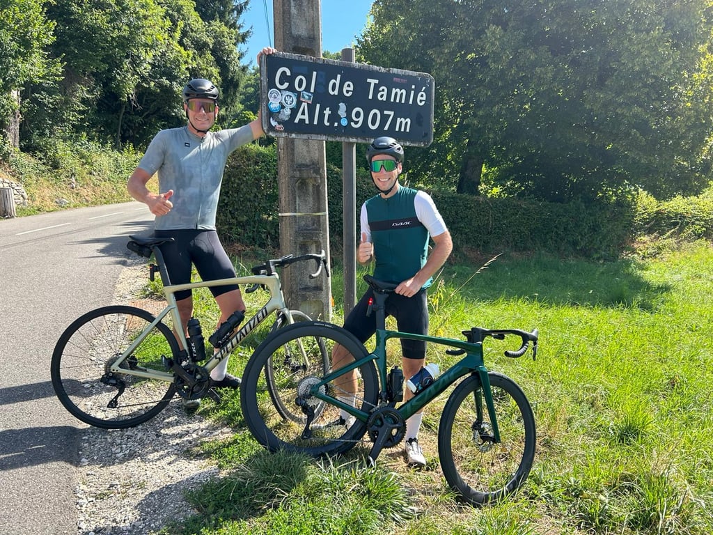
Col de Tamié is a climb in the region Annecy. It is 5.6 mi long and bridges 1795 ft of vertical ascent with an average gradient of 6%, resulting in a difficulty score of 377. The top of the ascent is located at 3015 ft above sea level. Climbfinder users shared 8 reviews of this climb and uploaded 11 photos.
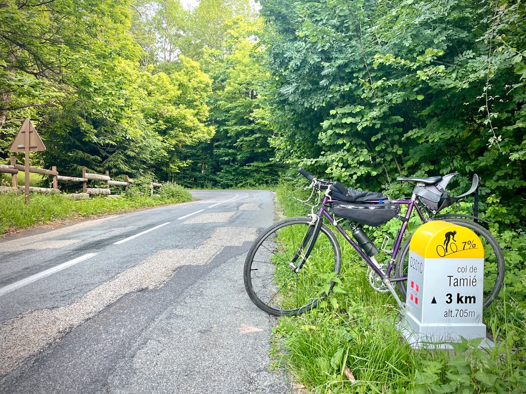
Road names: Route de Tamié, D64 & D201C
3.0 by FRWThis is an automatic translation, the original language is: Dutch.Nice climb to combine with a tour from Albertville, or for example on the way back to Annecy. It is reasonable with other traffic on the road.... read more

Welcome! Please activate your account if you would like to share something. Look for the verification email in your inbox.
If you want to upload your photos, you need to create an account. It only takes 1 minute and it's completely free.
A short, rolling pass. Not exactly exciting. Not unpleasant, either. A road in decent condition. Renovated sections. Gradients never violent. Traffic contained. Leaving aside the occasional furious driver of a Porsche or Maserati who comes along to show off his or her often dubious and disturbing skills.
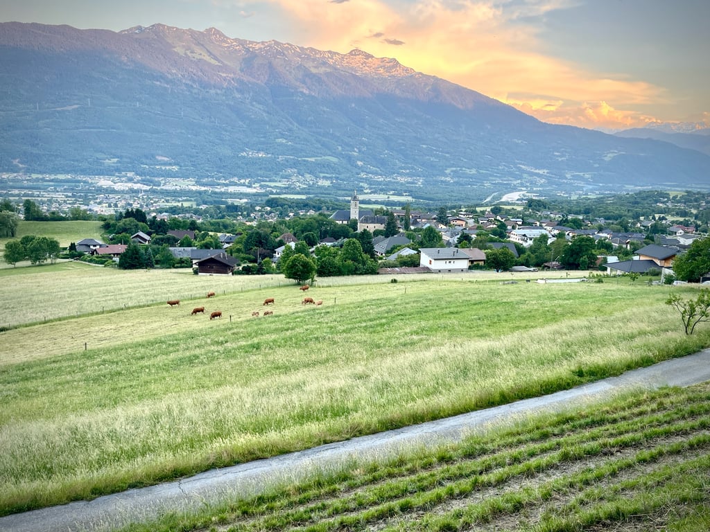
Not much to see. A view over the valley, but not a breathtaking one.
Up there, two big chalets. No view at all.
I especially enjoyed the descent to Gilly along the road that leads up to the collet. A road that also seems more interesting from a cycling point of view. In short, if you don't have much time, climb the eponymous collet instead.
Un col court et roulant. Pas franchement excitant. Pas désagréable, non plus. Une route dans un état correct. Des tronçons rénovés. Des pourcentages jamais violents. Une circulation contenue. Si l’on fait abstraction des quelques furieux qui viennent exhiber leurs aptitudes, souvent douteuses et inquiétantes, au volant de leurs Porsche et autres Maserati.
Pas grand chose à voir. Une vue sur la vallée, mais qui n’est pas époustouflante.
Là-haut, deux gros chalets. Pas de vue.
J’ai surtout aimé la descente vers Gilly par la route qui monte au collet. Route qui d’ailleurs me semble plus intéressante aussi d’un point de vue cycliste. Bref, si vous avez peu de temps, grimpez plutôt le collet éponyme.
Nice quiet and not too difficult climb. Rode back to Albertville via the other side. Great descent too and a nice round trip if you're in the area.
Leuke rustige en niet al te zware klim. Via de andere kant terug gereden naar Albertville. Prima afdaling ook en een leuk rondje als je in de buurt bent.
I rarely do this version, but as I live only a few kilometres away, it's good for training when I don't have much time.
Sunday 14 April 2024 before noon, busy road up to Gémilly, then a little less busy and then again when you reach the Frontenex version.
Good to medium tarmac (especially the Frontenex section).
I posted a photo with a magnificent view of Mont Blanc from Plancherine.
Je fais rarement cette version, mais vu que j'habite seulement à quelques kilomètres , elle sert d'entrainement quand je n'ai pas beaucoup de temps.
Dimanche 14 avril 2024 avant midi, Rte fréquentée jusqu'à Gémilly après un peu moins et à nouveau lorsque l'on rejoint la version Frontenex.
Bitume bon à moyen ( surtout la partie Frontenex )
J'ai posté une photo avec une magnifique vue du Mont-Blanc depuis Plancherine.
I did it with Eric on the 14th of February 2023 in the afternoon, at this time of year there is hardly any traffic, but I don't question some of the comments that say the opposite because I live a few kilometres from the foot of the mountain and I have no doubt that at certain times of the year there must be a lot of traffic.
This climb is not the best known, but it is a very nice and not too difficult variant.
At 4 km from the summit you join the route from Frontenex, only the last km is in the woods.
Fais avec Eric le 14 Février 2023 l'après midi, à cette période de l'année guère de circulation mais je ne remets pas en cause certains commentaires qui disent le contraire car j'habite à quelques kilomètres du pied et je ne doute pas qu'à certaines heures ou périodes de l'année ça doit circuler beaucoup.
Cette ascension n'est pas la plus connue, mais une variante bien sympathique et pas trop difficile.
A 4 kilomètres du sommet on rejoint l'itinéraire qui vient de Frontenex, seul le dernier Km est dans les bois.
Nice climb to combine with a tour from Albertville, or for example on the way back to Annecy. It is reasonable with other traffic on the road.
Leuke beklimming die goed te combineren is met een rondje vanuit Albertville, of bijvoorbeeld op de terugweg naar Annecy. Het is wel redelijk met ander verkeer op de weg.
Good climb but very busy (very residential)...especially until you reach the D201C. I would advise another alternative from Albertville :
Take the D104A (Route du Fort, Fort Villard) then the D104 (Route du Roc Rouge then Route du Colet de Tamié). This route also leads to the Col. The difficulty is quite similar, but there is less traffic and the road is much more pleasant for my taste :-)
Montée bien mais très fréquentée (très résidentielle)...notamment jusqu’à rejoindre la D201C. Je conseillerais plutôt une autre alternative au départ d'Albertville :
Prendre la D104A (Route du Fort, Fort Villard) puis la D104 (Route du Roc Rouge puis Route du Colet de Tamié). Cet itinéraire amène également au Col. La difficulté est assez similaire, mais surtout moins de fréquentation et la route est bien plus agréable à mon goût :-)
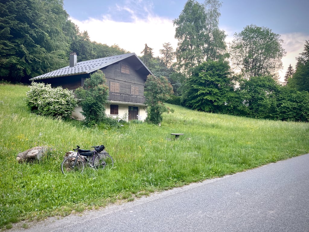
Great climb to use as a warm-up for a longer tour or if you are going to cycle for several days in the Albertville area. Similar to the Col d'Ornon in Bourg d'Oisans, known as a warm-up for Alpe d'Huez. Beautiful road with alternating meadows, woods and cute little houses.
Heerlijke klim om als opwarmer te gebruiken voor een langere toertocht of als je meerdaags in de buurt van Albertville gaat wielrennen. Vergelijkbaar met de Col d'Ornon in Bourg d'Oisans, bekend als opwarmertje voor Alpe d'Huez. Mooie weg met afwisselend weilanden, bos en schattige huisjes.
Beautiful climb to start if you just come from the flat Fryslân about 4% average and on the way back you can still beautiful an extra climb towards the ski area with a few very nice curves ...
Prachtige klim om mee te beginnen als je net uit het vlakke Fryslân komt ongeveer 4 % gemiddeld en op de terug weg kan je nog mooi een extra beklimming pakken richting het ski gebied met een paar héle mooie bochten ...
| 5 mph | 01:07:59 |
| 7 mph | 00:48:07 |
| 9 mph | 00:37:30 |
| 12 mph | 00:28:10 |
This page is better in the app