| 4 hairpin turns |
| #89 most elevation gain of Annecy |
| #65 longest climb of Haute Savoie |
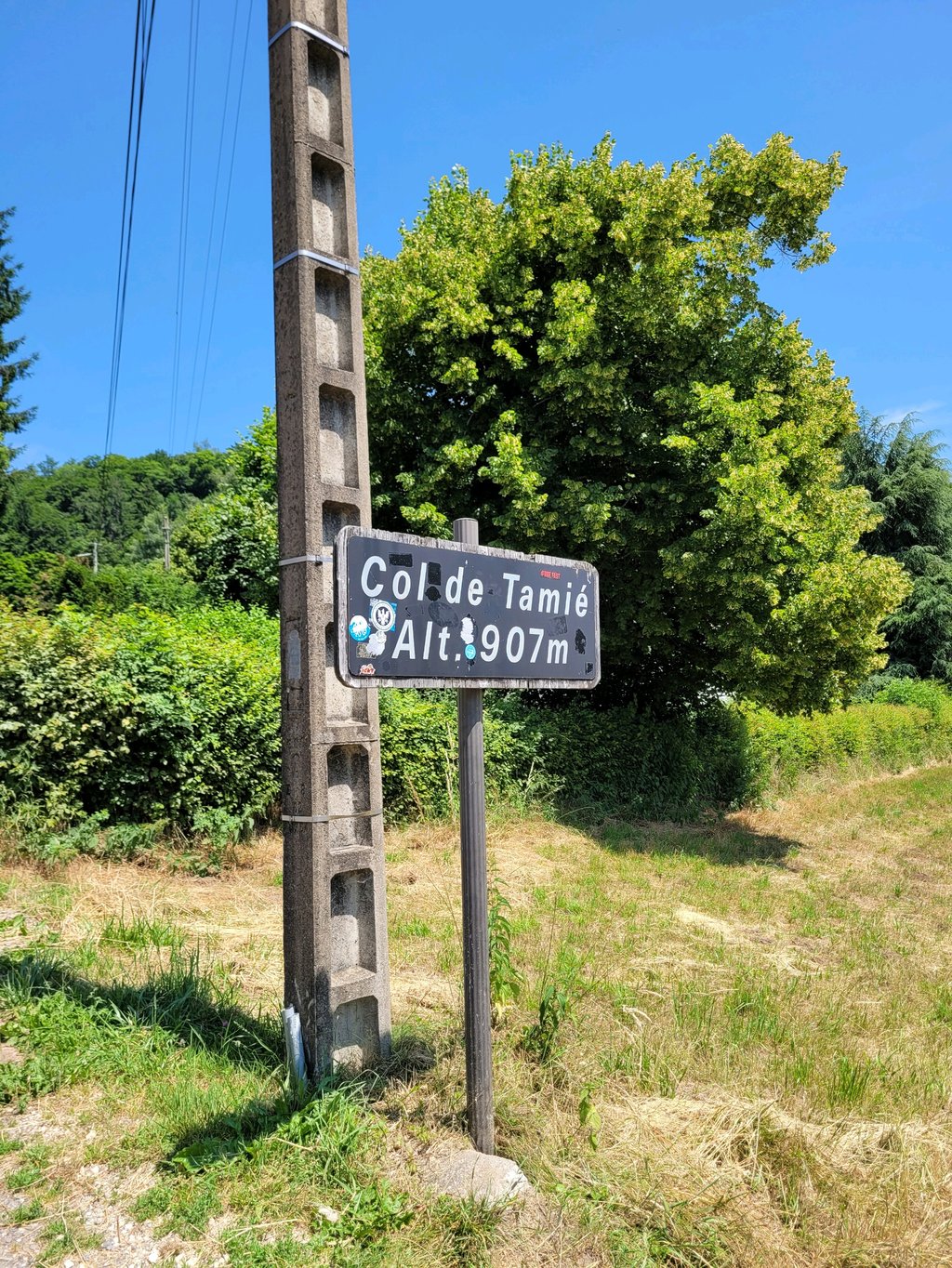
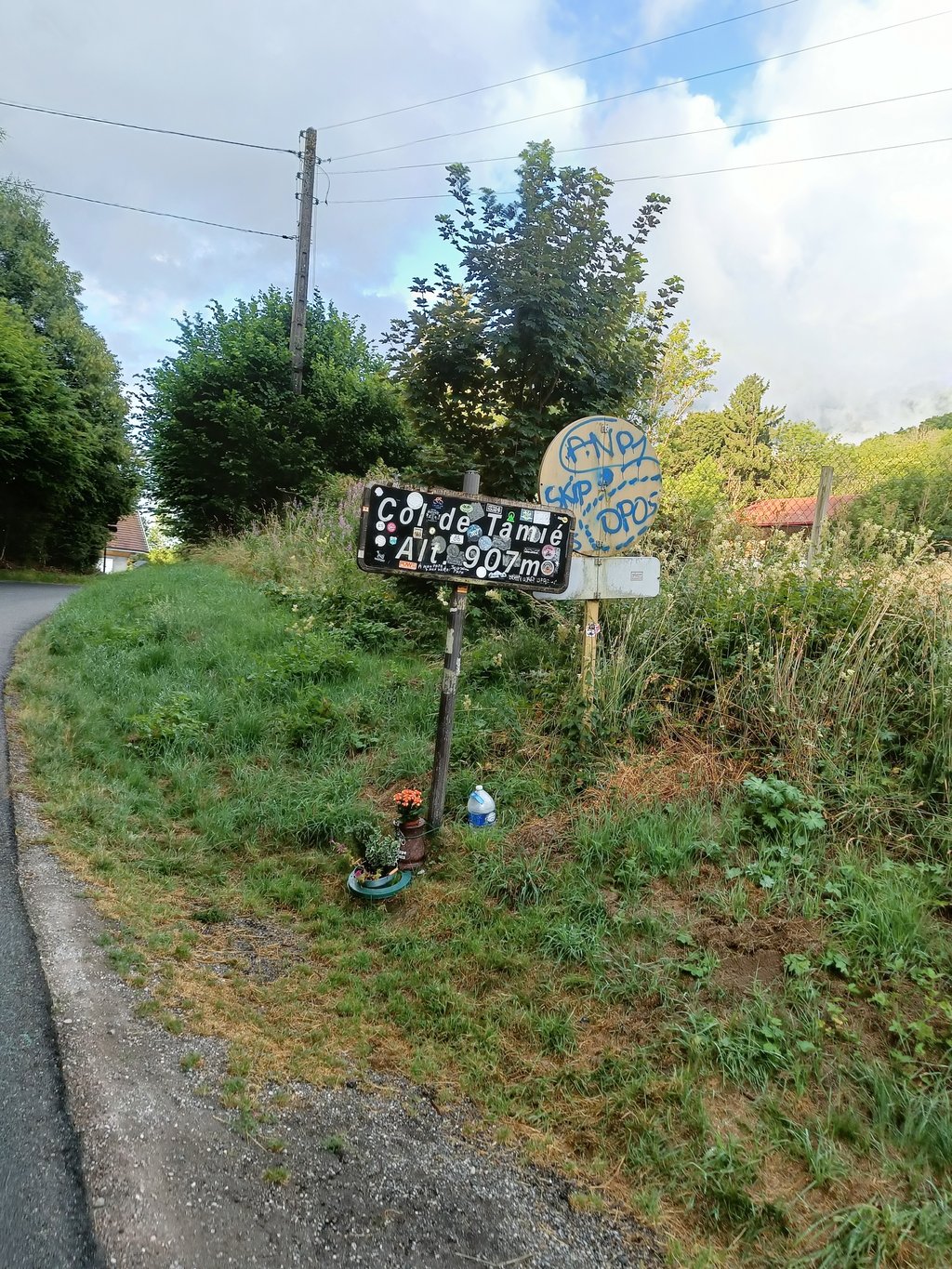
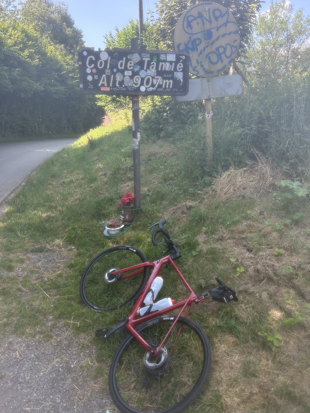
Col de Tamié from Faverges is a climb in the region Annecy. It is 6 mi long and bridges 1289 ft of vertical ascent with an average gradient of 4%, resulting in a difficulty score of 197. The top of the ascent is located at 2989 ft above sea level. Climbfinder users shared 12 reviews of this climb and uploaded 32 photos.
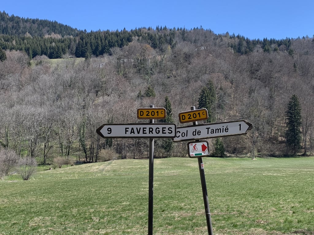
Road names: Route de Tamié & D201C
4.0 by XerckDThis is an automatic translation, the original language is: English.Nice climb, nothing too steep with some almost level parts to ease the legs. A worthy extension is the steepish climb to Collet de Tamié (960m). In addition: From the Collet, you may wish to visit Fort de Tamié. Continue down with amazing views on Albertville and snowy mountain tops via La Soffaz to Rte du Roc Rouge (test your brakes) and take the hidden gem climb with ringing cow bells to Alondaz. I took the way down via Ténésol from there and made the roundtrip through the valley fro... read more
Welcome! Please activate your account if you would like to share something. Look for the verification email in your inbox.
If you want to upload your photos, you need to create an account. It only takes 1 minute and it's completely free.
Did this col again today (see my log from 2 months ago). This time it is windless on the false flat from Ugine to the foot of the climb. The temp is also a lot lower, about half that! (21°C instead of 40.6) than last time. This time I climb smoothly, never went into the red and climbed 12 minutes faster. Says enough I think. Really a smooth training climb with limited traffic and good running road surface.
Vandaag opnieuw deze col gedaan (zie mijn log van 2 maanden geleden). Deze keer is het windstil op het stuk vals plat van Ugine tot aan de voet van de beklimming. Ook de temp is een pak lager, zowat de helft lager! (21°C ipv 40,6) dan de vorige keer. Deze keer klim ik vlotjes naar boven, nergens in het rood gegaan en 12 minuten sneller geklommen. Zegt genoeg denk ik. Echt een vlotte trainingsklim met beperkt verkeer en goed lopend wegdek.
A nice climb with not too high percentages. The road surface is fine, the road surface of the descent is of lesser quality.
Een leuke beklimming met niet al te hoge percentages. Het wegdek is prima, het wegdek van de afdaling is van mindere kwaliteit.
A year and a half ago, I had done the side from Frontenex, which is a lot steeper. The Faverges side had been on my list for a while. Especially as the Faverges side is a perfect tempocol. It was a very hot day. Started m'n ride in St-Pierre d'Albigny. The road then goes slightly uphill until the climb (1 to 3%)From Ugine until the foot of the col, there was even a very strong headwind so I had to ride for 20-25 min in a way too high heart rate to get ahead at all. And then immediately attacked the col at 85% max heart rate. Not ideal. At the foot of the Tamié, my bike computer indicated 40.6°C! Normally this climb should be smooth for me but I gave up quite a bit due to the heat and the unforeseen intensity beforehand. I will do this one again in autumn, then I am sure I will put a cog or two higher. Ideal training col.
Anderhalf jaar geleden had ik de kant vanuit Frontenex gedaan die een pak steiler is. Al een tijdje stond de kant van Faverges op m'n ljstje. Temeer het langs de Faverges-kant een perfecte tempocol is. Het was een zeer warme dag. Ben m'n rit begonnen in St-Pierre d'Albigny. De weg loopt dan tot aan de klim steeds licht bergop. (1 tot 3%)Vanaf Ugine tot aan de voet van de col stond er zelfs een zéér strakke tegenwind waardoor ik een 20 - 25 min in een veel te hoge hartslag heb moeten rijden om überhaupt nog vooruit te geraken. En dan meteen de col aan 85% max hartslag aangevallen. Niet ideaal dus. Aan de voet van de Tamié gaf mijn fietscomputer 40,6 °C aan! Normaal gesproken zou deze klim voor mij vlot te nemen moeten zijn maar toch flink afgezien door de hitte en de onvoorziene intensiteit vooraf. In het najaar zal ik deze nog eens doen, dan leg ik vast en zeker een tandje of twee groter. Ideale trainingscol.
A great climb to warm up on or when you are not too well trained (like me). A real runner where the start is still occasionally a bit steeper. As it gets quieter and there are fewer buildings, it gets easier. You even come across a stretch where you descend slightly. The scenery changes every few hundred metres, from villages, to woods, to meadows, etc.
Een heerlijke klim om op warm te draaien of wanneer je niet al te goed getraind bent (zoals ik). Een echte loper waarbij het begin nog zo af en toe wat steiler is. Naarmate het rustiger wordt en er minder bebouwing is wordt het makkelijker. Je komt zelfs een stukje tegen waar je iets daalt. De omgeving veranderd elke paar honderd meter, van dorpjes, naar bos, naar weilanden etc.
A very good return pass or one for beginners. The road is quite good, it feels good and traffic is generally light, which is not necessarily the case in summer with all the motorbikes...
Très bon col de reprise ou pour débutant. La route est assez bonne, elle rend bien l'effort et la circulation est en général faible ce qui n'est pas forcément le cas l'été avec toutes les motos...
It's a nice, quiet climb without too much traffic in a region with many passes and therefore many opportunities to link up!
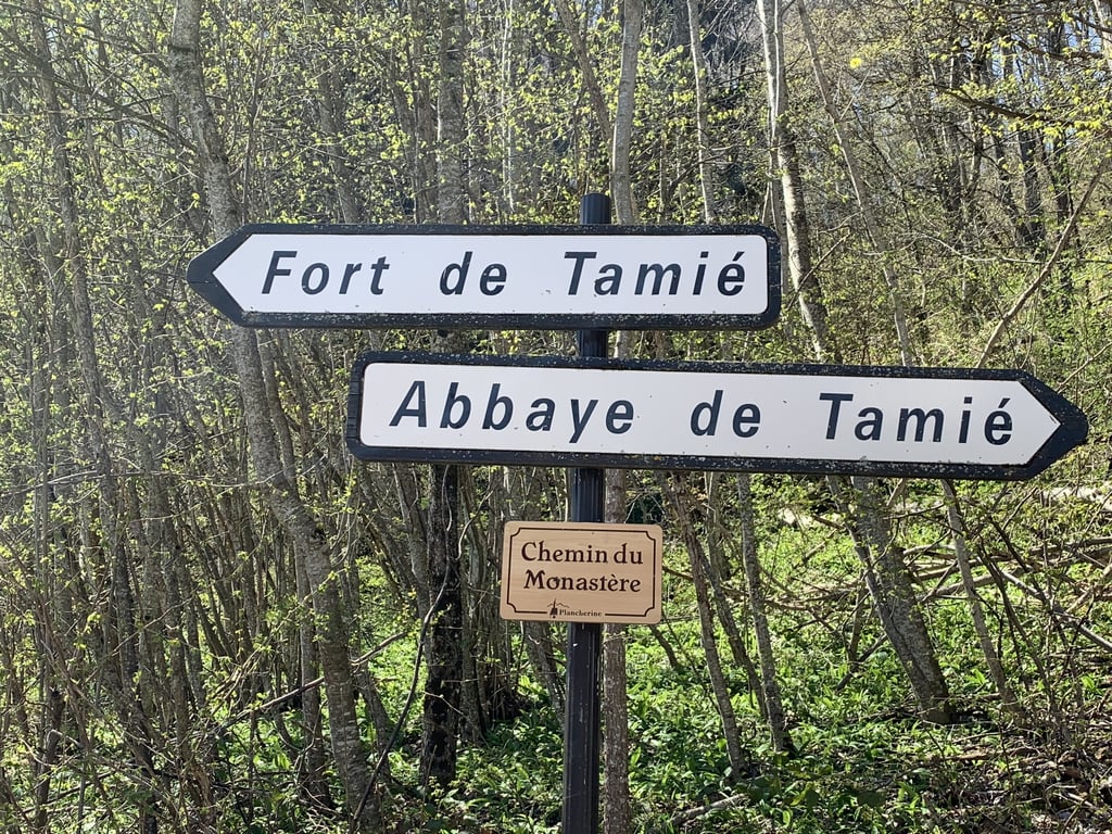
A visit to the Tamié monastery (monastic shop and beautiful church, a few hectometres diversions) and the Fort de Tamié at the Collet de Tamié (1-2km from the summit) add a little cultural pleasure!
Jolie montée tranquille sans trop de circulation dans une région qui compte de nombreux cols et donc de nombreuses possibilités d'enchaîner!
Une visite au monastère de Tamié (boutique monastique et belle église, détour de quelques hectomètres)et du Fort de Tamié au Collet de Tamié (1-2km depuis le sommet) ajoutent un peu d'agrément culturel !
Nice climb, nothing too steep with some almost level parts to ease the legs.
A worthy extension is the steepish climb to Collet de Tamié (960m).
In addition:
From the Collet, you may wish to visit Fort de Tamié. Continue down with amazing views on Albertville and snowy mountain tops via La Soffaz to Rte du Roc Rouge (test your brakes) and take the hidden gem climb with ringing cow bells to Alondaz. I took the way down via Ténésol from there and made the roundtrip through the valley from Ugine to Faverges.
Nice running climb. Not too heavy. Road surface is reasonable. Until the exit to Sambuy still some traffic, then quiet. For a 1st climb to get the legs used to it, fine!
Lekker lopende klim. Niet al te zwaar. Wegdek is redelijk. Tot de afslag naar Sambuy nog wel verkeer, daarna rustig. Voor een 1e klim om de benen te laten wennen, prima!
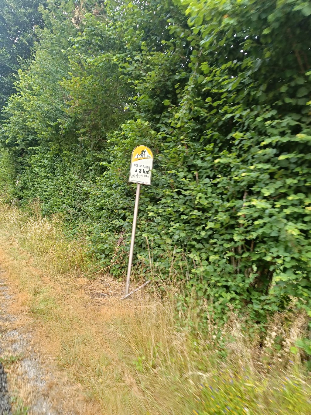
To go up to the Tamié pass located in the Bauges massif, there are many roads, the one by the D12 leaving Faverges is one of the most classical.
The surface is very good and the slope is relatively gentle.
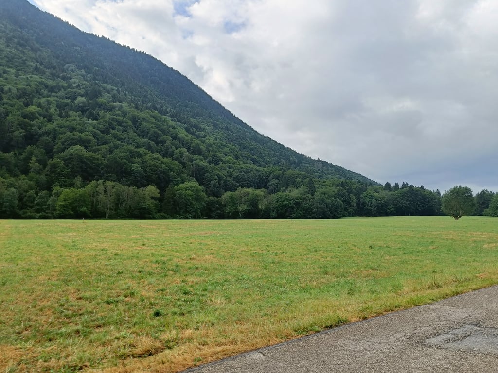
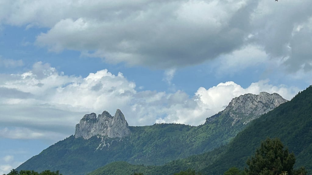
As for the landscape, nothing too crazy,
A slight detour at the top allows you to reach the Collet de Tamié Alt970M and then descend to Mercury and Albertville in Combe de Savoie.
Note at the top of the Col, 2 restaurants and a drinking water fountain, in the middle of summer it can help.
Good road and be careful.
Pour monter au col de Tamié situé dans le massif des Bauges, les routes sont multiples, celle par la D12 partant de Faverges fait partie des plus classiques.
Le revêtement est très bon et la pente relativement douce.
Coté paysages rien de bien folichon,
Un léger détour au sommet permet d’atteindre le Collet de Tamié Alt970M puis de descendre sur Mercury puis Albertville en Combe de Savoie.
A noter au sommet du Col, 2 restaurants et une fontaine d’eau potable, en plein été ça peut aider.
Bonne route et soyez prudents.
| 5 mph | 01:12:59 |
| 7 mph | 00:51:40 |
| 9 mph | 00:40:16 |
| 12 mph | 00:30:15 |
This page is better in the app