| Beautiful scenery |
| Hidden gem |
| 2 hairpin turns |
| #10 toughest climb of Haspengouw |
| #29 most elevation gain of Haspengouw |
| #26 average steepest climb of Haspengouw |
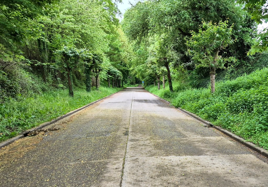
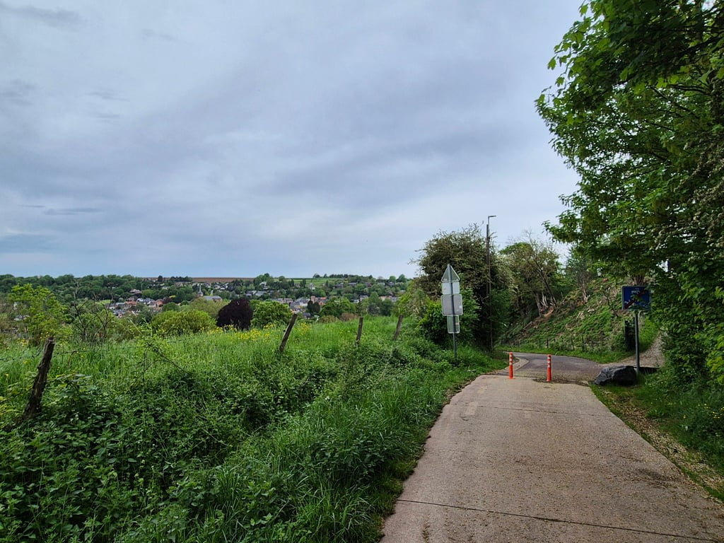
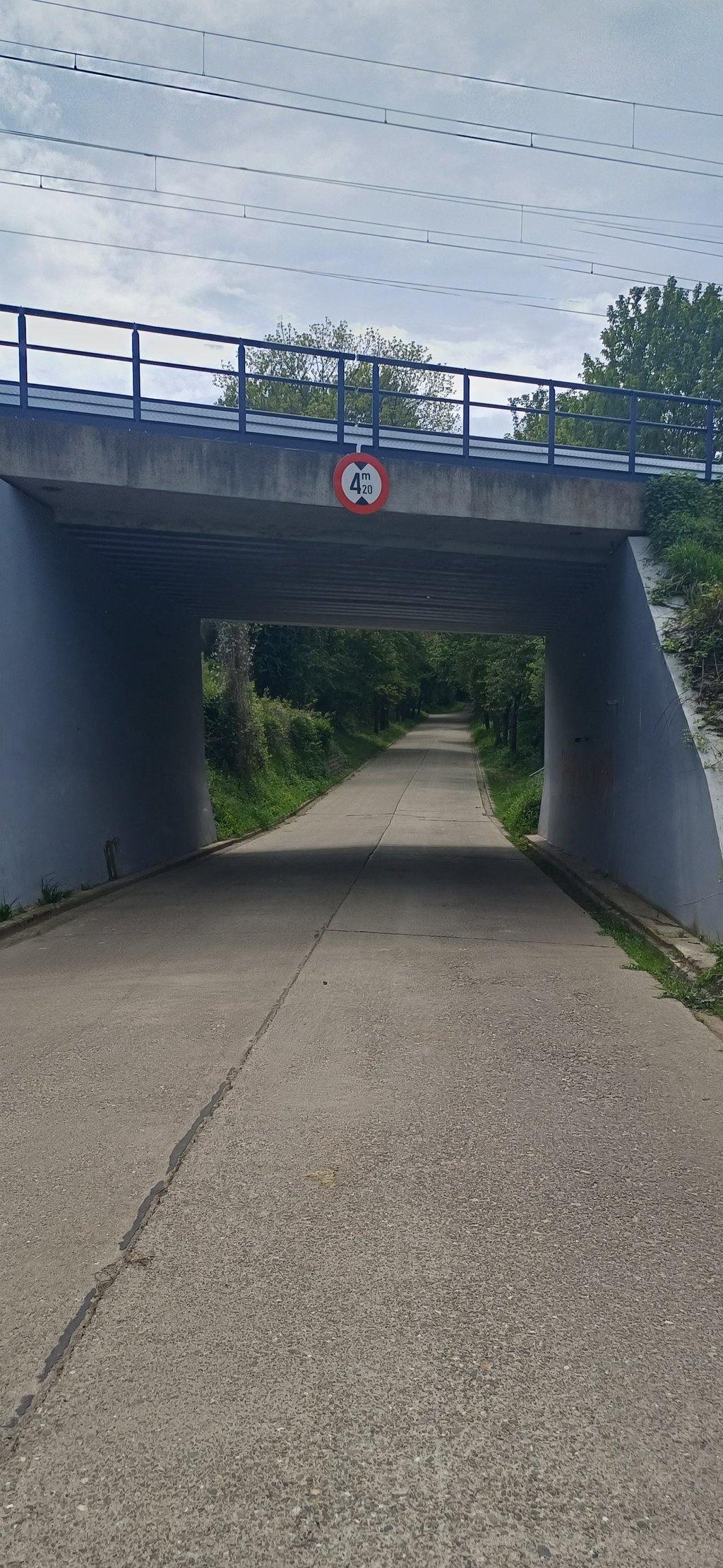
Chavée Arecht is a climb in the region Haspengouw. It is 0.5 mi long and bridges 187 ft of vertical ascent with an average gradient of 6.5%, resulting in a difficulty score of 47. The top of the ascent is located at 440 ft above sea level. Climbfinder users shared 10 reviews of this climb and uploaded 19 photos.
Road names: Rue du Chesnay & Chavée Arecht
3.0 by PiekpionierThis is an automatic translation, the original language is: Dutch.Nice and quiet connection between two valleys with a playful beginning and beautiful hairpin turns. It seems under control for a long time, but after the second turn there is a vicious stretch that demands everything before you reach the plateau.... read more
Welcome! Please activate your account if you would like to share something. Look for the verification email in your inbox.
If you want to upload your photos, you need to create an account. It only takes 1 minute and it's completely free.
Nice and quiet connection between two valleys with a playful beginning and beautiful hairpin turns. It seems under control for a long time, but after the second turn there is a vicious stretch that demands everything before you reach the plateau.
Mooie en rustige verbinding tussen twee valleien met een speels begin en fraaie haarspeldbochten. Het lijkt lang onder controle, maar na de tweede bocht volgt een venijnig stuk dat nog even alles vraagt voordat je het plateau bereikt.
The best way to cycle from the Geer Valley to the Meuse Valley (for example, if you want to do the Hallembaye). In the beginning it all runs relatively well, and with the two hairpin turns it's really enjoyable, but keep some more, because after that second turn the road climbs very steeply for a while.
De beste manier om van de Geervallei naar de Maasvallei te fietsen (bijvoorbeeld als je de Hallembaye wilt doen). In het begin loopt het allemaal nog relatief goed, en met de twee haarspeldbochten is het echt genieten, maar hou nog wat over, want na die tweede bocht loopt de weg eventjes heel steil naar boven.
The best alternative to reach the Meuse valley from the Geer valley. The road is in good condition and not very busy, but be careful not to be surprised by the steep gradients shortly before the end of the climb.
Meilleure alternative pour rejoindre la vallée de la Meuse depuis la vallée du Geer. Route en bon état et peu fréquentée, attention à ne pas se faire surprendre par les forts pourcentages peu avant la fin de l'ascension.
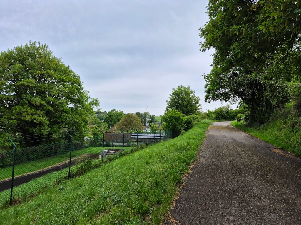
Solid and very attractive alternative (instead of the boring and busy main road) to get from the valley of Le Geer to the Meuse valley. The road starts as a concrete road and runs under the railroad into a beautiful little valley. In the first hairpin bend, the road surface changes to good asphalt and then you have a nice view of the valley for a while. The second hairpin is somewhat wider after which the road surface again turns into nice smooth concrete ... and the percentages suddenly increase significantly. The slope was so far just nice but now we have to work hard. The steepest part is just before the end when you see the road above you already flatten. At the fence is the end of this beautiful climb. On the plateau nice views, especially to the rear.
Stevig en zeer fraai alternatief (i.p.v. de saaie en drukke hoofdweg) om van het dal van Le Geer in het Maasdal te komen. De weg begint als een betonweg en loopt onder het spoor door een fraai dalletje in. In de eerste haarspeldbocht gaat het wegdek over in goed asfalt en daarna heb je even mooi uitzicht op het dal. De tweede haarspeldbocht is wat breder waarna het wegdek weer overgaat in mooi glad beton... en de percentages ineens flink stijgen. De helling was nog nu toe gewoon lekker maar nu mag er flink aan de bak gegaan worden. Het steilste stuk zit vlak voor het eind als je de weg boven je al ziet afvlakken. Bij het hekwerk is het eind van deze mooie klim. Op het plateau leuk uitzicht, vooral naar achteren.
Nice climb, classifying is the message. Hurts a bit. And hairpin bends, top! At the top, enjoying the scenery.
Mooie klim, indelen is idd de boodschap. Doet wel even pijn. En haarspeldbochten, toppie! Boven gekomen even genieten van het landschap.
The second part of the climb is very steep indeed, so plan well. Very quiet road leading to a country road. Definitely worth a climb.
Tweede deel van de klim is idd heel stevig, dus goed indelen is de boodschap. Heel rustige weg die uitkomt op een landweg. Zeker de moeite om eens te beklimmen.
Don't go too fast in the first part, after the second hairpin you will need your energy, here the steepness goes up to 15%. Once you get to the top, you'll find yourself in the middle of the fields, in the next turn 100 meters there's a lot of gravel on the bike path. In the descent you have to brake in time for the first turn, the grip of the bike path is not good in the braking zone and it is easy to make an error of judgement here and end up a bit short of the wall.
Niet te hard gaan in het eerste deel, na de tweede haarspeldbocht zal je je energie nodig hebben, hier gaat het steigingspercentage richting de 15%. Eens boven kom je uit tussen de velden, hier ligt het in de bocht 100 meter verder vol met steentjes op het fietspad. In de afdaling moet je optijd remmen voor de eerste bocht, de grip van het fietspad is niet goed in de remzone en het is gemakkelijk om hier een inschattingsfout te maken en wat kort op de muur uit te komen.
I often start in Boirs under the autostrade bridge, and then this climb is always there on the way to Visé/Voerstreek.
Nice warming-up, and in itself even a nice climb.
It ends up on a small agricultural road (like so often in this region) and can sometimes be very dirty.
Vertrek vaak in Boirs onder de autostradebrug, en dan zit deze klim er altijd in op weg naar Visé/Voerstreek.
Leuke opwarmer, en op zich zelfs een mooie klim.
Komt boven uit op een landbouwweggetje (zoals zo vaak in deze streek) en kan soms erg vuil zijn.
One of the most beautiful parts in the area. Very quiet and really steep uphill. Don't get caught out by starting too early because it's almost a foregone conclusion that you'll fall flat. You can really feel the 15% on the last part of the climb.
Een van de mooiste stukjes in de omgeving. Heel rustig en echt wel pittig omhoog. Laat je niet vangen door te vroeg eraan te beginnen want stilvallen is bijna vanzelfsprekend. 15% op het laatste deel van de klim voel je echt wel.
A very nice climb to include in your route is this one! The road is very quiet and you are treated to two real hairpin bends. After the second hairpin, the road goes nice and steep for a few hundred meters towards the 15%. Not very long, but enough to yell "Ouch". At the top, the road flattens quite rapidly and you have a nice view of the meadows and the plateau.
Een heel leuk klimmetje om in je route te verwerken is deze! De weg is heerlijk rustig en je wordt verwend met twee echte haarspeldbochten. Na de tweede haarspeldbocht gaat de weg een paar honderd meter lekker steil richting de 15%. Niet superlang, wel genoeg om ‘auw’ te roepen. Bovenaan vlakt het vrij snel af en heb je een mooi uitzicht over de weilanden en het plateau.
| 5 mph | 00:06:31 |
| 7 mph | 00:04:37 |
| 9 mph | 00:03:36 |
| 12 mph | 00:02:42 |
This page is better in the app