Tips nearby


| Famous climb |
| 1 hairpin turn |
| #10 toughest climb of Netherlands |
| #5 most elevation gain of Netherlands |
| #25 longest climb of Netherlands |
Vaalserberg / Drielandenpunt via Eschberg is a climb in the region South Limburg. It is 3.4 km long and bridges 140 m of vertical ascent with an average gradient of 4.2%, resulting in a difficulty score of 78. The top of the ascent is located at 320 m above sea level. Climbfinder users shared 46 reviews of this climb and uploaded 28 photos.
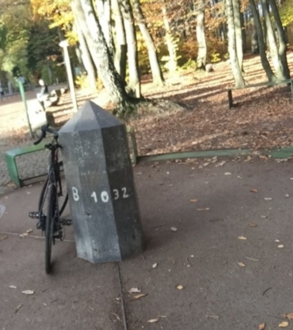
Road names: Eschberg, Nieuwe Hertogenweg & Viergrenzenweg
by AlexanderThis is an automatic translation, the original language is: Dutch.The day before yesterday, during a very busy sunday, I cycled around Vaals to get to know this area better. And I discovered an alternative route to the Vaals mountain, which is much more difficult than the one described here. If you really want to start from the valley of the Selzerbeek this is the route: - Sneeuwberglaan, then past the Lidl to the right - Beemderlaan, cross N278 - Koperstraat, straight on 2nd road left with the road - Bergstraat (watch out you are driving against the traffic),... read more
Welcome! Please activate your account if you would like to share something. Look for the verification email in your inbox.
If you want to upload your photos, you need to create an account. It only takes 1 minute and it's completely free.
A Limburg classic that you really must try at least once
Klassieker in Limburg, die je toch zeker wel eens gedaan moet hebben
The Vaalserberg via Eschberg is a well-known climb in South Limburg and takes you to the highest point in the Netherlands. From Vaals, it rises gradually with a few briefly steeper sections towards the forest.
Nowhere is it extremely tough, but the long, continuous nature makes it a serious effort. At the top, you finish at the busy Drielandenpunt.
De Vaalserberg via Eschberg is een bekende klim in Zuid-Limburg en brengt je naar het hoogste punt van Nederland. Vanaf Vaals loopt hij geleidelijk op met een paar kort steilere stukken richting het bos.
Het is nergens extreem zwaar, maar door het lange, continue karakter toch een serieuze inspanning. Boven eindig je bij het drukke Drielandenpunt.
Nice that you can drive to a tri-border point without getting into trouble (where outside Europe can you do this?). The Belgian side is superior in terms of beauty, the Dutch side is a bit crowded. At the top, you end up at a fairground with other tourists.
In terms of climbing, it is not very difficult but somewhat challenging. All in all, worth a diversion!
Leuk dat je zonder in de problemen kunt komen naar een drielandenpunt kan rijden (waar buiten Europa kan dit nou?). De Belgische kant is qua schoonheid superieur, de Nederlandse kant is wat druk. Bovenop kom je uit op een kermis met andere toeristen.
Qua klim is het niet heel moeilijk maar wel enigszins uitdagend. Al met al een omweg waard!
Very nice climb to do, especially in combination with Camerig. Camerig much more fun though because it's through greenery and there are fewer cars, which makes Vaalserberg a bit less so.
Erg leuke klim om te doen, zeker in combinatie met Camerig. Camerig wel veel leuker omdat het door het groen is en omdat er minder auto’s rijden, dat maakt de Vaalserberg wat minder.
If you do a route in south-limburg, this one just belongs in it. From the other side, though, it's more rewarding.
Doe je een route in zuid-limburg, hoort deze er gewoon in. Vanaf de andere kant is hij wel meer de moeite waard.
If you are in Limburg and in the area then you really must include this one in your route. This climb is part of it but not very special
Ben je in Limburg en in de buurt dan moet je deze toch echt meenemen in je route. Deze klim hoort erbij maar heel bijzonder is hij niet
The last bit to the trielandenpunt is nice, but the first part the road surface is not super. However, this climb is just part of your route through South Limburg
Het laatste stukje naar het drielandenpunt is wel leuk, maar het eerste gedeelte is het wegdek niet super. Echter hoort deze klim gewoon bij je route door Zuid-Limburg
It is frankly a mystery to me why this is considered lighter than the camerig. Goes down 2x more allowing your legs to recover
Het is mij zowaar een raadsel waarom dit als lichter wordt beschouwd dan de camerig. Gaat nog 2x naar beneden waardoor je benen kunnen herste
Yahaa, my holiday goal has succeeded, I can go home. Going up the Vaalserberg by handbike was something I really wanted to do this holiday. Unfortunately, the weather let me down. There were certainly some tough sections, but all in all it took me just over half an hour to get to the top 🇩🇪🇧🇪🇳🇱👍
Jahaa, mijn vakantiedoel is geslaagd, ik kan naar huis. Met de handbike de Vaalserberg op wilde ik deze vakantie echt doen. Jammergenoeg liet het weer mij in de steek. Zware stukken waren er zeker, maar alles bij elkaar was ik toch net iets langer dan een half uur bezig om boven te komen 🇩🇪🇧🇪🇳🇱👍
In the Vaals/Epen area, not the prettiest but one of the longer climbs. This variation starts at the Eschberg/Schuttebergsweg junction near Vaalsbroek castle and has two tougher intermediate sections. The first tougher section is on the Eschberg near the holiday park. The second tougher section with a peak of 10% is around the junction with the Viergrenzenweg. After the sharp turn to the left, it is only false flat until the playground on top of the Drielandenpunt
In de omgeving van Vaals/Epen niet de mooiste maar wel één van de langere klimmogelijkheden. Deze variant begint op de splitsing Eschberg/Schuttebergsweg bij kasteel Vaalsbroek en kent twee zwaardere tussenstukken. Het eerste zwaardere stuk zit nog op de Eschberg t.h.v. het vakantiepark. Het tweede zwaardere stuk met een piek van 10% zit rond de splitsing met de Viergrenzenweg. Na de scherpe bocht naar links is het alleen nog vals plat tot de speeltuin bovenop het Drielandenpunt
A year later I cycled this 'mountain' again and I stand by it. When you see the hairpin bend you know you are almost there. Otherwise, it is a fun climb to do although it is crowded every now and then. Do not go down again like a madman but always watch out.
Een jaar later weer deze 'berg' gefietst en ik blijf erbij. Als je de haarspeldbocht ziet weet je dat je er bijna bent. Verder is het een leuke klim om te doen al is het wel druk zo nu en dan. Ga niet als een malloot weer naar beneden maar kijk altijd uit.
This well-known climb is very crowded, especially at weekends, as the mountain is very popular with tourists. Nevertheless, the climbing with 1 beautiful hairpin bend is not bad but also nothing really special.
Dieser bekannte Anstieg wirkt vor allem an Wochenenden stark überlaufen, da der Berg stark touristisch geprägt ist. Dennoch ist das Klettern mit 1 schönen Kehre nicht schlecht aber auch nichts wirklich besonderes.
This climb doesn't really get very difficult anywhere. The moment you see the hairpin bend you know you are almost there. This is one in the category 'must have done'. So if you are in the neighbourhood, grab it because it is not really challenging.
With a handbike (recumbent) it is easy to do.
Deze klim word nergens echt heel erg moeilijk. Op het moment dat je de haarspeldbocht ziet dan weet je dat je er al bijna bent. Dit is er wel eentje in de categorie 'moet je gedaan hebben'. Dus mocht je in de buurt zijn pak hem even erbij want echt uitdagend is ie niet.
Met een handbike ( ligger ) is ie goed te doen
Nice climb with good road surface. Once you have passed the houses, it becomes really tough, but still doable.
Mooie klim met goed wegdek. Zodra je de huizen voorbij bent wordt het echt zwaar, maar nog steeds goed te doen.
Alternating runner with steeper sections, but everything remains fairly contained. This one came right after Camerig and a few other climbs, so the legs were well used up. I think this climb is not so bad if you don't have 1000hms in your legs first :)
Wisselende loper met steilere stukken, maar alles blijft redelijk in de perken. Deze kwam vlak na Camerig en nog enkele andere klimmen, dus de benen waren ver op. Ik denk dat deze klim goed meevalt als je niet eerst 1000hms in de benen hebt :)
Nice runner this climb. Not too difficult, but if you already have a lot of kilometres in your legs, it is still hard enough (3rd quarter of the AGR 150km for example). I find the other side from Belgium much more beautiful, but this side may not be missing on your list.
Lekkere loper deze beklimming. Niet al te moeilijk, maar als je al veel kilometers in de benen hebt toch nog lastig zat (3e kwart van de AGR 150km bijv). Ik vind de andere kant vanuit België wel veel mooier, maar deze kant mag ook niet op je lijst ontbreken.
Certainly not the most beautiful climb, but one that you do not just do. Cost me more strength than I thought, probably because I wanted to maintain a pace from the valley which you can not afford on this long climb for Dutch standards.
Zeker niet de mooiste beklimming, maar wel eentje die je niet zomaar even doet. Kostte me meer kracht dan ik had gedacht, waarschijnlijk omdat ik toch een tempo wilde vasthouden vanuit het dal die je je niet kan veroorloven op deze lange klim voor Nederlandse begrippen.
I must say I had estimated it to be more difficult than it actually was. It is quite long (at least for the region), but you can always keep on turning the big plateau because the steepness is not too bad. At the top you enter a tourist zone. It's amazing how much money can be raised on a three country point. But from the top of the Boudewijn tower (or the Wilhelmina tower for the neighbors to the north) you have a beautiful view. Personally I would prefer the Belgian side. Not because of the difficulty, but because of the beautiful hairpin bends. Although they are always nice downhill. Throw in the knees and go.
Ik moet zeggen dat ik hem lastiger had ingeschat dan dat hij eigenlijk was. Hij is wel redelijk lang (toch voor de regio), maar je kan altijd de grote plateau blijven draaien omdat de steiltegraad heel goed meevalt. Boven kom je in een toeristische zone. Onvoorstelbaar hoeveel geld er uit een drielandenpunt kan worden geklopt. Maar van boven op de Boudewijntoren (of de Wilhelminatoren voor de Noorderburen) heb je wel een prachtig zicht. Persoonlijk zou ik de Belgische kant verkiezen. Niet vanwege de lastigheid, maar vanwege de prachtige haarspeldbochten. Al zijn die natuurlijk ook altijd leuk bergaf. Knietjes erin smijten en gaan.
Famous climb to the highest point of the Netherlands! The tarmac is not always great, but the satisfaction is still great when you arrive at the Drielandenpunt! Everyone gets up here, as the percentages are not frightening.
Beroemde klim naar het hoogste punt van Nederland! Het asfalt is niet altijd even geweldig, maar de voldoening is toch groot als je bij het Drielandenpunt aankomt! Iedereen komt hier boven, aangezien de percentages niet angstaanjagend zijn.
July 2021 From Germany. To Vaals last climb of my Drielandenroute. To the highest point of the Netherlands. This climb has a lack of beautiful views. But you can climb the Wilhelmina or King Boudewijn Tower. (With elevator) We do this another time.
Juli 2021 Vanuit Duitsland. Naar Vaals laatste beklimming van mijn Drielandenroute. Naar het hoogste punt van Nederland. Deze klim heeft een gebrek aan mooi uitzicht. Maar je kunt de Wilhelmina of Koning Boudewijn Toren op. (voorzien van lift) Doen we een andere Keer.
I started at Landal Hoog Vaals (not difficult, because I stayed there). Those first hundreds of meters are uphill and if then the 'real'climb begins, your legs are pretty much on tension. Then there are one, two, three turns and some rising road, and you are at the highest point of (European) Holland. It is crowded, touristy, you have zero view while cycling and in most respects the Belgian side is more advisable. Nevertheless, you go for it, because the Vaalserberg must be ticked off your list. By the way.
Ik ben begonnen bij Landal Hoog Vaals (niet moeilijk, want daar verbleef ik). Die eerste honderden meters zijn gevoelig omhoog en als dan de 'echte' klim begint, zijn je benen aardig op spanning. Dan volgen er nog een, twee, drie bochten en wat stijgende weg, en sta je op het hoogste punt van (Europees) Nederland. dat is wat mij betreft ook direct alle allure van deze klim. Het is er druk, toeristisch, je hebt nul uitzicht bij het fietsen en in de meeste opzichten is de Belgische kant sterker aan te raden. Desondanks ga je erop, want de Vaalserberg moet je afgestreept hebben. Bij dezen.
Very varied route but it misses the beauty of the other routes. From the start it is already hard going (especially near the museum). After having turned right the trail flattens out but that changes when you have turned right again. Especially the part along the last houses and the Bellevue-flat is hard. Then you enter the forest and it becomes very nice cycling. After the hairpin bend the road flattens out. The last part along the parking places is no challenge but you want to go to the Drielandenpunt if you have come this far.
NB: I have done this (deliberately) just after the heavy rainfall in South Limburg, so no opinion on the crowds. It was very quiet then.
Zeer gevarieerde route maar het mist de schoonheid van de andere routes. Vanaf het begin is het al meteen aanzetten (vooral bij het museum). Na rechtsaf geslagen te zijn vlakt het flink af maar dat verandert als je daarna weer rechts bent gegaan. Vooral het stuk langs de laatste huizen en de Bellevue-flat is pittig. Daarna ga je het bos in en wordt het fraai fietsen. Na de haarspeldbocht zie je het al snel vlakker worden. Het laatste stuk langs de parkeerplaatsen biedt verder geen uitdaging maar je wilt toch naar het Drielandenpunt als je zo ver bent gekomen.
NB: Ik heb deze (bewust) gedaan vlak na de zware regenval waarbij Zuid-Limburg het zwaar te verduren had, dus geen oordeel over de drukte. Het was toen iig erg rustig.
A serious climb, especially if you just finished Camerig. But the traffic, and the lack of a nice view makes this climb not so attractive. The Belgian side to get to the Drielandenpunt is much nicer and quieter (and also a nice descent).
Een serieuze klim, zeker als je net Camerig achter de rug hebt. Maar het verkeer, en het gebrek aan een mooi uitzicht maakt deze klim niet zo aantrekkelijk. De Belgische kant om aan het Drielandenpunt te komen is veel mooier en rustiger (en ook een leuke afdaling).
I would definitely not recommend this climb. Always very busy with traffic and also not a very nice environment. The belgian side is a great alternative to reach the three countries point! Surprisingly much quieter and much more beautiful.
Deze beklimming zou ik zeker niet aanraden. Altijd erg druk met verkeer en ook geen hele mooie omgeving. Daarbij is de belgische zijde een schitterend alternatief om het drielandenpunt te bereiken! Verrassend veel rustiger en veel mooier.
Nice climb, but can in terms of beauty not match the côte des Trois frontiers from the other side. Especially nice because you climb to a nice point. Nice to take a break on top on a terrace
Leuke beklimming, maar kan qua schoonheid niet tippen aan de côte des Trois frontiers vanaf de andere kant. Vooral leuk omdat je naar een mooi punt toe klimt. Lekker om bovenop een pauze te nemen op een terrasje
By far I found this one of the most boring climbs in the region. Sure, it is a long climb and there is a hairpin in it, but you drive to a very busy tourist trap and there is little to see along the way. Really steep, heavy or special I 'm not, despite the high number of climbing points for the Netherlands. I am glad I have done it once; next time I will take the climb from Belgium. It looked much nicer in the descent.
Met afstand vond ik dit een van de saaiste beklimmingen in de regio. Tuurlijk, het is een lange klim en er zit een haarspeldbocht in, maar je rijdt naar een enorm drukke toeristenval en er is onderweg weinig moois te zien. Echt steil, zwaar of bijzonder vond ik 'm ook niet, ondanks het voor Nederland hoog aantal klimpunten. Ik ben blij dat ik 'm een keer heb gedaan; de volgende keer neem ik wel de beklimming vanuit België. Die zag er in de afdaling veel mooier uit.
If you start at Vaalserbroek you make the most altitude meters. Lots of traffic on the way, with also a bicycle path makes it not really a nice climb. Only halfway it becomes more beautiful (and a steep part) when you dive into the forest.
The last part you have to steer between the hikers at the three countries point. In short, you do not have to do this for the peace and quiet, it is better to take the Belgian side.
Als je bij Vaalserbroek begint maak je de meeste hoogtemeters. Veel verkeer onderweg, met ook een stukje fietspad maakt het niet echt een mooie klim. Eigenlijk pas halverwege als je het bos induikt wordt het mooier (en een stijl stukje).
Het laatste stuk moet je bij het drielandenpunt laveren tussen de wandelaars. Kortom voor de rust hoef je dit niet te doen, beter is het om de Belgische kant nemen.
Nice climb.
Good road surface.
Lots of traffic.
At the top you are at the highest point of NL.
Then you can descend to Gemmenich.
Mooie klim.
Goed wegdek.
Veel verkeer.
Boven aan gekomen ben je op het hoogste punt van NL.
Dan kun je afdalen naar Gemmenich
The base is at Vaalsbroek castle. You then climb first to the Vaals ring road, turn right and follow the signs towards the trielandenpunt. The road climbs through the forest and through a hairpin bend to the Wilhelmina Tower. From there, the road flattens out and continues to climb slightly to the highest point in the Netherlands and the nearby trielandenpunt. This climb is fairly (or sometimes very) busy with tourist traffic, and at the triangle point it can be crowded with pedestrians. The col is nowhere really steep, but it is long.
De voet is bij kasteel Vaalsbroek. Je klimt dan eerst tot de randweg rond Vaals, gaat rechts en volgt de borden richting drielandenpunt. De weg klimt door het bos en via een haarspeldbocht door tot de Wilhelminatoren. Vanaf daar vlakt de weg af en klimt nog licht door naar het hoogste punt van Nederland en het dichtbij gelegen drielandenpunt. Deze beklimming is redelijk (of soms zeer) druk met toeristisch verkeer, en bij het drielandenpunt kan het druk zijn met voetgangers. De col is nergens echt steil, maar wel lang.
On to the highest point! I started from Wolfhaag, that makes no difference in terms of difficulty. I did it early in the day and even then you can see it can get chaotic here. There were only a few stray oldies, but they gave a good impression of what can happen later in the day :).
The climb itself is doable, I think this, together with Camerig, is the closest to what I imagine the Alps to be (a bit longer, without huge steep parts). I was on my guard (because it is also high here), but suddenly I was on top...So it is really easy to do. The descent towards Belgium has perfect tarmac, is quiet and has nice hairpin bends. Definitely do it!
Op naar het hoogste punt! Ik ben gestart vanuit Wolfhaag, dat maakt qua zwaarte niets uit. Ik heb hem vroeg op de dag gedaan en zelfs dan zie je dat het hier chaotisch kan worden. Er waren nog maar een paar verdwaalde bejaarden, maar die gaven een prima indruk van wat er later op de dag kan gebeuren :).
De klim zelf is goed te doen, ik vind dit, samen met Camerig, het meest in de buurt komen van wat ik me bij de Alpen voorstel (wat langer, zonder enorme steile stukken). Ik was op mijn hoede (doordat ie hier ook hoog staat), maar was opeens boven...Hij is dus echt prima te doen. De afdaling richting Belgïe heeft perfect asfalt, is rustig en heeft leuke haarspeldbochten. Zeker doen!
Officially not a bike path, so hope uncle the cop turns a blind eye.
Officieel geen fietspad, dus hopen dat oom de agent een oogje toeknijpt.
The day before yesterday, during a very busy sunday, I cycled around Vaals to get to know this area better. And I discovered an alternative route to the Vaals mountain, which is much more difficult than the one described here. If you really want to start from the valley of the Selzerbeek this is the route:
- Sneeuwberglaan, then past the Lidl to the right
- Beemderlaan, cross N278
- Koperstraat, straight on 2nd road left with the road
- Bergstraat (watch out you are driving against the traffic), then turn right
- Tentstraat, then turn left (sign "Drielandenpunt 2")
- Viergrenzenweg, at the end turn left
- In the bend to the left (footpath Drielandenpunt, Viergrenzenweg nr. 222-224) see message Ni)
Eergisteren tijdens een hele drukke zondag rondom Vaals gefietst om dit gebied me meer eigen te maken. En ik heb een alternatieve route ontdekt naar de Vaalserberg, welke veel zwaarder is dan degene die hier beschreven is. Als je echt vanuit het dal van de Selzerbeek wilt beginnen is dit de route:
- Sneeuwberglaan, vervolgens langs de Lidl rechtsaf
- Beemderlaan, N278 oversteken
- Koperstraat, rechtdoor 2e weg linksaf met de weg mee
- Bergstraat (pas op je rijdt tegen het verkeer in), vervolgens rechtsaf
- Tentstraat, vervolgens linksaf (bord “Drielandenpunt 2”)
- Viergrenzenweg, aan het eind linksaf
- In de bocht linksaf (voetpad Drielandenpunt, Viergrenzenweg nr. 222-224) zie bericht Ni)
There are plenty of alternatives, because almost every road in the village is sloping. An interesting one could be to climb from the provincial road (N278) to the beginning of the Viergrenzenweg (exit sign 'Drielandenpunt 2') this is a steep road, with views to the left into Germany. You come out halfway the route as it is described here. You turn left here towards the forest and continue the route.
Er zijn tal van alternatieven te bedenken; want bijna iedere weg in het plaatsje zelf is hellend. Een interessante kan zijn om vanaf de provinciale weg (N278) te klimmen naar het begin van de Viergrenzenweg (afslag bord ‘Drielandenpunt 2’) dit is een flink stijgende weg, met links doorkijkjes Duitsland in. Je komt vervolgens uit halverwege de route zoals deze hier beschreven is. Je slaat hier dus links af richting het bos en vervolgt de route.
Kicking ass. You imagine yourself to be somewhere in France, for example.
Kicken. Je waant je toch even ergens in bijvoorbeeld Frankrijk.
So it seems no one knows the 3rd variant of the vaalserberg yet. The one from Aachen! Yes there is a German variant: https://climbfinder.com/nl/beklimmingen/dreilandereck-punkt-vaalserquartier-schmiedgasse The stretch between the car park and the forest, before it really goes down (seen from above then) is a good gravel, which I dare to ride over calmly with a race bike without being afraid of my paint.
Zo te lezen kent nog niemand de 3e variant van de vaalserberg. Die vanuit Aken! Ja er is een Duitse variant: https://climbfinder.com/nl/beklimmingen/dreilandereck-punkt-vaalserquartier-schmiedgasse Het stuk tussen de parkeerplaats en het bos, voordat het echt naar onder gaat (van bovenaf gezien dan) is een goed gravel, waar ik rustig met een renfiets overheen durf te rijden zonder angst voor mijn lak te zijn.
As already described, this is a nice mountain to tackle after camerig and then go into Belgium. Once a year there is grit on the mountain, camerig too.
Zoals al beschreven is dit een mooie berg om na camerig te pakken en dan België in te gaan. 1 keer per jaar wordt er wel met grind gestrooid, op camerig ook.
@Bram: it is certainly doable with a road bike, but there is a piece of about 50 m which is very rough. Especially in the steep s-curve there is very little asphalt left, but after that the weather is much better.
@Bram: het is zeker te doen met de racefiets, maar er zit een stuk in van zo'n 50 m wat heel ruw is. Zeker in de steile s-bocht ligt erg weinig asfalt meer, maar daarna is het weer een stuk beter.
@Ni is the road surface passable with the race bike up to the tower?
@Ni is het wegdek wel te berijden met de renfiets tot de toren?
Recently I discovered a nice abbreviation for the Vaalserberg with perhaps the most pithy piece of road that I have encountered so far in southern Limburg. The abbreviation begins at the turn at the Residence Bellevue. Where the normal road turns into the forest, you take the turn left, to what seems only a parking lot. Here you can continue and after about 50 m you can take a rough, but asphalted path into the forest. Here it becomes quite steep with a turn of at least 20%. Then it is still about 150 m raking with percentages around 15%. In total you climb about 40 m in 300 meters. You come out at the back of the Wilhelminatoren, at the parking lot.
Laatst een mooie afkorting van de Vaalserberg ontdekt met misschien wel het pittigste stukje weg dat ik tot nu toe in Zuid Limburg ben tegengekomen. De afkorting begint bij de bocht bij het Residence Bellevue. Waar de normale weg daar het bos in draait, pak je de afslag links, naar wat lijkt alleen een parkeerplaats. Hier kun je echter doorrijden en na zo'n 50 m kun je een ruw, maar geasfalteerd pad nemen het bos in. Hier word het flink steil met een bocht van zeker 20 %. Hierna is het nog zo'n 150 m harken met percentage rond de 15 %. In totaal stijg je ongeveer 40 m in 300 meter. Je komt dan uit aan de achterkant van Wilhelminatoren, bij de parkeerplaats.
just got back from a week at landal greenparcs in high vaals
high summer weather had race bike and so and bit all known climbs done in the south limburg landscape. have quite a bit in the real mountains cycling, but the hills in Limburg are also fun to do. the best I find at camerig and then through the woods to vijlen, then to the three countries at vaals.
,
net terug van een weekje hoog vaals op landal greenparcs
hoog zomers weer gehad race fiets mee en zo en beetje alle bekende klimmetjes gedaan in het zuid limburgse landschap.heb best wel wat in de echte bergen gefietst,maar toch zijn de heuvels in limburg ook leuk om te doen. de mooiste vindt ik wel bij camerig en dan door het bos naar vijlen,daarna door naar het drielanden bij vaals.
,
This climb is not very difficult although I do not quite believe that the beginning is 8%. It will be more like 5 I guess. The turn upwards after the viaduct is quite right.
Deze beklimming is niet heel erg lastig al geloof ik niet helemaal dat het begin 8% is. Dat zal eerder 5 zijn schat ik. De bocht omhoog na het viaduct klopt dan wel weer aardig.
Everyone who cycles in Limburg has to go up here, you won't get any higher. Good to do by the way.
Iedereen die in Limburg fietst moet hier omhoog, hoger kom je niet. Goed te doen overigens.
Not the most beautiful climb but nice when you just finished the Camerig and this one is right behind you.
Although the first 1,5 km are on wide and busy roads, it is here sometimes nice and steep.
Only when you leave the houses behind you, the real climbing starts, the run up to the forest is the steepest, after this you notice that you are already climbing for over 2 km.
At the top you can do 3 things: 1. Turn around and dive back into the Limburg hills. 2. Straight on, left of the tower and dive into the Belgian hills. 3. Sit down on the terrace and enjoy the view.
Niet de mooiste beklimming maar wel lekker als je net de Camerig achter de rug hebt en deze meteen erachteraan plakt.
Hoewel de eerste 1,5 kilometer over brede en drukke wegen gaan, is het hier bij vlagen lekker steil.
Pas als je de huizen achter je laat wordt het pas echt klimmen, de aanloop naar het bos is het steilste, hierna merk je dat je al ruim 2 kilometer aan het klimmen bent.
Bovenop kun je 3 dingen doen: 1. Omdraaien en de Limburgse heuvels weer induiken. 2. Rechtdoor, links van de toren de Belgische heuvels induiken. 3. Lekker op het terras gaan zitten en van het uitzicht genieten.
| 7 km/h | 00:28:47 |
| 11 km/h | 00:18:19 |
| 15 km/h | 00:13:26 |
| 19 km/h | 00:10:36 |
This page is better in the app