Signal de Botrange from Lac de la Gileppe is a climb in the region Valleys of the Vesdre, de l'Amblève et de l'Ourthe. It is 12.3 km long and bridges 406 m of vertical ascent with an average gradient of 3.3%, resulting in a difficulty score of 186. The top of the ascent is located at 694 m above sea level. Climbfinder users shared 1 review/story of this climb and uploaded 14 photos.
Road names: Chemin des Charbonniers, Route de l'Asse Hé, Hestreux (N68) & Rue de Botrange (N676)
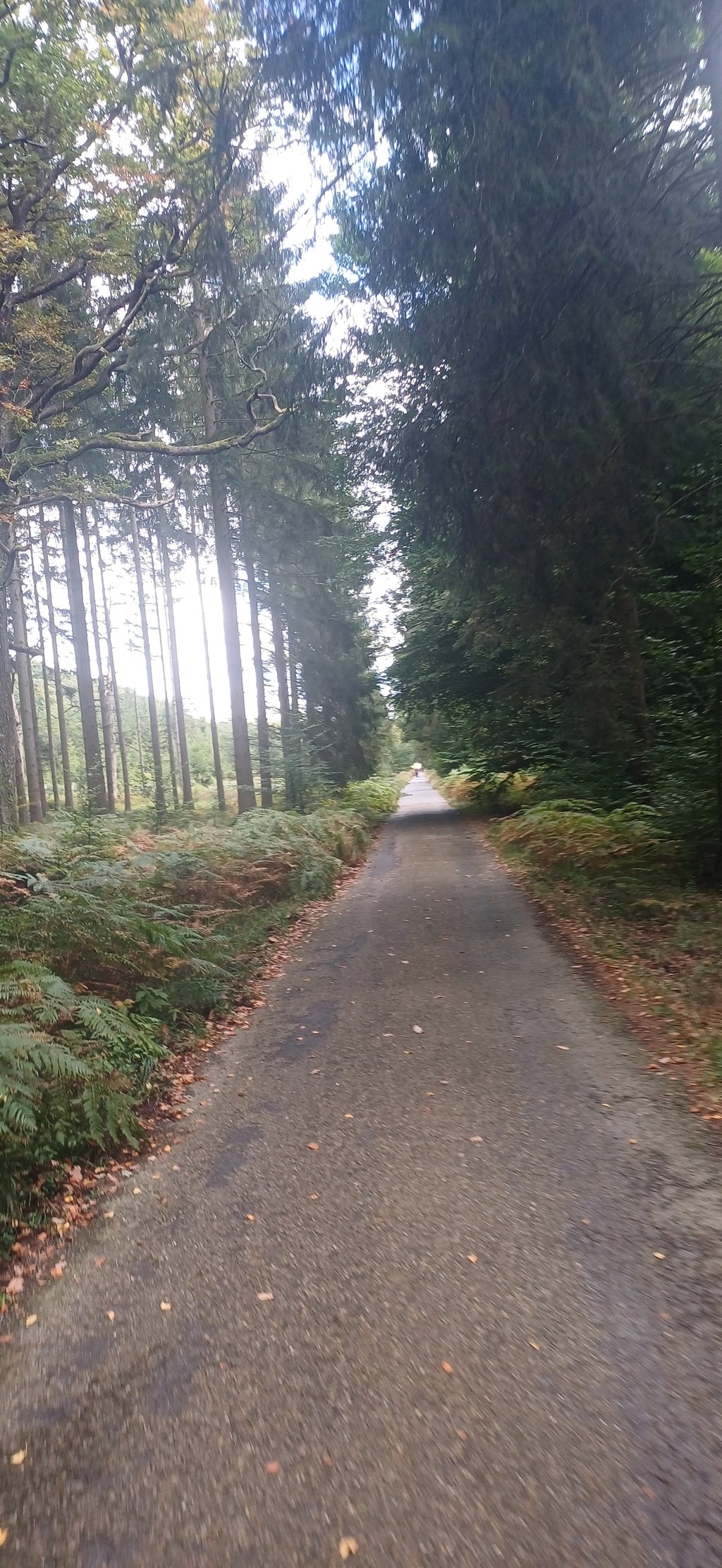
4.0 by FedorThis is an automatic translation, the original language is: Dutch.Climb that starts with a lovely little road through the forest uphill, with reasonable to good tarmac (a part has even been recently resurfaced. Fairly variable percentages in the beginning but it doesn't get tough anywhere except that it is of course a long climb. After a barrier (can be closed but there is a path around it) the picture changes completely because from a narrow car-free road you enter the main road and that's always a transition: wide runner with speeding cars. Fortuna... read more

Welcome! Please activate your account if you would like to share something. Look for the verification email in your inbox.
If you want to upload your photos, you need to create an account. It only takes 1 minute and it's completely free.
Climb that starts with a lovely little road through the forest uphill, with reasonable to good tarmac (a part has even been recently resurfaced. Fairly variable percentages in the beginning but it doesn't get tough anywhere except that it is of course a long climb. After a barrier (can be closed but there is a path around it) the picture changes completely because from a narrow car-free road you enter the main road and that's always a transition: wide runner with speeding cars. Fortunately, almost everyone takes sufficient distance. After Baraque Michel, the road only slopes slightly. The last part to Signal de Botrange has new asphalt and nowadays a good cycle lane.
First part is very nice and it is still a climb to the highest point in Belgium. Star extra so.
Klim die begint met een heerlijk weggetje door het bos omhoog, met redelijk tot goed asfalt (een deel is zelfs recent opnieuw geasfalteerd. Redelijk wisselende percentages in het begin maar zwaar wordt het nergens... behalve dat het natuurlijk wel een lange klim is. Na een slagboom (kan dicht zijn maar er is een paadje omheen) verandert het beeld totaal want van een smal autovrij weggetje ga je de hoofdweg op en da's altijd wel een overgang: brede loper met hardrijdende auto's. Gelukkig neemt vrijwel iedereen voldoende afstand. Na de Baraque Michel glooit de weg nog maar weinig. Het laatste deel naar Signal de Botrange heeft nieuw asfalt en tegenwoordig een goede fietsstrook.
Eerste deel is erg mooi en het is toch een klim naar het hoogste punt van België. Ster extra dus.
| 7 km/h | 01:45:05 |
| 11 km/h | 01:06:52 |
| 15 km/h | 00:49:02 |
| 19 km/h | 00:38:42 |
This page is better in the app