Tips nearby


| 21 hairpin turns |
| #84 average steepest climb of Savoie |
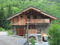
Plan Fournier is a climb in the region Savoie. It is 7.2 km long and bridges 583 m of vertical ascent with an average gradient of 8.1%, resulting in a difficulty score of 520. The top of the ascent is located at 1778 m above sea level. Climbfinder users shared 4 reviews of this climb and uploaded 7 photos.
Road names: Route de Chambéranger & Route de Plan Fournier
4.0 by patrickbaertThis is an automatic translation, the original language is: Dutch.Thanks to Climbfinder in the descent coming from Pralognan La Vanoise / Prioux this tough climb (avg. 8.1%) on the eastern valley flank was still included. Right turn just before Planay (signpost Camberanger) with the first of 22 hairpin bends. Narrow road winds up between the trees with occasional cottages. At times beautiful views of the valley from which you left and Bozel. The higher you climb the worse the road surface and towards the end there are also nasty wide metal water drains rig... read more
Welcome! Please activate your account if you would like to share something. Look for the verification email in your inbox.
If you want to upload your photos, you need to create an account. It only takes 1 minute and it's completely free.
Thanks to Climbfinder in the descent coming from Pralognan La Vanoise / Prioux this tough climb (avg. 8.1%) on the eastern valley flank was still included.
Right turn just before Planay (signpost Camberanger) with the first of 22 hairpin bends.
Narrow road winds up between the trees with occasional cottages. At times beautiful views of the valley from which you left and Bozel. The higher you climb the worse the road surface and towards the end there are also nasty wide metal water drains right across the road.
In "The middle of nowhere" the tarmac road stops.
Lonely beautiful climb with no traffic.
Definitely worthwhile for me (sorry Cyclopath) .
As a mountain cyclist, I adapt my descent style. It doesn't always have to be perfect asphalt!
Dankzij Climbfinder in de afdaling komende van Pralognan La Vanoise / Prioux deze pittige klim (gem. 8.1%) op de oostelijke dalflank nog meegenomen.
Rechtse afslag even voor Planay (wegwijzer Camberanger) met de eerste van de 22 haarspeldbochten.
Smalle weg kronkelt tussen de bomen omhoog met af en toe enkele huisjes. Bij momenten prachtige vergezichten op de vallei waaruit je vertrok en Bozel. Hoe hoger je klimt hoe slechter het wegdek en naar het einde toe zijn er ook nog vervelende brede metalen water afvoergoten dwars over de weg.
In "The middle of nowhere" stopt de asfaltweg.
Eenzame prachtige klim zonder verkeer.
Voor mij absoluut wel de moeite (sorry Cyclopaat) .
Als bergfietser pas ik mijn daalstijl aan. Het hoeft niet altijd perfect asfalt te zijn!
You may want to avoid this climb altogether, even if you have done all others in the area. A few nice views, little traffic, but that’s negated by the bad road condition, at least 2/3 of the way. The GPS shows a last bit past the parking in Plan Fournier, but there’s no way you can do that on a road bike.
Well, honestly this pass is not crazy either due to a bad surface (bad road, narrow road and gullies for the rain) but it's still worth the diversions because the view from the first village is magnificent !!! Be careful on the descent because as said above, the road is very narrow and the rain gutters hurt your bike ahah
Bon, honnêtement ce col est pas non plus foufou dû à un revêtement assez qualitatif (mauvaise route, route étroite et rigoles pour la pluie) mais il vaut quand même le détour car la vue à partir du premier village est magnifique !!! Faites bien attention dans la descente car comme dit plus haut, la route est très étroite et les rigoles d'eau de pluie font bien mal à votre vélo ahah
Gabe climb. Good steepness from time to time, but poor road surface. That's disastrous for a scared and bad descender like me. But despite the cramped descent, I would not have wanted to miss the climb. Like
If you come from the sal of Bozel, first cycle to Prioux and then take this climb on the way back to Bozel.
Climb on the way down :-)
Gabe klim. Goed steil van tijd tot tijd, maar wel matig wegdek. Dat is funest voor een bange en slechte daler, zoals ik. Maar ondanks de verkrampte afdaling had ik de klim niet willen missen. Als
Je vanuit het sal van Bozel komt, fiets dan eerst door naar Prioux en pak deze
Beklimming op de terugweg naar beneden :-)
| 7 km/h | 01:01:34 |
| 11 km/h | 00:39:11 |
| 15 km/h | 00:28:44 |
| 19 km/h | 00:22:41 |
This page is better in the app